واشنطن
Washington | |||
|---|---|---|---|
| State of Washington | |||
| الكنية: "The Evergreen State" (unofficial)[1] | |||
| الشعار: Al-ki or Alki, "by and by" in Chinook Jargon | |||
| النشيد: "Washington, My Home" | |||
 خريطة الولايات المتحدة، موضح فيها Washington | |||
| البلد | الولايات المتحدة | ||
| قبل الولائية | Washington Territory | ||
| انضمت للاتحاد | November 11, 1889 (42nd) | ||
| العاصمة | Olympia | ||
| أكبر مدينة | Seattle | ||
| أكبر منطقة عمرانية | Seattle | ||
| Government | |||
| • الحاكم | Jay Inslee (D) | ||
| • نائب الحاكم | Denny Heck (D) | ||
| المجلس التشريعي | State Legislature | ||
| • المجلس العلوي | State Senate | ||
| • المجلس السفلى | House of Representatives | ||
| القضاء | Washington Supreme Court | ||
| سناتورات الولايات المتحدة | Patty Murray (D) Maria Cantwell (D) | ||
| وفد مجلس النواب | 8 Democrats 2 Republicans (القائمة) | ||
| Area | |||
• Total | 71٬362 ميل² (184٬827 كم²) | ||
| • Land | 66٬544 ميل² (172٬587 كم²) | ||
| • Water | 4٬757 ميل² (12٬237 كم²) 6.6% | ||
| • Rank | 18th | ||
| Dimensions | |||
| • Length | 240 mi (400 km) | ||
| • Width | 360 mi (580 km) | ||
| Elevation | 1٬700 ft (520 m) | ||
| Highest elevation | 14٬411 ft (4٬392 m) | ||
| Lowest elevation (Pacific Ocean) | 0 ft (0 m) | ||
| Population (2023) | |||
• Total | 7٬812٬880 | ||
| • Rank | 13th | ||
| • Density | 103/sq mi (39٫6/km2) | ||
| • Rank | 25th | ||
| • الدخل الأوسط للأسرة | $70٬979 (2٬017)[2] | ||
| • ترتيب الدخل | 7th[2] | ||
| Demonym | Washingtonian | ||
| اللغة | |||
| • اللغة الرسمية | None (de jure) English (de facto) | ||
| Time zone | UTC–08:00 (Pacific) | ||
| اختصار البريد | WA | ||
| ISO 3166 code | US-WA | ||
| الاختصار التقليدي | Wash. | ||
| خط العرض | 45°33′ N to 49° N | ||
| خط الطول | 116°55′ W to 124°46′ W | ||
| Website | wa | ||
| |||
واشنطن Washington، هي ولاية على ساحل المحيط الهادي في شمال غربي الولايات المتحدة الأمريكية، عدد سكانها 4,887,941 نسمة. وتُعد سياتل أكبر مدينة فيها وأكبر مركز مهم للصناعة والتجارة، كما تُعد سپوكين وتاكوما ثانية وثالثة كبريات مدن واشنطن. أما أولمپيا فهي عاصمة الولاية. وقد أُطلق عليها اسم واشنطن، تكريمًا لجورج واشنطن أول رئيس للولايات المتحدة.[3] ويطلق عليها اسم الولاية الدائمة الخضرة لأن الغابات الدائمة الخضرة تغطي مساحة كبيرة منها. Washington borders the Pacific Ocean to the west, Oregon to the south, Idaho to the east, and the Canadian province of British Columbia to the north. The state was formed from the western part of the Washington Territory, which was ceded by the British Empire in the Oregon Treaty of 1846. It was admitted to the Union as the 42nd state in 1889. Olympia is the state capital, and the most populous city is Seattle.
Washington is the 18th-largest state, with an area of 71،362 ميل مربع (184،830 km2), and the 13th-most populous state, with more than 7.8 million people.[4] The majority of Washington's residents live in the Seattle metropolitan area, the center of transportation, business, and industry on Puget Sound,[5][6] an inlet of the Pacific Ocean consisting of numerous islands, deep fjords and bays carved out by glaciers. The remainder of the state consists of deep temperate rainforests in the west; mountain ranges in the west, center, northeast, and far southeast; and a semi-arid basin region in the east, center, and south, given over to intensive agriculture. Washington is the second most populous state on the West Coast and in the Western United States, after California. Mount Rainier, an active stratovolcano, is the state's highest elevation at 14،411 أقدام (4،392 متر), and is the most topographically prominent mountain in the contiguous U.S.
Washington is a leading lumber producer; its rugged surface is rich in stands of Douglas fir, hemlock, ponderosa pine, white pine, spruce, larch, and cedar. The state is the largest producer of apples, hops, pears, blueberries, spearmint oil, and sweet cherries in the U.S., and ranks high in the production of apricots, asparagus, dry edible peas, grapes, lentils, peppermint oil, and potatoes.[7][8] Livestock, livestock products, and commercial fishing—particularly of salmon, halibut, and bottomfish—are also significant contributors to the state's economy.[9] Washington ranks second only to California in wine production.
Manufacturing industries in Washington include aircraft, missiles, shipbuilding, and other transportation equipment, food processing, metals, and metal products, chemicals, and machinery.[10] Washington has more than a thousand dams, including the Grand Coulee Dam, built for a variety of purposes including irrigation, electricity generation, flood control, and water storage.
One of the wealthiest and most socially liberal states in the country,[11] Washington consistently ranks among the top states for highest life expectancy and employment rates.[12] It was one of the first states (alongside Colorado) to legalize medicinal and recreational cannabis,[13] was among the first states to introduce same-sex marriage,[14] and was one of only four states to have provided legal abortions on request before Roe v. Wade loosened abortion laws nationwide in 1973.[15] Washington voters also approved a 2008 referendum on the legalization of physician-assisted suicide,[16] making it one of 10 states to have legalized the practice.[17]
جزر سان جوان التي تقع قرب جزيرة فانكوفر بكندا مشهورة بجمال مشاهدها الطبيعية، وتجذب المنتجعات الخاصة بأيام العطلات كثيرًا من الزوار.
أصل الاسم
Washington was named after President George Washington by an act of the United States Congress during the creation of Washington Territory in 1853; the territory was to be named "Columbia", for the Columbia River and the Columbia District, but Kentucky representative Richard H. Stanton found the name too similar to the District of Columbia (the national capital, itself containing the city of Washington), and proposed naming the new territory after President Washington.[18][19][20] Washington is the only U.S. state named after a president.[21]
Confusion over the state of Washington and the city of Washington, D.C., led to renaming proposals during the statehood process for Washington in 1889, including David Dudley Field II's suggestion to name the new state "Tacoma"; these proposals failed to garner support.[22] Washington, D.C.'s, own statehood movement in the 21st century has included a proposal to use the name "State of Washington, Douglass Commonwealth", which would conflict with the current state of Washington.[23] Residents of Washington (known as "Washingtonians") and the Pacific Northwest simply refer to the state as "Washington", and the nation's capital "Washington, D.C.", "the other Washington",[24] or simply "D.C."
التاريخ
Early history

The 9,300-year-old skeletal remains of Kennewick Man, one of the oldest and most complete human remains found in North America, were discovered in Washington in the 1990s.[25] The area has been known to host megathrust earthquakes in the past, the last being the Cascadia earthquake of 1700.[26] The region has been home to many established tribes of indigenous peoples for thousands of years. They are notable for their ornately carved welcome figures, canoes, long houses and masks. Prominent among their industries were salmon fishing and, notably among the Makah, whale hunting.[27][28] The peoples of the Interior had a different subsistence-based culture based on hunting, food-gathering and some forms of agriculture, as well as a dependency on salmon from the Columbia and its tributaries.
European exploration
The first recorded European landing on the Washington coast was by Spanish Captain Don Bruno de Heceta in 1775,[29] on board the Santiago, part of a two-ship flotilla with the Sonora. He claimed the coastal lands up to Prince William Sound for Spain as part of their claimed rights under the Treaty of Tordesillas, which they maintained made the Pacific a "Spanish lake" and all its shores part of the Spanish Empire. Soon thereafter, The smallpox epidemic of the 1770s devastated the Native American population.[30]
In 1778, British explorer Captain James Cook sighted Cape Flattery, at the entrance to the Strait of Juan de Fuca, but Cook did not realize the strait existed.[31] It was not discovered until Charles William Barkley, captain of the Imperial Eagle, sighted it in 1787.[32] The straits were further explored by Spanish explorers Manuel Quimper in 1790 and Francisco de Eliza in 1791,[33][34] and British explorer George Vancouver in 1792.[35]
European settlement
The British–Spanish Nootka Convention of 1790 ended Spanish claims of exclusivity and opened the Northwest Coast to explorers and traders from other nations, most notably Britain and Russia as well as the fledgling United States.[36][37] American captain Robert Gray (for whom Grays Harbor County is named) then discovered the mouth of the Columbia River. He named the river after his ship, the Columbia.[38] Beginning in 1792, Gray established trade in sea otter pelts. The Lewis and Clark Expedition entered the state on October 10, 1805.[39]
Explorer David Thompson, on his voyage down the Columbia River, camped at the confluence with the Snake River on July 9, 1811,[40] and erected a pole and a notice claiming the territory for Great Britain and stating the intention of the North West Company to build a trading post at the site.

Britain and the United States agreed to what has since been described as "joint occupancy" of lands west of the Continental Divide to the Pacific Ocean as part of the Anglo–American Convention of 1818, which established the 49th Parallel as the international boundary west from Lake of the Woods to the Rocky Mountains.[41] Resolution of the territorial and treaty issues west to the Pacific was deferred until a later time. In 1819, Spain ceded their rights north of the 42nd Parallel to the United States.[42]
Negotiations with Great Britain over the next few decades failed to settle upon a compromise boundary and the Oregon boundary dispute was highly contested between Britain and the United States. Disputed joint occupancy by Britain and the U.S. lasted for several decades. With American settlers pouring into Oregon Country, Hudson's Bay Company, which had previously discouraged settlement because it conflicted with the fur trade, reversed its position in an attempt to maintain British control of the Columbia District.[43]
Fur trapper James Sinclair, on orders from Sir George Simpson, Governor of the Hudson's Bay Company, led some 200 settlers from the Red River Colony west in 1841 to settle on Hudson Bay Company farms near Fort Vancouver.[44] The party crossed the Rockies into the Columbia Valley, near present-day Radium Hot Springs, British Columbia, then traveled south-west down the Kootenai River and Columbia River. Despite such efforts, Britain eventually ceded all claims to land south of the 49th parallel to the United States in the Oregon Treaty on June 15, 1846.[45]
In 1836, a group of missionaries, including Marcus Whitman, established several missions and Whitman's own settlement Waiilatpu, in what is now southeastern Washington state, near present-day Walla Walla County, in the territory of both the Cayuse and the Nez Perce Indian tribes.[46] Whitman's settlement would in 1843 help the Oregon Trail, the overland emigration route to the west, get established for thousands of emigrants in the following decades. Whitman provided medical care for the Native Americans, but when Indian patients—lacking immunity to new, "European" diseases—died in striking numbers, while at the same time many white patients recovered, they held "medicine man" Marcus Whitman personally responsible, and murdered Whitman and twelve other white settlers in the Whitman massacre in 1847.[47] This event triggered the Cayuse War between settlers and Indians.
Fort Nisqually, a farm and trading post of the Hudson's Bay Company and the first European settlement in the Puget Sound area, was founded in 1833.[48] Black pioneer George Washington Bush and his Caucasian wife, Isabella James Bush, from Missouri and Tennessee, respectively, led four white families into the territory and founded New Market, now Tumwater, in 1846.[49] They settled in Washington to avoid Oregon's black exclusion law, which prohibited African Americans from entering the territory while simultaneously prohibiting slavery.[50][51] After them, many more settlers, migrating overland along the Oregon Trail, wandered north to settle in the Puget Sound area.
Spanish and Russian claims to the region were ceded in the early 19th century through a series of treaties. The Spanish signed the Adams–Onís Treaty of 1819, and the Russians the Russo-American Treaty of 1824 and 1825.
The Oregon Question remained contested between the United Kingdom and the United States until the 1846 Oregon Treaty established the border between British North America and the United States along the 49th parallel until the Strait of Georgia.[45] Vague wording in the treaty left the ownership of the San Juan Islands in doubt; during the so-called Pig War, both nations agreed to a joint military occupation of the islands.[52] Kaiser Wilhelm I of the German Empire was selected as an arbitrator to end the dispute, with a three-man commission ruling in favor of the United States in 1872. The border established by the Oregon Treaty and finalized by the arbitration in 1872 remains the boundary between Washington and British Columbia.
Statehood

The growing population of Oregon Territory north of the Columbia River formally requested a new territory. As a result of the Monticello Convention, held in present-day Cowlitz County, U.S. Congress passed legislation and President Millard Fillmore signed into law on March 2, 1853, the creation of a new Washington Territory.[53][20] The boundary of Washington Territory initially extended farther east than the present state, including what is now the Idaho Panhandle and parts of western Montana, and picked up more land to the southeast that was left behind when Oregon was admitted as a state; the creation of Idaho Territory in 1863 established the final eastern border. A Washington state constitution was drafted and ratified in 1878, but it was never officially adopted.[54] Although never approved by the United States Congress, the 1878 constitution is an important historical document that shows the political thinking of the time; it was used extensively during the drafting of Washington state's 1889 constitution, the one and only official Constitution of the State of Washington. Washington became the 42nd state of the United States on November 11, 1889.[55]
Early prominent industries in the new state included agriculture and lumber. In Eastern Washington, the Yakima River Valley became known for its apple orchards,[56] while the growth of wheat using dry farming techniques became particularly productive. Heavy rainfall to the west of the Cascade Range produced dense forests, and the ports along Puget Sound prospered from the manufacturing and shipping of lumber products, particularly the Douglas fir. Other industries that developed in the state included fishing, salmon canning and mining.[9][57]
Post–statehood


For a long period, Tacoma had large smelters where gold, silver, copper, and lead ores were treated.[58] Seattle was the primary port for trade with Alaska and the rest of the country, and for a time, it possessed a large shipbuilding industry. The region around eastern Puget Sound developed heavy industry during the period including World War I and World War II, and the Boeing company became an established icon in the area.[59]
During the Great Depression, a series of hydroelectric dams were constructed along the Columbia River as part of a project to increase the production of electricity. This culminated in 1941 with the completion of the Grand Coulee Dam, the largest concrete structure in the United States and the largest dam in the world at its construction.[60]
During World War II, the state became a focus for war industries. While the Boeing Company produced many heavy bombers, ports in Seattle, Bremerton, Vancouver, and Tacoma were available for the manufacture of warships. Seattle was the point of departure for many soldiers in the Pacific, several of whom were quartered at Fort Lawton, which later became Discovery Park.[61] In Eastern Washington, the Hanford Works atomic energy plant was opened in 1943 and played a major role in the construction of atomic bombs.[62]
After the end of World War II, and with the beginning of the civil rights movement, the state's growing Black or African American population's wages were 53% above the national average. The early diversification of Washington through the Great Migration led to successful efforts at reducing discrimination in the workplace.[63][64] In 1950, Seattle's first black representative for the state's legislature was elected. At the 1970 U.S. census, the black population grew to 7.13% of the total population.[65]
In 1970, the state was one of only four U.S. states to have been providing legal abortions before the 1973 Supreme Court decision in Roe v. Wade which loosened abortion laws nationwide.[15][66]
On May 18, 1980, following a period of heavy tremors and small eruptions, the north face of Mount St. Helens slid off in the largest landslide in recorded history before erupting violently, destroying a large part of the top of the volcano. The eruption flattened the forest up to 20 km north of the volcano, killed 57 people, flooded the Columbia River and its tributaries with ash and mud, and blanketed large parts of Washington eastward and other surrounding states in ash, making day look like night.[67][68]
الجغرافيا


Washington is the northwesternmost state of the contiguous United States. It borders Idaho to the east, bounded mostly by the meridian running north from the confluence of the Snake River and Clearwater River (about 117°02'23" west), except for the southernmost section where the border follows the Snake River. Oregon is to the south, with the Columbia River forming the western part and the 46th parallel forming the eastern part of the Oregon–Washington border. During Washington's partition from Oregon, the original plan for the border followed the Columbia River east until the confluence with the Snake, and then would have followed the Snake River east; this was changed to keep Walla Walla's fertile farmland in Washington.
To the west of Washington lies the Pacific Ocean.[69] Its northern border lies mostly along the 49th parallel, and then via marine boundaries through the Strait of Georgia, Haro Strait, and Strait of Juan de Fuca, with the Canadian province of British Columbia to the north.[70]
Washington is part of a region known as the Pacific Northwest, a term which always refers to at least Washington and Oregon, and may or may not include some or all the following, depending on the user's intent: Idaho, western Montana, northern California, British Columbia, and Alaska.
The high mountains of the Cascade Range run north-south, bisecting the state. In addition to Western Washington and Eastern Washington, residents call the two parts of the state the "Westside" and the "Eastside", "Wet side" and "Dry side", or "Timberland" and "Wheatland", the latter pair more commonly in the names of region-specific businesses and institutions. These terms reflect the geography, climate, and industry of the land on both sides of the Cascades.
Western Washington
|
|

From the Cascade Mountains westward, Western Washington has a mostly Mediterranean climate, with mild temperatures and wet winters, autumns and springs, and relatively dry summers. The Cascade Range has several volcanoes, which reach altitudes significantly higher than the rest of the mountains. From north to south, these major volcanoes are Mount Baker, Glacier Peak, Mount Rainier, Mount St. Helens, and Mount Adams. All are active volcanoes.[71]
Mount Rainier—the tallest mountain in the state—[72] is 50 ميل (80 km) south of the city of Seattle, from which it is prominently visible. The U.S. Geological Survey considers 14،411-قدم-tall (4،392 m) Mount Rainier the most dangerous volcano in the Cascade Range, due to its proximity to the Seattle metropolitan area, and most dangerous in the continental U.S. according to the Decade Volcanoes list.[73] It is also covered with more glacial ice than any other peak in the contiguous 48 states.[74]
Western Washington also is home of the Olympic Mountains, far west on the Olympic Peninsula, which support dense forests of conifers and areas of temperate rainforest. These deep forests, such as the Hoh Rainforest, are among the only rainforests in the continental United States.[75] While Western Washington does not always experience a high amount of rainfall as measured in total inches of rain per year, it does consistently have more rainy days per year than most other places in the country.[76]
Eastern Washington
Eastern Washington—the part of the state east of the Cascades—has a relatively dry climate, in distinct contrast to the west side. It includes large areas of semiarid steppe and a few truly arid deserts in the rain shadow of the Cascades; the Hanford reservation receives an average annual precipitation of 6 إلى 7 بوصات (150 إلى 180 mm). Despite the limited amount of rainfall, agriculture is an extremely important business throughout much of Eastern Washington, as the soil is highly productive and irrigation, aided by dams along the Columbia River, is fairly widespread.[77] The spread of population in Eastern Washington is dominated by access to water, especially rivers. The main cities are all located alongside rivers or lakes; most of them are named after the river or lake they adjoin.
Farther east, the climate becomes less arid, with annual rainfall increasing as one goes east to 21.2 بوصات (540 mm) in Pullman, near the Washington–Idaho border.[78] The Okanogan Highlands and the rugged Kettle River Range and Selkirk Mountains cover much of the state's northeastern quadrant. The Palouse southeast region of Washington was grassland that has been mostly converted into farmland, and extends to the Blue Mountains.[79]
تبلغ مساحة واشنطن 176,446 كم². وتشتهر الولاية بمناظرها الخلابة، وتحيط الأراضي المنخفضة الخضراء المورقة بمدينة پوجت ساوند غربي واشنطن. وتمتد أراض شبه صحراوية منبسطة في جزء كبير من شرقي واشنطن. وترتفع سلاسل الجبال في كلٍ من شمال غربي واشنطن، وجنوبها الغربي وشمالها الشرقي ووسطها.
ويرتفع جبل رينير قرب وسط الولاية ضمن سلسلة جبال الكاسكيد، ويصل أقل انخفاض للمرتفعات إلى مستوى سطح البحر على طول الشاطئ. ويتراوح متوسط درجات الحرارة في واشنطن بين 19°م في يوليو و1°م في يناير.
المناخ


The state of Washington has a temperate climate. The eastern half of Washington has a semi-arid climate, while the western side of Washington as well as the coastal areas of the state have a cool oceanic climate. Major factors determining Washington's climate include the large semi-permanent low pressure and high pressure systems of the north Pacific Ocean, the continental air masses of North America, and the Olympic and Cascade mountains. In the spring and summer, a high-pressure anticyclone system dominates the north Pacific Ocean, causing air to spiral out in a clockwise fashion. For Washington, this means prevailing winds from the northwest bring relatively cool air and a predictably dry season.[81][المصدر لا يؤكد ذلك]
In the autumn and winter, a low-pressure cyclone system takes over in the north Pacific Ocean. The air spiraling inward in a counter-clockwise fashion causes Washington's prevailing winds to come from the southwest, and bring relatively cool and overcast weather and a predictably wet season. The term "Pineapple Express" is used colloquially to describe atmospheric river events, where repeated storm systems are directed by this persistent cyclone from the tropical Pacific regions a great distance into the Pacific Northwest.[82]
Despite Western Washington's marine climate similar to many coastal cities of Europe, there are exceptions such as the "Big Snow" events of 1880, 1881, 1893, and 1916,[83][84] and the "deep freeze" winters of 1883–1884, 1915–1916, 1949–1950, and 1955–1956, among others.[85] During these events, Western Washington experienced up to 6 أقدام (1.8 m) of snow, sub-zero (−18 °C) temperatures, three months with snow on the ground, and lakes and rivers frozen over for weeks.[84] Seattle's lowest officially recorded temperature is 0 °F (−18 °C) set on January 31, 1950, but low-altitude areas approximately three hours away from Seattle have recorded lows as cold as −48 °F (−44 °C).[86]
The Southern Oscillation greatly influences weather during the cold season. During the El Niño phase, the jet stream enters the U.S. farther south through California, therefore late fall and winter are drier than normal with less snowpack. The La Niña phase reinforces the jet stream through the Pacific Northwest, causing Washington to have more rain and snow than average.[87]
In 2006, the Climate Impacts Group at the University of Washington published The Impacts of Climate change in Washington's Economy, a preliminary assessment of the risks and opportunities presented given the possibility of a rise in global temperatures and their effects on Washington state.[88]
Rain shadow effects

Rainfall in Washington varies dramatically going from east to west. The Olympic Peninsula's western side receives as much as 160 بوصات (4،100 mm) of precipitation annually, making it the wettest area of the 48 conterminous states and a temperate rainforest. Weeks may pass without a clear day. The western slopes of the Cascade Range receive some of the heaviest annual snowfall (in some places more than 200 بوصات أو 5،100 ميليمتر water equivalent) in the country. In the rain shadow area east of the Cascades, the annual precipitation is only 6 بوصات (150 mm). Precipitation then increases again eastward toward the Rocky Mountains (about 120 ميل (190 km) east of the Idaho border).
The Olympic mountains and Cascades compound this climatic pattern by causing orographic lift of the air masses blown inland from the Pacific Ocean, resulting in the windward side of the mountains receiving high levels of precipitation and the leeward side receiving low levels. This occurs most dramatically around the Olympic Mountains and the Cascade Range. In both cases, the windward slopes facing southwest receive high precipitation and mild, cool temperatures. While the Puget Sound lowlands are known for clouds and rain in the winter, the western slopes of the Cascades receive larger amounts of precipitation, often falling as snow at higher elevations.[89] Mount Baker, near the state's northern border, is one of the snowiest places in the world. In 1999, it set the world record for snowfall in a single season—1،140 بوصات (95 ft; 29 m).[90]
East of the Cascades, a large region experiences strong rain shadow effects. Semi-arid conditions occur in much of Eastern Washington with the strongest rain shadow effects at the relatively low elevations of the central Columbia Plateau—especially the region just east of the Columbia River from about the Snake River to the Okanagan Highland. Thus, instead of rain forests, much of Eastern Washington is covered with dry grassland, shrub-steppe, and dunes.
درجات الحرارة
The average annual temperature ranges from 51 °F (11 °C) on the Pacific coast to 40 °F (4 °C) in the northeast. The lowest temperature recorded in the state was −48 °F (−44 °C) in Winthrop and Mazama. The highest recorded temperature in the state was 120 °F (49 °C) at Hanford on June 29, 2021.[91][92] Both records were set east of the Cascades. Western Washington is known for its mild climate, considerable fog, frequent cloud cover, long-lasting drizzles in the winter and warm, temperate summers. The eastern region, which does not benefit from the general moderating effect of the Pacific Ocean, occasionally experiences extreme climate. Arctic cold fronts in the winter and heat waves in the summer are not uncommon. In the Western region, temperatures have reached as high as 118 °F (48 °C) in Maple Valley[93] during the June 2021 heat wave, and as low as −6 °F (−21 °C) in Longview,[94] and even -8 F (-22 C) in Sammamish.[95]
| بيانات المناخ لـ Washington state (1895–2015) | |||||||||||||
|---|---|---|---|---|---|---|---|---|---|---|---|---|---|
| الشهر | ينا | فب | مار | أبر | ماي | يون | يول | أغس | سبت | أكت | نوف | ديس | السنة |
| القصوى القياسية °ف (°س) | 74 (23) |
83 (28) |
95 (35) |
103 (39) |
107 (42) |
120 (49) |
118 (48) |
118 (48) |
111 (44) |
99 (37) |
83 (28) |
74 (23) |
120 (49) |
| متوسط القصوى اليومية °ف (°س) | 34.8 (1.6) |
40.6 (4.8) |
47.7 (8.7) |
55.9 (13.3) |
63.6 (17.6) |
69.9 (21.1) |
78.0 (25.6) |
77.3 (25.2) |
69.4 (20.8) |
57.2 (14.0) |
43.2 (6.2) |
36.2 (2.3) |
56.2 (13.4) |
| متوسط الدنيا اليومية °ف (°س) | 23.0 (−5.0) |
26.0 (−3.3) |
29.6 (−1.3) |
34.2 (1.2) |
40.1 (4.5) |
45.7 (7.6) |
50.5 (10.3) |
50.0 (10.0) |
44.7 (7.1) |
37.2 (2.9) |
29.9 (−1.2) |
25.3 (−3.7) |
36.4 (2.4) |
| متوسط الدنيا °ف (°س) | −19 (−28) |
−8 (−22) |
−2 (−19) |
14 (−10) |
21 (−6) |
26 (−3) |
31 (−1) |
31 (−1) |
24 (−4) |
16 (−9) |
2 (−17) |
−8 (−22) |
−20 (−29) |
| الصغرى القياسية °ف (°س) | −42 (−41) |
−40 (−40) |
−25 (−32) |
−7 (−22) |
11 (−12) |
20 (−7) |
22 (−6) |
20 (−7) |
11 (−12) |
−5 (−21) |
−29 (−34) |
−48 (−44) |
−48 (−44) |
| متوسط تساقط الأمطار inches (mm) | 6.08 (154) |
4.61 (117) |
4.23 (107) |
2.87 (73) |
2.31 (59) |
1.89 (48) |
0.85 (22) |
1.02 (26) |
1.93 (49) |
3.67 (93) |
6.22 (158) |
6.52 (166) |
42.2 (1٬072) |
| Source 1: "Office of the Washington State Climatologist". OWSC. Retrieved July 27, 2016. | |||||||||||||
| Source 2: "Comparative Data for the Western States". WRCC. Archived from the original on July 29, 2016. Retrieved July 27, 2016. | |||||||||||||
| Place | Jan | Feb | Mar | Apr | May | Jun | Jul | Aug | Sep | Oct | Nov | Dec |
|---|---|---|---|---|---|---|---|---|---|---|---|---|
| Bellingham[96] | 48 / 36 (9 / 2) |
50 / 36 (10 / 2) |
54 / 39 (12 / 4) |
59 / 42 (15 / 6) |
64 / 47 (18 / 8) |
69 / 51 (21 / 11) |
73 / 54 (23 / 12) |
74 / 54 (23 / 12) |
68 / 50 (20 / 10) |
59 / 45 (15 / 7) |
51 / 39 (11 / 4) |
46 / 35 (8 / 2) |
| Ephrata[97] | 35 / 22 (2 / −6) |
43 / 26 (6 / −3) |
54 / 32 (12 / 0) |
63 / 38 (17 / 3) |
72 / 46 (22 / 8) |
80 / 54 (27 / 12) |
88 / 60 (31 / 16) |
87 / 59 (31 / 15) |
78 / 50 (26 / 10) |
62 / 39 (17 / 4) |
45 / 29 (7 / −2) |
34 / 21 (1 / −6) |
| Forks[98] | 47 / 36 (8 / 2) |
49 / 35 (9 / 2) |
51 / 37 (11 / 3) |
55 / 39 (13 / 4) |
60 / 43 (16 / 6) |
63 / 48 (17 / 9) |
67 / 51 (19 / 11) |
69 / 51 (21 / 11) |
66 / 47 (19 / 8) |
58 / 42 (14 / 6) |
50 / 38 (10 / 3) |
46 / 35 (8 / 2) |
| Paradise[99] | 35 / 23 (2 / −5) |
36 / 22 (2 / −6) |
38 / 24 (3 / −4) |
42 / 26 (6 / −3) |
49 / 32 (9 / 0) |
55 / 36 (13 / 2) |
63 / 43 (17 / 6) |
65 / 44 (18 / 7) |
58 / 40 (14 / 4) |
48 / 33 (9 / 1) |
37 / 25 (3 / −4) |
34 / 21 (1 / −6) |
| Richland[100] | 41 / 29 (5 / −2) |
47 / 30 (8 / −1) |
58 / 35 (14 / 2) |
65 / 41 (18 / 5) |
73 / 48 (23 / 9) |
80 / 54 (27 / 12) |
88 / 59 (31 / 15) |
88 / 58 (31 / 14) |
78 / 50 (26 / 10) |
64 / 40 (18 / 4) |
49 / 34 (9 / 1) |
38 / 27 (3 / −3) |
| Seattle[101] | 47 / 37 (8 / 3) |
50 / 37 (10 / 3) |
54 / 39 (12 / 4) |
59 / 42 (15 / 6) |
65 / 47 (18 / 8) |
70 / 52 (21 / 11) |
76 / 56 (24 / 13) |
76 / 56 (24 / 13) |
71 / 52 (22 / 11) |
60 / 46 (16 / 8) |
51 / 40 (11 / 4) |
46 / 36 (8 / 2) |
| Spokane[102] | 35 / 24 (2 / −4) |
40 / 25 (4 / −4) |
49 / 31 (9 / −1) |
57 / 36 (14 / 2) |
67 / 43 (19 / 6) |
74 / 50 (23 / 10) |
83 / 55 (28 / 13) |
83 / 55 (28 / 13) |
73 / 46 (23 / 8) |
58 / 36 (14 / 2) |
42 / 29 (6 / −2) |
32 / 22 (0 / −6) |
| Vancouver[103] | 47 / 33 (8 / 1) |
51 / 33 (11 / 1) |
56 / 37 (13 / 3) |
60 / 40 (16 / 4) |
67 / 45 (19 / 7) |
72 / 50 (22 / 10) |
78 / 54 (26 / 12) |
79 / 53 (26 / 12) |
75 / 48 (24 / 9) |
63 / 41 (17 / 5) |
52 / 37 (11 / 3) |
46 / 32 (8 / 0) |
| Winthrop[104] | 31 / 15 (−1 / −9) |
39 / 18 (4 / −8) |
51 / 26 (11 / −3) |
62 / 32 (17 / 0) |
71 / 40 (22 / 4) |
78 / 46 (26 / 8) |
86 / 50 (30 / 10) |
86 / 49 (30 / 9) |
78 / 41 (26 / 5) |
62 / 32 (17 / 0) |
42 / 25 (6 / −4) |
29 / 14 (−2 / −10) |
| Yakima[105] | 39 / 23 (4 / −5) |
46 / 26 (8 / −3) |
56 / 30 (13 / −1) |
64 / 34 (18 / 1) |
72 / 42 (22 / 6) |
80 / 48 (27 / 9) |
88 / 53 (31 / 12) |
87 / 52 (31 / 11) |
78 / 44 (26 / 7) |
64 / 34 (18 / 1) |
48 / 27 (9 / −3) |
36 / 21 (2 / −6) |
النبيت والوحيش


Forests cover about half the state's land area, mostly west of the northern Cascades. Approximately two-thirds of Washington's forested area is publicly owned, including 64 percent of federal land.[106] Common trees and plants in the region are camassia, Douglas fir, hemlock, penstemon, ponderosa pine, western red cedar, and many species of ferns.[107] The state's various areas of wilderness offer sanctuary, with substantially large populations of shorebirds and marine mammals. The Pacific shore surrounding the San Juan Islands is heavily inhabited by killer, gray, and humpback whales.[108]
In Eastern Washington, the flora is vastly different. Tumbleweeds and sagebrush dominate the landscape throughout large parts of the countryside. Russian olives and other trees are common alongside riverbanks; however, apart from the riversides, large swaths of Eastern Washington have no naturally existing trees at all (though many trees have been planted and are irrigated by people, of course). A wider variety of flora can be found in both the Blue Mountains and the eastern sides of the Cascades.
Mammals native to the state include the bat, black bear, bobcat, cougar, coyote, deer, elk, gray wolf, hare, moose, mountain beaver, muskrat, opossum, pocket gopher, rabbit, raccoon, river otter, skunk, and tree squirrel.[109] Because of the wide range of geography, the state of Washington is home to several different ecoregions, which allow for a varied range of bird species. This range includes raptors, shorebirds, woodland birds, grassland birds, ducks, and others.[110] There have also been a large number of species introduced to Washington, dating back to the early 18th century, including horses and burros.[111] The channel catfish, lamprey, and sturgeon are among the 400 known freshwater fishes.[112][113] Along with the Cascades frog, there are several forms of snakes that define the most prominent reptiles and amphibians.[114][115] Coastal bays and islands are often inhabited by plentiful amounts of shellfish and whales. There are five species of salmon that ascend the Western Washington area, from streams to spawn.[108]
Washington has a variety of National Park Service units. Among these are the Alta Lake State Park, Lake Roosevelt National Recreation Area, San Juan Islands National Wildlife Refuge, as well as three national parks—the Olympic National Park, North Cascades National Park, and Mount Rainier National Park.[116] The three national parks were established between 1899 and 1968. Almost 95 percent (876,517 acres, 354,714 hectares, 3,547.14 square kilometers) of Olympic National Park's area has been designated as wilderness under the National Wilderness Preservation System.[117] Additionally, there are 143 state parks and 9 national forests, run by the Washington State Park System and the United States Forest Service.[118] The Okanogan National Forest is the largest national forest on the West Coast, encompassing 1،499،023 acre (606،633 ha). It is managed together as the Okanogan–Wenatchee National Forest, encompassing a considerably larger area of around 3،239،404 acre (1،310،940 ha).[119]
التقسيمات الإدارية
There are 39 counties within the state, and 281 incorporated municipalities which are divided into cities and towns.[120] The majority of the state's population lives within Western Washington, in the Seattle metropolitan area; the city of Seattle is the principal city of the metropolitan area, and Western Washington, with a 2020 census population of 737,015.[121]
| الترتيب | County | التعداد | |||||||
|---|---|---|---|---|---|---|---|---|---|
 Seattle .jpg&filetimestamp=20240228210504&) Spokane |
1 | Seattle | King | 737,015 | .jpg&filetimestamp=20240228210458&) Tacoma  Vancouver | ||||
| 2 | Spokane | Spokane | 228,989 | ||||||
| 3 | Tacoma | Pierce | 219,346 | ||||||
| 4 | Vancouver | Clark | 190,915 | ||||||
| 5 | Bellevue | King | 151,854 | ||||||
| 6 | Kent | King | 136,588 | ||||||
| 7 | Everett | Snohomish | 110,629 | ||||||
| 8 | Renton | King | 106,785 | ||||||
| 9 | Spokane Valley | Spokane | 102,976 | ||||||
| 10 | Federal Way | King | 101,030 | ||||||
السكان
| التعداد | Pop. | ملاحظة | %± |
|---|---|---|---|
| 1850 | 1٬201 | — | |
| 1860 | 11٬594 | 865٫4% | |
| 1870 | 23٬955 | 106٫6% | |
| 1880 | 75٬116 | 213٫6% | |
| 1890 | 357٬232 | 375٫6% | |
| 1900 | 518٬103 | 45�0% | |
| 1910 | 1٬141٬990 | 120٫4% | |
| 1920 | 1٬356٬621 | 18٫8% | |
| 1930 | 1٬563٬396 | 15٫2% | |
| 1940 | 1٬736٬191 | 11٫1% | |
| 1950 | 2٬378٬963 | 37�0% | |
| 1960 | 2٬853٬214 | 19٫9% | |
| 1970 | 3٬409٬169 | 19٫5% | |
| 1980 | 4٬132٬156 | 21٫2% | |
| 1990 | 4٬866٬692 | 17٫8% | |
| 2000 | 5٬894٬121 | 21٫1% | |
| 2010 | 6٬724٬540 | 14٫1% | |
| 2020 | 7٬705٬281 | 14٫6% | |
| 2023 (تق.) | 7٬951٬150 | 3٫2% | |
| Source: 1910–2020[123][124][125][126][127] | |||
Population
Washington's population was 7,705,281 in the 2020 census,[127] a 14.6% increase since the 2010 census.[128] In 2020, the state ranked 13th overall in population, and was the third most populous, after California and Texas, west of the Mississippi River.[129] Washington has the largest Pacific Northwest population, followed by Oregon, then Idaho. The Washington State Office of Financial Management reported the state population at 7,951,150 as of April 1, 2023.[130]
The Seattle-Tacoma-Bellevue Metropolitan Area population was 4,018,762 in the 2020 census, more than half the state total.[131]
The center of population of Washington in 2010 was at 47°20′N 121°37′W / 47.33°N 121.62°W, in an unpopulated part of the Cascade Mountains in rural eastern King County, southeast of North Bend, northeast of Enumclaw, and west of Snoqualmie Pass.[132]
Washington's proportion of residents under the age of five was 6.7%, 25.7% under 18, and 11.2% 65 or older.
Four-fifths of the states’s population is made up of people of white (European) stock. Washington also has a small proportion of African Americans. The ranks among the top 10 states in terms of population of Native Americans and Asians. Washington's Hispanic community began growing rapidly in the late 20th century.[133]
In 2018, The top countries of origin for Washington's immigrants were Mexico, India, China, the Philippines and Vietnam.[134]
According to HUD's 2022 Annual Homeless Assessment Report, there were an estimated 25,211 homeless people in Washington.[135][136]
The racial composition of Washington's population as of 2021 was:


| Race and Ethnicity[138] | Alone | Total | ||
|---|---|---|---|---|
| White (non-Hispanic) | 63.8% | 70.0% | ||
| Hispanic or Latino[أ] | — | 13.7% | ||
| Asian | 9.4% | 11.8% | ||
| African American (non-Hispanic) | 3.8% | 5.3% | ||
| Native American | 1.2% | 3.2% | ||
| Pacific Islander | 0.8% | 1.4% | ||
| Other | 0.6% | 1.7% | ||
| Racial composition | 1990[139] | 2000[140] | 2010[141] |
|---|---|---|---|
| White | 88.5% | 81.8% | 77.3% |
| Black or African American | 3.1% | 3.2% | 3.6% |
| American Indian and Alaska Native | 1.7% | 1.6% | 1.5% |
| Asian | 4.3% | 5.5% | 7.2% |
| Native Hawaiian and Other Pacific Islander | – | 0.4% | 0.6% |
| Other race | 2.4% | 3.9% | 5.2% |
| Two or more races | – | 3.6% | 4.7% |
According to the 2016 American Community Survey, 12.1% of Washington's population were of Hispanic or Latino origin (of any race): Mexican (9.7%), Puerto Rican (0.4%), Cuban (0.1%), and other Hispanic or Latino origin (1.8%).[142] The five largest ancestry groups were: German (17.8%), Irish (10.8%), English (10.4%), Norwegian (5.4%), and American (4.6%).[143]
- Birth data
In 2011, 44.3 percent of Washington's population younger than age 1 were minorities.[144]
Note: Births in table do not add up because Hispanics are counted both by their ethnicity and by their race, giving a higher overall number.
| Race | 2013[145] | 2014[146] | 2015[147] | 2016[148] | 2017[149] | 2018[150] | 2019[151] | 2020[152] | 2021[153] |
|---|---|---|---|---|---|---|---|---|---|
| White | 69,376 (80.1%) | 70,966 (80.1%) | 71,041 (78.9%) | ... | ... | ... | ... | ... | ... |
| Non-Hispanic White | 54,779 (63.2%) | 55,872 (63.1%) | 55,352 (62.2%) | 53,320 (58.9%) | 50,679 (57.9%) | 49,019 (56.9%) | 47,435 (55.9%) | 46,199 (55.6%) | 46,187 (55.0%) |
| Asian | 9,820 (11.3%) | 10,306 (11.6%) | 10,611 (11.9%) | 8,875 (9.8%) | 8,836 (10.1%) | 8,729 (10.1%) | 8,856 (10.4%) | 8,429 (10.1%) | 8,817 (10.5%) |
| Black | 5,241 (6.0%) | 5,254 (5.9%) | 5,302 (6.0%) | 3,862 (4.3%) | 3,944 (4.5%) | 3,922 (4.6%) | 3,813 (4.5%) | 3,841 (4.6%) | 3,698 (4.4%) |
| Pacific Islander | ... | ... | ... | 1,183 (1.3%) | 1,164 (1.3%) | 1,159 (1.3%) | 1,204 (1.4%) | 1,231 (1.5%) | 1,181 (1.4%) |
| American Indian | 2,140 (2.5%) | 2,059 (2.3%) | 2,036 (2.3%) | 1,309 (1.4%) | 1,112 (1.3%) | 1,166 (1.4%) | 1,018 (1.2%) | 1,002 (1.2%) | 928 (1.1%) |
| Hispanic (of any race) | 15,575 (18.0%) | 15,779 (17.8%) | 16,073 (18.1%) | 16,533 (18.3%) | 15,973 (18.2%) | 16,073 (18.7%) | 16,161 (19.0%) | 16,020 (19.3%) | 16,260 (19.4%) |
| Total Washington | 86,577 (100%) | 88,585 (100%) | 88,990 (100%) | 90,505 (100%) | 87,562 (100%) | 86,085 (100%) | 84,895 (100%) | 83,086 (100%) | 83,911 (100%) |
- Since 2016, data for births of White Hispanic origin are not collected, but included in one Hispanic group; persons of Hispanic origin may be of any race.
Areas of concentration

While the population of African Americans in the Pacific Northwest is relatively scarce overall, they are mostly concentrated in the South End and Central District areas of Seattle, and in inner Tacoma.[154] The black community of Seattle consisted of one individual in 1858, Manuel Lopes, and grew to a population of 406 by 1900.[155] It developed substantially during and after World War II when wartime industries and the U.S. Armed Forces employed and recruited tens of thousands of African Americans from the Southeastern United States. They moved west in the second wave of the Great Migration, leaving a high influence on West Coast rock music and R&B and soul in the 1960s, including Seattle native Jimi Hendrix, a pioneer in hard rock, who was of African American and Cherokee Indian descent.
Native Americans lived on Indian reservations or jurisdiction lands such as the Colville Indian Reservation, Makah, Muckleshoot Indian Reservation, Quinault, Salish people, Spokane Indian Reservation, and Yakama Indian Reservation. The westernmost and Pacific coasts have primarily American Indian communities, such as the Chinook, Lummi, and Salish. Urban Indian communities formed by the U.S. Bureau of Indian Affairs relocation programs in Seattle since the end of World War II brought a variety of Native American peoples to this diverse metropolis. The city was named for Chief Seattle in the very early 1850s when European Americans settled the sound.

Asian Americans are mostly concentrated in the Seattle−Tacoma metropolitan area of the state. Seattle, Bellevue, and Redmond, which are all within King County, have sizable Chinese communities (including Taiwanese), as well as significant Indian and Japanese communities. The Chinatown-International District in Seattle has a historical Chinese population dating back to the 1860s, who mainly emigrated from Guangdong Province in southern China, and is home to a diverse East and Southeast Asian community. Koreans are heavily concentrated in the suburban cities of Federal Way and Auburn to the south, and in Lynnwood to the north. Tacoma is home to thousands of Cambodians, and has one of the largest Cambodian-American communities in the United States, along with Long Beach, California, and Lowell, Massachusetts.[156] The Vietnamese and Filipino populations of Washington are mostly concentrated within the Seattle metropolitan area.[157]
Washington state has the second highest percentage of Pacific Islander people in the mainland U.S. (behind Utah); the Seattle-Tacoma area is home to more than 15,000 people of Samoan ancestry, who mainly reside in southeast Seattle, Tacoma, Federal Way, and in SeaTac.[158][159]
The most numerous (ethnic, not racial, group) are Latinos at 11%, as Mexican Americans formed a large ethnic group in the Chehalis Valley, Skagit Valley, farming areas of Yakima Valley, and Eastern Washington. They were reported to at least date as far back as the 1800s.[160] But it was in the late 20th century, that large-scale Mexican immigration and other Latinos settled in the southern suburbs of Seattle, with limited concentrations in King, Pierce, and Snohomish Counties during the region's real estate construction booms in the 1980s and 1990s.
Additionally, Washington has a large Ethiopian community, with many Eritrean residents as well.[161] Both emerged in the late 1960s, and developed since 1980.[162] An estimated 30,000 Somali immigrants reside in the Seattle area.[163]
Languages
| Language | Percentage of population (as of 2010)[164] |
|---|---|
| Spanish | 7.79% |
| Chinese[ب] | 1.19% |
| Vietnamese | 0.94% |
| Tagalog | 0.84% |
| Korean | 0.83% |
| Russian | 0.80% |
| German | 0.55% |
| Japanese | 0.39% |
| French | 0.33% |
| Ukrainian | 0.27% |
In 2010, 82.51% (5,060,313) of Washington residents age 5 and older spoke English at home as a primary language, while 7.79% (477,566) spoke Spanish, 1.19% (72,552) Chinese (which includes Cantonese and Standard Chinese), 0.94% (57,895) Vietnamese, 0.84% (51,301) Tagalog, 0.83% (50,757) Korean, 0.80% (49,282) Russian, and 0.55% (33,744) German. In total, 17.49% (1,073,002) of Washington's population age 5 and older spoke a mother language other than English.[164]
Religion
Religious self-identification in Washington, per Public Religion Research Institute's American Values Atlas in 2022.[165]
Major religious affiliations of the people of Washington are:[166]
- Christian: 50%
- Protestantism: 33%
- Catholicism: 17%
- Latter-day Saint: 3%
- Jehovah's Witness: 1%
- Unaffiliated/Other: 42%
- New Age: 3%
- Buddhism: 2%
- Judaism: 1%
- Hinduism: 1%
The largest denominations by number of adherents in 2010 were the Roman Catholic Church, with 784,332; The Church of Jesus Christ of Latter-day Saints, with 282,356;[167] and the Assemblies of God, with 125,005.[168]
Aquarian Tabernacle Church is the largest Wiccan church in the country.[169]
Like other West Coast states, the percentage of Washington's population identifying themselves as "non-religious" is higher than the national average.
الاقتصاد


Washington has a relatively strong economy, with a total gross state product of $612,996.5 million in 2019, placing it fifth in the nation and growing by 6.5 percent per year—the fastest rate in the United States.[170][171] The minimum wage was set at $11 in 2017 and has increased annually based on a cost-of-living index; as of January 1, 2024, it will be $16.28 an hour, the highest of any state.[172] Several cities have higher minimum wages, such as Seattle at $18.69 اعتبارا من 2023[تحديث].[173] اعتبارا من سبتمبر 2023[تحديث], the state's unemployment rate was 3.6 percent, ranked 36th among states.[174]
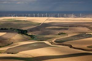
Significant business within the state include the design and manufacture of aircraft (Boeing), automotive (Paccar), computer software development (Microsoft, Bungie, Amazon, Nintendo of America, Valve, ArenaNet, Cyan Worlds), telecom (T-Mobile US), electronics, biotechnology, aluminum production, lumber and wood products (Weyerhaeuser), mining, beverages (Starbucks, Jones Soda), real estate (John L. Scott, Colliers International, Windermere Real Estate, Kidder Mathews), retail (Nordstrom, Eddie Bauer, Car Toys, Costco, R.E.I.), and tourism (Alaska Airlines, Expedia, Inc.). A Fortune magazine survey of the top 20 Most Admired Companies in the U.S. has four Washington-based companies: Amazon, Starbucks, Microsoft, and Costco.[175] At over 80 percent the state has significant amounts of hydroelectric power generation. Also, significant amounts of trade with Asia pass through the ports of the Puget Sound, leading to a number six ranking of U.S. ports (ranking combines twenty-foot equivalent units (TEUs) moved and infrastructure index).[176]
With the passage of Initiative 1183, the Washington State Liquor Control Board (WSLCB) ended its monopoly of all-state liquor store and liquor distribution operations on June 1, 2012. The board transitioned into licensing and regulating the sale of alcohol, tobacco, and later cannabis after the passage of Initiative 502.[177][178]
The state is home to several of the wealthiest people in the United States and the world by net worth. Microsoft co-founder Bill Gates and Amazon founder Jeff Bezos both held the title of world's richest person, as determined by Forbes, while living in Washington.[179]
Taxes
The state of Washington is one of seven states that do not levy a personal income tax. The state does not collect a corporate income tax or franchise tax either. Washington businesses are responsible for various other state levies, including the business and occupation tax (B & O), a gross receipts tax which charges varying rates for different types of businesses.
Washington's state base sales tax is 6.5%, which is combined with a local sales tax that varies by locality. The combined state and local retail sales tax rates increase the taxes paid by consumers, depending on the variable local sales tax rates, generally between 7.5% and 10%.[180] اعتبارا من 2024[تحديث], the combined sales tax rate in Seattle was 10.25%. The Snohomish County cities of Lynnwood, Mill Creek, Mukilteo are tied for the highest sales tax rate in the state at 10.6%.[181] These taxes apply to services as well as products, but not most foods due to a 1977 ballot measure.[182][183] However, prepared foods, dietary supplements, and soft drinks remain taxable.[184]
An excise tax applies to certain products such as gasoline, cigarettes, and alcoholic beverages. Property tax was the first tax levied in the state of Washington, and its collection accounts for about 30% of Washington's total state and local revenue. It continues to be the most important revenue source for public schools, fire protection, libraries, parks and recreation, and other special-purpose districts.
All real property and personal property are subject to tax unless specifically exempted by law. Most personal property owned by individuals is exempt from tax. Personal property tax applies to personal property used when conducting business, or to other personal property not exempt by law. All property taxes are paid to the county treasurer's office where the property is located. Neither does the state assess any tax on retirement income earned and received from another state. Washington does not collect inheritance taxes. However, the estate tax is de-coupled from the federal estate tax laws, and therefore, the state imposes its estate tax.
Washington state has the 18th highest per capita effective tax rate in the United States, as of 2017.[citation needed] اعتبارا من June 2023[تحديث], Washington has the highest gasoline prices in the United States, at an average of $4.97, in part due to the third-highest gasoline tax in the country.[185] Their tax policy differs from neighboring Oregon's, which levies no sales tax, but does levy a personal income tax. This leads to border economic anomalies in the Portland–Vancouver metropolitan area.[186] Additional border economies with tax disparities exist with neighboring Idaho, which has a lower sales tax rate;[187] and British Columbia, which has higher costs for goods and has residents who commute into Washington for shopping.[188] These include remote mailbox and courier services for American online retailers, which became ubiquitous in border communities in the 21st century.[189]
الزراعة

Washington is a leading agricultural state. For 2018, the total value of Washington's agricultural products was $10.6 billion.[190] In 2014, Washington ranked first in the nation in production of red raspberries (90.5 percent of total U.S. production), hops (79.3 percent), spearmint oil (75 percent), wrinkled seed peas (70.4 percent), apples (71.1 percent), sweet cherries (62.3 percent), pears (45.6 percent), Concord grapes (55.1 percent), carrots for processing (30.6 percent), and green peas for processing (32.4 percent).[191]
Washington also ranked second in the nation in the production of fall potatoes (a quarter of the nation's production), nectarines, apricots, asparagus, all raspberries, grapes (all varieties taken together), sweet corn for processing (a quarter of the nation's production), and summer onions (a fifth of the nation's production). Washington also ranked third in the nation in the production of dried peas, lentils, onions, and peppermint oil.[190]
The apple industry is of particular importance to Washington. Because of the favorable climate of dry, warm summers and cold winters of central Washington, the state has led the U.S. in apple production since the 1920s.[192] Two areas account for the vast majority of the state's apple crop: the Wenatchee–Okanogan region (comprising Chelan, Okanogan, Douglas, and Grant counties), and the Yakima region (comprising Yakima, Benton, and Kittitas counties).[193] Washington produces seven principal varieties of apples which are exported to more than sixty countries.[194]
النبيذ

Washington ranks second in the United States in the production of wine, behind only California.[195] By 2006, the state had over 31،000 acre (130 km2) of vineyards, a harvest of 120،000 short ton (109،000 t) of grapes, and exports going to more than forty countries around the world from the state's 600 wineries. By 2021, that number had grown to 1050 wineries. While there are some viticultural activities in the cooler, wetter western half of the state, almost all (99%) of wine grape production takes place in the desert-like eastern half.[196] The rain shadow of the Cascade Range leaves the Columbia River Basin with around 8 بوصات (200 mm) of annual rain fall, making irrigation and water rights of paramount interest to the Washington wine industry. Viticulture in the state is also influenced by long sunlight hours (on average, two more hours a day than in California during the growing season) and consistent temperatures.[197]
العسكرية
اعتبارا من 2022[تحديث], Washington has 108,542 total U.S. Department of Defense personnel, including active duty members of the military and civilian workers at United States Armed Forces bases.[198] It ranks seventh among states for most active duty personnel, at over 60,000, and seventeenth for reserve members.[199] The U.S. Navy and Marines comprise the largest branch in Washington with 45 percent of personnel, followed by the Army at 40 percent and the Air Force at 11 percent.[198] The state is also home to the 11th-largest population of retirees and veterans at over 560,000 اعتبارا من 2019[تحديث].[200]
The state's largest military installations are centered around the Puget Sound region and include Joint Base Lewis–McChord in Pierce County, the largest military base on the West Coast with over 25,000 active duty soldiers;[201] Naval Station Everett in Snohomish County; and Naval Air Station Whidbey Island in Island County.[198][202] The Kitsap Peninsula is home to Naval Base Kitsap, which includes the Puget Sound Naval Shipyard in Bremerton and Naval Submarine Base Bangor,[202] site of the third-largest arsenal of nuclear weapons in the world with more than 1,100 warheads for submarines.[203] Fairchild Air Force Base is a major air force installation near Spokane that has the largest aerial refueling fleet in the world.[204] Washington also has several major companies that serve as defense contractors for the U.S. military who were awarded $6.9 billion in fiscal year 2022. The largest contractors in the state include Boeing, PacMed, and Microsoft.[198][205]
Internet access
This section requires expansion. (December 2017) |
From 2009 to 2014, the Washington State Broadband Project was awarded $7.3 million in federal grants, but the program was discontinued in 2014.[206] For infrastructure, another $166 million has been awarded since 2011 for broadband infrastructure projects in Washington state.[207]
U.S. News & World Report ranked Washington second nationally for household internet access, and sixth for online download speed, based on data from 2014 and 2015.[208]
In 2019, Washington State Legislature established the Washington State Broadband Office with two key mandates: high-speed internet access for 100% of WA residents by 2024 and an increase to 150/150Mbit/s by 2028.[citation needed]
In March 2021, the Washington State Department of Commerce issued their first biennial report on the progress of these key mandates throughout 2020.[209]
The report includes five sections: public survey results, digital adoption disparities as they relate to federal census data, a Partner-Plan-Fund-Build-Adopt model for continued progress, success stories, and a policy discussion conclusion.
According to the report, "...over 42,000 survey responses from nearly 32,000 unique locations, showing that 6.4 percent of respondents reported having no broadband service, and 57 percent reported service at download speeds under 25 Mbps..."
النقل

الكيماويات السامة
القانون والحكومة

السياسة
| السنة | الجمهوري | الديمقراطي | حزب ثالث | |||
|---|---|---|---|---|---|---|
| رقم. | % | رقم. | % | رقم. | % | |
| 2020 | 1,584,651 | 38٫77% | 2,369,612 | 57٫97% | 133,368 | 3٫26% |
| 2016 | 1,221,747 | 36٫83% | 1,742,718 | 52٫54% | 352,531 | 10٫63% |
| 2012 | 1,290,670 | 41٫03% | 1,755,396 | 55٫80% | 99,892 | 3٫18% |
| 2008 | 1,229,216 | 40٫26% | 1,750,848 | 57٫34% | 73,197 | 2٫40% |
| 2004 | 1,304,894 | 45٫60% | 1,510,201 | 52٫77% | 46,618 | 1٫63% |
| 2000 | 1,108,864 | 44٫56% | 1,247,652 | 50٫13% | 132,229 | 5٫31% |
| 1996 | 840,712 | 37٫30% | 1,123,323 | 49٫84% | 289,802 | 12٫86% |
| 1992 | 731,234 | 31٫96% | 993,037 | 43٫40% | 563,959 | 24٫65% |
| 1988 | 903,835 | 48٫46% | 933,516 | 50٫05% | 27,902 | 1٫50% |
| 1984 | 1,051,670 | 55٫82% | 807,352 | 42٫86% | 24,888 | 1٫32% |
| 1980 | 865,244 | 49٫66% | 650,193 | 37٫32% | 226,957 | 13٫03% |
| 1976 | 777,732 | 50�00% | 717,323 | 46٫11% | 60,479 | 3٫89% |
| 1972 | 837,135 | 56٫92% | 568,334 | 38٫64% | 65,378 | 4٫44% |
| 1968 | 588,510 | 45٫12% | 616,037 | 47٫23% | 99,734 | 7٫65% |
| 1964 | 470,366 | 37٫37% | 779,881 | 61٫97% | 8,309 | 0٫66% |
| 1960 | 629,273 | 50٫68% | 599,298 | 48٫27% | 13,001 | 1٫05% |
| 1956 | 620,430 | 53٫91% | 523,002 | 45٫44% | 7,457 | 0٫65% |
| 1952 | 599,107 | 54٫33% | 492,845 | 44٫69% | 10,756 | 0٫98% |
| 1948 | 386,315 | 42٫68% | 476,165 | 52٫61% | 42,579 | 4٫70% |
| 1944 | 361,689 | 42٫24% | 486,774 | 56٫84% | 7,865 | 0٫92% |
| 1940 | 322,123 | 40٫58% | 462,145 | 58٫22% | 9,565 | 1٫20% |
| 1936 | 206,892 | 29٫88% | 459,579 | 66٫38% | 25,867 | 3٫74% |
| 1932 | 208,645 | 33٫94% | 353,260 | 57٫46% | 52,909 | 8٫61% |
| 1928 | 335,844 | 67٫06% | 156,772 | 31٫30% | 8,224 | 1٫64% |
| 1924 | 220,224 | 52٫24% | 42,842 | 10٫16% | 158,483 | 37٫60% |
| 1920 | 223,137 | 55٫96% | 84,298 | 21٫14% | 91,280 | 22٫89% |
| 1916 | 167,208 | 43٫89% | 183,388 | 48٫13% | 30,398 | 7٫98% |
| 1912 | 70,445 | 21٫82% | 86,840 | 26٫90% | 165,514 | 51٫27% |
| 1908 | 106,062 | 57٫68% | 58,691 | 31٫92% | 19,126 | 10٫40% |
| 1904 | 101,540 | 69٫95% | 28,098 | 19٫36% | 15,513 | 10٫69% |
| 1900 | 57,456 | 53٫44% | 44,833 | 41٫70% | 5,235 | 4٫87% |
| 1896 | 39,153 | 41٫84% | 53,314 | 56٫97% | 1,116 | 1٫19% |
| 1892 | 36,460 | 41٫45% | 29,802 | 33٫88% | 21,707 | 24٫68% |

The state is typically thought of as politically divided by the Cascade Mountains, with Western Washington being liberal (particularly the I-5 Corridor) and Eastern Washington being conservative.
Although the eastern half of the state votes heavily Republican, the overwhelming Democratic dominance in the Seattle metropolitan area has turned Washington into a reliably blue state. It is considered part of the Blue wall of states that have voted Democratic in every presidential election since 1992. This voting streak began with Democrat Michael Dukakis narrowly capturing Washington in 1988. The state has since turned much more solidly blue, beginning with Obama's landslide victory in 2008, and Democrats winning the state by double digits in every subsequent presidential election.
Washington was considered a key swing state in 1968, and it was the only western state to give its electoral votes to Democratic nominee Hubert Humphrey over his Republican opponent Richard Nixon. Washington was considered a part of the 1994 Republican Revolution, and had the biggest pick-up in the house for Republicans, who picked up seven of Washington's nine House seats.[211] However, this dominance did not last for long, as Democrats picked up one seat in the 1996 election,[212] and two more in 1998, giving the Democrats a 5–4 majority.[213]
The governorship is held by Democrat Jay Inslee, who was elected to his first term in the 2012 gubernatorial election and, after the 2020 election, became the first incumbent in more than 40 years to be elected for a third term. In 2013 and 2014, both houses of the Washington State Legislature (the Washington Senate and the Washington House of Representatives) were controlled by Democrats. The state senate was under Republican control, due to two Democrats' joining Republicans to form the Majority Coalition Caucus. After the 2014 elections, the Democrats retained control of the House, while Republicans took a majority in the Senate without the need for a coalition. In November 2017, a special election gave Democrats a one-seat majority in the Senate and complete control over state government. Since then, in the 2018 election, the Democrats have only expanded their majorities.
No state has gone longer without a Republican governor than Washington. Democrats have controlled the Washington Governor's Mansion for 41 years; the last Republican governor was John Spellman, who left office in 1985. Washington has not voted for a Republican senator, governor, or presidential candidate since 1994, tying with Delaware for the longest streak in the country.[214]
Washington uses the non-partisan blanket primary system after the approval of Initiative 872 in 2004.[215] All candidates run on the same ballot during primary elections and the top two candidates advance to the general election in November, regardless of party affiliation. This has resulted in several same-party general election match-ups. In a 2020 study, Washington was ranked as the second easiest state for citizens to vote in.[216]
The 2023 American Values Atlas by Public Religion Research Institute found that same-sex marriage is supported near-universally in Washington.[217]
التعليم
الثقافة
 علم Washington | |
 شعار Washington | |
| رموز حية | |
|---|---|
| البرمائي | Pacific chorus frog |
| الطائر | American goldfinch |
| السمك | Steelhead trout |
| الزهرة | Rhododendron |
| الحشائش | Bluebunch wheatgrass |
| الحشرة | Green Darner |
| الثديي | Olympic marmot/Orca |
| الشجرة | Western Hemlock |
| الخضروات | Sweet onion |
| رموز جامدة | |
| الرقصة | Square dance |
| الطعام | Apple |
| الحجر الكريم | Petrified wood |
| السفينة | Lady Washington |
| التربة | Tokul |
| الترتان | Washington state tartan |
| علامة طريق ولائي | |
 | |
| ربع دولار الولاية | |
 طـُرِح في 2007 | |
| قوائم رموز الولايات الأمريكية | |
Sports
Pickleball, a racquet sport invented on Bainbridge Island in 1965, was designated as Washington's official state sport in 2022.[218] For two years in a row, 2021 and 2022, the sport was named the fastest growing sport in the United States by the Sports and Fitness Industry Association (SFIA).[219]
Major professional teams
| Club | Sport | League | Stadium and city |
|---|---|---|---|
| Seattle Kraken | Ice Hockey | National Hockey League | Climate Pledge Arena, Seattle |
| Seattle Mariners | Baseball | Major League Baseball (AL) | T-Mobile Park, Seattle |
| Seattle Reign FC | Soccer | National Women's Soccer League | Lumen Field, Seattle |
| Seattle Seahawks | Football | National Football League (NFC) | Lumen Field, Seattle |
| Seattle Sounders FC | Soccer | Major League Soccer (West) | Lumen Field, Seattle |
| Seattle Storm | Basketball | Women's National Basketball Association | Climate Pledge Arena, Seattle |
Minor professional and amateur teams
College sports teams
- Washington Huskies (Pac-12 Conference; Football Bowl Subdivision)
- Washington State Cougars (Pac-12 Conference; Football Bowl Subdivision)
- Gonzaga Bulldogs (West Coast Conference)
- Seattle Redhawks (Western Athletic Conference)
- Eastern Washington Eagles (Big Sky Conference; Football Championship Subdivision)
- Central Washington Wildcats
- Saint Martin's Saints
- Seattle Pacific Falcons
- Western Washington Vikings
Individual sports
The Seattle Open Invitational golf tournament was part of the PGA Tour from the 1930s to the 1960s. The GTE Northwest Classic was part of the Senior PGA Tour from 1986 to 1995, and the Boeing Classic since 2005. In addition, the 2015 U.S. Open was held at Chambers Bay, and several major tournaments were held at Sahalee Country Club.
Pacific Raceways is a motorsports venue that has hosted the Northwest Nationals of the NHRA Mello Yello Drag Racing Series and a round of the Trans-Am Series.
The WTA Seattle tennis tournament was part of the WTA Tour from 1977 to 1982.
Symbols, honors, and names
Four ships of the United States Navy, including two battleships, have been named USS Washington in honor of the state. Previous ships had held that name in honor of George Washington. [citation needed]
Unofficial state nickname
The state's nickname, "The Evergreen State",[1][220] was proposed in 1890 by Charles T. Conover of Seattle. The name proved popular as the forests were full of evergreen trees and the abundance of rain keeps the shrubbery and grasses green throughout the year.[221] Although the nickname is widely used by the state, appearing on vehicle license plates for instance, it has not been officially adopted.[1] A 2023 bill in the state legislature to formally recognize it as the state nickname was passed by the senate but was returned to committee.[222][223] The Evergreen State College, a state-funded institution in Olympia, also takes its name from this nickname.
State symbols
The state song is "Washington, My Home", the state bird is the American goldfinch, the state fruit is the apple, and the state vegetable is the Walla Walla sweet onion.[224] The state dance, adopted in 1979, is the square dance. The state tree is the western hemlock. The state flower is the coast rhododendron. The state fish is the steelhead.[1] The state folk song is "Roll On, Columbia, Roll On" by Woody Guthrie. The unofficial, but popularly accepted, state rock song is Louie Louie.[225] The state grass is bluebunch wheatgrass. The state insect is the green darner dragonfly. The state gem is petrified wood. The state fossil is the Columbian mammoth. The state marine mammal is the orca. The state soil is Tokul soil.[226] The state land mammal is the Olympic marmot.[1] The state seal (featured in the state flag as well) was inspired by the unfinished portrait of President George Washington by Gilbert Stuart.[227] The state sport is pickleball.[218]
المدن الشقيقة – اتفاقيات صداقة
ولاية واشنطن لديها علاقات مع العديد من المقاطعات والولايات والكيانات الأخرى، حول العالم.
المدن الشقيقة
 خاليسكو، المكسيك (1996)[228]
 محافظة هيوگو، اليابان
 جولابوك-دو، كوريا الجنوبية
اتفاقيات صداقة
 سيتشوان، الصين
 پانگاسينان، الفلپين
انظر أيضا
ملاحظات
المصادر
- ^ أ ب ت ث ج خطأ استشهاد: وسم
<ref>غير صحيح؛ لا نص تم توفيره للمراجع المسماةSymbols@WA.gov - ^ أ ب خطأ استشهاد: وسم
<ref>غير صحيح؛ لا نص تم توفيره للمراجع المسماة2015CensusH8 - ^ "Word list and common terms". University of Washington (in الإنجليزية). Archived from the original on September 2, 2021. Retrieved September 2, 2021.
Lowercase state: state of Washington or Washington state. Note that Washington State refers to the university in Pullman, Washington.
- ^ "U.S. Census Bureau QuickFacts: Washington". United States Census Bureau. January 7, 2024. Archived from the original on November 21, 2021. Retrieved January 7, 2024.
- ^ Augustyn, Adam; Critchfield, Howard J. (August 12, 2021). "Washington state, United States". Encyclopædia Britannica (in الإنجليزية). Archived from the original on September 2, 2021. Retrieved September 2, 2021.
- ^ "Puget Sound". Washington State Department of Ecology (in الإنجليزية). Archived from the original on September 2, 2021. Retrieved September 2, 2021.
- ^ Cargill, Chris (March 23, 2016). "Agriculture: The cornerstone of Washington's economy". Washington Policy Center (in الإنجليزية). Archived from the original on September 2, 2021. Retrieved September 2, 2021.
- ^ "Washington Agriculture". Washington State Department of Agriculture (in الإنجليزية). Archived from the original on September 2, 2021. Retrieved September 2, 2021.
- ^ أ ب Smith, Rob (September 11, 2019). "Shining the Light on Washington's Robust Commercial Fishing Industry During National Seafood Month". Seattle Business Magazine (in الإنجليزية). Archived from the original on September 2, 2021. Retrieved September 2, 2021.
- ^ "Key Industries in Washington State". Washington State Department of Commerce (in الإنجليزية الأمريكية). Archived from the original on September 1, 2021. Retrieved September 2, 2021.
- ^ Balk, Gene (February 27, 2018). "Liberals outnumber conservatives for first time in Washington state, Gallup poll shows". The Seattle Times. Archived from the original on September 2, 2021. Retrieved May 28, 2020.
- ^ "America's best states to live in, ranked". USA Today. Archived from the original on November 7, 2018. Retrieved November 9, 2018.
- ^ Walsh, John (May 21, 2013). "Q&A: Legal Marijuana in Colorado and Washington". The Brookings Institution (in الإنجليزية الأمريكية). Archived from the original on September 2, 2021. Retrieved September 2, 2021.
- ^ Casey, Heather. "Guides: A Brief History of Civil Rights in the United States: A Timeline of the Legalization of Same-Sex Marriage in the U.S." Georgetown Law Library (in الإنجليزية). Archived from the original on September 2, 2021. Retrieved September 2, 2021.
- ^ أ ب Connelly, Joel (May 15, 2019). "Connelly: When Washington legalized abortion, before Roe v. Wade". Seattle Post-Intelligencer (in الإنجليزية الأمريكية). Archived from the original on September 2, 2021. Retrieved September 2, 2021.
- ^ "Death with Dignity Act". Washington State Department of Health. Archived from the original on September 2, 2021. Retrieved September 2, 2021.
- ^ "Physician-Assisted Suicide Fast Facts" (in الإنجليزية). CNN. November 26, 2014. Archived from the original on September 2, 2021. Retrieved September 2, 2021.
- ^ Brier, Warren J. (1960). "How Washington Territory Got Its Name". The Pacific Northwest Quarterly. 51 (1): 13–15. ISSN 0030-8803. JSTOR 40487423. Archived from the original on September 2, 2021. Retrieved September 2, 2021 – via JSTOR.
Two Southern Congressmen were instrumental in naming the Territory of Washington in 1853. Although the citizens of northern Oregon had requested the organization of a new territory to be called "Columbia", Richard H. Stanton of Kentucky and Edward Stanly of North Carolina convinced members of the House of Representatives that the territory should be named after George Washington. Attempts to change or alter the designation "Washington" were unsuccessful in both the House and the Senate.
- ^ "History". City of Longview, WA. Archived from the original on March 6, 2014. Retrieved April 17, 2014.
- ^ أ ب "Territorial Timeline". Washington History. Washington Secretary of State. Archived from the original on June 19, 2013. Retrieved February 26, 2010.
- ^ "House Resolution No. 2016–4662" (PDF). Washington State Legislature. February 15, 2016. Archived (PDF) from the original on February 15, 2017. Retrieved April 4, 2017.
- ^ Palmer, Brian (February 9, 2012). "How Did Washington State and Washington, D. C., Get the Same Name?". Slate. Archived from the original on April 7, 2017. Retrieved April 7, 2017.
- ^ Bush, Evan (October 19, 2016). "Dear D. C., you can't call yourself 'State of Washington'. That's our name". The Seattle Times. Archived from the original on April 8, 2017. Retrieved April 7, 2017.
- ^ Berger, Knute (November 7, 2016). "D. C. wants to steal our state's name. They can have it". Crosscut. Archived from the original on April 8, 2017. Retrieved April 7, 2017.
- ^ "Kennewick Man Skeletal Find May Revolutionalize Continent's History". Science Daily. Middle Tennessee State University. April 26, 2006. Archived from the original on March 6, 2019. Retrieved April 18, 2014.
- ^ Meyer, Robinson (August 16, 2016). "A Major Earthquake in the Pacific Northwest Looks Even Likelier". The Atlantic. Archived from the original on September 2, 2021. Retrieved September 2, 2021.
- ^ Eligon, John (November 14, 2019). "A Native Tribe Wants to Resume Whaling. Whale Defenders Are Divided". The New York Times (in الإنجليزية الأمريكية). ISSN 0362-4331. Archived from the original on September 2, 2021. Retrieved September 2, 2021.
- ^ "Makah Whaling & Whale Hunt – Makah Tribe (Neah Bay, Washington)". Makah Tribe (in الإنجليزية الأمريكية). Archived from the original on September 2, 2021. Retrieved September 2, 2021.
- ^ Walker, James. "Bruno de Hezeta y Dudagoitia (1744–1807)". Oregon Encyclopedia (in الإنجليزية). Archived from the original on September 2, 2021. Retrieved September 2, 2021.
- ^ Lange, Greg (January 23, 2003). "Smallpox epidemic ravages Native Americans on the northwest coast of North America in the 1770s". Historylink.org. Archived from the original on May 26, 2008. Retrieved July 31, 2010.
- ^ "Washington State Archives". Washington Secretary of State. Archived from the original on September 2, 2021. Retrieved September 2, 2021.
- ^ "Washington State Archives". Washington Secretary of State. Archived from the original on September 2, 2021. Retrieved September 2, 2021.
- ^ "Cascades Volcano Observatory, History – Ensign Manuel Quimper – Map of the Northwest Coast of North America – Strait of Juan de Fuca". United States Geological Survey. Archived from the original on September 2, 2021. Retrieved September 2, 2021.
In 1790, Ensign Manuel Quimper of the Spanish Navy set sail from Nootka, a temporary settlement on Vancouver Island, with orders to explore the newly discovered Strait of Juan de Fuca. Accompanying Quimper was first-pilot Gonzalo Lopez de Haro who drew detailed charts during the six-week expedition.
- ^ "Spanish Explorations of the Pacific Northwest and the First Nootka Sound Settlement, 1790–1791". The National Archives and Records Administration (in الإنجليزية الأمريكية). October 12, 2017. Archived from the original on September 2, 2021. Retrieved September 2, 2021.
- ^ "George Vancouver". Northwest Power and Conservation Council (in الإنجليزية). Archived from the original on September 2, 2021. Retrieved September 2, 2021.
- ^ "Center for the Study of the Pacific Northwest: Timeline of Events along the Northwest Coast". University of Washington. Archived from the original on September 2, 2021. Retrieved September 2, 2021.
- ^ "After Nootka". Maritime Museum of British Columbia (in الإنجليزية). Archived from the original on September 2, 2021. Retrieved September 2, 2021.
When the Nootka Convention was drawn in Europe in 1790, the details of the Nootka Crisis far off in the Pacific were not known. The Convention insisted that property seized by the Spanish be returned to the British and that Spain, Britain, and any other European nation, for that matter, could access and settle the Pacific Northwest. In signing the Nootka Convention, the Spanish gave up what the British thought to be their "pretension" to "exclusive sovereignty, navigation, and commerce" in the Pacific.
- ^ Lang, William. "Robert Gray (1755–1806)". Oregon Encyclopedia (in الإنجليزية). Archived from the original on September 2, 2021. Retrieved September 2, 2021.
- ^ "History of the journey through Washington". Washington State Parks and Recreation Commission. Archived from the original on September 2, 2021. Retrieved September 2, 2021.
- ^ Nisbet, Jack. "David Thompson (1770–1857)". Oregon Encyclopedia (in الإنجليزية). Archived from the original on September 2, 2021. Retrieved September 2, 2021.
- ^ "Milestones: 1801–1829 – Office of the Historian". Office of the Historian. Archived from the original on September 2, 2021. Retrieved September 2, 2021.
The Rush-Bagot Pact was an agreement between the United States and Great Britain to eliminate their fleets from the Great Lakes, excepting small patrol vessels. The Convention of 1818 set the boundary between the Missouri Territory in the United States and British North America (later Canada) at the forty-ninth parallel. Both agreements reflected the easing of diplomatic tensions that had led to the War of 1812 and marked the beginning of Anglo-American cooperation.
- ^ "A Question of Boundaries". Library of Congress. Archived from the original on September 2, 2021. Retrieved September 2, 2021.
- ^ Assmann, Cody (May 26, 2020). "Hudson's Bay Company: Tycoon of the Fur Trade". Frontier Life (in الإنجليزية الأمريكية). Archived from the original on September 2, 2021. Retrieved September 2, 2021.
- ^ "Biography – SINCLAIR, JAMES – Volume VIII (1851–1860)". Dictionary of Canadian Biography. Archived from the original on September 2, 2021. Retrieved September 2, 2021.
- ^ أ ب "Oregon Treaty". The Canadian Encyclopedia. Archived from the original on September 2, 2021. Retrieved September 2, 2021.
- ^ "What's This Place – Whitman Mission National Historic Site". United States National Park Service (in الإنجليزية). Archived from the original on September 2, 2021. Retrieved September 2, 2021.
- ^ Norton, Melanie J.; Booss, John (January 2019). "Missionaries, measles, and manuscripts: revisiting the Whitman tragedy". Journal of the Medical Library Association. 107 (1): 108–113. doi:10.5195/jmla.2019.538. ISSN 1536-5050. PMC 6300234. PMID 30598656.
The missionaries Marcus Whitman, a doctor, and Narcissa Whitman, his wife, and twelve other members of the Waiilatpu Mission were murdered in November 1847 by a small contingent of the Cayuse Indians in the Oregon Territory. The murders became known as the "Whitman Massacre." The authors examine the historical record, including archived correspondence held at the Yale University Libraries and elsewhere, for evidence of what motivated the killings and demonstrate that there were two valid perspectives, Cayuse and white. Hence, the event is better termed the "Whitman Tragedy." A crucial component, a highly lethal measles epidemic, has been called the spark that lit the fuse of the tragedy.
- ^ Williams, David B. (March 19, 2020). "Hudson's Bay Company builds Fort Nisqually in spring 1833". Historylink.org. Archived from the original on September 2, 2021. Retrieved September 2, 2021.
- ^ "History of the City of Tumwater, Washington". City of Tumwater, Washington Government. Archived from the original on September 2, 2021. Retrieved September 2, 2021.
- ^ "Articles on George Washington Bush". City of Tumwater, WA. Archived from the original on July 14, 2007. Retrieved June 15, 2007.
- ^ McClintock, Thomas C. (July 1, 1995). "James Saules, Peter Burnett, and the Oregon Black Exclusion Law of June 1844". The Pacific Northwest Quarterly. 86 (3): 122.
- ^ "The Pig War". National Park Service, U.S. Department of the Interior. Archived from the original on 2007-01-10. Retrieved 2012-09-07.
- ^ Weber, Dennis P. (2003). "The Creation of Washington: Securing Democracy North of the Columbia" (PDF). Columbia—The Magazine of Northwest History. 17 (3). Archived (PDF) from the original on June 29, 2016. Retrieved September 9, 2019.
- ^ Meany Condon, p. 4
- ^ Lange, Greg (February 15, 2003). "Washington is admitted as the 42nd state to the United States of America on November 11, 1889". Historylink.org. Archived from the original on June 22, 2011. Retrieved November 10, 2010.
- ^ Hoang, Mai (September 8, 2018). "Red Delicious no longer king as Yakima Valley embraces apple diversity". Yakima Herald-Republic (in الإنجليزية). Archived from the original on September 2, 2021. Retrieved September 2, 2021.
- ^ "Coal, Metallic and Mineral Resources". Washington State Department of Natural Resources. Archived from the original on September 2, 2021. Retrieved September 2, 2021.
- ^ Wigren, Erika L. (May 8, 2019). "From the Tacoma Community History Project: A History of the Tacoma Smelter & Its Workers". UW Tacoma Library (in الإنجليزية الأمريكية). Archived from the original on September 2, 2021. Retrieved September 2, 2021.
- ^ Kershner, Jim (September 8, 2015). "Boeing and Washington". Historylink.org. Archived from the original on September 2, 2021. Retrieved September 2, 2021.
- ^ "Grand Coulee Dam Construction and Legacy". University of Washington. Archived from the original on September 2, 2021. Retrieved September 2, 2021.
- ^ "Discovery Park History". City of Seattle, Washington Government. Archived from the original on September 2, 2021. Retrieved September 2, 2021.
- ^ "Hanford History – Hanford Site". Hanford Site. Archived from the original on September 2, 2021. Retrieved September 2, 2021.
- ^ "Lesson Twenty-One: African Americans in the Modern Northwest". University of Washington. Archived from the original on September 2, 2021. Retrieved September 2, 2021.
- ^ "Great Migration". University of Washington. Archived from the original on September 2, 2021. Retrieved September 2, 2021.
- ^ Caldbick, John (May 18, 2010). "1970 Census: Women outnumber men in Washington state for first time; Seattle and Spokane lose population as Tacoma and Everett gain; early baby boomers approach adulthood". historylink.org. Archived from the original on September 2, 2021. Retrieved September 2, 2021.
- ^ "Washington's 1970 Abortion Reform Victory: The Referendum 20 Campaign – Seattle Civil Rights and Labor History Project". University of Washington. Archived from the original on September 2, 2021. Retrieved September 2, 2021.
- ^ "Mount St. Helens: Senator Murray Speaks on the 25th Anniversary of the May 18, 1980 Eruption". Senate.gov. Archived from the original on August 21, 2012. Retrieved January 8, 2010.
- ^ "Mount St. Helens National Volcanic Monument". USDA Forest Service. Archived from the original on November 22, 2011. Retrieved January 8, 2010.
- ^ "Washington State Constitution—Article XXIV—Boundaries". Washington State Legislature. Archived from the original on July 24, 2019. Retrieved April 17, 2014.
- ^ "Britain and the United States agree on the 49th parallel as the main Pacific Northwest boundary in the Treaty of Oregon on June 15, 1846—HistoryLink.org". Historylink.org. Archived from the original on September 13, 2017. Retrieved September 4, 2017.
- ^ "Volcano Hazards including Lahars – Emergency Management". City of Seattle, Washington Government. Archived from the original on September 2, 2021. Retrieved September 2, 2021.
- ^ "Elevations and Distances in the United States—Highest and Lowest Elevations". U.S. Geological Survey. April 29, 2005. Archived from the original on November 9, 2013. Retrieved April 17, 2014.
- ^ "Volcano Hazards Program—Mount Rainier Hazards". U.S. Geological Survey. December 17, 2012. Archived from the original on April 19, 2014. Retrieved April 17, 2014.
- ^ Blumenthal, Les (August 29, 2006). "Washington State's Glaciers are Melting, and That Has Scientists Concerned". McClatchy Newspapers. Commondreams.org. Archived from the original on July 25, 2008. Retrieved September 13, 2009.
- ^ Mapes, Lynda V. (February 3, 2010). "Hoh Rain Forest revels in wet, 'wild ballet'". The Seattle Times. Archived from the original on February 4, 2010. Retrieved February 4, 2010.
- ^ "Seattle's Rainy Reputation Is Well-Deserved". October 15, 2016. Archived from the original on February 6, 2021. Retrieved January 17, 2021.
- ^ "Washington State Department of Agriculture". National Association of State Departments of Agriculture (in الإنجليزية الأمريكية). Archived from the original on September 2, 2021. Retrieved September 2, 2021.
Eastern Washington, known for its desert-like climate, has both irrigated and dryland farms. Agricultural highlights include cattle ranching, dairy farms, wheat, apples, pears, cherries, and other tree fruits, as well as varieties of grapes and vegetables.
- ^ "Pullman 2 NW, Washington Period of Record Climate summary". Western Regional Climate Center. Archived from the original on January 13, 2012. Retrieved September 22, 2011.
- ^ Phillips, James W. (1971). Washington State Place Names. University of Washington Press. ISBN 978-0-295-95158-4.
- ^ "Dust Storm in Eastern Washington: Image of the Day". NASA Earth Observatory. October 6, 2009. Archived from the original on October 9, 2009. Retrieved October 10, 2009.
- ^ Gibbens, Sarah (June 29, 2021). "What is a heat dome? Pacific Northwest swelters in record temperatures". National Geographic (in الإنجليزية). Archived from the original on September 2, 2021. Retrieved September 2, 2021.
- ^ Kruckeberg, Arthur R. (1991). The Natural History of Puget Sound Country. University of Washington Press. pp. 42–43. ISBN 978-0-295-97477-4.
- ^ Banel, Feliks (January 2, 2019). "The 'Big Snow of 1880' is still the biggest Seattle has ever seen". MyNorthwest. Archived from the original on September 2, 2021. Retrieved September 2, 2021.
- ^ أ ب Dorpat, Paul (January 31, 2002). "Snow and Other Weathers—Seattle and King County". Historylink.org. Archived from the original on September 2, 2021. Retrieved September 2, 2021.
- ^ Dougherty, Phil (January 23, 2007). "Record low temperatures and heavy snow plague Washington state for three weeks beginning on January 12, 1950". Historylink.org. Archived from the original on September 2, 2021. Retrieved September 2, 2021.
- ^ "United States Extreme Record Temperatures & Differences". Golden Gate Weather Services. 2005. Archived from the original on October 1, 2012. Retrieved October 14, 2012.
- ^ "Washington could see La Niña winter with wetter, colder weather than normal". KING5 (in الإنجليزية الأمريكية). September 10, 2020. Archived from the original on September 2, 2021. Retrieved September 2, 2021.
- ^ "Climate Change—Economic Impacts". Washington State Department of Ecology. Archived from the original on July 30, 2010. Retrieved July 31, 2010.
- ^ "Climate of Washington". Western Regional Climate Center. Archived from the original on September 2, 2021. Retrieved September 2, 2021.
- ^ "Mt. Baker Holds Snowfall Record". National Oceanic and Atmospheric Administration. August 2, 1999. Archived from the original on January 7, 2013. Retrieved April 17, 2014.
- ^ "Washington State Records". Office of the Washington State Climatologist. Archived from the original on September 2, 2021. Retrieved February 25, 2021.
- ^ Markell, Joanna (February 10, 2022). "Washington officially has a new all-time maximum temperature record: 120 degrees". Yakima Herald-Republic. Archived from the original on February 11, 2022. Retrieved February 10, 2022.
- ^ "118?!?! Here is how hot it got around Western Washington during historic heat wave". Fox 13 Seattle. June 29, 2021. Archived from the original on July 22, 2014. Retrieved September 28, 2021.
- ^ "Western Regional Climate Data Center, Longview". Wrcc.dri.edu. Archived from the original on May 18, 2012. Retrieved July 31, 2010.
- ^ "Seattle, WA Monthly Weather Forecast - weather.com". The Weather Channel (in الإنجليزية الأمريكية). Retrieved 2023-10-31.
- ^ "Bellingham 3 SSW, Washington". قالب:WRCC/name. Western Regional Climate Center (WRCC), National Oceanic and Atmospheric Administration (NOAA). Retrieved September 21, 2016.
- ^ "EPHRATA MUNI AP, WASHINGTON". قالب:WRCC/name. Western Regional Climate Center (WRCC), National Oceanic and Atmospheric Administration (NOAA).
- ^ "Quillayute State Airport, Washington". قالب:WRCC/name. Western Regional Climate Center (WRCC), National Oceanic and Atmospheric Administration (NOAA). Retrieved September 21, 2016.
- ^ "Rainier Paradise Ranger Station, Washington". قالب:WRCC/name. Western Regional Climate Center (WRCC), National Oceanic and Atmospheric Administration (NOAA). Retrieved September 21, 2016.
- ^ "Richland, Washington". قالب:WRCC/name. Western Regional Climate Center (WRCC), National Oceanic and Atmospheric Administration (NOAA). Retrieved September 21, 2016.
- ^ "Seattle Tacoma International Airport, Washington". قالب:WRCC/name. Western Regional Climate Center (WRCC), National Oceanic and Atmospheric Administration (NOAA). Retrieved September 21, 2016.
- ^ "NOWData". Spokane Area monthly summarized data for 1981–2010: mean maximum, mean average, and mean minimum temperature. National Weather Service Forecast Office, Spokane, Washington, National Oceanic and Atmospheric Administration (NOAA). Archived from the original on September 21, 2016. Retrieved September 21, 2016.
- ^ "Vancouver 4 NNE, Washington". قالب:WRCC/name. Western Regional Climate Center (WRCC), National Oceanic and Atmospheric Administration (NOAA). Retrieved September 21, 2016.
- ^ "WINTHROP 1 WSW, WASHINGTON". قالب:WRCC/name. Western Regional Climate Center (WRCC), National Oceanic and Atmospheric Administration (NOAA).
- ^ "Yakima Air Terminal, Washington". قالب:WRCC/name. Western Regional Climate Center (WRCC), National Oceanic and Atmospheric Administration (NOAA). Retrieved September 21, 2016.
- ^ "The Diversity of Washington's Forests—Washington Forestland Ownership". Washington Forest Protection Association. Archived from the original on April 18, 2014. Retrieved July 14, 2013.
- ^ "Washington Flora Checklist". University of Washington. University of Washington Herbarium. 2010. Archived from the original on August 20, 2013. Retrieved July 15, 2013.
- ^ أ ب Clark, Eugene. "Washington (state, United States)". Encyclopædia Britannica. Archived from the original on July 16, 2013. Retrieved July 15, 2013.
- ^ "Species Fact Sheets—Mammals". Washington Department of Fish & Wildlife. Archived from the original on July 8, 2013. Retrieved July 14, 2013.
- ^ "BirdWeb—Browse Birds". Seattle Audubon Society. Archived from the original on April 22, 2014. Retrieved April 17, 2014.
- ^ "Introduced Wildlife of Oregon and Washington" (PDF). University of Nebraska–Lincoln. April 27, 2001. Archived from the original on December 13, 2013. Retrieved July 14, 2013.
- ^ "Plants and Animals in Washington". Landscope. Archived from the original on June 24, 2013. Retrieved July 14, 2013.
- ^ Wydoski, Richard; Whitney, Richard (2003). Inland Fishes of Washington (2nd ed.). University of Washington Press. ISBN 978-0-295-98338-7.
- ^ "Species Fact Sheets—Reptiles and Amphibians". Washington Department of Fish and Wildlife. Archived from the original on July 27, 2013. Retrieved July 15, 2013.
- ^ "Washington Herp Atlas". Washington Department of Fish and Wildlife. June 1, 2009. Archived from the original on April 9, 2012. Retrieved July 15, 2013.
- ^ "Washington". United States National Park Service. 2013. Archived from the original on September 22, 2013. Retrieved July 15, 2013.
- ^ "Listing of National Park System Areas by State". United States National Park Service. Archived from the original on December 3, 2013. Retrieved July 15, 2013.
- ^ "Alphabetic list of Washington State Parks". Washington State Park System. Archived from the original on September 21, 2014. Retrieved July 15, 2013.
- ^ "Land Areas of the National Forest System" (PDF). United States Forest Service. January 1, 2013. Archived from the original on July 1, 2013. Retrieved July 15, 2013.
- ^ "Washington County Profiles". Municipal Research and Services Center. Archived from the original on September 3, 2021. Retrieved September 3, 2021.
- ^ "U.S. Census Bureau QuickFacts: Seattle city, Washington". United States Census Bureau (in الإنجليزية). Archived from the original on October 26, 2021. Retrieved September 3, 2021.
- ^ "QuickFacts". United States Census Bureau. Archived from the original on October 12, 2021. Retrieved November 2, 2021.
- ^ خطأ استشهاد: وسم
<ref>غير صحيح؛ لا نص تم توفيره للمراجع المسماة2010Census - ^ "Washington". State & County QuickFacts. U.S. Census Bureau. Archived from the original on September 16, 2008. Retrieved May 11, 2012.
- ^ خطأ استشهاد: وسم
<ref>غير صحيح؛ لا نص تم توفيره للمراجع المسماةCensus2012 - ^ خطأ استشهاد: وسم
<ref>غير صحيح؛ لا نص تم توفيره للمراجع المسماةCensusGuide - ^ أ ب "Table 2. Resident Population for the 50 States, the District of Columbia, and Puerto Rico: 2020 Census" (PDF). United States Census Bureau. April 26, 2021. Archived (PDF) from the original on April 26, 2021. Retrieved April 26, 2021.
- ^ "QuickFacts Washington; UNITED STATES". 2019 Population Estimates. United States Census Bureau, Population Division. March 19, 2020. Archived from the original on February 2, 2019. Retrieved March 19, 2020.
- ^ "National Totals: Vintage 2019". United States Census Bureau. Retrieved March 19, 2020.[dead link]
- ^ "April 1, 2023 Population of Cities, Towns and Counties Used for Allocation of Selected State Revenues State of Washington" (PDF). Office of Financial Management. Archived (PDF) from the original on July 27, 2023. Retrieved July 27, 2023.
- ^ "2020 Population and Housing State Data". U.S. Census Bureau. Retrieved July 27, 2023.
- ^ "Centers of Population". The United States Census Bureau (in الإنجليزية الأمريكية). Archived from the original on October 28, 2020. Retrieved October 30, 2020.
- ^ "Forests, Wildlife, Ecology". Encyclopedia Britannica. 26 July 1999.
- ^ "Immigrants in Washington" (PDF). americanimmigrationcouncil.org.
- ^ "2007-2022 PIT Counts by State".
- ^ "The 2022 Annual Homelessness Assessment Report (AHAR) to Congress" (PDF).
- ^ أ ب (Microsoft Excel)Estimates of April 1 population by age, sex, race and Hispanic origin, County: 2010–2017, Washington State Office of Financial Management, 2017, https://www.ofm.wa.gov/washington-data-research/population-demographics/population-estimates/estimates-april-1-population-age-sex-race-and-hispanic-origin, retrieved on November 6, 2017
- ^ "Race and Ethnicity in the United States: 2010 Census and 2020 Census". census.gov. United States Census Bureau. August 12, 2021. Archived from the original on August 15, 2021. Retrieved 2021-09-26.
- ^ Gibson, Campbell; Jung, Kay. "Historical Census Statistics on Population Totals By Race, 1790 to 1990, and By Hispanic Origin, 1970 to 1990, For The United States, Regions, Divisions, and States". United States Census Bureau. Archived from the original on July 25, 2008. Retrieved April 17, 2012.
- ^ "All Cities in Washington—Census 2000". US Census Data provided by CensusViewer.com. 2010. Archived from the original on April 19, 2014. Retrieved April 18, 2014.
- ^ "2010 Census Data". United States Census Bureau. 2010. Archived from the original on May 22, 2017. Retrieved April 18, 2014.
- ^ "2016 American Community Survey—Demographic and Housing Estimates". United States Census Bureau. Archived from the original on February 13, 2020. Retrieved November 21, 2018.
- ^ "2016 American Community Survey—Selected Social Characteristics". United States Census Bureau. Archived from the original on February 13, 2020. Retrieved November 21, 2018.
- ^ Exner, Rich (June 3, 2012). "Americans under age 1 now mostly minorities, but not in Ohio: Statistical Snapshot". The Plain Dealer. Cleveland. Archived from the original on July 14, 2016. Retrieved August 4, 2012.
- ^ "Births: Final Data for 2013" (PDF). Centres for Disease Control and Prevention. Archived (PDF) from the original on September 11, 2017. Retrieved September 4, 2017.
- ^ "Births: Final Data for 2014" (PDF). Centres for Disease Control and Prevention. Archived (PDF) from the original on February 14, 2017. Retrieved September 4, 2017.
- ^ "Births: Final Data for 2015" (PDF). Centres for Disease Control and Prevention. Archived (PDF) from the original on August 31, 2017. Retrieved September 4, 2017.
- ^ "Births: Final Data for 2016" (PDF). Centres for Disease Control and Prevention. Archived (PDF) from the original on June 3, 2018. Retrieved May 7, 2018.
- ^ Martin, J. A.; Hamilton, B. E.; Osterman, M. J.K.; Driscoll, A. K.; Drake, P. (2018). "Births: Final Data for 2017" (PDF). National Vital Statistics Reports. 67 (8): 1–50. PMID 30707672. Archived (PDF) from the original on February 1, 2019. Retrieved February 22, 2019.
- ^ "Births: Final Data for 2018" (PDF). Centres for Disease Control and Prevention. Archived (PDF) from the original on November 28, 2019. Retrieved December 21, 2019.
- ^ "Births: Final Data for 2019" (PDF). Centres for Disease Control and Prevention. Archived (PDF) from the original on June 23, 2021. Retrieved April 9, 2021.
- ^ "Births: Final Data for 2020" (PDF). Centres for Disease Control and Prevention. Archived (PDF) from the original on February 10, 2022. Retrieved 2022-02-21.
- ^ "Births: Final Data for 2021" (PDF). Centers for Disease Control and Prevention. Retrieved 2022-02-03.
- ^ Cassandra Tate, "Mandatory Busing in Seattle: Memories of a Bumpy Ride" Archived أكتوبر 31, 2007 at the Wayback Machine, History Link, August 7, 2002. Retrieved October 2, 2008.
- ^ Schwantes, Carlos (2000). The Pacific Northwest: An Interpretive History (Revised and Enlarged ed.). University of Nebraska Press. p. 155. ISBN 978-0803292284.
- ^ Lornet Turnbull (September 17, 2004). "1,500 Cambodian refugees face deportation for crimes". The Seattle Times. Archived from the original on February 23, 2011. Retrieved April 26, 2012.
- ^ "Seattle Population and Demographics". Seattle City, Washington Statistics and Demographics (2000 U.S. Census). areaConnect. Archived from the original on May 22, 2013. Retrieved May 10, 2013.
- ^ Brown, Charles E. (September 30, 2009). "Puget Sound's Samoan community awaits news". The Seattle Times. Archived from the original on January 16, 2013. Retrieved April 26, 2012.
- ^ Race, Hispanic or Latino, Age, and Housing Occupancy: 2010 more information 2010 Census Redistricting Data (Public Law 94-171) Summary File . Factfinder2census.gov. (2010). Retrieved December 30, 2011.
- ^ García, Jerry; Treviño, Dora Sánchez (1998). "A Chicana in Northern Aztlán: An Oral History of Dora Sánchez Treviño". Frontiers: A Journal of Women Studies. 19 (2): 16–52. doi:10.2307/3347156. JSTOR 3347156.
- ^ Ember, Melvin (1997). American Immigrant Cultures: Builders of a Nation. Simon & Schuster Macmillan. p. 264. ISBN 978-0028972145. Archived from the original on March 19, 2015. Retrieved October 17, 2015.
- ^ "Ethiopian and Eritrean Communities in Seattle". HistoryLink. Archived from the original on September 4, 2017. Retrieved June 1, 2017.
- ^ "Somali Community in Seattle—HistoryLink.org". Historylink.org. Archived from the original on April 9, 2017. Retrieved June 1, 2017.
- ^ أ ب "Washington". Modern Language Association. Archived from the original on December 1, 2007. Retrieved August 19, 2013.
- ^ "PRRI – American Values Atlas".
- ^ "Pew Forum on Religion & Public Life (2014)". Religions.pewforum.org. Archived from the original on September 10, 2015. Retrieved September 12, 2015.
- ^ "LDS Statistics and Church Facts | Total Church Membership". Newsroom.churchofjesuschrist.org. Archived from the original on December 27, 2019. Retrieved April 14, 2016.
- ^ "The Association of Religion Data Archives | State Membership Report". Thearda.com. Archived from the original on September 30, 2013. Retrieved December 12, 2013.
- ^ Duval, Cyndi (November 2007). "Wicca more prevalent in the Pacific Northwest than most realize". Christian Examiner. Archived from the original on January 17, 2013. Retrieved October 16, 2012.
- ^ "Gross Domestic Product by State: Fourth Quarter and Annual 2019" (Press release). Bureau of Economic Analysis. Retrieved March 3, 2021.
- ^ Van Dam, Andrew (May 2, 2019). "Fast-growing Washington state knocks Massachusetts out of the top 10 largest state economies". The Washington Post. Archived from the original on December 27, 2019. Retrieved May 2, 2019.
- ^ "History of Washington State's Minimum Wage". Washington State Department of Labor and Industries. Retrieved November 3, 2023.
- ^ Malinsky, Gili (April 14, 2023). "The state with the highest minimum wage isn't California or New York—and it pays more than $15/hour". CNBC. Retrieved November 3, 2023.
- ^ "Unemployment Rates for States". U.S. Bureau of Labor Statistics. October 20, 2023. Retrieved August 20, 2022.
- ^ "Top 20 Most Admired Companies". Fortune. Archived from the original on March 15, 2012. Retrieved March 21, 2012.
- ^ "Ports on East Coast, Gulf Coast Outgain West Coast Peers in Second-Annual CBRE Seaports Index". CBRE Group. April 2, 2016. Archived from the original on July 29, 2016. Retrieved August 9, 2016.
- ^ Saldanha, Alison (February 4, 2023). "Why some say WA efforts to diversify pot industry are not enough". The Seattle Times. Retrieved November 3, 2023.
- ^ González, Ángel (June 30, 2014). "In aftermath of liquor privatization, spirits everywhere, not cheap". The Seattle Times. Retrieved November 3, 2023.
- ^ Geraldo, Renata (November 3, 2023). "With Bezos headed to Miami, a look at WA's richest people". The Seattle Times. Retrieved November 3, 2023.
- ^ "Local Sales and Use Tax Rates by City/County" (PDF). Washington State Department of Revenue. Archived (PDF) from the original on December 31, 2017. Retrieved December 30, 2017.
- ^ Baumbach, Jenelle (December 27, 2023). "3 Snohomish County cities have highest sales tax rate in state". The Everett Herald. Retrieved February 22, 2024.
- ^ "Retail sales tax". Washington State Department of Revenue. Archived from the original on April 20, 2014. Retrieved April 19, 2014.
- ^ "Washington's Tax History" (PDF). Washington State Department of Revenue. p. 20. Retrieved February 22, 2024.
- ^ "Collecting retail sales tax from customers". Washington State Department of Revenue. Retrieved February 22, 2024.
- ^ Gendron, Jared (June 24, 2023). "Why is WA gas so expensive? Experts explain reasons Evergreen State has highest prices". The News Tribune. Retrieved June 24, 2023.
- ^ Uchikura, Azusa (April 25, 2012). "Border-hopping shoppers cost state millions in lost revenue". The Seattle Times. Archived from the original on November 13, 2018. Retrieved November 12, 2018.
- ^ "2014 Cross Border Study" (PDF). Washington State Department of Revenue. May 2014. p. 1. Retrieved November 3, 2023.
- ^ Chiang, Chuck (June 11, 2023). "U.S. border towns still wait for buyers from B.C., as Vancouver shopping buses vanish". CBC News. The Canadian Press. Retrieved November 3, 2023.
- ^ González, Ángel (June 25, 2015). "Border towns enjoy bonanza: packages, tax revenue pile up". The Seattle Times. Retrieved November 3, 2023.
- ^ أ ب "AGRICULTURE: A CORNERSTONE OF WASHINGTON'S ECONOMY". Washington State Department of Agriculture. October 10, 2018. Archived from the original on September 2, 2021. Retrieved March 8, 2021.
- ^ "What's Growing in Washington State?". planwashington.org. Archived from the original on April 17, 2021. Retrieved March 8, 2021.
- ^ Schotzko, Thomas R.; Granatstein, David (2005), A Brief Look at the Washington Apple Industry: Past and Present, Pullman, WA: Washington State University, p. 1, http://www.agribusiness-mgmt.wsu.edu/agbusresearch/docs/SES04-05_BRIEF_LOOK_WAFTA.pdf, retrieved on May 9, 2008
- ^ Lemons, Hoyt; Rayburn, D. Tousley (July 1945). "The Washington Apple Industry. I. Its Geographic Basis". Economic Geography. 21 (3): 161–162, 166. doi:10.2307/141294. JSTOR 141294.
- ^ "Fun facts about Washington Apples". Washington Apple Commission (in الإنجليزية الأمريكية). Archived from the original on September 8, 2018. Retrieved September 8, 2018.
- ^ A. Domine (ed) Wine pg 798–800 Ullmann Publishing 2008 ISBN 978-3-8331-4611-4
- ^ J. Robinson (ed) The Oxford Companion to Wine, Third Edition, pg. 761–762 Oxford University Press 2006 ISBN 0-19-860990-6
- ^ C. Fallis, editor The Encyclopedic Atlas of Wine, p. 50 Global Book Publishing 2006 ISBN 1-74048-050-3
- ^ أ ب ت ث Office of Local Defense Community Cooperation; Federal Research Division (October 2023). Defense Spending by State, Fiscal Year 2022. United States Department of Defense. pp. 112–113, 126. Archived from the original. You must specify the date the archive was made using the
|archivedate=parameter. https://oldcc.gov/sites/default/files/defense-spending-rpts/OLDCC_DSBS_FY2022_FINAL_WEB_October2023.pdf. Retrieved on January 28, 2024. - ^ 2022 Demographics Profile of the Military Community. United States Department of Defense. November 2023. pp. 36, 85. Archived from the original. You must specify the date the archive was made using the
|archivedate=parameter. https://download.militaryonesource.mil/12038/MOS/Reports/2022-demographics-report.pdf. Retrieved on January 28, 2024. - ^ "State Summaries: Washington" (PDF). United States Department of Veteran Affairs. 2020. Retrieved January 28, 2024.
- ^ Ashton, Adam (July 16, 2015). "JBLM retains combat brigades, but loses 4 smaller units". The News Tribune. Retrieved January 26, 2024.
- ^ أ ب Talton, Jon (September 26, 2014). "Military is big business in state, but at what cost?". The Seattle Times. Retrieved January 28, 2024.
- ^ Malone, Patrick (March 12, 2022). "What Russia's nuclear escalation means for Washington, with world's third-largest atomic arsenal". The Seattle Times. Retrieved January 28, 2024.
- ^ Cabeza, Garrett (May 12, 2022). "'My office in the sky:' Fairchild welcomes, refuels Thunderbirds ahead of Skyfest this weekend". The Spokesman-Review. Retrieved January 28, 2024.
- ^ Rivera, Ray (September 30, 2001). "State's huge military presence gains visibility with mobilization". The Seattle Times. Retrieved January 28, 2024.
- ^ "Washington State Broadband Office". Washington State Broadband Office. Archived from the original on June 7, 2015. Retrieved June 3, 2015.
- ^ "List of Broadband Grants in Washington". 2.ntia.doc.gov. Archived from the original on May 12, 2015. Retrieved June 3, 2015.
- ^ Best States for Internet Access, 2017, https://www.usnews.com/news/best-states/rankings/infrastructure/internet-access, retrieved on December 18, 2017
- ^ Washington State Broadband Office 2020 Report, 2021, https://www.commerce.wa.gov/wp-content/uploads/2021/04/032921-2020-WA-State-Broadband-Report-FINAL.pdf, retrieved on April 25, 2023
- ^ Leip, David. "Presidential General Election Results Comparison – Washington". US Election Atlas. Retrieved October 25, 2022.
- ^ "November 1994 General". Washington Secretary of State—Elections Division. Archived from the original on November 27, 2008. Retrieved July 31, 2010.
- ^ "November 1996 General". Washington Secretary of State—Elections Division. Archived from the original on November 27, 2008. Retrieved July 31, 2010.
- ^ "November 1998 General". Washington Secretary of State—Elections Division. Archived from the original on November 27, 2008. Retrieved July 31, 2010.
- ^ Cohn, Nate (June 19, 2017). "The 15 Best-Educated Districts in the U.S., and Why It Matters in the Georgia Race". The New York Times (in الإنجليزية الأمريكية). ISSN 0362-4331. Archived from the original on June 19, 2017. Retrieved June 19, 2017.
- ^ "Washington Top Two Primaries, Initiative 872 (2004)". Ballotpedia. Archived from the original on December 31, 2020. Retrieved December 23, 2020.
- ^ J. Pomante II, Michael; Li, Quan (December 15, 2020). "Cost of Voting in the American States: 2020". Election Law Journal: Rules, Politics, and Policy. 19 (4): 503–509. doi:10.1089/elj.2020.0666. S2CID 225139517.
- ^ Staff (February 24, 2023). "American Values Atlas: Approval of Same-Sex Marriage in Washington". Public Religion Research Institute. Retrieved April 12, 2023.
- ^ أ ب James, Albert (March 28, 2022). "'Life, liberty and pursuit of pickleball': Inslee signs bill designating Washington's official state sport". The Spokesman-Review. Archived from the original on March 29, 2022. Retrieved March 28, 2022.
- ^ Porterfield, Carlie (July 26, 2022). "Here's Why Pickleball—The Fastest-Growing Sport In America—Is Bill Gates' Favorite Game". Forbes. Retrieved August 9, 2022.
- ^ "The Evergreen State: Washington State Nickname". StateSymbolsUSA.org. April 29, 2014. Archived from the original on December 13, 2017. Retrieved December 13, 2017.
- ^ Jollota, Pat (2002). Naming Clark County. Clark County, Washington: Fort Vancouver Historical Society of Clark County. p. 17.
- ^ Dallas, Julia (February 20, 2023). "100 years later, progress for 'Evergreen State' to become Washington's official nickname". KIRO 7 News. Retrieved December 2, 2023.
- ^ "SB 5595 – 2023–24: Adopting the evergreen state as the state nickname". Washington State Legislature. Retrieved December 2, 2023.
- ^ "Senate passes measure designating Walla Walla onion state veggie". Seattle: KOMO News. April 5, 2007. Archived from the original on August 17, 2016. Retrieved July 19, 2016.
- ^ "WSDOT—Highway Map—Washington State Facts". Washington State Department of Transportation. Archived from the original on July 1, 2012. Retrieved November 30, 2010.
- ^ "Tokul – Washington State Soil" (PDF). National Resources Conservation Service – United States Department of Agriculture. Archived from the original (PDF) on May 23, 2022. Retrieved June 7, 2022.
- ^ "History of the State Seal". Secretary of State of Washington. Archived from the original on September 14, 2013. Retrieved April 5, 2007.
- ^ "State of Jalisco, Mexico". Washington Sister States. Archived from the original on September 4, 2020. Retrieved September 5, 2021.
وصلات خارجية
- No URL found. Please specify a URL here or add one to Wikidata.
- The official tourism site of the State of Washington
- Washington State Databases
- Secretary of State's Washington History website
- Constitution of the State of Washington
- Washington Administrative Code (State Administrative Rules)
- State Code Search Tool
- Energy Profile for Washington
- USGS real-time, geographic, and other scientific resources of Washington
- Washington State Facts from USDA
- U.S. Census Bureau Quick Facts: Washington
- Online Encyclopedia of Washington State History
- Police Scanner Information for Washington state
- CWU Brooks Library Edward W. Nolan Photograph Collection
- واشنطن at Curlie
 Geographic data related to واشنطن at OpenStreetMap
| سبقه Montana |
List of U.S. states by date of statehood Admitted on November 11, 1889 (42nd) |
تبعه Idaho |

|
British Columbia، |
| ||
| آيداهو | المحيط الهادي | |||
| المحيط الهادي |
- CS1 الإنجليزية الأمريكية-language sources (en-us)
- Articles with dead external links from July 2019
- Pages using gadget WikiMiniAtlas
- Short description with empty Wikidata description
- Pages using infobox settlement with possible motto list
- Pages using infobox settlement with no coordinates
- Articles with hatnote templates targeting a nonexistent page
- مقالات ذات عبارات بحاجة لمصادر
- مقالات فيها عبارات متقادمة منذ 2023
- جميع المقالات التي فيها عبارات متقادمة
- مقالات فيها عبارات متقادمة منذ سبتمبر 2023
- مقالات فيها عبارات متقادمة منذ 2024
- Articles with unsourced statements from November 2018
- مقالات فيها عبارات متقادمة منذ June 2023
- مقالات فيها عبارات متقادمة منذ 2022
- مقالات فيها عبارات متقادمة منذ 2019
- Articles to be expanded from December 2017
- All articles to be expanded
- Articles with unsourced statements from October 2023
- Articles with unsourced statements from May 2022
- Pages with empty portal template
- Official website missing URL
- Articles with Curlie links
- Coordinates not on Wikidata
- Washington (state)
- 1889 establishments in the United States
- Geography of the Pacific Northwest
- States and territories established in 1889
- ولايات أمريكية
- States of the West Coast of the United States
- الولايات المتحدة المتجاورة
- ولاية واشنطن
- دول ومناطق تأسست في 1889
- شمال غرب الهادي
- الساحل الغربي للولايات المتحدة