مقاطعة كاولتس، واشنطن
(تم التحويل من Cowlitz County، واشنطن)
Cowlitz County | |
|---|---|
 | |
 الموقع ضمن ولاية Washington | |
 موقع Washington ضمن الولايات المتحدة | |
| Coordinates: 46°11′N 122°41′W / 46.19°N 122.68°W | |
| البلد | |
| State | |
| تأسست | 21 April, 1854 |
| Seat | كلسو |
| أكبر مدينة | لونگڤيو |
| Area | |
• Total | 1٬166 ميل² (3٬020 كم²) |
| • Land | 1٬140 ميل² (3٬000 كم²) |
| • Water | 26 ميل² (70 كم²) 2.2% |
| Population | |
• Estimate (2017) | 106٬910 |
| • Density | 90/sq mi (30/km2) |
| Congressional district | 3rd |
| Website | www |
مقاطعة كاولتس إنگليزية: Cowlitz County هي إحدى مقاطعات ولاية واشنطون في الولايات المتحدة الأمريكية.
الديمغرافيا
| التعداد | Pop. | ملاحظة | %± |
|---|---|---|---|
| 1860 | 406 | — | |
| 1870 | 730 | 79٫8% | |
| 1880 | 2٬062 | 182٫5% | |
| 1890 | 5٬917 | 187�0% | |
| 1900 | 7٬877 | 33٫1% | |
| 1910 | 12٬561 | 59٫5% | |
| 1920 | 11٬791 | −6٫1% | |
| 1930 | 31٬906 | 170٫6% | |
| 1940 | 40٬155 | 25٫9% | |
| 1950 | 53٬369 | 32٫9% | |
| 1960 | 57٬801 | 8٫3% | |
| 1970 | 68٬616 | 18٫7% | |
| 1980 | 79٬548 | 15٫9% | |
| 1990 | 82٬119 | 3٫2% | |
| 2000 | 92٬948 | 13٫2% | |
| 2010 | 102٬410 | 10٫2% | |
| 2017 (تق.) | 106٬910 | [1] | 4٫4% |
| U.S. Decennial Census[2] 1790–1960[3] 1900–1990[4] 1990–2000[5] 2010–2016[6] | |||
السياسة
نتائج الانتخابات الرئاسية
| السنة | Republican | Democratic | Third parties |
|---|---|---|---|
| 2016 | 51.3% 24,185 | 38.0% 17,908 | 10.7% 5,049 |
| 2012 | 46.1% 20,746 | 50.5% 22,726 | 3.4% 1,540 |
| 2008 | 43.0% 19,554 | 54.1% 24,597 | 3.0% 1,361 |
| 2004 | 47.5% 20,217 | 50.8% 21,589 | 1.7% 724 |
| 2000 | 45.7% 16,873 | 49.3% 18,233 | 5.0% 1,856 |
| 1996 | 33.5% 11,221 | 53.9% 18,054 | 12.7% 4,240 |
| 1992 | 29.0% 10,000 | 43.6% 15,052 | 27.5% 9,477 |
| 1988 | 42.2% 12,009 | 56.5% 16,090 | 1.3% 366 |
| 1984 | 48.0% 14,858 | 49.6% 15,361 | 2.4% 749 |
| 1980 | 45.9% 13,154 | 43.9% 12,560 | 10.2% 2,925 |
| 1976 | 44.1% 12,531 | 52.7% 14,958 | 3.2% 917 |
| 1972 | 51.2% 14,431 | 45.0% 12,682 | 3.8% 1,069 |
| 1968 | 42.1% 10,842 | 51.9% 13,363 | 6.0% 1,545 |
| 1964 | 27.4% 6,708 | 71.9% 17,605 | 0.8% 188 |
| 1960 | 49.8% 12,103 | 49.6% 12,054 | 0.6% 153 |
| 1956 | 48.8% 11,912 | 51.0% 12,448 | 0.2% 50 |
| 1952 | 52.1% 12,366 | 47.3% 11,242 | 0.6% 138 |
| 1948 | 37.6% 7,098 | 58.6% 11,075 | 3.9% 729 |
| 1944 | 36.7% 6,157 | 62.4% 10,485 | 0.9% 157 |
| 1940 | 34.3% 6,078 | 64.5% 11,420 | 1.2% 216 |
| 1936 | 25.3% 3,617 | 71.0% 10,147 | 3.7% 528 |
| 1932 | 33.9% 3,767 | 49.0% 5,443 | 17.1% 1,903 |
| 1928 | 68.8% 5,882 | 30.2% 2,581 | 1.1% 91 |
| 1924 | 55.7% 3,274 | 15.8% 927 | 28.6% 1,681 |
| 1920 | 61.5% 2,267 | 21.7% 801 | 16.8% 619 |
| 1916 | 55.1% 2,113 | 33.4% 1,282 | 11.5% 439 |
| 1912 | 34.7% 1,348 | 23.6% 919 | 41.7% 1,622[8] |
| 1908 | 65.7% 1,573 | 25.8% 617 | 8.6% 206 |
| 1904 | 77.3% 1,589 | 15.4% 317 | 7.3% 149 |
| 1900 | 63.3% 1,171 | 33.5% 619 | 3.2% 59 |
| 1896 | 49.8% 989 | 49.0% 974 | 1.3% 25 |
| 1892 | 41.7% 738 | 32.0% 566 | 26.3% 466 |
الهامش
- ^ "Population and Housing Unit Estimates". Retrieved 4 April 2018.
- ^ "U.S. Decennial Census". United States Census Bureau. Archived from the original on 12 May 2015. Retrieved 7 January 2014.
{{cite web}}: Unknown parameter|deadurl=ignored (|url-status=suggested) (help) - ^ "Historical Census Browser". University of Virginia Library. Retrieved 7 January 2014.
- ^ "Population of Counties by Decennial Census: 1900 to 1990". United States Census Bureau. Retrieved 7 January 2014.
- ^ "Census 2000 PHC-T-4. Ranking Tables for Counties: 1990 and 2000" (PDF). United States Census Bureau. Retrieved 7 January 2014.
- ^ خطأ استشهاد: وسم
<ref>غير صحيح؛ لا نص تم توفيره للمراجع المسماةQF - ^ Leip, David. "Dave Leip's Atlas of U.S. Presidential Elections". uselectionatlas.org. Retrieved 6 April 2018.
- ^ The leading "other" candidate, Progressive Theodore Roosevelt, received 1,006 votes, while Socialist candidate Eugene Debs received 527 votes, Prohibition candidate Eugene Chafin received 79 votes, and Socialist Labor candidate Arthur Reimer received 10 votes.

|
Lewis County |
| ||
| Skamania County | Wahkiakum County | |||
| Clark County | Columbia County, Oregon |
بلديات ومجتمعات Cowlitz County، Washington، الولايات المتحدة | ||
|---|---|---|
| Cities | 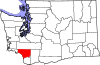 | |
| CDPs | ||
| Other communities | ||
| Footnotes | ‡This populated place also has portions in an adjacent county or counties | |
تصنيفات:
- CS1 errors: unsupported parameter
- Pages using gadget WikiMiniAtlas
- Short description is different from Wikidata
- Infobox U.S. county using a non-standard timezone
- مقاطعات ولاية واشنطن
- Articles containing إنگليزية-language text
- Pages using Lang-xx templates
- Pages using US Census population needing update
- Coordinates on Wikidata
- مقاطعة كاولتس، واشنطن
- تأسيسات 1854 في الولايات المتحدة
- أماكن مأهولة تأسست في 1854
- غرب واشنطن