كولومبيا البريطانية
كولومبيا البريطانية
| |
|---|---|
 Flag | |
| الشعار: | |
| Coordinates: 54°00′00″N 125°00′00″W / 54.00000°N 125.00000°W | |
| البلد | كندا |
| Confederation | July 20, 1871 (7th) |
| العاصمة | Victoria |
| Largest city | ڤانكوڤر |
| Largest metro | ڤانكوڤر الكبرى |
| Government | |
| • Type | ملكية دستورية |
| • Lieutenant Governor | Janet Austin |
| • Premier | John Horgan (NDP) |
| Legislature | Legislative Assembly of British Columbia |
| التمثيل الاتحادي | Parliament of Canada |
| المقاعد بمجلس العموم | 42 of 338 (12.4%) |
| المقاعد بمجلس الشيوخ | 6 of 105 (5.7%) |
| Area | |
• Total | 944٬735 كم² (364٬764 ميل²) |
| • Land | 925٬186 كم² (357٬216 ميل²) |
| • Water | 19٬548٫9 كم² (7٬547٫9 ميل²) 2.1% |
| • Rank | Ranked 5th |
| 9.5% of Canada | |
| Population (2016) | |
• Total | 4٬648٬055[3] |
• Estimate (2020 Q3) | 5٬147٬712[4] |
| • Rank | Ranked 3rd |
| • Density | 5٫02/km2 (13�0/sq mi) |
| Demonym | British Columbian[5] |
| Official languages | None |
| GDP | |
| • Rank | 4th |
| • Total (2015) | CA$$249٫981 billion[6] |
| • Per capita | CA$53,267 (8th) |
| HDI | |
| • HDI (2018) | 0.930[7] — Very high (2nd) |
| Time zones | |
| most of province | UTC−08:00 (Pacific) |
| • Summer (DST) | UTC−07:00 (Pacific DST) |
| far eastern | UTC−07:00 (Mountain) |
| • Summer (DST) | UTC−06:00 (Mountain DST) |
| Postal abbr. | BC |
| Postal code prefix | |
| ISO 3166 code | CA-BC |
| Flower | Pacific dogwood |
| Tree | Western red cedar |
| Bird | Steller's jay |
| Rankings include all provinces and territories | |


كولومبيا البريطانية British Columbia (BC) هي أقصى المقاطعات الكندية إلى الغرب، بين المحيط الهادي وجبال روكي. With an estimated population of 5.1 million اعتبارا من 2020[تحديث], it is Canada's third-most populous province. The capital of British Columbia is Victoria, the fifteenth-largest metropolitan region in Canada, named for Queen Victoria, who ruled during the creation of the original colonies. The largest city is Vancouver, the third-largest metropolitan area in Canada, the largest in Western Canada, and the second-largest in the Pacific Northwest. In October 2013, British Columbia had an estimated population of 4,606,371 (about 2.5 million of whom were in Greater Vancouver).[8] The province is currently governed by the British Columbia New Democratic Party, led by John Horgan with a majority government.
The first British settlement in the area was Fort Victoria, established in 1843, which gave rise to the City of Victoria, at first the capital of the separate Colony of Vancouver Island. Subsequently, on the mainland, the Colony of British Columbia (1858–1866) was founded by Richard Clement Moody[9] and the Royal Engineers, Columbia Detachment, in response to the Fraser Canyon Gold Rush. Moody was Chief Commissioner of Lands and Works for the Colony and the first Lieutenant Governor of British Columbia: he was hand-picked by the Colonial Office in London to transform British Columbia into the British Empire's "bulwark in the farthest west",[10] and "to found a second England on the shores of the Pacific".[11] Moody selected the site for and founded the original capital of British Columbia, New Westminster, established the Cariboo Road and Stanley Park,[12] and designed the first version of the coat of arms of British Columbia.[13] Port Moody is named after him.[14]
In 1866, Vancouver Island became part of the colony of British Columbia, and Victoria became the united colony's capital. In 1871, British Columbia became the sixth province of Canada. Its Latin motto is Splendor sine occasu ("Splendour without Diminishment"). British Columbia evolved from British possessions that were established in what is now British Columbia by 1871. First Nations, the original inhabitants of the land, have a history of at least 10,000 years in the area. Today there are few treaties, and the question of Aboriginal Title, long ignored, has become a legal and political question of frequent debate as a result of recent court actions. Notably, the Tsilhqot'in Nation has established Aboriginal title to a portion of their territory, as a result of the 2014 Supreme Court of Canada decision in Tsilhqot'in Nation v British Columbia.
أصل الاسم
The province's name was chosen by Queen Victoria, when the Colony of British Columbia (1858–1866), i.e., "the Mainland", became a British colony in 1858.[15] It refers to the Columbia District, the British name for the territory drained by the Columbia River, in southeastern British Columbia, which was the namesake of the pre-Oregon Treaty Columbia Department of the Hudson's Bay Company. Queen Victoria chose British Columbia to distinguish what was the British sector of the Columbia District from the United States ("American Columbia" or "Southern Columbia"), which became the Oregon Territory on August 8, 1848, as a result of the treaty.[16]
Ultimately, the Columbia in the name British Columbia is derived from the name of the Columbia Rediviva, an American ship which lent its name to the Columbia River and later the wider region;[17] the Columbia in the name Columbia Rediviva came from the name Columbia for the New World or parts thereof, a reference to Christopher Columbus.
The governments of Canada and British Columbia recognize Colombie-Britannique as the French name for the province.[18][19]
الجغرافيا

British Columbia is bordered to the west by the Pacific Ocean and the American state of Alaska, to the north by Yukon and the Northwest Territories, to the east by the province of Alberta, and to the south by the American states of Washington, Idaho, and Montana. The southern border of British Columbia was established by the 1846 Oregon Treaty, although its history is tied with lands as far south as California. British Columbia's land area is 944،735 متر كيلومربع (364،800 sq mi). British Columbia's rugged coastline stretches for more than 27،000 كيلومتر (17،000 mi), and includes deep, mountainous fjords and about 6,000 islands, most of which are uninhabited. It is the only province in Canada that borders the Pacific Ocean.
British Columbia's capital is Victoria, located at the southeastern tip of Vancouver Island. Only a narrow strip of Vancouver Island, from Campbell River to Victoria, is significantly populated. Much of the western part of Vancouver Island and the rest of the coast is covered by temperate rainforest.
The province's most populous city is Vancouver, which is at the confluence of the نهر فريزر ومضيق جورجيا، in the mainland's southwest corner (an area often called the Lower Mainland). By land area, Abbotsford is the largest city. Vanderhoof is near the geographic centre of the province.[20]

The Coast Mountains and the Inside Passage's many inlets provide some of British Columbia's renowned and spectacular scenery, which forms the backdrop and context for a growing outdoor adventure and ecotourism industry. 75 percent of the province is mountainous (more than 1،000 m [3،300 ft] above sea level); 60 percent is forested; and only about 5 percent is arable.
The province's mainland away from the coastal regions is somewhat moderated by the Pacific Ocean. Terrain ranges from dry inland forests and semi-arid valleys, to the range and canyon districts of the Central and Southern Interior, to boreal forest and subarctic prairie in the Northern Interior. High mountain regions both north and south have subalpine flora[21] and subalpine climate.
The Okanagan wine area, extending from Vernon to Osoyoos at the United States border, is one of several wine and cider-producing regions in Canada. Other wine regions in British Columbia include the Cowichan Valley on Vancouver Island and the Fraser Valley.
The Southern Interior cities of Kamloops and Penticton have some of the warmest and longest summer climates in Canada (while higher elevations are cold and snowy), although their temperatures are often exceeded north of the Fraser Canyon, close to the confluence of the Fraser and Thompson rivers, where the terrain is rugged and covered with desert-type flora. Semi-desert grassland is found in large areas of the Interior Plateau, with land uses ranging from ranching at lower altitudes to forestry at higher ones.
The northern, mostly mountainous, two-thirds of the province is largely unpopulated and undeveloped, except for the area east of the Rockies, where the Peace River Country contains BC's portion of the Canadian Prairies, centred at the city of Dawson Creek.
British Columbia is considered part of the Pacific Northwest and the Cascadia bioregion, along with the American states of Alaska, Idaho, (western) Montana, Oregon, Washington, and (northern) California.[22][23]
المناخ


Because of the many mountain ranges and rugged coastline, British Columbia's climate varies dramatically across the province.
Coastal southern British Columbia has a mild and rainy climate influenced by the North Pacific Current. Most of the region is classified as oceanic, though pockets of warm-summer Mediterranean climate also exist in the far-southern parts of the coast. Precipitation averages above 1،000 mm (39 in) in almost all of the coastal region, and Hucuktlis Lake on Vancouver Island receives an average of 6،903 mm (271.8 in) of rain annually.
Due to the blocking presence of successive mountain ranges, the climate of some of the interior valleys of the province (such as the Thompson, parts of the Fraser Canyon, the southern Cariboo and parts of the Okanagan) is semi-arid with certain locations receiving less than 250 ميليمتر (10 in) in annual precipitation. The annual mean temperature in the most populated areas of the province is up to 12 °C (54 °F), the mildest anywhere in Canada.
The valleys of the Southern Interior have short winters with only brief bouts of cold or infrequent heavy snow, while those in the Cariboo, in the Central Interior, are colder because of increased altitude and latitude, but without the intensity or duration experienced at similar latitudes elsewhere in Canada. Outside of the driest valleys, the Southern and Central Interior generally have a humid continental climate with widely variable precipitation. For example, the average daily low in Prince George (roughly in the middle of the province) in January is −12 °C (10 °F).[24] Small towns in the southern interior with high elevation such as Princeton are typically colder and snowier than cities in the valleys.[25]
Heavy snowfall occurs in all elevated mountainous terrain providing bases for skiers in both south and central British Columbia. Annual snowfall on highway mountain passes in the southern interior rivals some of the snowiest cities in Canada,[26] and freezing rain and fog are sometimes present on such roads as well.[27] This can result in hazardous driving conditions, as people are usually travelling between warmer areas such as Vancouver or Kamloops, and may be unaware that the conditions may be slippery and cold.[28]

Winters are generally severe in the Northern Interior which is generally in the subarctic climate zone, but even there, milder air can penetrate far inland. The coldest temperature in British Columbia was recorded in Smith River, where it dropped to −58.9 °C (−74.0 °F) on January 31, 1947,[29] one of the coldest readings recorded anywhere in North America. Atlin in the province's far northwest, along with the adjoining Southern Lakes region of Yukon, get midwinter thaws caused by the Chinook effect, which is also common (and much warmer) in more southerly parts of the Interior.
During winter on the coast, rainfall, sometimes relentless heavy rain, dominates because of consistent barrages of cyclonic low-pressure systems from the North Pacific. Average snowfall on the coast during a normal winter is between 25 و 50 سنتيمتر (10 و 20 in), but on occasion (and not every winter) heavy snowfalls with more than 20 سنتيمتر (8 in) and well below freezing temperatures arrive when modified arctic air reaches coastal areas, typically for short periods, and can take temperatures below −10 °C (14 °F), even at sea level. Arctic outflow winds can occasionally result in wind chill temperatures at or even below −17.8 °C (0.0 °F).[citation needed] While winters are very wet, coastal areas are generally milder and dry during summer under the influence of stable anti-cyclonic high pressure.
Southern Interior valleys are hot in summer; for example, in Osoyoos, the July maximum temperature averages 31.7 °C (89.1 °F), making it the hottest month of any location in Canada; this hot weather sometimes spreads towards the coast or to the far north of the province. Temperatures often exceed 40 °C (104 °F) in the lower elevations of valleys in the Interior during mid-summer, with the record high of 49.6 °C (121.3 °F) being held in Lytton on June 29, 2021, during a record-breaking heat wave that year.[30]

The extended summer dryness often creates conditions that spark forest fires, from dry-lightning or man-made causes. Many areas of the province are often covered by a blanket of heavy cloud and low fog during the winter months, in contrast to abundant summer sunshine. Annual sunshine hours vary from 2200 near Cranbrook and Victoria to less than 1300 in Prince Rupert, on the North Coast just south of Southeast Alaska.
The exception to British Columbia's wet and cloudy winters is during the El Niño phase. During El Niño events, the jet stream is much farther south across North America, making the province's winters milder and drier than normal. Winters are much wetter and cooler during the opposite phase, La Niña.
| البلدية | يناير | أبريل | يوليو | أكتوبر | ||||
|---|---|---|---|---|---|---|---|---|
| Max | Min | Max | Min | Max | Min | Max | Min | |
| Prince Rupert | 5.6 °C (42.1 °F) | −0.8 °C (30.6 °F) | 10.2 °C (50.4 °F) | 2.5 °C (36.5 °F) | 16.2 °C (61.2 °F) | 10.5 °C (50.9 °F) | 11.1 °C (52.0 °F) | 4.9 °C (40.8 °F) |
| Tofino | 8.3 °C (46.9 °F) | 2.3 °C (36.1 °F) | 11.9 °C (53.4 °F) | 4.0 °C (39.2 °F) | 18.9 °C (66.0 °F) | 10.5 °C (50.9 °F) | 13.6 °C (56.5 °F) | 6.3 °C (43.3 °F) |
| Nanaimo | 6.9 °C (44.4 °F) | 0.1 °C (32.2 °F) | 14.1 °C (57.4 °F) | 3.9 °C (39.0 °F) | 23.9 °C (75.0 °F) | 12.3 °C (54.1 °F) | 14.6 °C (58.3 °F) | 5.2 °C (41.4 °F) |
| Victoria | 7.6 °C (45.7 °F) | 1.5 °C (34.7 °F) | 13.6 °C (56.5 °F) | 4.3 °C (39.7 °F) | 22.4 °C (72.3 °F) | 11.3 °C (52.3 °F) | 14.2 °C (57.6 °F) | 5.7 °C (42.3 °F) |
| Vancouver | 6.9 °C (44.4 °F) | 1.4 °C (34.5 °F) | 13.2 °C (55.8 °F) | 5.6 °C (42.1 °F) | 22.2 °C (72.0 °F) | 13.7 °C (56.7 °F) | 13.5 °C (56.3 °F) | 7.0 °C (44.6 °F) |
| Chilliwack | 6.1 °C (43.0 °F) | 0.4 °C (32.7 °F) | 15.8 °C (60.4 °F) | 5.2 °C (41.4 °F) | 25.0 °C (77.0 °F) | 12.5 °C (54.5 °F) | 15.3 °C (59.5 °F) | 6.4 °C (43.5 °F) |
| Penticton | 1.8 °C (35.2 °F) | −3.0 °C (26.6 °F) | 15.7 °C (60.3 °F) | 2.5 °C (36.5 °F) | 28.7 °C (83.7 °F) | 13.3 °C (55.9 °F) | 14.3 °C (57.7 °F) | 3.2 °C (37.8 °F) |
| Kamloops | 0.4 °C (32.7 °F) | −5.9 °C (21.4 °F) | 16.6 °C (61.9 °F) | 3.2 °C (37.8 °F) | 28.9 °C (84.0 °F) | 14.2 °C (57.6 °F) | 13.7 °C (56.7 °F) | 3.3 °C (37.9 °F) |
| Osoyoos | 2.0 °C (35.6 °F) | −3.8 °C (25.2 °F) | 18.1 °C (64.6 °F) | 3.6 °C (38.5 °F) | 31.5 °C (88.7 °F) | 14.3 °C (57.7 °F) | 16.4 °C (61.5 °F) | 3.5 °C (38.3 °F) |
| Princeton | −1.4 °C (29.5 °F) | −8.6 °C (16.5 °F) | 14.4 °C (57.9 °F) | −0.3 °C (31.5 °F) | 26.3 °C (79.3 °F) | 9.5 °C (49.1 °F) | 13.2 °C (55.8 °F) | 0.3 °C (32.5 °F) |
| Cranbrook | −1.9 °C (28.6 °F) | −10.2 °C (13.6 °F) | 12.9 °C (55.2 °F) | 0.3 °C (32.5 °F) | 26.2 °C (79.2 °F) | 11.2 °C (52.2 °F) | 11.7 °C (53.1 °F) | −0.3 °C (31.5 °F) |
| Prince George | −4.0 °C (24.8 °F) | −11.7 °C (10.9 °F) | 11.2 °C (52.2 °F) | −1.1 °C (30.0 °F) | 22.4 °C (72.3 °F) | 9.1 °C (48.4 °F) | 9.4 °C (48.9 °F) | −0.5 °C (31.1 °F) |
| Fort Nelson | −16.1 °C (3.0 °F) | −24.6 °C (−12.3 °F) | 9.6 °C (49.3 °F) | −3.6 °C (25.5 °F) | 23.2 °C (73.8 °F) | 10.9 °C (51.6 °F) | 5.2 °C (41.4 °F) | −4.2 °C (24.4 °F) |
المنتزهات والمحميات
.jpg&filetimestamp=20221107200849&)

There are 14 designations of parks and protected areas in the province that reflect the different administration and creation of these areas in a modern context. There are 141 ecological reserves, 35 provincial marine parks, 7 provincial heritage sites, 6 National Historic Sites of Canada, 4 national parks and 3 national park reserves. 12.5 percent of the province's area (114،000 km2 أو 44،000 sq mi) is considered protected under one of the 14 different designations that includes over 800 distinct areas.
British Columbia contains seven of Canada's national parks and National Park Reserves:
- Glacier National Park
- Gulf Islands National Park Reserve
- Gwaii Haanas National Park Reserve and Haida Heritage Site
- Kootenay National Park
- Mount Revelstoke National Park
- Pacific Rim National Park Reserve
- Yoho National Park
British Columbia contains a large number of provincial parks, run by BC Parks under the aegis of the Ministry of Environment. British Columbia's provincial parks system is the second largest parks system in Canada, the largest being Canada's National Parks system.
Another tier of parks in British Columbia are regional parks, which are maintained and run by the province's regional districts. The Ministry of Forests operates forest recreation sites.
In addition to these areas, over 47،000 متر كيلومربع (18،000 sq mi) of arable land are protected by the Agricultural Land Reserve.
الوحيش

Much of the province is undeveloped, so populations of many mammalian species that have become rare in much of the United States still flourish in British Columbia.[32] Watching animals of various sorts, including a very wide range of birds, has long been popular. Bears (grizzly, black—including the Kermode bear or spirit bear) live here, as do deer, elk, moose, caribou, big-horn sheep, mountain goats, marmots, beavers, muskrats, coyotes, wolves, mustelids (such as wolverines, badgers and fishers), cougars, eagles, ospreys, herons, Canada geese, swans, loons, hawks, owls, ravens, harlequin ducks, and many other sorts of ducks. Smaller birds (robins, jays, grosbeaks, chickadees, and so on) also abound.[33] Murrelets are known from Frederick Island, a small island off the coast of Haida Gwaii.[34]
Many healthy populations of fish are present, including salmonids such as several species of salmon, trout, steelhead, and char. Besides salmon and trout, sport-fishers in BC also catch halibut, bass, and sturgeon. On the coast, harbour seals and river otters are common.[35] Cetacean species native to the coast include the orca, humpback whale, grey whale, harbour porpoise, Dall's porpoise, Pacific white-sided dolphin and minke whale.
.jpg&filetimestamp=20240420131053&)

Some endangered species in British Columbia are: Vancouver Island marmot, spotted owl, American white pelican, and badgers.
| Type of organism | Red-listed species in BC | Total number of species in BC |
|---|---|---|
| Freshwater fish | 24 | 80 |
| Amphibians | 5 | 19 |
| Reptiles | 6 | 16 |
| Birds | 34 | 465 |
| Terrestrial mammals | (Requires new data) | (Requires new data) |
| Marine mammals | 3 | 29 |
| Plants | 257 | 2333 |
| Butterflies | 19 | 187 |
| Dragonflies | 9 | 87 |
الغابات
White spruce or Engelmann spruce and their hybrids occur in 12 of the 14 biogeoclimatic zones of British Columbia.[37] Common types of trees present in BC's forests include western redcedar, yellow-cedar, Rocky Mountain juniper, lodgepole pine, ponderosa or yellow pine, whitebark pine, limber pine, western white pine, western larch, tamarack, alpine larch, white spruce, Engelmann spruce, Sitka spruce, black spruce, grand fir, Amabilis fir, subalpine fir, western hemlock, mountain hemlock, Douglas-fir, western yew, Pacific dogwood, bigleaf maple, Douglas maple, vine maple, arbutus, black hawthorn, cascara, Garry oak, Pacific crab apple, choke cherry, pin cherry, bitter cherry, red alder, mountain alder, paper birch, water birch, black cottonwood, balsam poplar, trembling aspen.
الأطعمة النباتية التقليدية
First Nations peoples of British Columbia used plants for food, and to produce material goods like fuel and building products. Plant foods included berries, and roots like camas.[38]
المناطق البيئية
Environment Canada subdivides British Columbia into six ecozones:
- Pacific Marine
- Pacific Maritime
- Boreal Cordillera
- Montane Cordillera
- Taiga Plains
- Boreal Plains Ecozones.
التاريخ
المجتمعات الأصلية
._Thunderbird_Transformation_Mask,_19th_century.jpg&filetimestamp=20240420130256&)
The area now known as British Columbia is home to First Nations groups that have a deep history with a significant number of indigenous languages. There are more than 200 First Nations in BC. Prior to contact (with non-Aboriginal people), human history is known from oral histories of First Nations groups, archaeological investigations, and from early records from explorers encountering societies early in the period.
The arrival of Paleoindians from Beringia took place between 20,000 and 12,000 years ago.[39] Hunter-gatherer families were the main social structure from 10,000 to 5,000 years ago.[40] The nomadic population lived in non-permanent structures foraging for nuts, berries and edible roots while hunting and trapping larger and small game for food and furs.[40] Around 5,000 years ago individual groups started to focus on resources available to them locally. Coast Salish peoples had complex land management practices linked to ecosystem health and resilience. Forest gardens on Canada's northwest coast included crabapple, hazelnut, cranberry, wild plum, and wild cherry species.[41] Thus with the passage of time there is a pattern of increasing regional generalization with a more sedentary lifestyle.[40] These indigenous populations evolved over the next 5,000 years across a large area into many groups with shared traditions and customs.
To the northwest of the province are the peoples of the Na-Dene languages, which include the Athapaskan-speaking peoples and the Tlingit, who lived on the islands of southern Alaska and northern British Columbia. The Na-Dene language group is believed to be linked to the Yeniseian languages of Siberia.[42] The Dene of the western Arctic may represent a distinct wave of migration from Asia to North America.[42] The Interior of British Columbia was home to the Salishan language groups such as the Shuswap (Secwepemc), Okanagan and Athabaskan language groups, primarily the Dakelh (Carrier) and the Tsilhqot'in.[43] The inlets and valleys of the British Columbia coast sheltered large, distinctive populations, such as the Haida, Kwakwaka'wakw and Nuu-chah-nulth, sustained by the region's abundant salmon and shellfish.[43] These peoples developed complex cultures dependent on the western red cedar that included wooden houses, seagoing whaling and war canoes and elaborately carved potlatch items and totem poles.[43]
Contact with Europeans brought a series of devastating epidemics of diseases from Europe the people had no immunity to.[44] The result was a dramatic population collapse, culminating in the 1862 Smallpox outbreak in Victoria that spread throughout the coast. European settlement did not bode well for the remaining native population of British Columbia. Colonial officials deemed colonists could make better use of the land than the First Nations people, and thus the land territory be owned by the colonists.[45]: قالب:R/where To ensure colonists would be able to settle properly and make use of the land, First Nations were forcibly relocated onto reserves, which were often too small to support their way of life.[45]: قالب:R/where By the 1930s, British Columbia had over 1500 reserves.[45]: قالب:R/where
تجارة الفراء والعصر الاستعماري
Lands now known as British Columbia were added to the British Empire during the 19th century. Colonies originally begun with the support of the Hudson's Bay Company (Vancouver Island, the mainland) were amalgamated, then entered Confederation as British Columbia in 1871 as part of the Dominion of Canada.
During the 1770s, smallpox killed at least 30 percent of the Pacific Northwest First Nations.[46] This devastating epidemic was the first in a series; the 1862 Pacific Northwest smallpox epidemic killed about half to two-thirds of the native population of what became British Columbia.[47][48][49]


The arrival of Europeans began around the mid-18th century, as fur traders entered the area to harvest sea otters. While it is thought Sir Francis Drake may have explored the British Columbian coast in 1579, it was Juan Pérez who completed the first documented voyage, which took place in 1774. Juan Francisco de la Bodega y Quadra explored the coast in 1775. In doing so, Pérez and Quadra reasserted the Spanish claim for the Pacific coast, first made by Vasco Núñez de Balboa in 1513.
The explorations of James Cook in 1778 and George Vancouver in 1792 and 1793 established British jurisdiction over the coastal area north and west of the Columbia River. In 1793, Sir Alexander Mackenzie was the first European to journey across North America overland to the Pacific Ocean, inscribing a stone marking his accomplishment on the shoreline of Dean Channel near Bella Coola. His expedition theoretically established British sovereignty inland, and a succession of other fur company explorers charted the maze of rivers and mountain ranges between the Canadian Prairies and the Pacific. Mackenzie and other explorers—notably John Finlay, Simon Fraser, Samuel Black, and David Thompson—were primarily concerned with extending the fur trade, rather than political considerations.[citation needed] In 1794, by the third of a series of agreements known as the Nootka Conventions, Spain conceded its claims of exclusivity in the Pacific. This opened the way for formal claims and colonization by other powers, including Britain, but because of the Napoleonic Wars, there was little British action on its claims in the region until later.
The establishment of trading posts by the North West Company and the Hudson's Bay Company (HBC), effectively established a permanent British presence in the region. The Columbia District was broadly defined as being south of 54°40 north latitude, (the southern limit of Russian America), north of Mexican-controlled California, and west of the Rocky Mountains. It was, by the Anglo-American Convention of 1818, under the "joint occupancy and use" of citizens of the United States and subjects of Britain (which is to say, the fur companies).[citation needed] This co-occupancy was ended with the Oregon Treaty of 1846.
The major supply route was the York Factory Express between Hudson Bay and Fort Vancouver. Some of the early outposts grew into settlements, communities, and cities. Among the places in British Columbia that began as fur trading posts are Fort St. John (established 1794); Hudson's Hope (1805); Fort Nelson (1805); Fort St. James (1806); Prince George (1807); Kamloops (1812); Fort Langley (1827); Fort Victoria (1843); Yale (1848); and Nanaimo (1853). Fur company posts that became cities in what is now the United States include Vancouver, Washington (Fort Vancouver), formerly the "capital" of Hudson's Bay operations in the Columbia District, Colville, Washington and Walla Walla, Washington (old Fort Nez Percés).
.jpg&filetimestamp=20240420130240&)
With the amalgamation of the two fur trading companies in 1821, modern-day British Columbia existed in three fur trading departments. The bulk of the central and northern interior was organized into the New Caledonia district, administered from Fort St. James. The interior south of the Thompson River watershed and north of the Columbia was organized into the Columbia District, administered from Fort Vancouver on the lower Columbia River. The northeast corner of the province east of the Rockies, known as the Peace River Block, was attached to the much larger Athabasca District, headquartered in Fort Chipewyan, in present-day Alberta.
Until 1849, these districts were a wholly unorganized area of British North America under the de facto jurisdiction of HBC administrators; however, unlike Rupert's Land to the north and east, the territory was not a concession to the company. Rather, it was simply granted a monopoly to trade with the First Nations inhabitants. All that was changed with the westward extension of American exploration and the concomitant overlapping claims of territorial sovereignty, especially in the southern Columbia Basin (within present day Washington and Oregon). In 1846, the Oregon Treaty divided the territory along the 49th parallel to the Strait of Georgia, with the area south of this boundary (excluding Vancouver Island and the Gulf Islands) transferred to sole American sovereignty. The Colony of Vancouver Island was created in 1849, with Victoria designated as the capital. New Caledonia, as the whole of the mainland rather than just its north-central Interior came to be called, continued to be an unorganized territory of British North America, "administered" by individual HBC trading post managers.
مستعمرة كلومبيا البريطانية (1858–1866)
بدأ احتلال جزيرة فانكوفر في سنة (1266 هـ -1849 م ) ، ثم اندمجت أرضها الجبلية في سنة (1283 هـ - 1866 م) في مستعمرة كولومبيا ، وأصبحت مستعمرة في سنة (1288 هـ - 1871 م ) ، تبلغ مساحتها ( 948,596 ) كيلو متراً مربعاً ، وسكانها في سنة (1401 هـ - 1981 ) ، 2,744,467 نسمة ، وعاصمتها مدينة فكتوريا ، وأهم مدنها مدينة فنكوفر وبرنس جورج .
With the Fraser Canyon Gold Rush in 1858, an influx of Americans into New Caledonia prompted the colonial office to designate the mainland as the Colony of British Columbia. When news of the Fraser Canyon Gold Rush reached London, Richard Clement Moody was hand-picked by the Colonial Office, under Sir Edward Bulwer-Lytton, to establish British order and to transform the newly established Colony of British Columbia into the British Empire's "bulwark in the farthest west"[10] and "found a second England on the shores of the Pacific".[50] Lytton desired to send to the colony "representatives of the best of British culture, not just a police force": he sought men who possessed "courtesy, high breeding and urbane knowledge of the world"[51]: قالب:R/where and he decided to send Moody, whom the government considered to be the "English gentleman and British Officer"[51]: قالب:R/where to lead the Royal Engineers, Columbia Detachment.
Moody and his family arrived in British Columbia in December 1858, commanding the Royal Engineers, Columbia Detachment.[9] He was sworn in as the first lieutenant governor of British Columbia and appointed Chief Commissioner of Lands and Works for British Columbia. On the advice of Lytton, Moody hired Robert Burnaby as his personal secretary.

In British Columbia, Moody "wanted to build a city of beauty in the wilderness" and planned his city as an iconic visual metaphor for British dominance, "styled and located with the objective of reinforcing the authority of the crown and of the robe".[51]: قالب:R/where Subsequent to the enactment of the Pre-emption Act of 1860, Moody settled the Lower Mainland. He selected the site and founded the new capital, New Westminster. He selected the site due to the strategic excellence of its position and the quality of its port.[51]: قالب:R/where He was also struck by the majestic beauty of the site, writing in his letter to Blackwood,
The entrance to the Frazer is very striking—Extending miles to the right & left are low marsh lands (apparently of very rich qualities) & yet fr the Background of Superb Mountains-- Swiss in outline, dark in woods, grandly towering into the clouds there is a sublimity that deeply impresses you. Everything is large and magnificent, worthy of the entrance to the Queen of England's dominions on the Pacific mainland. ... My imagination converted the silent marshes into Cuyp-like pictures of horses and cattle lazily fattening in rich meadows in a glowing sunset. ... The water of the deep clear Frazer was of a glassy stillness, not a ripple before us, except when a fish rose to the surface or broods of wild ducks fluttered away.[52][53]

Lord Lytton "forgot the practicalities of paying for clearing and developing the site and the town" and the efforts of Moody's engineers were continuously hampered by insufficient funds, which, together with the continuous opposition of Governor James Douglas, whom Sir Thomas Frederick Elliot (1808 - 1880) described as 'like any other fraud',[54] 'made it impossible for [Moody's] design to be fulfilled'.[13][14][51]: قالب:R/where
Moody and the Royal Engineers also built an extensive road network, including what would become Kingsway, connecting New Westminster to False Creek, the North Road between Port Moody and New Westminster, and the Cariboo Road and Stanley Park.[12] He named Burnaby Lake after his private secretary Robert Burnaby and named Port Coquitlam's 400-foot "Mary Hill" after his wife. As part of the surveying effort, several tracts were designated "government reserves", which included Stanley Park as a military reserve (a strategic location in case of an American invasion). The Pre-emption Act did not specify conditions for distributing the land, so large parcels were snapped up by speculators, including 1،518 هكتار (3،750 acre) by Moody himself. For this he was criticized by local newspapermen for land grabbing. Moody designed the first coat of arms of British Columbia. Port Moody is named after him. It was established at the end of a trail that connected New Westminster with Burrard Inlet to defend New Westminster from potential attack from the US.
By 1862, the Cariboo Gold Rush, attracting an additional 5000 miners, was underway, and Douglas hastened construction of the Great North Road (commonly known now as the Cariboo Wagon Road) up the Fraser Canyon to the prospecting region around Barkerville. By the time of this gold rush, the character of the colony was changing, as a more stable population of British colonists settled in the region, establishing businesses, opening sawmills, and engaging in fishing and agriculture. With this increased stability, objections to the colony's absentee governor and the lack of responsible government began to be vocalized, led by the influential editor of the New Westminster British Columbian and future premier, John Robson. A series of petitions requesting an assembly were ignored by Douglas and the colonial office until Douglas was eased out of office in 1864. Finally, the colony would have both an assembly and a resident governor.
Later gold rushes
A series of gold rushes in various parts of the province followed, the largest being the Cariboo Gold Rush in 1862, forcing the colonial administration into deeper debt as it struggled to meet the extensive infrastructure needs of far-flung boom communities like Barkerville and Lillooet, which sprang up overnight. The Vancouver Island colony was facing financial crises of its own, and pressure to merge the two eventually succeeded in 1866, when the colony of British Columbia was amalgamated with the Colony of Vancouver Island to form the Colony of British Columbia (1866–1871), which was, in turn, succeeded by the present day province of British Columbia following the Canadian Confederation of 1871.
Rapid growth and development (1860s to 1910s)

.jpg&filetimestamp=20240420130223&)
The Confederation League led the chorus pressing for the colony to join Canada, which had been created out of three British North American colonies in 1867 (the Province of Canada, Nova Scotia and New Brunswick). Several factors motivated this agitation, including the fear of annexation to the US, the overwhelming debt created by rapid population growth, the need for government-funded services to support this population, and the economic depression caused by the end of the gold rush.[citation needed] With the agreement by the Canadian government to extend the Canadian Pacific Railway to British Columbia and assume the colony's debt, British Columbia became the sixth province to join Confederation on July 20, 1871. The Treaty of Washington sent the Pig War San Juan Islands Border dispute to arbitration in 1871 and in 1903, the province's territory shrank again after the Alaska boundary dispute settled the vague boundary of the Alaska Panhandle.
Population in British Columbia continued to expand as the mining, forestry, agriculture, and fishing sectors were developed. Mining activity was notable throughout the Mainland, that a common epithet it, even after provincehood, was "the Gold Colony".[55] Agriculture attracted settlers to the fertile Fraser Valley. Cattle ranchers and later fruit growers came to the drier grasslands of the Thompson Rivers, the Cariboo, the Chilcotin, and the Okanagan. Forestry drew workers to the temperate rainforests of the coast, which was also the locus of a growing fishery.
The completion of the railway in 1885 contributed to the economy, facilitating the transportation of the region's considerable resources to the east. The milltown of Granville, also known as Gastown was selected as the terminus. This prompted the incorporation of the city of Vancouver in 1886. The completion of the Port of Vancouver spurred rapid growth, and in less than fifty years the city surpassed Winnipeg, Manitoba, as the largest in Western Canada. The early decades of the province were ones in which issues of land use—specifically, its settlement and development—were paramount. This included expropriation from First Nations people of their land, control over its resources, as well as the ability to trade in some resources, such as fishing.
Establishing a labour force to develop the province was problematic, and British Columbia was a destination of immigration from Europe, China, Japan and India. The influx of a non-European population stimulated resentment from the dominant ethnic groups, resulting in agitation and an attempt to restrict the ability of Asian people to immigrate to British Columbia through the imposition of a head tax.[citation needed] This resentment culminated in mob attacks against Chinese and Japanese immigrants in Vancouver in 1887 and 1907.
القرن العشرون
In World War I, the province responded strongly to the call to assist the British Empire against its German foes in French and Belgian battlefields. About 55,570 of the province's 400,000 residents, the highest per-capita rate in Canada, responded to the military's need. About 6,225 men from the province died in combat.[56]
In 1914, a second transcontinental rail line, the Grand Trunk Pacific, was completed. This opened up the North Coast and Bulkley Valley region to new economic opportunities. What had previously been an almost exclusively fur-trading and subsistence economy soon became an area for forestry, farming, and mining. This sector attracted workers from Asia and Europe, leading to a diverse but conflict-ridden society. The early 20th century saw significant interaction between immigrants, First Nations, and economic forces. There was a rise in the labour movement, marked by strikes and conflicts such as the 1935 docker's strike at Ballantyne Pier and the On-to-Ottawa Trek. These events underscored tensions between workers and big business, often mediated by the Communist Party. Racial and ethnic relations were strained, with legislation reflecting the era's racial prejudices, notably against Asian immigrants and First Nations. The early and mid-20th century was marred by incidents like the Komagata Maru incident, highlighting anti-Asian sentiment.
The interwar period and World War II introduced significant changes, including prohibition and its eventual repeal, and the internment of Japanese Canadians. The post-war era saw coalition governments and a booming economy, spearheaded by infrastructure projects and industrial expansion. The Social Credit Party, under W.A.C. Bennett, dominated BC politics, initiating major projects and laying the groundwork for future economic growth. The 1970s and 1980s brought economic challenges and political shifts, culminating in the Expo 86 world's fair and the end of Social Credit dominance. This period also saw significant social movements, such as Operation Solidarity. There was a transition to New Democratic Party governance in the 1990s, focusing on environmental conservation and economic struggles. In its second term especially, the NDP government faced political scandals, such as the fast ferry scandal, that ultimately contributed to its downfall.
القرن 21

In the 2001 provincial election, Gordon Campbell's Liberals defeated the NDP, gaining 77 out of 79 total seats in the provincial legislature. Campbell instituted reforms and removed some of the NDP's policies, along with selling off the previous government's "fast ferries", lowering income taxes, and instituting the controversial long-term lease of BC Rail to Canadian National Railway. Campbell led his party to victory in the 2005 provincial election against a substantially strengthened NDP opposition and won a third term in the 2009 provincial election.
The province won a bid to host the 2010 Winter Olympics in Vancouver and Whistler. In 2003, Vancouver's residents had voted in a referendum accepting the responsibilities of the host city should it win its bid. 64 percent of residents voted in favour of hosting.[57] After the Olympic joy faded, Campbell's popularity fell. His management style, implementation of the Harmonized Sales Tax (HST) despite election promises not to introduce it, and cancellation of the BC Rail corruption trial[disputed – discuss] led to low approval ratings and loss of caucus support: he resigned in November 2010.[58] In early 2011, former deputy premier Christy Clark became leader of the Liberals. Early Clark government actions included raising the minimum wage, creating a new statutory holiday in February called "Family Day", and pushing the development of BC's liquefied natural gas industry. In the lead-up to the 2013 election, the Liberals lagged behind the NDP by a double-digit gap in the polls but were able to achieve a surprise victory, winning a majority and making Clark the first woman to lead a party to victory in BC.[59] Her government went on to balance the budget, implement changes to liquor laws and continue with the question of the proposed Enbridge Northern Gateway Pipelines. In the 2017 election, the NDP formed a minority government with the support of the Green Party through a confidence and supply agreement. In July 2017, NDP leader John Horgan was sworn in as a premier. Clark resigned and Andrew Wilkinson became leader of the BC Liberals. In the 2020 British Columbia general election, the NDP won 57 seats and formed a majority government. Wilkinson resigned as the leader of the BC Liberals.
British Columbia has been significantly affected by demographic changes within Canada and around the world. Vancouver was a major destination for many immigrants from Hong Kong who left the former UK colony prior to its handover to China. British Columbia has been a significant destination for internal Canadian migrants, because of its natural environment, mild climate, relaxed lifestyle, and strong economy.[citation needed] It moved from 10 percent of Canada's population in 1971 to 13 percent in 2006. Trends of urbanization mean the Greater Vancouver area now includes 51 percent of the province's population, followed by Greater Victoria with 8 percent. These two metropolitan regions have dominated the demographics of BC.
By 2018, housing prices in Vancouver were the second-least affordable in the world.[60] Many experts point to evidence of money-laundering from China as a contributing factor. The high price of residential real estate has led to the implementation of an empty homes tax, a housing speculation and vacancy tax, and a foreign buyers' tax on housing.[61] The net number of people coming to BC from other provinces in 2016 was almost four times larger than in 2012 and BC was the largest net recipient of interprovincial migrants in Canada.[62]
By 2021, the COVID-19 pandemic had had a major effect on the province,[63] with over 2,000 deaths and 250,000 confirmed cases. However, the COVID-19 vaccine reduced the spread, with 78 percent of people in BC over the age of five having been fully vaccinated. The unmarked gravesites of hundreds of Indigenous children were discovered at three former Indian residential schools (Kamloops, St. Eugene's Mission, Kuper Island).[64][65]
الحكومة والنمو في الأقتصاد

الجغرافيا
الموقع
يحدها المحيط الأطلسي وألاسكا من الغرب والشمال الغربي ، وفي الشمال المقاطعات الشمالية ، ومن الشرق ولاية ألبرتا ، ومن الجنوب الولايات المتحدة ، وأمام سواحلها جزر فكوفر .
الأرض
يغلب على أرض الولاية المظهر الجبلي المضرس ، فتبدأ من الغرب بسلسلة جبال الساحل على شكل جزر جبلية أمام شواطىء كولومبيا ، ويلي الشاطىء مباشرة سلاسل جبلية هي امتداد لسلاسل كاسكيد في الولايات المتحدة ، وتقطع هذه السلاسل الساحلية لتعبر من خلال الأنهار ، ويلي الجبال الساحلية هضبة ضيقة ثم سلاسل جبال الروكي في شرق هذه الهضبة ، ثم تنحدر الروكي شرقاً نحو إقليم البراري .
المناخ
يتنوع المناخ نتيجة تنوع السطح ، وتقع المنطقة في مهب الرياح الغربية الدافئة ، وهذا قلل من قسوة برودتها ، ويقل المدى الحراري في المناطق الساحلية ، فالشتاء معتدل والصيف دافىء ، ثم يزداد المدى الحراري فوق المرتفعات فيظهر الشتاء البارد الطويل ، وتهبط الحرارة إلى ما دون درجة التجمد ، والصيف قصير دافىء ، والأمطار غزيرة على السواحل وتقل نحو الداخل ، والصورة النباتية متنوعة فعلى السواحل تنمو الغابات الصنوبرية ، وتقل الأشجار نحو الداخل .
التوزيع السكاني
سكان كولومبيا البريطانية منذ 1851
الدين
| 1991 BC % | 2001 BC % | 2001 Canada % | BC 2001 number | ||
|---|---|---|---|---|---|
| Total population | 100% | 100% | 100% | 3,868,875 | |
| Total Christian | 64.3% | 55.7% | 77% | 2,124,615 | |
| Protestant | 41.9% | 31.4% | 29% | 1,213,295 | |
| Catholic | 18.3% | 17.2% | 44% | 675,320 | includes Roman Catholic, Eastern Catholic . |
| Christian Orthodox | 0.7% | 0.9% | 2% | 35,655 | |
| Christian n. i. e. | 2.7% | 5.2% | 3% | 200,345 | Includes mostly answers of 'Christian', not otherwise stated |
| Sikh | 2.3% | 3.5% | 6% | 450,310 | |
| Buddhist | 1.1% | 2.2% | 1% | 85,540 | |
| Muslim | 0.8% | 1.5% | 2% | 56,220 | |
| Hindu | 0.6% | 0.8% | 1% | 31,500 | |
| Jewish | 0.5% | 0.5% | 1% | 21,230 | |
| Eastern religions | 0.3% | 0.1% | 9,970 | includes Baha'i, Eckankar, Jains, Shinto, Taoist, Zoroastrian and Eastern religions, not identified elsewhere | |
| Other religions | 0.4% | 0.2% | 16,205 | includes Aboriginal spirituality, Pagan, Wicca, Unity - New Thought - Pantheist, Scientology, Rastafarian, New Age, Gnostic, Satanist, etc. | |
| No religious affiliation | 30.0% | 35.9% | 17% | 1,388,300 | includes Agnostic, Atheist, Humanist, and No religion, and other responses, such as Darwinism, etc. |
المجموعات العرقية
| Ethnic Origin | Population | Percent |
|---|---|---|
| English | 1,144,335 | 29.6% |
| Canadian / Canadien | 939,460 | 24.3% |
| Scottish | 748,905 | 19.4% |
| Irish | 562,895 | 14.5% |
| German | 500,675 | 12.9% |
| Chinese | 373,830 | 9.7% |
| French | 331,535 | 8.6% |
| East Indian | 183,650 | 4.75% |
| Dutch (Netherlands) | 180,635 | 4.7% |
| Ukrainian | 178,880 | 4.6% |
| North American Indian | 175,085 | 4.5% |
| Italian | 126,420 | 3.3% |
| Norwegian | 112,045 | 2.9% |
| Polish | 107,340 | 2.8% |
| Swedish | 89,630 | 2.3% |
| Welsh | 86,710 | 2.2% |
| Russian | 86,110 | 2.2% |
| Filipino | 69,345 | 1.8% |
| American (USA) | 59,075 | 1.5% |
| Danish | 49,685 | 1.3% |
| Ethnic Origin | Population | Percent |
|---|---|---|
| Métis | 45,455 | 1.2% |
| Hungarian | 43,515 | 1.1% |
| Japanese | 37,385 | 1.0% |
| Austrian | 36,850 | 1.0% |
| Spanish | 33,945 | 0.9% |
| Korean | 32,200 | 0.8% |
| Jewish | 31,280 | 0.8% |
| British | 30,630 | 0.8% |
| Portuguese | 30,085 | 0.8% |
| Finnish | 27,270 | 0.7% |
| Vietnamese | 27,190 | 0.7% |
| Swiss | 23,895 | 0.6% |
| Iranian | 21,910 | 0.6% |
| Romanian | 19,910 | 0.5% |
| Icelandic | 19,155 | 0.5% |
| Czech | 17,865 | 0.5% |
| Greek | 17,705 | 0.5% |
| Punjabi | 16,565 | 0.4% |
| Croatian | 16,285 | 0.4% |
| Belgian | 14,555 | 0.4% |
اللغات

As of the 2021 Canadian Census, the ten most spoken languages in the province included English (4,753,280 or 96.69%), French (327,350 or 6.66%), Punjabi (315,000 or 6.41%), Mandarin (312,625 or 6.36%), Cantonese (246,045 or 5.01%), Spanish (143,900 or 2.93%), Hindi (134,950 or 2.75%), Tagalog (133,780 or 2.72%), German (84,325 or 1.72%), and Korean (69,935 or 1.42%).[68] The question on knowledge of languages allows for multiple responses.
Of the 4,648,055 population counted by the 2016 census, 4,598,415 people completed the section about language. Of these, 4,494,995 gave singular responses to the question regarding their first language. The languages most commonly reported were the following:
| Language | عدد المتكلمين أصلاً |
كنسبة من الردود الأحادية الاختيار |
|---|---|---|
| الإنگليزية | 2,875,770 | 71.5% |
| Chinese languages | 342,920 | 8.5% |
| Punjabi | 158,750 | 4.0% |
| German | 86,690 | 2.2% |
| French | 54,745 | 1.4% |
| Tagalog (Filipino/Philipino) | 50,425 | 1.3% |
| Korean | 46,500 | 1.2% |
| Spanish | 34,075 | 0.9% |
| Persian (Farsi) | 28,150 | 0.7% |
| Italian | 27,020 | 0.7% |
| Dutch (Nederlands) | 26,355 | 0.7% |
| Vietnamese | 24,560 | 0.7% |
| Hindi | 23,240 | 0.6% |
| Japanese | 20,040 | 0.5% |
| Russian | 19,320 | 0.5% |
| Polish | 17,565 | 0.4% |
| Portuguese | 14,385 | 0.4% |
| Ukrainian | 12,285 | 0.3% |
| Hungarian (Magyar) | 10,670 | 0.3% |
| Croatian | 8,505 | 0.2% |
| Language | Number of native speakers |
Percentage of singular responses |
|---|---|---|
| العربية | 8,440 | 0.2% |
| Urdu | 7,025 | 0.2% |
| Danish | 6,720 | 0.5 |
| Greek | 6,620 | 0.2% |
| Gujarati | 6,565 | 0.2% |
| Romanian | 6,335 | 0.2% |
| Serbian | 6,180 | 0.2% |
| Czech | 6,000 | 0.1% |
| Finnish | 4,770 | 0.1% |
| Athabaskan languages | 3,500 | 0.1% |
| Slovak | 3,490 | 0.1% |
| Norwegian | 3,275 | 0.1% |
| Tamil | 3,200 | 0.1% |
| Salish languages | 3,190 | 0.1% |
| Ilocano | 3,100 | 0.1% |
| Malay | 3,100 | 0.1% |
| Bisayan languages | 3,035 | 0.1% |
| السويدية | 2,875 | 0.1% |
| التركية | 2,255 | 0.1% |
| Tsimshian languages | 2,125 | 0.1% |
السياسة


الاقتصاد
 مقالة مفصلة: اقتصاد كلومبيا البريطانية


BC's economy is diverse, with service-producing industries accounting for the largest portion of the province's GDP.[69] It is the terminus of two transcontinental railways, and the site of 27 major marine cargo and passenger terminals. Though less than 5 percent of its vast 944،735 متر كيلومربع (364،764 sq mi) land is arable, the province is agriculturally rich (particularly in the Fraser and Okanagan valleys), because of milder weather near the coast and in certain sheltered southern valleys. Its climate encourages outdoor recreation and tourism, though its economic mainstay has long been resource extraction, principally logging, farming, and mining. Vancouver, the province's largest city, serves as the headquarters of many western-based natural resource companies. It also benefits from a strong housing market and a per capita income well above the national average. While the coast of British Columbia and some valleys in the south-central part of the province have mild weather, the majority of its land mass experiences a cold-winter-temperate climate similar to the rest of Canada. The Northern Interior region has a subarctic climate with very cold winters. The climate of Vancouver is by far the mildest winter climate of the major Canadian cities, with nighttime January temperatures averaging above the freezing point.[70]
British Columbia has a history of being a resource dominated economy, centred on the forestry industry but also with fluctuating importance in mining. Employment in the resource sector has fallen steadily as a percentage of employment, and new jobs are mostly in the construction and retail/service sectors. It now has the highest percentage of service industry jobs in the west, constituting 72 percent of industry (compared to 60 percent Western Canadian average).[71] The largest section of this employment is in finance, insurance, real estate and corporate management; however, many areas outside of metropolitan areas are still heavily reliant on resource extraction. With its film industry known as Hollywood North, the Vancouver region is the third-largest feature film production location in North America, after Los Angeles and New York City.[72]
The economic history of British Columbia is replete with tales of dramatic upswings and downswings, and this boom and bust pattern has influenced the politics, culture and business climate of the province. Economic activity related to mining in particular has widely fluctuated with changes in commodity prices over time, with documented costs to community health.[73]
In 2020, British Columbia had the third-largest GDP in Canada, with a GDP of $309 billion and a GDP per capita of $60,090.[74][75] British Columbia's debt-to-GDP ratio is edging up to 15.0 percent in fiscal year 2019–20, and it is expected to reach 16.1 percent by 2021–22.[76][77] British Columbia's economy experienced strong growth in recent years with a total growth rate of 9.6% from 2017 to 2021, a growth rate that was second in the country.[78]
النقل
النقل البرى

سطح النقل العام
السكك الحديدية

النقل البحرى
النقل الجوى
الحدائق والمناطق المحمية

الترفيه
خرائط
-
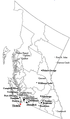 المدن في كلومبيا البريطانية
 -
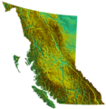 خريطة طبيعية لكلومبيا البريطانية

المناطق الاقليمية

المدن

|
|

|
- Other municipalities
|
الحياة البرية
الانواع المهددة بالانقراض
أنظر أيضا
وصلات خارجية
- Tourism British Columbia Official Website
- Provincial Archives (includes online photo database)
- BC Govt online map archive (free)
- [http://bcprogressboard.com/ BC Progress Board (tracks economic and social indicators
المصادر
- ^ Government of Canada, Natural Resources Canada. "Place names - British Columbia / Colombie-Britannique". www4.rncan.gc.ca. Retrieved April 16, 2020.
- ^ "BC Geographical Names". apps.gov.bc.ca. Retrieved April 16, 2020.
- ^ "Population and dwelling counts, for Canada, provinces and territories, 2016 and 2011censuses". Statistics Canada. February 8, 2017. Retrieved February 8, 2012.
- ^ "Population by year of Canada of Canada and territories". Statistics Canada. June 14, 2018. Retrieved September 29, 2018.
- ^ According to the Oxford Guide to Canadian English Usage (ISBN 0-19-541619-8; p. 335), BCer(s) is an informal demonym that is sometimes used for residents of BC
- ^ Statistics Canada. Gross domestic product, expenditure-based, by province and territory (2015); November 9, 2016 [cited January 26, 2017].
- ^ "Sub-national HDI - Subnational HDI - Global Data Lab". globaldatalab.org. Retrieved June 18, 2020.
- ^ "Population Estimates, British Columbia and Sub-Provincial". BC Stats. December 2012. Archived from the original on August 11, 2014. Retrieved February 12, 2014.
- ^ أ ب Minutes of the Proceedings of the Institution of Civil Engineers, Volume 90, Issue 1887, 1887, pp. 453–455, Obituary. Major-General Richard Clement Moody, R.E., 1813–1887.
- ^ أ ب Donald J. Hauka, McGowan's War, Vancouver: 2003, New Star Books, p.146. خطأ استشهاد: وسم
<ref>غير صالح؛ الاسم "Donald J. Hauka 2003, p.146" معرف أكثر من مرة بمحتويات مختلفة. - ^ Jean Barman, The West Beyond the West: A History of British Columbia, (Toronto: University of Toronto), p.71
- ^ أ ب "Col. Richard Clement Moody – Postscript". Retrieved July 4, 2016. خطأ استشهاد: وسم
<ref>غير صالح؛ الاسم "royalengineers.ca" معرف أكثر من مرة بمحتويات مختلفة. - ^ أ ب Margaret Ormsby, Richard Clement Moody, in Dictionary of Canadian Biography Online خطأ استشهاد: وسم
<ref>غير صالح؛ الاسم "ReferenceA" معرف أكثر من مرة بمحتويات مختلفة. - ^ أ ب "Heraldic Science Héraldique, Arms and Devices of Provinces and Territories, British Columbia". Retrieved November 3, 2016. خطأ استشهاد: وسم
<ref>غير صالح؛ الاسم "heraldicscienceheraldique.com" معرف أكثر من مرة بمحتويات مختلفة. - ^ Martin, Ged (1978). "The Naming of British Columbia". Albion: A Quarterly Journal Concerned with British Studies. 10 (3): 257–263. doi:10.2307/4048132. JSTOR 4048132.
- ^ Akrigg, Helen B.; G.P.V. (1977). British Columbia Chronicle, 1847–1871: Gold & Colonists (illustrated ed.). Discovery Press. ISBN 9780919624030.
- ^ "Why is the Western Region of Canada Called British Columbia?". Retrieved May 17, 2017.
- ^ "Colombie-Britannique". BC Geographical Names. Retrieved December 12, 2022.
- ^ "Lois constitutionelles de 1867 à 1982 (rapport de 1990)". Department of Justice - Government of Canada. August 7, 2020. Retrieved December 12, 2022.
- ^ "Vanderhoof". Tourism BC. Archived from the original on July 9, 2011. Retrieved April 26, 2007.
- ^ "The Ecology of the Engelmann Spruce – Subalpine Fir Zone" (PDF). B.C. Ministry of Forests. Archived (PDF) from the original on November 14, 2018. Retrieved January 17, 2019.
- ^ "Pacific Northwest Washington Oregon British Columbia". Celebratebig.com. Archived from the original on December 22, 2011. Retrieved January 24, 2012.
- ^ "Northwest Hiking Trails: Washington, Oregon, Idaho". Cooltrails.com. Archived from the original on January 19, 2012. Retrieved January 24, 2012.
- ^ "Canadian Climate Normals 1981–2010 Station Data". Environment and Climate Change Canada. October 31, 2011. Archived from the original on December 8, 2015. Retrieved October 19, 2015.
- ^ "Princeton A". Canadian Climate Normals 1981–2010. Environment Canada. September 25, 2013. Archived from the original on January 16, 2019. Retrieved January 15, 2018.
- ^ "GLACIER NP ROGERS PASS". Canadian Climate Normals 1981–2010 Station Data. Environment Canada. September 25, 2013. Archived from the original on January 16, 2019. Retrieved January 16, 2019.
- ^ McElroy, Justin (February 9, 2017). "Weather closes every highway linking Lower Mainland to rest of B.C." CBC News. Canadian Broadcasting Corporation. Archived from the original on January 16, 2019. Retrieved January 16, 2019.
- ^ "What You Need to Know About Winter Weather on the "Coq"". TranBC. Archived from the original on October 17, 2015. Retrieved January 16, 2019.
- ^ Heidorn, Keith C. (2002). "North America's Record Cold". The Weather Doctor Almanac. Archived from the original on July 21, 2012. Retrieved July 14, 2012.
- ^ Uguen-Csenge, Eva; Lindsay, Bethany (June 29, 2021). "For 3rd straight day, B.C. village smashes record for highest Canadian temperature at 49.6 C". CBC News. Archived from the original on August 1, 2021. Retrieved June 30, 2021.
- ^ "Canadian Climate Normals or Averages 1981–2010". Environment Canada. October 31, 2011. Archived from the original on February 27, 2014. Retrieved December 19, 2014.
- ^ "Plants, Animals & Ecosystems – Province of British Columbia". Ministry of Environment and Climate Change. Archived from the original on February 12, 2022. Retrieved February 12, 2022.
- ^ "Wildlife of British Columbia: 13 Species To Look Out For This Summer". Summit Lodge Boutique Hotel Whistler (in الإنجليزية الأمريكية). July 30, 2015. Archived from the original on February 12, 2022. Retrieved February 12, 2022.
- ^ Attenborough, David (1998). The Life of Birds. BBC. ISBN 0563-38792-0.
- ^ "Sealife" (in الإنجليزية الكندية). Oceanwatch BC Coast. November 28, 2016. Archived from the original on February 12, 2022. Retrieved February 12, 2022.
- ^ BC Ministry of Sustainable Resource Management, Conservation Data Centre
- ^ Coates, K. Dave; Haeussler, Sybille; Lindeburgh, Scott; Pojar, Rosamund; Stock, Arthur J. (January 1994). Ecology and Silviculture of Interior Spruce in British Columbia. Canada/British Columbia Partnership Agreement Forest Resource Development: FRDA II. ISSN 0835-0752. Archived from the original. You must specify the date the archive was made using the
|archivedate=parameter. https://www.for.gov.bc.ca/hfd/pubs/Docs/Frr/FRR220.pdf. Retrieved on October 30, 2022. - ^ Turner, Nancy (September 2007). "Importance of biodiversity for First Peoples of British Columbia" (PDF). Biodiversity BC. Archived (PDF) from the original on November 15, 2013. Retrieved September 21, 2014.
- ^ Muckle, Robert James (2007). The First Nations of British Columbia: An Anthropological Survey. UBC Press. pp. 18–19. ISBN 978-0-7748-4010-1. Archived from the original on May 18, 2016. Retrieved November 22, 2015.
- ^ أ ب ت Bastian, Dawn Elaine; Mitchell, Judy K. (2004). Handbook of Native American Mythology. ABC-CLIO. p. 6. ISBN 978-1-85109-533-9. Archived from the original on June 27, 2014. Retrieved November 22, 2015.
- ^ "Ancient Indigenous forest gardens promote a healthy ecosystem: SFU study". SFU News. Simon Fraser University. April 22, 2021. Archived from the original on June 12, 2021. Retrieved June 14, 2021.
- ^ أ ب Bengtson, John D. (2008). "Materials for a Comparative Grammar of the Dene-Caucasian (Sino-Caucasian) Languages – In Aspects of Comparative Linguistics" (PDF). Moscow- RSUH. pp. 45–118. Archived (PDF) from the original on September 21, 2021. Retrieved April 11, 2010.
- ^ أ ب ت "First Nations – People of the Northwest Coast". BC Archives. 1999. Archived from the original on March 14, 2010. Retrieved April 11, 2010.
- ^ Boyd, Robert T. (1990). "Demographic History, 1774–1874". Handbook of North American Indians: 7 the Northwest Coast. Smithsonian Institution.
- ^ أ ب ت Gilmartin, Mary (2009). "Colonialism/ Imperialism". Key Concepts in Political Geography. SAGE Publications.
- ^ Lange, Greg (January 23, 2003). "Smallpox epidemic ravages Native Americans on the northwest coast of North America in the 1770s". HistoryLink. Archived from the original on May 26, 2008. Retrieved February 22, 2011.
- ^ "Plagues and Peoples on the Northwest Coast". .h-net.msu.edu. Archived from the original on December 27, 2010. Retrieved February 22, 2011.
- ^ Boyd, Robert Thomas (1999). "A final disaster: the 1862 smallpox epidemic in coastal British Columbia". The Coming of the Spirit of Pestilence: Introduced Infectious Diseases and Population Decline Among Northwest Coast Indians, 1774–1874. University of British Columbia Press. pp. 172–201. ISBN 978-0-295-97837-6. Archived from the original on May 11, 2021. Retrieved February 10, 2021.
- ^ Lange, Greg. "Smallpox Epidemic of 1862 among Northwest Coast and Puget Sound Indians". HistoryLink. Archived from the original on January 25, 2021. Retrieved February 8, 2021.
- ^ Barman 2007, p. 71.
- ^ أ ب ت ث ج Scott, Laura Elaine (1983). The Imposition of British Culture as Portrayed in the New Westminster Capital Plan of 1859 to 1862 (M.A. thesis). Simon Fraser University.
- ^ Moody, Richard Clement. Letter of Colonel Richard Clement Moody, R.E., to Arthur Blackwood, February 1, 1859, preserved in the British Columbia Historical Quarterly (January – April 1951), ed. Willard E. Ireland, Archives of British Columbia. British Columbia Historical Association. pp. 85–107.
- ^ Barman 2007, p. 7.
- ^ "'Elliot, Thomas Frederick', University of Victoria British Columbia, Colonial Despatches of Vancouver Island and British Columbia". Retrieved 30 April 2023.
- ^ Belshaw, John Douglas (2015). "13.9 The Gold Colony". Canadian History: Pre-Confederation. Archived from the original on January 1, 2022. Retrieved January 1, 2022.
- ^ Dickson, Greg; Forsythe, Mark (Summer 2015). "From the West Coast to the Western Front: British Columbians and the Great War". British Columbia History magazine. Vol. 48, no. 2.
- ^ Wallechinsky, D.; Loucky, J. (2010). The Complete Book of the Winter Olympics: 2010 Edition. p. 12.
- ^ "BC Premier Campbell stepping down". CBC News. November 3, 2010. Archived from the original on March 29, 2014. Retrieved May 22, 2014.
- ^ "Christy Clark leads BC Liberals to surprise majority". CBC News. Canadian Broadcasting Corporation. May 15, 2013. Archived from the original on April 7, 2014. Retrieved April 25, 2014.
- ^ Kwan, Shawna (January 21, 2019). "Hong Kong Housing Is World's Least Affordable for 9th Year". Bloomberg News. Archived from the original on October 12, 2020. Retrieved September 24, 2020.
- ^ German, Peter M. (March 31, 2018). Dirty Money: An Independent Review of Money Laundering in Lower Mainland Casinos conducted for the Attorney General of British Columbia. Government of British Columbia. Archived from the original. You must specify the date the archive was made using the
|archivedate=parameter. https://news.gov.bc.ca/files/Gaming_Final_Report.pdf. Retrieved on June 27, 2021. - ^ Carman, Tara (August 5, 2016). "Canadians flock to B.C. in search of jobs". Vancouver Sun. Archived from the original on May 11, 2017. Retrieved April 21, 2017.
- ^ "British Columbia's Response to COVID-19". www2.gov.bc.ca. Brititish Columbia Ministry of Health. Archived from the original on December 31, 2021. Retrieved January 1, 2022.
- ^ "Remains of 215 children found at former Kamloops, B.C. residential school". The Globe and Mail. The Canadian Press. Archived from the original on June 18, 2021. Retrieved June 3, 2021.
- ^ "Former Native Residential School: Over 160 Graves Found on Kuper Island". The Canadian. July 13, 2021. Archived from the original on July 13, 2021. Retrieved July 13, 2021.
- ^ Statistics Canada.
- ^ Statistics Canada.
- ^ "Census Profile, 2021 Census of Population Profile table British Columbia [Province]". Statistics Canada. August 17, 2022. Retrieved August 17, 2022.
- ^ "2014 British Columbia Financial and Economic Review, 74th Edition April 2013 – March 2014" (PDF). BC Ministry of Finance. July 2014. Archived from the original (PDF) on March 12, 2016. Retrieved March 11, 2016.
- ^ "Canadian climate normals 1981–2010 Vancouver International Airport". Environment Canada. October 31, 2011. Archived from the original on May 18, 2015. Retrieved October 3, 2015.
- ^ Roach, Robert (2010). "Economic output in the West". State of the West 2010 | Western Canadian Demographic and Economic Trends (PDF). Canada West Foundation. pp. 103–109. Archived from the original (PDF) on August 12, 2011. Retrieved September 21, 2014.
- ^ "Film and TV". Vancouver Economic Development. 2005. Archived from the original on January 1, 2007. Retrieved April 26, 2007.
- ^ Thomson, Hilary (October 6, 2005). Hard on Health of Mining Communities. 51. University of British Columbia. Archived from the original. You must specify the date the archive was made using the
|archivedate=parameter. http://www.publicaffairs.ubc.ca/ubcreports/2005/05oct06/mining.html. Retrieved on April 26, 2007. - ^ "Add/Remove data – Gross domestic product, expenditure-based, provincial and territorial, annual". Statistics Canada. May 30, 2018. Archived from the original on December 9, 2021. Retrieved September 19, 2019.
- ^ "2020 Sub-Provincial Population Estimates Highlights" (PDF). Government of BC. 2020. Archived (PDF) from the original on October 9, 2022.
- ^ Lovely, Warren; Maltais, Catherine (February 19, 2019). "British Columbia 2019 Budget" (PDF). National Bank of Canada Financial Markets: 1–3. Archived from the original (PDF) on December 24, 2019. Retrieved September 19, 2019 – via National Bank of Canada.
- ^ Canadian Federal and Provincial Fiscal Tables. Royal Bank of Canada. January 14, 2020. Archived from the original. You must specify the date the archive was made using the
|archivedate=parameter. http://www.rbc.com/economics/economic-reports/pdf/canadian-fiscal/prov_fiscal.pdf. Retrieved on January 18, 2020. - ^ "Gross domestic product (GDP) at basic prices, by industry, provinces and territories, growth rates". Statistics Canada. December 14, 2012. Retrieved July 21, 2022.
- ^ Statistics Canada (2002). StatsCan "Population and Dwelling Counts, for Canada, Provinces and Territories, Census Metropolitan Areas and Census Agglomerations". Retrieved 2007-04-26.
{{cite web}}: Check|url=value (help)
المراجع
- الأقليات المسلمة في الأمريكتين والبحر الكاريبي – سيد عبد المجيد بكر .
| التقسيمات | |
|---|---|
| المستوطنات | |
| المراكز الحضرية | |
| المقاطعات | |
|---|---|
| الأقاليم | |
| تاريخية | |
| متعلقة | |
54°54′N 124°30′W / 54.900°N 124.500°W{{#coordinates:}}: لا يمكن أن يكون هناك أكثر من وسم أساسي واحد لكل صفحة
- Pages using gadget WikiMiniAtlas
- CS1 الإنجليزية الأمريكية-language sources (en-us)
- CS1 الإنجليزية الكندية-language sources (en-ca)
- CS1 errors: URL
- صفحات ذات وسوم إحداثيات غير صحيحة
- Short description is different from Wikidata
- Articles containing فرنسية-language text
- Articles containing لاتينية-language text
- Pages using Lang-xx templates
- Articles containing إنگليزية-language text
- Pages using infobox settlement with possible motto list
- Coordinates on Wikidata
- Pages using infobox settlement with image map1 but not image map
- مقالات فيها عبارات متقادمة منذ 2020
- جميع المقالات التي فيها عبارات متقادمة
- Articles with hatnote templates targeting a nonexistent page
- Articles with unsourced statements from June 2019
- Articles with unsourced statements from March 2024
- Articles with unsourced statements from January 2024
- All accuracy disputes
- Articles with disputed statements from April 2024
- Articles with unsourced statements from January 2019
- كولومبيا البريطانيا
- مقاطعات وأقاليم كندا