بوسطن
بوسطن | |
|---|---|
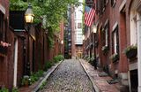
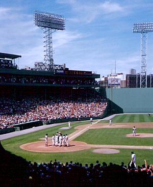
شارع أكرون في بيكن هل. منتزه فنواي أثناء مباراة لبوسطن رد سوكس. | |
| الكنية: انظر الكنية | |
| الشعار: Sicut patribus sit Deus nobis (اللاتينية) 'كما كان الله مع آبائنا فليكن معنا. | |
 | |
 خرائط تفاعلية لبوسطن. | |
| الإحداثيات: 42°21′37″N 71°3′28″W / 42.36028°N 71.05778°W | |
| البلد | الولايات المتحدة |
| المنطقة | نيو إنجلاند |
| الولاية | مساتشوستس |
| المقاطعة | سفوك[1]
|
| مقاطعات تاريخية | مملكة إنجلترة كومنولث إنجلترة مملكة بريطانيا العظمى |
| مستعمرات تاريخية | مستعمرة خليج مساتشوستس، دومينيون نيو إنجلاند، مقاطعة خليج مساتشوستس |
| استوطنت | 1625 |
| دُمجت (كبلدة) | |
| دُمجت (كمدينة) | 19 مارس 1822 |
| السمِيْ | بوسطن، لنكنشاير |
| الحكومة | |
| • النوع | حكومة مجلس-عمدة |
| • العمدة | ميشيل وو (د) |
| • المجلس | مجلس مدينة بوسطن |
| • رئيس المجلس | إدوارد فلين (د) |
| المساحة | |
| • عاصمة ولاية مساتشوستس | 89٫61 ميل² (232٫10 كم²) |
| • البر | 48٫34 ميل² (125٫20 كم²) |
| • الماء | 41٫27 ميل² (106٫90 كم²) |
| • الحضر | 1٫655٫9 ميل² (4٫288٫7 كم²) |
| • العمران | 4٬500 ميل² (11٬700 كم²) |
| • CSA | 10٬600 ميل² (27٬600 كم²) |
| المنسوب | 141 ft (43 m) |
| التعداد | |
| • عاصمة ولاية مساتشوستس | 675٬647 |
| • Estimate (2021)[3] | 654٫776 |
| • الترتيب | رقم 24 في الولايات المتحدة رقم 1 في مساتشوستس |
| • الكثافة | 13٬976٫98/sq mi (5٬396٫51/km2) |
| • Urban | 4٫382٫009 (الولايات المتحدة: رقم 19) |
| • الكثافة الحضرية | 2٫646٫3/sq mi (1٫021٫8/km2) |
| • العمرانية | 4٬941٬632 (الولايات المتحدة: رقم 10) |
| صفة المواطن | بوسطنيون |
| منطقة التوقيت | UTC−5 (التوقيت الشرقي) |
| • الصيف (التوقيت الصيفي) | UTC−4 (التوقيت الشرقي الصيفي) |
| الرمز البريدي | 53 ZIP Codes[6]
|
| رموز المنطقة | 617 و857 |
| رمز FIPS | 25-07000 |
| GNIS feature ID | 617565 |
| الموقع الإلكتروني | Boston.gov |
بوسطن أو بوستن (بالإنجليزية: Boston؛ US: /ˈbɔːstən/, UK: /ˈbɒstən/)[7]) هي عاصمة كومنولث مساتشوسِتس، الولايات المتحدة، والمدينة الأكبر[8] بها. وتحتل الترتيب 21 كأكثر المدن اكتظاظاً بالسكان في الولايات المتحدة.[9] تبلغ مساحتها 232.10 كم²[10] بتعداد سكان 692.600 نسمة عام 2019،[11] مما يجعلها أيضاً أكثر المدن اكتظاظاً بالسكان في نيو إنجلاند.[8] وهي مركز مقاطعة سفوك (على الرغم من أن حكومة المقاطعة قد حُلت في 1 يوليو 1999).[12] المدينة هي المركز الاقتصادي والثقافي لمنطقة حضرية أكبر إلى حد كبير تُعرف باسم بوسطن الكبرى، وهي منطقة إحصائية حضرية كانت تضم قرابة 4.8 مليون شخص عام 2016 وهي عاشر أكبر منطقة إحصائية حضرية في البلاد.[13] كمنطقة احصائية مجمعة، تضم هذه المنطقة الأوسع نطاقاً حوالي 8.2 مليون شخص، مما يجعلها سادس أكبر المناطق اكتظاظاً بالسكان في الولايات المتحدة.[14]
بوسطن هي واحدة من أقدم البلديات في الولايات المتحدة، تأسست على شبه جزيرة شومت عام 1630 من قبل مستوطنين بيوريتان من بلدة إنجليزية تحمل الاسم نفسه.[15][16] كان مسرحًا لعدة أحداث رئيسية في الثورة الأمريكية، مثل مذبحة بوسطن وحفل شاي بوسطن ومعركة بانكر هيل وحصار بوسطن. عند استقلال الولايات المتحدة عن بريطانيا العظمى، استمرت المدينة كميناءاً رئيسياً ومركزاً صناعياً هاماً فضلاً عن كونها مركزاً للتعليم والثقافة.[17][18] توسعت المدينة إلى ما بعد شبه الجزيرة الأصلية من خلال استصلاح الأراضي وضم البلديات. يجذب تاريخها الغني العديد من السياح، حيث تجذب قاعة فانيوِل وحدها أكثر من 20 مليون زائر سنويًا.[19] تتضمن أولى مبادرات بوسطن العديدة تأسيس أول منتزه عام في الولايات المتحدة (بوسطن كومون، 1634)، أو المدارس الولائية (مدرسة بوسطن اللاتينية، 1635)[20] وأول نظام مترو أنفاق (مترو أنفاق ترمونت ستريت، 1897).[21]
اليوم، بوسطن هي مركز مزدهر للبحث العلمي. تضم المدينة العديد من الكليات والجامعات مما يجعلها رائدة عالمياً في التعليم العالي،[22] والتي تشمل كليات الحقوق والطب والهندسة والأعمال، وتعتبر المدينة رائدة عالمياً في الابتكار ومبادرات الأعمال، بما يقارب 5.000 شركة ناشئة.[23][24][25] كما تتضمن قاعدة بوسطن الاقتصادية المراكز المالية،[26] والخدمية ومراكز الأعمال، الأنشطة الحكومية والتكنولوجيا الحيوية وتكنولوجيا المعلومات.[27] تتمتع الأسر بالمدينة بأعلى متوسط أعمال خيرية في الولايات المتحدة؛[28] تحتل الشركات والمؤسسات المرتبة الأولى في البلاد من حيث الاستدامة والاستثمار.[29] كما تُعرف بوسطن بأنها واحدة من أغلى المدن من حيث تكلفة المعيشة بالولايات المتحدة[30][31]، كما تشهد المدينة حالة من الارتقاء الطبقي،[32] على الرغم من أنها لا تزال تحتل الترتيبات الأولى عالمياً من حيث تكلفة المعيشة.[33]
التاريخ
فترة الشعوب الأصلية
قبل الاستعمار الأوروبي، كانت المنطقة المحيطة ببوسطن الحالية مأهولة بالسكان الأصليين من شعب مساتشوست. كانت مساكنهم من تجمعات موسمية صغيرة. من المرجح أن الأشخاص الذين عاشوا في المنطقة كانوا يتنقلون بين منازل الشتاء الداخلية على امتداد نهر تشارلز (يسميها السكان الأصليون كوينبوكوين، وتعني "التعرج") والتجمعات الصيفية على الساحل. كان اصطياد الطرائد أكثر سهولة في الداخل خلال مواسم الشجرة العارية، وكان صيد أسماك المياه الضحلة والمحار أكثر سهولة خلال أشهر الصيف.[34][35]
نظرًا لكونها محاظة [[سهل طيني|بالسهول الطينية كريهة الرائحة خلال الجزء المعتدل من العام، كانت شبه جزيرة شومت نفسها أقل استيطاناً من المناطق المحيطة بها قبل وصول الأوروبيين. ومع ذلك، كشفت الحفريات الأثرية عن أحد أقدم سدود صيد السمكفي شارع بويلستون في نيو إنجلاند. بنى السكان الأصليون هذا السد لصيد الأسماك منذ 7000 عام قبل وصول الأوروبيين غلى نصف الكرة الغربي..[35][34][36]
تأسيسها من قبل الأوروبيين
كان أول أوروبي يعيش في ما سيصبح بوسطن رجل دين أسقفي درس في كامبريدج يدعى وليام بلاكستون. كان الشخص كبير المسئولين عن تأسيس بوسطن من قبل المستعمرين البيوريتانيين عام 1630. حدث هذا بعد أن دعا بلاكستون أحد قادتهم، إسحاق جونسون لعبور الخليج الخلفي من مستعمرة تشارلزتاون الفاشلة والعيش على شبه الجزيرة. وهذا هو ما فعله البيوريتانيون في سبتمبر 1630.[37][38][39]
الاسم "بوسطن"
قبل وفاته في 30 سبتمبر 1630، كان أحد آخر الأعمال الرسمية التي قام جونسون كزعيم لمجتمع تشارلزتاون هو تسمية مستوطنتهم الجديدة عبر النهر باسم "بوسطن". أطلق على المستوطنة اسم مسقط رأسه في لنكنشاير، المكان الذي ينحدر منه هو وزوجته (التي تحمل اسم "أربيلا") وجون كوتون (جد كوتون ماذر) الذي هاجر إلى نيو إنجلاند. اشتق اسم المدينة الإنجليزية من قديسها الراعي، القديس بوتلوف، في كنيستها عمل جون كوتون حتى هجرته مع جونسون. في المصادر المبكرة، عُرفت بوسطن لنكنشايرباسم "مدينة القديس بوتولف"، وحُرفت لاحقاً إلى مع "بوسطن". قبل هذا إعادة تسمية المستوطنة في شبه الجزيرة كان بلاكستون يعرفها باسم "شاموت" ويعرفها المستوطنين البيوريتانيون الذي دعاهم باسم "تريمونتين".[40][41][42][43][44]
الاحتلال البيوريتاني
بدأ التأثير البيوريتاني على بوسطن قبل تأسيسها، مع اتفاقية كامبردج 1629. تأسس بموجب هذه الاتفاقية مستعمرة خليج مساتشوستس ووقع عليها أول حكامها جون وينثروب. ركزت الأخلاقي أثرت الأخلاق البيوريتانية وتركيزهم على التعليم على التاريخ المبكر للمدينة. تأسست أول مدرسة حكومية في أمريكا، مدرسة بوسطن اللاتينية، في بوسطن عام 1635.[20][45]
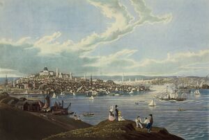
كانت بوسطن أكبر بلدة في المستعمرات الثلاثة عشر حتى نمت فيلادلفيا أكثر منها في منتصف القرن الثامن عشر.[46] جعلت موقع بوسطن المطل على المحيط المحيط من بوسطن ميناءاً حيوياً، وكانت المدينة تعمل بشكل أساسي في الشحن وصيد الأسماك أثناء تاريخها الاستعمارية. كانت بوسطن المحطة الرئيسية في طريق تجارة الكاريبي واستوردت كميات كبيرة من دبس السكر، مما أدى إلى ظهور فاصولياء بوسطن المخبوزة.[47]
شهدت بوسطن ركوداً اقتصادياً في العقود التي سبقت الثورة. بحلول منتصف القرن الثامن عشر، تجاوزت مدينة نيويورك وفيلادلفيا بوسطن في الثروة. خلال هذه الفترة، واجهت بوسطن صعوبات مالية حتى مع نمو المدن الأخرى في نيو إنجلاند بشكل متسارع.[48][49]
الثورة وحصار بوسطن


وليام هاو, في رسالة إلى وليام ليج، إيرل ثاني دارتموث، حول قرار الجيش البريطاني مغادرة بوسطن، بتاريخ 21 مارس 1776.[50]
وقعت الكثير من الأحداث الحاسمة في الثورة الأمريكية[51] في بوسطن أو بالقرب منها. أدى تواجد الغوغاء في المدينة جنبًا إلى جنب مع تزايد افتقار المستعمرين للإيمان إما في بريطانيا أو برلمانها إلى تعزيز الروح الثورية في المدينة.[48] عندما أقر البرلمان البريطاني قانون التمغة عام 1765، دمرت الغوغاء في بوسطن منازل أندرو أوليفر، المسؤول المكلف بفرض القانون، وتوماس هتشنسون، نائب حاكم ولاية مساتشوستس في ذلك الوقت.[48][52] عام 1768 أرسل البريطانيون فوجين إلى بوسطن في محاولة لقمع المستعمرين الغاضبين. لم هذا يرضي المستعمرين. عام 1770، أثناء مذبحة بوسطن، أطلقت القوات البريطانية النار على حشد بدأ في مضايقتهم بعنف. أجبر المستعمرون البريطانيين على سحب قواتهم. تم الترويج للحدث على نطاق واسع وغذى الحركة الثورية في أمريكا.[49]
عام 1773، أقر البرلمان قانون الشاي. رأى العديد من المستعمرين في هذا الفعل محاولة لإجبارهم على قبول الضرائب التي فرضتها قوانين تاونشند. أدى هذا إلى حفلة شاي بوسطن، حيث ألقى مجموعة من مواطني بوسطن الغاضبين شحنة كاملة من الشاي أرسلتها شركة الهند الشرقية إلى ميناء بوسطن. كان حفل شاي بوسطن حدثًا رئيسيًا أدى إلى الثورة، حيث ردت الحكومة البريطانية بشراسة مع بالأفعال القسرية، وطالبت سكان بوسطن بالتعويض عن الشاي المدمر.[48][53]
كانت بوسطن نفسها محاصرة لمدة عام تقريبًا أثناء حصار بوسطن، الذي بدأ في 19 أبريل 1775. أعاقت ميليشيا نيو إنجلاند حركة الجيش البريطاني. السير ويليام هاو، القائد العام للقوات البريطانية في أمريكا الشمالية في ذلك الوقت، قاد الجيش البريطاني في الحصار. في 17 يونيو، استولى البريطانيون على شبه جزيرة تشارلستون في بوسطن، أثناء معركة بانكر هيل. فاق عدد الجيش البريطاني عدد الميليشيات المتمركزة هناك، لكنه كان انتصارًا باهظ الثمن للبريطانيين لأن جيشهم عانى من خسائر لا يمكن تعويضها. كانت أيضًا شهادة على مهارة وتدريب الميليشيا، حيث أن دفاعهم العنيد جعل من الصعب على البريطانيين الاستيلاء على تشارلزتاون دون التعرض لمزيد من الخسائر التي لا يمكن تعويضها.[54][55]
بعد عدة أسابيع، تولى جورج واشنطن قيادة الميليشيا بعد أن تأسيس الجيش القاري من قبل المؤتمر القاري لتوحيد الجهد الثوري. أثناء الحصار واجه كلا الجانبين صعوبات ونقصًا في الإمدادات، واقتصر القتال على غارات ومناوشات صغيرة. أعاقت منطقة بوسطن نيك، التي كان عرضها في ذلك الوقت حوالي مائة قدم فقط، قدرة واشنطن عن غزو بوسطن، وتلا ذلك حالة من الجمود الطويل. توصل الضابط الشاب روفوس بوتنام إلى خطة لعمل تحصينات محمولة من الخشب يمكن تشييدها على الأرض المتجمدة تحت جنح الظلام. أشرف بوتنام على هذا الجهد، الذي نجح في تثبيت كل من التحصينات وعشرات المدافع على مرتفعات دورتشستر التي جلبها هنري نوكس بشق الأنفس عبر الجليد من حصن تيكونديروجا. استيقظ البريطانيون المذهولون في صباح اليوم التالي ليروا مجموعة كبيرة من المدافع تنهمر عليهم. يعتقد أن الجنرال هاو قال إن الأمريكيين فعلوا في ليلة واحدة أكثر مما كان يمكن أن يفعله جيشه في ستة أشهر. حاول الجيش البريطاني إطلاق وابل من المدافع لمدة ساعتين، لكن طلقاتهم لم تصل إلى مدافع المستعمرين على هذا الارتفاع. استسلم البريطانيون وركبوا سفنهم وأبحروا بعيدًا. لا تزال بوسطن تحتفل "بيوم الإخلاء" كل عام. تأثرت واشنطن بشدة، فعين روفوس بوتنام كبيراً لمهندسيه.[53][54][56]
ما بعد الثورة وحرب 1812
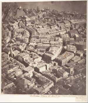

بعد الثورة ساعدت تقاليد بوسطن الطويلة في فن الإبحار في جعلها واحدة من أكثر موانئ البلاد ازدحامًا للتجارة المحلية والدولية. تقلص نشاط ميناء بوسطن بشكل كبير بموجب قانون الحظر 1807 (الذي تم تبنيه أثناء الحروب النابليونية) وحرب 1812. عادت التجارة الخارجية بعد هذه الأعمال العدائية، لكن في غضون ذلك وجد تجار بوسطن بدائل لاستثماراتهم الرأسمالية. أصبح التصنيع عنصرًا مهمًا في اقتصاد المدينة، وتجاوز التصنيع الصناعي للمدينة التجارة الدولية في الأهمية الاقتصادية بحلول منتصف القرن التاسع عشر. شهلت شبكة الأنهار الصغيرة على حدود المدينة وربطها بالمنطقة المحيطة شحن البضائع وأدت إلى انتشار المطاحن والمصانع. في وقت لاحق، عززت شبكة كثيفة من السكك الحديدية الصناعة والتجارة في المنطقة.[57]
خلال هذه الفترة، ازدهرت بوسطن ثقافيًا أيضًا، ونالت الإعجاب النخبة الأدبية النادرة ورعاة الفنون الأسخياء،[58][59] مع أفراد عائلات بوسطن القديمة - التي أُطلق عليهم في النهاية اسم "نخبة بوسطن - باعتبارهم النخب الاجتماعية والثقافية في البلاد.[60] غالبًا ما يرتبطون بالطبقة العليا الأمريكية، جامعة هارفرد؛[61] والكنيسة الأسقفية.[62][63]
كانت بوسطن ميناءًا مبكرًا لتجارة رقيق الأطلسي الثلاثية في مستعمرات نيو إنجلاند، لكن سرعان ما تم تجاوزتها سالم في مساتشوستس ونيوبورت في رود آيلاند.[64] أصبحت بوسطن في النهاية مركزًا للحركة المؤيدة لإلغاء العبودية.[65] ردت المدينة بقوة على قانون العبيد الهاربين 1850،[66] مساهمة في محاولة الرئيس فرانكلين بيرس جعل بوسطن نموذجًا بعد قضية العبد الهارب أنتوني بيرنز.[67][68]
عام 1822،[17] صوّت مواطنو بوسطن لتغيير الاسم الرسمي من "بلدة بوسطن" إلى "مدينة بوسطن"، وفي 19 مارس 1822، وافق سكان بوسطن على ميثاق دمج المدينة.[69] في ذلك الوقت كان عدد سكان المدينة 46.226 نسمة، وكانت مساحتها لا تتعدى 12 كم².[69]
القرن 19

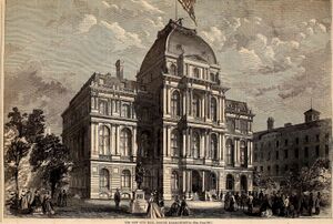
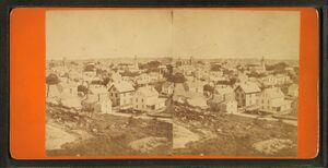
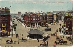
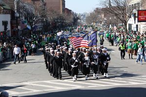
في عشرينيات القرن التاسع عشر، نما عدد سكان بوسطن بشكل سريع، وتغير التكوين العرقي للمدينة بشكل كبير مع الموجة الأولى من المهاجرين الأوروبيين. سيطر المهاجرون الأيرلنديون على الموجة الأولى من الوافدين الجدد خلال هذه الفترة، خاصة بعد المجاعة الكبرى؛ بحلول عام 1850، كان هناك حوالي 35000 أيرلدني يعيشون في بوسطن.[70] في النصف الأخير من القرن التاسع عشر، شهدت المدينة أعدادًا متزايدة من الإيرلنديين والألمان واللبنانيين والسوريين[71] والكنديين الفرنسيين والروس واليهود البولندنيين في المدينة. بحلول نهاية القرن التاسع عشر، أصبحت ضواحي بوسطن الرئيسية جيباً لمهاجرين مختلفين عرقياً وأدت إقامتهم إلى تغيير ثقافي دائم. أصبح الإيطاليون أكبر سكان نورث إند،[72] وأصبح الأيرنديون يهيمنون على جنوب بوسطن وتشارلزتاون، وكان اليهود الروس يعيشون في وست إند. أتى المهاجرون الأيرلنديون والإيطاليون معهم بالكاثوليكية الرومانية. حالياً، يشكل الكاثوليك أكبر جالية دينية في بوسطن،[73] ولعب الأيرلنديون دورًا رئيسيًا في سياسة بوسطن منذ أوائل القرن العشرين؛ ومن أبرزهم كنيدي وتيب أونيل وجون فتسجرالد.[74]
بين عامي 1631 و1890، تضاعفت مساحة المدينة ثلاث مرات من خلال ردم البحر عن طريق ملء المستنقعات والمسطحات الطينية والفجوات بين الأرصفة على امتداد الواجهة البحرية. خلقت مشاريع الردم في منتصف القرن أجزاء مهمة من ساوث إند وويست إند والحي المالي وتشايناتاون.[75]
بعد حريق بوسطن العظيم 1872، استخدم العمال أنقاض المباني كمكب للنفايات على امتداد الواجهة البحرية لوسط المدينة. خلال منتصف القرن التاسع عشر حتى أواخره، ملأ العمال ما يقرب من 600 فداناً من مستنقعات نهر تشارلز معتدلة الملوحة غرب بوسطن كومون بالحصى الذي تم جلبه بالسكك الحديدية من تلال مرتفعات نيدهام. ضمت المدينة المدن المجاورة وتشمل جنوب بوسطن (1804)، شرق بوسطن (1836)، روكسبري (1868)، دورشيستر (بما في ذلك ماتابان الحالية وجزء من جنوب بوسطن) (1870)، برايتون (بما في ذلك ألستون الحالية) (1874)، وست روكسبري (بما في ذلك جامايكا بلين وروزليندال الحالية) (1874)، وتشارلزتاون (1874)، وهايد بارك (1912).[76][77] لم تنجح المقترحات الأخرى لضم بروكلين، كامبريدج،[78] وتشيلسي.[79][80]
القرن 20
يضم منتزه فنواي، بوسطن رد سوكس، التي افتتحت عام 1912.[81]
خلال هذه السنوات الأولى من القرن العشرين، بُنيت العديد من المباني ذات الأهمية المعمارية: قاعة البستنة،[82] نادي التنس والراكت،[83] /تحف إيزبلا ستواتر جاردنر،[84] استديوهات فنواي،[85] قاعة جوردان،[86] ودار أوبرا بوسطن. جسر لونجفيلو،[87] الذي بُني عام 1906، أشأر له روبرت مكلوسكي في كتابه افسح الطريق للبط الصغير، واصفاً إياه بأنه "كهزازات الملح والفلفل".[88]
أُفتتح مطار لوجان الدولي في 8 سبتمبر 1923.[89] أما بوسطن برونيز فقد تأسس عام 1923 ولعب أولى مبارياته في بوسطن جاردن نوفمبر 1928.[90]
تعرضت بوسطن للتراجع من أوائل القرن العشرين إلى منتصفه، حيث أصبحت المصانع قديمة وعفا عليها الزمن وانتقلت الشركات من المنطقة بحثًا عن العمالة الرخيصة في أماكن أخرى.[91] استجابت بوسطن ببدء العديد من مشاريع التجديد الحضري، تحت إشراف هيئة إعادة تطوير بوسطن (BRA) التي تأسست عام 1957. عام 1958، بدأت الهيئة مشروعًا لتحسين الغرب التاريخي نهاية الحي. قوبل الهدم الواسع بمعارضة شعبية قوية، ونزحت آلاف العائلات.[92]
واصلت الهيئة تنفيذ مشروعات نزع الملكية للمنفعة العامة، بما في ذلك إخلاء بما منطقة ميدان سكولاي النابضة بالحياة لبناء مركز الحكومة على الطراز الحديث. عام 1965 ، افتتح مركز كولومبيا بوينت الصحي في دورتشستر، وهو أول مركز للصحة المجتمعية في الولايات المتحدة. خدم في الغالب مجمع كولومبيا بوينت السكني الضخم المجاور له، والذي بُني عام 1953. لا يزال المركز الصحي قيد التشغيل وأعيد تخصيصه عام 1990 كمركز جيجر جيبسون للصحة المجتمعية.[93] أعيد تطوير مجمع كولومبيا بوينت نفسه وتنشيطه من عام 1984 حتى 1990 إلى مشروع سكني مختلط الدخل يسمى شقق هاربر بوينت.[94]
بحلول السبعينيات، بدأ اقتصاد المدينة في الانتعاش بعد 30 عامًا من الانكماش الاقتصادي. خلال هذه الفترة شيد عدد كبير من الأبراج الشاهقة في الحي المالي وفي باك باي.[95] استمرت هذه الطفرة حتى منتصف الثمانينيات واستؤنفت بعد فترات توقف قليلة. مستشفيات مثل مستشفى مساتشوستس العام ومركز بيت إسرائيل ديكونيس الطبي ومستشفى بريجهام والنساء قادت الأمة في الابتكارات الطبية ورعاية المرضى. مدارس مثل كلية بوسطن المعمارية، كلية بوسطن، جامعة بوسطن، كلية الطب بجامعة هارفارد، كلية الطب بجامعة تافتس، جامعة نورث إيسترن، كلية مساتشوستس للفنون والتصميم، معهد وينتورث للتكنولوجيا، كلية بركلي للموسيقى، معهد بوسطن الموسيقي، والعديد غيرها تجذب الطلاب إلى المنطقة. ومع ذلك، شهدت المدينة صراعًا بدأ عام 1974 حول إلغاء الفصل العنصري في الحافلات، مما أدى إلى الاضطرابات والعنف حول المدارس العامة طوال منتصف السبعينيات.[96]
القرن 21
بوسطن هي مركز فكري وتكنولوجي وسياسي لكنها فقدت بعض المؤسسات الإقليمية الهامة،[97] بما في ذلك الخسارة الناتجة عن عمليات الدمج والاستحواذ على المؤسسات المالية المحلية مثل فليت بوسطن فاينانشيال، التي استحوذ عليها بنك أمريكا عام 2004، ومقره شارلوت.[98] اندمجت المتاجر الكبرى التي تتخذ من بوسطن مقراً لها مثل جوردان مارش وفيلنز في ماكيز ومقرها مدينة نيويورك.[99] استحواذ نيويورك تايمز على ذا بوسطن جلوب عام 1993[100] الصفقة التي عُكست عام 2013 عندما أعيد بيعها لرجل أعمال من بوسطن يسمى جون دبليو هنري. عام 2016، أُعلن أن جنرال إلكتريك ستنقل مقر الشركة الرئيسي من ولاية كنتيكت إلى منطقة الميناء في بوسطن، لتنضم إلى العديد من الشركات الأخرى في هذا الحي سريع التطور.
شهدت بوسطن تغير الطبقات الاجتماعية في النصف الأخير من القرن العشرين،[101] مع ارتفاع أسعار المساكن بشكل حاد منذ التسعينيات.[31]
في 15 أبريل 2013، شقيقان شيشانيان إسلاميان فجرا قنبلتين بالقرب من خط النهاية لماراثون بوسطن، مما أسفر عن مقتل ثلاثة أشخاص وإصابة حوالي 264 آخرين.[102]
عام 2016، كانت بوسطن لفترة وجيزة تحمل عرضًا كمتقدم أمريكي للمشاركة في الألعاب الأولمبية الصيفية لعام 2024. دُعم العرض من قبل رئيس البلدية وائتلاف من قادة الأعمال والمحسنين المحليين، لكنه أسقط في النهاية بسبب المعارضة العامة.[103] اختارت اللجنة الأولمبية الأمريكية لوس أنجلس لتكون المرشح الأمريكي مع تأمين لوس أنجلس حق استضافة الألعاب الأولمبية الصيفية 2028.[104]
الجغرافيا

تبلغ مساحة بوسطن 89.63232.1 كم²- 48.4125.4 كم² (54٪) أرض و106.7 كم² (46٪) من المياه. الارتفاع الرسمي للمدينة، كما تم قياسه في مطار لوجان الدولي، هو 5.8 متراً فوق مستوى سطح البحر. .[105] أعلى نقطة في بوسطن هي بلفيو هيل على ارتفاع 100 متراً فوق مستوى سطح البحر، وأوطى نقطة عند مستوى سطح البحر.[106] تقع بوسطن على ميناء بوسطن، وهو أحد ذراعي خليج مساتشوستس، وهو نفسه ذراع المحيط الأطلسي.
الأحياء
تسمى بوسطن أحيانًا "مدينة الأحياء" بسبب وفرة الأقسام الفرعية المتنوعة؛ حدد مكتب خدمات الجوار التابع لحكومة المدينة رسميًا 23 حيًا.[107] لم يكن أكثر من ثلثي مساحة الأراضي الحديثة الداخلية لبوسطن موجودًا عند تأسيس المدينة. بدلاً من ذلك، فقد تأسس من خلال الملء التدريجي لمناطق المد المحيطة على مر القرون،[75] مع أراضي تأسست بتسوية أو خفض تلال بوسطن الأصلية الثلاثة ("تريمونت"، وبعد ذلك تم تسمية شارع تريمونت) وبالحصى الذي تم إحضاره بالقطار من نيدهام لملء باك باي.[18]
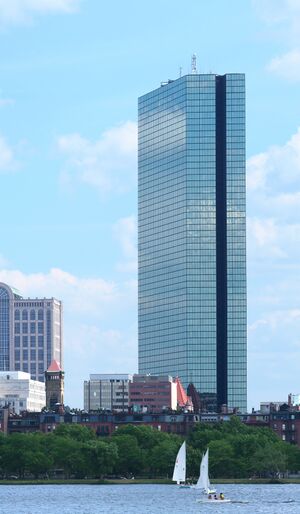
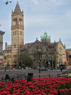
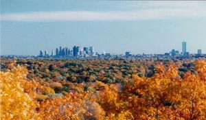
وسط المدينة ومحيطها المباشر يتكون إلى حد كبير من مباني منخفضة الارتفاع (غالبًا النمط الفيدرالي والنهضة اليونانية تتخللها ارتفاعات حديثة، في الحي المالي، المراكز الحكومية وجنوب بوسطن.[108] يضم حي باك باي العديد من المعالم البارزة، مثل مكتبة بوسطن العامة، كريستيان ساينس سنتر، كوبلي سكوير، شارع نيوبري، وأعلى مبنيين في نيو إنجلاند: برج جون هانكوك ومركز برودنشيال.[109]
بالقرب من برج جون هانكوك يوجد مبنى جون هانكوك القديم مع منارة مضيئة بارزة، والتي يتوقع لونها الطقس.[110] تتناثر المناطق التجارية الصغيرة بين مناطق منازل الأسرة الواحدة والمنازل الخشبية/المبنية من الطوب والتي تضم العديد من العائلات. تعد منطقة ساوذ إند التاريخية أكبر حي متجاور من العصر الفيكتوري في الولايات المتحدة.[111] تأثرت جغرافية وسط المدينة وجنوب بوسطن بشكل خاص بمشروع سنترال أرتيري/النفق المركزي (المعروف بشكل غير رسمي باسم "بيج بيج") الذي أزال سنترال أرتيري ودمج المساحات الخضراء الجديدة والمناطق المفتوحة.[112]
المناخ
| بوسطن | ||||||||||||||||||||||||||||||||||||||||||||||||||||||||||||
|---|---|---|---|---|---|---|---|---|---|---|---|---|---|---|---|---|---|---|---|---|---|---|---|---|---|---|---|---|---|---|---|---|---|---|---|---|---|---|---|---|---|---|---|---|---|---|---|---|---|---|---|---|---|---|---|---|---|---|---|---|
| جدول الطقس (التفسير) | ||||||||||||||||||||||||||||||||||||||||||||||||||||||||||||
| ||||||||||||||||||||||||||||||||||||||||||||||||||||||||||||
| ||||||||||||||||||||||||||||||||||||||||||||||||||||||||||||
حسب تصنف كوبن للمناخ، تبعاً لاستخدامه، تتمتع بوسطن بمناخ رطب شبه مداري، بدرجات حرارة تتراوح بين -3 إلى 3°س أو مناخ قاري رطب بدرجات حرارة 0°س.[113]
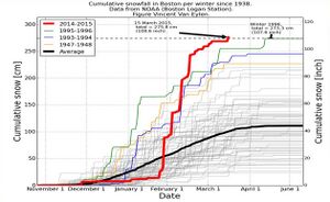
أفضل وصف للمدينة بأنها تقع في منطقة انتقالية بين المناخين. عادةً ما يكون الصيف دافئًا ورطبًا، بينما يكون الشتاء باردًا وعاصفًا، مع فترات متقطعة للثلوج الكثيفة. عادةً ما يكون الربيع والخريف باردًا إلى معتدل، مع اختلاف الظروف التي تعتمد على اتجاه الرياح وموضع التيار النفاث. تقلل أنماط الرياح السائدة التي تهب في الخارج من تأثير المحيط الأطلسي. ومع ذلك، غالبًا ما تشهد المناطق الشتوية بالقرب من الساحل المباشر أمطارًا أكثر من الثلوج حيث يُسحب الهواء الدافئ من المحيط الأطلسي في بعض الأحيان.[114] بحسب تصنيف وزارة الزراعة الأمريكية، تقع المدينة في المرحلة الانتقالية بين نباتات مناطق الصلابة 6 ب (معظم المدينة) و7 أ (وسط المدينة وجنوب بوسطن وشرق بوسطن).[115]
| الشهر | ينا | فب | مار | أبر | ماي | يون | يول | أغس | سبت | أكت | نوف | ديس | السنة |
|---|---|---|---|---|---|---|---|---|---|---|---|---|---|
| القصوى القياسية °ف (°س) | 74 (23) |
73 (23) |
89 (32) |
94 (34) |
97 (36) |
100 (38) |
104 (40) |
102 (39) |
102 (39) |
90 (32) |
83 (28) |
76 (24) |
104 (40) |
| متوسط القصوى اليومية °ف (°س) | 36.8 (2.7) |
39.0 (3.9) |
45.5 (7.5) |
56.4 (13.6) |
66.5 (19.2) |
76.2 (24.6) |
82.1 (27.8) |
80.4 (26.9) |
73.1 (22.8) |
62.1 (16.7) |
51.6 (10.9) |
42.2 (5.7) |
59.3 (15.2) |
| المتوسط اليومي °ف (°س) | 29.9 (−1.2) |
31.8 (−0.1) |
38.3 (3.5) |
48.6 (9.2) |
58.4 (14.7) |
68.0 (20.0) |
74.1 (23.4) |
72.7 (22.6) |
65.6 (18.7) |
54.8 (12.7) |
44.7 (7.1) |
35.7 (2.1) |
51.9 (11.1) |
| متوسط الدنيا اليومية °ف (°س) | 23.1 (−4.9) |
24.6 (−4.1) |
31.1 (−0.5) |
40.8 (4.9) |
50.3 (10.2) |
59.7 (15.4) |
66.0 (18.9) |
65.1 (18.4) |
58.2 (14.6) |
47.5 (8.6) |
37.9 (3.3) |
29.2 (−1.6) |
44.5 (6.9) |
| متوسط الدنيا °ف (°س) | 4.8 (−15.1) |
8.3 (−13.2) |
15.6 (−9.1) |
31.0 (−0.6) |
41.2 (5.1) |
49.7 (9.8) |
58.6 (14.8) |
57.7 (14.3) |
46.7 (8.2) |
35.1 (1.7) |
24.4 (−4.2) |
13.1 (−10.5) |
2.6 (−16.3) |
| الصغرى القياسية °ف (°س) | −13 (−25) |
−18 (−28) |
−8 (−22) |
11 (−12) |
31 (−1) |
41 (5) |
50 (10) |
46 (8) |
34 (1) |
25 (−4) |
−2 (−19) |
−17 (−27) |
−18 (−28) |
| متوسط تساقط الأمطار inches (mm) | 3.39 (86) |
3.21 (82) |
4.17 (106) |
3.63 (92) |
3.25 (83) |
3.89 (99) |
3.27 (83) |
3.23 (82) |
3.56 (90) |
4.03 (102) |
3.66 (93) |
4.30 (109) |
43.59 (1٬107) |
| متوسط هطول الثلج inches (cm) | 14.3 (36) |
14.4 (37) |
9.0 (23) |
1.6 (4.1) |
0.0 (0.0) |
0.0 (0.0) |
0.0 (0.0) |
0.0 (0.0) |
0.0 (0.0) |
0.2 (0.51) |
0.7 (1.8) |
9.0 (23) |
49.2 (125) |
| Average precipitation days (≥ 0.01 in) | 11.8 | 10.6 | 11.6 | 11.6 | 11.8 | 10.9 | 9.4 | 9.0 | 9.0 | 10.5 | 10.3 | 11.9 | 128.4 |
| متوسط الرطوبة النسبية (%) | 62.3 | 62.0 | 63.1 | 63.0 | 66.7 | 68.5 | 68.4 | 70.8 | 71.8 | 68.5 | 67.5 | 65.4 | 66.5 |
| متوسط نقطة الندى °ف (°س) | 16.5 (−8.6) |
17.6 (−8.0) |
25.2 (−3.8) |
33.6 (0.9) |
45.0 (7.2) |
55.2 (12.9) |
61.0 (16.1) |
60.4 (15.8) |
53.8 (12.1) |
42.8 (6.0) |
33.4 (0.8) |
22.1 (−5.5) |
38.9 (3.8) |
| Mean monthly ساعات سطوع الشمس | 163.4 | 168.4 | 213.7 | 227.2 | 267.3 | 286.5 | 300.9 | 277.3 | 237.1 | 206.3 | 143.2 | 142.3 | 2٬633٫6 |
| نسبة السطوع المحتمل للشمس | 56 | 57 | 58 | 57 | 59 | 63 | 65 | 64 | 63 | 60 | 49 | 50 | 59 |
| متوسط مؤشر فوق البنفسجية | 1 | 2 | 4 | 5 | 7 | 8 | 8 | 8 | 6 | 4 | 2 | 1 | 5 |
| Source 1: NOAA (relative humidity, dew point and sun 1961−1990)[117][118][119] | |||||||||||||
| Source 2: Weather Atlas (UV)[120] | |||||||||||||
| Climate data for Boston, Massachusetts | |||||||||||||
|---|---|---|---|---|---|---|---|---|---|---|---|---|---|
| Month | Jan | Feb | Mar | Apr | May | Jun | Jul | Aug | Sep | Oct | Nov | Dec | Year |
| Average sea temperature °F (°C) | 41.3 (5.2) |
38.1 (3.4) |
38.4 (3.5) |
43.1 (6.2) |
49.2 (9.5) |
58.4 (14.7) |
65.7 (18.7) |
67.9 (20.0) |
64.8 (18.2) |
59.4 (15.3) |
52.3 (11.3) |
46.6 (8.2) |
52.1 (11.2) |
| Source: Weather Atlas[120] | |||||||||||||
See or edit raw graph data.
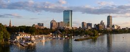
أفق المدينة
الديموغرافيا
| السنة | تعداد | ±% |
|---|---|---|
| 1680 | 4٬500 | — |
| 1690 | 7٬000 | +55.6% |
| 1700 | 6٬700 | −4.3% |
| 1710 | 9٬000 | +34.3% |
| 1722 | 10٬567 | +17.4% |
| 1742 | 16٬382 | +55.0% |
| 1765 | 15٬520 | −5.3% |
| 1790 | 18٬320 | +18.0% |
| 1800 | 24٬937 | +36.1% |
| 1810 | 33٬787 | +35.5% |
| 1820 | 43٬298 | +28.1% |
| 1830 | 61٬392 | +41.8% |
| 1840 | 93٬383 | +52.1% |
| 1850 | 136٬881 | +46.6% |
| 1860 | 177٬840 | +29.9% |
| 1870 | 250٬526 | +40.9% |
| 1880 | 362٬839 | +44.8% |
| 1890 | 448٬477 | +23.6% |
| 1900 | 560٬892 | +25.1% |
| 1910 | 670٬585 | +19.6% |
| 1920 | 748٬060 | +11.6% |
| 1930 | 781٬188 | +4.4% |
| 1940 | 770٬816 | −1.3% |
| 1950 | 801٬444 | +4.0% |
| 1960 | 697٬197 | −13.0% |
| 1970 | 641٬071 | −8.1% |
| 1980 | 562٬994 | −12.2% |
| 1990 | 574٬283 | +2.0% |
| 2000 | 589٬141 | +2.6% |
| 2010 | 617٬594 | +4.8% |
| 2020 | 675٬647 | +9.4% |
| 2021 | 654٬283 | −3.2% |
| *=population estimate. المصدر: سجلات تعداد الولايات المتحدة وبيانات برنامج تقديرات السكان.[121][122][123][124][125][126][127][128][129][130][131][132] 2010–2020[3] Source: التعداد العشري للولايات المتحدة[133] | ||
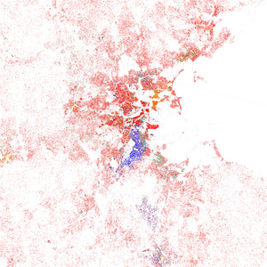
| العرق/العرقية | 2020[134] | 2010[135] | 1990[136] | 1970[136] | 1940[136] |
|---|---|---|---|---|---|
| بيض غير هسبان | 44.7% | 47.0% | 59.0% | 79.5%[ث] | 96.6% |
| سود | 22.0% | 24.4% | 23.8% | 16.3% | 3.1% |
| هسبان أو لاتينيون (من أي عرقية) | 19.5% | 17.5% | 10.8% | 2.8%[ث] | 0.1% |
| آسيويون | 9.7% | 8.9% | 5.3% | 1.3% | 0.2% |
| عرقيتان أو أكثر | 3.2% | 3.9% | – | – | – |
| أمريكان أصليون | 0.2% | 0.4% | 0.3% | 0.2% | – |

الأصول
| الأصول | النسبة المئوية من سكان بوسطن |
النسبة المئوية من سكان مساتشوستس |
النسبة المئوية من سكان الولايات المتحدة |
المدينة-إلى-الولاية | المدينة-إلى-الولايات المتحدة |
|---|---|---|---|---|---|
| أيرلنديون | 14.06% | 21.16% | 10.39% | −7.10% | 3.67% |
| إيطاليون | 8.13% | 13.19% | 5.39% | −5.05% | 2.74% |
| هنود غربيون آخرون | 6.92% | 1.96% | 0.90% | 4.97% | 6.02% |
| دومنيكان | 5.45% | 2.60% | 0.68% | 2.65% | 4.57% |
| بورتوريكيون | 5.27% | 4.52% | 1.66% | 0.75% | 3.61% |
| صينيون | 4.57% | 2.28% | 1.24% | 2.29% | 3.33% |
| ألمان | 4.57% | 6.00% | 14.40% | −1.43% | −9.83% |
| إنجليز | 4.54% | 9.77% | 7.67% | −5.23% | −3.13% |
| أمريكان | 4.13% | 4.26% | 6.89% | −0.13% | −2.76% |
| أفارقة جنوب الصحراء | 4.09% | 2.00% | 1.01% | 2.09% | 3.08% |
| هايتيون | 3.58% | 1.15% | 0.31% | 2.43% | 3.27% |
| بولنديون | 2.48% | 4.67% | 2.93% | −2.19% | −0.45% |
| الرأس الأخضر | 2.21% | 0.97% | 0.03% | 1.24% | 2.18% |
| فرنسيون | 1.93% | 6.82% | 2.56% | −4.89% | −0.63% |
| فيتناميون | 1.76% | 0.69% | 0.54% | 1.07% | 1.22% |
| جامايكون | 1.70% | 0.44% | 0.34% | 1.26% | 1.36% |
| روس | 1.62% | 1.65% | 0.88% | −0.03% | 0.74% |
| هنود آسيويون | 1.31% | 1.39% | 1.09% | −0.08% | 0.22% |
| إسكتلنديون | 1.30% | 2.28% | 1.71% | −0.98% | −0.41% |
| كنديون فرنسيون | 1.19% | 3.91% | 0.65% | −2.71% | 0.54% |
| مكسيكيون | 1.12% | 0.67% | 11.96% | 0.45% | −10.84% |
| عرب | 1.10% | 1.10% | 0.59% | 0.00% | 0.50% |
الأديان
بحسبدراسة أجراها مركز بيو للأبحاث عام 2014، عرّف 57٪ من سكان المدينة أنفسهم على أنهم مسيحيون، مع 25٪ يحضرون مجموعة متنوعة من الكنائس البروتستانتية و29٪ من الروم الكاثوليك؛[137][138] 33% بلا ديانة، بينما 10% الباقيين من الديانة اليهودية والبوثية والإسلام والهندوسية والبهائية ومعتقدات أخرى.
يوجد في منطقة بوسطن الكبرى 248.000 يهودي.[139] يقيم أكثر من نصف الأسر اليهودية بمنطقة بوسطن الكبرى في المدينة نفسها وفي بروكلين، نيوتن، كمبردج، سمرفيل أو البلدات المجاورة.[139]
الحكومة
الاقتصاد
| أكبر شركات بوسطن العامة لعام 2018 (مرتّبة حسب الدخل) مع ترتيبات على مستوى المدينة والولايات المتحدة المصدر: فورتشن 500[140] | |||||||
| بوسطن | المؤسسة | الولايات المتحدة | الدخل (بالمليون) | ||||
| 1 | جنرال إلكتريك | 18 | $122.274 | ||||
| 2 | ليبرتي ميوتشوال | 68 | $42.687 | ||||
| 3 | ستيت ستريت | 259 | $11.774 | ||||
| 4 | أمريكان تاور | 419 | $6.663.9 | ||||
| أكبر أرباب العمل بالمدينة المصدر: المكتب التنفيذي للعمل وتنمية العاملة بمساتشوستس[141] | |||||||
| الترتيب | الشركة/المنظمة | ||||||
| 1 | مستشفى بريگم والنساء | ||||||
| 2 | المستشفى العام بمساتشوستس | ||||||
| 3 | مركز بيت إسرائيل ديكونس الطبي | ||||||
| 4 | مستشفى بوسطن للأطفال | ||||||
| 5 | مركز بوسطن الطبي | ||||||
| 6 | كلية الطب، جامعة بوسطن | ||||||
| 7 | جامعة بوسطن | ||||||
| 8 | المستشفى الطافي للأطفال | ||||||
| 9 | شركة جون هانكوك للتأمين على الحياة | ||||||
| 10 | مجموعة ليبرتي ميوتشوال | ||||||
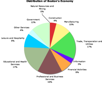
A global city, Boston is placed among the top 30 most economically powerful cities in the world.[144] Encompassing $363 billion, the Greater Boston metropolitan area has the sixth-largest economy in the country and 12th-largest in the world.[145]
Boston's colleges and universities exert a significant impact on the regional economy. Boston attracts more than 350,000 college students from around the world, who contribute more than US$4.8 billion annually to the city's economy.[146][147] The area's schools are major employers and attract industries to the city and surrounding region. The city is home to a number of technology companies and is a hub for biotechnology, with the Milken Institute rating Boston as the top life sciences cluster in the country.[148] Boston receives the highest absolute amount of annual funding from the National Institutes of Health of all cities in the United States.[149]
The city is considered highly innovative for a variety of reasons, including the presence of academia, access to venture capital, and the presence of many high-tech companies.[24][150] The Route 128 corridor and Greater Boston continue to be a major center for venture capital investment,[151] and high technology remains an important sector.
Tourism also composes a large part of Boston's economy, with 21.2 million domestic and international visitors spending $8.3 billion in 2011.[152] Excluding visitors from Canada and Mexico, over 1.4 million international tourists visited Boston in 2014, with those from China and the United Kingdom leading the list.[153] Boston's status as a state capital as well as the regional home of federal agencies has rendered law and government to be another major component of the city's economy.[154] The city is a major seaport along the East Coast of the United States and the oldest continuously operated industrial and fishing port in the Western Hemisphere.[155]
In the 2018 Global Financial Centres Index, Boston was ranked as having the thirteenth most competitive financial services center in the world and the second most competitive in the United States.[156] Boston-based Fidelity Investments helped popularize the mutual fund in the 1980s and has made Boston one of the top financial centers in the United States.[157][158] The city is home to the headquarters of Santander Bank, and Boston is a center for venture capital firms. State Street Corporation, which specializes in asset management and custody services, is based in the city. Boston is a printing and publishing center[159]—Houghton Mifflin Harcourt is headquartered within the city, along with Bedford-St. Martin's Press and Beacon Press. Pearson PLC publishing units also employ several hundred people in Boston. The city is home to three major convention centers—the Hynes Convention Center in the Back Bay, and the Seaport World Trade Center and Boston Convention and Exhibition Center on the South Boston waterfront.[160] The General Electric Corporation announced in January 2016 its decision to move the company's global headquarters to the Seaport District in Boston, from Fairfield, Connecticut, citing factors including Boston's preeminence in the realm of higher education.[161] Boston is home to the headquarters of several major athletic and footwear companies including Converse, New Balance, and Reebok. Rockport, Puma and Wolverine World Wide, Inc. headquarters or regional offices[162] are just outside the city.[163]
In 2019, a yearly ranking of time wasted in traffic listed Boston area drivers lost approximately 164 hours a year in lost productivity due to the area's traffic congestion. This amounted to $2,300 a year per driver in costs.[164]
التعليم
التعليم العالي

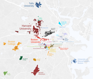
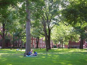
تقع بعض الجامعات الأكثر شهرة وذات التصنيف العالي في العالم بالقرب من بوسطن.[165][166] هناك ثلاث جامعات لها حضور كبير في المدينة، هارڤرد، معهد مساتشوستس للتكنولوجيا، وتافتس، تقع خارج بوسطن في مدينتي كامبردج وسمرڤيل، المعروفتين باسم "مثلث القوة الذهنية".[167] هارڤرد هي أقدم مؤسسة للتعليم العالي في البلاد وتتمركز عبر نهر تشارلز في كامبردج، على الرغم من أن غالبية ممتلكاتها من الأراضي وكمية كبيرة من أنشطتها التعليمية موجودة في بوسطن. تقع مرافق المدرسة والألعاب الرياضية التابعة لها لكلية الأعمال بحي ألستون في بوسطن، وكلية الطب، كلية طب الأسنان، وتقع كلية الصحة العامة في منطقة لونجوود.[168]
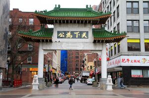
نشأ معهد مساتشوستس للتكنولوجيا (MIT) في بوسطن وكان معروفًا منذ فترة طويلة باسم "بوسطن تك"؛ عام 1916 انتقل عبر النهر إلى كمبردج.[169] يقع الحرم الجامعي الرئيسي لجامعة تافتس في شمال مدينة سمرڤيل وميدفورد، على الرغم من أنها تحدد موقع كليتي الطب وطب الأسنان في الحي الصيني بمدينة بوسطن، في مركز تافتس الطبي، مؤسسة طبية أكاديمية بسعة 451 سريرًا تضم مستشفى كامل الخدمات للبالغين والمستشفى العائم للأطفال.[170]
يوجد أربعة أعضاء في رابطة الجامعات الأمريكية في بوسطن الكبرى (أكثر من أي منطقة حضرية أخرى): جامعة هارڤرد ومعهد مساتشوستس للتكنولوجيا وجامعة بوسطن وجامعة برانديز.[171]
علاوة على ذلك، تضم بوسطن الكبرى سبع جامعات بأعلى نشاط بحثي (R1) بحسب تصنيف كارنيجى. ويشمل هذا، بالإضافة إلى الأربعة المذكورة أعلاه، كلية بوسطن، جامعة نورث إيسترن، وجامعة تافتس. الذي يعتبر أعلى تجمع لمثل هذه المؤسسات في منطقة حضرية واحدة.
تلقت المستشفيات والجامعات والمؤسسات البحثية في بوسطن الكبرى أكثر من 1.77 مليار دولار في منح المعاهد الوطنية للصحة عام 2013، وهي أموال أكثر من أي منطقة حضرية أمريكية أخرى.[172]
يوجد في بوسطن الكبرى أكثر من 100 كلية وجامعة، بها 250.000 طالب مسجلين في بوسطن وكمبردج وحدهما.[173]
تشمل أكبر الجامعات الخاصة في المدينة جامعة بوسطن (وهي أيضًا رابع أكبر جهة توظيف في المدينة)،[174] مع الحرم الجامعي الرئيسي على امتداد شارع الكومنولث والحرم الجامعي الطبي في ساوث إند، جامعة نورث إيسترن في منطقة فينواي،[175] جامعة سفوك بالقرب من بيكون هيل، والتي تضم كليتي الحقوق وإدارة الأعمال،[176] وكلية بوسطن، التي تمتد على حدود بوسطن (برايتون)-نيوتن.[177] الجامعة الحكومية الوحيدة في بوسطن هي جامعة مساتشوستس بوسطن في كولومبيا بوينت في دورشستر. كلية روكسبري المجتمعية وكلية بنكر هيل المجتمعية هما كليتان مجتمعيتان حكوميتان في المدينة. إجمالاً، توظف كليات وجامعات بوسطن أكثر من 42600 شخص، وهو ما يمثل ما يقرب من سبعة بالمائة من القوى العاملة في المدينة.[178]
تشمل الكليات الخاصة الأصغر كلية بابسون، جامعة بنتلي، كلية بوسطن المعمارية، كلية إيمانويل، كلية فيشر، معهد إم جي إتش للمهن الصحية، كلية مساتشوستس للصيدلة والعلوم الصحية ، كلية سيمونز، كلية ويلسلي، كلية ويلوك، معهد وينتورث للتكنولوجيا، كلية نيو إنجلاند للحقوق (تأسست في الأصل كأول كلية حقوق للبنات في أمريكا)،[179] وكلية إيمرسون.[180]
تضم بوسطن الكبرى للعديد من المعاهد الموسيقية والمدارس الفنية، بما في ذلك كلية ليسلي الجامعية للفنون والتصميم، كلية مساتشوستس للفنون، كلية متحف الفنون الجميلة، معهد نيو إنجلاند للفنون، مدرسة نيو إنجلاند للفنون والتصميم (جامعة سفوك)، مدرسة لونجي للموسيقى في كلية بارد، ومعهد نيو إنجلاند الموسيقي (أقدم معهد موسيقي مستقل في الولايات المتحدة).[181] تشمل المعاهد الموسيقية الأخرى معهد بوسطن الموسيقي وكلية بيركلي للموسيقى، مما جعل بوسطن مدينة هامة لموسيقى الجاز.[182]
الثقافة
وسائل الاعلام
الرياضة
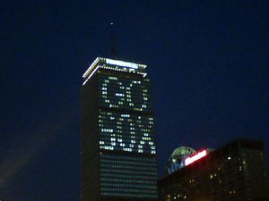
السياسة
| السنة | الديمقراطي | الجمهوري |
|---|---|---|
| 2016 | 80.6% 221,093 | 13.9% 38,087 |
| 2012 | 78.8% 200,190 | 19.3% 48,985 |
| 2008 | 79.0% 185,976 | 19.4% 45,548 |
| 2004 | 77.3% 160,884 | 21.4% 44,518 |
| 2000 | 71.7% 132,393 | 19.7% 36,389 |
| 1996 | 73.8% 125,529 | 19.6% 33,366 |
| 1992 | 62.4% 114,260 | 22.9% 41,868 |
| 1988 | 65.2% 122,349 | 33.2% 62,202 |
| 1984 | 63.4% 131,745 | 36.2% 75,311 |
| 1980 | 53.3% 95,133 | 32.9% 58,656 |
| 1976 | 60.4% 115,802 | 35.3% 67,604 |
| 1972 | 66.2% 139,598 | 33.3% 70,298 |
| تسجيل الناخبين وتسجيل الأحزاب اعتباراً من 1 فبراير 2019[184] | |||||
|---|---|---|---|---|---|
| الحزب | عدد الناخبين | النسبة | |||
| الديمقراطي | 210,570 | 50.73% | |||
| الجمهوري | 24,034 | 5.79% | |||
| الليبرتاري | 1,443 | 0.35% | |||
| الخضر | 403 | 0.10% | |||
| مستقلون | 175,308 | 42.23% | |||
| الإجمالي | 415,103 | 100% | |||
الرعاية الصحية والمرافق العامة
البنية التحتية
 مقالة مفصلة: البنية التحتية في بوسطن
النقل

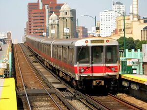
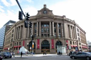

Logan International Airport, in East Boston and operated by the Massachusetts Port Authority (Massport), is Boston's principal airport.[186] Nearby general aviation airports are Beverly Municipal Airport to the north, Hanscom Field to the west, and Norwood Memorial Airport to the south. Massport also operates several major facilities within the Port of Boston, including a cruise ship terminal and facilities to handle bulk and container cargo in South Boston, and other facilities in Charlestown and East Boston.[187]
In 2013, the Boston-Cambridge-Newton metropolitan statistical area (Boston MSA) had the seventh-lowest percentage of workers who commuted by private automobile (75.6 percent), with 6.2 percent of area workers traveling via rail transit. During the period starting in 2006 and ending in 2013, the Boston MSA had the greatest percentage decline of workers commuting by automobile (3.3 percent) among MSAs with more than a half-million residents.[188]
العلاقات الدولية
مدينة بوسطن على توأمة رسمية مع احدى عشر مدينة:[189]
 كيوتو، اليابان (1959)
 ستراسبورج، فرنسا (1960)
 برشلونة، إسپانيا (1980)
 هانجزو، الصين (1982)
 پادوا، إيطاليا (1983)
 ملبورن، أستراليا (1985)
 بيرا، موزمبيق (1990)
 تايبي، تايوان (1996)
 سكوندي-تاكورادي، غانا (2001)
 بلفاست، أيرلندا الشمالية، المملكة المتحدة (2014)
 پرايا، الرأس الأخضر (2015)
لدى بوسطن علاقات شراكة رسمية من خلال مذكرة تفاهم مع أربع مدن أو مناطق إضافية:
 جوانجزو، الصين (2014)[190]
 ليون، فرنسا (2016)[191]
 كوبنهاجن، الدنمارك (2017)[192]
 مكسيكو سيتي، المكسيك (2017)[193]
 شمال غرب أيرلندا، أيرلندا (2017)[194]
انظر أيضاً
- موضوعات بوسطن
- رابطة مدينة بوسطن (مؤتمر ألعاب القوى للمدارس الثانوية)
- أسماء تدليل بوسطن
- علاقات بوسطن-هاليفاكس
- قائمة البعثات الدبلوماسية في بوسطن
- قائمة أشخاص من بوسطن
- السجل الوطني للأماكن التاريخية في بوسطن
ملاحظات
- ^ On the New Style (modern) calendar, anniversaries fall on September 17.
- ^ Mean monthly maxima and minima (i.e. the expected highest and lowest temperature readings at any point during the year or given month) calculated based on data at said location from 1991 to 2020.
- ^ Official records for Boston were kept at downtown from January 1872 to December 1935, and at Logan Airport (KBOS) since January 1936.[116]
- ^ أ ب From 15% sample
المراجع
الهامش
- ^ "List of intact or abandoned Massachusetts county governments". sec.state.ma.us. Secretary of the Commonwealth of Massachusetts. Archived from the original on April 6, 2021. Retrieved October 31, 2016.
- ^ "2020 U.S. Gazetteer Files". United States Census Bureau. Retrieved May 21, 2022.
- ^ أ ب ت "QuickFacts: Boston city, Massachusetts". census.gov. United States Census Bureau. Retrieved January 21, 2023.
- ^ "List of 2020 Census Urban Areas". census.gov. United States Census Bureau. Retrieved January 8, 2023.
- ^ "2020 Population and Housing State Data". United States Census Bureau. Archived from the original on August 24, 2021. Retrieved August 22, 2021.
- ^ "ZIP Code Lookup – Search By City". United States Postal Service. Archived from the original on September 3, 2007. Retrieved April 20, 2009.
- ^ Wells, John C. (2008). Longman Pronunciation Dictionary (3rd ed.). Longman. ISBN 978-1-4058-8118-0.
- ^ أ ب خطأ استشهاد: وسم
<ref>غير صحيح؛ لا نص تم توفيره للمراجع المسماة2010census - ^ https://ballotpedia.org/Largest_cities_in_the_United_States_by_population
- ^ http://www.bostonplans.org/getattachment/86dd4b02-a7f3-499e-874e-53b7e8be4770#:~:text=%E2%80%94%20With%20a%20land%20area%20of,up%20the%20Commonwealth%20of%20Massachusetts.
- ^ "Annual Estimates of the Resident Population for Incorporated Places of 50,000 or More, Ranked by July 1, 2019 Population: April 1, 2010 to July 1, 2019". United States Census Bureau, Population Division. Retrieved May 21, 2020.
- ^ "List of intact or abandoned Massachusetts county governments". sec.state.ma.us. Secretary of the Commonwealth of Massachusetts. Retrieved October 31, 2016.
- ^ "Annual Estimates of the Resident Population: April 1, 2010 to July 1, 2016 Population Estimates". United States Census Bureau. Archived from the original on February 13, 2020. Retrieved June 3, 2017.
- ^ "Annual Estimates of the Resident Population: April 1, 2010 to July 1, 2016 Population Estimates Boston-Worcester-Providence, MA-RI-NH-CT CSA". United States Census Bureau. Archived from the original on February 13, 2020. Retrieved June 3, 2017.
- ^ Banner, David. "Boston History – The History of Boston, Massachusetts". SearchBoston. Archived from the original on March 15, 2009. Retrieved April 20, 2009.
- ^ Kennedy 1994, pp. 11–12.
- ^ أ ب "About Boston". City of Boston. Retrieved May 1, 2016.
- ^ أ ب Morris 2005, p. 8.
- ^ "Top 25 Most Visited Tourist Destinations in America". The Travelers Zone. May 10, 2008. Retrieved February 14, 2013.
- ^ أ ب "BPS at a Glance". Boston Public Schools. March 14, 2007. Archived from the original on April 3, 2007. Retrieved April 28, 2007.
- ^ Hull 2011, p. 42.
- ^ "World Reputation Rankings". April 21, 2016. Retrieved May 12, 2016.
- ^ "Venture Investment – Regional Aggregate Data". National Venture Capital Association and PricewaterhouseCoopers. Archived from the original on April 8, 2016. Retrieved April 22, 2016.
- ^ أ ب Kirsner, Scott (July 20, 2010). "Boston is #1 ... But will we hold on to the top spot? – Innovation Economy". The Boston Globe. Retrieved August 30, 2010.
- ^ Innovation that Matters 2016. US Chamber of Commerce. 2016. Archived from the original. You must specify the date the archive was made using the
|archivedate=parameter. http://www.1776.vc/reports/innovation-that-matters-2016/. - ^ [1] Accessed October 7, 2018.
- ^ "The Boston Economy in 2010" (PDF). Boston Redevelopment Authority. January 2011. Archived from the original (PDF) on July 30, 2012. Retrieved March 5, 2013.
- ^ "Transfer of Wealth in Boston" (PDF). The Boston Foundation. March 2013. Retrieved December 6, 2015.
- ^ "Boston Ranked Most Energy-Efficient City in the United States". City Government of Boston. September 18, 2013. Retrieved December 6, 2015.
- ^ "In the wake of the Ghost Ship fire, examining Oakland's 'staggering' rent hikes". December 10, 2016. Retrieved December 12, 2016.
- ^ أ ب Heudorfer, Bonnie; Bluestone, Barry. "The Greater Boston Housing Report Card" (PDF). Center for Urban and Regional Policy (CURP), Northeastern University. p. 6. Archived from the original (PDF) on November 8, 2006. Retrieved December 12, 2016. خطأ استشهاد: وسم
<ref>غير صالح؛ الاسم "Heudorfer" معرف أكثر من مرة بمحتويات مختلفة. - ^ Tom Acitelli (December 7, 2016). "Which Boston neighborhoods will gentrify next?". Vox Media. Retrieved December 12, 2016.
- ^ "Quality of Living global city rankings 2010 – Mercer survey". Mercer. May 26, 2010. Archived from the original on August 12, 2011. Retrieved August 20, 2011.
- ^ أ ب "Native Americans in Jamaica Plain". Jamaica Plains Historical Society. Archived from the original on December 10, 2017. Retrieved September 21, 2021.
- ^ أ ب "The Native Americans' River". Harvard College. Archived from the original on July 11, 2015. Retrieved September 21, 2021.
- ^ "Chickataubut". The Massachusett Tribe at Ponkapoag. Archived from the original on June 11, 2019. Retrieved September 21, 2021.
- ^ Morison, Samuel Eliot (1932). English University Men Who Emigrated to New England Before 1646: An Advanced Printing of Appendix B to the History of Harvard College in the Seventeenth Century. Cambridge, MA: Harvard University Press. p. 10.
- ^ Morison, Samuel Eliot (1963). The Founding of Harvard College. Cambridge, Mass: Harvard University Press. ISBN 9780674314504.
- ^ Banks, Charles Edward (1937). Topographical dictionary of 2885 English emigrants to New England, 1620–1650. The Bertram press. p. 96.
- ^ قالب:DNB
- ^ Weston, George F. Boston Ways: High, By & Folk, Beacon Press: Beacon Hill, Boston, p.11–15 (1957).
- ^ "Guide | Town of Boston | City of Boston". Archived from the original on April 20, 2013. Retrieved March 20, 2013.
- ^ Kay, Jane Holtz, Lost Boston, Amherst : University of Massachusetts Press, 2006. ISBN 9781558495272. Cf. p.4
- ^ Thurston, H. (1907). "St. Botulph." The Catholic Encyclopedia. New York: Robert Appleton Company. Retrieved June 17, 2014 from New Advent: http://www.newadvent.org/cathen/02709a.htm
- ^ Christopher 2006, p. 46.
- ^ ""Growth" to Boston in its Heyday, 1640s to 1730s" (PDF). Boston History & Innovation Collaborative. 2006. p. 2. Archived from the original (PDF) on July 23, 2013. Retrieved March 5, 2013.
- ^ "Boston" (in الإنجليزية). Encyclopedia Britannica. 2023-04-21. Retrieved 2023-04-23.
- ^ أ ب ت ث Smith, Robert W. (2005). Encyclopedia of the New American Nation (1st ed.). Detroit, MI: Charles Scribner's Sons. pp. 214–219. ISBN 978-0684313467.
- ^ أ ب Bunker, Nick (2014). An Empire on the Edge: How Britain Came to Fight America. Knopf. ISBN 978-0307594846.
- ^ Dawson, Henry B. (1858). Battles of the United States, by sea and land: embracing those of the Revolutionary and Indian Wars, the War of 1812, and the Mexican War; with important official documents. New York, NY: Johnson, Fry & Company.
- ^ Morris 2005, p. 7.
- ^ Morgan, Edmund S. (1946). "Thomas Hutchinson and the Stamp Act". The New England Quarterly. 21 (4): 459–492. doi:10.2307/361566. JSTOR 361566.
- ^ أ ب Frothingham, Richard Jr. (1851). History of the Siege of Boston and of the Battles of Lexington, Concord, and Bunker Hill. Little and Brown. Archived from the original on June 23, 2016. Retrieved May 21, 2018.
- ^ أ ب French, Allen (1911). The Siege of Boston. Macmillan.
- ^ McCullough, David (2005). 1776. New York, NY: Simon & Schuster. ISBN 978-0-7432-2671-4.
- ^ Hubbard, Robert Ernest. Rufus Putnam: George Washington's Chief Military Engineer and the "Father of Ohio," pp. 45–8, McFarland & Company, Inc., Jefferson, North Carolina, 2020. ISBN 978-1-4766-7862-7.
- ^ Kennedy 1994, p. 46.
- ^ "Home page" (Exhibition at Boston Public Library and Massachusetts Historical Society). Forgotten Chapters of Boston's Literary History. The Trustees of Boston College. July 30, 2012. Archived from the original on February 25, 2021. Retrieved May 22, 2012.
- ^ "An Interactive Map of Literary Boston: 1794–1862" (Exhibition). Forgotten Chapters of Boston's Literary History. The Trustees of Boston College. July 30, 2012. Archived (PDF) from the original on May 16, 2012. Retrieved May 22, 2012.
- ^ Kennedy 1994, p. 44.
- ^ B. Rosenbaum, Julia (2006). Visions of Belonging: New England Art and the Making of American Identity. Cornell University Press. p. 45. ISBN 9780801444708.
By the late nineteenth century, one of the strongest bulwarks of Brahmin power was Harvard University. Statistics underscore the close relationship between Harvard and Boston's upper strata.
- ^ C. Holloran, Peter (1989). Boston's Wayward Children: Social Services for Homeless Children, 1830-1930. Fairleigh Dickinson Univ Press. p. 73. ISBN 9780838632970.
- ^ J. Harp, Gillis (2003). Brahmin Prophet: Phillips Brooks and the Path of Liberal Protestantism. Rowman & Littlefield Publishers. p. 13. ISBN 9780742571983.
- ^ Dilworth, Richardson (September 13, 2011). Cities in American Political History. SAGE Publications. p. 28. ISBN 9780872899117. Archived from the original on April 18, 2022. Retrieved December 26, 2021.
- ^ "Boston African American National Historic Site". National Park Service. April 28, 2007. Archived from the original on November 6, 2010. Retrieved May 8, 2007.
- ^ "Fugitive Slave Law". The Massachusetts Historical Society. Archived from the original on October 27, 2017. Retrieved May 2, 2009.
- ^ "The "Trial" of Anthony Burns". The Massachusetts Historical Society. Archived from the original on September 22, 2017. Retrieved May 2, 2009.
- ^ "150th Anniversary of Anthony Burns Fugitive Slave Case". Suffolk University. April 24, 2004. Archived from the original on May 20, 2008. Retrieved May 2, 2009.
- ^ أ ب State Street Trust Company; Walton Advertising & Printing Company (1922). Boston: one hundred years a city (TXT). Vol. 2. Boston: State Street Trust Company. Retrieved April 20, 2009.
- ^ "People & Events: Boston's Immigrant Population". WGBH/PBS Online (American Experience). 2003. Archived from the original on October 11, 2007. Retrieved May 4, 2007.
- ^ "Immigration Records". The National Archives. Archived from the original on January 14, 2009. Retrieved January 7, 2009.
- ^ Puleo, Stephen (2007). "Epilogue: Today". The Boston Italians (illustrated ed.). Beacon Press. ISBN 978-0-8070-5036-1. Archived from the original on February 3, 2021. Retrieved May 16, 2009.
- ^ "Faith, Spirituality, and Religion". American College Personnel Association. Archived from the original on February 25, 2021. Retrieved February 29, 2020.
- ^ Bolino 2012, pp. 285–286.
- ^ أ ب "The History of Land Fill in Boston". iBoston.org. 2006. Archived from the original on December 21, 2020. Retrieved January 9, 2006.. Also see Howe, Jeffery (1996). "Boston: History of the Landfills". Boston College. Archived from the original on April 10, 2007. Retrieved April 30, 2007.
- ^ Historical Atlas of Massachusetts. University of Massachusetts. 1991. p. 37.
- ^ Holleran, Michael (2001). "Problems with Change". Boston's Changeful Times: Origins of Preservation and Planning in America. The Johns Hopkins University Press. p. 41. ISBN 978-0-8018-6644-9. Archived from the original on February 4, 2021. Retrieved August 22, 2010.
- ^ "Boston's Annexation Schemes.; Proposal To Absorb Cambridge And Other Near-By Towns". The New York Times. March 26, 1892. p. 11. Archived from the original on June 14, 2018. Retrieved August 21, 2010.
- ^ Rezendes, Michael (October 13, 1991). "Has the time for Chelsea's annexation to Boston come? The Hub hasn't grown since 1912, and something has to follow that beleaguered community's receivership". The Boston Globe. p. 80. Archived from the original on July 23, 2013. Retrieved August 22, 2010.
- ^ Estes, Andrea; Cafasso, Ed (September 9, 1991). "Flynn offers to annex Chelsea". Boston Herald. p. 1. Archived from the original on July 23, 2013. Retrieved August 22, 2010.
- ^ "Fenway Park | Definition, History, & Facts". Encyclopedia Britannica. Archived from the original on December 6, 2020. Retrieved November 19, 2020.
- ^ "Horticultural Hall, Boston - Lost New England". Lost New England. January 18, 2016. Archived from the original on October 29, 2020. Retrieved November 19, 2020.
- ^ "The Tennis and Racquet Club (T&R)". The Tennis and Racquet Club (T&R). Archived from the original on January 20, 2021. Retrieved November 19, 2020.
- ^ "Isabella Stewart Gardner Museum | Isabella Stewart Gardner Museum". www.gardnermuseum.org. Archived from the original on April 5, 2021. Retrieved November 19, 2020.
- ^ "Fenway Studios". fenwaystudios.org. Archived from the original on February 10, 2021. Retrieved November 19, 2020.
- ^ "Jordan Hall History". necmusic.edu. Archived from the original on May 11, 2021. Retrieved November 19, 2020.
- ^ "How the Longfellow Bridge Got its Name". November 23, 2013. Archived from the original on February 4, 2021. Retrieved November 19, 2020.
- ^ Guide, Boston Discovery. "Make Way for Ducklings | Boston Discovery Guide". www.boston-discovery-guide.com. Archived from the original on February 24, 2021. Retrieved November 19, 2020.
- ^ "Lt. General Edward Lawrence Logan International Airport : A history". Massachusetts Institute of Technology. Archived from the original on May 3, 2003. Retrieved September 21, 2021.
- ^ "Boston Bruins History". Boston Bruins. Archived from the original on February 1, 2021. Retrieved November 19, 2020.
- ^ Bluestone & Stevenson 2002, p. 13.
- ^ Collins, Monica (August 7, 2005). "Born Again". The Boston Globe. Archived from the original on March 3, 2016. Retrieved May 8, 2007.
- ^ Roessner, Jane (2000). A Decent Place to Live: from Columbia Point to Harbor Point – A Community History. Boston: Northeastern University Press. p. 80. ISBN 978-1-55553-436-3.
- ^ Cf. Roessner, p.293. "The HOPE VI housing program, inspired in part by the success of Harbor Point, was created by legislation passed by Congress in 1992."
- ^ Kennedy 1994, p. 195.
- ^ Kennedy 1994, pp. 194–195.
- ^ Feeney, Mark; Mehegan, David (April 15, 2005). "Atlantic, 148-year institution, leaving city". The Boston Globe. Archived from the original on March 3, 2016. Retrieved March 31, 2007.
- ^ "FleetBoston, Bank of America Merger Approved by Fed". The Boston Globe. March 9, 2004. Archived from the original on March 4, 2016. Retrieved March 5, 2013.
- ^ Abelson, Jenn; Palmer, Thomas C. Jr. (July 29, 2005). "It's Official: Filene's Brand Will Be Gone". The Boston Globe. Archived from the original on March 4, 2016. Retrieved March 5, 2013.
- ^ Glaberson, William (June 11, 1993). "Largest Newspaper Deal in U.S. – N.Y. Times Buys Boston Globe for $1.1 Billion". Pittsburgh Post-Gazette. p. B-12. Archived from the original on May 11, 2021. Retrieved March 5, 2013.
- ^ Hampson, Rick (April 19, 2005). "Studies: Gentrification a boost for everyone". USA Today. Archived from the original on June 28, 2012. Retrieved May 2, 2009.
- ^ خطأ استشهاد: وسم
<ref>غير صحيح؛ لا نص تم توفيره للمراجع المسماة260herald - ^ "The life and death of Boston's Olympic bid". August 4, 2016. Archived from the original on May 10, 2021. Retrieved July 20, 2017.
- ^ Futterman, Matthew (September 13, 2017). "Los Angeles Is Officially Awarded the 2028 Olympics". The Wall Street Journal (in الإنجليزية الأمريكية). ISSN 0099-9660. Archived from the original on March 8, 2021. Retrieved January 7, 2021.
- ^ "Elevation data – Boston". U.S. Geological Survey. 2007.
- ^ "Bellevue Hill, Massachusetts". Peakbagger.com.
- ^ "Official list of Boston neighborhoods". Cityofboston.gov. March 24, 2011. Archived from the original on July 16, 2016. Retrieved September 1, 2012.
- ^ Shand-Tucci, Douglass (1999). Built in Boston: City & Suburb, 1800–2000 (2 ed.). University of Massachusetts Press. pp. 11, 294–299. ISBN 978-1-55849-201-1.
- ^ "Boston Skyscrapers". Emporis.com. 2005. Archived from the original on October 26, 2012. Retrieved May 15, 2005.
- ^ Hull 2011, p. 91.
- ^ "Our History". South End Historical Society. 2013. Archived from the original on July 23, 2013. Retrieved February 17, 2013.
- ^ Morris 2005, pp. 54, 102.
- ^ "World Map of the Köppen-Geiger climate classification updated". University of Veterinary Medicine Vienna. November 6, 2008. Archived from the original on September 6, 2010. Retrieved May 5, 2018.
- ^ خطأ استشهاد: وسم
<ref>غير صحيح؛ لا نص تم توفيره للمراجع المسماةBostonWeather - ^ "USDA Plant Hardiness Zone Map". United States Department of Agriculture. Archived from the original on February 27, 2014. Retrieved March 22, 2018.
- ^ ThreadEx
- ^ "Summary of Monthly Normals 1991–2020". National Oceanic and Atmospheric Administration. Retrieved May 4, 2021.
- ^ "NowData - NOAA Online Weather Data". National Oceanic and Atmospheric Administration. Retrieved May 24, 2021.
- ^ "WMO Climate Normals for BOSTON/LOGAN INT'L AIRPORT, MA 1961–1990". National Oceanic and Atmospheric Administration. Retrieved July 18, 2020.
- ^ أ ب "Boston, Massachusetts, USA - Monthly weather forecast and Climate data". Weather Atlas. Retrieved July 4, 2019.
- ^ "TOTAL POPULATION (P1), 2010 Census Summary File 1, All County Subdivisions within Massachusetts". United States Census Bureau. Retrieved September 13, 2011.
- ^ "Massachusetts by Place and County Subdivision - GCT-T1. Population Estimates". United States Census Bureau. Retrieved July 12, 2011.
- ^ "1990 Census of Population, General Population Characteristics: Massachusetts" (PDF). US Census Bureau. 1990. Table 76: General Characteristics of Persons, Households, and Families: 1990. 1990 CP-1-23. Retrieved July 12, 2011.
{{cite web}}: Unknown parameter|month=ignored (help) - ^ "1980 Census of the Population, Number of Inhabitants: Massachusetts" (PDF). US Census Bureau. 1981. Table 4. Populations of County Subdivisions: 1960 to 1980. PC80-1-A23. Retrieved July 12, 2011.
{{cite web}}: Unknown parameter|month=ignored (help) - ^ "1950 Census of Population" (PDF). Bureau of the Census. 1952. Section 6, Pages 21-10 and 21-11, Massachusetts Table 6. Population of Counties by Minor Civil Divisions: 1930 to 1950. Retrieved July 12, 2011.
- ^ "1920 Census of Population" (PDF). Bureau of the Census. Number of Inhabitants, by Counties and Minor Civil Divisions. Pages 21-5 through 21-7. Massachusetts Table 2. Population of Counties by Minor Civil Divisions: 1920, 1910, and 1920. Retrieved July 12, 2011.
- ^ "1890 Census of the Population" (PDF). Department of the Interior, Census Office. Pages 179 through 182. Massachusetts Table 5. Population of States and Territories by Minor Civil Divisions: 1880 and 1890. Retrieved July 12, 2011.
- ^ "1870 Census of the Population" (PDF). Department of the Interior, Census Office. 1872. Pages 217 through 220. Table IX. Population of Minor Civil Divisions, &c. Massachusetts. Retrieved July 12, 2011.
- ^ "1860 Census" (PDF). Department of the Interior, Census Office. 1864. Pages 220 through 226. State of Massachusetts Table No. 3. Populations of Cities, Towns, &c. Retrieved July 12, 2011.
- ^ "1850 Census" (PDF). Department of the Interior, Census Office. 1854. Pages 338 through 393. Populations of Cities, Towns, &c. Retrieved July 12, 2011.
- ^ "1950 Census of Population" (PDF). Bureau of the Census. 1952. Section 6, Pages 21–07 through 21-09, Massachusetts Table 4. Population of Urban Places of 10,000 or more from Earliest Census to 1920. Archived (PDF) from the original on July 21, 2011. Retrieved July 12, 2011.
- ^ United States Census Bureau (1909). "Population in the Colonial and Continental Periods" (PDF). A Century of Population Growth. p. 11. Archived (PDF) from the original on August 4, 2021. Retrieved August 17, 2020.
- ^ "Census of Population and Housing". Census.gov. Archived from the original on April 26, 2015. Retrieved June 4, 2015.
- ^ "Boston, MA | Data USA". datausa.io (in الإنجليزية). Archived from the original on March 31, 2022. Retrieved October 5, 2022.
- ^ "U.S. Census website". United States Census Bureau. Archived from the original on December 27, 1996. Retrieved October 15, 2019.
- ^ أ ب ت خطأ استشهاد: وسم
<ref>غير صحيح؛ لا نص تم توفيره للمراجع المسماةcensus4 - ^ Major U.S. metropolitan areas differ in their religious profiles Archived مارس 8, 2021 at the Wayback Machine, Pew Research Center
- ^ "America's Changing Religious Landscape". Pew Research Center: Religion & Public Life. May 12, 2015. Archived from the original on December 26, 2018. Retrieved July 30, 2015.
- ^ أ ب "2015 Greater Boston Jewish Community Study" (PDF). Maurice and Marilyn Cohen Center for Modern Jewish Studies, Brandeis University. Archived (PDF) from the original on October 25, 2020. Retrieved November 24, 2016.
- ^ "Fortune 500 Companies 2018: Who Made The List". Fortune. Retrieved October 1, 2018.
- ^ MA Executive Office of Labor and Workforce Development: Largest 200 Employers in Suffolk County (2017). Retrieved on May 10, 2017, updated on February 11, 2019.
- ^ "Industry by Occupation for the Civilian Employed Population 16 Years and Over [Boston-Cambridge-Nashua, MA-NH Metropolitan NECTA]". US Census Bureau. 2016. Archived from the original on February 13, 2020. Retrieved October 9, 2018.
- ^ "Boston Economy". City-Data.com. 2007. Retrieved 2007-06-20.
- ^ Florida, Richard (May 8, 2012). "What Is the World's Most Economically Powerful City?". The Atlantic Monthly Group. Archived from the original on March 18, 2015. Retrieved February 21, 2013.
- ^ "Global city GDP rankings 2008–2025". Pricewaterhouse Coopers. Archived from the original on May 13, 2011. Retrieved November 20, 2009.
- ^ McSweeney, Denis M. "The prominence of Boston area colleges and universities" (PDF). Archived (PDF) from the original on March 18, 2021. Retrieved April 25, 2014.
- ^ "Leadership Through Innovation: The History of Boston's Economy" (PDF). Boston Redevelopment Authority. 2003. Archived from the original (PDF) on October 6, 2010. Retrieved May 6, 2012.
- ^ "Milken report: The Hub is still tops in life sciences". The Boston Globe. May 19, 2009. Archived from the original on May 23, 2009. Retrieved August 25, 2009.
- ^ "Top 100 NIH Cities". SSTI.org. 2004. Archived from the original on February 24, 2021. Retrieved February 19, 2007.
- ^ "Boston: The City of Innovation". TalentCulture. August 2, 2010. Archived from the original on August 19, 2010. Retrieved August 30, 2010.
- ^ "Venture Investment – Regional Aggregate Data". National Venture Capital Association. Archived from the original on April 8, 2016. Retrieved January 17, 2016.
- ^ "Tourism Statistics & Reports". Greater Boston Convention and Visitors Bureau. 2009–2011. Archived from the original on February 26, 2013. Retrieved February 20, 2013.
- ^ "GBCVB, Massport Celebrate Record Number of International Visitors in 2014". Greater Boston Convention and Visitors Bureau. August 21, 2015. Archived from the original on May 12, 2016. Retrieved January 17, 2016.
- ^ CASE STUDY: City of Boston, Massachusetts;Cost Plans for Governments Archived يوليو 9, 2017 at the Wayback Machine
- ^ "About the Port – History". Massport. 2007. Archived from the original on July 2, 2007. Retrieved April 28, 2007.
- ^ "The Global Financial Centres Index 24" (PDF). Zyen. September 2018. Archived (PDF) from the original on November 18, 2018. Retrieved January 18, 2019.
- ^ Yeandle, Mark (March 2011). "The Global Financial Centres Index 9" (PDF). The Z/Yen Group. p. 4. Archived from the original (PDF) on November 28, 2012. Retrieved January 31, 2013.
- ^ "Top 10 Cities for a Career in Finance". Investopedia.com. Archived from the original on March 30, 2010. Retrieved May 13, 2010.
- ^ "History of Boston's Economy – Growth and Transition 1970–1998" (PDF). Boston Redevelopment Authority. November 1999. p. 9. Archived from the original (PDF) on July 23, 2013. Retrieved March 12, 2013.
- ^ Morris, Marie (2006). Frommer's Boston 2007 (2 ed.). John Wiley & Sons. p. 59. ISBN 978-0-470-08401-4.
- ^ "General Electric To Move Corporate Headquarters To Boston". CBS Local Media. January 13, 2016. Archived from the original on January 16, 2016. Retrieved January 15, 2016.
- ^ "Top shoe brands, like Reebok and Converse, move headquarters to Boston". Omaha.com (in الإنجليزية). Archived from the original on December 31, 2019. Retrieved January 19, 2017.
- ^ "Reebok Is Moving to Boston". Boston Magazine (in الإنجليزية الأمريكية). Archived from the original on October 23, 2017. Retrieved January 19, 2017.
- ^ "Boston Has Worst Traffic in Nation, According To New Rankings". WBZ-TV. February 12, 2019. Archived from the original on February 3, 2021. Retrieved February 12, 2019.
- ^ "Academic Ranking of World Universities 2015". ShanghaiRanking Consultancy. Retrieved January 16, 2016.
- ^ "CWUR 2015 – World University Rankings". Center for World University Rankings. Retrieved January 16, 2016.
- ^ "Brainpower Triangle Cambridge Massachusetts – New Media Technology and Tech Clusters". the New Media. Archived from the original on July 14, 2016. Retrieved May 8, 2016.
- ^ Kladko, Brian (April 20, 2007). "Crimson Tide". Boston Business Journal. Retrieved April 28, 2007.
- ^ "The MIT Press: When MIT Was "Boston Tech"". The MIT Press. 2013. Retrieved March 5, 2013.
- ^ "Boston Campus Map". Tufts University. 2013. Retrieved February 13, 2013.
- ^ "MEMBER INSTITUTIONS AND YEARS OF ADMISSION". Association of American Universities. Retrieved July 17, 2014.
- ^ Jan, Tracy (April 2, 2014). "Rural states seek to sap research funds from Boston". The Boston Globe.
- ^ "City of Boston". Boston University. 2014. Archived from the original on February 22, 2014. Retrieved February 9, 2014.
- ^ "The Largest Employers in the City of Boston" (PDF). Boston Redevelopment Authority. 1996–1997. Archived from the original (PDF) on July 23, 2013. Retrieved May 6, 2012.
- ^ "Northeastern University". U.S. News and World Reports. 2013. Retrieved February 5, 2013.
- ^ "Suffolk University". U.S. News and World Reports. 2013. Retrieved February 13, 2013.
- ^ Laczkoski, Michelle (February 27, 2006). "BC outlines move into Allston-Brighton". The Daily Free Press. Boston University. Retrieved May 6, 2012.
- ^ "Boston by the Numbers". City of Boston. Retrieved June 9, 2014.
- ^ "History of NESL". New England School of Law. 2010. Retrieved October 17, 2010.
- ^ "Emerson College". U.S. News and World Reports. 2013. Archived from the original on January 30, 2013. Retrieved February 6, 2013.
- ^ "A Brief History of New England Conservatory". New England Conservatory of Music. 2007. Archived from the original on November 20, 2008. Retrieved April 28, 2007.
- ^ Everett, Carole J. (2009). College Guide for Performing Arts Majors: The Real-World Admission Guide for Dance, Music, and Theater Majors. Peterson's. pp. 199–200. ISBN 978-0-7689-2698-9.
- ^ "Massachusetts Election Statistics". Retrieved September 26, 2018.
- ^ "The Commonwealth of Massachusetts: Enrollment Breakdown as of 02/01/2019" (PDF). Massachusetts Elections Division. February 2, 2019. p. 16. Retrieved March 18, 2020.
- ^ "Statistics" (PDF). apta.com. Archived (PDF) from the original on November 13, 2018. Retrieved December 8, 2014.
- ^ "About Logan". Massport. 2007. Archived from the original on May 21, 2007. Retrieved May 9, 2007.
- ^ "About Port of Boston". Massport. 2013. Archived from the original on February 25, 2013. Retrieved March 3, 2013.
- ^ McKenzie, Brian (August 2015). "Who Drives to Work? Commuting by Automobile in the United States: 2013" (PDF). American Survey Reports. Archived (PDF) from the original on March 20, 2021. Retrieved December 26, 2017.
- ^ "Sister Cities" (in English). City of Boston. July 18, 2017. Retrieved July 20, 2018.
{{cite web}}: CS1 maint: unrecognized language (link) - ^ "Friendly Cities" (in English). Guangzhou People's Government. Retrieved July 20, 2018.
{{cite web}}: CS1 maint: unrecognized language (link) - ^ City of Boston (February 10, 2016). "MAYOR WALSH SIGNS MEMORANDUM OF UNDERSTANDING WITH LYON, FRANCE VICE-MAYOR KARIN DOGNIN-SAUZE" (in English). City of Boston. Retrieved July 20, 2018.
{{cite web}}: CS1 maint: unrecognized language (link) - ^ "CITY OF CAMBRIDGE JOINS BOSTON, COPENHAGEN IN CLIMATE MEMORANDUM OF COLLABORATION" (in English). City of Cambridge. Retrieved July 20, 2017.
{{cite web}}: CS1 maint: unrecognized language (link) - ^ Boston City TV (April 4, 2017). "Memorandum of Understanding with Mexico City's Mayor Mancera – Promo" (in English). City of Boston. Retrieved July 20, 2018.
{{cite web}}: CS1 maint: unrecognized language (link) - ^ Derry City & Strabane District Council (November 17, 2017). "Ireland North West and City of Boston sign MOU" (in English). Derry City & Strabane District Council. Retrieved July 20, 2018.
{{cite web}}: CS1 maint: unrecognized language (link)
المصادر
- Bluestone, Barry; Stevenson, Mary Huff (2002). The Boston Renaissance: Race, Space, and Economic Change in an American Metropolis. Russell Sage Foundation. ISBN 978-1-61044-072-1.
- Bolino, August C. (2012). Men of Massachusetts: Bay State Contributors to American Society. iUniverse. ISBN 978-1-4759-3376-5.
- Christopher, Paul J. (2006). 50 Plus One Greatest Cities in the World You Should Visit. Encouragement Press, LLC. ISBN 978-1-933766-01-0.
- Hull, Sarah (2011). The Rough Guide to Boston (6 ed.). Penguin. ISBN 978-1-4053-8247-2.
- Kennedy, Lawrence W. (1994). Planning the City Upon a Hill: Boston Since 1630. University of Massachusetts Press. ISBN 978-0-87023-923-6.
- Morris, Jerry (2005). The Boston Globe Guide to Boston. Globe Pequot. ISBN 978-0-7627-3430-6.
- Vorhees, Mara (2009). Lonely Planet Boston City Guide (4th ed.). Lonely Planet. ISBN 978-1-74179-178-5.
- Wechter, Eric B.; et al. (2009). Fodor's Boston 2009. Random House Digital. ISBN 978-1-4000-0699-1.
وصلات خارجية
Boston travel guide from Wikitravel
- City of Boston official website
- Greater Boston Chamber of Commerce
- Greater Boston Convention & Visitors Bureau
- Photos of Boston
- The Boston Indicators Project
- Open Space Plan 2002–2006, City of Boston, maps and analyses
- Historical Maps of Boston from the Norman B. Leventhal Map Center at the Boston Public Library
- Boston Streets: Mapping Directory Data Project – Tufts University and The Bostonian Society.
- Maps of Income, Landfill, Growth, Squares, and Public Transport, from www.radicalcartography.net.
- Historical sites from around Boston
- Historical maps of Boston in the Boston Public Library collection
- Pages using gadget WikiMiniAtlas
- صفحات بها مخططات
- CS1: Julian–Gregorian uncertainty
- CS1 الإنجليزية الأمريكية-language sources (en-us)
- CS1 errors: unsupported parameter
- Short description is different from Wikidata
- Pages using multiple image with auto scaled images
- Articles containing لاتينية-language text
- Pages using infobox settlement with possible motto list
- Coordinates on Wikidata
- Articles with hatnote templates targeting a nonexistent page
- بوسطن
- تأسيسات 1630 في مساتشوستس
- مدن مساتشوستس
- مدن في مقاطعة سوفك، مساتشوستس
- مراكز مقاطعات في مساتشوستس
- بوسطن الكبرى
- الثقافة الأمريكية الأيرلندية في بوسطن
- أماكن ساحلية مأهولة في مقاطعة سوفك، مساتشوستس
- أماكن مأهولة تأسست في 1630
- بلدات جامعات في الولايات المتحدة
- صفحات مع الخرائط

