بيكرزفيلد، كاليفورنيا
Bakersfield, California | |
|---|---|
| City of Bakersfield | |
.jpg&filetimestamp=20221118051329&) _(cropped).jpg&filetimestamp=20221118051323&) .jpg&filetimestamp=20221118051318&)  .jpg&filetimestamp=20221118051307&) .JPG&filetimestamp=20221118051301&) Top: Fox Theater, Padre Hotel; Middle: Beale Memorial Clock Tower, Bakersfield Californian Building, Kern County Museum; Bottom: aerial view of central Bakersfield | |
 Flag  الشعار | |
| الكنية: "Nashville West"[1] | |
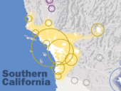
 Location of Bakersfield in Kern County, California | |
 Bakersfield Location within California  Bakersfield Location within the United States  Bakersfield Location within North America | |
| الإحداثيات: 35°22′N 119°1′W / 35.367°N 119.017°W | |
| Country | United States |
| State | California |
| County | Kern |
| Region | San Joaquin Valley |
| Incorporated | 1873–1876[2] |
| Re-incorporated | January 11, 1898[3] |
| السمِيْ | Thomas Baker |
| الحكومة | |
| • النوع | Council-Manager |
| • الكيان | Bakersfield City Council |
| • Mayor | Karen K. Goh (R)[4] |
| • Mayor Pro Tem | Ken Weir (R) |
| • City Council | Eric Arias (D) Andrae Gonzales (D) Bob Smith (I) Bruce Freeman (R) Patty Gray (R) Chris Parlier (R) |
| • City Manager | Christian Clegg[5] |
| المساحة | |
| • City | 151٫28 ميل² (391٫80 كم²) |
| • البر | 149٫81 ميل² (388٫01 كم²) |
| • الماء | 1٫46 ميل² (3٫79 كم²) |
| المنسوب | 404 ft (123 m) |
| التعداد (2020) | |
| • City | 403٬455 |
| • الترتيب | 48th in the United States 9th in California |
| • الكثافة | 2٬700/sq mi (1٬000/km2) |
| • العمرانية | 909٬235 (62nd) |
| صفة المواطن | Bakersfieldian |
| منطقة التوقيت | UTC−8 (Pacific) |
| • الصيف (التوقيت الصيفي) | UTC−7 (PDT) |
| ZIP codes | 93220, 93301–93309, 93311–93314, 93380–93390, 93399 |
| Area code | 661 |
| FIPS code | 06-03526 |
| GNIS feature IDs | 1652668, 2409774 |
| الموقع الإلكتروني | www |
بيكرزفيلد Bakersfield هي مدينة في مقاطعة كرن، كاليفورنيا، بالولايات المتحدة. وهي مقر المقاطعة وأكبر مدينة في مقاطعة كرن. وتغطي المدينة مساحة 151 sq mi (390 km2)[9][10] بالقرب من الطرف الجنوبي لمنطقة وادي سان هواكين والوادي المركزي. تعداد بيكرزفيلد في تعداد 2020 403,455,[11] making it the 48th-most populous city in the United States of America and the 9th-most populous city in California. The Bakersfield–Delano Metropolitan Statistical Area, which includes all of Kern County, had a 2020 census population of 909,235,[8] making it the 62nd-largest metropolitan area in the United States.[12] The more built-up portion of the metro area that includes Bakersfield and areas immediately around the city, such as East Bakersfield, Oildale, and Rosedale, has a population of 523,994.
Bakersfield is a significant hub for both agriculture and energy production. Kern County is the most productive oil-producing county in California[13] and the fourth-most productive agricultural county (by value) in the United States.[14] Industries in and around Bakersfield include natural gas and other energy extraction, mining, petroleum refining, distribution, food processing, and corporate regional offices.[15] The city is the birthplace of the country music genre known as the Bakersfield sound.
التاريخ

Archaeological evidence indicates the presence of Native American settlements dating back thousands of years.[16] Upon Spanish arrival, present-day Bakersfield was inhabited by the Yowlumne, a Yokuts people.[17] Yowlumne accounts indicate that the village of Woilu was situated in the bounds of the present city.[18]
The Yokuts of the region lived in lodges[19] along the branches of the Kern River delta and hunted antelope, tule elk, deer, bear, fish, and game birds.

In 1776, Spanish missionary Francisco Garcés became the first European to explore the area. Recording his May 1 arrival to a Yokuts village along the Kern River, immediately northeast of present-Bakersfield, Garcés wrote,[18]
The people of the rancheria had a great feast over my arrival, and having regaled me well I reciprocated to them all with tobacco and glass beads, congratulating myself on seeing the people so affable and affectionate.
Given the remoteness and inaccessibility of the region, the Yokuts remained largely isolated from further contact until after the Mexican War of Independence, when Mexican settlers began to migrate to the area. Following the discovery of gold in California in 1848, settlers flooded into the San Joaquin Valley. In 1851, gold was discovered along the Kern River in the southern Sierra Nevada, and in 1865, oil was discovered in the valley.[20] The Bakersfield area, once a tule reed-covered marshland, was first known as Kern Island to the handful of pioneers, who built log cabins there in 1860. The area was subject to periodic flooding from the Kern River, which occupied what is now the downtown area, and experienced outbreaks of malaria.[21]
التأسيس

In 1861, disastrous floods swept away the original settlement founded in 1860 by the German-born Christian Bohna.[22] Among those attracted to the area by the California gold rush was Thomas Baker, a lawyer and former colonel in the militia of Ohio, his home state.[22][23] Baker moved to the banks of the Kern River in 1863,[22] at what became known as Baker's Field, which became a stopover for travelers.[24] By 1870, with a population of 600, what is now known as Bakersfield was becoming the principal town in Kern County.[22]
الديمغرافيا
| التعداد | Pop. | ملاحظة | %± |
|---|---|---|---|
| 1880 | 801 | — | |
| 1890 | 2٬626 | 227٫8% | |
| 1900 | 4٬836 | 84٫2% | |
| 1910 | 12٬727 | 163٫2% | |
| 1920 | 18٬638 | 46٫4% | |
| 1930 | 26٬015 | 39٫6% | |
| 1940 | 29٬252 | 12٫4% | |
| 1950 | 34٬784 | 18٫9% | |
| 1960 | 56٬848 | 63٫4% | |
| 1970 | 69٬515 | 22٫3% | |
| 1980 | 105٬611 | 51٫9% | |
| 1990 | 174٬820 | 65٫5% | |
| 2000 | 247٬057 | 41٫3% | |
| 2010 | 347٬483 | 40٫6% | |
| 2016 (تق.) | 376٬380 | [25] | 8٫3% |
| التركيب العرقي | 2010[27] | 1990[28] | 1970[28] | 1940[28] |
|---|---|---|---|---|
| White | 56.8% | 72.7% | 83.6% | 94.6% |
| —Non-Hispanic | 37.8% | 65.9% | 70.8%[29] | n/a |
| Black or African American | 8.1% | 9.4% | 13.3% | 3.5% |
| Hispanic or Latino (of any race) | 45.5% | 20.5% | 10.9%[29] | n/a |
| Asian | 6.2% | 3.6% | 1.1% | − |
.png&filetimestamp=20180122010747&)
الجغرافيا

Bakersfield lies near the southern "horseshoe" end of the San Joaquin Valley, with the southern tip of the Sierra Nevada just to the east. The city limits extend to the Sequoia National Forest, at the foot of the Greenhorn Mountain Range and at the entrance to the Kern Canyon.[30] To the south, the Tehachapi Mountains, rising more than a vertical mile, feature the historic Tejon Ranch. To the west is the Temblor Range, behind which is the Carrizo Plain National Monument and the San Andreas Fault. The Temblor Range is about 35 mi (56 km) from Bakersfield across the valley floor.[31]
المناخ
| بيانات المناخ لـ بيكرزفيلد، كاليفورنيا (المعتادة 1981–2010) | |||||||||||||
|---|---|---|---|---|---|---|---|---|---|---|---|---|---|
| الشهر | ينا | فب | مار | أبر | ماي | يون | يول | أغس | سبت | أكت | نوف | ديس | السنة |
| القصوى القياسية °ف (°س) | 82 (28) |
88 (31) |
94 (34) |
101 (38) |
110 (43) |
114 (46) |
118 (48) |
117 (47) |
112 (44) |
104 (40) |
95 (35) |
87 (31) |
118 (48) |
| متوسط القصوى اليومية °ف (°س) | 56.2 (13.4) |
62.8 (17.1) |
68.7 (20.4) |
75.0 (23.9) |
83.5 (28.6) |
90.9 (32.7) |
97.1 (36.2) |
95.8 (35.4) |
90.0 (32.2) |
79.4 (26.3) |
65.7 (18.7) |
56.6 (13.7) |
76.8 (24.9) |
| المتوسط اليومي °ف (°س) | 47.8 (8.8) |
52.6 (11.4) |
57.6 (14.2) |
62.6 (17.0) |
70.5 (21.4) |
77.5 (25.3) |
83.8 (28.8) |
82.4 (28.0) |
77.0 (25.0) |
67.2 (19.6) |
55.1 (12.8) |
47.8 (8.8) |
65.1 (18.4) |
| متوسط الدنيا اليومية °ف (°س) | 39.3 (4.1) |
42.4 (5.8) |
46.5 (8.1) |
50.2 (10.1) |
57.5 (14.2) |
64.2 (17.9) |
70.5 (21.4) |
69.0 (20.6) |
64.0 (17.8) |
55.0 (12.8) |
44.6 (7.0) |
39.0 (3.9) |
53.5 (11.9) |
| الصغرى القياسية °ف (°س) | 12 (−11) |
20 (−7) |
20 (−7) |
28 (−2) |
34 (1) |
38 (3) |
45 (7) |
44 (7) |
30 (−1) |
29 (−2) |
22 (−6) |
13 (−11) |
12 (−11) |
| متوسط تساقط الأمطار inches (mm) | 1.15 (29) |
1.23 (31) |
1.21 (31) |
.52 (13) |
.18 (4.6) |
.08 (2.0) |
0 (0) |
.04 (1.0) |
.08 (2.0) |
.30 (7.6) |
.64 (16) |
1.02 (26) |
6.45 (163.2) |
| متوسط هطول الثلج inches (cm) | 0.1 (0.25) |
0 (0) |
0 (0) |
0 (0) |
0 (0) |
0 (0) |
0 (0) |
0 (0) |
0 (0) |
0 (0) |
0 (0) |
0 (0) |
0.1 (0.25) |
| Average precipitation days (≥ 0.01 in) | 6.7 | 7.1 | 6.5 | 3.7 | 1.7 | .5 | .1 | .3 | 1.0 | 1.8 | 3.9 | 5.9 | 39.2 |
| Source: NOAA (extremes 1893–present)[32] | |||||||||||||
المدن الشقيقة
Bakersfield لها ست مدن شقيقة، حسب توصيف المدن الشقيقة الدولية: [33]
- Bucheon, Gyeonggi-do, South Korea [34]
- Minsk, Belarus (Inactive since June 1999)[35]
- Wakayama, Japan (July 14, 1961)[36]
- Cixi, Zhejiang, China [34]
- Santiago de Querétaro, Querétaro, Mexico
- Amritsar, Punjab, India
انظر أيضاً
الهامش
- ^ Rachel Rubin; Jeffrey Paul Melnick (يونيو 2001). American Popular Music: New Approaches to the Twentieth Century. University of Massachusetts Press. p. 94. ISBN 978-1-55849-268-4.
- ^ Richards, Patrick (1984). Heart of the Golden Empire – An Illustrated History of Bakersfield. Woodland Hills, California: Windsor Publications, Inc. pp. 45, 51. ISBN 978-0-89781-065-4.
- ^ "California Cities by Incorporation Date". California Association of Local Agency Formation Commissions. Archived from the original (Word) on November 3, 2014. Retrieved August 25, 2014.
- ^ "Mayor's Office". City of Bakersfield. City of Bakersfield. Retrieved أكتوبر 15, 2015.
- ^ "City Manager's Office". City of Bakersfield. City of Bakersfield. Archived from the original on نوفمبر 9, 2017. Retrieved أكتوبر 15, 2015.
- ^ "2020 U.S. Gazetteer Files". United States Census Bureau. Retrieved أكتوبر 30, 2021.
- ^ "Bakersfield". نظام معلومات الأسماء الجغرافية، المسح الجيولوجي الأمريكي.
- ^ أ ب "2020 Population and Housing State Data". United States Census Bureau. Retrieved أغسطس 22, 2021.
- ^ قالب:Cite US Gazetteer
- ^ "City of Bakersfield – Community Profile". bakersfieldcity.us. Archived from the original on أبريل 1, 2019. Retrieved مارس 31, 2019.
- ^ "QuickFacts: Bakersfield city, California". United States Census Bureau. Retrieved سبتمبر 13, 2021.
- ^ "Bakersfield California Home Inspectors". BakersfieldHomeInspector.biz. 2009.
- ^ Bakersfield – Oil Capital of California. San Joaquin Valley Geology. Retrieved March 14, 2012.
- ^ خطأ استشهاد: وسم
<ref>غير صحيح؛ لا نص تم توفيره للمراجع المسماةBAKERSFIELD_INFO_STATISTICS - ^ Community Profile Archived يونيو 30, 2014 at the Wayback Machine. Greater Bakersfield Chamber of Commerce. Page 4. Retrieved March 14, 2012.
- ^ Yokuts History and Cultural Relations from everyculture.com
- ^ Kroeber, Alfred L. (1963). "Yokuts Dialect Survey". University of California Anthropological Records. 11: 234.
- ^ أ ب Arkush, Brooke S. (1993). "Yokuts Trade Networks and Native Culture Change in Central and Eastern California". Ethnohistory. 40 (4): 619–640. doi:10.2307/482590. ISSN 0014-1801. JSTOR 482590.
- ^ Yokuts Dwellings from bsahighadventure.org
- ^ "History on gold & oil". oceanpark.ws. 2009.
- ^ "Full text of "California water"". CONTROLLING THE KERN RIVER Problems. 1979. Retrieved أبريل 7, 2009.
- ^ أ ب ت ث Mildred Brooke Hoover, Douglas E. Kyle (1990). Historic Spots in California. Stanford University Press. p. 128. ISBN 978-0-8047-1734-2.
- ^ Lull, Gordon F. "Kern County Shapers". Bakersfield Magazine. Archived from the original on نوفمبر 15, 2011. Retrieved يناير 17, 2013.
Baker ...was admitted to the Ohio bar at age 19 and later appointed a colonel in his home state's militia.
- ^ Gavin, Camille. Leverett, Kathy. Kern's Movers & Shakers. Jostens. Visalia, California: 1987. ISBN 0-9618770-0-6. Page 13.
- ^ "Population and Housing Unit Estimates". Retrieved يونيو 9, 2017.
- ^ "Census of Population and Housing". Census.gov. Archived from the original on May 12, 2015. Retrieved June 4, 2015.
{{cite web}}: Unknown parameter|deadurl=ignored (|url-status=suggested) (help) - ^ "Bakersfield (city), California". State & County QuickFacts. U.S. Census Bureau. Archived from the original on أغسطس 16, 2012.
{{cite web}}: Unknown parameter|deadurl=ignored (|url-status=suggested) (help) - ^ أ ب ت خطأ استشهاد: وسم
<ref>غير صحيح؛ لا نص تم توفيره للمراجع المسماةpop - ^ أ ب From 15% sample
- ^ "Bakersfield Geography". source. 2010. Archived from the original on أكتوبر 11, 2010.
- ^ "The San Andreas Fault". USGS General Interest Publications. 2010.
- ^ "NowData – NOAA Online Weather Data". National Oceanic and Atmospheric Administration. Retrieved يونيو 30, 2013.
- ^ "Bakersfield Sister City Project Corporation | People Helping People". bakersfieldsistercity.org (in الإنجليزية الأمريكية). Retrieved يونيو 25, 2018.
- ^ أ ب "Data Visualizations – Asia – Sister Partnerships – Asia – Asia Matters for America".
- ^ Partisan District of Minsk, Belarus. Bakersfield Sister City Project. Copyright 2009–2010. Accessed: September 9, 2011.
- ^ "Northern and Central California Sister Cities in Japan".
وصلات خارجية
- Official website

- Bakersfield Convention & Visitors Bureau
- بيكرزفيلد، كاليفورنيا at Curlie
- "Bakersfield". C-SPAN Cities Tour. يوليو 2013.
روابط إلى مقالات ذات صلة | |||||||||||||||||||||||||||||
|---|---|---|---|---|---|---|---|---|---|---|---|---|---|---|---|---|---|---|---|---|---|---|---|---|---|---|---|---|---|
    قالب:Bakersfield, California
    قالب:Kern County, California
| |||||||||||||||||||||||||||||
.png&filetimestamp=20180122010747)
| International | |
|---|---|
| National | |
- Pages using gadget WikiMiniAtlas
- CS1 errors: unsupported parameter
- CS1 الإنجليزية الأمريكية-language sources (en-us)
- Short description is different from Wikidata
- Articles with hatnote templates targeting a nonexistent page
- Missing redirects
- Use mdy dates from May 2012
- Coordinates on Wikidata
- Pages using US Census population needing update
- Articles with Curlie links
- Portal-inline template with redlinked portals
- Pages with empty portal template
- Pages using columns-list with unknown parameters
- Bakersfield, California
- Cities in Kern County, California
- San Joaquin Valley
- Incorporated cities and towns in California
- County seats in California
- Basque-American culture in California
- 1873 establishments in California
- Populated places established in 1860
- مدن وبلدات مشهرة في كاليفورنيا
- مدن كاليفورنيا