مقاطعة ستانيسلوس، كاليفورنيا
Stanislaus County, California | |
|---|---|
| County of Stanislaus | |
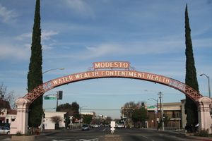
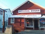
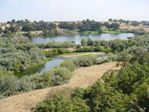
Images, from top down, left to right: Modesto Arch, Knights Ferry's General Store, a view of the Tuolumne River from Waterford | |
| الشعار: "Striving to be the best!" | |
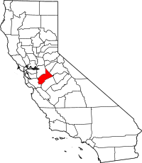 Location in the state of California | |
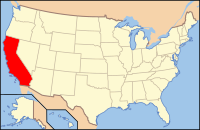 California's location in the United States | |
| Country | |
| State | |
| Region | San Joaquin Valley |
| Incorporated | April 1, 1854[1] |
| السمِيْ | Estanislao |
| County seat (and largest city) | Modesto |
| المساحة | |
| • الإجمالي | 1٬515 ميل² (3٬920 كم²) |
| • البر | 1٬495 ميل² (3٬870 كم²) |
| • الماء | 20 ميل² (50 كم²) |
| أعلى منسوب | 3٬807 ft (1٬160 m) |
| التعداد | |
| • الإجمالي | 514٬453 |
| • Estimate (2019)[4] | 550٬660 |
| • الكثافة | 340/sq mi (130/km2) |
| منطقة التوقيت | UTC−8 (Pacific Time Zone) |
| • الصيف (التوقيت الصيفي) | UTC−7 (Pacific Daylight Time) |
| Area code | 209 |
| FIPS code | 06-099 |
| GNIS feature ID | 277314 |
| الموقع الإلكتروني | www |
مقاطعة ستانيسلوس {{إنج|Stanislaus County}؛ /ˈstænɪslɔːs/ or /ˈstænɪslɔː/}[5] هي إحدى مقاطعات Central Valley في ولاية كاليفورنيا في الولايات المتحدة. As of the 2010 census, the population was 514,453.[3] The county seat is Modesto.[6]
Stanislaus County comprises the Modesto Metropolitan Statistical Area. The County is located just east of the San Francisco Bay Area and serves as a bedroom community for those who work in the eastern part of the Bay Area.
التاريخ
The first European to see the area was Gabriel Moraga in 1806.
The county was named after the Estanislao river, which in turn was named in honor of Estanislao, a mission-educated renegade Native American chief who led a band of Native Americans in a series of battles against Mexican troops until finally being defeated by General Mariano Vallejo in 1826. Estanislao was his baptismal name, the Spanish version of Stanislaus (پولندية: Stanisław), itself the Latin version of the name of an 11th-century Polish Catholic Saint Stanislaus the Martyr.
As the price of housing has increased in the San Francisco Bay Area, many people who work in the southern reaches of the Bay Area have opted for the longer commute and moved to Stanislaus County for the relatively affordable housing.
الجغرافيا
According to the U.S. Census Bureau, the county has a total area of 1،515 ميل مربع (3،920 km2), of which 1،495 ميل مربع (3،870 km2) is land and 20 ميل مربع (52 km2) (1.3%) is water.[7]
السكان
2011
| Population, race, and income | |||||
|---|---|---|---|---|---|
| Total population[8] | 512,469 | ||||
| White[8] | 391,597 | 76.4% | |||
| Black or African American[8] | 14,691 | 2.9% | |||
| American Indian or Alaska Native[8] | 5,270 | 1.0% | |||
| Asian[8] | 26,718 | 5.2% | |||
| Native Hawaiian or other Pacific Islander[8] | 3,584 | 0.7% | |||
| Some other race[8] | 49,245 | 9.6% | |||
| Two or more races[8] | 21,364 | 4.2% | |||
| Hispanic or Latino (of any race)[9] | 211,811 | 41.3% | |||
| Per capita income[10] | $21,820 | ||||
| Median household income[11] | $50,671 | ||||
| Median family income[12] | $56,996 | ||||
Places by population, race, and income
| Places by population and race | ||||||||
|---|---|---|---|---|---|---|---|---|
| Place | Type[13] | Population[8] | White[8] | Other[8] [note 1] |
Asian[8] | Black or African American[8] |
Native American[8] [note 2] |
Hispanic or Latino (of any race)[9] |
| Airport | CDP | 1,490 | 78.7% | 16.3% | 0.0% | 0.0% | 5.0% | 61.7% |
| Bret Harte | CDP | 4,916 | 62.7% | 30.7% | 1.4% | 2.2% | 3.1% | 82.2% |
| Bystrom | CDP | 3,858 | 73.8% | 20.1% | 5.8% | 0.3% | 0.0% | 79.7% |
| Ceres | City | 44,731 | 70.9% | 18.2% | 7.1% | 2.0% | 1.7% | 54.8% |
| Cowan | CDP | 302 | 75.8% | 11.6% | 0.0% | 0.0% | 12.6% | 25.5% |
| Crows Landing | CDP | 425 | 37.2% | 0.0% | 0.0% | 0.0% | 62.8% | 75.5% |
| Del Rio | CDP | 1,071 | 94.3% | 0.0% | 5.7% | 0.0% | 0.0% | 8.2% |
| Denair | CDP | 4,529 | 87.3% | 11.3% | 1.2% | 0.0% | 0.2% | 37.7% |
| Diablo Grande | CDP | 551 | 78.4% | 11.8% | 2.2% | 7.6% | 0.0% | 29.0% |
| East Oakdale | CDP | 3,118 | 96.5% | 2.3% | 0.9% | 0.0% | 0.3% | 13.5% |
| Empire | CDP | 4,071 | 84.6% | 14.9% | 0.3% | 0.0% | 0.1% | 54.7% |
| Grayson | CDP | 1,324 | 74.5% | 13.2% | 0.0% | 12.3% | 0.0% | 83.5% |
| Hickman | CDP | 490 | 95.1% | 4.3% | 0.6% | 0.0% | 0.0% | 9.8% |
| Hughson | City | 6,425 | 78.2% | 18.5% | 1.7% | 0.4% | 1.2% | 49.4% |
| Keyes | CDP | 5,809 | 76.7% | 19.8% | 2.0% | 0.7% | 0.7% | 60.9% |
| Modesto | City | 201,886 | 74.6% | 12.6% | 6.8% | 3.9% | 2.1% | 35.7% |
| Monterey Park Tract | CDP | 350 | 97.7% | 2.3% | 0.0% | 0.0% | 0.0% | 27.7% |
| Newman | City | 9,989 | 73.6% | 22.7% | 2.0% | 1.2% | 0.6% | 62.6% |
| Oakdale | City | 20,364 | 87.7% | 6.0% | 3.2% | 0.4% | 2.7% | 23.3% |
| Parklawn | CDP | 1,180 | 74.7% | 14.9% | 10.4% | 0.0% | 0.0% | 76.6% |
| Patterson | City | 19,697 | 60.9% | 23.1% | 4.5% | 8.9% | 2.6% | 57.6% |
| Riverbank | City | 22,198 | 77.5% | 13.7% | 4.1% | 3.7% | 1.1% | 51.9% |
| Riverdale Park | CDP | 1,243 | 81.6% | 18.3% | 0.0% | 0.2% | 0.0% | 70.0% |
| Rouse | CDP | 1,437 | 61.7% | 23.4% | 12.2% | 2.7% | 0.0% | 70.4% |
| Salida | CDP | 15,156 | 80.6% | 10.8% | 5.1% | 2.9% | 0.6% | 42.8% |
| Shackelford | CDP | 2,829 | 68.8% | 22.1% | 0.7% | 4.9% | 3.4% | 71.4% |
| Turlock | City | 67,953 | 78.1% | 12.3% | 6.3% | 2.0% | 1.3% | 34.7% |
| Valley Home | CDP | 327 | 93.3% | 5.8% | 0.9% | 0.0% | 0.0% | 4.6% |
| Waterford | City | 8,395 | 80.3% | 17.7% | 0.3% | 0.5% | 1.3% | 45.7% |
| Westley | CDP | 861 | 95.0% | 5.0% | 0.0% | 0.0% | 0.0% | 90.8% |
| West Modesto | CDP | 6,470 | 69.4% | 20.0% | 7.9% | 2.0% | 0.6% | 56.8% |
| Places by population and income | |||||
|---|---|---|---|---|---|
| Place | Type[13] | Population[14] | Per capita income[10] | Median household income[11] | Median family income[12] |
| Airport | CDP | 1,490 | $9,706 | $18,779 | $17,907 |
| Bret Harte | CDP | 4,916 | $10,300 | $30,833 | $36,856 |
| Bystrom | CDP | 3,858 | $10,543 | $22,227 | $34,000 |
| Ceres | City | 44,731 | $17,688 | $48,550 | $51,839 |
| Cowan | CDP | 302 | $11,544 | $33,594 | $30,729 |
| Crows Landing | CDP | 425 | $12,860 | $70,357 | $71,250 |
| Del Rio | CDP | 1,071 | $77,510 | $107,171 | $196,200 |
| Denair | CDP | 4,529 | $23,537 | $64,136 | $69,291 |
| Diablo Grande | CDP | 551 | $40,719 | $88,393 | $89,000 |
| East Oakdale | CDP | 3,118 | $46,810 | $107,250 | $119,300 |
| Empire | CDP | 4,071 | $12,729 | $31,570 | $35,718 |
| Grayson | CDP | 1,324 | $12,381 | $41,250 | $41,086 |
| Hickman | CDP | 490 | $19,337 | $60,150 | $60,380 |
| Hughson | City | 6,425 | $19,985 | $48,875 | $54,357 |
| Keyes | CDP | 5,809 | $12,996 | $34,423 | $35,571 |
| Modesto | City | 201,886 | $22,886 | $49,852 | $56,629 |
| Monterey Park Tract | CDP | 350 | $13,865 | $85,256 | $85,513 |
| Newman | City | 9,989 | $18,134 | $48,409 | $49,673 |
| Oakdale | City | 20,364 | $25,238 | $61,183 | $66,505 |
| Parklawn | CDP | 1,180 | $12,647 | $38,519 | $39,417 |
| Patterson | City | 19,697 | $20,649 | $58,090 | $64,471 |
| Riverbank | City | 22,198 | $21,205 | $59,779 | $62,859 |
| Riverdale Park | CDP | 1,243 | $14,726 | $34,353 | $34,698 |
| Rouse | CDP | 1,437 | $9,476 | $18,895 | $21,838 |
| Salida | CDP | 15,156 | $22,969 | $72,671 | $73,179 |
| Shackelford | CDP | 2,829 | $7,829 | $18,478 | $21,453 |
| Turlock | City | 67,953 | $22,289 | $50,862 | $60,434 |
| Valley Home | CDP | 327 | $18,402 | $38,250 | $27,292 |
| Waterford | City | 8,395 | $17,228 | $54,583 | $55,806 |
| Westley | CDP | 861 | $8,714 | $38,798 | $39,327 |
| West Modesto | CDP | 6,470 | $12,751 | $31,110 | $28,441 |
2010
| التعداد | Pop. | ملاحظة | %± |
|---|---|---|---|
| 1860 | 2٬245 | — | |
| 1870 | 6٬499 | 189٫5% | |
| 1880 | 8٬751 | 34٫7% | |
| 1890 | 10٬040 | 14٫7% | |
| 1900 | 9٬550 | −4٫9% | |
| 1910 | 22٬522 | 135٫8% | |
| 1920 | 43٬557 | 93٫4% | |
| 1930 | 56٬641 | 30�0% | |
| 1940 | 74٬866 | 32٫2% | |
| 1950 | 127٬231 | 69٫9% | |
| 1960 | 157٬294 | 23٫6% | |
| 1970 | 194٬506 | 23٫7% | |
| 1980 | 265٬900 | 36٫7% | |
| 1990 | 370٬522 | 39٫3% | |
| 2000 | 446٬997 | 20٫6% | |
| 2010 | 514٬453 | 15٫1% | |
| 2019 (تق.) | 550٬660 | [4] | 7�0% |
| U.S. Decennial Census[15] 1790-1960[16] 1900-1990[17] 1990-2000[18] 2010-2015[3] | |||
| Population reported at 2010 United States Census | |||||||||
|---|---|---|---|---|---|---|---|---|---|
Population |
American |
American |
Islander |
races |
more races |
or Latino (of any race) | |||
| Stanislaus County | 514,453 | 337,342 | 14,721 | 5,902 | 26,090 | 3,401 | 99,210 | 27,787 | 215,658 |
cities |
Population |
American |
American |
Islander |
races |
more races |
or Latino (of any race) | ||
| Ceres | 45,417 | 26,217 | 1,185 | 609 | 3,093 | 346 | 11,463 | 2,504 | 25,436 |
| Hughson | 6,640 | 5,125 | 55 | 74 | 97 | 13 | 982 | 294 | 2,871 |
| Modesto | 201,165 | 130,833 | 8,396 | 2,494 | 13,557 | 1,924 | 31,244 | 12,717 | 71,381 |
| Newman | 10,224 | 6,812 | 234 | 106 | 191 | 40 | 2,287 | 554 | 6,299 |
| Oakdale | 20,675 | 16,558 | 163 | 210 | 463 | 37 | 2,386 | 858 | 5,398 |
| Patterson | 20,413 | 10,117 | 1,291 | 221 | 1,069 | 280 | 6,235 | 1,200 | 11,971 |
| Riverbank | 22,678 | 14,951 | 480 | 269 | 770 | 88 | 4,949 | 1,171 | 11,822 |
| Turlock | 68,549 | 47,864 | 1,160 | 601 | 3,865 | 313 | 11,328 | 3,418 | 24,957 |
| Waterford | 8,456 | 6,003 | 77 | 110 | 129 | 11 | 1,740 | 386 | 3,579 |
places |
Population |
American |
American |
Islander |
races |
more races |
or Latino (of any race) | ||
| Airport | 1,964 | 1,108 | 41 | 47 | 66 | 3 | 564 | 135 | 1,250 |
| Bret Harte | 5,152 | 2,441 | 52 | 50 | 40 | 45 | 2,327 | 197 | 4,272 |
| Bystrom | 4,008 | 2,006 | 79 | 62 | 91 | 18 | 1,580 | 172 | 3,053 |
| Cowan | 318 | 274 | 0 | 2 | 0 | 0 | 32 | 10 | 161 |
| Crows Landing | 355 | 162 | 5 | 1 | 0 | 0 | 182 | 5 | 248 |
| Del Rio | 1,270 | 1,027 | 25 | 5 | 143 | 1 | 27 | 42 | 107 |
| Denair | 4,404 | 3,425 | 25 | 55 | 42 | 4 | 699 | 154 | 1,423 |
| Diablo Grande | 826 | 510 | 77 | 3 | 70 | 6 | 77 | 83 | 254 |
| East Oakdale | 2,762 | 2,530 | 7 | 18 | 60 | 5 | 78 | 64 | 284 |
| Empire | 4,189 | 2,274 | 22 | 56 | 59 | 8 | 1,500 | 270 | 2,275 |
| Grayson | 952 | 455 | 17 | 4 | 3 | 0 | 417 | 56 | 819 |
| Hickman | 641 | 503 | 1 | 15 | 4 | 0 | 98 | 20 | 180 |
| Keyes | 5,601 | 3,109 | 71 | 60 | 200 | 32 | 1,919 | 210 | 3,233 |
| Monterey Park Tract | 133 | 77 | 17 | 0 | 0 | 0 | 38 | 1 | 112 |
| Parklawn | 1,337 | 673 | 24 | 22 | 7 | 0 | 541 | 70 | 1,090 |
| Riverdale Park | 1,128 | 575 | 6 | 25 | 29 | 0 | 414 | 79 | 700 |
| Rouse | 2,005 | 896 | 101 | 24 | 199 | 12 | 658 | 115 | 1,280 |
| Salida | 13,722 | 8,479 | 435 | 111 | 669 | 83 | 3,134 | 811 | 6,426 |
| Shackelford | 3,371 | 1,560 | 27 | 63 | 59 | 1 | 1,496 | 165 | 2,685 |
| Valley Home | 228 | 186 | 2 | 3 | 0 | 0 | 27 | 10 | 34 |
| West Modesto | 5,682 | 3,020 | 136 | 84 | 263 | 8 | 1,885 | 286 | 3,526 |
| Westley | 603 | 212 | 0 | 5 | 1 | 0 | 368 | 17 | 579 |
unincorporated areas |
Population |
American |
American |
Islander |
races |
more races |
or Latino (of any race) | ||
| All others not CDPs (combined) | 49,585 | 37,360 | 510 | 493 | 851 | 123 | 8,535 | 1,713 | 17,953 |
Politics
Voter registration statistics
| Population and registered voters | ||
|---|---|---|
| Total population[8] | 512,469 | |
| Registered voters[19][note 3] | 231,870 | 45.2% |
| Democratic[19] | 92,788 | 40.0% |
| Republican[19] | 90,002 | 38.8% |
| Democratic–Republican spread[19] | +2,786 | +1.2% |
| Independent[19] | 6,442 | 2.8% |
| Green[19] | 698 | 0.3% |
| Libertarian[19] | 1,144 | 0.5% |
| Peace and Freedom[19] | 682 | 0.3% |
| Americans Elect[19] | 14 | 0.0% |
| Other[19] | 2,437 | 1.1% |
| No party preference[19] | 37,663 | 16.2% |
Cities by population and voter registration
| Cities by population and voter registration | |||||||
|---|---|---|---|---|---|---|---|
| City | Population[8] | Registered voters[19] [note 3] |
Democratic[19] | Republican[19] | D–R spread[19] | Other[19] | No party preference[19] |
| Ceres | 44,731 | 42.6% | 46.4% | 33.0% | +13.4% | 7.1% | 16.1% |
| Hughson | 6,425 | 50.8% | 32.2% | 44.8% | -12.6% | 8.4% | 17.8% |
| Modesto | 202,751 | 48.6% | 41.9% | 37.5% | +4.4% | 7.7% | 15.7% |
| Newman | 9,989 | 37.4% | 42.9% | 33.4% | +9.5% | 8.7% | 18.2% |
| Oakdale | 20,364 | 48.1% | 31.2% | 45.0% | -13.8% | 9.9% | 17.6% |
| Patterson | 19,697 | 39.4% | 49.9% | 25.7% | +24.2% | 8.2% | 19.3% |
| Riverbank | 22,198 | 41.9% | 39.9% | 36.7% | +3.2% | 7.7% | 18.6% |
| Turlock | 69,733 | 44.9% | 38.4% | 39.3% | -0.9% | 7.6% | 17.3% |
| Waterford | 8,395 | 41.2% | 31.7% | 41.9% | -10.2% | 9.1% | 21.0% |
Overview
Just like neighboring Merced County, Stanislaus is considered a bellwether county in presidential elections. It voted for the winning candidate for president in every election from 1972-2012. In 2012, Barack Obama won the county with 49.9 percent of the vote. The last Democrat to win a majority in the county was Jimmy Carter in 1976, although Barack Obama won a plurality in 2008 and 2012, as did Bill Clinton in both 1992 and 1996. In 2016, Hillary Clinton won the county but lost the election, the first time Stanislaus backed the losing candidate since 1968 when it voted for Hubert Humphrey.
| Year | GOP | DEM | Others |
|---|---|---|---|
| 2016 | 45.01% 78,494 | 46.81% 81,647 | 8.18% 14,265 |
| 2012 | 47.14% 73,459 | 49.88% 77,724 | 2.97% 4,633 |
| 2008 | 47.98% 77,497 | 49.70% 80,279 | 2.31% 3,736 |
| 2004 | 58.65% 85,407 | 40.40% 58,829 | 0.95% 1,388 |
| 2000 | 52.38% 67,188 | 44.01% 56,448 | 3.61% 4,631 |
| 1996 | 44.79% 52,403 | 45.93% 53,738 | 9.28% 10,866 |
| 1992 | 36.93% 47,275 | 40.95% 52,415 | 22.12% 28,315 |
| 1988 | 53.07% 51,648 | 45.92% 44,685 | 1.01% 982 |
| 1984 | 59.23% 55,665 | 39.86% 37,459 | 0.92% 861 |
| 1980 | 49.41% 41,595 | 40.01% 33,683 | 10.58% 8,908 |
| 1976 | 44.83% 32,937 | 52.34% 38,448 | 2.83% 2,080 |
| 1972 | 51.41% 39,521 | 45.54% 35,005 | 3.05% 2,341 |
| 1968 | 45.45% 29,573 | 48.13% 31,316 | 6.42% 4,174 |
| 1964 | 33.74% 21,973 | 66.14% 43,078 | 0.12% 77 |
| 1960 | 49.62% 30,213 | 49.77% 30,302 | 0.62% 375 |
| 1956 | 48.60% 26,695 | 51.05% 28,040 | 0.35% 192 |
| 1952 | 55.57% 29,270 | 43.35% 22,837 | 1.08% 570 |
| 1948 | 48.38% 18,564 | 47.82% 18,350 | 3.80% 1,457 |
| 1944 | 47.23% 14,297 | 51.33% 15,537 | 1.44% 437 |
| 1940 | 46.63% 14,803 | 51.96% 16,494 | 1.41% 449 |
| 1936 | 35.44% 8,613 | 63.13% 15,341 | 1.43% 348 |
| 1932 | 36.18% 7,614 | 58.63% 12,336 | 5.19% 1,092 |
| 1928 | 67.13% 10,753 | 31.61% 5,063 | 1.27% 203 |
| 1924 | 56.86% 7,569 | 9.57% 1,274 | 33.57% 4,469 |
| 1920 | 61.61% 7,038 | 26.74% 3,055 | 11.64% 1,330 |
| 1916 | 37.66% 4,401 | 46.98% 5,490 | 15.37% 1,796 |
| 1912 | 0.22% 17 | 39.58% 3,127 | 60.20% 4,756 |
| 1908 | 46.45% 1,663 | 38.83% 1,390 | 14.72% 527 |
| 1904 | 52.39% 1,437 | 40.47% 1,110 | 7.15% 196 |
| 1900 | 43.81% 1,058 | 52.59% 1,270 | 3.60% 87 |
| 1896 | 40.92% 1,007 | 56.81% 1,398 | 2.28% 56 |
| 1892 | 38.90% 992 | 53.69% 1,369 | 7.41% 189 |
In the United States House of Representatives, Stanislaus County is in California's 10 congressional district, represented by قالب:Representative/format/pfl.[21]
In the California State Senate, Stanislaus is split between 3 legislative districts:[22]
- the 5 Senate District, represented by Democrat Cathleen Galgiani,
- the 8 Senate District, represented by Republican Tom Berryhill, and
- the 12 Senate District, represented by Republican Anthony Cannella.
In the California State Assembly, Stanislaus is split between the 12 Assembly District, represented by Republican Kristin Olsen, and the 21st Assembly District, represented by Democrat Adam Gray.[23]
Economy
Agriculture is Stanislaus County's number one industry, with almonds being the primary agricultural product.[24]
Education
The California State University, Stanislaus is a campus of the California State University located in Turlock.
The Yosemite Community College District covers a 4,500 square mile area and serves a population over 550,000 encompassing all of two counties (Stanislaus and Tuolumne) and parts of 4 others (Calaveras, Merced, San Joaquin and Santa Clara). It is composed of 2 colleges: Modesto Junior College in Modesto and Columbia College in Sonora in Tuolumne County to the northeast.
There is also a Kaplan College campus in Modesto, an ITT Technical Institute campus in Lathrop in San Joaquin County to the northeast, and a San Joaquin Valley College campus in Modesto.
Media
- The Modesto Press is the local online news site for Modesto and the surrounding areas of the Central Valley.
- The Modesto Bee is a Modesto-based daily newspaper.
Communities
Incorporated cities
Census-designated places
Other unincorporated communities
Population ranking
The population ranking of the following table is based on the 2010 census of Stanislaus County.[25]
† county seat
| Rank | City/Town/etc. | Municipal type | Population (2010 Census) |
|---|---|---|---|
| 1 | † Modesto | City | 201,165 |
| 2 | Turlock | City | 68,549 |
| 3 | Ceres | City | 45,417 |
| 4 | Riverbank | City | 22,678 |
| 5 | Oakdale | City | 20,675 |
| 6 | Patterson | City | 20,413 |
| 7 | Salida | CDP | 13,722 |
| 8 | Newman | City | 10,224 |
| 9 | Waterford | City | 8,456 |
| 10 | Hughson | City | 6,640 |
| 11 | West Modesto | CDP | 5,682 |
| 12 | Keyes | CDP | 5,601 |
| 13 | Bret Harte | CDP | 5,152 |
| 14 | Denair | CDP | 4,404 |
| 15 | Empire | CDP | 4,189 |
| 16 | Bystrom | CDP | 4,008 |
| 17 | Shackelford | CDP | 3,371 |
| 18 | East Oakdale | CDP | 2,762 |
| 19 | Rouse | CDP | 2,005 |
| 20 | Airport | CDP | 1,964 |
| 21 | Parklawn | CDP | 1,337 |
| 22 | Del Rio | CDP | 1,270 |
| 23 | Riverdale Park | CDP | 1,128 |
| 24 | Grayson | CDP | 952 |
| 25 | Diablo Grande | CDP | 826 |
| 26 | Hickman | CDP | 641 |
| 27 | Westley | CDP | 603 |
| 28 | Crows Landing | CDP | 355 |
| 29 | Cowan | CDP | 318 |
| 30 | Valley Home | CDP | 228 |
| 31 | Monterey Park Tract | CDP | 133 |
See also
- List of museums in the San Joaquin Valley
- List of school districts in Stanislaus County, California
- National Register of Historic Places listings in Stanislaus County, California
Notes
References
- ^ "Stanislaus County". نظام معلومات الأسماء الجغرافية، المسح الجيولوجي الأمريكي. Retrieved January 14, 2015.
- ^ "Mount Stakes". Peakbagger.com. Retrieved February 3, 2015.
- ^ أ ب ت "American Fact Finder - Results". United States Census Bureau. Archived from the original on February 14, 2020. Retrieved April 19, 2019.
- ^ أ ب "American FactFinder". Archived from the original on February 14, 2020. Retrieved April 19, 2019.
- ^ KCRA News (August 3, 2011). "Proper Way To Say Stanislaus" – via YouTube.
- ^ "Find a County". National Association of Counties. Retrieved 2011-06-07.
- ^ "US Gazetteer files: 2010, 2000, and 1990". United States Census Bureau. 2011-02-12. Retrieved 2011-04-23.
- ^ أ ب ت ث ج ح خ د ذ ر ز س ش ص ض ط U.S. Census Bureau. American Community Survey, 2011 American Community Survey 5-Year Estimates, Table B02001. U.S. Census website. Retrieved 2013-10-26.
- ^ أ ب U.S. Census Bureau. American Community Survey, 2011 American Community Survey 5-Year Estimates, Table B03003. U.S. Census website. Retrieved 2013-10-26.
- ^ أ ب U.S. Census Bureau. American Community Survey, 2011 American Community Survey 5-Year Estimates, Table B19301. U.S. Census website. Retrieved 2013-10-21.
- ^ أ ب U.S. Census Bureau. American Community Survey, 2011 American Community Survey 5-Year Estimates, Table B19013. U.S. Census website. Retrieved 2013-10-21.
- ^ أ ب U.S. Census Bureau. American Community Survey, 2011 American Community Survey 5-Year Estimates, Table B19113. U.S. Census website. Retrieved 2013-10-21.
- ^ أ ب U.S. Census Bureau. American Community Survey, 2011 American Community Survey 5-Year Estimates. U.S. Census website. Retrieved 2013-10-21.
- ^ U.S. Census Bureau. American Community Survey, 2011 American Community Survey 5-Year Estimates, Table B01003. U.S. Census website. Retrieved 2013-10-21.
- ^ "U.S. Decennial Census". United States Census Bureau. Retrieved May 31, 2014.
- ^ "Historical Census Browser". University of Virginia Library. Retrieved May 31, 2014.
- ^ "Population of Counties by Decennial Census: 1900 to 1990". United States Census Bureau. Retrieved May 31, 2014.
- ^ "Census 2000 PHC-T-4. Ranking Tables for Counties: 1990 and 2000" (PDF). United States Census Bureau. Retrieved May 31, 2014.
- ^ أ ب ت ث ج ح خ د ذ ر ز س ش ص ض ط ظ California Secretary of State. February 10, 2013 - Report of Registration Archived يوليو 27, 2013 at the Wayback Machine. Retrieved 2013-10-31.
- ^ Leip, David. "Dave Leip's Atlas of U.S. Presidential Elections". uselectionatlas.org.
- ^ قالب:Cite GovTrack
- ^ "Communities of Interest — County". California Citizens Redistricting Commission. Archived from the original on أكتوبر 23, 2015. Retrieved سبتمبر 28, 2014.
- ^ "Communities of Interest — County". California Citizens Redistricting Commission. Archived from the original on أكتوبر 23, 2015. Retrieved سبتمبر 28, 2014.
- ^ Stanislaus County, California (2016). "Top 10 Commodities" (PDF). Stanislaus County Agricultural Report.
- ^ CNMP, US Census Bureau. "This site has been redesigned and relocated. - U.S. Census Bureau". www.census.gov.
Further reading
- John T. Bramhall, The Story of Stanislaus. Modesto, CA: Modesto Herald, 1914.
- Sol P. Elias, Stories of Stanislaus: A Collection of Stories on the History and Achievement of Stanislaus County. Modesto, CA: Sol P. Elias, 1924.
- John Torrey, Paul Awosika et al., Expanded initial study, Boulder Creek subdivision, Stanislaus County, Earth Metrics, Report 7999: California State Clearinghouse, Sacramento, November, 1989.
- A Memorial and Biographical History of the Counties of Merced, Stanislaus, Calaveras, Tuolumne and Mariposa, California. Chicago: Lewis Publishing Co., 1892.
وصلات خارجية
- Official website

- Connecting Stanislaus
- Visit Stanislaus
- Stanislaus County Fair
- California State University Stanislaus
- Modesto Junior College
- Stanislaus PRIDE Center
- Stanislaus County Farm Bureau
- Stanislaus County Free Library
- Stanislaus County Law Library
- Stanislaus County at the Wayback Machine (archived نوفمبر 1, 1996)

|
Tuolumne County | Calaveras County | San Joaquin County and Alameda County | 
|
| Mariposa County | Merced County | Santa Clara County |
قالب:Cities of Stanislaus County, California
قالب:Western U.S. majority-minority counties 37°34′N 120°59′W / 37.56°N 120.99°W
- Pages using gadget WikiMiniAtlas
- Short description is different from Wikidata
- Pages using infobox settlement with no coordinates
- Articles containing پولندية-language text
- Pages using Lang-xx templates
- Pages using US Census population needing update
- Articles with hatnote templates targeting a nonexistent page
- Portal-inline template with redlinked portals
- Pages with empty portal template
- Coordinates on Wikidata
- Stanislaus County, California
- San Joaquin Valley
- 1854 establishments in California
- Populated places established in 1854
- مقاطعات كاليفورنيا
