مقاطعة دل نورتى، كاليفورنيا
مقاطعة دل نورتى
Del Norte County | |
|---|---|
| County of Del Norte | |
|
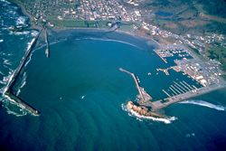
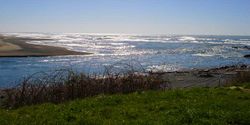
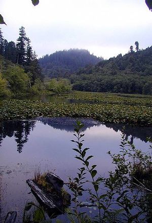
الصور من أعلى لأسفل، ومن اليسار إلى اليمين: ميناء كرسنت سيتي، Redwood National Park, Castle Rock، مصب نهر سميث | |
 Interactive map of Del Norte County | |
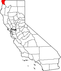 موقع كاليفورنيا في الولايات المتحدة | |
| البلد | |
| الولاية | |
| المنطقة | الساحل الشمالي |
| أشهرت | March 2, 1857[1] |
| السمِيْ | "Of the North" (إسپانية: Del norte) |
| مقر المقاطعة | كرسنت سيتي |
| أكبر مدينة | كرسنت سيتي |
| المساحة | |
| • الإجمالي | 1٬230 ميل² (3٬200 كم²) |
| • البر | 1٬006 ميل² (2٬610 كم²) |
| • الماء | 223 ميل² (580 كم²) |
| أعلى منسوب | 6٬415 ft (1٬955 m) |
| التعداد | |
| • الإجمالي | 28٬610 |
| • Estimate (2016)[3] | 27٬540 |
| • الكثافة | 23/sq mi (9�0/km2) |
| منطقة التوقيت | UTC-8 (Pacific Time Zone) |
| • الصيف (التوقيت الصيفي) | UTC-7 (Pacific Daylight Time) |
| Area codes | 707, 541 |
| FIPS code | 06-015 |
| GNIS feature ID | 1682074 |
| الموقع الإلكتروني | www |
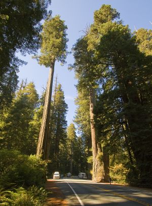
مقاطعة دل نورتى (إنگليزية: Del Norte County ؛ /dɛl ˈnɔːrt/ (بالإسبانية "بتاعة الشمال") هي مقاطعة في أقصى شمال ولاية كاليفورنيا في الولايات المتحدة الأمريكية. Its population was 27,743 as of the 2020 census, down from 28,610 from the 2010 census. The county seat and only incorporated city is Crescent City.[4] Del Norte was settled and colonized by Azorean Portuguese settlers and dairy farmers, which may account for the local pronunciation of the county name.[5] Locals pronounce the county name as Del Nort, not Del Nor-teh as would be expected in Spanish.[6] Del Norte County comprises the Crescent City, CA Micropolitan Statistical Area. The rural county is notable for forests containing giant Coast Redwoods, with some attaining heights over 350 أقدام (110 m). This northernmost county on the California coast also has scores of unique plants and flowers, dozens of species of coastal birds and fish, rocky primitive beaches and sea stacks, pristine rivers and historic lighthouses.
التاريخ
The area that is now known as Del Norte was and still is inhabited by the Yurok (هنود نهر كلاماث) and Tolowa Nations of indigenous peoples. The first European American to explore this land was pioneer Jedediah Smith in the mid-19th century. He was the first European American to reach the area overland on foot in a time before the European Americans knew anything about such a distant territory. For him it was literally "Land's End" — where the American continent ended at the Pacific Ocean. In 1855 Congress authorized the building of a lighthouse at "the battery point" (a high tide island on the coast of Crescent City) which is still functioning as a historical landmark.
مقاطعة دل نورتى تأسست في 1857، من جزء من أراضي كقاطعة كلاماث إثر California Gold Rush الكبير. مقاطعة كلاماث نفسها اختفت في 1874.
الجغرافيا
According to the U.S. Census Bureau, the county has a total area of 1،230 ميل مربع (3،200 km2), of which 1،006 ميل مربع (2،610 km2) is land and 223 ميل مربع (580 km2) (18%) is water.[7]
The mountainous terrain associated with the Coastal Range and the Klamath Mountains dominates Del Norte County's geography. Elevation ranges from sea level to over 6,400 feet. Although much of the county is made up of steep terrain, there are small patches of flat terrain along the coast and in isolated mountain valleys. There are 37 miles of coastline in the county, forming a coastal zone that covers approximately 51,000 acres (80 square miles). A broad coastal plain can be found in the northwest portion of the county with the western edge of the Coastal Range as its easterly boundary. Rising abruptly from the coastal plain, the Coastal Range extends north into Oregon and is situated next to the Klamath Mountains to the east.[8]
المقاطعات المجاورة
- Curry County, Oregon - northwest
- Josephine County, Oregon - northeast
- Siskiyou County - east
- Humboldt County - south
Beach
Recreation area
Rivers
- Klamath - one of the longest in California.
- Smith - a crown jewel of the National Wild and Scenic River program.
Wildlife refuge
المنتزهات
- Del Norte Coast Redwoods State Park
- Jedediah Smith Redwoods State Park
- Redwood National Park
- Tolowa Dunes State Park
- Ruby Van Deventer County Park
- Florence Keller County Park
Ecology
There is a diversity of flora and fauna within Del Norte County. Vegetative plant associations feature several forest types including mixed oak forest. The California endemic Blue oak, Quercus douglasii is at the northernmost part of its range in Del Norte County.[9] The Black Oak and Douglas-fir are also found in Del Norte County.
الديمغرافيا
| التعداد | Pop. | ملاحظة | %± |
|---|---|---|---|
| 1860 | 1٬993 | — | |
| 1870 | 2٬022 | 1٫5% | |
| 1880 | 2٬584 | 27٫8% | |
| 1890 | 2٬592 | 0٫3% | |
| 1900 | 2٬408 | −7٫1% | |
| 1910 | 2٬417 | 0٫4% | |
| 1920 | 2٬759 | 14٫1% | |
| 1930 | 4٬739 | 71٫8% | |
| 1940 | 4٬745 | 0٫1% | |
| 1950 | 8٬078 | 70٫2% | |
| 1960 | 17٬771 | 120�0% | |
| 1970 | 14٬580 | −18�0% | |
| 1980 | 18٬217 | 24٫9% | |
| 1990 | 23٬460 | 28٫8% | |
| 2000 | 27٬507 | 17٫3% | |
| 2010 | 28٬610 | 4�0% | |
| 2020 | 27٬743 | −3�0% | |
| 2024 (تق.) | 27٬009 | [10] | −2٫6% |
| U.S. Decennial Census[11] 1790–1960[12] 1900–1990[13] 1990–2000[14] 2010–2015[15] | |||
2020 census
| Race / Ethnicity (NH = Non-Hispanic) | Pop 1980[16] | Pop 1990[17] | Pop 2000[18] | Pop 2010[19] | Pop 2020[20] | % 1980 | % 1990 | % 2000 | % 2010 | % 2020 |
|---|---|---|---|---|---|---|---|---|---|---|
| White alone (NH) | 15,729 | 18,302 | 19,294 | 18,513 | 16,262 | 86.34% | 78.01% | 70.14% | 64.71% | 58.62% |
| Black or African American alone (NH) | 52 | 853 | 1,167 | 967 | 841 | 0.29% | 3.64% | 4.24% | 3.38% | 3.03% |
| Native American or Alaska Native alone (NH) | 1,301 | 1,415 | 1,593 | 1,935 | 2,136 | 7.14% | 6.03% | 5.79% | 6.76% | 7.70% |
| Asian alone (NH) | 83 | 433 | 619 | 938 | 826 | 0.46% | 1.85% | 2.25% | 3.28% | 2.98% |
| Native Hawaiian or Pacific Islander alone (NH) | x [21] | x [22] | 18 | 26 | 28 | 0.07% | 0.09% | 0.07% | 0.09% | 0.10% |
| Other race alone (NH) | 34 | 43 | 39 | 172 | 122 | 0.19% | 0.18% | 0.14% | 0.60% | 0.44% |
| Mixed race or Multiracial (NH) | x [23] | x [24] | 948 | 966 | 2,207 | x | x | 3.45% | 3.38% | 7.96% |
| Hispanic or Latino (any race) | 1,018 | 2,414 | 3,829 | 5,093 | 5,321 | 5.59% | 10.29% | 13.92% | 17.80% | 19.18% |
| Total | 18,217 | 23,460 | 27,507 | 28,610 | 27,743 | 100.00% | 100.00% | 100.00% | 100.00% | 100.00% |
2011
| التعداد، العرق والدخل | |||||
|---|---|---|---|---|---|
| إجمالي التعداد[25] | 28,561 | ||||
| White[25] | 20,804 | 72.8% | |||
| Black or African American[25] | 937 | 3.3% | |||
| American Indian or Alaska Native[25] | 1,571 | 5.5% | |||
| Asian[25] | 891 | 3.1% | |||
| Native Hawaiian or other Pacific Islander[25] | 271 | 0.9% | |||
| Some other race[25] | 2,343 | 8.2% | |||
| Two or more races[25] | 1,744 | 6.1% | |||
| Hispanic or Latino (of any race)[26] | 5,003 | 17.5% | |||
| Per capita income[27] | $19,247 | ||||
| Median household income[28] | $37,588 | ||||
| Median family income[29] | $52,076 | ||||
الأماكن حسب التعداد والعرق والدخل
| الأماكن حسب التعداد والعرق | ||||||||
|---|---|---|---|---|---|---|---|---|
| المكان | Type[30] | Population[25] | White[25] | Other[25] [note 1] |
Asian[25] | Black or African American[25] |
Native American[25] [note 2] |
Hispanic or Latino (of any race)[26] |
| Bertsch-Oceanview | CDP | 2,729 | 77.9% | 13.6% | 1.1% | 0.0% | 7.4% | 8.1% |
| Crescent City | City | 7,673 | 54.0% | 26.9% | 3.9% | 9.9% | 5.3% | 27.7% |
| Gasquet | CDP | 551 | 100.0% | 0.0% | 0.0% | 0.0% | 0.0% | 14.3% |
| Hiouchi | CDP | 472 | 91.9% | 6.8% | 1.3% | 0.0% | 0.0% | 8.3% |
| Klamath | CDP | 956 | 49.0% | 21.8% | 4.0% | 0.3% | 25.0% | 8.3% |
| Smith River | CDP | 649 | 80.4% | 18.2% | 1.4% | 0.0% | 0.0% | 13.6% |
| الأماكن حسب التعداد والدخل | |||||
|---|---|---|---|---|---|
| المكان | النمط[30] | Population[31] | Per capita income[27] | Median household income[28] | Median family income[29] |
| Bertsch-Oceanview | CDP | 2,729 | $19,434 | $48,205 | $58,727 |
| Crescent City | City | 7,673 | $10,350 | $30,058 | $37,143 |
| Gasquet | CDP | 551 | $19,286 | $43,750 | $55,227 |
| Hiouchi | CDP | 472 | $30,285 | $47,596 | $66,591 |
| Klamath | CDP | 956 | $16,332 | $26,172 | $28,864 |
| Smith River | CDP | 649 | $18,120 | $46,411 | $57,989 |
2010
| التعداد | Pop. | ملاحظة | %± |
|---|---|---|---|
| 1860 | 1٬993 | — | |
| 1870 | 2٬022 | 1٫5% | |
| 1880 | 2٬584 | 27٫8% | |
| 1890 | 2٬592 | 0٫3% | |
| 1900 | 2٬408 | −7٫1% | |
| 1910 | 2٬417 | 0٫4% | |
| 1920 | 2٬759 | 14٫1% | |
| 1930 | 4٬739 | 71٫8% | |
| 1940 | 4٬745 | 0٫1% | |
| 1950 | 8٬078 | 70٫2% | |
| 1960 | 17٬771 | 120�0% | |
| 1970 | 14٬580 | −18�0% | |
| 1980 | 18٬217 | 24٫9% | |
| 1990 | 23٬460 | 28٫8% | |
| 2000 | 27٬507 | 17٫3% | |
| 2010 | 28٬610 | 4�0% | |
| 2016 (تق.) | 27٬540 | [3] | −3٫7% |
| U.S. Decennial Census[32] 1790–1960[33] 1900–1990[34] 1990–2000[35] 2010–2015[15] | |||
The 2010 United States Census reported that Del Norte County had a population of 28,610. The racial makeup of Del Norte County was 21,098 (73.7%) White, 993 (3.5%) African American, 2,244 (7.8%) Native American, 965 (3.4%) Asian, 32 (0.1%) Pacific Islander, 1,980 (6.9%) from other races, and 1,298 (4.5%) from two or more races. Hispanic or Latino of any race were 5,093 persons (17.8%).[36]
| Population reported at 2010 United States Census | |||||||||
|---|---|---|---|---|---|---|---|---|---|
Population |
American |
American |
Islander |
races |
more races |
or Latino (of any race) | |||
| مقاطعة دل نورتى | 28,610 | 21,098 | 993 | 2,244 | 965 | 32 | 1,980 | 1,298 | 5,093 |
city |
Population |
American |
American |
Islander |
races |
more races |
or Latino (of any race) | ||
| كرسنت سيتي | 7,643 | 5,052 | 910 | 370 | 333 | 7 | 696 | 275 | 2,342 |
places |
Population |
American |
American |
Islander |
races |
more races |
or Latino (of any race) | ||
| Bertsch-Oceanview | 2,436 | 1,810 | 3 | 294 | 94 | 0 | 81 | 154 | 310 |
| Gasquet | 661 | 585 | 2 | 27 | 1 | 1 | 15 | 30 | 39 |
| Hiouchi | 301 | 267 | 0 | 11 | 6 | 2 | 8 | 7 | 11 |
| Klamath | 779 | 379 | 1 | 325 | 3 | 0 | 5 | 66 | 90 |
| Smith River | 866 | 528 | 1 | 59 | 5 | 0 | 234 | 39 | 293 |
communities |
Population |
American |
American |
Islander |
races |
more races |
or Latino (of any race) | ||
| All others not CDPs (combined) | 15,924 | 12,477 | 76 | 1,158 | 523 | 22 | 941 | 727 | 2,008 |
السياسة
| Year | GOP | DEM | Others |
|---|---|---|---|
| 2016 | 54.8% 5,134 | 37.2% 3,485 | 7.9% 742 |
| 2012 | 52.6% 4,614 | 43.2% 3,791 | 4.2% 365 |
| 2008 | 52.1% 4,967 | 45.4% 4,323 | 2.5% 231 |
| 2004 | 56.9% 5,356 | 41.3% 3,892 | 1.8% 173 |
| 2000 | 54.6% 4,526 | 37.6% 3,117 | 7.9% 651 |
| 1996 | 41.3% 3,670 | 41.1% 3,652 | 17.6% 1,567 |
| 1992 | 33.0% 3,083 | 38.9% 3,639 | 28.1% 2,631 |
| 1988 | 49.7% 3,714 | 48.0% 3,587 | 2.2% 167 |
| 1984 | 58.4% 3,996 | 39.4% 2,696 | 2.2% 149 |
| 1980 | 57.5% 4,016 | 33.5% 2,338 | 9.1% 633 |
| 1976 | 45.3% 2,481 | 50.9% 2,789 | 3.8% 208 |
| 1972 | 51.8% 2,927 | 38.2% 2,156 | 10.0% 565 |
| 1968 | 46.2% 2,387 | 43.3% 2,236 | 10.6% 545 |
| 1964 | 36.2% 2,075 | 63.8% 3,652 | 0.0% 0 |
| 1960 | 48.1% 3,024 | 51.2% 3,225 | 0.7% 45 |
| 1956 | 53.2% 2,918 | 46.5% 2,552 | 0.3% 17 |
| 1952 | 63.4% 2,938 | 35.4% 1,640 | 1.1% 53 |
| 1948 | 54.3% 1,541 | 41.3% 1,172 | 4.5% 127 |
| 1944 | 55.3% 1,011 | 44.7% 818 | 0.1% 1 |
| 1940 | 53.6% 1,233 | 44.9% 1,034 | 1.5% 35 |
| 1936 | 39.2% 853 | 59.4% 1,292 | 1.3% 29 |
| 1932 | 30.9% 637 | 64.1% 1,319 | 5.0% 103 |
| 1928 | 55.9% 771 | 43.4% 599 | 1.7% 10 |
| 1924 | 52.6% 530 | 12.1% 122 | 35.3% 355 |
| 1920 | 62.6% 596 | 29.3% 279 | 8.1% 77 |
| Year | GOP | DEM |
|---|---|---|
| 2014 | 50.4% 3,539 | 49.6% 3,488 |
| 2010 | 41.2% 3,373 | 50.0% 4,093 |
| 2006 | 54.9% 3,639 | 38.2% 2,531 |
| 2003 | 55.0% 3,522 | 25.5% 1,634 |
| 2002 | 45.8% 3,093 | 43.3% 2,922 |
| 1998 | 41.5% 3,087 | 51.3% 3,820 |
| 1994 | 61.8% 4,626 | 31.7% 2,372 |
| 1990 | 53.2% 3,615 | 40.0% 2,717 |
| 1986 | 65.8% 4,213 | 31.6% 2,026 |
| 1982 | 51.3% 3,355 | 44.9% 2,934 |
| 1978 | 49.9% 2,933 | 41.7% 2,451 |
| 1974 | 46.1% 1,921 | 51.6% 2,149 |
| 1970 | 57.1% 2,755 | 41.0% 1,977 |
| 1966 | 64.0% 3,409 | 36.0% 1,918 |
| 1962 | 45.9% 2,418 | 52.0% 2,741 |
التجمعات السكنية
Crescent City is the county seat of and only incorporated city in Del Norte County. Its population count includes the inmates of Pelican Bay State Prison located ten miles north of the city.
المدن
Census-designated places
Other unincorporated communities
ترتيب التعداد
The population ranking of the following table is based on the 2010 census of Del Norte County.[38]
† مقر المقاطعة
| الترتيب | المدينة/البلدة/إلخ. | نوع البلدية | التعداد (تعداد 2010)
|
|---|---|---|---|
| 1 | † كرسنت سيتي | City | 7,643 |
| 2 | Bertsch-Oceanview | CDP | 2,436 |
| 3 | Yurok Reservation[39] (partially in Humboldt County) | AIAN | 1,238 |
| 4 | Smith River | CDP | 866 |
| 5 | Klamath | CDP | 779 |
| 6 | Gasquet | CDP | 661 |
| 7 | Hiouchi | CDP | 301 |
| 8 | Smith River Rancheria[40] | AIAN | 113 |
| 9 | Elk Valley Rancheria[41] | AIAN | 99 |
| 10 | Resighini Rancheria[42] | AIAN | 31 |
انظر أيضاً
- Hiking trails in Del Norte County
- National Register of Historic Places listings in Del Norte County, California
ملاحظات
الهامش
- ^ "Del Norte County". نظام معلومات الأسماء الجغرافية، المسح الجيولوجي الأمريكي. Retrieved January 5, 2015.
- ^ "Bear Mountain". Peakbagger.com. Retrieved February 11, 2015.
- ^ أ ب ت "Annual Estimates of the Resident Population: April 1, 2010 to July 1, 2016 Estimates". Retrieved April 27, 2017.
- ^ "Find a County". National Association of Counties. Archived from the original on May 31, 2011. Retrieved June 7, 2011.
- ^ Genzoli, Andrew (November 1971). "When the Portuguese Pioneered". Humboldt Historian. 19 (6): 8.
- ^ Roberts, Rich (April 10, 1991). "A California Time Capsule : Pristine Version of State Awaits in Smith River Recreation Area". Los Angeles Times. Retrieved May 21, 2016.
- ^ "2010 Census Gazetteer Files". United States Census Bureau. August 22, 2012. Retrieved September 24, 2015.
- ^ "Del Norte Fire Safe Plan" (PDF). Archived from the original (PDF) on April 25, 2012. Retrieved October 28, 2011.
- ^ C. Michael Hogan. 2008. Blue Oak: Quercus douglasii, GlobalTwitcher.com, ed. N. Stromberg Archived فبراير 28, 2012 at the Wayback Machine
- ^ "Annual Estimates of the Resident Population for Counties: April 1, 2020 to July 1, 2024". United States Census Bureau. Retrieved May 9, 2025.
- ^ "U.S. Decennial Census". United States Census Bureau. Retrieved September 24, 2015.
- ^ "Historical Census Browser". University of Virginia Library. Retrieved September 24, 2015.
- ^ Forstall, Richard L., ed. (March 27, 1995). "Population of Counties by Decennial Census: 1900 to 1990". United States Census Bureau. Retrieved September 24, 2015.
- ^ "Census 2000 PHC-T-4. Ranking Tables for Counties: 1990 and 2000" (PDF). United States Census Bureau. April 2, 2001. Retrieved September 24, 2015.
- ^ أ ب "State & County QuickFacts". United States Census Bureau. Archived from the original on October 13, 2015. Retrieved April 3, 2016.
- ^ "California: 1980, General Social and Economic Characteristics, Part 1" (PDF). United States Census Bureau.
- ^ "California: 1990, Part 1" (PDF). United States Census Bureau. Retrieved July 14, 2024.
- ^ "P004: Hispanic or Latino, and Not Hispanic or Latino by Race – 2000: DEC Summary File 1 – Del Norte County, California". United States Census Bureau.
- ^ "P2: Hispanic or Latino, and Not Hispanic or Latino by Race – 2010: DEC Redistricting Data (PL 94-171) – Del Norte County, California". United States Census Bureau.
- ^ "P2: Hispanic or Latino, and Not Hispanic or Latino by Race – 2020: DEC Redistricting Data (PL 94-171) – Del Norte County, California". United States Census Bureau.
- ^ included in the Asian category in the 1980 Census
- ^ included in the Asian category in the 1990 Census
- ^ not an option in the 1980 Census
- ^ not an option in the 1990 Census
- ^ أ ب ت ث ج ح خ د ذ ر ز س ش ص خطأ استشهاد: وسم
<ref>غير صحيح؛ لا نص تم توفيره للمراجع المسماةUS-CB-B02001 - ^ أ ب U.S. Census Bureau. American Community Survey, 2011 American Community Survey 5-Year Estimates, Table B03003. American FactFinder Archived سبتمبر 11, 2013 at the Wayback Machine. Retrieved October 26, 2013.
- ^ أ ب U.S. Census Bureau. American Community Survey, 2011 American Community Survey 5-Year Estimates, Table B19301. American FactFinder Archived سبتمبر 11, 2013 at the Wayback Machine. Retrieved October 21, 2013.
- ^ أ ب U.S. Census Bureau. American Community Survey, 2011 American Community Survey 5-Year Estimates, Table B19013. American FactFinder Archived سبتمبر 11, 2013 at the Wayback Machine. Retrieved October 21, 2013.
- ^ أ ب U.S. Census Bureau. American Community Survey, 2011 American Community Survey 5-Year Estimates, Table B19113. American FactFinder Archived سبتمبر 11, 2013 at the Wayback Machine. Retrieved October 21, 2013.
- ^ أ ب U.S. Census Bureau. American Community Survey, 2011 American Community Survey 5-Year Estimates. American FactFinder Archived سبتمبر 11, 2013 at the Wayback Machine. Retrieved October 21, 2013.
- ^ U.S. Census Bureau. American Community Survey, 2011 American Community Survey 5-Year Estimates, Table B01003. American FactFinder Archived سبتمبر 11, 2013 at the Wayback Machine. Retrieved October 21, 2013.
- ^ "U.S. Decennial Census". United States Census Bureau. Archived from the original on May 12, 2015. Retrieved September 24, 2015.
{{cite web}}: Unknown parameter|deadurl=ignored (|url-status=suggested) (help) - ^ "Historical Census Browser". University of Virginia Library. Retrieved September 24, 2015.
- ^ Forstall, Richard L., ed. (March 27, 1995). "Population of Counties by Decennial Census: 1900 to 1990". United States Census Bureau. Retrieved September 24, 2015.
- ^ "Census 2000 PHC-T-4. Ranking Tables for Counties: 1990 and 2000" (PDF). United States Census Bureau. April 2, 2001. Retrieved September 24, 2015.
- ^ قالب:USCensus2010CA
- ^ http://uselectionatlas.org/RESULTS/
- ^ "Archived copy". Archived from the original on December 21, 2013. Retrieved February 10, 2013.
{{cite web}}: Unknown parameter|deadurl=ignored (|url-status=suggested) (help)CS1 maint: archived copy as title (link) - ^ http://www.census.gov/2010census/popmap/ipmtext.php?fl=4760
- ^ http://www.census.gov/2010census/popmap/ipmtext.php?fl=3855
- ^ http://www.census.gov/2010census/popmap/ipmtext.php?fl=1010
- ^ http://www.census.gov/2010census/popmap/ipmtext.php?fl=3145
وصلات خارجية
- Official website

- Del Norte County Tourism and Travel website
- Chamber of Commerce website
- "DNCWOW.COM" Wiki-website devoted to Del Norte County
- Del Norte Historical Society

|
Josephine County, Oregon | Curry County, Oregon | 
| |
| Siskiyou County | المحيط الهادي | |||
| مقاطعة همبولت |
قالب:Cities of Del Norte County, California قالب:North Coast (California)
- CS1 errors: unsupported parameter
- Short description is different from Wikidata
- Articles containing إسپانية-language text
- Pages using Lang-xx templates
- Pages using infobox settlement with no coordinates
- Articles containing إنگليزية-language text
- Articles with hatnote templates targeting a nonexistent page
- Pages using US Census population needing update
- Portal-inline template with redlinked portals
- Pages with empty portal template
- بذرة كاليفورنيا
- مقاطعات كاليفورنيا
- Del Norte County, California
- 1857 establishments in California
- Populated places established in 1857
- صفحات مع الخرائط
