مقاطعة ماريپوسا، كاليفورنيا
مقاطعة ماريپوسا، كاليفورنيا | |
|---|---|
| مقاطعة ماريپوسا | |
|
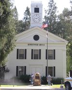
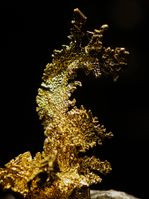
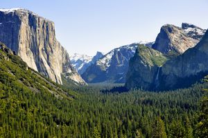
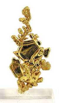
الصور من أعلى لأسفلـ ومن اليسار إلى اليمين: مبنى محكمة مقاطعة ماريپوسا؛ "التنين"، ذهب بلوري من منجم كولورادو كوارتس بالقرب من ميدپاينز؛ منظر وادي يوسمتي من مشهد النفق | |
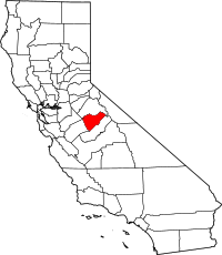 Location in the state of California | |
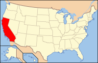 California's location in the الولايات المتحدة | |
| البلد | |
| State | |
| المنطقة | Sierra Nevada |
| Incorporated | February 18, 1850[1] |
| مقر المقاطعة | ماريپوسا |
| المساحة | |
| • الإجمالي | 1٬463 ميل² (3٬790 كم²) |
| • البر | 1٬449 ميل² (3٬750 كم²) |
| • الماء | 14 ميل² (40 كم²) |
| التعداد | |
| • الإجمالي | 18٬251 |
| • Estimate (2016)[3] | 17٬410 |
| • الكثافة | 12/sq mi (4٫8/km2) |
| منطقة التوقيت | UTC-8 (Pacific Standard Time) |
| • الصيف (التوقيت الصيفي) | UTC-7 (Pacific Daylight Time) |
| الموقع الإلكتروني | www.mariposacounty.org |
مقاطعة ماريپوسا إنگليزية: Mariposa County هي إحدى مقاطعات ولاية كاليفورنيا في الولايات المتحدة الأمريكية.
التاريخ
مقاطعة ماريپوسا كانت واحدة من المقاطعات الأصلية لكاليفورنيا، أنشئت في زمن إشهار الولاية في 1850. While it began as the state's largest county, territory that was once part of Mariposa was ceded over time to form twelve other counties: Fresno, Inyo, Kern, Kings, Los Angeles, Madera, Merced, Mono, San Benito, San Bernardino, San Luis Obispo, and Tulare. Thus, Mariposa County is known as the "Mother of Counties".[4]
الديمغرافيا
2014
The largest self-reported ancestry groups in Mariposa County were English (14.5%), German (13.7%), Irish (13.1%), Italian (4.1%), American (3.8%), Scottish (3.2%) and Portuguese (3.0%).[5]
2011
| Population, race, and income | |||||
|---|---|---|---|---|---|
| Total population[6] | 18,290 | ||||
| White[6] | 16,357 | 89.4% | |||
| Black or African American[6] | 180 | 1.0% | |||
| American Indian or Alaska Native[6] | 335 | 1.8% | |||
| Asian[6] | 200 | 1.1% | |||
| Native Hawaiian or other Pacific Islander[6] | 50 | 0.3% | |||
| Some other race[6] | 458 | 2.5% | |||
| Two or more races[6] | 710 | 3.9% | |||
| Hispanic or Latino (of any race)[7] | 1,727 | 9.4% | |||
| Per capita income[8] | $27,209 | ||||
| Median household income[9] | $49,174 | ||||
| Median family income[10] | $58,237 | ||||
Places by population, race, and income
| Places by population and race | ||||||||
|---|---|---|---|---|---|---|---|---|
| Place | Type[11] | Population[6] | White[6] | Other[6] [note 1] |
Asian[6] | Black or African American[6] |
Native American[6] [note 2] |
Hispanic or Latino (of any race)[7] |
| Bear Valley | CDP | 255 | 100.0% | 0.0% | 0.0% | 0.0% | 0.0% | 0.0% |
| Bootjack | CDP | 951 | 85.0% | 13.6% | 1.5% | 0.0% | 0.0% | 0.0% |
| Buck Meadows | CDP | 12 | 0.0% | 0.0% | 100.0% | 0.0% | 0.0% | 0.0% |
| Catheys Valley | CDP | 811 | 83.5% | 16.5% | 0.0% | 0.0% | 0.0% | 11.6% |
| Coulterville | CDP | 190 | 100.0% | 0.0% | 0.0% | 0.0% | 0.0% | 7.4% |
| El Portal | CDP | 509 | 72.5% | 7.1% | 6.1% | 7.3% | 7.1% | 19.4% |
| Fish Camp | CDP | 53 | 41.5% | 0.0% | 0.0% | 0.0% | 58.5% | 0.0% |
| Greeley Hill | CDP | 805 | 97.8% | 0.6% | 0.0% | 0.1% | 1.5% | 6.3% |
| Hornitos | CDP | 67 | 100.0% | 0.0% | 0.0% | 0.0% | 0.0% | 0.0% |
| Lake Don Pedro | CDP | 1,088 | 88.4% | 7.1% | 3.4% | 1.1% | 0.0% | 14.8% |
| Mariposa | CDP | 2,479 | 74.4% | 18.3% | 0.0% | 0.4% | 7.0% | 27.4% |
| Midpines | CDP | 661 | 91.8% | 5.6% | 1.7% | 0.9% | 0.0% | 7.1% |
| Wawona | CDP | 80 | 56.2% | 0.0% | 43.8% | 0.0% | 0.0% | 0.0% |
| Yosemite Valley | CDP | 779 | 90.9% | 2.1% | 1.0% | 6.0% | 0.0% | 6.0% |
| Places by population and income | |||||
|---|---|---|---|---|---|
| Place | Type[11] | Population[12] | Per capita income[8] | Median household income[9] | Median family income[10] |
| Bear Valley | CDP | 255 | $17,787 | $15,417 | $12,050 |
| Bootjack | CDP | 951 | $26,801 | $45,875 | $46,333 |
| Buck Meadows | CDP | 12 | [13] | [13] | [13] |
| Catheys Valley | CDP | 811 | $18,940 | $26,759 | $26,759 |
| Coulterville | CDP | 190 | $9,579 | $12,351 | $43,000 |
| El Portal | CDP | 509 | $27,412 | $70,870 | $45,862 |
| Fish Camp | CDP | 53 | $15,630 | [13] | [13] |
| Greeley Hill | CDP | 805 | $19,854 | $29,333 | $28,625 |
| Hornitos | CDP | 67 | [13] | [13] | [13] |
| Lake Don Pedro | CDP | 1,088 | $44,112 | $83,372 | $86,771 |
| Mariposa | CDP | 2,479 | $19,614 | $43,418 | $39,830 |
| Midpines | CDP | 661 | $39,161 | $36,803 | $36,947 |
| Wawona | CDP | 80 | $19,068 | $22,353 | $85,156 |
| Yosemite Valley | CDP | 779 | $28,524 | $62,321 | $147,717 |
2010
| التعداد | Pop. | ملاحظة | %± |
|---|---|---|---|
| 1850 | 4٬379 | — | |
| 1860 | 6٬243 | 42٫6% | |
| 1870 | 4٬572 | −26٫8% | |
| 1880 | 4٬339 | −5٫1% | |
| 1890 | 3٬787 | −12٫7% | |
| 1900 | 4٬720 | 24٫6% | |
| 1910 | 3٬956 | −16٫2% | |
| 1920 | 2٬775 | −29٫9% | |
| 1930 | 3٬233 | 16٫5% | |
| 1940 | 5٬605 | 73٫4% | |
| 1950 | 5٬145 | −8٫2% | |
| 1960 | 5٬064 | −1٫6% | |
| 1970 | 6٬015 | 18٫8% | |
| 1980 | 11٬108 | 84٫7% | |
| 1990 | 14٬302 | 28٫8% | |
| 2000 | 17٬130 | 19٫8% | |
| 2010 | 18٬251 | 6٫5% | |
| 2016 (تق.) | 17٬410 | [3] | −4٫6% |
| U.S. Decennial Census[14] 1790–1960[15] 1900–1990[16] 1990–2000[17] 2010–2015[2] | |||
The 2010 United States Census reported that Mariposa County had a population of 18,251. The racial makeup of Mariposa County was 16,103 (88.2%) White, 138 (0.8%) African American, 527 (2.9%) Native American, 204 (1.1%) Asian, 26 (0.1%) Pacific Islander, 508 (2.8%) from other races, and 745 (4.1%) from two or more races. Hispanic or Latino of any race were 1,676 persons (9.2%).[18]
| Population reported at 2010 United States Census | |||||||||
|---|---|---|---|---|---|---|---|---|---|
Population |
American |
American |
Islander |
races |
more races |
or Latino (of any race) | |||
| Mariposa County | 18,251 | 16,103 | 138 | 527 | 204 | 26 | 508 | 745 | 1,676 |
place |
Population |
American |
American |
Islander |
races |
more races |
or Latino (of any race) | ||
| Bear Valley | 125 | 117 | 0 | 1 | 2 | 0 | 1 | 4 | 8 |
| Bootjack | 960 | 811 | 2 | 34 | 11 | 0 | 31 | 71 | 76 |
| Buck Meadows | 31 | 23 | 0 | 0 | 0 | 0 | 5 | 3 | 7 |
| Catheys Valley | 825 | 730 | 6 | 12 | 12 | 1 | 33 | 31 | 80 |
| Coulterville | 201 | 181 | 0 | 5 | 1 | 0 | 0 | 14 | 20 |
| El Portal | 474 | 434 | 1 | 9 | 5 | 0 | 5 | 20 | 28 |
| Fish Camp | 59 | 57 | 0 | 0 | 1 | 0 | 0 | 1 | 3 |
| Greeley Hill | 915 | 847 | 7 | 14 | 1 | 6 | 11 | 29 | 53 |
| Hornitos | 75 | 66 | 0 | 2 | 1 | 0 | 0 | 6 | 5 |
| Lake Don Pedro | 1,077 | 979 | 7 | 18 | 12 | 2 | 18 | 41 | 109 |
| Mariposa | 2,173 | 1,895 | 10 | 105 | 30 | 0 | 59 | 74 | 215 |
| Midpines | 1,204 | 990 | 4 | 63 | 7 | 0 | 97 | 43 | 208 |
| Wawona | 169 | 138 | 2 | 3 | 4 | 0 | 8 | 14 | 12 |
| Yosemite Valley | 1,035 | 831 | 28 | 31 | 31 | 7 | 70 | 37 | 123 |
communities |
Population |
American |
American |
Islander |
races |
more races |
or Latino (of any race) | ||
| All others not CDPs (combined) | 8,928 | 8,004 | 71 | 230 | 86 | 10 | 170 | 357 | 729 |
النقل
Major highways
Public transportation
- Mariposa County Transit provides dial-a-ride and some fixed route service
- Yosemite Area Regional Transportation System (YARTS) provides service along State Routes 120 and 140 to Yosemite National Park.
المطارات
Mariposa Yosemite Airport is a general aviation airport. The nearest airports with scheduled flights are in Fresno and Merced.
Communities
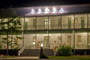
Census-designated places
Unincorporated communities
Population ranking
The population ranking of the following table is based on the 2010 census of Mariposa County.[19]
† county seat
| Rank | City/Town/etc. | Municipal type | Population (2010 Census)
|
|---|---|---|---|
| 1 | † Mariposa | CDP | 2,173 |
| 2 | Midpines | CDP | 1,204 |
| 3 | Lake Don Pedro | CDP | 1,077 |
| 4 | Yosemite Valley | CDP | 1,035 |
| 5 | Bootjack | CDP | 960 |
| 6 | Greeley Hill | CDP | 915 |
| 7 | Catheys Valley | CDP | 825 |
| 8 | El Portal | CDP | 474 |
| 9 | Coulterville | CDP | 201 |
| 10 | Wawona | CDP | 169 |
| 11 | Bear Valley | CDP | 125 |
| 12 | Hornitos | CDP | 75 |
| 13 | Fish Camp | CDP | 59 |
| 14 | Buck Meadows | CDP | 31 |
انظر أيضاً
- List of school districts in Mariposa County, California
- National Register of Historic Places listings in Mariposa County, California
- Valley and Sierra Miwok people
- Yokut people (Mariposan)
Notes
References
- ^ "Chronology". California State Association of Counties. Retrieved February 6, 2015.
- ^ أ ب خطأ استشهاد: وسم
<ref>غير صحيح؛ لا نص تم توفيره للمراجع المسماةQF - ^ أ ب "Annual Estimates of the Resident Population: April 1, 2010 to July 1, 2016 Estimates". Retrieved April 27, 2017.
- ^ "Mariposa: Mother Of Counties". Superior Court of California, County of Mariposa. Retrieved 2009-05-17.
- ^ http://factfinder.census.gov/bkmk/table/1.0/en/ACS/14_5YR/DP02/0500000US06043
- ^ أ ب ت ث ج ح خ د ذ ر ز س ش ص خطأ استشهاد: وسم
<ref>غير صحيح؛ لا نص تم توفيره للمراجع المسماةUS-CB-B02001 - ^ أ ب U.S. Census Bureau. American Community Survey, 2011 American Community Survey 5-Year Estimates, Table B03003. American FactFinder. Retrieved 2013-10-26.
- ^ أ ب U.S. Census Bureau. American Community Survey, 2011 American Community Survey 5-Year Estimates, Table B19301. American FactFinder. Retrieved 2013-10-21.
- ^ أ ب U.S. Census Bureau. American Community Survey, 2011 American Community Survey 5-Year Estimates, Table B19013. American FactFinder. Retrieved 2013-10-21.
- ^ أ ب U.S. Census Bureau. American Community Survey, 2011 American Community Survey 5-Year Estimates, Table B19113. American FactFinder. Retrieved 2013-10-21.
- ^ أ ب U.S. Census Bureau. American Community Survey, 2011 American Community Survey 5-Year Estimates. American FactFinder. Retrieved 2013-10-21.
- ^ U.S. Census Bureau. American Community Survey, 2011 American Community Survey 5-Year Estimates, Table B01003. American FactFinder. Retrieved 2013-10-21.
- ^ أ ب ت ث ج ح خ د Data unavailable
- ^ "U.S. Decennial Census". United States Census Bureau. Retrieved September 28, 2015.
- ^ "Historical Census Browser". University of Virginia Library. Retrieved September 28, 2015.
- ^ Forstall, Richard L., ed. (March 27, 1995). "Population of Counties by Decennial Census: 1900 to 1990". United States Census Bureau. Retrieved September 28, 2015.
- ^ "Census 2000 PHC-T-4. Ranking Tables for Counties: 1990 and 2000" (PDF). United States Census Bureau. April 2, 2001. Retrieved September 28, 2015.
- ^ قالب:USCensus2010CA
- ^ 2010 Census
للاستزادة
- A Memorial and Biographical History of the Counties of Merced, Stanislaus, Calaveras, Tuolumne and Mariposa, California. Chicago: Lewis Publishing Co., 1892.
وصلات خارجية
- Official website

- Mariposa County Chamber of Commerce
- Yosemite / Mariposa County Tourism Bureau
- Daily News and Photos of Mariposa County
- History and Genealogy of Mariposa County
- Mockingbird mine crystalline gold discovery, c. 2006, includes photo gallery
37°35′N 119°55′W / 37.58°N 119.91°W

|
Tuolumne County | Stanislaus County | 
| |
| Madera County | Merced County | |||
| Madera County |
- Pages using gadget WikiMiniAtlas
- Articles with hatnote templates targeting a nonexistent page
- Short description is different from Wikidata
- Pages using infobox settlement with no coordinates
- Articles containing إنگليزية-language text
- Pages using Lang-xx templates
- Pages using US Census population needing update
- Pages using div col with unknown parameters
- Coordinates on Wikidata
- Portal-inline template with redlinked portals
- Pages with empty portal template
- بذرة كاليفورنيا
- مقاطعات كاليفورنيا
- Mariposa County, California
- 1850 establishments in California
- Populated places established in 1850
- California Gold Rush
