مقاطعة سان برناردينو، كاليفورنيا
(تم التحويل من San Bernardino County, California)
San Bernardino County, California | |
|---|---|
| County of San Bernardino | |
|
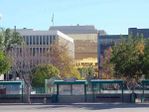
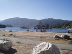
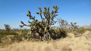
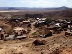
Images, from top down, left to right: Downtown San Bernardino, Big Bear Lake, Joshua Tree in the Mojave National Preserve, Calico Ghost Town, Bear Mountain | |
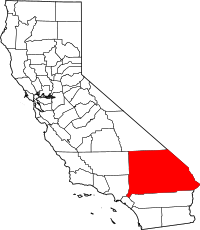 Location in the state of California | |
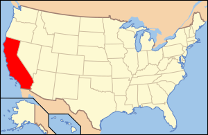
 California's location in the الولايات المتحدة | |
| Country | |
| State | |
| Metropolitan area | Inland Empire |
| Established | April 26, 1853[1] |
| السمِيْ | |
| County seat | |
| Largest city | San Bernardino |
| المساحة | |
| • الإجمالي | 20٬105 ميل² (52٬070 كم²) |
| • البر | 20٬057 ميل² (51٬950 كم²) |
| • الماء | 48 ميل² (120 كم²) |
| أعلى منسوب | 11٬503 ft (3٬506 m) |
| التعداد | |
| • الإجمالي | 2٬035٬210 |
| • Estimate (2014)[6] | 2٬112٬619 |
| • الكثافة | 100/sq mi (39/km2) |
| منطقة التوقيت | UTC−8 (Pacific Time Zone) |
| • الصيف (التوقيت الصيفي) | UTC−7 (Pacific Daylight Time) |
| Area codes | 442/760, 909 |
| FIPS code | 06-071 |
| GNIS feature ID | 277300 |
| الموقع الإلكتروني | www |
مقاطعة سان بيرناردينو إنگليزية: San Bernardino County هي إحدى مقاطعات ولاية كاليفورنيا في الولايات المتحدة.
المقاطعات المجاورة
المناطق المحمية الوطنية
- Angeles National Forest (part)
- Death Valley National Park (part)
- Havasu National Wildlife Refuge (part)
- Joshua Tree National Park (part)
- Mojave National Preserve
- San Bernardino National Forest (part)
السكان
2011
| Population, race, and income | |||||
|---|---|---|---|---|---|
| Total population[7] | 2,023,452 | ||||
| White[7] | 1,240,228 | 61.3% | |||
| Black or African American[7] | 176,209 | 8.7% | |||
| American Indian or Alaska Native[7] | 20,762 | 1.0% | |||
| Asian[7] | 126,991 | 6.3% | |||
| Native Hawaiian or other Pacific Islander[7] | 5,984 | 0.3% | |||
| Some other race[7] | 364,236 | 18.0% | |||
| Two or more races[7] | 89,042 | 4.4% | |||
| Hispanic or Latino (of any race)[8] | 984,022 | 48.6% | |||
| Per capita income[9] | $21,932 | ||||
| Median household income[10] | $55,853 | ||||
| Median family income[11] | $61,525 | ||||
Places by population, race, and income
| Places by population and race | ||||||||
|---|---|---|---|---|---|---|---|---|
| Place | Type[12] | Population[7] | White[7] | Other[7] [note 1] |
Asian[7] | Black or African American[7] |
Native American[7] [note 2] |
Hispanic or Latino (of any race)[8] |
| Adelanto | City | 30,670 | 55.5% | 19.4% | 2.4% | 21.1% | 1.5% | 51.8% |
| Apple Valley | Town | 68,316 | 76.6% | 10.1% | 2.0% | 10.4% | 0.9% | 28.7% |
| Baker | CDP | 713 | 37.0% | 52.5% | 0.0% | 8.7% | 1.8% | 69.6% |
| Barstow | City | 22,913 | 58.8% | 18.0% | 1.7% | 16.4% | 5.0% | 39.6% |
| Big Bear City | CDP | 11,504 | 82.3% | 13.7% | 1.1% | 1.3% | 1.6% | 23.7% |
| Big Bear Lake | City | 5,109 | 74.9% | 20.9% | 0.0% | 1.8% | 2.3% | 24.0% |
| Big River | CDP | 1,213 | 88.0% | 8.9% | 0.0% | 0.0% | 3.1% | 12.1% |
| Bloomington | CDP | 25,234 | 60.9% | 33.2% | 0.8% | 3.5% | 1.6% | 83.5% |
| Bluewater | CDP | 114 | 100.0% | 0.0% | 0.0% | 0.0% | 0.0% | 10.5% |
| Chino | City | 78,050 | 60.8% | 22.2% | 9.8% | 6.4% | 0.9% | 54.3% |
| Chino Hills | City | 74,765 | 55.6% | 11.8% | 28.3% | 3.8% | 0.5% | 30.2% |
| Colton | City | 52,283 | 50.2% | 32.5% | 5.2% | 10.4% | 1.6% | 68.0% |
| Crestline | CDP | 8,743 | 87.5% | 9.7% | 0.8% | 1.2% | 0.8% | 14.2% |
| Fontana | City | 192,779 | 58.2% | 24.8% | 6.4% | 9.7% | 0.9% | 65.9% |
| Fort Irwin | CDP | 9,781 | 69.4% | 10.1% | 7.1% | 10.2% | 3.2% | 25.5% |
| Grand Terrace | City | 12,132 | 65.4% | 20.8% | 7.6% | 5.6% | 0.6% | 37.9% |
| Hesperia | City | 88,247 | 74.9% | 15.0% | 2.1% | 6.3% | 1.7% | 47.9% |
| Highland | City | 52,777 | 52.4% | 29.5% | 7.1% | 10.1% | 0.9% | 47.9% |
| Homestead Valley | CDP | 3,072 | 94.7% | 3.6% | 1.3% | 0.0% | 0.4% | 3.8% |
| Joshua Tree | CDP | 7,194 | 82.4% | 10.6% | 2.7% | 3.0% | 1.3% | 16.4% |
| Lake Arrowhead | CDP | 9,434 | 81.0% | 16.4% | 0.6% | 1.4% | 0.6% | 23.7% |
| Lenwood | CDP | 3,784 | 63.3% | 25.1% | 0.4% | 9.4% | 1.8% | 44.7% |
| Loma Linda | City | 23,081 | 48.4% | 15.0% | 28.7% | 6.8% | 1.1% | 22.8% |
| Lucerne Valley | CDP | 6,029 | 76.4% | 6.6% | 1.7% | 12.1% | 3.1% | 21.3% |
| Lytle Creek | CDP | 735 | 86.8% | 2.3% | 8.2% | 0.0% | 2.7% | 27.3% |
| Mentone | CDP | 8,670 | 75.5% | 12.0% | 4.2% | 7.7% | 0.7% | 29.7% |
| Montclair | City | 36,802 | 43.1% | 39.8% | 10.2% | 4.6% | 2.3% | 67.1% |
| Morongo Valley | CDP | 3,550 | 81.7% | 15.3% | 0.1% | 0.0% | 2.9% | 25.4% |
| Mountain View Acres | CDP | 3,376 | 68.5% | 18.2% | 1.9% | 11.1% | 0.4% | 58.4% |
| Muscoy | CDP | 11,573 | 52.2% | 41.8% | 3.2% | 1.7% | 1.0% | 82.8% |
| Needles | City | 4,910 | 74.5% | 9.3% | 1.6% | 3.0% | 11.5% | 16.0% |
| Oak Glen | CDP | 502 | 95.6% | 1.4% | 0.0% | 3.0% | 0.0% | 20.9% |
| Oak Hills | CDP | 8,780 | 84.2% | 9.6% | 3.5% | 0.7% | 2.1% | 34.5% |
| Ontario | City | 165,120 | 52.6% | 33.9% | 4.6% | 7.6% | 1.4% | 66.5% |
| Phelan | CDP | 12,851 | 78.5% | 14.8% | 4.0% | 1.2% | 1.4% | 29.5% |
| Piñon Hills | CDP | 6,130 | 93.4% | 5.1% | 0.4% | 1.0% | 0.0% | 18.0% |
| Rancho Cucamonga | City | 163,151 | 63.2% | 16.4% | 10.5% | 8.4% | 1.5% | 34.8% |
| Redlands | City | 68,995 | 69.6% | 15.9% | 7.9% | 5.3% | 1.3% | 29.5% |
| Rialto | City | 99,501 | 59.2% | 22.5% | 2.4% | 14.9% | 0.9% | 67.2% |
| Running Springs | CDP | 5,027 | 84.4% | 11.2% | 0.9% | 0.4% | 3.1% | 17.6% |
| San Antonio Heights | CDP | 3,914 | 74.0% | 18.0% | 7.1% | 0.1% | 0.8% | 21.5% |
| San Bernardino | City | 210,100 | 44.8% | 34.9% | 4.4% | 14.9% | 1.1% | 58.8% |
| Searles Valley | CDP | 1,812 | 91.9% | 5.0% | 0.0% | 2.2% | 0.8% | 9.9% |
| Silver Lakes | CDP | 4,508 | 88.1% | 4.3% | 3.7% | 3.2% | 0.7% | 14.2% |
| Spring Valley Lake | CDP | 8,080 | 91.3% | 5.4% | 1.9% | 1.0% | 0.3% | 21.1% |
| Twentynine Palms | City | 25,786 | 74.8% | 10.1% | 3.6% | 7.4% | 4.1% | 19.8% |
| Upland | City | 74,021 | 61.0% | 22.5% | 9.3% | 5.5% | 1.8% | 37.8% |
| Victorville | City | 111,704 | 62.0% | 17.1% | 4.5% | 15.4% | 1.1% | 47.5% |
| Wrightwood | CDP | 4,556 | 96.6% | 2.5% | 0.9% | 0.0% | 0.0% | 10.1% |
| Yucaipa | City | 50,862 | 81.0% | 13.6% | 2.5% | 1.9% | 1.0% | 26.3% |
| Yucca Valley | Town | 20,508 | 82.7% | 11.0% | 2.6% | 2.4% | 1.4% | 14.1% |
| Places by population and income | |||||
|---|---|---|---|---|---|
| Place | Type[12] | Population[13] | Per capita income[9] | Median household income[10] | Median family income[11] |
| Adelanto | City | 30,670 | $11,771 | $42,208 | $45,187 |
| Apple Valley | Town | 68,316 | $23,229 | $50,664 | $57,811 |
| Baker | CDP | 713 | $11,235 | $33,000 | $43,047 |
| Barstow | City | 22,913 | $20,571 | $45,417 | $55,403 |
| Big Bear City | CDP | 11,504 | $21,008 | $41,509 | $54,881 |
| Big Bear Lake | City | 5,109 | $22,207 | $31,541 | $36,750 |
| Big River | CDP | 1,213 | $24,254 | $29,219 | $43,611 |
| Bloomington | CDP | 25,234 | $13,492 | $44,673 | $44,855 |
| Bluewater | CDP | 114 | $25,664 | $32,500 | $41,250 |
| Chino | City | 78,050 | $22,918 | $73,400 | $80,411 |
| Chino Hills | City | 74,765 | $35,157 | $101,905 | $108,140 |
| Colton | City | 52,283 | $16,385 | $41,788 | $46,195 |
| Crestline | CDP | 8,743 | $24,872 | $51,478 | $58,171 |
| Fontana | City | 192,779 | $19,297 | $64,058 | $65,652 |
| Fort Irwin | CDP | 9,781 | $18,214 | $52,798 | $53,774 |
| Grand Terrace | City | 12,132 | $29,591 | $64,337 | $82,898 |
| Hesperia | City | 88,247 | $17,589 | $48,624 | $52,894 |
| Highland | City | 52,777 | $22,494 | $59,419 | $66,445 |
| Homestead Valley | CDP | 3,072 | $19,107 | $26,356 | $38,838 |
| Joshua Tree | CDP | 7,194 | $25,501 | $43,510 | $49,221 |
| Lake Arrowhead | CDP | 9,434 | $35,810 | $63,117 | $68,462 |
| Lenwood | CDP | 3,784 | $16,799 | $43,000 | $53,938 |
| Loma Linda | City | 23,081 | $31,242 | $61,116 | $71,844 |
| Lucerne Valley | CDP | 6,029 | $16,034 | $25,323 | $34,167 |
| Lytle Creek | CDP | 735 | $21,703 | $65,982 | $74,050 |
| Mentone | CDP | 8,670 | $25,747 | $56,075 | $57,198 |
| Montclair | City | 36,802 | $17,173 | $50,959 | $51,434 |
| Morongo Valley | CDP | 3,550 | $23,084 | $37,734 | $57,321 |
| Mountain View Acres | CDP | 3,376 | $17,573 | $54,427 | $58,125 |
| Muscoy | CDP | 11,573 | $11,294 | $44,853 | $50,236 |
| Needles | City | 4,910 | $19,818 | $30,139 | $34,968 |
| Oak Glen | CDP | 502 | $23,376 | $63,902 | $68,462 |
| Oak Hills | CDP | 8,780 | $29,805 | $76,882 | $84,158 |
| Ontario | City | 165,120 | $19,123 | $55,902 | $57,731 |
| Phelan | CDP | 12,851 | $23,682 | $52,863 | $61,746 |
| Piñon Hills | CDP | 6,130 | $26,576 | $38,140 | $58,542 |
| Rancho Cucamonga | City | 163,151 | $32,738 | $78,782 | $88,362 |
| Redlands | City | 68,995 | $32,586 | $68,015 | $82,420 |
| Rialto | City | 99,501 | $15,967 | $50,452 | $54,271 |
| Running Springs | CDP | 5,027 | $28,608 | $60,833 | $76,121 |
| San Antonio Heights | CDP | 3,914 | $46,524 | $97,960 | $102,692 |
| San Bernardino | City | 210,100 | $15,762 | $40,161 | $42,771 |
| Searles Valley | CDP | 1,812 | $22,908 | $31,970 | $65,472 |
| Silver Lakes | CDP | 4,508 | $30,517 | $64,058 | $73,405 |
| Spring Valley Lake | CDP | 8,080 | $24,390 | $54,344 | $67,877 |
| Twentynine Palms | City | 25,786 | $21,546 | $43,412 | $45,225 |
| Upland | City | 74,021 | $29,614 | $67,449 | $75,304 |
| Victorville | City | 111,704 | $17,249 | $52,357 | $53,667 |
| Wrightwood | CDP | 4,556 | $36,747 | $80,793 | $89,583 |
| Yucaipa | City | 50,862 | $26,985 | $59,596 | $73,302 |
| Yucca Valley | Town | 20,508 | $21,990 | $45,502 | $52,942 |
2010
| التعداد | Pop. | ملاحظة | %± |
|---|---|---|---|
| 1860 | 5٬551 | — | |
| 1870 | 3٬988 | −28٫2% | |
| 1880 | 7٬786 | 95٫2% | |
| 1890 | 25٬497 | 227٫5% | |
| 1900 | 27٬929 | 9٫5% | |
| 1910 | 56٬706 | 103�0% | |
| 1920 | 73٬401 | 29٫4% | |
| 1930 | 133٬900 | 82٫4% | |
| 1940 | 161٬108 | 20٫3% | |
| 1950 | 281٬642 | 74٫8% | |
| 1960 | 503٬591 | 78٫8% | |
| 1970 | 684٬072 | 35٫8% | |
| 1980 | 895٬016 | 30٫8% | |
| 1990 | 1٬418٬380 | 58٫5% | |
| 2000 | 1٬709٬434 | 20٫5% | |
| 2010 | 2٬035٬210 | 19٫1% | |
| 2014 (تق.) | 2٬112٬619 | 3٫8% | |
| U.S. Decennial Census[14] 1790–1960[15] 1900–1990[16] 1990–2000[17] 2010–2014[6] | |||
| Population reported at 2010 United States Census | |||||||||
|---|---|---|---|---|---|---|---|---|---|
Population |
American |
American |
Islander |
races |
more races |
or Latino (of any race) | |||
| San Bernardino County | 2,035,210 | 1,153,161 | 181,862 | 22,689 | 128,603 | 6,870 | 439,661 | 102,364 | 1,001,145 |
cities and towns |
Population |
American |
American |
Islander |
races |
more races |
or Latino (of any race) | ||
| Adelanto | 31,765 | 13,909 | 6,511 | 411 | 617 | 194 | 8,337 | 1,786 | 18,513 |
| Apple Valley | 69,135 | 47,762 | 6,321 | 779 | 2,020 | 294 | 8,345 | 3,614 | 20,156 |
| Barstow | 22,639 | 11,840 | 3,313 | 477 | 723 | 278 | 4,242 | 1,766 | 9,700 |
| Big Bear Lake | 5,019 | 4,204 | 22 | 48 | 78 | 10 | 491 | 166 | 1,076 |
| Chino | 77,983 | 43,981 | 4,829 | 786 | 8,159 | 168 | 16,503 | 3,557 | 41,993 |
| Chino Hills | 74,799 | 38,035 | 3,415 | 379 | 22,676 | 115 | 6,520 | 3,659 | 21,802 |
| Colton | 52,154 | 22,613 | 5,055 | 661 | 2,590 | 176 | 18,413 | 2,646 | 37,039 |
| Fontana | 196,069 | 92,978 | 19,574 | 1,957 | 12,948 | 547 | 58,449 | 9,616 | 130,957 |
| Grand Terrace | 12,040 | 7,912 | 673 | 120 | 778 | 32 | 1,898 | 627 | 4,708 |
| Hesperia | 90,173 | 55,129 | 5,226 | 1,118 | 1,884 | 270 | 22,115 | 4,431 | 44,091 |
| Highland | 53,104 | 27,836 | 5,887 | 542 | 3,954 | 168 | 11,826 | 2,891 | 25,556 |
| Loma Linda | 23,261 | 11,122 | 2,032 | 97 | 6,589 | 154 | 2,022 | 1,245 | 5,171 |
| Montclair | 36,664 | 19,337 | 1,908 | 434 | 3,425 | 74 | 9,882 | 1,604 | 25,744 |
| Needles | 4,844 | 3,669 | 95 | 399 | 35 | 9 | 323 | 314 | 1,083 |
| Ontario | 163,924 | 83,683 | 10,561 | 1,686 | 8,453 | 514 | 51,373 | 7,654 | 113,085 |
| Rancho Cucamonga | 165,269 | 102,401 | 15,246 | 1,134 | 17,208 | 443 | 19,878 | 8,959 | 57,688 |
| Redlands | 68,747 | 47,452 | 3,564 | 625 | 5,216 | 235 | 8,266 | 3,389 | 20,810 |
| Rialto | 99,171 | 43,592 | 16,236 | 1,062 | 2,258 | 361 | 30,993 | 4,669 | 67,038 |
| San Bernardino | 209,924 | 95,734 | 31,582 | 2,822 | 8,454 | 839 | 59,827 | 10,666 | 125,994 |
| Twentynine Palms | 25,048 | 17,938 | 2,063 | 329 | 979 | 345 | 1,678 | 1,716 | 5,212 |
| Upland | 73,732 | 48,364 | 5,400 | 522 | 6,217 | 159 | 9,509 | 3,561 | 28,035 |
| Victorville | 115,903 | 56,258 | 19,483 | 1,665 | 4,641 | 489 | 26,036 | 7,331 | 55,359 |
| Yucaipa | 51,367 | 40,824 | 837 | 485 | 1,431 | 74 | 5,589 | 2,127 | 13,943 |
| Yucca Valley | 20,700 | 17,280 | 666 | 232 | 469 | 44 | 1,185 | 824 | 3,679 |
places |
Population |
American |
American |
Islander |
races |
more races |
or Latino (of any race) | ||
| Baker | 735 | 302 | 1 | 5 | 10 | 14 | 380 | 23 | 502 |
| Big Bear City | 12,304 | 10,252 | 83 | 202 | 103 | 31 | 1,089 | 544 | 2,323 |
| Big River | 1,327 | 1,137 | 14 | 50 | 2 | 0 | 54 | 70 | 160 |
| Bloomington | 23,851 | 12,988 | 649 | 309 | 330 | 47 | 8,600 | 928 | 19,326 |
| Bluewater | 172 | 156 | 2 | 1 | 0 | 1 | 9 | 3 | 11 |
| Crestline | 10,770 | 9,289 | 107 | 135 | 96 | 20 | 526 | 597 | 1,775 |
| Fort Irwin | 8,845 | 5,481 | 1,086 | 103 | 402 | 120 | 916 | 737 | 2,261 |
| Homestead Valley | 3,032 | 2,594 | 34 | 58 | 30 | 9 | 196 | 111 | 517 |
| Joshua Tree | 7,414 | 6,176 | 234 | 84 | 104 | 18 | 368 | 430 | 1,308 |
| Lake Arrowhead | 12,424 | 10,729 | 95 | 93 | 152 | 33 | 847 | 475 | 2,709 |
| Lenwood | 3,543 | 2,133 | 219 | 94 | 37 | 25 | 813 | 222 | 1,675 |
| Lucerne Valley | 5,811 | 4,507 | 170 | 106 | 90 | 0 | 676 | 262 | 1,447 |
| Lytle Creek | 701 | 606 | 6 | 7 | 23 | 0 | 25 | 34 | 98 |
| Mentone | 8,720 | 6,114 | 438 | 122 | 352 | 32 | 1,234 | 428 | 3,085 |
| Morongo Valley | 3,552 | 3,076 | 40 | 73 | 31 | 4 | 187 | 141 | 531 |
| Mountain View Acres | 3,130 | 1,748 | 215 | 48 | 98 | 17 | 861 | 143 | 1,647 |
| Muscoy | 10,644 | 4,459 | 454 | 125 | 101 | 16 | 4,992 | 497 | 8,824 |
| Oak Glen | 638 | 545 | 50 | 13 | 2 | 1 | 14 | 13 | 123 |
| Oak Hills | 8,879 | 6,796 | 266 | 100 | 226 | 28 | 1,166 | 297 | 2,719 |
| Phelan | 14,304 | 10,807 | 276 | 139 | 446 | 20 | 1,993 | 623 | 4,128 |
| Piñon Hills | 7,272 | 5,966 | 58 | 65 | 189 | 4 | 659 | 331 | 1,738 |
| Running Springs | 4,862 | 4,325 | 23 | 47 | 50 | 6 | 146 | 265 | 695 |
| San Antonio Heights | 3,371 | 2,765 | 67 | 24 | 284 | 15 | 115 | 101 | 612 |
| Searles Valley | 1,739 | 1,405 | 69 | 56 | 16 | 6 | 83 | 104 | 293 |
| Silver Lakes | 5,623 | 4,566 | 315 | 39 | 198 | 15 | 270 | 220 | 907 |
| Spring Valley Lake | 8,220 | 6,450 | 403 | 55 | 381 | 23 | 481 | 427 | 1,528 |
| Wrightwood | 4,525 | 4,126 | 38 | 28 | 51 | 7 | 112 | 163 | 538 |
communities |
Population |
American |
American |
Islander |
races |
more races |
or Latino (of any race) | ||
| All others not CDPs (combined) | 115,368 | 69,810 | 5,951 | 1,738 | 2,997 | 366 | 29,149 | 5,357 | 61,233 |
Politics
Voter registration
| Population and registered voters | ||
|---|---|---|
| Total population[7] | 2,023,452 | |
| Registered voters[18][note 3] | 869,637 | 43.0% |
| Democratic[18] | 339,603 | 39.1% |
| Republican[18] | 307,945 | 35.4% |
| Democratic–Republican spread[18] | +31,658 | +3.7% |
| Independent[18] | 31,121 | 3.6% |
| Green[18] | 3,174 | 0.4% |
| Libertarian[18] | 5,121 | 0.6% |
| Peace and Freedom[18] | 3,204 | 0.4% |
| Americans Elect[18] | 68 | 0.0% |
| Other[18] | 1,941 | 0.2% |
| No party preference[18] | 177,460 | 20.4% |
Cities by population and voter registration
| Cities by population and voter registration | |||||||
|---|---|---|---|---|---|---|---|
| City | Population[7] | Registered voters[18] [note 3] |
Democratic[18] | Republican[18] | D–R spread[18] | Other[18] | No party preference[18] |
| Adelanto | 30,670 | 29.8% | 48.8% | 21.7% | +27.1% | 11.1% | 23.2% |
| Apple Valley | 68,316 | 52.3% | 29.1% | 46.1% | -17.0% | 11.5% | 18.4% |
| Barstow | 22,913 | 37.2% | 41.5% | 29.0% | +12.5% | 11.0% | 23.3% |
| Big Bear Lake | 5,109 | 56.7% | 23.9% | 51.6% | -27.7% | 10.8% | 17.9% |
| Chino | 78,050 | 42.0% | 39.2% | 36.9% | +2.3% | 7.1% | 19.8% |
| Chino Hills | 74,765 | 52.6% | 31.8% | 40.6% | -8.8% | 6.9% | 23.4% |
| Colton | 52,283 | 38.9% | 49.9% | 25.4% | +24.5% | 7.5% | 20.2% |
| Fontana | 192,779 | 38.2% | 48.6% | 24.7% | +23.9% | 7.0% | 22.5% |
| Grand Terrace | 12,132 | 54.9% | 37.0% | 39.3% | -2.3% | 8.1% | 18.9% |
| Hesperia | 88,247 | 41.7% | 34.3% | 38.2% | -3.9% | 10.9% | 21.2% |
| Highland | 52,777 | 45.5% | 38.4% | 37.4% | +1.0% | 8.0% | 19.5% |
| Loma Linda | 23,081 | 46.2% | 32.9% | 36.3% | -3.4% | 8.5% | 25.8% |
| Montclair | 36,802 | 35.8% | 50.2% | 23.5% | +26.7% | 7.1% | 21.8% |
| Needles | 4,910 | 39.1% | 40.8% | 28.7% | +12.1% | 13.8% | 22.8% |
| Ontario | 165,120 | 36.7% | 46.9% | 28.5% | +18.4% | 7.1% | 20.3% |
| Rancho Cucamonga | 163,151 | 53.8% | 35.6% | 39.5% | -3.9% | 8.0% | 20.3% |
| Redlands | 68,995 | 56.1% | 33.9% | 42.4% | -8.5% | 8.9% | 18.4% |
| Rialto | 99,501 | 39.6% | 52.0% | 23.7% | +28.3% | 6.9% | 20.1% |
| San Bernardino | 210,100 | 36.8% | 46.5% | 29.5% | +17.0% | 7.7% | 19.4% |
| Twentynine Palms | 25,786 | 22.1% | 27.5% | 41.1% | -13.6% | 11.1% | 24.9% |
| Upland | 74,021 | 52.0% | 35.4% | 40.7% | -5.3% | 7.6% | 19.3% |
| Victorville | 111,704 | 38.4% | 43.5% | 29.6% | +13.9% | 10.0% | 21.1% |
| Yucaipa | 50,862 | 54.1% | 27.5% | 48.9% | -21.4% | 10.4% | 17.5% |
| Yucca Valley | 20,508 | 48.0% | 28.1% | 45.3% | -17.2% | 11.4% | 20.1% |
Overview
| Year | GOP | DEM | Others |
|---|---|---|---|
| 2012 | 45.1% 262,358 | 52.3% 305,109 | 2.3% 12,376 |
| 2008 | 45.8% 277,408 | 52.1% 315,720 | 2.2% 13,206 |
| 2004 | 55.3% 289,306 | 43.6% 227,789 | 1.1% 5,682 |
| 2000 | 48.8% 221,757 | 47.2% 214,749 | 4.0% 18,387 |
| 1996 | 43.6% 180,135 | 44.4% 183,372 | 12.1% 49,848 |
| 1992 | 37.2% 176,563 | 38.7% 183,634 | 24.0% 113,873 |
| 1988 | 60.0% 235,167 | 38.6% 151,118 | 1.5% 5,723 |
| 1984 | 64.8% 222,071 | 34.0% 116,454 | 1.2% 4,180 |
| 1980 | 59.7% 172,957 | 31.7% 91,790 | 8.7% 25,065 |
| 1976 | 49.5% 113,265 | 47.9% 109,636 | 2.6% 5,984 |
| 1972 | 59.7% 144,689 | 35.5% 85,986 | 4.8% 11,581 |
| 1968 | 50.1% 111,974 | 40.0% 89,418 | 9.9% 22,224 |
| 1964 | 42.8% 92,145 | 57.1% 123,012 | 0.1% 243 |
| 1960 | 52.0% 99,481 | 47.5% 90,888 | 0.5% 944 |
| 1956 | 56.9% 86,263 | 42.8% 64,946 | 0.3% 443 |
| 1952 | 57.3% 77,718 | 41.8% 56,663 | 0.9% 1,153 |
| 1948 | 48.6% 46,570 | 47.7% 45,691 | 3.8% 3,577 |
| 1944 | 46.5% 34,084 | 52.6% 38,530 | 0.9% 646 |
| 1940 | 44.3% 30,511 | 54.5% 37,520 | 1.2% 847 |
| 1936 | 39.0% 22,219 | 59.5% 33,955 | 1.5% 842 |
| 1932 | 44.6% 22,094 | 50.2% 24,889 | 5.2% 2,565 |
| 1928 | 74.7% 29,229 | 24.1% 9,436 | 1.1% 447 |
| 1924 | 56.9% 15,974 | 9.4% 2,634 | 33.7% 9,453 |
| 1920 | 62.8% 12,518 | 28.2% 5,620 | 9.0% 1,783 |
Economy
Major Employers[19]
| Name of Employer | Location | Number of Employees |
|---|---|---|
| County of Riverside | Riverside | 18291 |
| Stater Bros. Markets | San Bernardino | 18000 |
| Arrowhead Regional Medical Center | Colton | 18000 |
| County of San Bernardino | San Bernardino | 17395 |
| National Training Center | Fort Irwin | 13805 |
| U.S. Marine Corps Air | Twentynine Palms | 12486 |
| Abbott Vascular | Temecula | 12000 |
| March Air Reserve Base | Moreno Valley | 8750 |
| San Bernardino City Unified School District | San Bernardino | 8574 |
| Ontario International Airport | Ontario | 7510 |
| University of California | Riverside | 6657 |
| Claremont Colleges | Claremont | 6500 |
| University of California | Riverside | 6294 |
| Kaiser Permanente | Fontana | 5682 |
| Riverside Unified School District | Riverside | 5099 |
| Pechanga Resort & Casino | Temecula | 4800 |
| Loma Linda University Medical Center | Loma Linda | 4676 |
| Guidant Corp (now Abbot Labs) | Temecula | 4500 |
| San Bernardino City Unified School District | San Bernardino | 4055 |
| Fontana Unified School District | Fontana | 3953 |
| Loma Linda University | Loma Linda | 3906 |
| Riverside Community College | Riverside | 3753 |
| Kaiser Permanente Medical Center | Riverside | 3200 |
| Chino Valley Unified School District | Chino | 3200 |
| City of Riverside | Riverside | 3261 |
| San Manuel Band of Mission Indians | Highland | 3261 |
| California State University | San Bernardino | 3012 |
| Morongo Casino, Resort & Spa | Cabazon | 3000 |
| Southern California Edison | Rosemead | 2804 |
| Temecula Unified School District | Temecula | 2667 |
| Cal Poly Pomona | Pomona | 2640 |
| California Institution for Men | Chino | 2327 |
| Hemet Unified School District | Hemet | 2270 |
| Pomona Unified School District | Pomona | 2267 |
| Colton Joint Unified School District | Colton | 2257 |
| Jerry L. Pettis Veterans Hospital | Loma Linda | 2100 |
| Eisenhower Medical Center | Rancho Mirage | 2053 |
| Riverside County Office of Education | Riverside | 2000 |
| Hemet Valley Medical Center | Hemet | 2000 |
| Patton State Hospital | Highland | 2000 |
| Fender | Corona | 2000 |
| Alvord Unified School District | Riverside | 2000 |
| Hesperia Unified School District | Hesperia | 1946 |
| San Antonio Community Hospital | Upland | 1900 |
| Fleewood Enterprises Inc. | Riverside | 1875 |
| Marine Corps Logistics Base | Barstow | 1868 |
| Redlands Unified School District | Redlands | 1824 |
| City of San Bernardino | San Bernardino | 1760 |
| Riverside Community Hospital | Riverside | 1600 |
| Environmental Science Research Institute (ESRI) | Redlands | 1600 |
| Lake Elsinore Unified School District | Lake Elsinore | 1577 |
| Jurupa Unified School District | Riverside | 1548 |
| City of San Bernardino | San Bernardino | 1500 |
| Watson Pharmaceuticals | Corona | 1500 |
| Riverside Community College | Riverside | 1436 |
| The Press-Enterprise | Riverside | 1400 |
| United States Postal Service | Redlands | 1400 |
| Starcrest | Perris | 1400 |
| Saint Bernardine Medical Center | San Bernardino | 1400 |
| Apple Valley Unified School District | Apple Valley | 1390 |
| Chaffey Community College District | Rancho Cucamonga | 1385 |
| North American Medical Management | Ontario | 1304 |
| Redlands Community Hospital | Redlands | 1300 |
| Community Hospital of San Bernardino | San Bernardino | 1200 |
| State of California Rehabilitation Center | Norco | 1169 |
| Fantasy Springs Resort Casino | Indio | 1100 |
| Etiwanda School District | Etiwanda | 1094 |
| City of Ontario | Ontario | 1075 |
| Corona Regional Medical Center | Corona | 1011 |
| Agua Caliente Casino | Rancho Mirage | 1000 |
| California Steel Industries Inc. | Fontana | 956 |
| Naval Surface Warfare Center | Corona | 926 |
Education
Colleges and universities
- Barstow Community College
- Brandman University, Ontario Campus
- California State University, San Bernardino
- Chaffey College
- Crafton Hills College
- Loma Linda University
- National University, Ontario Campus
- National University, San Bernardino Campus
- Palo Verde Community College-Needles Campus
- Pioneer University[dead link], Oro Grande
- San Bernardino Valley College
- University of La Verne
- University of Redlands
- Victor Valley College
Communities
Cities
| San Bernardino County Cities |
Year Incorporated |
Population, 2014 |
Median Income, 2012[20] |
Land Area sq mi (km2) |
|---|---|---|---|---|
| Adelanto | 1970 | 32,511 | $34,925 | 56.009 (145.062) |
| Apple Valley | 1988 | 70,755 | $40,313 | 73.193 (189.57) |
| Barstow | 1947 | 23,292 | $41,556 | 41.385 (107.186) |
| Big Bear Lake | 1981 | 5,121 | $32,869 | 6.346 (16.435) |
| Chino | 1910 | 81,747 | $66,035 | 29.639 (76.766) |
| Chino Hills | 1991 | 76,131 | $82,241 | 44.681 (115.723) |
| Colton | 1887 | 53,057 | $38,329 | 15.324 (39.689) |
| Fontana | 1952 | 204,312 | $61,085 | 42.432 (109.899) |
| Grand Terrace | 1978 | 12,285 | $64,073 | 3.502 (9.07) |
| Hesperia | 1988 | 91,506 | $38,058 | 73.096 (189.316) |
| Highland | 1987 | 54,033 | $53,524 | 18.755 (48.575) |
| Loma Linda | 1970 | 23,614 | $59,358 | 7.516 (19.467) |
| Montclair | 1956 | 37,374 | $47,360 | 5.517 (14.289) |
| Needles | 1913 | 4,908 | $29,613 | 30.808 (79.793) |
| Ontario | 1891 | 167,382 | $52,014 | 49.941 (129.345) |
| Rancho Cucamonga | 1977 | 172,299 | $74,118 | 39.851 (103.212) |
| Redlands | 1888 | 69,882 | $61,681 | 36.126 (93.565) |
| Rialto | 1911 | 101,429 | $48,197 | 22.351 (57.889) |
| San Bernardino | 1854 | 212,721 | $37,244 | 59.201 (153.33) |
| Twentynine Palms | 1987 | 26,576 | $40,975 | 59.143 (153.179) |
| Upland | 1906 | 75,147 | $56,480 | 15.617 (40.448) |
| Victorville | 1962 | 120,590 | $44,426 | 73.178 (189.529) |
| Yucaipa | 1989 | 52,654 | $57,539 | 27.888 (72.231) |
| Yucca Valley | 1991 | 21,053 | $40,057 | 40.015 (103.639) |
Unincorporated communities
- Amboy
- Angelus Oaks
- Arrowhead Farms
- Baker
- Baldwin Lake
- Big Bear City
- Big River
- Bloomington
- Bluewater
- Cadiz
- Cedar Glen
- Crafton
- Crestline
- Daggett
- Declezville
- Devore (Devore Heights)
- Earp
- Forest Falls
- Fort Irwin
- Goffs
- Helendale
- Hinkley
- Hodge
- Homestead Valley
- Joshua Tree
- Johnson Valley
- Kingston
- Kramer Junction
- Lake Arrowhead
- Landers
- Lenwood
- Lucerne Valley
- Ludlow
- Lytle Creek
- Mentone
- Morongo Valley
- Mount Baldy
- Mountain View Acres
- Muscoy
- Newberry Springs
- Nipton
- Oak Glen
- Oak Hills
- Oro Grande
- Phelan
- Pinon Hills
- Red Mountain
- Running Springs
- Rice
- Rimforest
- San Antonio Heights
- Searles Valley
- Siberia
- Silver Lakes
- Skyforest
- Spring Valley Lake
- Sugarloaf
- Trona
- Twentynine Palms Base
- Twin Peaks
- Venus
- Vidal
- Vidal Junction
- Wild Crossing
- Wrightwood
- Yermo
- Zzyzx
Places of interest
- The Mojave National Preserve
- Calico Ghost Town — northeast of Barstow via Interstate 15
- Zzyzx — a small desert settlement that used to be a health spa and is now the Desert Studies Center
- Joshua Tree National Park
- San Bernardino National Forest — home to Big Bear Lake outdoor activities
- Goldstone Deep Space Communications Complex
- Snow Summit and Bear Mountain (Ski Area) are home to Southern California's premier winter ski resorts. Mountain High, although technically located in Los Angeles County, is also an alternative to Snow Summit and Bear Mountain because of its proximity to San Bernardino County.
See also
- List of California counties
- List of cemeteries in San Bernardino County
- List of museums in the Inland Empire (California)
- List of school districts in San Bernardino County, California
- National Register of Historic Places listings in San Bernardino County, California
Notes
References
- ^ "San Bernardino County". نظام معلومات الأسماء الجغرافية، المسح الجيولوجي الأمريكي. Retrieved January 18, 2015.
- ^ "SBSun Editorial: Plan holds promise for SB". InlandPolitics.com. December 18, 2009. Retrieved July 13, 2013.
- ^ "San Bernardino, California Tourism". PlanetWare. Retrieved September 16, 2009.
- ^ Van de Grift Sanchez, Nellie (1914). Spanish and Indian place names of California: their meaning and their romance. p. 74. Retrieved September 17, 2009.
- ^ "San Gorgonio Mountain". Peakbagger.com. Retrieved February 16, 2015.
- ^ أ ب ت خطأ استشهاد: وسم
<ref>غير صحيح؛ لا نص تم توفيره للمراجع المسماةQF - ^ أ ب ت ث ج ح خ د ذ ر ز س ش ص ض ط U.S. Census Bureau. American Community Survey, 2011 American Community Survey 5-Year Estimates, Table B02001. American FactFinder. Retrieved October 26, 2013.
- ^ أ ب U.S. Census Bureau. American Community Survey, 2011 American Community Survey 5-Year Estimates, Table B03003. American FactFinder. Retrieved October 26, 2013.
- ^ أ ب U.S. Census Bureau. American Community Survey, 2011 American Community Survey 5-Year Estimates, Table B19301. American FactFinder. Retrieved October 21, 2013.
- ^ أ ب U.S. Census Bureau. American Community Survey, 2011 American Community Survey 5-Year Estimates, Table B19013. American FactFinder. Retrieved October 21, 2013.
- ^ أ ب U.S. Census Bureau. American Community Survey, 2011 American Community Survey 5-Year Estimates, Table B19113. American FactFinder. Retrieved October 21, 2013.
- ^ أ ب U.S. Census Bureau. American Community Survey, 2011 American Community Survey 5-Year Estimates. American FactFinder. Retrieved October 21, 2013.
- ^ U.S. Census Bureau. American Community Survey, 2011 American Community Survey 5-Year Estimates, Table B01003. American FactFinder. Retrieved October 21, 2013.
- ^ "U.S. Decennial Census". United States Census Bureau. Retrieved October 4, 2015.
- ^ "Historical Census Browser". University of Virginia Library. Retrieved October 4, 2015.
- ^ Forstall, Richard L., ed. (March 27, 1995). "Population of Counties by Decennial Census: 1900 to 1990". United States Census Bureau. Retrieved October 4, 2015.
- ^ "Census 2000 PHC-T-4. Ranking Tables for Counties: 1990 and 2000" (PDF). United States Census Bureau. April 2, 2001. Retrieved October 4, 2015.
- ^ أ ب ت ث ج ح خ د ذ ر ز س ش ص ض ط ظ California Secretary of State. February 10, 2013 - Report of Registration. Retrieved October 31, 2013.
- ^ "San Bernardino Area Chamber of Commerce Facts Page". Retrieved November 11, 2012.
- ^ Husing, John (October 2014). "Inland Empire City Profile 2014" (PDF). Inland Empire Quarterly Economic Report. Redlands: Economics & Politics, Inc. 26 (4). Retrieved January 4, 2015.
وصلات خارجية
الكلمات الدالة:
?
تصنيفات:
- Pages using gadget WikiMiniAtlas
- Short description is different from Wikidata
- Pages using infobox settlement with no coordinates
- Articles containing إنگليزية-language text
- Pages using Lang-xx templates
- Pages using US Census population needing update
- Articles with dead external links from December 2011
- Pages using div col with unknown parameters
- Pages with empty portal template
- Portal-inline template with redlinked portals
- Coordinates on Wikidata
- California counties
- San Bernardino County, California
- Counties in Southern California
- Greater Los Angeles Area
- Inland Empire (California)
- 1853 establishments in California
- Populated places established in 1853
- مقاطعات كاليفورنيا
- بذرة كاليفورنيا
