توسان، أريزونا
توسان، أريزونا | |
|---|---|
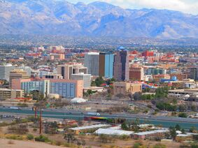
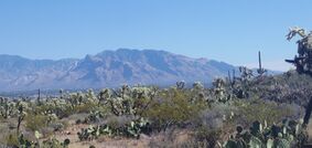
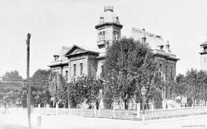
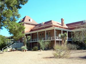
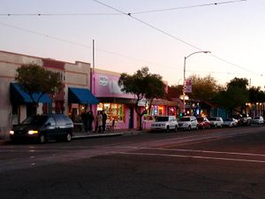
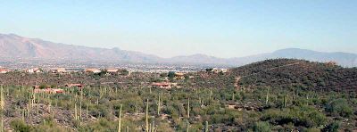
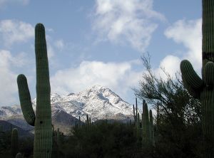
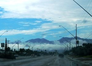
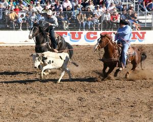
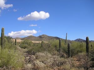
تجاه عقارب الساعة، من أعلى: أفق وسط مدينة توسان، أولاد مين، جامعة أريزونا، كاتدرائية سانت أوجستين، جبال سانتا كتالينا، منتزه ساجوارو الوطني، محكمة مقاطعة پيما | |
| أصل الاسم: O'odham: Cuk Ṣon قالب:IPA-azc، "(عند) قاعدة [التل] الأسود"[بحاجة لمصدر] | |
| الكنية: "مدينة پابليو القديمة", "وادي البصريات"، "البلدة الصغرى الأكبر في أمريكا" | |
 خريطة تفاعلية لتوسان | |
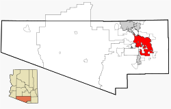 موقع توسان في مقاطعة پيما | |
| الإحداثيات: 32°13′18″N 110°55′35″W / 32.22167°N 110.92639°W | |
| البلد | الولايات المتحدة |
| الولاية | أريزونا |
| المقاطعة | پيما |
| تأسست | 20 أغسطس 1775 |
| دُمجت | 7 فبراير 1877[1] |
| أسسها | هوجو أوكونور |
| السمِيْ | Oʼodham for "(at the) base of the black hill” |
| الدائرة | |
| الحكومة | |
| • النوع | حكومة المجلس-رئيس المدينة |
| • الكيان | مجلس مدينة توسان |
| • العمدة | رجينا روميرو (د) |
| • نائب العمدة | لان سانتا كروز |
| • رئيس المدينة | مايكل أورتيجا |
| • مجلس المدينة | قائمة
|
| المساحة | |
| • مدينة | 241٫33 ميل² (625٫04 كم²) |
| • البر | 241٫01 ميل² (624٫22 كم²) |
| • الماء | 0٫32 ميل² (0٫82 كم²) |
| المنسوب | 2٬389 ft (728 m) |
| التعداد (2020) | |
| • مدينة | 542٬629 |
| • الترتيب | رقم 33 في الولايات المتحدة رقم 2 في أريزونا |
| • الكثافة | 2٬251٫44/sq mi (869٫29/km2) |
| • Urban | 875٬441 (الولايات المتحدة: رقم 52) |
| • الكثافة الحضرية | 2٫449٫8/sq mi (945٫9/km2) |
| • العمرانية | 1٬043٬433 (الولايات المتحدة: رقم 53) |
| صفة المواطن | توساني |
| منطقة التوقيت | UTC-07:00 (MST (no DST)) |
| الرمز البريدي | 85701-85775 |
| رمز المنطقة | 520 |
| رمز FIPS | 04-77000 |
| GNIS feature ID | 43534[4] |
| الموقع الإلكتروني | tucsonaz |
| 1 Urban = 2010 Census | |
توسان (إنگليزية: Tucson؛ /ˈtuːsɒn/؛ TOO-saun؛ إسپانية: Tucson، O'odham: Cuk-Ṣon)، هي مدينة ومركز مقاطعة پيما، أريزونا، الولايات المتحدة،[5] وهي مقر جامعة أريزونا. وهي ثاني أكبر مدن أريزونا بعد فينكس، بتعداد سكان 542.629 نسمة بحسب تعداد الولايات المتحدة 2020،[6] بينما كان إجمالي سكان منطقة إحصائية كبرى|منطقة توسان الإحصائية الكبرى]] 1.043.433 نسمة.[7] تشكل منطقة توسان الإحصائية الكبرى جزءاً من منطقة توسان-نوجالس الاحصائية المجمعة. تعتبر كلاً من توسان وفينكس مرتكزاً لرواق أريزونا صن. تقع المدينة على بعد 174 كم جنوب شرق فينكس و97 كم شمال الحدود الأمريكية المكسيكية.[5] تحتل توسان الترتيب 34 كأكبر مدن الولايات المتحدة ورقم 53 كأكبر منطقة كبرى في البلاد (2014).
تشمل الضواحي الرئيسية المدمجة في توسان وادي أورو ومارانا شمال غرب المدينة، ساهواريتا[8] جنوب المدينة، وساوث توسان في جيب بجنوب وسط المدينة. التجمعات المجاورة لتوسان (بعضها داخل حدود المدينة أو متداخلة معها) تشمل كاساس أدوبيس، كاتالينا فوتهيلز، فلوينج ويلز، ميدڤال پارك، تانك ڤيرد، تورتوليتا، ڤيل. تشمل المدن الواقعة خارج منطقة توسان الكبرى بنسون إلى الجنوب الشرقي، كاتالينا وأوراكل إلى الشمال، وجرين ڤالي إلى الجنوب.
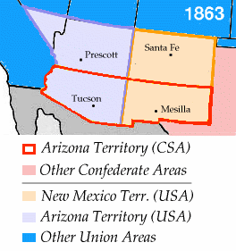
أسس الإسپان توسان كحصن عسكري عندما أذن هوجو أوكونور ببناء حصن توسان عام 1775. دُمجت توسان ولاية سونورا بعد استقلال المكسيك عن الإمبراطورية الإسپانية عام 1821. بموجب شراء جادسن، حصلت الولايات المتحدة من المكسيك على منطقة تبلغ مساحتها 76.840 كم في جنوب أريزونا الحالية وجنوب غرب نيو مكسيكو[9] عام 1853. كان توسان عاصمة أراضي أريزونا من 1867 حتى 1877.[10] كانت توسان أكبر مدينة في أريزونا حسب السزان أثناء فترة أراضي أريزونا والفترة الولائية المبكرة، حتى تعدتها فينكس عام 1920. ومع ذلك، ظل نموها السكاني قويًا خلال أواخر القرن العشرين. كانت توسان أول مدينة أمريكية صنفتها اليونسكو "كمدينة فن الطبخ" عام 2015.[11]
اسم المدينة الإسپاني Tucsón (النطق الإسپاني: [tuɣˈson])، مشتق من الكلمة الأودهامية Cuk Ṣon (قالب:IPA-azc)، ويعني "(عند) قاعدة [التل] الأسود"،[12] إشارة إلى التل المغطى بالبازلت يُعرف الآن باسم سنتشينل پيك . يشار إلى توسان في بعض الأحيان باسم پويبلو ووادي البصريات، ويشير هذا الأخير إلى علومها البصرية والتلسكوبات المعروفة في جميع أنحاء العالم.
التاريخ
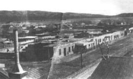
The Tucson area was probably first visited by Paleo-Indians, who were known to have been in southern Arizona about 12,000 years ago. Recent archaeological excavations near the Santa Cruz River found a village site dating from 2100 BC.[13] The floodplain of the Santa Cruz River was extensively farmed during the Early Agricultural Period, c. 1200 BC to AD 150. These people hunted, gathered wild plants and nuts, and ate corn, beans, and other crops grown using irrigation canals they constructed.[13]
The Early Ceramic period occupation of Tucson had the first extensive use of pottery vessels for cooking and storage. The groups designated as the Hohokam lived in the area from AD 600 to 1450 and are known for their vast irrigation canal systems and their red-on-brown pottery.[14][15]
Spanish Jesuit missionary Eusebio Francisco Kino first visited the Santa Cruz River valley in 1692. He founded the Mission San Xavier del Bac in 1700, about 7 mi (11 km) upstream from the site of the settlement of Tucson. A separate Convento settlement was founded downstream along the Santa Cruz River, near the base of what is now known as "A" mountain. Hugo Oconór (Hugo O'Conor), the founding father of the city of Tucson, Arizona, authorized the construction of a military fort in that location, Presidio San Agustín del Tucsón, on August 20, 1775 (the present downtown Pima County Courthouse was built near this site). During the Spanish period of the presidio, attacks such as the Second Battle of Tucson were repeatedly mounted by the Apache. Eventually, the town came to be called Tucsón, a Spanish version of the O'odham word for the area. It was included in the state of Sonora after Mexico gained independence from the Kingdom of Spain and its Spanish Empire in 1821.[بحاجة لمصدر]
During the Mexican–American War in 1846–1848, Tucsón was captured by Philip St. George Cooke with the Mormon Battalion, but it soon returned to Mexican control as Cooke proceeded to the west, establishing Cooke's Wagon Road to California. Tucsón was not included in the Mexican Cession to the United States following the war. Cooke's road through Tucsón became one of the important routes into California during the California Gold Rush of 1849.[بحاجة لمصدر]
The US acquired those portions of (modern day) Arizona that lay south of the Gila River by treaty from Mexico in the Gadsden Purchase on June 8, 1854. Under this treaty and purchase, Tucsón became a part of the United States of America. The American military did not formally take over control until March 1856. In time, the name of the town became standardized in English in its current form, where the stress is on the first syllable, the "u" is long, and the "c" is silent.
In 1857, Tucson was established as a stage station on the San Antonio-San Diego Mail Line. In 1858, it became third division headquarters of the Butterfield Overland Mail and operated until the line was shut down in March 1861. The Overland Mail Corporation attempted to continue running, but following the Bascom Affair, devastating Apache attacks on the stations and coaches ended operations in August 1861.[بحاجة لمصدر]
Tucson was incorporated in 1877, making it the oldest incorporated city in Arizona.[بحاجة لمصدر]
تأسست كمدينة عام 1858 هي ثاني أكبر مدن أريزونا بعد فينكس بلغ عدد سكانها عام 2005 حوالي 515.526نسمة تعتبر من اهم المدن في الولاية عندما أسست أسست بعيدا عن أراضي الهنود الحمر الذين كانوا منتشرين في الولاية لكن الهنود رفضوا وضع مستوطنة بالقرب منهم ونشأت حرب بين المدينة والهنود الحمر حتى استطاع سكان المدينة إرغام الهنود على البقاء وأجبروهم على الرحيل وبسبب كل ما جرى ولذلك إحتاجت إلى وقت طويل لتصبح مدينة بالكامل.
الجغرافيا

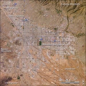
أفق المدينة
المناخ
| توسن | ||||||||||||||||||||||||||||||||||||||||||||||||||||||||||||
|---|---|---|---|---|---|---|---|---|---|---|---|---|---|---|---|---|---|---|---|---|---|---|---|---|---|---|---|---|---|---|---|---|---|---|---|---|---|---|---|---|---|---|---|---|---|---|---|---|---|---|---|---|---|---|---|---|---|---|---|---|
| جدول الطقس (التفسير) | ||||||||||||||||||||||||||||||||||||||||||||||||||||||||||||
| ||||||||||||||||||||||||||||||||||||||||||||||||||||||||||||
| ||||||||||||||||||||||||||||||||||||||||||||||||||||||||||||
التوزيع السكاني
| التعداد تاريخياً | |||
|---|---|---|---|
| الإحصاء | التعداد | %± | |
| 1850 | 400 | ||
| 1860 | 915 | 128.8% | |
| 1870 | 3٬215 | 251.4% | |
| 1880 | 7٬007 | 117.9% | |
| 1890 | 5٬150 | -26.5% | |
| 1900 | 7٬531 | 46.2% | |
| 1910 | 13٬193 | 75.2% | |
| 1920 | 20٬292 | 53.8% | |
| 1930 | 32٬506 | 60.2% | |
| 1940 | 35٬752 | 10.0% | |
| 1950 | 45٬454 | 27.1% | |
| 1960 | 212٬892 | 368.4% | |
| 1970 | 262٬933 | 23.5% | |
| 1980 | 330٬537 | 25.7% | |
| 1990 | 405٬371 | 22.6% | |
| 2000 | 486٬699 | 20.1% | |
| تقديري 2007 | 525٬529 | 8.0% | |
| sources:[16][17] | |||
السياسة
الاقتصاد
الثقافة والفنون
الرياضة
الحدائق والمنتزهات
الاعلام
الحكومة
التعليم
| Public Schools | |
|---|---|
| District | Area(s) served |
| Altar Valley School District | Located southwest of the city, primarily serving Three Points. |
| Amphitheater Public Schools | Serves segments of the North Side, Casas Adobes, Catalina Foothills, and the communities of Oro Valley, eastern Tortolita and Catalina northwest of the city. |
| Catalina Foothills Unified School District | Serves segments of the upper Catalina Foothills north of the city. |
| Continental School District | Serves the rural area south of Sahuarita. |
| Flowing Wells Unified School District | Serves segments of the North Side and the Northwest Side along I-10. |
| Marana Unified School District | Serves the town of Marana, Picture Rocks, Avra Valley and western Tortolita northwest of the city. |
| Sahuarita Unified School District | Located south of the city and serves Sahuarita and Arivaca. |
| Sunnyside Unified School District | Serves the far South Side and segments of the Southwest Side. |
| Tanque Verde Unified School District | Serves the far Northeast Side, including the community of Tanque Verde. |
| Tucson Unified School District | Encompasses the central Tucson valley, including the lower Catalina Foothills and segments of the Tanque Verde Valley. As the largest school district in Tucson in terms of enrollment, TUSD has 115 schools serving grades K–12. |
| Vail School District | Serves the far Southeast Side, including the community of Vail. |
النقل
المدن الشقيقة
Tucson لها eleven مدن شقيقة، حسب توصيف المدن الشقيقة الدولية:
 Almaty, قزاخستان
 Ciudad Obregón, Sonora, المكسيك
 County Roscommon, ايرلندا
 Guadalajara, Jalisco, المكسيك
 Liupanshui, الصين
 Nouakchott, موريتانيا
 Pécs, المجر
 Segovia, Castile and León, اسبانيا
 السليمانية, العراق
 Taichung City. تايوان
 Trikala, اليونان
انظر أيضا
- National Register of Historic Places listings in Pinal County, Arizona
- List of people from Tucson, Arizona
- Tucson Garbage Project
- Davis-Monthan Air Force Base
المصادر
- ^ "Annexations | Official website of the City of Tucson". Tucsonaz.gov. Archived from the original on March 27, 2017. Retrieved April 21, 2017.
- ^ "2020 U.S. Gazetteer Files". United States Census Bureau. Retrieved October 29, 2021.
- ^ "2020 Population and Housing State Data". United States Census Bureau. Retrieved August 22, 2021.
- ^ "Tucson". نظام معلومات الأسماء الجغرافية، المسح الجيولوجي الأمريكي.
- ^ أ ب "Find a County". National Association of Counties. Archived from the original on May 31, 2011. Retrieved June 7, 2011.
- ^ "U.S. Census website". United States Census Bureau. Retrieved May 25, 2018.
- ^ Trevisan, Sesto (February 8, 2018). "Tucson – A Fast Growing AZ City". Qedfinancialsystems.com. Archived from the original on February 10, 2018. Retrieved February 8, 2018.
- ^ Leighton, David (Feb 8, 2016). "Street Smarts: Sahuarita's name may be misspelling". Arizona Daily Star. Archived from the original on February 10, 2016. Retrieved February 14, 2016.
- ^ "Gadsden Purchase Treaty". National Archives (in الإنجليزية). August 15, 2016. Retrieved February 27, 2020.
- ^ "Capitals of the Arizona Territory". Pima County Public Library (in الإنجليزية الأمريكية). December 9, 2014. Archived from the original on August 9, 2020. Retrieved February 27, 2020.
- ^ "Tucson Named First UNESCO City of Gastronomy in the USA". Visit Tucson (in الإنجليزية). Archived from the original on June 20, 2019. Retrieved June 14, 2019.
- ^ Saxton, Dean; Saxton, Lucille; Enos, Susie (1983). Tohono O'odham/Pima to English, English to Tohono O'odham/Pima Dictionary. Tucson, AZ: The University of Arizona Press. ISBN 9780816519422.
- ^ أ ب Thiel, J. Homer; Diehl, Michael W. "Cultural History of the Tucson Basin and the Project Area" (PDF). Archived from the original (PDF) on October 3, 2017. Retrieved October 3, 2017.
- ^ "The Hohokam". Arizona Museum of Natural History. Archived from the original on October 3, 2017. Retrieved October 3, 2017.
- ^ Mabry, Jonathan B.; Thiel, J. Homer (1995). "A thousand years of irrigation in Tucson" (PDF). Archaeology in Tucson. No. Fall 1995. Center of Desert Archaeology. Archived from the original (PDF) on April 12, 2019. Retrieved October 3, 2017.
- ^ Moffatt, Riley. Population History of Western U.S. Cities & Towns, 1850–1990. Lanham: Scarecrow, 1996, 16.
- ^ "Subcounty population estimates: Arizona 2000–2007" (CSV). United States Census Bureau, Population Division. 2009-03-18. Retrieved 2009-04-25.
قراءات اضافية
- Bancroft, Hubert Howe, 1888, History of Arizona and New Mexico, 1530–1888. The History Company, San Francisco.
- Cooper, Evelyn S., 1995, Tucson in Focus: The Buehman Studio. Arizona Historical Society, Tucson. (ISBN 0-910037-35-3).
- Dobyns, Henry F., 1976, Spanish Colonial Tucson. University of Arizona Press, Tucson. (ISBN 0-8165-0546-2).
- Drachman, Roy P., 1999, From Cowtown to Desert Metropolis: Ninety Years of Arizona Memories. Whitewing Press, San Francisco. (ISBN 1-888965-02-9.
- Fontana, Bernard L., 1996, Biography of a Desert Church: The Story of Mission San Xavier del Bac. Smoke Signal, Tucson Corral of the Westerners.
- Hand, George, 1995, Whiskey, Six-Guns and Red-Light Ladies. High Lonesome Books, Silver City, New Mexico. (ISBN 0-944383-30-0).
- Hand, George, 1996, The Civil War in Apacheland. High Lonesome Books, Silver City, New Mexico. (ISBN 0-944383-36-X).
- Harte, John Bret, 2001, Tucson: Portrait of a Desert Pueblo. American Historical Press, Sun Valley, California. (ISBN 1-892724-25-1).
- Henry, Bonnie, 1992, Another Tucson. Arizona Daily Star, Tucson. (ISBN 0-9607758-2-X).
- Kalt III, William D., 2007, Tucson Was a Railroad Town., VTD Rail Publishing, Tucson. (ISBN 978-09719915-4-5).
- McIntyre, Allan J. and the Arizona Historical Society, 2008, The Tohono O'odham and Pimeria Alta., Arcadia Publishing, Charleston, South Carolina. (ISBN 978-0738556-33-8).
- Moisés, Rosalio, 2001, The Tall Candle: The Personal Chronicle of a Yaqui Indian. University of Nebraska Press. (ISBN 0-8032-0747-6).
- Painter, Muriel Thayer, 1971, A Yaqui Easter. University of Arizona Press, Tucson. (ISBN 0816501688). Read online.
- Ronstadt, Edward E. (editor), 1993, Borderman: The Memoirs of Federico Jose Maria Ronstadt. University of New Mexico Press, Albuquerque. (ISBN 0826314627) Read online.
- Schellie, Don, 1968, Vast Domain of Blood: The Story of the Camp Grant Massacre. Westernlore Press, Tucson.
- Sheaffer, Jack and Steve Emerine, 1985, Jack Sheaffer's Tucson, 1945–1965. Arizona Daily Star, Tucson. (ISBN 0-9607758-1-1).
- Sheridan, Thomas E., 1983, Del Rancho al Barrio: The Mexican legacy of Tucson. Arizona Historical Society, Tucson.
- Sheridan, Thomas E., 1992, Los Tucsonenses: The Mexican Community in Tucson, 1854–1941. University of Arizona Press, Tucson. (ISBN 0-8165-1298-1).
- Sonnichsen, C. L., 1987, Tucson: The Life and Times of an American City. University of Oklahoma Press, Norman. (ISBN 0-8061-2042-8).
- Woosley, Anne I. and the Arizona Historical Society: 2008, Early Tucson. Arcadia Publishing, Charleston, South Carolina. (ISBN 0738556467).
وصلات خارجية
- Official City of Tucson government website
- Metropolitan Tucson Convention & Visitors Bureau
- Tucson Metropolitan Chamber of Commerce
- توسان، أريزونا at Curlie
 Geographic data related to توسان، أريزونا at OpenStreetMap
- "Tucson, Arizona". C-SPAN Cities Tour. November 2016.
- Pages using gadget WikiMiniAtlas
- CS1 الإنجليزية الأمريكية-language sources (en-us)
- Short description is different from Wikidata
- Articles with hatnote templates targeting a nonexistent page
- Missing redirects
- Pages using multiple image with auto scaled images
- Articles containing O'odham-language text
- Pages using Lang-xx templates
- Articles with unsourced statements from September 2021
- Coordinates on Wikidata
- Articles containing إنگليزية-language text
- Articles containing إسپانية-language text
- Lang and lang-xx code promoted to ISO 639-1
- Articles with unsourced statements from November 2018
- Articles with unsourced statements from November 2011
- Pages with empty portal template
- Articles with Curlie links
- توسن، أريزونا
- مدن أريزونا
- مقاعد مقاطعة في أريزونا
- مدن تأسست في 1775
- Tucson, Arizona
- Tucson metropolitan area
- Cities in Arizona
- County seats in Arizona
- Arizona placenames of Native American origin
- Populated places in the Sonoran Desert
- Populated places established in 1775
- 1775 establishments in New Spain
- Butterfield Overland Mail
- San Antonio–San Diego Mail Line
- Stagecoach stops in the United States
- Cities in Pima County, Arizona
- Metropolitan areas of Arizona
- صفحات مع الخرائط
