پاترسون، نيوجرزي
پاترسون، نيوجرزي | |
|---|---|
| مدينة پاترسون | |
 Downtown Paterson in 2024 | |
 Flag  الشعار  Coat of arms Logo | |
| الكنية: مدينة الحرير[1]، "رام الله الصغيرة" | |
| الشعار: Spe et Labore (Latin) "By hope and effort" | |
 خريطة پاترسون في مقاطعة پاسيك. | |
 خريطة پاترسون، نيوجرزي، مكتب الاحصاءات. | |
 Paterson Location in Passaic County  Paterson Location in New Jersey  Paterson Location in the United States | |
| Coordinates: 40°54′53″N 74°09′46″W / 40.914746°N 74.162826°W | |
| البلد | |
| الولاية | |
| المقاطعة | پاسيك |
| تأسست | 22 نوفمبر 1791 |
| دُمجت | 11 أبريل 1831 (كبلدة) |
| أعيد إدماجها | 14 أ[ريل 1851 (كمدينة) |
| Named after | وليام پاترسون |
| Government | |
| • Type | Faulkner Act المجلس-العمدة |
| • العمدة | Andre Sayegh (term ends June 30, 2026)[4] |
| • Business Administrator | Kathleen Long[5] |
| • Municipal clerk | Sonia Gordon[6] |
| Area | |
• Total | 8٫704 ميل² (22٫544 كم²) |
| • Land | 8٫428 ميل² (21٫829 كم²) |
| • Water | 0٫276 ميل² (0٫715 كم²) 3.17% |
| • Rank | 223rd of 566 in state 7th of 16 in county[2] |
| Elevation | 112 ft (34 m) |
| Population | |
• Total | 159٬732 |
| 156٬452 | |
| • Rank | 168th in country (as of 2023)[11] 3rd of 565 in state 1st of 16 in county[13] |
| • Density | 18٬986٫3/sq mi (7٬330٫7/km2) |
| • Rank | 11th of 565 in state 2nd of 16 in county[13] |
| Time zone | UTC-5 (الشرقية (EST)) |
| • Summer (DST) | UTC-4 (الشرقية (EDT)) |
| الرموز البريدية | 07501-07505, 07508-07514, 07522, 07524, 07533, 07538, 07543, 07544[14] |
| Area code(s) | 201 and 973[15] |
| FIPS code | 3403157000[2][16][17] |
| GNIS feature ID | 0885343[2][18] |
| Website | www |
پاترسون Paterson، هي أكبر مدينة ومقعد مقاعدة في مقاطعة پاسيك، نيوجرزي، الولايات المتحدة،[19][20] في منطقة مدينة نيويورك الكبرى. في تعداد 2010 كان عدد سكانها 146.199 نسمة،sey's third-most-populous city[21] مما يعكس انخفاض بمقدار 3.023 (-2%) من 149.222 نسمة في تعداد 2000، والذي زاد بدوره بمقدار 8.331 نسمة (+5.9%) عن 140.891 نسمة في تعداد 1990.[22]
كانت المدينة من الوجهات الرئيسية للمهاجرين الهسپان فضلاً عن المهاجرين القادمين من العالم العربي والإسلامي. ولديها ثاني أكبر عدد من المسلمين في الولايات المتحدة.[23]
التاريخ
 مقالة مفصلة: تاريخ نيوجرزي
The area of Paterson was inhabited by the Algonquian-speaking Native American Acquackanonk tribe of the Lenape, also known as the Delaware Indians. The land was known as the Lenapehoking. The Dutch claimed the land as New Netherlands, followed by the British as the Province of New Jersey.[24]
التأسيس


In 1791, Alexander Hamilton (1755/57–1804), first United States Secretary of the Treasury, helped found the Society for Establishing Useful Manufactures (S.U.M.), which helped encourage the harnessing of energy from the Great Falls of the Passaic River to secure economic independence from British manufacturers. The society founded Paterson, which became the cradle of the Industrial Revolution in America.[25] Paterson was named for William Paterson, statesman, signer of the Constitution and Governor of New Jersey, who signed the 1792 charter that established the Town of Paterson.[26][27]
Architect, engineer and city planner Pierre L'Enfant (1754–1825), who had earlier developed the initial plans for Washington, D.C., was the first planner for the S.U.M. project.[28] His plan proposed to harness the power of the Great Falls through a channel in the rock and an aqueduct. The society's directors felt he was taking too long and was over budget; he was replaced by Peter Colt, who used a less complicated reservoir system to get the water flowing to factories in 1794. Eventually, Colt's system developed some problems and a scheme resembling L'Enfant's original plan was used after 1846.[29][30]
Paterson was originally formed as a township from portions of Acquackanonk Township on April 11, 1831, while the area was still part of Essex County. It became part of the newly created Passaic County on February 7, 1837, and was incorporated as a city on April 14, 1851, based on the results of a referendum held that day. The city was reincorporated on March 14, 1861.[31]
النمو الصناعي
The 77-قدم-high (23 m) Great Falls and a system of water raceways that harnessed the falls' power provided power for the mills in the area until 1914 and fostered growth of the city.[32] The district originally included dozens of mill buildings and other manufacturing structures associated with the textile industry and, later, the firearms, silk, and railroad locomotive manufacturing industries. In the latter half of the 19th century, silk production became the dominant industry and formed the basis of Paterson's most prosperous period, earning it the nickname "Silk City."[33]
In 1835, Samuel Colt began producing firearms in Paterson, but within a few years moved his business to Hartford, Connecticut. Later in the 19th century, Paterson was the site of early experiments with submarines by Irish-American inventor John Philip Holland. Two of Holland's early models—one found at the bottom of the Passaic River—are on display in the Paterson Museum, housed in the former Rogers Locomotive and Machine Works near the Passaic Falls.[34]
Behind Newark and New York, the brewing industry was booming in Paterson in the late 1800s. Braun Brewery, Sprattler & Mennell, Graham Brewery, The Katz Brothers, and Burton Brewery merged in 1890 to form Paterson Consolidated Brewing Company. Hinchliffe Brewing and Malting Company, founded in 1861, produced 75,000 barrels a year from its state-of-the-art facility at 63 Governor Street. All the breweries closed during Prohibition.[35]
The city was a mecca for immigrant laborers, who worked in its factories, particularly Italian weavers from the Piedmont and Naples regions. Paterson was the site of historic labor unrest that focused on the six-month-long Paterson silk strike of 1913 led by Luigi Galleani and Carlo Tresca that demanded the eight-hour day and better working conditions. It was defeated, with workers returning at the end of the strike without having negotiated any changes.[36]
In 1919, Paterson was one of eight locations bombed by self-identified anarchists.[37]
-
 A view of Paterson ح. 1880
 -
 The central business district of Paterson at the intersection of Market and Main Streets, 1911
.jpg&filetimestamp=20260501144638&)
فترة ما بعد الحرب العالمية
During World War II, Paterson played an important part in the aircraft engine industry. By the end of the war, however, urban areas were in decline; Paterson was no exception. Beginning in the late 1960s, the city suffered high unemployment rates and white flight.[38]
According to the New Jersey Historical Commission, Paterson's industrialism ended “as the economy and technological needs of the United States changed. By 1983, Paterson was the fifth poorest city in the United States. The town that had called itself Silk City, the Iron City, and the Cotton City, was in economic ruin”.[39] Once millwork and production left the city, Paterson's poverty became reminiscent of what occurred in the towns surrounding the Appalachian Mountains once the coal mining industry ended. In 2020, 25.2% of Paterson residents lived in poverty.[9]
Competition from malls in upscale neighboring towns like Wayne and Paramus forced large chain stores out of Paterson's downtown. With the decline of the city's industrial base, small businesses became the city's most prominent businesses. But the city still attracts many immigrants, who have revived its economy, especially through small businesses.[40][مطلوب مصدر أفضل]
The downtown area has been struck by massive fires several times, most recently on January 17, 1991. In this fire, almost an entire city block was engulfed in flames due to an electrical fire in the basement of a bar at 161 Main Street.[41] Firefighter John A. Nicosia lost his life in the fire.[42] A plaque honoring his memory was later placed on a wall near the area. The area was so badly damaged that most of the burned buildings were demolished, with an outdoor mall standing in their place. The most notable of the destroyed buildings was the Meyer Brothers department store, which closed in 1987 and had since been parceled out.[43]
Paterson includes numerous locations listed on the National Register of Historic Places, including museums, civic buildings such as City Hall, Hinchliffe Stadium, Public School Number Two and the Danforth Memorial Library, churches (Cathedral of St. John the Baptist and St. Michael's Roman Catholic Church), individual residences, such as Lambert Castle, and districts of the city, such as the Paterson Downtown Commercial Historic District, the Great Falls/Society for the Establishment of Useful Manufactures Historic District and the Eastside Park Historic District.[44]
In August 2011, Paterson was severely affected in the aftermath of Hurricane Irene, particularly by flooding of the Passaic River, where waters rose to levels unseen for 100 years, leading to the displacement of thousands and the closure of bridges over the river.[45] Touring the area with Federal Emergency Management Agency Administrator Craig Fugate, U.S. Homeland Security Secretary Janet Napolitano declared, "This is as bad as I've seen, and I've been in eight states that have been impacted by Irene." The same day, President Obama declared New Jersey a disaster area.[46]
-
 A Hooverville for the unemployed on the outskirts of Paterson, 1937
 -
 Downtown, Paterson, New Jersey
الجغرافيا

Paterson is in the southern part of Passaic County, which is near the northern edge of New Jersey, as a county that spans some hilly areas and has dozens of lakes. The county covers a region about 30 × 20 ميل wide (48 × 32 km). The region is split by major roads, including portions of Interstate 80, which runs through Paterson (see map at left). The Garden State Parkway cuts across the south of Paterson, near Clifton, New Jersey. The Passaic River winds northeast past Totowa into Paterson, where the river then turns south to Passaic town, on the way to Newark, further south.
According to the U.S. Census Bureau, the city had a total area of 8.71 square miles (22.55 km2), including 8.41 square miles (21.79 km2) of land and 0.29 square miles (0.76 km2) of water (3.38%).[2][3]
Unincorporated communities, localities and place names located partially or completely within the city include Riverside and Totowa.[47]
The city borders the municipalities of Clifton, Haledon, Hawthorne, Prospect Park, Totowa and Woodland Park (formerly West Paterson) in Passaic County; and both Elmwood Park (formerly East Paterson) and Fair Lawn in Bergen County.[48][49][50]
Neighborhoods
| ضواحي پاترسون |
| – توتوا سكشن |
| – هيلكرست |
| – مقاطعة گريت فولز التاريخية |
| – ستوني رود |
| – ساوث پاترسون |
| – ليكڤيو |
| – نير إيستسايد |
| – مينور سكشن |
| – مقاطعة إيستسايد پارك التاريخية |
| – ساندي هيل |
| – پيپول پارك |
| – ريڤرسايد |
| – داونتاون |
| – مقاطعة الأعمال المركزية |
| – مقاطعة دبلن التاريخية |
| – ليتل إيتالي |
| – ريگلي پارك |
| – نورثسايد |
Downtown Paterson
Downtown Paterson is the main commercial district of the city and was once a shopping destination for many who lived in North Jersey. After a devastating fire in 1902, the city rebuilt the downtown with massive Beaux-Arts-style buildings, many of which remain to this day. These buildings are usually four to seven stories tall. Downtown Paterson is home to Paterson City Hall and the Passaic County Courthouse Annex, two of the city's architectural landmarks. City Hall was designed by the New York firm Carrere and Hastings in 1894, and was modeled after the Hôtel de Ville (city hall) in Lyon, France, capital of the silk industry in Europe.[51]
The former Orpheum Theatre located on Van Houten Street has been converted to a mosque by the Islamic Foundation of New Jersey. The massive structure, now known as Masjid Jalalabad, can accommodate 1,500 worshipers.[52]
As with many other old downtown districts in the United States, Downtown Paterson suffered as shoppers and retailers moved to the suburban shopping malls of the region. Many historic buildings are in disrepair or are abandoned after years of neglect. In addition, Downtown Paterson is an Urban Enterprise Zone. The city has, in recent years, begun initiatives in hopes of reviving the downtown area with the centerpiece being the Center City Mall, constructed on a large parking lot spanning Ward Street from Main to Church Streets and features retail, entertainment, and commercial space. Downtown Paterson is located in the city's 1st Ward.[53]
Eastside Park
Eastside Park Historic District consists of about 1,000 homes in a variety of architectural styles, including Tudors, Georgian colonials, Victorians, Italianate villas and Dutch colonials. It is located east of downtown. Once the home of the city's industrial and political leaders, the neighborhood experienced a significant downturn as industry fled Paterson. In recent years, gentrification has begun to occur in the neighborhood and some of the area's historic houses have been restored.[citation needed]
The Eastside Park Historic District is a state and nationally registered historic place. The jewel of the neighborhood is Eastside Park and the mansions that surround it. This section of Paterson once had a large Jewish population that reached 40,000 at its peak; a synagogue still remains.[54] Eastside Park and what is commonly known as the Upper Eastside are located in Paterson's 3rd Ward.[55]
East River
East River Section is a section that is referred to by locals roughly bordering Riverside at 5th Avenue and extending south to Broadway, sandwiched in by Madison Avenue to McClean Boulevard (Route 20). However, the neighborhood's layout unofficially extends to the "Paterson-Newark/Hudson Route" of River Road in the Paterson-Memorial Park section of Fair Lawn whose house addresses are in alignment with the now-defunct Jewish synagogue on the corner of 33rd Street and Broadway, which connects Paterson to Newark/Hudson, and at one time was the main route through River Drive, which starts in Elmwood Park and rides north to south along the East Bank of the Passaic River in Paterson's original county.[citation needed]
Built when Paterson was still Bergen County, River Drive changes to River Road in the greater Eastside Sections of Upper Eastside-Manor Section, East River, and Riverside Sections, and turns into Wagaraw Road north of 1st Avenue / Maple Avenue in the old Bunker Hill extension of Columbia Heights in Fair Lawn an indication of not only entering the Industrial Section but also entering the foothills of the Ramapo Mountains in Hawthorne.[citation needed]
River Drive then turns into East Main Street to indicate that you have entered the Northside Section. The East River neighborhood which was and still maintains its "blue-collar" working-class identity, was at one time known for its large Jewish community, as well as a Neapolitan/Italian population and more recently other Mediterranean and Adriatic Europeans, Caribbean and South Americans, and other modern immigrant groups from all over the world, as well as African-Americans.[citation needed]
Manor Section
Manor Section is a residential neighborhood in Paterson. It is located east of East 33rd Street, north of Broadway, and southwest of Route 20 and the Passaic River. The Manor section of Paterson is located in the city's 3rd Ward. The layout and culture of the Manor Section also extends into the neighboring Lyncrest and Rivercrest sections of Fair Lawn, with all the addresses aligning themselves to the now-defunct Jewish Temple, located at the corner of 33rd and Broadway.
South Paterson
South Paterson, also known as Little Istanbul or Little Ramallah, is a diverse neighborhood with a growing number of immigrants from the Middle East, with significant Turkish and Arab communities.[56] The neighborhood is located in the 6th Ward, east of Main Street and west of West Railway Avenue. A majority of the city's Arabs live in this section of Paterson. Many of the retail shops and restaurants cater to this community. The neighborhood is characterized by Halal meat markets which offer goat and lamb, and shop signs are in Arabic. South Paterson's Arab community is mostly made up of Jordanians, Palestinians,[57] Syrians,[58][59] and Lebanese.[60]
Lakeview
Lakeview is situated in the southern part of the city, and is a middle-class neighborhood. Interstate 80 runs north of this district. Lakeview is home to the Paterson Farmers Market, where many people from across North Jersey come to buy fresh produce. The neighborhood is roughly 65% Hispanic, although it also has a significant Filipino presence. Lakeview also shares some of the same characteristics as neighboring Clifton as they both share a neighborhood bearing the same name. The Lakeview section of Paterson is located in the city's 6th ward.
Hillcrest
Hillcrest is a largely residential, middle class enclave, to the west of the downtown area. Its borders' limits are Preakness Avenue to the east, Cumberland Avenue to the west, and Totowa Avenue along with West Side Park and the Passaic River to the south. The neighborhood is very diverse having significant Italian, Arab, and Asian populations. The Hillcrest section of Paterson is located in the city's 2nd Ward.[61]
People's Park
People's Park is a neighborhood located north of 23rd Avenue and south of Market Street. Twenty-First Avenue, or "La Veinte y uno", as it is known by most of Paterson's Spanish-speaking community, is located in the People's Park section of Paterson. It is an active and vibrant retail strip featuring a variety of shops and services catering to a diverse clientele. Twenty-First Avenue used to have a large Italian population. Although there is still a significant Italian presence left in the neighborhood, it also has a large first-generation Hispanic population, particularly Colombian.
Wrigley Park
Wrigley Park is a neighborhood that has suffered from years of poverty, crime, and neglect. It is mostly African-American. Poverty, crime, open-air drug markets, prostitution, vacant lots, and boarded-up windows are all common in this area. However, new houses are being built, and crime has dropped in recent years. This neighborhood is located north of Broadway. It is also known as the '4th Ward'.[61] It was named for a Paterson paper manufacturing family.[62][63]
Sandy Hill
Sandy Hill is a neighborhood in the Eastside located roughly west of Madison Avenue, north of 21st Avenue, south of Park Avenue, and east of Straight Street. Due to Paterson's significant population turn-over, this neighborhood is now home to a large and growing Hispanic community, mostly first-generation Dominicans. The Sandy Hill section of Paterson is located in the city's 5th Ward. Roberto Clemente Park, which was originally known as Sandy Hill Park, is located in this neighborhood.[citation needed]
Part of the 5th Ward is called Near Eastside by residents to differentiate it from the Eastside Park Historic District to its immediate east.
Northside
Northside, located north of Downtown, suffers from many of the social problems facing the Wrigley Park neighborhood, but to a lesser extent. This neighborhood borders the boroughs of Haledon and Prospect Park and is known for its hills and sweeping views of the New York City skyline. The Northside section of Paterson is located in the city's 1st Ward.[citation needed]
Totowa Section
Totowa Section is a large neighborhood located west of the Passaic River, southwest of West Broadway and northeast of Preakness Avenue. As the name implies, it borders the town of Totowa. It is mostly Hispanic but with an increasing South Asian community, mainly Bangladeshi. Many Bengali grocery and clothing stores are located on Union Avenue and the surrounding streets. Masjid Al-Ferdous is located on Union Avenue, which accommodates the daily Bangladeshi pedestrian population.[citation needed]
A large Italian presence remains in this neighborhood. Many Peruvian and other Latin American restaurants and businesses are located on Union Avenue. Colonial Village and Brooks Sloate Terraces are located in this neighborhood. The Totowa Section is located in parts of the 1st and 2nd Wards of Paterson.[citation needed]
Stoney Road
Stoney Road is Paterson's southwesternmost neighborhood, bordering Woodland Park to the south and Totowa across the Passaic River to the west. This neighborhood is home to Pennington Park, Hayden Heights, Lou Costello Pool, the Levine reservoir, Murray Avenue, Mc Bride Avenue, Great Falls (Passaic River) and Garret Heights. The Stoney Road section of Paterson is located in the city's 2nd Ward. It also contains the Great Falls, which is a national historic park.
Riverside
Riverside is a larger neighborhood in Paterson and, as its name suggests, is bound by the Passaic River to the north and east, separating the city from Hawthorne and Fair Lawn. Riverside is a working-class neighborhood. The neighborhood is mostly residential with some industrial uses. Madison Avenue cuts through the heart of this district. Route 20 runs through the eastern border of Riverside, providing an easy commute to Route 80 East and New York City. This section is ethnically diverse with a growing Hispanic community concentrating mostly north and along River Street. Many Albanians make their home in the East 18th Street and River Street areas. River View Terrace is located in this neighborhood. Riverside is located in parts of the 3rd and 4th Wards of Paterson.[citation needed]
Bunker Hill
Bunker Hill is a mostly industrial area west of River Street and east of the Passaic River.
Westside Park
Westside Park is located off Totowa Avenue and is best known as the site of the Holland submarine, Fenian Ram, which was built from 1879 to 1881[64] for the Fenian Brotherhood. It became the target of graffiti artists because the fence surrounding it was too low and too close to the submarine itself. The sub is now located in Paterson Museum.[65] The local Bangladeshi community commemorates International Mother Language Day at a shaheed minar (martyr's monument) built in the park in 2015.[66]
-
 Paterson City Hall, April 2008
 -
 The Great Falls of the Passaic River in Paterson
 -
 Paterson's skyline, showing the canyon of the Passaic River in the foreground. The area along the river was formerly the site of most of the mills that flourished throughout Paterson's history.
 -
 The Islamic Center of Passaic County in Paterson
 -
 House in Paterson's inner city, 1974
 -
 Interstate 80 and the east side of Paterson from the Garrett Mountain Reservation


المناخ
The climate in this area is characterized by hot, humid summers and generally cool to cold winters. According to the Köppen Climate Classification system, Paterson has a humid subtropical climate, abbreviated Cfa on climate maps.[67] Despite the size of the city, it has no weather reporting station, and thus, no historical climate data. Paterson uses Newark's airport for its local weather.[citation needed]
الضواحي


| ضواحي پاترسون |
| – توتوا سكشن |
| – هيلكرست |
| – مقاطعة گريت فولز التاريخية |
| – ستوني رود |
| – ساوث پاترسون |
| – ليكڤيو |
| – نير إيستسايد |
| – مينور سكشن |
| – مقاطعة إيستسايد پارك التاريخية |
| – ساندي هيل |
| – پيپول پارك |
| – ريڤرسايد |
| – داونتاون |
| – مقاطعة الأعمال المركزية |
| – مقاطعة دبلن التاريخية |
| – ليتل إيتالي |
| – ريگلي پارك |
| – نورثسايد |
الديموغرافيا

| التعداد | Pop. | ملاحظة | %± |
|---|---|---|---|
| 1840 | 7٬596 | — | |
| 1850 | 11٬334 | 49٫2% | |
| 1860 | 19٬586 | 72٫8% | |
| 1870 | 33٬579 | 71٫4% | |
| 1880 | 51٬031 | 52�0% | |
| 1890 | 78٬347 | 53٫5% | |
| 1900 | 105٬171 | 34٫2% | |
| 1910 | 125٬600 | 19٫4% | |
| 1920 | 135٬875 | 8٫2% | |
| 1930 | 138٬513 | 1٫9% | |
| 1940 | 139٬656 | 0٫8% | |
| 1950 | 139٬336 | −0٫2% | |
| 1960 | 143٬663 | 3٫1% | |
| 1970 | 144٬824 | 0٫8% | |
| 1980 | 137٬970 | −4٫7% | |
| 1990 | 140٬891 | 2٫1% | |
| 2000 | 149٬222 | 5٫9% | |
| 2010 | 146٬199 | −2�0% | |
| 2020 | 159٬732 | 9٫3% | |
| 2023 (تق.) | 156٬452 | [9][11][12] | −2٫1% |
| Population sources: 1800–1920[68] 1840–1900[69] 1840–1870[70] 1840[71] 1850[72] 1870[73] 1880–1890[74] 1890–1910[75] 1860–1930[76] 1940–2000[77] 2000[78][79] 2010[80][81][21] 2020[9][10] | |||
According to then-Mayor Jose Torres, Paterson had 52 distinct ethnic groups in 2014.[82] By 2020, Paterson had the second-largest Muslim population in the United States by percentage.[83] Paterson's rapidly growing Bangladeshi American,[84] Turkish American, Arab American,[85] Albanian American, Bosnian American, Dominican American, and Peruvian American communities are among the largest and most prominent in the United States, the latter owing partially to the presence of the Consulate of Peru.[86] Paterson's Muslim population has been estimated at 25,000 to 30,000.[1] Paterson has become a prime destination for one of the fastest-growing communities of Dominican Americans, who have become the city's largest ethnic group.[87] The Puerto Rican population has established a highly significant presence as well.[88]
2020 census
This section requires expansion with: examples with reliable citations. (September 2021) |
| Race / Ethnicity (NH = Non-Hispanic) | Pop 1990[89] | Pop 2000[90] | Pop 2010[91] | Pop 2020[92] | % 1990 | % 2000 | % 2010 | % 2020 |
|---|---|---|---|---|---|---|---|---|
| White alone (NH) | 34,571 | 19,765 | 13,426 | 12,523 | 24.54% | 13.25% | 9.18% | 7.84% |
| Black or African American alone (NH) | 46,100 | 46,882 | 41,431 | 36,667 | 32.72% | 31.42% | 28.34% | 22.96% |
| Native American or Alaska Native alone (NH) | 225 | 242 | 217 | 186 | 0.16% | 0.16% | 0.15% | 0.12% |
| Asian alone (NH) | 1,754 | 2,728 | 4,663 | 7,991 | 1.24% | 1.83% | 3.19% | 5.00% |
| Pacific Islander alone (NH) | N/A | 56 | 21 | 17 | N/A | 0.04% | 0.01% | 0.01% |
| Other race alone (NH) | 530 | 496 | 437 | 1,260 | 0.38% | 0.33% | 0.30% | 0.79% |
| Mixed race or Multiracial (NH) | N/A | 4,279 | 1,750 | 2,225 | N/A | 2.87% | 1.20% | 1.39% |
| Hispanic or Latino (any race) | 57,711 | 74,774 | 84,254 | 98,863 | 40.96% | 50.11% | 57.63% | 61.89% |
| Total | 140,891 | 149,222 | 146,199 | 159,732 | 100.00% | 100.00% | 100.00% | 100.00% |
الجماعات العرقية
منذ بدياتها المبكرة، كانت پاترسون بوتقة صهر. في القرن 18 استقر بها المهاجرون الأيرلنديون، الألمان، الهولنديون، واليهود. سرعان ما تبعهم المهاجرون الإيطاليون والشرق أوروپيون. في أوائل 1890، وصل إلى المدينة الكثير من المهاجرين السوريين واللبنانيون.
تضم پاترسون ثالث أكبر جالية أمريكية-دومينيكة في الولايات المتحدة، بعد مدينة نيويورك ولورنس، مساتشوستس. في تعداد 2000، أدرج 10.27% أنفسهم على أنهم من أصول أمريكية دومينيكية، وتضم ثاني أكبر جالية أمريكية عربية بعد ديربورن، مشگن.[85] انعكاساً لهذه الجاليات، تحتفل مدرستي پاترسون ومنتزه پروسپكت الحكومية بالعطلات الإسلامية. ضاحية جنوب پاترسون عبارة عن إسطنبول الصغرى واتي أصبحت تعرف أيضاً باسم "رام الله الصغرى"،[93] والتي تعتبر مركز للسكان الأمريكان الفلسطينيين الآخذين في الازدياد.[57] تضم پاترسون الرابطة المدنية للأمريكان العرب والتي تقدم برنامج للغة العربية في مدارس پاترسون الحكومية والتي تخدم 125 طالب في 9 مدارس في أيام السبت.[94]
الديانات
الإسلام

في 11 مارس 2020، صوت مجلس مدينة پاترسون، ثالث أكبر مدن ولاية نيوجرزي الأمريكية على رفع الآذان للصلاة عبر مكبرات الصوت. بموجب هذا القرار، يُسمح برفع الآذان، عبر مكبرات الصوت من المساجد ما بين الساعة 6 صباحاً حتى 10 مساءاً بارتفاع صوت محدد وبما لا يتجاوز خمس دقائق. يبلغ عدد مسلمي پاترسون حوالي 30.000 من إجمالي سكان المدينة البالغ عددهم 146.000 نسمة تقريباً.[95]
وبذلك أصبحت پاترسون المدينة الثالثة التي تسمح بالآذان، بعد هامتراميك وديربورن، مشيگن، وكلاهما في ولاية مشيگن الأمريكية.
الحكومة
الحكومة المحلية
التمثيل الفدرالي، الولائي، والمقاطعي
السياسة
خدمات الطوارئ
التجارة
النقل
الطرق والطرق السريعة
النقل العام
التعليم
الفنون والترفيه
مدن شقيقة
المدن الشقيقة پاترسون تشمل:
 إسكيشهر، تركيا، 22 مايو 2002[96]
 ليون، فرنسا[citation needed]
 لويل، مساتشوستس[citation needed]
 سيلهت، بنگلادش[citation needed]
 سرات، الهند[97]
- بارودا، الهند[98]
 مدينة يولين، الصين[99]
الصداقة

في الثقافة العامة
- ألف إيليا أبو ماضي الشاعر اللبناني المهاجر إلى الولايات المتحدة، قصيدة تتغزل في پترسون، بعنوان أم القرى: يقول في مطلعها:
| أبصرتها، والشمس عند شروقها | فرأيتها مغمورة بالنار |
| ورأيتها عند الغروب غريقه | في لجّة من سندس ونضار |
| ورأيتها تحت الدجى، فرأيتها | في بردتين: سكينة ووقار |
| فتنبّهت في النفس أحلام الصبى | وغرقت في بحر من التّذكار |
| نفسي لها من جنّة خلّابة | نسجت غلائلها يد الأمطار |
| أنّى مشيت نشقت مسكا أزفرا | في أرضها وسمعت صوت هزار |
| ذات الجبال الشّامخات إلى العلا يا | ليت في أعلى جبالك داري |
مشاهير المدينة
انظر أيضاً
المصادر
- ^ أ ب خطأ استشهاد: وسم
<ref>غير صحيح؛ لا نص تم توفيره للمراجع المسماةReuters - ^ أ ب ت ث ج ح Gazetteer of New Jersey Places, United States Census Bureau. Accessed June 14, 2013.
- ^ أ ب US Gazetteer files: 2010, 2000, and 1990, United States Census Bureau. Accessed September 4, 2014. خطأ استشهاد: وسم
<ref>غير صالح؛ الاسم "GR1" معرف أكثر من مرة بمحتويات مختلفة. - ^ خطأ استشهاد: وسم
<ref>غير صحيح؛ لا نص تم توفيره للمراجع المسماةMayor - ^ Administration, City of Paterson. Accessed March 2, 2023.
- ^ Municipal Clerk, City of Paterson. Accessed March 2, 2023.
- ^ خطأ استشهاد: وسم
<ref>غير صحيح؛ لا نص تم توفيره للمراجع المسماةDataBook - ^ U.S. Geological Survey Geographic Names Information System: City of Paterson, Geographic Names Information System. Accessed March 8, 2013.
- ^ أ ب ت ث ج QuickFacts Paterson city, New Jersey, United States Census Bureau. Accessed December 11, 2022.
- ^ أ ب Total Population: Census 2010 - Census 2020 New Jersey Municipalities Archived فبراير 13, 2023 at the Wayback Machine, New Jersey Department of Labor and Workforce Development. Accessed December 1, 2022.
- ^ أ ب ت خطأ استشهاد: وسم
<ref>غير صحيح؛ لا نص تم توفيره للمراجع المسماةANNRNK - ^ أ ب Annual Estimates of the Resident Population for Minor Civil Divisions in New Jersey: April 1, 2020 to July 1, 2023 Archived مايو 24, 2024 at the Wayback Machine, United States Census Bureau, released May 2024. Accessed May 16, 2024.
- ^ أ ب Population Density by County and Municipality: New Jersey, 2020 and 2021 Archived مارس 7, 2023 at the Wayback Machine, New Jersey Department of Labor and Workforce Development. Accessed March 1, 2023.
- ^ Look Up a ZIP Code, United States Postal Service. Accessed September 4, 2011.
- ^ Area Code Lookup - NPA NXX for Paterson, NJ, Area-Codes.com. Accessed November 7, 2014.
- ^ American FactFinder, United States Census Bureau. Accessed September 4, 2014.
- ^ A Cure for the Common Codes: New Jersey, Missouri Census Data Center. Accessed August 5, 2012.
- ^ US Board on Geographic Names, United States Geological Survey. Accessed September 4, 2014.
- ^ Find a County, National Association of Counties. Accessed January 27, 2015.
- ^ Passaic County, NJ, National Association of Counties. Accessed January 21, 2013.
- ^ أ ب The Counties and Most Populous Cities and Townships in 2010 in New Jersey: 2000 and 2010, United States Census Bureau. Accessed September 3, 2011. خطأ استشهاد: وسم
<ref>غير صالح؛ الاسم "Census2010XLS" معرف أكثر من مرة بمحتويات مختلفة. - ^ Table 7. Population for the Counties and Municipalities in New Jersey: 1990, 2000 and 2010, New Jersey Department of Labor and Workforce Development, February 2011. Accessed August 16, 2012.
- ^ "Robert Menendez, New Senate Foreign Relations Committee Chair: 'No Daylight Between US, Israel On My Watch'", The Algemeiner, March 13, 2013. Accessed January 27, 2015. "JNS.org asked Menendez if his public support for the Jewish community and for Israel in any way has conflicted with his work in diverse New Jersey communities such as Paterson, a city that is home to the second-largest Muslim population in the U.S. as well as a mosque, the Islamic Center of Passaic County, whose leader, Mohammad Qatanani, is allegedly a member of Hamas."
- ^ Scott, William Winfield. "The Founding of Passaic 250 years ago" Archived مايو 12, 2015 at the Wayback Machine, Passaic County Historical Society, September 1, 1929. Accessed January 27, 2015.
- ^ District Significance Archived يوليو 27, 2011 at the Wayback Machine, Paterson Friends of the Great Falls. Accessed September 4, 2011.
- ^ Who Was William Paterson? Archived يوليو 8, 2011 at the Wayback Machine, William Paterson University. Accessed September 4, 2011. "He also supported a proposal by Secretary of the Treasury Alexander Hamilton and a group of investors to incorporate them as the Society for Establishing Useful Manufactures (SUM). In 1792 he signed the charter incorporating SUM as well as a municipal charter covering 36 square miles for the Corporation of the Town of Paterson at the site of the Great Falls of the Passaic River."
- ^ Hutchinson, Viola L. The Origin of New Jersey Place Names Archived نوفمبر 15, 2015 at the Wayback Machine, New Jersey Public Library Commission, May 1945. Accessed September 16, 2015.
- ^ Jusserand, Jean Jules (1916). "Major L'Enfant and the Federal City". With Americans of Past and Present Days. New York: Charles Scribner's Sons. p. 184. ISBN 9780722276648.
- ^ Society for Establishing Useful Manufactures Archived أغسطس 24, 2011 at the Wayback Machine, Paterson Friends of the Great Falls. Accessed August 15, 2011.
- ^ Introduction: Project Copy of the Calendar of the S.U.M. Collection of Manuscripts from the New Jersey Historical Records Survey, Paterson Friends of the Great Falls, backed up by the Internet Archive as of March 11, 2015. Accessed December 9, 2016.
- ^ Snyder, John P. The Story of New Jersey's Civil Boundaries: 1606–1968 Archived مايو 30, 2024 at the Wayback Machine, Bureau of Geology and Topography; Trenton, New Jersey; 1969. p. 210. Accessed May 30, 2024.
- ^ Narvaez, Alfonso A. "Historic Power Plant Reborn At The Great Falls In Paterson" Archived نوفمبر 10, 2017 at the Wayback Machine, The New York Times, June 30, 1987. Accessed April 18, 2012.
- ^ Paterson, New Jersey:America's Silk City, National Park Service. Accessed April 18, 2012. "These mills manufactured many things during the long history of this industrial city—cotton textiles, steam locomotives, Colt revolvers, and aircraft engines. In the late 19th and early 20th centuries, they produced silk fabrics in such quantities that Paterson was known as 'Silk City.'"
- ^ Sachs, Andrea. "Escapes: Paterson, N.J.'s Great Falls is an urban oasis with depth" Archived فبراير 27, 2018 at the Wayback Machine, Washington Post, August 6, 2010. Accessed April 18, 2012. "The museum, for example, owns the first two submersibles built by John Philip Holland, the Father of the Modern Submarine, and 30 of the rare Colt Paterson firearms (1837–42), the third-largest collection in the world."
- ^ Hinchliffe Brewery Archived يوليو 26, 2023 at the Wayback Machine, City of Paterson. Accessed July 26, 2023. "The brewing industry in Paterson was soon thereafter crippled and dissolved by the Temperance movement and prohibition era of the 1920-30s."
- ^ Worth-Baker, Marcia. "Striking Out: Paterson’s Famous Labor Dispute" Archived يوليو 26, 2023 at the Wayback Machine, New Jersey Monthly, January 17, 2013. Accessed July 26, 2023. "The workers’ key demands: an eight-hour day and improved working conditions, including a return to the two-loom system.... One by one, the silk mills began to spin again without significant concessions from the owners. In the end, Steiger wrote, the strike was 'one of the most bitterly contested and wasteful contests in the history of the industries of this nation.'"
- ^ Salerno, Salvatore. "Paterson's Italian Anarchist Silk Workers and the Politics of Race by Salvatore Salerno" Archived ديسمبر 25, 2011 at the Wayback Machine, libcom.org, February 5, 2011. Accessed November 28, 2011.
- ^ Hirsch, James S. Hurricane: The Miraculous Journey of Rubin Carter, p. 8. Houghton Mifflin Harcourt, 2000. ISBN 0618087281. Accessed March 9, 2025. "At the time of Rubin Carter's arrest in 1966, his hometown of Paterson, New Jersey, was dominated by Mayor Frank X. Graves.... Faced with white flight and fears of rising crime rates, he launched a law-and-order crusade with a hard-edged moralism."
- ^ "It Happened Here New Jersey Alexander Hamilton's Dream of Industry" (PDF). nj.gov. Archived (PDF) from the original on February 13, 2023. Retrieved November 15, 2022.
- ^ Get to Know Paterson Archived يوليو 1, 2012 at the Wayback Machine, Merchants & Businesses of Downtown Paterson. Accessed August 16, 2012. "Today, the city's growth and economy has been boosted by immigrants who still migrate to Paterson for the small business opportunities."
- ^ Last Alarm Archived يوليو 8, 2011 at the Wayback Machine, Paterson Fire Journal, June 21, 2008. Accessed August 5, 2014.
- ^ Via Associated Press. "Firefighter's Body Is Found", The New York Times, January 21, 1991. Accessed August 5, 2014. "Paterson firefighters have found the body of a missing colleague, two days after a fire destroyed much of two city blocks."
- ^ Meyer Brothers Department Store Fire January 17, 1991 Archived يوليو 26, 2023 at the Wayback Machine, Paterson Fire History. Accessed July 26, 2023.
- ^ New Jersey and National Registers of Historic Places, New Jersey Department of Environmental Protection, Historic Preservation Office, updated June 22, 2023. Accessed July 26, 2023.
- ^ Dolnick, Sam. "River, at 100-Year High, Ravages a City That Once Thrived on It" Archived أكتوبر 5, 2017 at the Wayback Machine, The New York Times, August 31, 2011. Accessed August 5, 2014. "On Wednesday, this working-class city in North Jersey was fighting back the highest floodwaters in over a century. At least 6,000 people here have been affected, Mayor Jeffery Jones said."
- ^ Staff. "President Obama declares N.J. a disaster area as residents continue to deal with Hurricane Irene's impact" Archived سبتمبر 26, 2011 at the Wayback Machine, The Star-Ledger, September 1, 2011. Accessed August 5, 2014.
- ^ Locality Search Archived يوليو 9, 2016 at the Wayback Machine, State of New Jersey. Accessed May 21, 2015.
- ^ Areas touching Paterson Archived مارس 3, 2020 at the Wayback Machine, MapIt. Accessed March 2, 2020.
- ^ Passaic County Map Archived مارس 2, 2020 at the Wayback Machine, Coalition for a Healthy NJ. Accessed March 2, 2020.
- ^ New Jersey Municipal Boundaries Archived ديسمبر 4, 2003 at the Wayback Machine, New Jersey Department of Transportation. Accessed November 15, 2019.
- ^ Walking Tour of Downtown Archived مارس 19, 2012 at the Wayback Machine, PatersonHistory.com. Accessed May 3, 2012.
- ^ خطأ استشهاد: وسم
<ref>غير صحيح؛ لا نص تم توفيره للمراجع المسماةSavor City - ^ Rumley, Ed. "Paterson mayor hears community complaints on speeding, drugs and parking at ward meeting" Archived يوليو 26, 2023 at the Wayback Machine, Paterson Press, August 21, 2019. Accessed July 26, 2023. "The 1st Ward covers about half the section of the city north of the Passaic River as well as the area around the Great Falls and Paterson’s downtown."
- ^ Hyman, Vicki. "Colonial mansion restored in Paterson's once- (and again) grand Eastside Park", The Star-Ledger, July 1, 2009. Accessed September 22, 2011. "Smaller but no less spectacular examples of Tudor, Craftsman, Dutch Colonial, Federal, Greek Revival, Spanish and even mid-century modern homes sprang up over the next half-century. Eastside Park at one point was home to as many as 40,000 Jews, but they decamped rapidly to burgeoning suburbs starting in the late 1950s (though Temple Emanuel, the octagonal art deco neighborhood landmark, didn't pull up roots until 2005)."
- ^ Master Plan Archived يوليو 26, 2023 at the Wayback Machine, City of Paterson, March 2014. Accessed July 26, 2023.
- ^ Vittek, Shelby (December 7, 2016). "Food Crawl: Turkish scene around South Paterson". Northjersey.com (in الإنجليزية الأمريكية). North Jersey Media Group. Retrieved January 6, 2025.
- ^ أ ب Cowen, Richard. "Paterson's Palestinians celebrate annual flag-raising at City Hall" Archived مايو 20, 2014 at the Wayback Machine, The Record, May 18, 2014. Accessed August 5, 2014.
- ^ خطأ استشهاد: وسم
<ref>غير صحيح؛ لا نص تم توفيره للمراجع المسماةsyrianpaterson - ^ خطأ استشهاد: وسم
<ref>غير صحيح؛ لا نص تم توفيره للمراجع المسماةsyrian2paterson - ^ La Valle-Finn, Lisa. "Living The Dream: Palestinian traditions and American freedoms blend perfectly in Paterson.", New Jersey Monthly, November 10, 2009. Accessed November 14, 2011.
- ^ أ ب "Ward Boundaries Revised February 2012" (PDF). Archived (PDF) from the original on June 16, 2022. Retrieved May 19, 2022.
- ^ "Clipped from the Morning Call". The Morning Call. January 9, 1902. p. 1. Archived from the original on June 8, 2022. Retrieved June 8, 2022.
- ^ "Fourth Ward Redevelopment Plan" (PDF). www.patersonnj.gov. Archived from the original on May 9, 2018.
- ^ "Historic Naval Ships Visitors Guide - Fenian Ram". Archived from the original on October 14, 2007. Retrieved September 14, 2007.
- ^ Other Important Industries In Paterson Archived مارس 4, 2012 at the Wayback Machine, Paterson Friends of the Great Falls. Accessed August 5, 2012.
- ^ Franklin, Thomas E. (February 21, 2025). "Paterson's Bangladeshi Community Marks International Mother Language Day". TAPinto. Archived from the original on February 21, 2025. Retrieved June 12, 2025.
- ^ "Climate and monthly weather forecast Paterson, NJ". Archived from the original on June 9, 2025. Retrieved March 9, 2025.
- ^ Compendium of censuses 1726–1905: together with the tabulated returns of 1905 Archived فبراير 26, 2021 at the Wayback Machine, New Jersey Department of State, 1906. Accessed August 7, 2013.
- ^ Gilman, Dainel Coit; Peck, Harry Thurston; and Colby, Frank Moore. "Paterson", New International Encyclopedia, p. 784, Dodd, Mead and Company, 1903. Accessed January 14, 2013. "Population in 1840, 7,596; 1850, 11,334; 1860, 19,586; 1870, 33,579; 1880= 51,031; 1890, 78,347; 1900, 105,171."
- ^ Raum, John O. The History of New Jersey: From Its Earliest Settlement to the Present Time, Volume 1, p. 274, J. E. Potter and company, 1877. Accessed January 14, 2013. "The population in 1840 was 7,596; in 1850, 11,334; in 1860, 19,588; and in 1870, 33,579."
- ^ Bowen, Francis. American Almanac and Repository of Useful Knowledge for the Year 1843, p. 231, David H. Williams, 1842. Accessed August 7, 2013. Population of 7,598 listed for 1840 is two higher than values shown in other sources.
- ^ Debow, James Dunwoody Brownson. The Seventh Census of the United States: 1850, p. 140. R. Armstrong, 1853. Accessed January 14, 2013.
- ^ Staff. A compendium of the ninth census, 1870, p. 260. United States Census Bureau, 1872. Accessed January 14, 2013.
- ^ Porter, Robert Percival. Preliminary Results as Contained in the Eleventh Census Bulletins: Volume III - 51 to 75, p. 99. United States Census Bureau, 1890. Accessed January 14, 2013.
- ^ Thirteenth Census of the United States, 1910: Population by Counties and Minor Civil Divisions, 1910, 1900, 1890, United States Census Bureau, p. 338. Accessed January 14, 2013.
- ^ Fifteenth Census of the United States : 1930 – Population Volume I, United States Census Bureau, p. 718. Accessed January 14, 2013.
- ^ Table 6: New Jersey Resident Population by Municipality: 1940 - 2000 Archived أكتوبر 5, 2022 at the Wayback Machine, Workforce New Jersey Public Information Network, August 2001. Accessed May 1, 2023.
- ^ خطأ استشهاد: وسم
<ref>غير صحيح؛ لا نص تم توفيره للمراجع المسماةCensus2000 - ^ خطأ استشهاد: وسم
<ref>غير صحيح؛ لا نص تم توفيره للمراجع المسماةCensus2000SF1 - ^ DP-1 – Profile of General Population and Housing Characteristics: 2010 for Paterson city, Passaic County, New Jersey Archived فبراير 12, 2020 at archive.today, United States Census Bureau. Accessed November 28, 2011.
- ^ Table DP-1. Profile of General Demographic Characteristics: 2010 for Paterson city Archived يناير 18, 2012 at the Wayback Machine, New Jersey Department of Labor and Workforce Development. Accessed November 27, 2011.
- ^ Malinconico, Joe. "Political battle brewing over Paterson's plans for Hispanic Heritage Month event" Archived سبتمبر 26, 2014 at the Wayback Machine, The Record, September 25, 2014. Accessed December 10, 2014. "'I have 52 different ethnic groups in the city,' said Torres. 'If I incur the expense, I have to do it for everybody.'"
- ^ خطأ استشهاد: وسم
<ref>غير صحيح؛ لا نص تم توفيره للمراجع المسماةalgemeiner.com - ^ Rumley, Ed (October 12, 2014). "Paterson's Bangladeshi community celebrates start of Martyrs' Monument". NorthJersey.com. Archived from the original on October 13, 2014.
- ^ أ ب via Associated Press. "Muslims could prove key in choosing next U.S. president" Archived يونيو 22, 2011 at the Wayback Machine, The Seattle Times, October 8, 2004. Accessed July 17, 2011. "... Paterson, which is the nation's second-largest Arab-American community after the Dearborn, Mich.-area."
- ^ Sudol, Karen. "North Jersey Peruvians celebrate Peru's independence with a flag-raising in Paterson" Archived أغسطس 10, 2014 at the Wayback Machine, The Record, July 27, 2013. Accessed August 5, 2014.
- ^ Valencia, Laura. "Thousands celebrate their heritage in Paterson's Dominican Parade" Archived أغسطس 10, 2014 at the Wayback Machine, Paterson Press, September 8, 2013. Accessed August 5, 2014. "The Dominican community has become the largest among the city's more than 50 ethnic groups, with tens of thousands tracing their heritage to the Dominican Republic."
- ^ خطأ استشهاد: وسم
<ref>غير صحيح؛ لا نص تم توفيره للمراجع المسماةhispanicpaterson - ^ "New Jersey: 1990" (PDF). Archived (PDF) from the original on June 5, 2024. Retrieved June 19, 2024.
- ^ "P004: Hispanic or Latino, and Not Hispanic or Latino by Race – 2000: DEC Summary File 1 – Paterson city, New Jersey". United States Census Bureau. Retrieved January 26, 2024.
- ^ "P2: Hispanic or Latino, and Not Hispanic or Latino by Race – 2010: DEC Redistricting Data (PL 94-171) – Paterson city, New Jersey". United States Census Bureau. Retrieved January 26, 2024.
- ^ "P2: Hispanic or Latino, and Not Hispanic or Latino by Race – 2020: DEC Redistricting Data (PL 94-171) – Paterson city, New Jersey". United States Census Bureau. Archived from the original on January 18, 2024. Retrieved January 26, 2024.
- ^ Adely, Hannan. "Hundreds of Palestinians rally in Paterson in protest of Israeli military campaign", The Record (Bergen County), July 19, 2014. Accessed August 5, 2014. "Organized by community leaders, the rally took place in the South Paterson neighborhood often called Little Ramallah for its large population of Palestinian-Americans."
- ^ Staff. "Paterson school district restarts Arab language program for city youths", Paterson Press, December 10, 2014. Accessed December 10, 2014. "City education officials have resumed providing a program that teaches 125 students the Arab language. The district has been offering the program, which is run by the Paterson-based Arab American Civic Association, for more than a decade."
- ^ "Paterson: 3rd US city greenlights Muslim call to prayer". yenisafak.com. 2020-03-11. Retrieved 2020-03-11.
- ^ Eskisehir Municipality's Sister Cities List
- ^ Malinconico, Joe; and Green, Jeff. "Paterson mayor reports India delegation will be visiting soon", The Record (Bergen County), July 5, 2013. Accessed December 10, 2014. "Jones said he reached a sister-city agreement with Surat City that was signed by members of the Indian community's chamber of commerce."
- ^ Staff. "Mr Jones wants Surat as a sister city", Paterson Times, June 28, 2013. Accessed August 5, 2014. "Jeffery Jones, the mayor of Paterson, during his much lambasted visit to India, has proposed to establish sister city link between the Indian city of Surat, a large diamond cutting town with a population of more than 4 million, and the city of Paterson, according to a local Indian newspaper."
- ^ Clunn, Nick. "PATERSON OFFICIALS INVITED TO SISTER CITY IN CHINA", The Record (Bergen County), December 10, 2011. Accessed December 10, 2014. "The expo is considered an important regional event for business interests in southeast China and Yulin City, which struck a 'friendship agreement' with Paterson."
وصلات خارجية
- City of Paterson, New Jersey (official site)
- Paterson Public Schools
- Paterson Public Schools's 2012–13 School Report Card from the New Jersey Department of Education
- School Data for the Paterson Public Schools, National Center for Education Statistics
- centercitypaterson.com
- patersononline.net
- patersonpulseonline.net
- patersonpulse.net
- Paterson: Great Falls State Park. Master plan design competition
- Paterson, New Jersey: America's Silk City, a National Park Service Teaching with Historic Places (TwHP) lesson plan
- Stoney Road, Paterson, New Jersey
- Hamilton Partnership for Paterson
- Friends of Hinchliffe Stadium
- Working in Paterson: Occupational Heritage in an Urban Setting An ethnographic study from the Library of Congress. Oral history interviews and photographs from a study of working life in Paterson conducted in 1994. Accessed August 28, 2009.
بلديات ومجتمعات مقاطعة پاسيك، نيوجرزي، الولايات المتحدة | ||
|---|---|---|
| المدن | 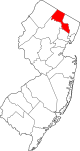 | |
| الضواحي | ||
| البلدات | ||
| CDPs | ||
| كميونات أخرى غير مدمجة | ||
| المقاطعات |  | |
|---|---|---|
| المدينة الرئيسية | ||
| المدن والبلدات 100–999 ألف | ||
| المدن والبلدات 25–99 ألف | بايون • برانفورد • Cheshire • كلفتن • دانبري • إيست هاڤن • إيست اورانج • إنگلوود • فيرفيلد • گارفيلد • گرينتش • هاكنساك • هامدن • هوبوكن • هاول • كارني • لونگ بيتش • لونگ برانش • مريدن • مدلتاون • ملفورد • ماونت ڤرنون • نوگاتك • نيو برنزويك • نيو ملفورد • نيو روشل • نيوبرگ • نيوتن • نورواك • پاسيك • پرث أمبوي • پلينفيلد • پوكپسي • راوِيْ • شلتن • ستراتفورد • Torrington • ترنتون • ترمبول • يونيون سيتي • Wallingford • وست هيڤن • وستفيلد • وستپورت • هوايت پلينز | |
| المدن والبلدات 10–25 ألف | أنسونيا • آسبري پارك • بيكن • بثل • بروكفيلد • دارين • دربي • دوڤر • گلفورد • گوتنبرگ • هاريسن (نيو جرزي) • هاريسن (نيويورك) • كنگستن • ليندن • ماديسون • منرو • موريستاون • نيو كينن • New Fairfield • North Branford • North Haven • اورانج • پليموث • پيكسكيل • Ridgefield • راي • سكارسديل • سكوكس • سيمور • ساوثبري • سمت • واترتاون • وست نيويورك • وستن • ولتن • ونشستر • وولكت | |
| المناطق الفرعية | ||
- CS1 الإنجليزية الأمريكية-language sources (en-us)
- CS1: Julian–Gregorian uncertainty
- Webarchive template archiveis links
- Short description is different from Wikidata
- Pages using infobox settlement with possible motto list
- Pages using gadget WikiMiniAtlas
- Pages using infobox settlement with possible area code list
- Pages using infobox settlement with potentially too many maps
- كل المقالات بدون مراجع موثوقة
- كل المقالات بدون مراجع موثوقة from January 2024
- Articles with unsourced statements from July 2023
- Articles to be expanded from September 2021
- All articles to be expanded
- Articles with hatnote templates targeting a nonexistent page
- Articles with unsourced statements from November 2011
- Articles with unsourced statements from December 2014
- پاترسون، نيوجرزي
- تأسيسات 1851 في نيوجرزي
- الثقافة الأمريكية العربية في نيوجرزي
- التاريخ الأمريكي الألباني
- مدن في مقاطعة پاسيك، نيوجرزي
- مقاعد مقاطعات في نيورجزي
- مراكز صناعية أمريكية مبكرة
- Faulkner Act Mayor-Council
- New Jersey Urban Enterprise Zones
- أماكن مأهولة تأسست في 1851
- Populated places on the Underground Railroad