تشينغهاي
Qinghai
青海 | |
|---|---|
| الترجمة اللفظية بالـ Name | |
| • Chinese | 青海省 (Qīnghǎi Shěng) |
| • Abbreviation | QH / 青 (پنين: Qīng) |
 The region of Hoh Xil, a World Heritage Site | |
 Map showing the location of Qinghai Province | |
| Coordinates: 35°N 96°E / 35°N 96°E | |
| Country | |
| Named after | من المنغولية Köke Naɣur: Köke - أزرق Naɣur - Lake "blue lake" (بحيرة تشينگهاي) في الصينية: 青 qīng - أخضر/أزرق 海 hǎi - البحر "البحر الأخضر" |
| العاصمة (وأكبر مدينة) | شينينگ |
| Divisions - Prefecture-level - County-level - Township- level | 8 prefectures 44 counties 404 towns and subdistricts |
| Government | |
| • Body | Qinghai Provincial People's Congress |
| • CCP Secretary | Chen Gang |
| • Congress Chairman | Chen Gang |
| • Governor | Wu Xiaojun |
| • Provincial CPPCC Chairman | Gönbo Zhaxi |
| • National People's Congress Representation | 24 deputies |
| Area | |
• Total | 720٬000 كم² (280٬000 ميل²) |
| • Rank | 4th |
| Highest elevation | 6٬860 m (22٬510 ft) |
| Population (2020)[2] | |
• Total | 5٬923٬957 |
| • Rank | 31st |
| • Density | 8٫2/km2 (21/sq mi) |
| • Rank | 30th |
| Demographics | |
| • Ethnic composition | الهان - 54% التبت - 23% الهوي - 16% Tu - 4% Salar - 1.8% منغول - 1.8% |
| • Languages and dialects | Zhongyuan Mandarin Chinese, Amdo Tibetan, Monguor, Oirat Mongolian, Salar and Western Yugur |
| ISO 3166 code | CN-QH |
| GDP[3] | 2022 |
| – Total | ¥361 billion (30th) $53.7 billion (nominal) |
| – Per capita | ¥60,724 (24th) $9,028 (nominal) |
| – Growth | ▲ 2.3% |
| HDI (2021) | 0.695[4] (28th) – medium |
| Website | www |
| تشينغهاي | |||||||||||||||||||||||||||||||||||||
|---|---|---|---|---|---|---|---|---|---|---|---|---|---|---|---|---|---|---|---|---|---|---|---|---|---|---|---|---|---|---|---|---|---|---|---|---|---|
.svg&filetimestamp=20230716115128&) "Qinghai" in Chinese characters | |||||||||||||||||||||||||||||||||||||
| Chinese name | |||||||||||||||||||||||||||||||||||||
| الصينية | 青海 | ||||||||||||||||||||||||||||||||||||
| البريد | Tsinghai | ||||||||||||||||||||||||||||||||||||
| المعنى الحرفي | "Qinghai (Lake)" | ||||||||||||||||||||||||||||||||||||
| |||||||||||||||||||||||||||||||||||||
| Tibetan name | |||||||||||||||||||||||||||||||||||||
| Tibetan | མཚོ་སྔོན་ | ||||||||||||||||||||||||||||||||||||
| |||||||||||||||||||||||||||||||||||||
| Mongolian name | |||||||||||||||||||||||||||||||||||||
| Mongolian Cyrillic | Хөхнуур | ||||||||||||||||||||||||||||||||||||
| Mongolian script | ᠬᠥᠬᠡ ᠨᠠᠭᠤᠷ | ||||||||||||||||||||||||||||||||||||
| |||||||||||||||||||||||||||||||||||||
| Manchu name | |||||||||||||||||||||||||||||||||||||
| Manchu script | ᡥᡠᡥᡠ ᠨᠣᠣᡵ | ||||||||||||||||||||||||||||||||||||
| Romanization | Huhu Noor | ||||||||||||||||||||||||||||||||||||
| Oirat name | |||||||||||||||||||||||||||||||||||||
| Oirat | Kokonur | ||||||||||||||||||||||||||||||||||||
تشينغهاي أو چينگهاي (بالصينية: 青海 ، بالإنگليزية: Qinghai)، هي مقاطعة صينية تقع في شمال غرب جمهورية الصين الشعبية. وهي من أصغر المقاطعات الصينية سكاناً، حيث يبلغ عدد السكان فيها أكثر من خمس ملايين نسمة. كواحدة من أكبر التقسيمات الإدارية على مستوى المقاطعة في الصين من حيث المساحة، تعتبر المقاطعة الرابعة من حيث المساحة والثالثة كأقل المقاطعات سكاناً. عاصمتها وأكبر مدنها هي شيننگ.
تحدها گانسو من الشمال الشرقي، شينجيانگ من الشمال الغربي، سيچوان من الجنوب الشرقي، ومنطقة التبت ذاتية الحكم من الجنوب الغربي. تأسست مقاطعة چينگهاي عام 1928 في عهد جمهورية الصين الفترة التي كان يحكم فيها أمراء الحرب المسلمون الصينيون الذين عُرفوا بعصابة ما. سميت المقاطعة باسمها الصيني، چينگهاي، على اسم بحيرة چينگهاي، أكبر بحيرة في الصين. كانت المقاطعة تُعرف في السابق بالإنگليزية بكوكونور، المشتق من الاسم الأويراتي لبحيرة چينگهاي.
المقاطعة التي يقع معظمها على هضبة التبت، لطالما كانت بوتقة ينصهر فيها عدد من المجموعات العرقية بما في ذلك الهان، التبت، الهوي، المونگور، المغول والسلار. يشكل التبتيون خمس سكان چينگهاي، بينما يشكل الهوي حوالي سدس سكانها. هناك أكثر من 37 جماعة عرقية معترف بها بين سكان چينگهاي البالغ عددهم 5.6 بليون نسمة، حيث تشكل الأقليات العرقية إجمالي 45.5% من السكان.
عام 1724 أصبحت منطقة چينگهاي تحت حكم أسرة چينگ. بعد الإطاحة بأسرة چينگ عام 1911، أصبحت المنطقة تحت سيطرة أمراء الحرب المسلمين الصينيين، عصابة ما، حتى التجريدة الشمالية التي أطلقتها جمهورية الصين والتي عززت السيطرة المركزية عام 1928، وتأسست المقاطعة.
التاريخ
During the Bronze Age, Qinghai was home to a diverse group of nomadic tribes closely related to other Central Asians who traditionally made a living in agriculture and husbandry, the Kayue culture. The eastern part of the area of Qinghai was under the control of the Han dynasty about 2,000 years ago. It was a battleground during the Tang and subsequent Central Plain dynasties when they fought against successive Tibetan tribes.[5]
In the middle of 3rd century CE, nomadic people related to the Mongolic Xianbei migrated to pasture lands around the Qinghai Lake (Koko Nur) and established the Tuyuhun Kingdom.
In the 7th century, the Tuyuhun Kingdom was attacked by both the Tibetan Empire and the Tang dynasty as both sought control over the Silk Road trade routes. Tibetan King Songsten Gampo was victorious, and settled the area around Tso ngon (Lake Go, or Kokonor Lake).[6] Military conflicts had severely weakened the Tuyuhun kingdom and it was incorporated into the Tibetan Empire. The Tibetan Empire continued expanding beyond Tso ngon during Trisong Detsen's and Ralpacan's reigns, and the empire controlled vast areas north and east of Tso ngon until 848,[7] which included Xi'an.
After the disintegration of the Tibetan Empire,[clarification needed] small local factions emerged, some under the titular authority of Central Plain polities. The Song dynasty defeated the Kokonor Kingdom in the 1070s.[8] During the Mongol-led Yuan dynasty's administrative rule of Tibet, the region comprised the headwaters of the Ma chu (Machu River, Yellow River) and the Yalong (Yangtze) rivers and was known as Amdo, but apportioned to different administrative divisions than Tibet proper.[9]
Most of Qinghai was, for a short time in the aftermath of the Yuan Dynasty’s overthrow, under the control of early Ming dynasty, but later gradually lost to the Khoshut Khanate founded by the Oirats. The Xunhua Salar Autonomous County is where most Salar people live in Qinghai. The Salars migrated to Qinghai from Samarkand in 1370.[10] The chief of the four upper clans around this time was Han Pao-yuan and Ming granted him office of centurion, it was at this time the people of his four clans took Han as their surname.[11] The other chief Han Shan-pa of the four lower Salar clans got the same office from Ming, and his clans were the ones who took Ma as their surname.[12]
From 1640 to 1724, a big part of the area that is now Qinghai was under Khoshut Mongol control, but in 1724 it was conquered by the armies of the Qing dynasty.[13] Xining, the capital of modern Qinghai province, began to function as the administrative center, although the city itself was then part of Gansu province within the "Tibetan frontier district".[14][15] In 1724, 13-Article for the Effective Governing of Qinghai (Chinese:青海善后事宜十三条) was proposed by Nian Gengyao and adopted by the Central Government to gain full control of Qinghai.
Under the Qing dynasty, the governor was a viceroy of the Emperor, but local ethnic groups enjoyed significant autonomy. Many chiefs retained their traditional authority, participating in local administrations.[16] The Dungan revolt (1862–77) devastated the Hui Muslim population of Shaanxi, shifting the Hui center of population to Gansu and Qinghai.[17] Another Dungan revolt broke out in Qinghai in 1895 when various Muslim ethnic groups in Qinghai and Gansu rebelled against the Qing. Following the overthrow of the Qing dynasty in 1911, the region came under Chinese Muslim warlord Ma Qi control until the Northern Expedition by the Republic of China consolidated central control in 1928.
In July–August 1912, General Ma Fuxiang was "Acting Chief Executive Officer of Kokonur" (de facto Governor of the region that later became Qinghai).[18] In 1928, Qinghai province was created. The Muslim warlord and General Ma Qi became military governor of Qinghai, followed by his brother Ma Lin (warlord) and then Ma Qi's son Ma Bufang. In 1932 Tibet invaded Qinghai, attempting to capture southern parts of Qinghai province, following contention in Yushu, Qinghai, over a monastery in 1932. The army of Ma Bufang defeated the Tibetan armies. Governor of Qinghai Ma Bufang was described as a socialist by American journalist John Roderick and friendly compared to the other Ma Clique warlords.[19] Ma Bufang was reported to be good humoured and jovial in contrast to the brutal reign of Ma Hongkui.[20] Most of eastern China was ravaged by the Second Sino-Japanese War and the Chinese Civil War, by contrast, Qinghai was relatively untouched.
Ma Bufang increased the prominence of the Hui and Salar people in Qinghai's politics by heavily recruiting to his army from the counties in which those ethnic groups predominated.[21] General Ma started a state run and controlled industrialization project, directly creating educational, medical, agricultural, and sanitation projects, run or assisted by the state. The state provided money for food and uniforms in all schools, state run or private. Roads and a theater were constructed. The state controlled all the press, no freedom was allowed for independent journalists.[22]
As the 1949 Chinese revolution approached Qinghai, Ma Bufang abandoned his post and flew to Hong Kong, traveling abroad but never returning to China. On January 1, 1950, the Qinghai Province People's Government was declared, owing its allegiance to the new People's Republic of China. Aside from some minor adjustments to suit the geography, the PRC maintained the province's territorial integrity.[23] Resistance to Communist rule continued in the form of the Huis' Kuomintang Islamic insurgency (1950–58), spreading past traditionally Hui areas to the ethnic-Tibetan south.[17] Although the Hui composed 15.6% of Qinghai's population in 1949, making the province the second-largest concentration of Hui after Ningxia, the state denied the Hui ethnic autonomous townships and counties that their numbers warranted under Chinese law until the 1980s.[17]
-
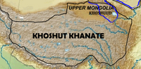 خانية خوشوت (1642–1717) التي كانت في هضبة التبت
 -
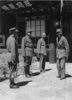 Chiang Kai-shek, leader of Nationalist China (right), meets with the Muslim generals Ma Bufang (second from left), and Ma Buqing (first from left) in Xining, Qinghai, in August 1942


الجغرافيا
Qinghai is located on the northeastern part of the Tibetan Plateau. By area, it is the largest province in the People's Republic of China (excluding the autonomous regions).
ينشأ النهر الأصفر (هوانگ هيه) في وسط المقاطعة في منطقتها الجبلية، كما توجد منابع لنهري يانگتسي وميكونگ في الجنوب. مساحتها 721000 كم2، وهي من أكبر مقاطعات الصين مساحة، وعاصمتها شيننگ. تجاورها گانسو وسيتشوان والتبت وشينجيانگ. Qinghai is separated by the Riyue Mountain into pastoral and agricultural zones in the west and east.[24]
The Sanjiangyuan National Nature Reserve is located in Qinghai and contains the headwaters of the Yellow River, Yangtze River, and Mekong River. The reserve was established to protect the headwaters of these three rivers and consists of 18 subareas, each containing three zones which are managed with differing degrees of strictness.
Qinghai Lake is the largest salt water lake in China, and the second largest in the world. Other large lakes are Lake Hala in the Qilian mountains, lakes Gyaring and Ngoring in the headwater region of the Yellow River, Lake Donggi Cona, and many saline and salt lakes in the western part of the province.
The Qaidam basin lies in the northwest part of the province at an altitude between 3000 and 5000 meters above sea level. About a third of this resource rich basin is desert.
-
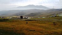
 Nyenpo Yurtse, Jigzhi County, Qinghai
 -
 Riyue Mountain in Qinghai

.jpg&filetimestamp=20230716115041&)
المناخ
The average elevation of Qinghai is approximately 3000 m.[25] Mountain ranges include the Tanggula Mountains and Kunlun Mountains, with the highest point being Bukadaban Feng at 6860 m.[26] Due to the high altitude, Qinghai has quite cold winters (harsh in the highest elevations), mild summers, and a large diurnal temperature variation.[بحاجة لمصدر] Its mean annual temperature is approximately −5 إلى 8 °C (23 إلى 46 °F), with January temperatures ranging from −18 إلى −7 °C (0 إلى 19 °F) and July temperatures ranging from 15 إلى 21 °C (59 إلى 70 °F).[بحاجة لمصدر] It is also prone to heavy winds as well as sandstorms from February to April. Significant rainfall occurs mainly in summer, while precipitation is very low in winter and spring, and is generally low enough to keep much of the province semi-arid or arid.[بحاجة لمصدر]
البيئة

تشتهر مقاطعة تشينگهاى الواقعة في غربى الصين باسم " برج الماء في آسيا"، حيث تؤثر الأوضاع البيئة والاحيائية في بحيرة تشينغهاى ومنابع الانهار الثلاثة الكبرى في الصين الا وهى نهر اليانغتسى والنهر الأصفر ونهر لان تشانگ تؤثر مباشرة على حياة نصف سكان العالم. وخلال السنوات الاخيرة، عززت الحكومات الصينية على مختلف المستويات أنفاقها لحماية البيئة ومعالجة التلوث، الامر الذى حسن الظروف الأحيائية بشكل ملحوظ. بحلول موسم الربيع من كل سنة، بدأ الطيور المهاجرة القادمة من جنوبى الصين ومنطقة جنوب شرقى آسيا رحلتها الطويلة الى شمالى الصين. ومقصدها هو بحيرة چينگهاي الواقعة في مقاطعة چينگهاي غربي الصين والتي تسمى بأجمل بحيرة في الصين وأصبحت جزيرة وسط البحيرة التى تكتظ فيها مختلف الطيور عالماً للانسجام بين البشر والطبيعة في چينگهاي. [27]
السياسة
The Politics of Qinghai Province in the People's Republic of China are structured in a one party-government system like all other governing institutions in mainland China.
The Governor of Qinghai (青海省省长) is the highest-ranking official in the People's Government of Qinghai. However, in the province's dual party-government governing system, the Governor has less power than the Qinghai Chinese Communist Party (CCP) Provincial Committee Secretary (青海省委书记), colloquially termed the "Qinghai Party Chief".
|
|
التقسيمات الإدارية
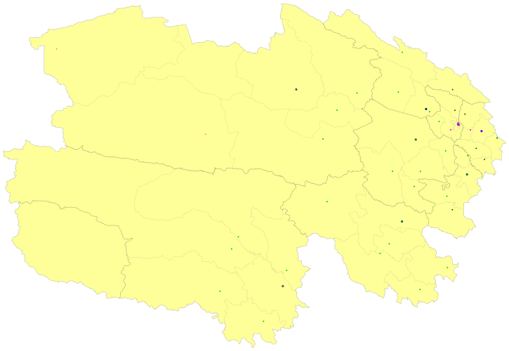
نظراً لأن الهان يشكلون أقلية عرقية في چينگهاي[24] ولأن أياً من الأقليات العرقية المتعددة بالمقاطعة لا تتمتع بسيطرة واضحة على بقية الأقليات العرقية، فإن المقاطعة لا تدار كمنطقة حكم ذاتي. بدلاً من ذلك، يوجد في المقاطعة العديد من مناطق الحكم الذاتي العرقي على مستوى المقاطعة والمديرية.[21] تنقسم چينگهاي إدارياً إلى ثمانية تقسيمات على مستوى المقاطعة: 2 مدينة بمستوى مقاطعة و6 محافظات ذاتية الحكم:
| التقسيمات الادارية في چينگهاي | ||||||||
|---|---|---|---|---|---|---|---|---|
| الرمز الاداري[28] | التقسيم | المساحة (كم)2[29] | السكان 2010[30] | المركز | التقسيمات [31] | |||
| المديريات | النواحي | النواحي ذاتية الحكم | مدن بمستوى ناحية | |||||
| 630000 | مقاطعة چينگهاي | 720000.00 | 5,626,723 | مدينة شيننگ | 7 | 25 | 7 | 5 |
| 630100 | مدينة شيننگ | 7424.11 | 2,208,708 | مديرية تشنگژونگ | 5 | 1 | 1 | |
| 630200 | مدينة هايدونگ | 13043.99 | 1,396,845 | مديرية لىدو | 2 | 4 | ||
| 632200 | محافظة هايبيْ التبتية ذاتية الحكم | 33349.99 | 273,304 | ناحية هاييان | 3 | 1 | ||
| 632300 | محافظة هوانگنان التبتية ذاتية الحكم | 17908.89 | 256,716 | مدينة تونگرن city | 2 | 1 | 1 | |
| 632500 | محافظة هاينان التبتية ذاتية الحكم | 43377.11 | 441,691 | ناحية گونگهى | 5 | |||
| 632600 | محافظة گولوگ التبتية ذاتية الحكم | 76442.38 | 181,682 | ناحية ماچين | 6 | |||
| 632700 | محافظة يوشو التبتية ذاتية الحكم | 197953.70 | 378,439 | مدينة يوشو | 5 | 1 | ||
| 632800 | محافظة هايشي المنغولية والتبتية ذاتية الحكم | 300854.48 | 489,338 | مدينة دىلينگها | 3 | 3 | ||
| التقسيمات الإدارية بالعربية والصينية الصينية | ||||
|---|---|---|---|---|
| العربية | الصينية | پنين | ||
| مقاطعة چينگهاي | 青海省 | Qīnghǎi Shěng | ||
| مدينة شيننگ | 西宁市 | Xīníng Shì | ||
| مدينة هايدونگ city | 海东市 | Hǎidōng Shì | ||
| محافظة هايبيْ التبتية ذاتية الحكم | 海北藏族自治州 | Hǎiběi Zàngzú Zìzhìzhōu | ||
| محافظة هوانگينان التبتية ذاتية الحكم | 黄南藏族自治州 | Huángnán Zàngzú Zìzhìzhōu | ||
| محافظة هاينان التبتية ذاتية الحكم | 海南藏族自治州 | Hǎinán Zàngzú Zìzhìzhōu | ||
| محافظة گولوگ التبتية ذاتية الحكم | 果洛藏族自治州 | Guǒluò Zàngzú Zìzhìzhōu | ||
| محافظة يوشو التبتية ذاتية الحكم | 玉树藏族自治州 | Yùshù Zàngzú Zìzhìzhōu | ||
| محافظة هايشي المنغولية والتبتية ذاتية الحكم | 海西蒙古族藏族自治州 | Hǎixī Měnggǔzú Zàngzú Zìzhìzhōu | ||
التقسيمات الثمانية بمستوى محافظة في چينگهاي تنقسم إلى 44 تقسيم بمستوى ناحية (6 [[مديرية (جمهورية الصين الشعبية)|مديرياتي]، 4 مدن بمستوى ناحية)، 27 ناحية و7 نواحي ذاتية الحكم).
المناطق الحضرية
| السكان حسب المنطقة الحضرية في المحافظات والمدن بمستوى ناحية | |||||
|---|---|---|---|---|---|
| # | المدينة | المنطقة الحضرية[32] | مساحة المحافظة[32] | زمام المدينة[32] | تاريخ التعداد |
| 1 | شيننگ | 1,153,417 | 1,198,304 | 2,208,708 | 2010-11-01 |
| 2 | گولمود | 156,779 | 186,341 | جزء من محافظة هايشي | 2010-11-01 |
| (3) | هايدونگ[أ] | 120,433 | 363,159 | 1,396,845 | 2010-11-01 |
| (4) | يوشو[ب] | 56,802 | 120,447 | جزء من محافظة يوشو | 2010-11-01 |
| 5 | دىلينگهوا | 54,844 | 78,184 | جزء من محافظة هايشي | 2010-11-01 |
| (6) | مانگناي[ت] | 33,440 | 33,451 | جزء من محافظة هايشي | 2010-11-01 |
- ^ Haidong Prefecture is currently known as Haidong PLC after census; Ledu County & Ping'an County is currently known as Ledu & Ping'an (core districts of Haidong) after census.
- ^ Yushu County is currently known as Yushu CLC after census.
- ^ Mangnai Administrative Zone & Lenghu Administrative Zone County is currently known as Mangnai CLC after census.
الاقتصاد

Qinghai's economy is amongst the smallest in China. Its nominal GDP in 2022 was just RMB 361 billion (USD 50 billion) and contributes to about 0.30% of the entire country's economy. Per capita GDP was RMB 60,724 (USD 9,028) in nominal), the 24th in China.[3]
Its heavy industry includes iron and steel production, located near its capital city of Xining. Oil and natural gas from the Qaidam Basin have also been an important contributor to the economy.[33] Salt works operate at many of the province's numerous salt lakes.
Outside of the provincial capital, Xining, most of Qinghai remains underdeveloped. Qinghai ranks second lowest in China in terms of highway length, and will require a significant expansion of its infrastructure to capitalize on the economic potential of its rich natural resources.[33]
القطاع الحيواني من اهم مكونات الناتج المحلي في مقاطعة تشينگهاي الذي يصل الى 55 مليار دولار اميركي. مقاطعة تشينغهاى غنية بموارد الاعشاب حيث تشكل مساحة مراعيها ما يزيد عن 96% من مساحتها الاجمالية ، ويعيش على تلك السهول والمراعي مترامية الاطراف و خصبة التربة اكثر من 22 مليون رأس من الغنم تعتاش على اكثر من 940 نوع من انواع الاعشاب الطبيعية ، من بينها ما يزيد عن 190 نوعا من الاعشاب الممتازة السلالة و ذات القيمة الغذائية العالية. [34]

منطقة التنمية الاقتصادية والتكنولوجية
Xining Economic & Technological Development Zone (XETDZ) was approved as state-level development zone in July 2000. It has a planned area of 4.4 km2. XETDZ lies in the east of Xining, 5 km from the city centre. In the east of the province, Xining stands at the upper reaches of the Huangshui River—one of the Yellow River's branches. The city is surrounded by the mountains with an average elevation of 2261 m and the highest at 4393 m. XETDZ is the first of its kind at the national level on the Qinghai-Tibet Plateau. It is established to fulfill the nation's strategy of developing the west.
XETDZ enjoys a convenient transportation system, connected by the Xining-Lanzhou expressway and running through by two main roads, the broadest in the city. It is 4 km from the railway station, 15 km from Xi'ning Airport — a grade 4D airport with 14 airlines to cities such as Beijing, Guangzhou, Shanghai, Chengdu and Xi'an. Xining is Qinghai province's passage to the outside world, a transportation hub with more than ten highways, over 100 roads and two railways, Lanzhou-Qinghai and Qinghai-Tibet Railways in and out of the city.
It focuses on the development of following industries: chemicals based on salt lake resources, nonferrous metals, and petroleum and natural gas processing; special medicine, foods and bio-chemicals using local plateau animals and plants; new products involving ecological and environmental protection, high technology, new materials as well as information technology; and services such as logistics, banking, real estate, tourism, hotel, catering, agency and international trade.[35]
السياحة

Many tourist attractions center on Xining, the provincial seat of Qinghai.
During the hot summer months, many tourists from the hot southern and eastern parts of China travel to Xining, as the climate of Xining in July and August is quite mild and comfortable, making the city an ideal summer retreat.
Qinghai Lake (青海湖; qīnghǎi hú) is another tourist attraction, albeit further from Xining than Kumbum Monastery (Ta'er Si). The lake is the largest saltwater lake in China, and is also located on the "Roof of the World", the Tibetan Plateau. The lake itself lies at 3,600 m elevation. The surrounding area is made up of rolling grasslands and populated by ethnic Tibetans. Most pre-arranged tours stop at Bird Island (鸟岛; niǎo dǎo). An international bicycle race takes place annually from Xining to Qinghai Lake.
النقل

The Lanqing Railway, running between Lanzhou, Gansu and Xining, the province's capital, was completed in 1959 and is the major transportation route in and out of the province. A continuation of the line, the Qinghai-Tibet Railway via Golmud and western Qinghai, has become one of the most ambitious projects in PRC history. It was completed in October 2005 and now links Tibet with the rest of China through Qinghai.
Construction on the Golmud–Dunhuang Railway, in the province's northwestern part, started in 2012.
Six National Highways run through the province.
Xining Caojiabao International Airport provides service to Beijing, Lanzhou, Golmud and Delingha. Smaller regional airports, Delingha Airport, Golog Maqin Airport, Huatugou Airport, Qilian Airport and Yushu Batang Airport, serve the province’s smaller communities; plans exist for the construction of three more by 2020.[36]
الاتصالات
Since the Ministry of Industry and Information Technology began its "Access to Telephones Project", Qinghai has invested 640 million yuan to provide telephone access to 3860 out its 4133 administrative villages. At the end of 2006, 299 towns had received Internet access. However, 6.6 percent of villages in the region still have no access to the telephone. These villages are mainly scattered in Qingnan Area, with 90 percent of them located in Yushu and Guoluo. The average altitude of these areas exceeds 3600 meters, and the poor natural conditions hamper the establishment of telecommunication facilities in the region.
Satellite phones have been provided to 186 remote villages in Qinghai Province as of September 14, 2007.[citation needed] The areas benefited were Yushu Tibetan Autonomous Prefecture and Guoluo Tibetan Autonomous Prefecture. Qinghai has recently been provided with satellite telephone access. In June 2007, China Satcom carried out an in-depth survey in Yushu and Guoluo, and made a special satellite phones for these areas. Two phones were provided to each village for free, and calls were charged at the rate of 0.2 RMB (about a quarter of a US cent at that time) per minute for both local and national calls, with the extra charges assumed by China Satcom. No monthly rent was charged on the satellite phone. International calls were also available.
الديموغرافيا
يقدر عدد سكان تشينگهاي بحوالي 5.2 مليون نسمة، ويشكل الهان حوالي 54.5% من السكان المجموعات الأخرى تشمل التبت 20.87%، الهوي 16%، التو 4%، السلر، والمنغول.
| السنة | تعداد | ±% |
|---|---|---|
| 1912[37] | 368٬000 | — |
| 1928[38] | 619٬000 | +68.2% |
| 1936–37[39] | 1٬196٬000 | +93.2% |
| 1947[40] | 1٬308٬000 | +9.4% |
| 1954[41] | 1٬676٬534 | +28.2% |
| 1964[42] | 2٬145٬604 | +28.0% |
| 1982[43] | 3٬895٬706 | +81.6% |
| 1990[44] | 4٬456٬946 | +14.4% |
| 2000[45] | 4٬822٬963 | +8.2% |
| 2010[46] | 5٬626٬722 | +16.7% |
العرقيات
هناك أكثر من 37 جماعة عرقية معترف بها بين عدد سكان مقاطعة چينگهاي البالغ عددهم 5.6 مليون نسمة، حيث تشكل الأقليات القومية أكثر من 45.5% من السكان. التركيبة العرقية شبيهة بمقاطعة گانسو، حيث يشكل الهان (54.5%)، التبت (20.7%)، الهوي (16%)، التو (المونگور) (4%)، المنغول، والسلر هما أكثر الجماعات عدداً. يغلب صينيو الهان على مدن شيننگ، هايدونگ، دىلينگها، وگولمود، وأماكن أخرى في شمال شرق المقاطعة. بينما يتركز الهوي في شيننگ، هايدونگ، ناحية مينهى، ناحية هوالونگ، وناحية داتونگ. ينتشر شعب التو في ناحية هوژو والسلر في ناحية هونهوا؛ بينما يتركز التبت والمنغول في المناطق الغربية الريفية من المقاطعة.[21]
من بين الجماعات العرقية المسلمة في الصين، يوجد في مقاطعة چينگهاي عرقية الهوي، السلر، الدونگشيانگ، والبوآن.[10] يهيمن الهوي على تجارة البيع بالجملة في چينگهاي.[47]
الديانات

الديانة السائدة في چينگهاي هي الديانات الشعبية الصينية (وتشمل (الطاوية، الكونفشيوسية)، والبوذية الصينية بين صيني الهان. يمارس شعب التبت البوذية التبتية أو ديانة البون التبتية التقليدية حيث يشكلون 0.76% من سكان المقاطعة حسب المسح الاجتماعي العام الصيني لعام 2004.[49] حسب مسح 2010، فإن 17.51% من سكان چينگهاي مسلمين.[48]
من سبتمبر 1848، كانت المدينة مركزاً للنيابة الرسولية الكاثوليكية اللاتينية قصيرة العمر في كوكونور، لكنها قُمعت عام 1861. لا توجد سجلات للمسئولين.[50]
|


الثقافة
تأثرت چينگهاي بالتفاعلات "بين الثقافة المنغولية والتبتية، من الشمال إلى الجنوب، والثقافة الصينية الهانية والثقافة الإسلامية في آسيا الوسطى، من الشرق إلى الغرب".[21] لعقود شكلت لغات چينگهاي رابطة لغوية، حيث تأثرت مندرينية السهول الوسطى، تبتية الأمدو، السلر، اليوگور، والمونگور ببعضها البعض وتشاركت المفردات اللغوية.[51] في الثقافة الصينية، ترتبط چينگهاي بشكل كبير بحكاية الملك مو، ابن السماء.[52] حسب هذه الأسطورة، فإن الملك مو من ژو (حكم 976-922 ق.م.) قد سعى خلف البدو الرحل من چوانرونگ إلى شرق چينگهاي، حيث أقامت الإلهة شي وانگچينگهايمو وليمة للملك في جبال كونلون.[53]
الديانات الرئيسية في چينگهاي هي البوذية التبتية والإسلام. لا يزال مسجد دونگگوان يفتح أبوابه منذ تأسيسه عام 1380.[17] معايير التعليم في چينگهاي متدنية، وخاصة بين الجماعات العرقية المسلمة مثل الهوي والسلر، الذين يفضلون أحياناً إرسال أطفالهم إلى المدارس الدينية بدلاً من المدارس العلمانية.[21] الياك، الذي يترجع أصوله إلى چينگهاي، يستخدم بشكل كبير في المقاطعة كوسيلة للنقل وكذلك من أجل لحومه.[24] يحتفل منغول چينگهاي سنوياً بمهرجان نادم على حوض چايدام.[54]
الكليات والجامعات
 مقالة مفصلة: قائمة كليات وجامعات چينگهاي
- جامعة چينگهاي (青海大学)
- Qinghai Normal University (青海师范大学)
- Qinghai University for Nationalities (青海民族大学)
- Qinghai Medical College (青海医学院)
- جامعة چينگهاي للإذاعة والتلفزيون
انظر أيضاً
- 2010 Yushu earthquake
- Amdo
- گىلاداندونگ
- قائمة سجون چينگهاي
- سجن شينينگ
- شركة چينگهاي للأدوات اليدوية ذات المسؤولية المحدودة
- مناجم لاوگاي
- المجموعة الفردانية D1 (Y-DNA)
- المجموعة الفردانية O3 (Y-DNA)
- مشاهير چينگهاي
- حكام چينگهاي
المصادر
- ^ "Qinghai Province". Qinghai Province Department of Commerce. Archived from the original on 4 مارس 2016. Retrieved 5 أغسطس 2013.
- ^ "Communiqué of the Seventh National Population Census (No. 3)". National Bureau of Statistics of China. 11 May 2021. Retrieved 11 May 2021.
- ^ أ ب "National Data". National Bureau of Statistics of China. 1 March 2022. Retrieved 23 March 2022.
- ^ "Subnational Human Development Index". Global Data Lab China. 2021. Retrieved 9 April 2020.
- ^ Purdue – Tibetan history Archived 2007-08-21 at the Wayback Machine.
- ^ Laurent Deshayes, 1997. Histoire du Tibet. Paris: Fayard.
- ^ Gertraud Taenzer, 2012. The Dunhuang Region during Tibetan Rule (787-848). (Berlin): Harrassowitz Verlag.
- ^ Leung 2007, p. 57.
- ^ Smith, Warren W (2009). China's Tibet?: Autonomy or Assimilation. Rowman & Littlefield. pp. 24, 252.
- ^ أ ب Betta, Chiara (2004). The Other Middle Kingdom: A Brief History of Muslims in China. Indianapolis University Press. p. 21.
- ^ William Ewart Gladstone, Baron Arthur Hamilton-Gordon Stanmore (1961). Gladstone-Gordon correspondence, 1851–1896: selections from the private correspondence of a British Prime Minister and a colonial Governor, Volume 51. American Philosophical Society. p. 27. ISBN 9780871695147. Retrieved 2010-06-28.
- ^ William Ewart Gladstone, Baron Arthur Hamilton-Gordon Stanmore (1961). Gladstone-Gordon correspondence, 1851–1896: selections from the private correspondence of a British Prime Minister and a colonial Governor, Volume 51. American Philosophical Society. p. 27. ISBN 9780871695147. Retrieved 2010-06-28.
- ^ The Times Atlas of World History. (Maplewood, New Jersey: Hammond, 1989) p. 175
- ^ Louis M. J. Schram (2006). The Monguors of the Kansu-Tibetan Frontier: Their Origin, History, and Social Organization. Kessinger Publishing. p. 17. ISBN 1-4286-5932-3. Retrieved 2010-06-28.
- ^ Graham Hutchings (2003). Modern China: a guide to a century of change (illustrated, reprint ed.). Harvard University Press. p. 351. ISBN 0-674-01240-2. Retrieved 2010-06-28.
- ^ M.C. Goldstein (1994). Barnett and Akiner (ed.). Change, Conflict and Continuity among a community of nomadic pastoralists—A Case Study from western Tibet, 1950–1990., Resistance and Reform in Tibet. London: Hurst & Co.
- ^ أ ب ت ث Cooke, Susette. "Surviving State and Society in Northwest China: The Hui Experience in Qinghai Province under the PRC." Journal of Muslim Minority Affairs 28.3 (2008): 401–420.
- ^ Henry George Wandesforde Woodhead, Henry Thurburn Montague Bell (1969). The China year book, Part 2. North China Daily News & Herald. p. 841. Retrieved 2011-06-05.
- ^ John Roderick (1993). Covering China: the story of an American reporter from revolutionary days to the Deng era. Imprint Publications. p. 104. ISBN 1-879176-17-3. Retrieved 2010-06-28.
- ^ Felix Smith (1995). China pilot: flying for Chiang and Chennault. Brassey's. p. 140. ISBN 1-57488-051-9. Retrieved 2010-06-28.
- ^ أ ب ت ث ج Goodman, David (2004). China's Campaign to "Open Up the West": National, Provincial, and Local Perspectives. Cambridge University Press. pp. 67–83.
- ^ Werner Draguhn; David S. G. Goodman (2002). China's communist revolutions: fifty years of the People's Republic of China. Psychology Press. p. 38. ISBN 0-7007-1630-0. Retrieved 2011-04-09.
- ^ Blondeau, Anne-Marie; Buffetrille, Katia (2008). Authenticating Tibet: Answers to China's 100 Questions. University of California Press. pp. 203–205.
It is often assumed that this current policy [of not politically uniting all ethnically Tibetan areas] reflects the PRC leadership's intention to divide and rule Tibet, but this assumption is not wholly accurate.... The PRC cemented the [historical] status quo by keeping Amdo/Qinghai as a separate, multinational province... China does not reverse perceived territorial acquisitions. Hence, all territories that escaped the domination of Lhasa in recent history remained attached to the neighboring Chinese constituencies they tended to be under the influence of.
- ^ أ ب ت Lahtinen, Anja (2009). "Maximising Opportunities for the Tibetans of Qinghai Province, China". In Cao, Huahua (ed.). Ethnic Minorities and Regional Development in Asia: Reality and Challenges. Amsterdam University Press. pp. 20–22.
- ^ [1]
- ^ Bukadaban Feng, Peakbagger.com
- ^ إذاعة الصين الدولية
- ^ 中华人民共和国县以上行政区划代码 (in الصينية المبسطة). Ministry of Civil Affairs.
- ^ Shenzhen Statistical Bureau. 《深圳统计年鉴2014》 (in الصينية المبسطة). China Statistics Print. Archived from the original on 2015-05-12. Retrieved 2015-05-29.
- ^ Census Office of the State Council of the People's Republic of China; Population and Employment Statistics Division of the National Bureau of Statistics of the People's Republic of China (2012). 中国2010年人口普查分乡、镇、街道资料 (1 ed.). Beijing: China Statistics Print. ISBN 978-7-5037-6660-2.
- ^ Ministry of Civil Affairs (August 2014). 《中国民政统计年鉴2014》 (in الصينية المبسطة). China Statistics Print. ISBN 978-7-5037-7130-9.
- ^ أ ب ت 国务院人口普查办公室、国家统计局人口和社会科技统计司编 (2012). 中国2010年人口普查分县资料. Beijing: China Statistics Print. ISBN 978-7-5037-6659-6.
- ^ أ ب "Qinghai Province: Economic News and Statistics for Qinghai's Economy". Archived from the original on 2011-10-08. Retrieved 2011-10-25.
- ^ المركز العربي للمعلومات
- ^ RightSite.asia|Xining Economic & Technological Development Zone
- ^ Qinghai to build 3 new airports before 2020
- ^ 1912年中国人口. Retrieved 6 March 2014.
- ^ 1928年中国人口. Retrieved 6 March 2014.
- ^ 1936–37年中国人口. Retrieved 6 March 2014.
- ^ 1947年全国人口. Retrieved 6 March 2014.
- ^ 中华人民共和国国家统计局关于第一次全国人口调查登记结果的公报. National Bureau of Statistics of China. Archived from the original on August 5, 2009.
- ^ 第二次全国人口普查结果的几项主要统计数字. National Bureau of Statistics of China. Archived from the original on September 14, 2012.
- ^ 中华人民共和国国家统计局关于一九八二年人口普查主要数字的公报. National Bureau of Statistics of China. Archived from the original on May 10, 2012.
- ^ 中华人民共和国国家统计局关于一九九〇年人口普查主要数据的公报. National Bureau of Statistics of China. Archived from the original on June 19, 2012.
- ^ 现将2000年第五次全国人口普查快速汇总的人口地区分布数据公布如下. National Bureau of Statistics of China. Archived from the original on August 29, 2012.
- ^ "Communiqué of the National Bureau of Statistics of People's Republic of China on Major Figures of the 2010 Population Census". National Bureau of Statistics of China. Archived from the original on July 27, 2013.
- ^ "Demand for an aphrodisiac has brought unprecedented wealth to rural Tibet—and trouble in its wake". The Economist. 19 December 2015. Retrieved 20 December 2015.
- ^ أ ب Min Junqing. The Present Situation and Characteristics of Contemporary Islam in China. JISMOR, 8. 2010 Islam by province, page 29. Data from: Yang Zongde, Study on Current Muslim Population in China, Jinan Muslim, 2, 2010.
- ^ أ ب China General Social Survey (CGSS) 2009. Report by: Xiuhua Wang (2015, p. 15) Archived سبتمبر 25, 2015 at the Wayback Machine
- ^ http://www.gcatholic.org/dioceses/former/koko0.htm
- ^ Janhunen, Juha (2006). "From Manchuria to Amdo Qinghai: On the Ethnic Implications of the Tuyuhun Migration". Tumen Jalafun Jecen Aku. Otto Harrassowitz Verlag. pp. 111–112.
- ^ "Qinghai". English Channel. CCTV. Retrieved 2013-06-05.
- ^ Asiapac Editorial (2006). Chinese History: Ancient China to 1911. Asiapac Books. p. 28.
- ^ "Qaidam culture shines in Qinghai, NW China". Global Times. 2009-07-21. Archived from the original on 2016-03-04. Retrieved 2013-06-05.
وصلات خارجية
أماكن مجاورة لـ تشينغهاي | ||||||||||||||||
|---|---|---|---|---|---|---|---|---|---|---|---|---|---|---|---|---|
| ||||||||||||||||
| مقاطعات |  | |
|---|---|---|
| مناطق الحكم الذاتي | ||
| البلديات | ||
| SAR | ||
1 تايوان تطالب بها جمهورية الصين الشعبية إلا أن جمهورية الصين(ROC) تديرها. انظر الوضع السياسي لتايوان. | ||
- Pages using gadget WikiMiniAtlas
- CS1 uses الصينية-language script (zh)
- CS1 الصينية المبسطة-language sources (zh-hans)
- CS1 uses اليابانية-language script (ja)
- Short description is different from Wikidata
- Articles containing صينية-language text
- Coordinates on Wikidata
- Articles with صينية-language sources (zh)
- Articles containing منغولية-language text
- جميع الصفحات التي تحتاج تنظيف
- Wikipedia articles needing clarification from November 2020
- مقالات ذات عبارات بحاجة لمصادر
- Articles with hatnote templates targeting a nonexistent page
- مقالات تحتوي نصوصاً باللغة الصينية
- Articles with unsourced statements from January 2012
- چينگهاي
- مقاطعات الصين
- أمدو
- دول وأقاليم تأسست في 1928
- هضبة التبت
- غرب الصين
- تأسيسات 1928 في الصين