سليپي هولو، نيويورك
سليپي هولو، نيويورك Sleepy Hollow, New York | |
|---|---|
 The Old Dutch Church in 1907 | |
 موقع سليپي هولو، نيويورك | |
| Coordinates: 41°5′31″N 73°51′52″W / 41.09194°N 73.86444°W | |
| البلد | الولايات المتحدة |
| الولاية | نيويورك |
| المقاطعة | وستشستر |
| البلدة | ماونت پلزانت |
| Area | |
• Total | 5٫1 ميل² (13٫2 كم²) |
| • Land | 2٫3 ميل² (5٫9 كم²) |
| • Water | 2٫8 ميل² (7٫3 كم²) |
| Elevation | 89 ft (27 m) |
| Population (2010) | |
• Total | 9٬870 |
• Estimate (2016)[1] | 10٬198 |
| • Density | 4٬300/sq mi (1٬700/km2) |
| Time zone | UTC-5 (Eastern (EST)) |
| • Summer (DST) | UTC-4 (EDT) |
| ZIP code | 10591 |
| Area code | 914 |
| FIPS code | 36-67638 |
| GNIS feature ID | 0958934 |
سليپي هولو Sleepy Hollow هي قرية في بلدة ماونت پلزانت، في مقاطعة وستشستر، نيويورك. وتقع القرية على الضفة الشرقية لنهر الهدسون، على بعد 30 ميل شمال مدينة نيويورك، وتخدمها محطة Philipse Manor على Metro-North Hudson Line. To the south of Sleepy Hollow is the village of Tarrytown, and to the north and east are unincorporated parts of Mount Pleasant. The population of the village at the 2010 census was 9,870.[2]
Originally incorporated as North Tarrytown in the late 19th century, in 1996 the village officially adopted the traditional name for the area.[3] The village is known to many via "The Legend of Sleepy Hollow", a short story about the local area and its infamous specter, the Headless Horseman, written by Washington Irving, who lived in Tarrytown and is buried in Sleepy Hollow Cemetery. Owing to this story, as well as the village's roots in early American history and folklore, Sleepy Hollow is considered by some to be one of the "most haunted places in the world".[4][5][6]
The village is home to the Philipsburg Manor House and the Old Dutch Church of Sleepy Hollow, as well as the Sleepy Hollow Cemetery, where in addition to Washington Irving, numerous other notable people are buried.
التاريخ

The two square miles of land that would become Sleepy Hollow belonged to the larger domain of the Wecquaesgeek,[7] a Munsee-speaking band of Wappinger people. Their fort and burying ground may have been located on the hillside where the Old Dutch Church of Sleepy Hollow was to be built later.[8] In 1609, Henry Hudson claimed the Hudson Valley, including the Tappan Zee area, for the Netherlands.[9] There was relative peace between the Native Americans and the Dutch until the mid-17th century, and the Dutch West India Company had been providing its investors with large land grants called patroonships to encourage settlement of the New Netherland colony on lands bought from local Native American tribes along the East Coast of what is now the United States.
The Upper Mills
 |
Much of the land that would become Philipsburg Manor had previously belonged to Adriaen van der Donck, who had invested in such a patroonship before the English conquest of New Netherland in 1664. In 1672, merchants Frederick Philipse (or Vredryk Flypse),[10] Thomas Delavall, and Thomas Lewis purchased from his widow's brother the first tracts of land in current-day northern Yonkers.[11] Philipse made several additional purchases between 1680 and 1686 from the Wecquaesgeek and Sintsink tribes, expanding the property to both the north and south. Philipse also bought out his partners' stakes during this time, enticing friends from New Amsterdam and Long Island to move with him with the promise of free land and limited taxes. The manor grew to around 52,000 acres (21,000 ha) or about 81 sq mi (210 km2), comprising much of today's lower Westchester County. Philipse was granted a royal charter in 1693, creating the Manor of Philipsburg and establishing him as first lord of the manor.[11]

Philipse founded his country seat[12] at the mouth of the Pocantico River, in the northern part of his manor, which would be called the Upper Mills. A small Dutch community had already been established there when he arrived in 1683.[13] He built a gristmill[note 1] and shipping depot, today part of the Philipse Manor House historic site. A pious man (and a carpenter by trade), he was architect and financier of the settlement's stone church, known today as the Old Dutch Church of Sleepy Hollow, and was said to have built the pulpit with his own hands.[14] The church served successive lords and ladies of the manor and their tenant farmers[12] (who were largely Dutch, French Huguenot, Swiss, and German immigrants[7][note 2]) until the outbreak of the American Revolutionary War.
When Philipse died in 1702, the manor was divided between his son, Adolphus Philipse, and his grandson, Frederick Philipse II. Adolphus received the Upper Mills property, which extended from Dobbs Ferry to the Croton River. Frederick II was given the Lower Mills at the confluence of the Saw Mill and Hudson Rivers.[15] Adolphus transformed the Upper Mills into a major commercial operation and managed it for nearly 50 years. The complex then included a stone gristmill,[15] a bakehouse, workshops for blacksmiths, carpenters, and coopers, and a wharf[16] for exporting grain and cornmeal internationally and for importing foreign goods.[17] It was surrounded by fields of grain, orchards, stands of timber, and stone quarries.[17] The complex was largely operated by enslaved Africans. Slave quarters were installed by Adolphus about 90 feet from the main house.[18] By the time of his death, twenty-three enslaved men, women, and children lived and worked at the manor. They are catalogued by name (and children, also with ages) in the 1750 probate inventory of his properties. As the most valuable "chattel" (personal property), they are listed first - before cattle, furniture, and tools.[18][19]
Adolphus's nephew, Frederick Philipse III, became the third lord of the manor upon his uncle's death.[11] He did not live at the modest Upper Mills house, choosing the manor house at the Lower Mills (now Philipse Manor Hall State Historic Site) as his primary country estate and developing it into a grand Georgian-style mansion suitable for a man of his status.[note 3] The Upper Mills main house, gristmill, surrounding buildings, ponds, fields, woods, and a wharf on the Hudson River (that is, everything related to the large-scale production and sale of flour, dairy products, timber, and other goods) were leased by Philipse to members of prominent local landowning families, first Josiah Martling[note 4] (from 1752 to 1761) and then William Pugsley[note 5] (from 1761 till after the American Revolutionary War).[20][21] It is the area of this leaseholding that would become the core of the present-day village of Sleepy Hollow.
During the American Revolutionary War, the Upper Mills area was situated within the "neutral ground" of Westchester County, an unprotected buffer zone between British-controlled territory to the south and American lines to the north. Numerous local histories and scholarly articles document the hardships faced by residents in the neutral ground, who were subjected to devastating raids from both sides. Their level of desperation is well illustrated by the oft-quoted description, “They feared everybody whom they saw.”[22] Knowing the terrain well, many local residents served as crucial scouts, guides, and foragers for the Continental Army in the infamous neutral ground.[23][24] The Old Dutch Burying Ground, the area's oldest cemetery, holds one of the highest concentrations of Revolutionary War veteran graves in the state of New York.[25]
In the late 1790s, Washington Irving visited the Sleepy Hollow area with his local friend James K. Paulding, a Revolutionary War militiaman who in 1780 had helped capture British Major John André in what is now known as Patriot's Park and thereby foiled the plans of Benedict Arnold.[26] Together they explored the area, hunting, fishing and talking with the local folk. The visits of Irving—and the local folklore and ghost tales he heard while there—were immortalized in the enduringly popular story The Legend of Sleepy Hollow.
بلدة بيكمان

In 1779, Frederick Philipse III, the last lord of Philipsburg Manor and a staunch Loyalist, was attainted for treason by New York's revolutionary government. Philipsburg Manor was confiscated, split into about 300 lots, and then sold at public auction.[29][30] Most of the buyers were Philipse’s tenant farmers who used the opportunity to buy the small plots they worked. A much larger Upper Mills property, about 750 acre (300 ha),[11] was purchased by the New York merchant Gerard (Gerardus) Garret Beekman Jr.[21]
There were no more enslaved people on the land — in 1786, the state of New York passed a law emancipating all enslaved people whose masters’ property had been confiscated;[31] the law predated all other emancipation-related landmark events in the United States.[32] Beekman used the property as farmland; his tenant farmers were veterans of the American Revolutionary War, as was Beekman himself.[7][33] Ironically, the first American ancestors of both Frederick III, a Loyalist, and Gerard Beekman, a Patriot who acquired his confiscated land, reportedly arrived in the New World on the same ship.[34]
Beekman later expanded his property to nearly 900 acres.[35] He died in 1822, and his widow, Cornelia, laid out the central portion of the estate into streets and sold building lots.[36][37] The development eventually became known as Beekman Town (also spelled Beekmantown), with Beekman Street, soon to be upgraded to Beekman Avenue, as its main street.[38] The street follows the route of the old “road to landing;” the latter was an important local shipyard, “where many vessels were built... with timber cut in the dense forests of the Mill Woods.”[39][note 6]
Cornelia was a well-known figure among the Westchester Patriots[40][41] and the daughter of Pierre Van Cortlandt, the first lieutenant governor of New York. She named one of the streets "Cortlandt" and another "Clinton,"[35] after George Clinton, the first governor of New York and later vice president of the United States.[note 7] She donated a plot at the top of Beekman Street, a triangular island where the flagpole and the village clock stand today, for "the public use forever."[8] By 1839, all the lots had been sold and released to the town of Mount Pleasant.[36] In the 1860s, the undeveloped waterfront tract of Beekman's property was bought by Ambrose Kingsland[7][42] in addition to his 1850s estate further south.

,_New_York_-_Geographicus_-_Tarrytown-beers-1868.jpg&filetimestamp=20260428213535&)
Meanwhile, Beekman Town's closest neighbor, Tarrytown, was developing as a trading center on the Albany Post Road and a commercial port on the Hudson River. The Industrial Revolution brought to it a railway station on the Hudson River Railroad, industrial mills, banks, and throngs of new people. Eventually, the industrial boom started spilling over into Beekman Town. Constructed between 1837 and 1842, the first Croton Aqueduct, New York City’s original water supply system, passed through Beekman Town as part of its route to the city. It was built primarily by Irish immigrants (as was the Hudson River Railroad),[44][45] many of whom settled in the village.[37] Washington Irving wrote to his friends that aqueduct builders claimed that on their walks back from taverns in the night, they saw headless apparitions around Sleepy Hollow.[46][47]
Before and during the U.S. Civil War, the Underground Railroad ran through the neighboring Tarrytown. Tarrytown's famous Foster Memorial AME Zion Church served as a vital Underground Railroad stop. Known as the “Freedom Church," it provided food and shelter to escaped slaves en route to Canada.[48] Company H of the 32nd New York Infantry Regiment that served in the Union Army during the Civil War was composed exclusively of volunteers from the Tarrytown area,[49] including Beekmantown. They fought in the First Battle of Bull Run, the Peninsular Campaign, and the Battles of South Mountain, Antietam, and Chancellorsville; and their letters home were often published in local newspapers. Many of them are buried in the Sleepy Hollow Cemetery, where the Civil War Soldiers Monument was erected in 1890[50] in their honor. Its granite base is topped by a 7-foot-6-inch bronze statue of a Union infantry soldier standing at "parade rest"; bronze plaques on the base list some 240 names.[51]
North Tarrytown


Beekman Town's post office opened in 1871.[52] In 1874, the village incorporated as North Tarrytown, using the recognizable name of its commercially successful neighbor to the south.[note 8] Italian, German, and Eastern European immigrants began settling in the Tarrytowns in the late 19th and early 20th centuries to open stores and shops[53] and join the industrial workforce.
North Tarrytown began its association with the automobile industry in 1899, when "Renaissance man"[54] John Brisben Walker (who at the time owned The Cosmopolitan magazine and lived in nearby Irvington) acquired the Stanley Brothers steam-car patents. He bought part of the former Ambrose Kingsland estate in North Tarrytown[55] and built there a large factory, designed by McKim, Mead & White, to produce steam-powered "Mobiles."[56] In 1900, his Mobile Company of America went into operation at the foot of Beekman Avenue. When the first Mobile was completed, approximately 180 men worked in the new factory.[57]
Walker began subdividing the northern part of his North Tarrytown property, attempting to capitalize on the site's location along the Hudson River Railroad. One of his selling points for this residential development, called Philipse Manor in a confused reference to nearby Philipsburg Manor House,[note 9] was the rail access, but this failed to materialize, and Walker's Philipse Manor Land Company floundered. The Mobile Company of America also failed: steam-powered carriages proved to be inferior to gasoline internal combustion vehicles.[56] The heavily indebted Walker had to sell his North Tarrytown properties to William Abraham Bell, who had invested in Walker’s automobile venture.[58] Bell, with his extensive experience in railroad development, not only continued the residential construction at Philipse Manor but also made the rail service possible by building the station and presenting it to the railroad.[59][60] Wealthy New Yorkers started eagerly buying homes in the Philipse Manor neighborhood.
A second residential neighborhood, Sleepy Hollow Manor, was developed in the vicinity of the station in the 1920s, on the former estate of renowned explorer and politician John C. Frémont.[61][62] Today, the two neighborhoods form the northern part of the village. The Philipse Manor station is on the National Register of Historic Places. A parcel of the former Ambrose Kingsland estate where Kingsland's opulent mansion once stood[42] was acquired by New York's Westchester County in 1924 and converted into a public park. It opened in 1926 and was named Kingsland Point Park.[63]


In 1903, the closed automobile plant at the foot of Beekman Avenue was leased (and subsequently sold) to Maxwell-Briscoe, manufacturer of gasoline internal combustion automobiles. Destroyed in a fire in 1907, it was rebuilt and acquired by Chevrolet in 1914-1915. In 1918, Chevrolet was integrated into General Motors, and the plant became the GM North Tarrytown Assembly facility.
To alleviate housing shortage for workers of the expanding plant, John D. Rockefeller Jr. (whose estate was two miles from North Tarrytown) conceived and financed the construction of a large housing cooperative on Beekman Avenue.[64] Completed in 1929, the five-story Van Tassel Apartments complex, arranged around a large courtyard, is a prime example of early garden apartment architecture. Bricks for the building were imported from the Netherlands,[65] and its design embraces the area's Dutch heritage. The main entrance is flanked by bas-relief medallions featuring explorer Henry Hudson and Katrina Van Tassel, the building's literary namesake from The Legend of Sleepy Hollow. Other bas-reliefs on the building depict scenes from Dutch colonial history. (The idea for the building's name and the bas reliefs belonged to Abby Aldrich Rockefeller, Rockefeller's wife.[65]) The building was known for its high-quality construction and luxury (for the time) amenities, such as radio antennas and kitchens with electric refrigerators, gas ranges, and dumbwaiters.[65] To this day, the Van Tassel is still the largest single residential building in Sleepy Hollow by unit count.
By the 1940s, the historic Upper Mills complex with its gristmill and wharf was long gone.[15][17] Only the main house remained, significantly altered by several generations of the Beekman family and the later owners, including the Broadway star Elsie Janis.[66] In 1940, John D. Rockefeller Jr. purchased the property to preserve and restore it.[7] After several major restorations, the rebuilt site would become the present-day Philipsburg Manor House living-history museum, designated as a National Historic Landmark.[17]

By the middle of the 20th century, North Tarrytown was a quintessential factory town. The sprawling GM plant, or “the Shop” as the locals called it, was by far the village's (and the whole region's) largest employer.[67] The GM ranks had swelled with African American workers[68] as well as French Canadian, Polish, and Slovak immigrants, followed by Cubans, Dominicans, Ecuadorians, and others.[7] The plant at its peak employed some 5,000[69] people. It worked around the clock, running three shifts.[67] Everybody in the village knew the schedule of shift changes, because all roads would be clogged by cars coming to and from the plant.[68] The plant also altered the geography of the village: its 1920s expansions involved rerouting the lower Pocantico River north of the site; and later, the plant completed the filling-in of the Pocantico Bay, a process started in the 1840s to support the construction of the Hudson River Railroad.[70] That is why the Hudson River coastline in Sleepy Hollow looks very different today from how it looked on early maps and photographs.[note 10]


The industrial heyday of the Tarrytowns lasted until the 1973–1975 recession in the United States. Manufacturing employment in the Tarrytowns started steadily declining, following a nationwide trend. The Duracell (formerly, P. R. Mallory and Co) battery manufacturing facility on Elm Street closed in 1984. The North Tarrytown Assembly followed in 1996. When the last vehicle rolled off the line at the end of June 1996, it concluded "the run of the longest continuously operating manufacturing facility in the GM family."[67] Within years, manufacturing buildings were demolished. (The heavily polluted sites subsequently underwent a lengthy decontamination.[71][70])
قرية سليبي هولو

With its days as a factory town over, North Tarrytown began reconnecting with, and drawing upon, its storied history, literary heritage, and natural beauty of its surroundings. Luckily, much of its historic and natural sites survived the industrial era, largely through the restoration and preservation efforts of John D. Rockefeller Jr. and other members of several generations of the Rockefeller family. In 1996, the same year General Motors closed its North Tarrytown operations, the village voted to officially change its name to the historical name of the area immortalized in The Legend of Sleepy Hollow.[7][72]
The idea of Sleepy Hollow disaffiliating from the town of Mount Pleasant has been raised periodically (most notably in the mid-1970s and again around 2007 by longtime mayor Philip Zegarelli) often as a way to consolidate services and save money by eliminating one layer of government.[73] These attempts did not succeed.
After years of site decontamination and re-zoning, the former GM site was developed into several residential communities, the largest of which is Edge-on-Hudson. It is a village-within-a-village, with more than 1,100 residential units, that range from affordable housing and rental apartments to condominium buildings and luxury townhomes.[67] Its street names, such as Legend Drive and Horseman Boulevard, commemorate Irving's The Legend of Sleepy Hollow, and its large DeCicco's supermarket hosts an exhibit of memorabilia from the 1999 movie Sleepy Hollow.
The former GM plant's extensive waterfront, which was inaccessible to the public for more than a century, is now part of Westchester RiverWalk,[74] offering breathtaking views of the Hudson River. Sleepy Hollow has become a major tourist destination, especially during the Halloween season, when tens of thousands of people flock to the village, drawn by its myths, legends, and historic sites. In the words of Washington Irving,[75]
the place still continues under the sway of some witching power, that holds a spell over the minds of the good people, causing them to walk in a continual reverie.
الجغرافيا
Sleepy Hollow is located at 41°5′31″N 73°51′52″W / 41.09194°N 73.86444°W (41.091998, −73.864361).[76] According to the United States Census Bureau, the village has a total area of 5.1 ميل مربع (13 km2), of which 2.3 ميل مربع (6.0 km2) is land and 2.8 ميل مربع (7.3 km2), or 55.58%, is water.[77]
الديمغرافيا
| التعداد | Pop. | ملاحظة | %± |
|---|---|---|---|
| 1880 | 2٬684 | — | |
| 1890 | 3٬179 | 18٫4% | |
| 1900 | 4٬241 | 33٫4% | |
| 1910 | 5٬421 | 27٫8% | |
| 1920 | 5٬927 | 9٫3% | |
| 1930 | 7٬417 | 25٫1% | |
| 1940 | 8٬804 | 18٫7% | |
| 1950 | 8٬740 | −0٫7% | |
| 1960 | 8٬818 | 0٫9% | |
| 1970 | 8٬334 | −5٫5% | |
| 1980 | 7٬994 | −4٫1% | |
| 1990 | 8٬152 | 2�0% | |
| 2000 | 9٬212 | 13�0% | |
| 2010 | 9٬870 | 7٫1% | |
| 2016 (تق.) | 10٬198 | [1] | 3٫3% |
| U.S. Decennial Census[78] | |||
انظر أيضاً
الهامش
- ^ أ ب "Population and Housing Unit Estimates". Retrieved June 9, 2017.
- ^ "Profile of General Population and Housing Characteristics: 2010 Demographic Profile Data (DP-1): Sleepy Hollow village, New York". U.S. Census Bureau, American Factfinder. Retrieved November 18, 2011.
- ^ Berger, Joseph (December 11, 1996). "North Tarrytown Votes to Pursue Its Future as Sleepy Hollow". The New York Times. Retrieved November 18, 2011.
- ^ Hoeller, Sophie-Claire (October 28, 2014). "The 6 Most Haunted Towns in the World". Thrillist. Retrieved July 31, 2015.
- ^ Summers, Ken (October 13, 2014). "Phantom Ships, Headless Skeletons, and Weeping Spirits: Investigating the Real Ghosts of New York's Sleepy Hollow". Week In Weird. Retrieved July 31, 2015.
- ^ "The Sleepy Hollow Hauntings". Haunted Places to Go. Retrieved July 31, 2015.
- ^ أ ب ت ث ج ح خ "History of the Village". Village of Sleepy Hollow. Archived from the original on July 10, 2024. Retrieved November 30, 2025.
- ^ أ ب Steiner, Henry (1998). The Place Names of Historic Sleepy Hollow & Tarrytown. Heritage Books. p. 12. ISBN 978-0-7884-0961-5.
- ^ Middleton, Simon. "Conflict and Commerce: The Rise and Fall of New Netherland". Gilder Lehrman Institute of American History (in الإنجليزية). Archived from the original on March 26, 2025. Retrieved December 15, 2025.
- ^ Chronicles of Tarrytown and Sleepy Hollow by Edgar Mayhew Bacon. The Knickerbocker Press. (1900), p. 5.
- ^ أ ب ت ث Maika, Dennis J. (2005). "Philipsburg Manor". Encyclopedia of the State of New York, First ed. (Peter Eisenstadt, ed.). Syracuse, New York: Syracuse University Press. p. 1199. ISBN 0-8156-0808-X
- ^ أ ب "Thematic Survey of Dutch Heritage Resources in the Greater Hudson Valley". New York State Office of Parks, Recreation and Historic Preservation. 2021. p. 41. Retrieved January 26, 2026.
- ^ "NATIONAL REGISTER OF HISTORIC PLACES INVENTORY -- NOMINATION FORM: Sleepy Hollow Church". NPGallery Digital Archive / National Register of Historic Places. Archived from the original on November 3, 2025. Retrieved January 4, 2026.
- ^ Edited Appletons Encyclopedia, Famous Americans: Biography of Frederick Philipse: "...He worked at the carpenter's trade for several years, aided in building the Old Dutch church, and is said to have made the pulpit with his own hands.
- ^ أ ب ت "Which Mill is Which? Telling Philipse Manor Hall and Philipsburg Manor Apart". Philipse Manor Hall State Historic Site (in الإنجليزية). Archived from the original on May 19, 2024. Retrieved January 1, 2026.
- ^ "Historical Description: Phillipsburg Manor". Hudson River Valley Institute (in الإنجليزية الأمريكية). Archived from the original on October 6, 2025. Retrieved December 30, 2025.
- ^ أ ب ت ث "NATIONAL REGISTER OF HISTORIC PLACES INVENTORY -- NOMINATION FORM: Philipsburg Manor". NPGallery Digital Asset Management System. Archived from the original on April 25, 2025. Retrieved January 2, 2026.
- ^ أ ب "Adolph Philipse estate records". NYPL Digital Collections (in الإنجليزية). Retrieved December 30, 2025.
- ^ "Adolph Philipse's 1750 probate inventory". People Not Property / Historic Hudson Valley (in الإنجليزية). Archived from the original on April 24, 2025. Retrieved December 26, 2025.
- ^ "Where Was the Philipsburg Proclamation Issued?". Philipse Manor Hall State Historic Site (in الإنجليزية). September 1, 2023. Archived from the original on January 17, 2025. Retrieved December 23, 2025.
- ^ أ ب "Upper Mill Deed". Westchester County Archives. Archived from the original on August 4, 2024. Retrieved December 26, 2025.
- ^ Osborn, David (2014). "The Revolutionary War 'neutral ground' of Westchester County" (PDF). St. Paul's National Historic Site, NPS. Archived from the original (PDF) on June 21, 2015. Retrieved December 15, 2025.
- ^ Browne, George W. (1962). The Role of the Westchester Guides During the American Revolution (Thesis) (in الإنجليزية). University of Rhode Island. doi:10.23860/the. Archived from the original on April 17, 2025.
- ^ "The Revolutionary War in Westchester County: Digital Resources". Westchester County Historical Society (in الإنجليزية الأمريكية). Retrieved January 10, 2026.
- ^ "Old Dutch Church and Burying Ground". I LOVE NY / New York Department of Economic Development (in الإنجليزية الأمريكية). Archived from the original on October 8, 2025. Retrieved January 10, 2026.
- ^ Egner Gruber, Katherine (October 23, 2024). "The Legend of Sleepy Hollow: Hidden History in an American Ghost Story". American Revolution Museum at Yorktown.
- ^ "Carl's Mill, Tarrytown, New York". New-York Historical Society (in الإنجليزية). Archived from the original on November 1, 2014. Retrieved December 15, 2025.
- ^ Irving, Washington (1865). Wolfert's roost : and other papers, now first collected. University of Connecticut Libraries. G.P. Putnam's Sons.
- ^ Bielinski, Stefan (1976). "An American Loyalist: The Ordeal of Frederick Philipse III" (PDF). Hudson River Valley Institute (HRVI). New York State Museum. p. 31. Archived from the original (PDF) on September 24, 2015. Retrieved December 28, 2025.
- ^ "Commissioners of Forfeiture Proceedings, 1784-1786". Westchester County Archives. Retrieved January 4, 2026.
- ^ [see Public Lands Law, L. 1786, Ch. 58, Sections 1-15, 22, 28-31] (1886). Laws of the State of New York passed at the sessions of the Legislature 1785-1788. Vol. 2. HathiTrust.
{{cite book}}: CS1 maint: location missing publisher (link) CS1 maint: multiple names: authors list (link) CS1 maint: numeric names: authors list (link) - ^ "Freeing Enslaved Africans". Enslaved Africans' Rain Garden (in الإنجليزية الأمريكية). Archived from the original on March 27, 2025. Retrieved January 7, 2026.
- ^ "Revolutionary War Soldiers Burial Index (p.4)" (PDF). Westchester County Historical Society. Retrieved November 19, 2025.
- ^ Steiner, Henry (1998). The Place Names of Historic Sleepy Hollow & Tarrytown. Heritage Books. p. 21. ISBN 978-0-7884-0961-5.
- ^ أ ب "Map of Beekman Farm in Mount Pleasant". Westchester County Archives (in الإنجليزية). c. 1848. Archived from the original on October 15, 2025. Retrieved December 29, 2025.
- ^ أ ب "Map of Beekmantown in Mount Pleasant". Westchester County Archives (in الإنجليزية). 1836–1839. Archived from the original on March 18, 2025. Retrieved December 29, 2025.
- ^ أ ب "Village of Sleepy Hollow Local Waterfront Revitalization Program, Section II. Inventory and Analysis". New York State Department of State. 1997. Retrieved October 26, 2025.
- ^ Steiner, Henry (1998). The Place Names of Historic Sleepy Hollow & Tarrytown. Heritage Books. pp. 24–25. ISBN 978-0-7884-0961-5.
- ^ Steiner, Henry (1998). The Place Names of Historic Sleepy Hollow & Tarrytown. Heritage Books. pp. 24, 88. ISBN 978-0-7884-0961-5.
- ^ Germain, Edward St. "Cornelia Beekman Biography | Women of the Revolution". AmericanRevolution.org (in الإنجليزية الأمريكية). Retrieved 2025-11-13.
- ^ McKito, Valerie H. (10 August 2015). From Loyalists to Loyal Citizens: The DePeyster Family of New York (in الإنجليزية). SUNY Press. pp. 75–76. ISBN 978-1-4384-5812-0. Retrieved 9 August 2021.
- ^ أ ب Seaman, Barrett (August 31, 2025). "A Trove of Kingsland Treasure Returns To Sleepy Hollow". The Hudson Independent (in الإنجليزية الأمريكية). Retrieved 2025-11-09.
- ^ The location of Philipsburg Manor House and surrounding property on the uppermost section of the map is marked as "J. Storm." Hudson River boat captain Jacob Storm, who owned the property at the time, was a descendant of Dirck Storm, historian of the Old Dutch Church and friend of Frederick Philipse, the first lord of Philipsburg Manor.
- ^ "History". Friends of the Old Croton Aqueduct. Retrieved October 27, 2025.
- ^ Vigilante, Ami. "9 Immigrant-Built Industries that Shaped the Hudson Valley". Reher Center (in الإنجليزية). Retrieved 2025-11-13.
- ^ "Aqueduct met New York City's need for clean water in 1842". American Society of Civil Engineers (in الإنجليزية الأمريكية). Archived from the original on March 22, 2025. Retrieved December 19, 2025.
- ^ Rappole, George H. (1978). "The Old Croton Aqueduct". IA: The Journal of the Society for Industrial Archeology. 4 (1): 15–25.
- ^ Riley Wentzler and Felicia Barber (January 2, 2019). "A Different Kind of Rebel: Greenburgh's Contributions to the Underground Railroad". River Journal (in الإنجليزية الأمريكية). Archived from the original on June 24, 2025. Retrieved December 27, 2025.
- ^ "32nd Infantry Regiment". New York State Military Museum and Veterans Research Center. Archived from the original on March 2, 2025. Retrieved December 27, 2025.
- ^ "Westchester County Civil War Monuments (Part Two)". New York Almanack (in الإنجليزية الأمريكية). Retrieved January 27, 2026.
- ^ "Our Union Soldiers Historical Marker". Historical Marker Database (in الإنجليزية). Retrieved January 26, 2026.
- ^ Steiner, Henry (1998). The Place Names of Historic Sleepy Hollow & Tarrytown. Heritage Books. p. 88. ISBN 978-0-7884-0961-5.
- ^ Sojak, Notary (2021). G. Washington Slept Here: A Sleepy Hollow Local History: The Merchants of Main Street. Independently published. ISBN 979-8468602317.
- ^ "Morrison History: John Brisben Walker". Morrison Historical Society (in الإنجليزية). November 6, 2010. Retrieved January 20, 2026.
- ^ 1892 Joseph R. Bien map, Villages of Tarrytown and North Tarrytown, at the David Rumsey Historical Map Collection.
- ^ أ ب Foster, Kit (2004). The Stanley Steamer: America's Legendary Steam Car. Stanley Museum Inc. ISBN 978-1886727076.
- ^ Miller, Richard (May 16, 2008). "Steam Starts the 1899 Auto Industry". River Journal. Archived from the original on September 29, 2020. Retrieved July 22, 2022.
- ^ "B'way reprise for Rocawear". New York Post (in الإنجليزية الأمريكية). October 28, 2009. Retrieved 2025-10-24.
- ^ William A. Bell Papers, Tutt Library, Colorado College, http://www2.coloradocollege.edu/library/specialcollections/Manuscript/Bell.html, retrieved on 7 April 2012
- ^ Kuhn, Robert (January 1991). "National Register of Historic Places nomination, Philipse Manor Railroad Station". New York State Office of Parks, Recreation and Historic Preservation. Archived from the original on February 19, 2012. Retrieved June 22, 2008.
- ^ "Past present at Pokahoe". WAG MAGAZINE (in الإنجليزية الأمريكية). November 2, 2015. Archived from the original on August 2, 2016. Retrieved January 26, 2026.
- ^ Denton, Sally (2007). Passion and Principle, John and Jessie Fremont, The Couple whose Power, Politics, and Love Shaped Nineteenth-Century America. Bloomsbury. p. 347. ISBN 978-1-59691-019-5.
- ^ "Kingsland Point Park". parks.westchestergov.com. Retrieved 2025-11-09.
- ^ "ROCKEFELLER APARTMENTS AT NORTH TARRYTOWN TO BE OPENED THIS WEEK; Store Rent for Maintenance". The New York Times. Retrieved November 26, 2025.
- ^ أ ب ت Madsen, Krista (May 4, 2016). "Warner Oral Histories: Life in the Van Tassel". The Hudson Independent - Westchester's Rivertowns News (in الإنجليزية الأمريكية). Retrieved November 26, 2025.
- ^ "A New Look at an Anglo-Dutch Plantation on the Hudson: The Philipsburg Manor Reinterpretation Project". Antiques and The Arts Weekly (in الإنجليزية الأمريكية). June 1, 2004. Retrieved December 30, 2025.
- ^ أ ب ت ث Mcdade, Jared (September 17, 2021). "25 Years After GM's Closure, Sleepy Hollow Welcomes New Developments". Westchester Magazine (in الإنجليزية الأمريكية). Archived from the original on September 8, 2025. Retrieved December 16, 2025.
- ^ أ ب "Veterans of the Civil Rights Movement -- Judy Richardson". Civil Rights Movement Archive. February 2007. Archived from the original on June 12, 2025. Retrieved January 3, 2026.
- ^ Minchin, Timothy J. (April 26, 2022). ""A Gallant Fight": The UAW and the 1970 General Motors Strike". International Review of Social History (in الإنجليزية). 68 (1): 41–73. doi:10.1017/S0020859022000293. ISSN 0020-8590. Archived from the original on July 28, 2023.
- ^ أ ب "Former GM North Tarrytown West Parcel Cleanup Certified" (PDF). New York State Department of Environmental Conservation Fact Sheet. April 2014. Retrieved November 11, 2025.
- ^ "Hazardous Waste Cleanup: Duracell Lithium Systems Division, in Sleepy Hollow, New York". United States Environmental Protection Agency. Retrieved November 11, 2025.
- ^ It was the second referendum; in the first one, in 1988, the name change was rejected.
- ^ "Two Villages, One Project, Another Lawsuit". The New York Times (in الإنجليزية). October 28, 2007. Retrieved November 22, 2015.
- ^ "Westchester RiverWalk / Tarrytown-Sleepy Hollow" (PDF). Westchester County Department of Planning. Retrieved December 7, 2025.
- ^ Irving, Washington (1820). "The Legend of Sleepy Hollow" (PDF). Ibiblio. p. 6. Retrieved February 2, 2026.
- ^ "US Gazetteer files: 2010, 2000, and 1990". United States Census Bureau. 2011-02-12. Retrieved 2011-04-23.
- ^ "Sleepy Hollow, NY Population - Census 2010 and 2000 Interactive Map, Demographics, Statistics, Quick Facts". CensusViewer. Retrieved 2017-05-12.
- ^ "Census of Population and Housing". Census.gov. Retrieved June 4, 2015.
وصلات خارجية
- Village of Sleepy Hollow official website
- Sleepy Hollow Fire Department
- Sleepy Hollow Cemetery
- The Hudson Independent (local paper)
- Tarrytown-Sleepy Hollow Patch
 Sleepy Hollow travel guide from Wikivoyage
بلديات ومجتمعات مقاطعة وستشستر، نيويورك، الولايات المتحدة | ||
|---|---|---|
| المدن | 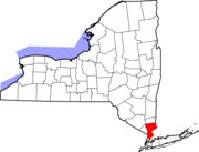 | |
| البلدات | ||
| القرى | ||
| أماكن تعداد | ||
| قرى أخرى | ||
| الهوامش | ‡هذا المكان المأهول لديه مناطق في مقاطعة أو مقاطعات مجاورة | |
خطأ استشهاد: وسوم <ref> موجودة لمجموعة اسمها "note"، ولكن لم يتم العثور على وسم <references group="note"/>
- Pages using gadget WikiMiniAtlas
- CS1 الإنجليزية الأمريكية-language sources (en-us)
- CS1 maint: location missing publisher
- CS1 maint: numeric names: authors list
- Short description is different from Wikidata
- Coordinates on Wikidata
- Articles with hatnote templates targeting a nonexistent page
- Pages using US Census population needing update
- قرى ولاية نيويورك
- عائلة روكفلر
- قرى في مقاطعة وستشستر، نيويورك
- أماكن مأهولة على نهر هدسون
- Mount Pleasant, New York
- سليپي هولو، نيويورك
- واشنطن إرڤنگ