فردركسبرگ، ڤرجينيا
Fredericksburg, Virginia | |
|---|---|
| City of Fredericksburg | |
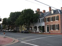 Historic downtown Fredericksburg | |
| الشعار: America's Most Historic City | |
| الإحداثيات: 38°18′6.5″N 77°28′15″W / 38.301806°N 77.47083°W | |
| Country | United States |
| State | Commonwealth of Virginia |
| County | None (Independent city since 1879, adjacent to Spotsylvania County) |
| Founded | 1728 |
| Incorporated | 1781 |
| الحكومة | |
| • Mayor | Mary Katherine Greenlaw |
| المساحة | |
| • Independent city | 10٫52 ميل² (27٫24 كم²) |
| • البر | 10٫45 ميل² (27٫07 كم²) |
| • الماء | 0٫07 ميل² (0٫18 كم²) |
| المنسوب | 59 ft (18 m) |
| التعداد | |
| • Independent city | 24٬286 |
| • Estimate (2019)[3] | 29٬036 |
| • الكثافة | 2٬300/sq mi (890/km2) |
| • Urban | 141٬238 (US: 231st) |
| منطقة التوقيت | UTC−05:00 (Eastern (EST)) |
| • الصيف (التوقيت الصيفي) | UTC−04:00 (EDT) |
| ZIP Codes | 22401–22405 (5 total) |
| مفتاح الهاتف | 540 |
| FIPS code | 51-29744[4] |
| GNIS feature ID | 1494947[5] |
| الموقع الإلكتروني | www |
| * Independent from Spotsylvania County in 1879 | |
Fredericksburg is an independent city located in the Commonwealth of Virginia in the United States. As of the 2010 census, the population was 24,286,[2] an increase from 19,279 at the 2000 census. The city population was estimated at 29,144 in 2018.[6] The Bureau of Economic Analysis of the United States Department of Commerce combines the city of Fredericksburg with neighboring Spotsylvania County for statistical purposes.
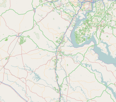
Fredericksburg is located 53 ميل (85 km) south of Washington, D.C. and 58 ميل (94 km) north of Richmond.[7] Fredericksburg is a part of Northern Virginia and is in the Baltimore-Washington Metropolitan Area.
Located near where the Rappahannock River crosses the Atlantic Seaboard fall line, Fredericksburg was a prominent port in Virginia during the colonial era. During the Civil War, Fredericksburg, located halfway between the capitals of the opposing forces, was the site of the Battle of Fredericksburg and Second Battle of Fredericksburg. These battles are preserved, in part, as the Fredericksburg and Spotsylvania National Military Park. More than 10,000 African-Americans in the region left slavery for freedom in 1862 alone, getting behind Union lines. Tourism is a major part of the economy, with approximately 1.5 million people visiting the Fredericksburg area annually, including the battlefield park, the downtown visitor center, events, museums, and historic sites.[8]
Geography and climate
| بيانات المناخ لـ Fredericksburg, Virginia (downtown, 1981−2010 normals) | |||||||||||||
|---|---|---|---|---|---|---|---|---|---|---|---|---|---|
| الشهر | ينا | فب | مار | أبر | ماي | يون | يول | أغس | سبت | أكت | نوف | ديس | السنة |
| متوسط القصوى اليومية °ف (°س) | 45.3 (7.4) |
48.7 (9.3) |
56.9 (13.8) |
67.5 (19.7) |
75.9 (24.4) |
84.5 (29.2) |
87.8 (31.0) |
86.5 (30.3) |
80.0 (26.7) |
69.9 (21.1) |
59.4 (15.2) |
49.0 (9.4) |
67.7 (19.8) |
| متوسط الدنيا اليومية °ف (°س) | 24.3 (−4.3) |
26.1 (−3.3) |
33.2 (0.7) |
43.0 (6.1) |
52.4 (11.3) |
62.5 (16.9) |
67.1 (19.5) |
65.7 (18.7) |
58.0 (14.4) |
44.9 (7.2) |
35.6 (2.0) |
27.3 (−2.6) |
45.1 (7.3) |
| متوسط تساقط الأمطار inches (mm) | 2.90 (74) |
2.51 (64) |
3.99 (101) |
3.35 (85) |
4.08 (104) |
3.97 (101) |
4.53 (115) |
3.39 (86) |
4.32 (110) |
3.38 (86) |
3.75 (95) |
3.18 (81) |
43.35 (1٬102) |
| Average precipitation days (≥ 0.01 in) | 9.5 | 10.1 | 11.4 | 11.7 | 12.5 | 10.2 | 13.1 | 10.0 | 9.4 | 8.8 | 9.8 | 11.2 | 127.7 |
| Source: NOAA (precipitation days at Fredericksburg National Battlefield Park)[9][10] | |||||||||||||
السكان
| التعداد | Pop. | ملاحظة | %± |
|---|---|---|---|
| 1830 | 3٬308 | — | |
| 1840 | 3٬974 | 20٫1% | |
| 1850 | 4٬061 | 2٫2% | |
| 1860 | 5٬022 | 23٫7% | |
| 1870 | 4٬046 | −19٫4% | |
| 1880 | 5٬010 | 23٫8% | |
| 1890 | 4٬528 | −9٫6% | |
| 1900 | 5٬068 | 11٫9% | |
| 1910 | 5٬874 | 15٫9% | |
| 1920 | 5٬882 | 0٫1% | |
| 1930 | 6٬819 | 15٫9% | |
| 1940 | 10٬066 | 47٫6% | |
| 1950 | 12٬158 | 20٫8% | |
| 1960 | 13٬639 | 12٫2% | |
| 1970 | 14٬450 | 5٫9% | |
| 1980 | 15٬322 | 6�0% | |
| 1990 | 19٬027 | 24٫2% | |
| 2000 | 19٬279 | 1٫3% | |
| 2010 | 24٬286 | 26�0% | |
| 2019 (تق.) | 29٬086 | [3] | 19٫8% |
| U.S. Decennial Census[11] 1790–1960[12] 1900–1990[13] 1990–2000[14] | |||
السياسة
| Year | Republican | Democratic | Third Parties |
|---|---|---|---|
| 2016 | 33.3% 3,744 | 59.6% 6,707 | 7.2% 806 |
| 2012 | 35.5% 4,060 | 62.4% 7,131 | 2.2% 246 |
| 2008 | 35.3% 3,413 | 63.6% 6,155 | 1.1% 109 |
| 2004 | 45.0% 3,390 | 54.2% 4,085 | 0.9% 67 |
| 2000 | 43.9% 2,935 | 50.3% 3,360 | 5.8% 386 |
| 1996 | 41.8% 2,579 | 52.2% 3,215 | 6.0% 370 |
| 1992 | 41.0% 2,819 | 47.5% 3,266 | 11.5% 794 |
| 1988 | 55.3% 3,401 | 43.6% 2,683 | 1.1% 70 |
| 1984 | 58.6% 3,500 | 40.8% 2,439 | 0.6% 34 |
| 1980 | 50.4% 2,502 | 43.8% 2,174 | 5.9% 292 |
| 1976 | 49.1% 2,527 | 49.5% 2,550 | 1.4% 73 |
| 1972 | 64.5% 3,211 | 34.2% 1,702 | 1.3% 63 |
| 1968 | 42.3% 2,142 | 40.2% 2,036 | 17.6% 890 |
| 1964 | 38.5% 1,511 | 61.4% 2,410 | 0.2% 7 |
| 1960 | 53.7% 1,566 | 45.5% 1,326 | 0.8% 23 |
| 1956 | 60.3% 1,672 | 33.7% 934 | 6.1% 169 |
| 1952 | 61.2% 1,536 | 38.7% 970 | 0.2% 4 |
| 1948 | 42.0% 810 | 42.3% 816 | 15.8% 305 |
| 1944 | 38.9% 698 | 60.9% 1,092 | 0.2% 3 |
| 1940 | 33.4% 522 | 66.3% 1,037 | 0.4% 6 |
| 1936 | 30.3% 411 | 69.6% 944 | 0.2% 2 |
| 1932 | 30.7% 366 | 68.2% 812 | 1.1% 13 |
| 1928 | 54.0% 697 | 46.0% 594 | |
| 1924 | 27.6% 223 | 69.0% 558 | 3.5% 28 |
| 1920 | 33.5% 299 | 65.1% 581 | 1.5% 13 |
| 1916 | 31.2% 173 | 68.6% 380 | 0.2% 1 |
| 1912 | 9.0% 51 | 73.1% 414 | 17.9% 101 |
Culture and recreation
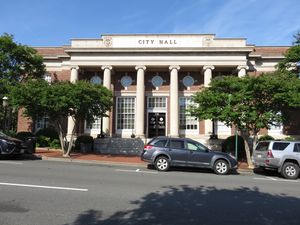
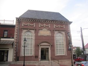
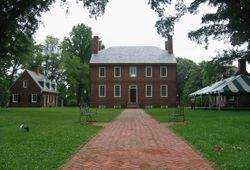
Architecture and historic sites
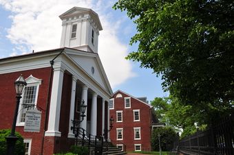
Fredericksburg Historic District | |
 | |
| الموقع | Roughly bounded by Rappahannock River, Hazel Run, Prince Edward and Canal Sts., Fredericksburg, Virginia |
|---|---|
| المساحة | 200 acre (81 ha) |
| رقم NRHP المرجعي | خطأ لوا: invalid capture index %2 in replacement string. |
| VLR No. | 111-0132 |
| تواريخ بارزة | |
| أضيف إلى NRHP | September 22, 1971 |
| أُدرِجـَت VLR | March 2, 1971[17] |
Sister cities
الهامش
References
- ^ "2018 U.S. Gazetteer Files". United States Census Bureau. Retrieved Feb 16, 2020.
- ^ أ ب "Geographic Identifiers: 2010 Demographic Profile Data (G001): Fredericksburg city, Virginia". U.S. Census Bureau, American Factfinder. Retrieved October 20, 2016.[dead link]
- ^ أ ب "Population and Housing Unit Estimates". Retrieved April 1, 2020.
- ^ "U.S. Census website". United States Census Bureau. Retrieved January 31, 2008.
- ^ "US Board on Geographic Names". United States Geological Survey. October 25, 2007. Retrieved January 31, 2008.
- ^ "Population and Housing Unit Estimates". Retrieved June 4, 2019.
- ^ "Distance between Richmond, VA and Washington, DC". www.distance-cities.com. Retrieved March 22, 2019.
Fredericksburg, VA, situated 58.27 miles from Richmond, VA and 52.71 miles from Washington, DC.
- ^ "Fredericksburg, VA - Official Website - Official Website". www.fredericksburgva.gov.
- ^ "Station Name: VA FREDERICKSBURG SEWAGE". National Oceanic and Atmospheric Administration. Retrieved February 28, 2013.
- ^ "Station Name: VA FREDERICKSBURG NP". National Oceanic and Atmospheric Administration. Retrieved February 28, 2013.
- ^ "U.S. Decennial Census". United States Census Bureau. Retrieved January 6, 2014.
- ^ "Historical Census Browser". University of Virginia Library. Retrieved January 6, 2014.
- ^ "Population of Counties by Decennial Census: 1900 to 1990". United States Census Bureau. Retrieved January 6, 2014.
- ^ "Census 2000 PHC-T-4. Ranking Tables for Counties: 1990 and 2000" (PDF). United States Census Bureau. Retrieved January 6, 2014.
- ^ خطأ استشهاد: وسم
<ref>غير صحيح؛ لا نص تم توفيره للمراجع المسماةuselectionatlas.org - ^ "National Register Information System". National Register of Historic Places. National Park Service. يوليو 9, 2010.
- ^ "Virginia Landmarks Register". Virginia Department of Historic Resources. Archived from the original on سبتمبر 21, 2013. Retrieved مارس 19, 2013.
- ^ "Why Italian Flags Downtown?". WFVA. June 17, 2015. Retrieved June 18, 2015.
A delegation from Este, Italy is here. They are the city's newest sister city.
- ^ أ ب Baroody, Timothy J. "Sister Cities". Fredericksburg, Virginia. Retrieved April 14, 2017.
- ^ Jett, Cathy (December 15, 2015). "Fredericksburg Forming Sister City With Kathmandu". Free Lance-star. Retrieved April 14, 2017.
- ^ Larson, Susan (December 17, 2012). "City Adds Schwetzingen, Germany as Sister City". Fredericksburg Patch. Retrieved September 27, 2013.
External links
- Official website
- General Interest Information about Fredericksburg Virginia
- Local history resources from the Central Rappahannock Regional Library
- Fredericksburg.com, the website of the Free Lance-Star newspaper
- Daily Star, Google news archive. —PDFs for 7,659 issues, dating from 1893 through 1926.
- Central Rappahannock Heritage Center a nonprofit all volunteer historical archive in Fredericksburg, Virginia.
- U.S. Geological Survey Geographic Names Information System: فردركسبرگ، ڤرجينيا
- Articles with dead external links from April 2020
- Articles using NRISref without a reference number
- Pages using gadget WikiMiniAtlas
- Short description is different from Wikidata
- Pages using US Census population needing update
- Articles with hatnote templates targeting a nonexistent page
- NRHP infobox with nocat
- Official website different in Wikidata and Wikipedia
- Coordinates on Wikidata
- Historic districts on the National Register of Historic Places in Virginia
- Cities in Virginia
- Fredericksburg, Virginia
- Washington metropolitan area
- Populated places established in 1728
- University towns in the United States
- 1728 establishments in Virginia
- Former county seats in Virginia
- National Register of Historic Places in Fredericksburg, Virginia

