كلگري
كلگري
Calgary | |
|---|---|
مدينة | |
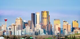
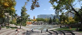
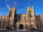
From top, left to right: Downtown Calgary skyline, Stephen Avenue, Lougheed House, Olympic Plaza, Southern Alberta Institute of Technology, Calgary Stampede Rodeo. | |
|
| |
| الكنية: | |
| الشعار: Onward | |
| الإحداثيات: 51°03′N 114°04′W / 51.050°N 114.067°W | |
| البلد | |
| المقاطعة | Alberta |
| Region | Calgary Metropolitan Region |
| Census division | 6 |
| Adjacent municipal districts | Rocky View County and Foothills County |
| Founded | 1875 |
| Incorporated[3] | |
| • Town | November 7, 1884 |
| • City | January 1, 1894 |
| السمِيْ | Calgary, Mull |
| الحكومة | |
| • الكيان | |
| • Mayor | Naheed Nenshi |
| • Manager | David Duckworth[4] |
| • MPs | List of MPs
|
| • MLAs | List of MLAs
|
| المساحة | |
| • البر | 825٫56 كم² (318٫75 ميل²) |
| • الحضر | 586٫08 كم² (226٫29 ميل²) |
| • العمران | 5٬110٫21 كم² (1٬973٫06 ميل²) |
| المنسوب | 1٬045 m (3٬428 ft) |
| التعداد | |
| • مدينة | 1٬239٬220 |
| • Estimate (2020) | 1٬361٬852[10] |
| • الكثافة | 1٬501٫1/km2 (3٬888/sq mi) |
| • Urban | 1٬237٬656 |
| • الكثافة الحضرية | 2٬111/km2 (5٬470/sq mi) |
| • العمرانية | 1٬392٬609 (4th) |
| • الكثافة العمرانية | 272٫5/km2 (706/sq mi) |
| • Municipal census (2019) | 1٬285٬711[9] |
| صفة المواطن | Calgarian |
| منطقة التوقيت | UTC−07:00 (MST) |
| • الصيف (التوقيت الصيفي) | UTC−06:00 (MDT) |
| Forward sortation areas | |
| مفتاح الهاتف | 403, 587, 825 |
| NTS Map | 082O01 |
| GNBC Code | IAKID |
| Major airport | Calgary International Airport (YYC) |
| Highways | |
| Public transit | Calgary Transit |
| Waterways | Bow River, Elbow River, Glenmore Reservoir |
| GDP (Calgary CMA) | CA$101.1 billion (2016)[11] |
| GDP per capita (Calgary CMA) | CA$72,610 (2016) |
كـَلگري (تــُنطـَق /ˈkælɡri, ˈkælɡəri/) مركز النفط في كندا وأكبر مدينة في مقاطعة ألبرتا، تقع على السفوح الشرقية لسلسلة جبال روكي الكندية. يبلغ عدد سكان كلجاري 768,082 نسمة، أما عدد سكان منطقة كلجاري الكبرى فيبلغ 821,628 نسمة. ومعظم أهالي كلجاري من أصل أوروبي مع أن الهنود يمثلون نحو 1% من سكان المدينة.
وفي كلجاري ما يزيد على 940 مصنعاً تصنع منتجات مثل الكيميائيات، والأسمدة واللدائن، والكبريت، وبها المقار الرئيسية لنحو 640 شركة نفط. تصدر المدينة صحيفتين يوميتين وبها ثلاث محطات للتلفاز ونحو 15 محطة إذاعية.
استضافت كلجاري الألعاب الاوليمبية الشتوية 1988م.
الاقتصاد
| Employment by industry[12] | ||
|---|---|---|
| Industry | Calgary | Alberta |
| Agriculture | 6.1% | 10.9% |
| Manufacturing | 15.8% | 15.8% |
| Trade | 15.9% | 15.8% |
| Finance | 6.4% | 5.0% |
| Health and education | 25.1% | 18.8% |
| Business services | 25.1% | 18.8% |
| Other services | 16.5% | 18.7% |
| Labour force (2016)[13] | |||
|---|---|---|---|
| Rate | Calgary | Alberta | Canada |
| Employment | 66.9% | 66.3% | 61.2% |
| Unemployment | 10.3% | 9.0% | 6.8% |
| Participation | 74.6% | 72.9% | 65.6% |
المناخ
| بيانات المناخ لـ Calgary International Airport, 1981-2010 normals, extremes 1881-present | |||||||||||||
|---|---|---|---|---|---|---|---|---|---|---|---|---|---|
| الشهر | ينا | فب | مار | أبر | ماي | يون | يول | أغس | سبت | أكت | نوف | ديس | السنة |
| القصوى القياسية humidex | 17.3 | 21.9 | 25.2 | 27.2 | 31.6 | 33.3 | 36.9 | 36.0 | 32.9 | 28.7 | 22.2 | 19.4 | 36.9 |
| القصوى القياسية °س (°ف) | 17.6 (63.7) |
22.6 (72.7) |
25.4 (77.7) |
29.4 (84.9) |
32.4 (90.3) |
35.0 (95.0) |
36.1 (97.0) |
36.7 (98.1) |
33.3 (91.9) |
29.4 (84.9) |
23.1 (73.6) |
19.5 (67.1) |
36.7 (98.1) |
| متوسط القصوى اليومية °س (°ف) | −0.9 (30.4) |
0.7 (33.3) |
4.4 (39.9) |
11.2 (52.2) |
16.3 (61.3) |
19.8 (67.6) |
23.2 (73.8) |
22.8 (73.0) |
17.8 (64.0) |
11.7 (53.1) |
3.4 (38.1) |
−0.8 (30.6) |
10.8 (51.4) |
| المتوسط اليومي °س (°ف) | −7.1 (19.2) |
−5.4 (22.3) |
−1.6 (29.1) |
4.6 (40.3) |
9.7 (49.5) |
13.7 (56.7) |
16.5 (61.7) |
15.8 (60.4) |
11.0 (51.8) |
5.2 (41.4) |
−2.4 (27.7) |
−6.8 (19.8) |
4.4 (39.9) |
| متوسط الدنيا اليومية °س (°ف) | −13.2 (8.2) |
−11.4 (11.5) |
−7.5 (18.5) |
−2.0 (28.4) |
3.1 (37.6) |
7.5 (45.5) |
9.8 (49.6) |
8.8 (47.8) |
4.1 (39.4) |
−1.4 (29.5) |
−8.2 (17.2) |
−12.8 (9.0) |
−1.9 (28.6) |
| الصغرى القياسية °س (°ف) | −44.4 (−47.9) |
−45.0 (−49.0) |
−37.2 (−35.0) |
−30.0 (−22.0) |
−16.7 (1.9) |
−3.3 (26.1) |
−0.6 (30.9) |
−3.2 (26.2) |
−13.3 (8.1) |
−25.7 (−14.3) |
−35.0 (−31.0) |
−42.8 (−45.0) |
−45.0 (−49.0) |
| الصغرى القياسية تبريد الرياح | −52 | −53 | −45 | −37 | −24 | −6 | 0 | −4 | −12 | −34 | −48 | −55 | −55 |
| متوسط تساقط الأمطار mm (inches) | 9.4 (0.37) |
9.4 (0.37) |
17.8 (0.70) |
25.2 (0.99) |
56.8 (2.24) |
94.0 (3.70) |
65.5 (2.58) |
57.0 (2.24) |
45.1 (1.78) |
15.3 (0.60) |
13.1 (0.52) |
10.2 (0.40) |
418.8 (16.49) |
| متوسط تساقط الأمطار mm (inches) | 0.1 (0.00) |
0.1 (0.00) |
2.2 (0.09) |
10.8 (0.43) |
46.1 (1.81) |
93.9 (3.70) |
65.5 (2.58) |
57.0 (2.24) |
41.7 (1.64) |
7.5 (0.30) |
1.5 (0.06) |
0.3 (0.01) |
326.7 (12.86) |
| متوسط هطول الثلج cm (inches) | 15.3 (6.0) |
14.5 (5.7) |
22.7 (8.9) |
18.8 (7.4) |
11.9 (4.7) |
0.1 (0.0) |
0.0 (0.0) |
0.0 (0.0) |
3.9 (1.5) |
10.0 (3.9) |
16.6 (6.5) |
15.0 (5.9) |
128.8 (50.5) |
| Average precipitation days (≥ 0.2 mm) | 7.3 | 6.8 | 9.2 | 9.0 | 11.2 | 13.8 | 13.0 | 10.6 | 9.1 | 7.2 | 7.6 | 6.9 | 111.7 |
| Average rainy days (≥ 0.2 mm) | 0.27 | 0.20 | 1.3 | 4.1 | 10.1 | 13.8 | 13.0 | 10.5 | 8.7 | 4.2 | 1.4 | 0.40 | 67.97 |
| متوسط الرطوبة النسبية (%) | 54.5 | 53.2 | 50.3 | 40.7 | 43.5 | 48.6 | 46.8 | 44.6 | 44.3 | 44.3 | 54.0 | 55.3 | 48.3 |
| Mean monthly ساعات سطوع الشمس | 119.5 | 144.6 | 177.2 | 220.2 | 249.4 | 269.9 | 314.1 | 284.0 | 207.0 | 175.4 | 121.1 | 114.0 | 2٬396٫3 |
| نسبة السطوع المحتمل للشمس | 45.6 | 51.3 | 48.2 | 53.1 | 51.8 | 54.6 | 63.1 | 62.9 | 54.4 | 52.7 | 45.0 | 46.0 | 52.4 |
| متوسط مؤشر فوق البنفسجية | 1 | 1 | 2 | 4 | 6 | 7 | 7 | 6 | 4 | 2 | 1 | 0 | 3 |
| Source: Environment Canada[14] and Weather Atlas[15] | |||||||||||||
| بيانات المناخ لـ Springbank Hill, 1981–2010 normals | |||||||||||||
|---|---|---|---|---|---|---|---|---|---|---|---|---|---|
| الشهر | ينا | فب | مار | أبر | ماي | يون | يول | أغس | سبت | أكت | نوف | ديس | السنة |
| القصوى القياسية °س (°ف) | 16.5 (61.7) |
22.1 (71.8) |
23.8 (74.8) |
26.5 (79.7) |
33 (91) |
31 (88) |
33.8 (92.8) |
32.1 (89.8) |
30.6 (87.1) |
27.1 (80.8) |
20.4 (68.7) |
17.9 (64.2) |
33.8 (92.8) |
| متوسط القصوى اليومية °س (°ف) | −1.8 (28.8) |
0 (32) |
3.9 (39.0) |
10.5 (50.9) |
15.3 (59.5) |
18.8 (65.8) |
22.2 (72.0) |
21.2 (70.2) |
17 (63) |
11 (52) |
2.3 (36.1) |
−0.6 (30.9) |
10.0 (50.0) |
| المتوسط اليومي °س (°ف) | −8.2 (17.2) |
−6.7 (19.9) |
−2.7 (27.1) |
3.4 (38.1) |
8.1 (46.6) |
12.1 (53.8) |
14.8 (58.6) |
13.7 (56.7) |
9.5 (49.1) |
3.9 (39.0) |
−3.8 (25.2) |
−7 (19) |
3.1 (37.5) |
| متوسط الدنيا اليومية °س (°ف) | −14.5 (5.9) |
−13.4 (7.9) |
−9.2 (15.4) |
−3.8 (25.2) |
0.9 (33.6) |
5.4 (41.7) |
7.4 (45.3) |
6.2 (43.2) |
1.9 (35.4) |
−3.3 (26.1) |
−9.9 (14.2) |
−13.3 (8.1) |
−3.8 (25.2) |
| الصغرى القياسية °س (°ف) | −42.8 (−45.0) |
−41.6 (−42.9) |
−36.3 (−33.3) |
−21.7 (−7.1) |
−14.1 (6.6) |
−6.1 (21.0) |
−0.1 (31.8) |
−5.9 (21.4) |
−9.8 (14.4) |
−29.1 (−20.4) |
−36.5 (−33.7) |
−41.6 (−42.9) |
−42.8 (−45.0) |
| متوسط تساقط الأمطار mm (inches) | 9.9 (0.39) |
11.5 (0.45) |
17.6 (0.69) |
25.4 (1.00) |
61.1 (2.41) |
106.7 (4.20) |
66.9 (2.63) |
78 (3.1) |
50.3 (1.98) |
16.3 (0.64) |
16.3 (0.64) |
9.8 (0.39) |
469.8 (18.52) |
| متوسط تساقط الأمطار mm (inches) | 0.2 (0.01) |
0 (0) |
0.4 (0.02) |
9.3 (0.37) |
49.5 (1.95) |
106.7 (4.20) |
66.9 (2.63) |
78 (3.1) |
45.5 (1.79) |
7 (0.3) |
2.4 (0.09) |
0.3 (0.01) |
366.2 (14.47) |
| متوسط هطول الثلج cm (inches) | 12.7 (5.0) |
14.7 (5.8) |
21.7 (8.5) |
19 (7.5) |
12.4 (4.9) |
0 (0) |
0.1 (0.0) |
0.0 (0.0) |
5.3 (2.1) |
11.6 (4.6) |
17.4 (6.9) |
12.4 (4.9) |
127.3 (50.2) |
| [citation needed] | |||||||||||||
الديمغرافيا
| السنة | تعداد | ±% |
|---|---|---|
| 1891 | 3٬876 | — |
| 1901 | 4٬091 | +5.5% |
| 1906 | 11٬967 | +192.5% |
| 1911 | 43٬704 | +265.2% |
| 1916 | 56٬514 | +29.3% |
| 1921 | 63٬305 | +12.0% |
| 1926 | 65٬291 | +3.1% |
| 1931 | 83٬761 | +28.3% |
| 1936 | 83٬407 | −0.4% |
| 1941 | 88٬904 | +6.6% |
| 1946 | 100٬044 | +12.5% |
| 1951 | 129٬060 | +29.0% |
| 1956 | 181٬780 | +40.8% |
| 1961 | 249٬641 | +37.3% |
| 1966 | 330٬575 | +32.4% |
| 1971 | 403٬319 | +22.0% |
| 1976 | 469٬917 | +16.5% |
| 1981 | 592٬743 | +26.1% |
| 1986 | 636٬107 | +7.3% |
| 1991 | 710٬795 | +11.7% |
| 1996 | 768٬082 | +8.1% |
| 2001 | 878٬866 | +14.4% |
| 2006 | 988٬193 | +12.4% |
| 2011 | 1٬096٬833 | +11.0% |
| 2016 | 1٬239٬220 | +13.0% |
| Source: Statistics Canada [16][17][18][19][20][21][22][23][24][25][26] [27][28][29][30][31][32][33][34][35][36][5][37] | ||
المدن الشقيقة
| البلد | City | المقاطعة/الولاية | التاريخ |
|---|---|---|---|
| مدينة كويبك | كويبك | 1956 | |
| جايپور | راجستان | 1973 | |
| ناوكلپان | ولاية مكسيكو | 1994 | |
| داچنگ | هـِيلونگجيانگ | 1995 | |
| دايجيون | چونگنام | 1996 | |
| فينكس | أريزونا | 1997 |
انظر أيضاً
الهامش
|
وصلات خارجية
- Official Website
- Tourism
- Calgary Wiki
- كلگري travel guide from Wikitravel
- Folk Music Festival
- 2001 Census Profile
| Rocky View No. 44 | Airdrie | كوكران |
| ||||
| Chestermere | Canmore | ||||||
| Foothills No. 31 | Okotoks | Tsuu T'ina Nation 145 Bragg Creek |
الكلمات الدالة:
All content in this article is created by Marefa contributors and is © Marefa. All rights reserved.
تصنيفات:
- Pages using gadget WikiMiniAtlas
- CS1 errors: extra text: volume
- Short description with empty Wikidata description
- Pages using infobox settlement with possible nickname list
- Coordinates not on Wikidata
- صفحات تستخدم جدول مستوطنة بقائمة محتملة لمفاتيح الهاتف
- Articles with hatnote templates targeting a nonexistent page
- Portal-inline template with redlinked portals
- Pages with empty portal template
- المدن المضيفة للألعاب الاولمبية الشتوية
- كلگري
- المدن المضيفة للألعاب الاوليمپية الشتوية
- أماكن مأهولة تأسست في 1884
- Hudson's Bay Company trading posts
- مدن كندا
