ميلفورد، كنتيكت
Milford, Connecticut | |
|---|---|
 Aerial view of Milford city center and harbor | |
| أصل الاسم: Ford by a mill | |
| الكنية: Sleepy Hollow[1] | |
| الشعار: A Small City with a Big Heart! | |
 Location in New Haven County, Connecticut | |
| Coordinates: 41°13′27″N 73°03′35″W / 41.22417°N 73.05972°W | |
| Country | |
| U.S. state | |
| County | New Haven |
| Metropolitan area | New Haven |
| Settled | 1639 |
| Incorporated (city) | 1959 |
| Named after | Milford, Surrey |
| Government | |
| • Type | Mayor–Board of Aldermen |
| • Mayor | Benjamin G. Blake (D) |
| Area | |
• Total | 25٫13 ميل² (65٫09 كم²) |
| • Land | 21٫91 ميل² (56٫73 كم²) |
| • Water | 3٫23 ميل² (8٫35 كم²) |
| Population | |
• Total | 52٬759 |
• Estimate (2019)[5] | 53٬195 |
| • Density | 2٬428٫44/sq mi (937٫64/km2) |
| United States Census 2010, United States Census Bureau | |
| Time zone | UTC−5 (Eastern) |
| • Summer (DST) | UTC−4 (Eastern) |
| ZIP Codes | 06460, 06461 |
| Area code(s) | 203/475 |
| FIPS code | 09-47515 |
| GNIS feature ID | 0208882 |
| Major highways | |
| Commuter Rail | |
| Website | www |
Milford is a city within Coastal Connecticut and New Haven County, Connecticut, between Bridgeport, Connecticut and New Haven, Connecticut, United States. The population was estimated to be 53,195 in a July 2019 estimate.[6] The city includes the Village of Devon and the borough of Woodmont. Milford is part of the New York-Newark Bridgeport, NY-NJ-CT-PA Combined Statistical Area.
التاريخ
التاريخ المبكر

The land which today comprises Milford, Orange and West Haven was purchased on February 1, 1639 from Ansantawae, chief of the local Paugussets (an Algonquian tribe) by English settlers affiliated with the contemporary New Haven Colony. Originally, the area was known as "Wepawaug", after the small river which runs through the town, and which has given its name to several streets in both Milford and Orange.
A grist mill was first built over the Wepawaug River in 1640.[7]
During the Revolutionary War the Milford section of the Boston Post Road, a vital route connecting Boston, New York and other major coastal cities, was blockaded by Continental forces, and Fort Trumbull was constructed to protect the town. The site of the blockade is commemorated by the Liberty Rock monument.
By 1822, the town had grown large enough that residents in the northern and eastern sections of Milford chartered their own independent course as the town of Orange. During the next century and a half, the remaining section of Milford was known for shipbuilding, farming and oystering, although a small subset of industrial facilities also developed in town. During this time, Milford also became known as a beach resort for residents of New Haven and Bridgeport.
Also in 1899, the "Memorial Bridge" (a "stone bridge and tower commemorating the town's history and founders")[8] was built at the site of the last mill over the Wepawaug after it was closed in 1894.[7] "The stone bridge is simple in design, its broad copings surmounted with rough hewn blocks of granite, bearing the names of the first settlers. There are ten blocks on the south and twenty on the north coping. At each end of the former is a stone four feet wide by five and a half high."[7] It is located where Broad Street crosses the Wepawaug River.
In 1903, the southeastern portion of the town was incorporated as the Borough of Woodmont. In 1959, the town of Milford including the Borough of Woodmont was incorporated as the City of Milford.
Towns created from Milford
Milford was one of the early settlements in south central Connecticut and, over time, gave rise to several new towns that broke off and incorporated separately. The following is a list of towns created from parts of Milford.
- Woodbridge in 1784 (also partly from New Haven)
- Bethany, created from Woodbridge in 1832
- Orange (originally North Milford) in 1822 (also partly from New Haven)
- West Haven, created from Orange in 1921
The "oatmeal lots" of Liberty Park
Starting in 1902, Quaker Oats oatmeal boxes came with a coupon redeemable for the legal deed to a tiny lot in Milford. The lots, sometimes as small as 10 أقدام (3 m) by 10 feet, were carved out of a 15-acre (6.1 ha) tract in a never-built subdivision called "Liberty Park". A small number of children (or their parents), often residents living near Milford, collected the deeds and started paying the extremely small property taxes on the "oatmeal lots". The developer of the prospective subdivision hoped the landowners would hire him to build homes on the lots, although several lots would need to be combined before building could start. Since the subdivision into small lots predated Milford's planning and zoning regulations, the deeds were entirely legal, although they created a large amount of paperwork for town tax collectors, who frequently couldn't find the property owners and received almost no tax revenue from the lots.[9]
In the mid-1970s, when the town wanted to develop the area, town officials put an end to the oatmeal lots in a "general foreclosure" that avoided the enormous expense of individual foreclosures by condemning nearly all of the property in one legal filing. One of the streets in the Liberty Park subdivision plans, Shelland Street, was later built in the late 1990s as an access road to the Milford Power Company. The site is currently home to the Bic Corporation's lighter factory at 565 Bic Drive.
In a separate land giveaway in 1955 tied to the Sergeant Preston of the Yukon television show, Quaker Oats offered in its Puffed Wheat and Puffed Rice cereal boxes genuine deeds to land in the Klondike.[9]
التطور بعد الحرب العالمية الثانية
In the post-World War II period, Milford—like many Connecticut towns—underwent significant suburbanization. Interstate 95 was routed through town, and the Milford section was completed in 1958.
The 1960s and 1970s witnessed the construction of the Connecticut Post Mall, one of the state's largest shopping malls, and the extensive commercial development of the town's stretch of the Boston Post Road. One notable small business located on the Boston Post Road during the 1970s was SCELBI Computer Consulting, credited by many as being the world's first personal-computer manufacturer. Starting in 1975, the city began hosting the Milford Oyster Festival, which has since become firmly established as an annual Milford tradition that is held "rain or shine".[10][11]
The city became host to several headquarters of multinational corporations, including the Schick Shaving company,[12] and Doctor's Associates, Inc., owners of the Subway chain of fast-food restaurants. The US operations of BIC were headquartered in Milford, but in March 2008 moved most of its operations to Shelton. Milford Hospital has also developed into an important health care resource for the area. It has also become home of smaller national corporations such as K-Mart and Orchid Medical.
السكان
| التعداد | Pop. | ملاحظة | %± |
|---|---|---|---|
| 1790 | 2٬098 | — | |
| 1800 | 2٬417 | 15٫2% | |
| 1810 | 674 | −72٫1% | |
| 1820 | 2٬785 | 313٫2% | |
| 1830 | 2٬256 | −19�0% | |
| 1840 | 2٬455 | 8٫8% | |
| 1850 | 2٬465 | 0٫4% | |
| 1860 | 2٬828 | 14٫7% | |
| 1870 | 3٬405 | 20٫4% | |
| 1880 | 3٬347 | −1٫7% | |
| 1890 | 3٬811 | 13٫9% | |
| 1900 | 3٬783 | −0٫7% | |
| 1910 | 4٬366 | 15٫4% | |
| 1920 | 10٬193 | 133٫5% | |
| 1930 | 12٬660 | 24٫2% | |
| 1940 | 16٬439 | 29٫8% | |
| 1950 | 26٬870 | 63٫5% | |
| 1960 | 41٬662 | 55٫1% | |
| 1970 | 50٬858 | 22٫1% | |
| 1980 | 50٬898 | 0٫1% | |
| 1990 | 49٬938 | −1٫9% | |
| 2000 | 52٬212 | 4٫6% | |
| 2010 | 52٬759 | 1�0% | |
| 2019 (تق.) | 53٬195 | [5] | 0٫8% |
| [13] | |||
According to the 2010 US census Demographic Profile Data, there were 51,271 people living in 21,017 housing units of which 13,534 were counted as family households.[14] The population density was 2,341/sq mi (904/km2). The average density of housing units was 1,017.7 per square mile. The racial makeup of Milford was 93.55% White, 1.91% African American, 0.13% Native American, 2.36% Asian, 0.03% Pacific Islander, 0.88% from other races, and 1.14% from two or more races. Hispanic or Latino people of any race were 3.34% of the population.
Of the aforementioned households 29.3% had children under the age of 18 living with them, 54.7% were married couples living together, 9.7% had a female householder with no husband present, and 32.4% were non-families. 26.3% of all households were made up of individuals and 10.3% had someone living alone who was 65 years of age or older. The average household size was 2.49 and the average family size was 3.04.
(In Milford the population was 22.4% under the age of 18, 5.9% from 18 to 24, 31.7% from 25 to 44, 25.0% from 45 to 64, and 14.9% who were 65 years of age or older. The median age was 39 years. For every 100 females, there were 93.6 males. For every 100 females age 18 and over, there were 90.0 males.)
As of the 2000 census, the median income for a household was $61,183. The per capita income was $28,773. About 2.4% of families and 3.8% of the population were below the poverty line, including 4.1% of those under age 18 and 5.4% of those age 65 or over.
The Census Bureau's 2010–2012 American Community Survey showed that (in 2012 inflation-adjusted dollars) median household income was $77,925 and the median family income was $93,697. Year-round male workers had a median income of $67,631 versus $59,992 for females. The per capita income for the city was $38,560.[15]
Gallery
-
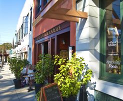 River Street in Downtown Milford
 -
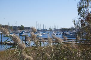 Milford Harbor seen from Pond Street
 -
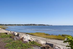 View of coastline from Fort Trumbull Beach, with Gulf Beach in distance
 -
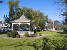 Milford Green, the first longest green in New England
 -
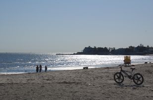 View of Long Island Sound from a Milford beach
 -
-
 Milford Town Hall
 -
Silver Sands Beach at sunset in Milford
-
 Charles Island, Sunrise at Silver Beach


Government
Government in the city is set up with the mayor as chief executive and the Board of Aldermen as a legislative body. The mayor is permitted to propose legislation to the Board of Aldermen and introduces the city budget, but possesses no veto power over what the Aldermen chooses to pass.

Taxes
In 2005, the mill rate for Milford was 34.36[16] and was 27.88 mills for fiscal year 2015–2016.[17]
Elected positions
The following is a list of city government positions elected by city residents and the terms thereof:[18]
- Mayor: The mayor is the city's chief executive and is elected in odd-numbered years. The mayor receives compensation for his or her services.
- Board of Aldermen: The Board of Aldermen consists of 15 members elected in odd-numbered years, three from each of the city's five political districts. Per City Charter requirements, only two of the three aldermen elected from each district may be from one political party to allow for minority representation on the board; voters are permitted to vote for any three aldermen in their district. Members of the Board of Aldermen receive no compensation for their services.
- Board of Education: The Board of Education deals with educational matters in the city and consists of 10 members elected in odd-numbered years, two from each of the city's five political districts. Members receive no compensation for their services.
- Planning & Zoning Board: The Planning & Zoning Board deals with development and land use issues and consists of 10 members, two from each of the city's five political districts. Members serve a four-year term, with one of the two members of each political district up for election during each odd-numbered year's election cycle, ensuring that no more than half of the board is made up of new members at the start of a new session. Members of the Planning & Zoning Board receive no compensation for their services.
- City Clerk: The city clerk is elected in odd-numbered years and receives a compensation for services provided.
- Constables: Seven constables are elected in odd-numbered years, though individual voters are only permitted to vote for any four of their choosing on the ballot. They are compensated on a case-by-case basis.
- Registrars of Voters: Pursuant to Connecticut state law, each town must have a Republican and Democratic registrar of voters to serve as election administrators, though an additional third party registrar is permitted if they receive more votes than either of the major parties' registrar. Registrars in Milford are elected to two-year terms, their election taking place during each even-year state election cycle. Registrars are compensated for their services. Voters may only vote for one choice for registrar.
List of mayors
After becoming incorporated as a city in 1959, the city reformed its system of government by establishing a mayor–board of aldermen format. It elected its first mayor, Charles Iovino,[19] the incumbent city manager under Milford's previous form of government, on November 3, 1959.
Since 1959, 10 people have held the office of mayor in the city.[20]
#3333FF #E81B23 #DDDDBB| Voter registration and party enrollment as of November, 01 2017[21] | ||||||
|---|---|---|---|---|---|---|
| Party | Active voters | Inactive voters | Total voters | Percentage | Change since 2015[22] | |
| Democratic | 10,319 | 405 | 10,724 | 28.5% | +15.6% | |
| Republican | 8,166 | 248 | 8,414 | 22.4% | +18.6% | |
| Unaffiliated | 17,256 | 606 | 17,862 | 47.5% | +6.3% | |
| Total | 36,309 | 1,274 | 37,583 | 100% | +12.0% | |
| # | Name | In office | Political party |
|---|---|---|---|
| 1 | Charles Iovino | 1959–1963 | Independent |
| 2 | Alan Jepson | 1963–1969 | Democratic |
| 3 | Edward Kozlowski | 1969–1971 | Republican |
| 4 | Clifton Moore | 1971–1973 | Republican |
| 5 | Joel Baldwin | 1973–1977 | Democratic |
| 6 | Henry Povinelli | 1977–1981 | Republican |
| 7 | Alberta Jagoe | 1981–1989 | Democratic |
| 8 | Frederick L. Lisman | 1989–2001 | Republican |
| 9 | James L. Richetelli, Jr. | 2001–2011 | Republican |
| 10 | Benjamin G. Blake | 2011–present | Democratic |
Education
Milford Public Schools currently operates eight elementary schools, three middle schools, two high schools, and one alternative education high school.[23] There are also a number of private schools in the city.
Public
- The Academy[24]
- Calf Pen Meadow Elementary School[25]
- East Shore Middle School[26]
- Harborside Middle School[27]
- John F. Kennedy Elementary School[28]
- Jonathan Law High School[29]
- Joseph A. Foran High School[30]
- Live Oaks Elementary School[31]
- Mathewson Elementary School[32]
- Meadowside Elementary School[33]
- Orange Avenue Elementary School[34]
- Orchard Hills Elementary School[35]
- Platt Technical High School
- Pumpkin Delight Elementary School[36]
- West Shore Middle School[37]
Milford High School operated for 141 years at the time of its closing in June, 1983. It was the first public high school to operate in Milford, beginning in 1842. [38] The former Milford High School building is now the Parson's Government building. [39]
Private schools
- Academy of Our Lady of Mercy, Lauralton Hall High School [40]
- Charles F. Hayden School (K-8)[41]
- Connecticut Center for Child Development (K-12)
- The Foundation School (9-12)[42]
- Milford Christian Academy (K-12)
- St. Mary School (PK-8) - Archdiocese of Hartford[43]
St. Gabriel's School opened in 1965; at the time clergy were the primary teachers. By the 2010s there were fewer clergy teachers, and lay teachers were more expensive; in addition fewer parishioners gave money to the church. By 2016 the school's budget was $111,709 in deficit. In 2008-2009 it had a peak enrollment of 219. In 2014 there was concern expressed about the school's survival expressed in the community, and in 2016 enrollment was down to 139, with 22 being in special education. The school directors chose to close the school in June 2016; the archdiocese did not order the closure.[44]
Emergency services
Fire Department
The city of Milford is protected 24/7, 365 by the 114 paid, full-time firefighters of the city of Milford Fire Department - ISO Class 1. The department currently operates out of five fire stations located throughout the city, under the command of a Battalion Chief and a Shift Commander. The Milford Fire Department is one of only two fire departments in the state of Connecticut to maintain an ISO Class 1 rating. The current[when?] Fire Chief is Douglas Edo.[45]
Fire station locations and apparatus
Below is a complete listing of all fire station locations and apparatus in the city of Milford.[46]
| Engine company | Truck company | Rescue ambulance | Special unit | Command unit | Address |
|---|---|---|---|---|---|
| Squad 1 (rescue pumper) | Medic 1, Medic 2 | Car 4 (Shift Commander), Car 5 (Battalion Chief) | 72 New Haven Ave. | ||
| Quint 3, Engine 4 | Haz-Mat. 1, Dive Rescue Unit | 349 Naugatuck Ave. | |||
| Quint 5, Engine 6 | Rescue 234(Collapse Unit), Utility 3 | 980 New Haven Ave. | |||
| Engine 7 | Tower Ladder 1 | Medic 3, Medic 4 (Stored at Repair Shop) | Decon. Trailer | 55 Wheelers Farms Rd. | |
| Special Services Canteen Unit | 3 Charles Street |
The Milford Fire Department also operates four reserve engines. Engine 2 (Reserve) is located at the quarters of Squad 1 and Tower Ladder 1. Engines 8 and 10 (Reserve) are located at the quarters of Quint 3 and Engine 4, while Engine 9 (Reserve) is located at the quarters of Quint 5 and Engine 6. The Canteen Unit is operated out of a garage at 3 Charles Street.
Police department
As of April 4, 2014 the Milford Police Department became one of 28 of Connecticut's 106 police departments accredited by the state of Connecticut.[47] Divisions and units include Detective Division, Special Investigations Unit, Identification Bureau and Narcotics & Vice Squad, Crime Prevention Unit, Training Unit/Recruit Academy and Marine Patrol / Dive Team.[48] The current chief of Milford Police is Keith L Mello[49]
الأحياء الرئيسية في ميلفورد

- Downtown Milford
- Devon
- Rivercliff
- Morningside†
- Point Beach†
- Bayview†
- Walnut Beach†
- Wildermere Beach†
- Laurel Beach†
- Woodmont‡
Other minor communities and geographic features are Anchor Beach, Bayview Heights, Burwells Beach, Cedar Beach, Downtown Historic District, Ettadore Park, Far View Beach, Forest Heights, Fort Trumbull, Great River, Gulf Beach, Heatherstone, Laurel Beach, Lexington Green, Merwin's Beach, Merwin's Point, Milford Lawns, Milford Point, Myrtle Beach, Naugatuck Gardens, Point Lookout, Silver Sands Beach, South of the Green, Walnut Beach, Wheelers Farms. Some of these communities have access to public and/or private beaches.
†: Denotes that the community is chartered by Special Act of the Connecticut General Assembly and have been granted some of the powers normally held only by a municipality including taxing authority.
‡: The Borough of Woodmont is chartered by Special Act of the Connecticut General Assembly as a municipality and has been granted all statutory powers of a municipality while simultaneously remaining part of the city of Milford.[50]
Culture and events

Every year on the third Saturday in August, Milford celebrates its annual Oyster Festival, which serves as a combination of a typical town fair with a culinary celebration of the town's location on historically shellfish-rich Long Island Sound. This festival takes place in and around the Milford Green, near the center of town, as well as in various locations throughout the downtown area, and features a wide variety of events including canoe and kayak races, musical performances, and classic car shows.
The Milford Oyster Festival has drawn large musical acts over the years including Joan Jett, The Marshall Tucker Band, John Cafferty & The Beaver Brown Band, and Soul Asylum. [citation needed]
There are also other features such as carnival rides, food stands, crafts, face painting, and even opening your own oyster for a pearl.
The Milford Cultural Center, operated by the Milford Council for the Arts, offers various events throughout the year. The Firehouse Art Gallery was recently opened in Devon. The beach resort quality of the town lives on, with several rocky beaches, Silver Sands State Park, the Connecticut Audubon Society Coastal Center at Milford Point, Charles Island, two golf courses, and numerous other recreational facilities available for residents and tourists.
Since 2011, the Walnut Beach Concert Series has taken place under the pavilion at Walnut Beach. It features a different band playing every Sunday afternoon during the summer.[51]
Economy
Top employers
According to the City's 2014 Comprehensive Annual Financial Report,[52] the top employers in the city are:
| # | Employer | Employees |
|---|---|---|
| 1 | City of Milford, Board of Education | 1,076 |
| 2 | Subway | 870 |
| 3 | Milford Hospital | 774 |
| 4 | Schick | 696 |
| 5 | City of Milford | 542 |
| 6 | Neopost Hasler | 390 |
| 7 | Macy's | 325 |
| 8 | Stop & Shop | 288 |
| 9 | Costco | 240 |
| 10 | Alinabal | 226 |
Geography and environment
According to the United States Census Bureau, Milford, including the borough of Woodmont, has a total area of 26.1 ميل مربع (67.7 km2), of which 22.2 ميل مربع (57.4 km2) is land and 3.9 ميل مربع (10.2 km2), or 15.11%, is water.[53]
Milford's Devon neighborhood[54] is located at the mouth of the Housatonic River near Stratford, and features the Connecticut Audubon Coastal Center overlooking the estuary.
Islands and coastline

Milford has over 14 ميل (23 km) of shoreline facing Long Island Sound, the most of any town in Connecticut.[55] A large portion of Milford's shoreline forms the Silver Sands State Park. A newly built 3/4 mile boardwalk was opened in 2011 that connects Silver Sands to Walnut Beach in Devon. Charles Island is also a part of the park and is a protected bird nesting ground. There is a sandbar (called a tombolo since it is perpendicular, not parallel to the coast) accessible during low tide that people can walk on from Silver Sands Beach to Charles Island. However, the sandbar can be dangerous to walk on as the quick change from low tide to high tide has led to several drownings. Visitors to Charles Island include treasure hunters looking for stolen treasure believed to have been buried in 1699 by Captain William Kid and his pirate crew.[23]
The island is a part of the Hamonasset-Ledyard Moraine and was formed as glaciers retreated at the end of the last ice age. The Wisconsin glaciation formed drumlins in Milford: Clark, Burwell, Eels, Bryan and Merwin hills.[56]
Milford owns three islands in the Housatonic River: Fowler Island, just to the south of the Igor I. Sikorsky Memorial Bridge, Duck Island, and Nells Island, both near the mouth of the river. In addition to Silver Sands State Park, Milford has five public beaches with lifeguard services for its residents - Gulf Beach, Anchor Beach, Hawley Avenue Beach, Walnut Beach, and Middle Beach - as well as seven private beaches.
Transportation
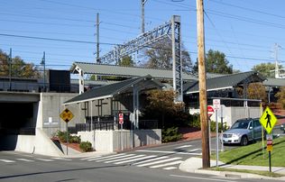
Interstate 95 and U.S. Route 1 pass through the southern part of Milford. The Wilbur Cross Parkway cuts across the northern part of the city and is connected to I-95 and Route 1 via the Milford Parkway, also known as the Daniel S. Wasson connector, named for the first police officer to die in the line of duty in the city of Milford. The Metro-North New Haven Line has a station stop in downtown Milford (Milford station) with direct service to New York City. The Milford Transit District provides in-town service to major attractions. Connections with the Greater Bridgeport Transit Authority, Norwalk Transit District, and Connecticut Transit New Haven are also available.
On the National Register of Historic Places
- Academy of Our Lady of Mercy Lauralton Hall — 200 High St. (added in 2011)
- Buckingham House, 61 North Street (added in 1977)[57][58]
- Eells-Stow House — 34 High St. (added in 1977)
- Hebrew Congregation of Woodmont — 15 and 17 Edgefield Ave. (added in 1995)
- Housatonic River Railroad Bridge — Amtrak right-of-way at Housatonic River (added in 1987)
- Milford Point Hotel, (added in 1988)[59]
- River Park Historic District Roughly bounded by Boston Post Road, Cherry St. and Amtrak, and High St. (added in 1986)[60]
- St. Peter's Episcopal Church — 61, 71, 81 River St. (added in 1979)
- Taylor Memorial Library — 5 Broad St. (added in 1979)
- US Post Office-Milford Main — 6 W. River St. (added in 1986)
- Washington Bridge — spans the Housatonic River to Stratford (added in 2004)
Notable people
- Mark Arcobello, former NHL forward; tied a league record for most teams played on during a single season
- Dylan Bruno, actor[61]
- Jeff Davis, creator of the TV show Teen Wolf
- Justin Gallagher, bike jump builder
- Anne Griffin, actress[62]
- Doug Henry, National Champion motocross and snowmobile racer[63]
- Simon Lake (1866–1945), inventor and naval engineer[64]
- Jonathan Law (1674–1750), colonial era judge; Governor of the Colony of Connecticut, 1741–1750[65]
- Joseph Plumb Martin (1760–1850), Revolutionary War soldier, raised by his grandparents in Milford
- Abigail Merwin (1759–1786), colonial-era wife and mother who alerted the local militia of a raid by British forces arriving from the warship HMS Swan[66]
- Ellen Muth, actress[67]
- Erin Pac, won bronze medal for two-woman-bobsleigh event at the 2010 Winter Olympics[68]
- Dan Patrick, sportscaster and radio personality; host of The Dan Patrick Show; co-host of Football Night in America; senior writer for Sports Illustrated
- Jason Peter, collegiate All-American defensive tackle (1997) and defensive end for the Carolina Panthers; attended Milford Academy[69]
- Catherine Pollard (c. 1918–2006), first female Scoutmaster in the Boy Scouts of America
- Charles H. Pond (1781–1861), judge of the New Haven County Court; sheriff of New Haven; Lieutenant Governor and 37th Governor of Connecticut[70]
- Peter Pond (1739/40?–1807), first explorer of the Athabasca region of North America in the 1780s; founding member of the North West Company[71]
- Peter L. Pond (1933–2000), human rights activist and philanthropist; adopted 16 Cambodian orphans[72]
- Jonathan Quick, NHL goaltender for the Los Angeles Kings;[73] Stanley Cup champion
- John Ratzenberger, actor
- Christy Carlson Romano, actress[74]
- Dan Rusanowsky, NHL radio broadcaster for the San Jose Sharks[75]
- Al Scaduto (1928–2007), cartoonist (They'll Do It Every Time)[76]
- Frank J. Sprague (1857–1934), inventor; helped develop the electric motor, electric railways, and electric elevators[77]
- Robert Treat (c. 1624–1710), colonial era deputy and military officer; Governor of the Colony of Connecticut, 1683–1698[78]
Movies filmed in Milford
Movies filmed at least in part in Milford include:[79]
- The Light That Failed (1916)
- Man on a Swing (1974)
- Daylight (1996)
- Furious Fish (2005)[80]
- Save the Forest (2005)[81]
- December Plans (2007)[82]
- Righteous Kill (2008)
- Sad Sack Sally (2009)[83]
الهامش
- ^ "Connecticut's Sleepy Hollow". ConnecticutHistory.org. ConnecticutHumanities. Retrieved 14 June 2017.
- ^ "2019 U.S. Gazetteer Files". United States Census Bureau. Retrieved July 2, 2020.
- ^ "CT - Milford city (balance)". United States Census 2010. US Census Bureau. Retrieved 16 June 2017.
- ^ "QuickFacts". US Census Bureau. U.S. Department of Commerce. Retrieved 17 June 2017.
- ^ أ ب "Population and Housing Unit Estimates". United States Census Bureau. May 24, 2020. Retrieved May 27, 2020.
- ^ "Population and Housing Unit Estimates". Retrieved May 21, 2020.
- ^ أ ب ت Greene, M. Louise (March 1899). "Early Milford". The Connecticut Magazine. V (3).
- ^ South Central Regional Council of Governments (1991). "#5 Milford Center Historic Walk". Milford Center Historic Walk.
- ^ أ ب Juliano, Frank (October 3, 2010). "'Oatmeal lots' gave officials indigestion". Connecticut Post. pp. A1, A12. Retrieved 2010-10-23.
- ^ "Milford Oyster Festival 2010." Daily Postal. August 21, 2010
- ^ Misur, Susan. "Annual Oyster Festival draws thousands in Milford Archived 2012-03-06 at the Wayback Machine." New Haven Register. Sunday, August 22, 2010
- ^ "Schick® | Shaving History". Schick.com. Archived from the original on 2013-03-25. Retrieved 2013-05-19.
- ^ Enter your Company or Top-Level Office. "Office of the Secretary of the State". Sots.state.ct.us. Archived from the original on 2005-09-13. Retrieved 2013-05-19.
- ^ "QuickFacts". United States Census Bureau. U.S. Department of Commerce. Retrieved 17 June 2017.
- ^ SELECTED ECONOMIC CHARACTERISTICS more information 2010–2012 American Community Survey 3-Year Estimates[dead link], United States Census Bureau. Accessed 2013-12-01.
- ^ "Connecticut Mill Rates - Hartford Courant". courant.com. Retrieved 2016-06-11.
- ^ "Tax Collector | Milford CT". ci.milford.ct.us. Retrieved 2016-06-11.
- ^ An Act Concerning a Charter for the City of Milford, Articles II-III. City of Milford, Connecticut. Effective November 9, 1959. Revised November 8, 1983.
- ^ "EX-CITY MANAGER BECOMING MAYOR; Iovino Takes Post Tomorrow in Milford, Conn., After Old Job Is Abolished". The New York Times. November 8, 1959. Retrieved 2010-05-08.
- ^ John H. O'Connell (November 1, 2009). "Historic City Election Ahead". Milford Republican Town Committee. Retrieved 2010-03-02.
- ^ "Registration and Party Enrollment Statistics as of November 01, 2017" (PDF). Connecticut Secretary of State. Retrieved 20 April 2017.
- ^ Wayback Machine - CT Sec of State 2015 (PDF) https://web.archive.org/web/20160304050323/http://www.sots.ct.gov/sots/lib/sots/electionservices/registration_and_enrollment_stats/nov15re.pdf. Archived from the original (PDF) on 2016-03-04.
{{cite web}}: Missing or empty|title=(help) - ^ أ ب Capuzzo, Jill P. (2019-05-29). "Milford, Conn.: A Pretty New England City That's 'Just Big Enough'". The New York Times (in الإنجليزية الأمريكية). ISSN 0362-4331. Retrieved 2019-10-03.
- ^ "Milford Public Schools: The Academy". milforded.org. Archived from the original on 2016-06-06. Retrieved 2016-06-11.
- ^ "Milford Public Schools: Calf Pen Meadow". milforded.org. Archived from the original on 2016-06-25. Retrieved 2016-06-11.
- ^ "Milford Public Schools: East Shore". milforded.org. Archived from the original on 2016-03-31. Retrieved 2016-06-11.
- ^ "Milford Public Schools: Harborside". milforded.org. Archived from the original on 2016-05-25. Retrieved 2016-06-11.
- ^ "Milford Public Schools: John F. Kennedy". milforded.org. Archived from the original on 2016-04-01. Retrieved 2016-06-11.
- ^ "Milford Public Schools: Jonathan Law". milforded.org. Archived from the original on 2016-03-23. Retrieved 2016-06-11.
- ^ "Milford Public Schools: Joseph A. Foran". milforded.org. Archived from the original on 2016-05-15. Retrieved 2016-06-11.
- ^ "Milford Public Schools: Live Oaks". milforded.org. Archived from the original on 2016-06-25. Retrieved 2016-06-11.
- ^ "Milford Public Schools: Mathewson". milforded.org. Archived from the original on 2016-04-01. Retrieved 2016-06-11.
- ^ "Milford Public Schools: Meadowside". milforded.org. Archived from the original on 2016-06-25. Retrieved 2016-06-11.
- ^ "Milford Public Schools: Orange Avenue". milforded.org. Archived from the original on 2016-05-12. Retrieved 2016-06-11.
- ^ "Milford Public Schools: Orchard Hills". milforded.org. Archived from the original on 2016-06-07. Retrieved 2016-06-11.
- ^ "Milford Public Schools: Pumpkin Delight". milforded.org. Archived from the original on 2016-06-25. Retrieved 2016-06-11.
- ^ "Milford Public Schools: West Shore". milforded.org. Archived from the original on 2016-04-22. Retrieved 2016-06-11.
- ^ https://www.milfordmirror.com/calendar/article/Milford-High-Indians-return-for-another-All-Class-13893581.php
- ^ https://www.ci.milford.ct.us/home/pages/parsons-directory
- ^ "Quick Facts - Lauralton Hall". lauraltonhall.org. Retrieved 2018-10-03.
- ^ "Charles F. Hayden Day School". bgvillage.org. Retrieved 2016-06-11.
- ^ "The Foundation School". foundationschool.org. Archived from the original on 2014-08-31. Retrieved 2016-06-11.
- ^ "St. Mary School | Milford, CT | preK-8 | Catholic School". Archived from the original on 2013-05-06. Retrieved 2016-06-11.
- ^ Mayko, Michael P. (2016-01-27). "Milford's St. Gabriel's School to close in June". Houston Chronicle.
- ^ City of Milford, CT (2013-05-08). "City of Milford, CT - Milford Fire Department". Ci.milford.ct.us. Archived from the original on 2013-05-20. Retrieved 2013-05-19.
- ^ City of Milford, CT (2013-02-28). "City of Milford, CT - Fire Stations". Ci.milford.ct.us. Retrieved 2013-05-19.[dead link]
- ^ "ACCREDITED POLICE DEPARTMENTS IN CONNECTICUT" (PDF). www.cga.ct.gov. Office of Legislative Research (CT). Retrieved 20 June 2017.
- ^ "Divisions and Units". City of Milford. Virtual Towns & Schools Website. Retrieved 20 June 2017.
- ^ "Chief of Police - Keith L. Mello". City of Milford, Connecticut. Virtual Towns & Schools Website. Retrieved 20 June 2017.
- ^ Number 92 of the Special Acts of 1957 of the Connecticut General Assembly
- ^ "Welcome to Walnut Beach". walnutbeachassociation.com. Archived from the original on 2014-10-17. Retrieved 2016-06-11.
- ^ [1]
- ^ "Geographic Identifiers: 2010 Demographic Profile Data (G001): Milford town, New Haven County, Connecticut". United States Census Bureau. Retrieved 2012-09-26.
- ^ "Village of Devon official website". villageofdevon.com. Retrieved 2016-06-11.
- ^ Charles, Eleanor "If You're Thinking of Living In/Milford, Conn.; Long Shoreline and a Wealth of Activities", The New York Times, April 7, 2002, accessed 2011-07-03.
- ^ Skehan, James W., Roadside Geology of Connecticut and Rhode Island, p 218, Missoula, Montana: Mountain Press Publishing Co., 2008, ISBN 978-0-8784-2547-1
- ^ "History of Milford, Connecticut, 1639-1939". The Internet Archive. Retrieved 18 June 2017.
- ^ "Buckingham House". The Gombach Group. The Gombach Group. Retrieved 18 June 2017.
- ^ "Milford Point Hotel". LandmarkHunter.com. James Baughn and contributors. Retrieved 18 June 2017.
- ^ "River Park Historic District". The Gombach Group.
- ^ "Dylan Bruno - IMDb". imdb.com. Retrieved 2016-06-11.
- ^ "Anne Griffin - IMDb". imdb.com. Retrieved 2016-06-11.
- ^ [2] Archived يناير 13, 2010 at the Wayback Machine
- ^ "Inventor & Engineer". Simonlake.com. Retrieved 2013-05-19.
- ^ "Jonathan Law". Cslib.org. Archived from the original on 2013-01-06. Retrieved 2013-05-19.
- ^ "NavigatorHomeSubpage". Oceanvoyaging.com. Retrieved 2013-05-19.
- ^ "Ellen Muth - Biography - IMDb". imdb.com. Retrieved 2016-06-11.
- ^ "Two-woman women". www.olympic.org. The International Olympic Committee. 2017-06-03. Retrieved 20 June 2017.
- ^ Finley, Bill (February 12, 2006). "IN PERSON; When the Cheers Aren't Enough". The New York Times. Retrieved 2010-05-12.
- ^ "Governors of Connecticut". Cslib.org. Retrieved 2013-05-19.
- ^ "POND, PETER - Dictionary of Canadian Biography Online". Biographi.ca. 2007-10-18. Retrieved 2013-05-19.
- ^ Mooney, Tom, "Peter Pond's War," Providence Journal, Oct 15, 1989 p. M-06.
- ^ "Jonathan Quick Los Angeles Kings - 2012–2013 Stats - Los Angeles Kings - Team". Kings.nhl.com. 1986-01-21. Retrieved 2013-05-19.
- ^ "Christy Carlson Romano - IMDb". imdb.com. Retrieved 2016-06-11.
- ^ "Dan Rusanowsky, Radio Play-By-Play Broadcaster - San Jose Sharks - Front Office Staff". Sharks.nhl.com. Retrieved 2013-05-19.
- ^ "Edwards and Dowdle, New York | Obituaries". Edwardsanddowdle.com. Archived from the original on 2013-05-18. Retrieved 2013-05-19.
- ^ "The Inventors (E)". Theelevatormuseum.org. 1934-10-25. Archived from the original on 2011-05-16. Retrieved 2013-05-19.
- ^ "Robert Treat". Cslib.org. Archived from the original on 2013-01-08. Retrieved 2013-05-19.
- ^ "IMDb: Most Popular Titles With Location Matching "Milford, Connecticut, USA"". imdb.com. Retrieved 2016-06-11.[dead link]
- ^ "Furious Fish (2005)". IMDb. IMDb.com, Inc. Retrieved 19 June 2017.
- ^ "Save the Forest (2005)". IMDb. IMDb.com, Inc. Retrieved 19 June 2017.
- ^ "December Plans (2007)". IMDb.com, Inc. IMDb. Retrieved 20 June 2017.
- ^ "Sad Sack Sally (2009)". IMDb.com, Inc. IMDb. Retrieved 20 June 2017.
وصلات خارجية
- City of Milford municipal website
- Milford, CT official website
- Milford Public Schools
- Milford Historical Society
- Milford,CT Milford Living Magazine
- ميلفورد، كنتيكت at Curlie
- "Early Milford"[dead link], history

|
West Haven | Orange | Shelton / Housatonic River |
|
| Long Island Sound | Stratford / Housatonic River | |||
| Long Island Sound |

بلديات ومجتمعات مقاطعة نيو هيڤن، كنتيكت، الولايات المتحدة | ||
|---|---|---|
| المدن | 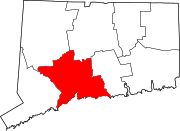 | |
| البلدات |
*Consolidated borough and town | |
| Borough | ||
| تجمعات أخرى | ||
| المقاطعات |  | |
|---|---|---|
| المدينة الرئيسية | ||
| المدن والبلدات 100–999 ألف | ||
| المدن والبلدات 25–99 ألف | بايون • برانفورد • Cheshire • كلفتن • دانبري • إيست هاڤن • إيست اورانج • إنگلوود • فيرفيلد • گارفيلد • گرينتش • هاكنساك • هامدن • هوبوكن • هاول • كارني • لونگ بيتش • لونگ برانش • مريدن • مدلتاون • ملفورد • ماونت ڤرنون • نوگاتك • نيو برنزويك • نيو ملفورد • نيو روشل • نيوبرگ • نيوتن • نورواك • پاسيك • پرث أمبوي • پلينفيلد • پوكپسي • راوِيْ • شلتن • ستراتفورد • Torrington • ترنتون • ترمبول • يونيون سيتي • Wallingford • وست هيڤن • وستفيلد • وستپورت • هوايت پلينز | |
| المدن والبلدات 10–25 ألف | أنسونيا • آسبري پارك • بيكن • بثل • بروكفيلد • دارين • دربي • دوڤر • گلفورد • گوتنبرگ • هاريسن (نيو جرزي) • هاريسن (نيويورك) • كنگستن • ليندن • ماديسون • منرو • موريستاون • نيو كينن • New Fairfield • North Branford • North Haven • اورانج • پليموث • پيكسكيل • Ridgefield • راي • سكارسديل • سكوكس • سيمور • ساوثبري • سمت • واترتاون • وست نيويورك • وستن • ولتن • ونشستر • وولكت | |
| المناطق الفرعية | ||
- Pages using gadget WikiMiniAtlas
- Articles with dead external links from April 2020
- CS1 errors: missing title
- CS1 errors: bare URL
- CS1 الإنجليزية الأمريكية-language sources (en-us)
- Articles with dead external links from July 2019
- Articles with dead external links from May 2019
- Short description is different from Wikidata
- Coordinates on Wikidata
- Pages using infobox settlement with possible area code list
- Pages using US Census population needing update
- Vague or ambiguous time from June 2012
- Articles with hatnote templates targeting a nonexistent page
- Articles with unsourced statements from October 2018
- Pages with empty portal template
- Articles with Curlie links
- Articles with dead external links from May 2020
- Milford, Connecticut
- Cities in Connecticut
- Cities in New Haven County, Connecticut
- Census balances in the United States
- Cities in the New York metropolitan area
- Populated coastal places in Connecticut