أنديز
الأنديز ( Andes ؛ /ˈændiːz/ AN-deez)، Andes Mountains أو سلسلة جبال الأنديز (إسپانية: Cordillera de los Andes؛ Quechua: Anti) هي سلسلة جبلية واسعة ممتدة على طول الساحل الغربي لأمريكا الجنوبية. يقارب طولها 8900 كيلومترا، وعرضها يترواح بين 200-700 كيلومتر (الأعرض بين خطي العرض 18°ج و20°ج)، ومعدل ارتفاعها 4000 مترا. تمتد السلسلة في سبع دول هي الأرجنتين والإكوادور وبوليفيا وبيرو وتشيلي وكولومبيا وفنزويلا.
| جبال الأنديز Andes Mountains | |
|---|---|
| Cordillera de los Andes | |
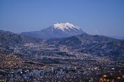
 سلسلة جبال الأنديز، كما تبدو من طائرة، بين سانتياگو دى تشيلى ومندوزا، الأرجنتين، في الصيف. حقل الثلج الكبير يناظر السفح الجنوبي لبركان سان خوسيه (يسار) و مرموليخو (يمين). توپونگاتو على يمينهم. | |
| أعلى نقطة | |
| القمة | أكونكاگوا, Las Heras Department، مندوسا، الأرجنتين |
| الارتفاع | 6,961 m (22,838 ft) |
| الإحداثيات | 32°S 70°W / 32°S 70°WCoordinates: 32°S 70°W / 32°S 70°W |
| الأبعاد | |
| الطول | 7,000 km (4,300 mi) |
| العرض | 500 km (310 mi) |
| التسمية | |
| الاسم المحلي | أنتي (Quechua) |
| الجغرافيا | |
 خريطة أمريكا الجنوبية تبين الأنديز ممتدة بطول الجزء الغربي للقارة (تقريباً موازية لساحل الهادي) للقارة.
| |
| البلدان | الأرجنتين, بوليڤيا, تشيلى, كولومبيا, الإكوادور, پيرو and ڤنزويلا |
سلسلة جبال الأنديز هي السلسلة الجبلية الأعلى خارج قارة آسيا، أعلى قممها هي قمة أكونكاجوا التي ترتفع 6959 متراً فوق مستوى البحر. الأنديز لا تستطيع مجاراة الهيملايا في الارتفاع ولكن طولها -تقريبا- ضعفي طول الهيمالايا.

جبال الأنديز أطول سلسلة جبال في العالم فوق سطح البحر، فهي تمتد على طول ساحل أمريكا الجنوبية الغربي بأكمله من رأس هورن إلى بنما بمسافة قدرها 7,200 كم. لا يفوق سلسلة الأنديز في الارتفاع سوى جبال الهيمالايا في شمالي الهند والتبت. وتتجاوز كثير من قمم جبال الأنديز 6,100م في ارتفاعها. وتبلغ المسافة العرضية عبر هذه الجبال نحو 645 كم عند أكثر أجزائها عرضاً.
Along their length, the Andes are split into several ranges, separated by intermediate depressions. The Andes are the location of several high plateaus—some of which host major cities such as Quito, Bogotá, Cali, Arequipa, Medellín, Bucaramanga, Sucre, Mérida and La Paz. The Altiplano plateau is the world's second-highest after the Tibetan plateau. These ranges are in turn grouped into three major divisions based on climate: the Tropical Andes, the Dry Andes, and the Wet Andes.
The Andes Mountains are the highest mountain range outside Asia. The highest mountain outside Asia, Argentina's Mount Aconcagua, rises to an elevation of about 6,961 m (22,838 ft) above sea level. The peak of Chimborazo in the Ecuadorian Andes is farther from the Earth's center than any other location on the Earth's surface, due to the equatorial bulge resulting from the Earth's rotation. The world's highest volcanoes are in the Andes, including Ojos del Salado on the Chile-Argentina border, which rises to 6,893 m (22,615 ft).
The Andes are also part of the American Cordillera, a chain of mountain ranges (cordillera) that consists of an almost continuous sequence of mountain ranges that form the western "backbone" of North America, Central America, South America and Antarctica.
.jpg)

. . . . . . . . . . . . . . . . . . . . . . . . . . . . . . . . . . . . . . . . . . . . . . . . . . . . . . . . . . . . . . . . . . . . . . . . . . . . . . . . . . . . . . . . . . . . . . . . . . . . . . . . . . . . . . . . . . . . . . . . . . . . . . . . . . . . . . . . . . . . . . . . . . . . . . . . . . . . . . . . . . . . . . . .
أصل الاسم
The etymology of the word Andes has been debated. The majority consensus is that it derives from the Quechua word anti, which means "east"[1] as in Antisuyu (Quechua for "east region"),[1] one of the four regions of the Inca Empire.
The term cordillera comes from the Spanish word cordel, meaning "rope",[2] and is used as a descriptive name for several contiguous sections of the Andes, as well as the entire Andean range, and the combined mountain chain along the western part of the North and South American continents.
الجغرافيا
%E2%80%93Valle_Carbajal_01.jpg)
ويمكن تقسيم الأنديز إلى ثلاث أقسام:
- الأنديز الجنوبية
- في الأرجنتين وتشيلى، جنوب Llullaillaco.
- الأنديز الوسطى
- في پيرو وبوليڤيا.
- الأنديز الشمالية
- في ڤنزويلا وكولومبيا والإكوادور. في الجزء الشمالي من الأنديز، فإن سلسلة جبال سييرا نـِڤادا دى سانتا مارتا المنفصلة كثيراً ما تُعتبر جزءاً من الأنديز الشمالية.[3]
The Leeward Antilles islands Aruba, Bonaire, and Curaçao, which lie in the Caribbean Sea off the coast of Venezuela, were formerly thought to represent the submerged peaks of the extreme northern edge of the Andes range, but ongoing geological studies indicate that such a simplification does not do justice to the complex tectonic boundary between the South American and Caribbean plates.[4]
الملامح الطبيعية
يمكن تقسيم جبال الأنديز إلى ثلاث مناطق طبيعية : الجنوبية والوسطى والشمالية. يبلغ ارتفاع الأنديز الجنوبية أقل من 3000م قرب طرف القارة الجنوبي. وإذا توغل المرء في اتجاه الشمال، تصبح القمم أكثر ارتفاعاً. وأعلى قمة في الأمريكتين هي أكونكاجوا (6959م)، وتقع في الأرجنتين، على بعد نحو 100كم من سانتياجو عاصمة تشيلي.
وتشكل جبال الأنديز الوسطى أعرض أجزاء هذه المنظومة الجبلية. فهذا الجزء يتشكل من سلسلتين تمتدان إلى الشمال الغربي والجنوب الشرقي. وبين هاتين السلسلتين تقع سهول عريضة مرتفعة أو نجود في بيرو وغربي بوليفيا. وترتفع النجود نفسها حوالي 4000م فوق مستوى سطح البحر. وإلى شمالي هذه النجود، تقترب السلسلتان إحداهما من الأخرى. ثم تلتقيان في النهاية لتشكلا سلسلة واحدة ضخمة في الإكوادور. وأعلى قمم جبال الأنديز الوسطى بسيس (6779م)، وهواسكاران (6768م)، وسوراتا أو إللامبو (6485م) وساجاما (6542م)، وإليماني (6402م) وتشيمبورازو (6267م) وكوتوباكسي (5897م).
أما جبال الأنديز الشمالية فهي ثلاث سلاسل. ولا تصل أي من هذه السلاسل إلى ارتفاع يعادل الجبال الأبعد منها باتجاه الجنوب. وتمتد إحدى السلاسل على طول الساحل عبر كولومبيا إلى داخل بنما. وتقع السلسلة الوسطى بين وادي نهر كوكا الضيق ووادي نهر ماجدلينا. وتشتمل هذه السلسلة على بركان توليما (5215م). وتمتد السلسلة الثالثة، الواقعة في الشرق، باتجاه الشمال الشرقي إلى داخل فنزويلا.
تصل قمم كثيرة في جبال الأنديز الشمالية إلى ارتفاع 4570م أو أكثر، وأعلاها قمة كريستوبال كولون (5775م) في كولومبيا. البراكين والزلازل. عدد كبير من قمم جبال الأنديز العالية جبال بركانية وبعض براكينها نشطة. وأشهر هذه البراكين نيفادو دل رويز في كولومبيا، وكوتوباكسي وتنغراهوا، وسانجاي في الإكوادور. كما يكثر حدوث الزلازل في جبال الأنديز. وقد اختفت بعض المدن الصغيرة بصورة كاملة بفعل هذه الزلازل. ومن بين المدن التي ألحقت بها الزلازل أضرارا بالغة فالباريسو وليما وكالاو وكويتو. أما أكونكاجوا فهو بركان خامد.
المثالج والبحيرات والأنهار
تغطي المثالج قممًا كثيرة من قمم الأنديز العالية، وينطبق هذا حتى على القمم القريبة من خط الاستواء. وتقع أعرض هذه المثالج في جنوبي تشيلي. وتهبط أنهار أخرى حتى تصل ساحل المحيط الهادئ. وقد أحدثت مثالج كثيرة تقع بين جبال الأنديز الجنوبية أودية عميقة في الشريط الساحلي الصخري. وتصل هذه الوديان إلى انخفاض أدنى بكثير عن مستوى سطح البحر، وهذا يجعل الشريط الساحلي مثلَّما كساحل النرويج، وتقع أجوان عمقية (ألسنة في الماء تتوغل في اليابس) كثيرة على طول الساحل، وتقع بعض الجزر الصخرية على مقربة منه. كما تصب الأنهار في المحيط الهادئ من خلال فجوات أحدثتها المثالج على الجانب الغربي من جبال الأنديز.
وينشأ المجرى الرئيسي لنهر الأمازون عند السفوح الشرقية لجبال الأنديز. وكذلك تصب روافد مصدرها جبال الأنديز في نهرين كبيرين آخرين هما ؛ بارانا، وأورينوكو. وهطول الأمطار خفيف على سفوح الأنديز الغربية، باستثناء الجزء القريب من خط الاستواء وفي الثلث الجنوبي من دولة تشيلي.
وقد حدث تطور غير طبيعي في الجزء الواقع بين سلسلتي الأنديز الوسطى في بوليفيا وشمالي الأرجنتين. فالمياه الآتية من النجد العالي لا تصب في أي من المحيطين الأطلسي أو الهادئ، بل تتجمع بدلاً من ذلك في بحيرة تيتيكاكا ثم تتدفق عبر نهر ديساغواديرو إلى بحيرة بوبو. وقد هبط مستوى هذه البحيرة إلى مستوى أدنى من الجدول المتدفق منها، ولم يعد من الممكن خروج المياه إلا عن طريق التبخر، أو أنها حين تكون مرتفعة تفيض وتشكل مستنقعًا.
الجيولوجيا
| جيولوجيا الأنديز |
|---|
| تكون الجبال |
| Pampean • الفاماتيني • الگوندواني • الأنديزي |
| أحزمة طيات ودسر |
| الباثولثات |
| Antioquia • كوردييرا بلانكا • Peruvian Coastal • Vicuña Mackenna • Elqui-Limarí • Colangüil • تشيلى الساحلي • ش. پتاگونيا • ج. پتاگونيا |
| بنى مندسة |
|
صفيحة ألوك (سابقاً) • صفيحة أنتارتيكا • Carnegie Ridge • Chile Rise • صفيحة فارالون (سابقاً) • Juan Fernández Ridge • صفيحة نازكا • Nazca Ridge |
| الفوالق |
|
Dolores-Guayaquil • كوردييرا بلانكا • Cochabamba • دوميكو • El Tigre • San Ramón • Liquiñe-Ofqui • Magallanes-Fagnano |
| حزام براكين الأنديز |
|
Northern Zone • Peruvian flat-slab • Central Zone • Pampean flat-slab • Southern Zone • Patagonian Gap • Austral Zone |
| الشظايا التكتونية |
|
Arequipa-Antofalla • Mejillonia • Chilenia • Chaitenia • Chiloé Block • Cuyania • Pampia • پتاگونيا • فتس روي • مادرى دى ديوس |

The Andes are a Mesozoic–Tertiary orogenic belt of mountains along the Pacific Ring of Fire, a zone of volcanic activity that encompasses the Pacific rim of the Americas as well as the Asia-Pacific region. The Andes are the result of tectonic plate processes, caused by the subduction of oceanic crust beneath the South American Plate. It is the result of a convergent plate boundary between the Nazca Plate and the South American Plate. The main cause of the rise of the Andes is the compression of the western rim of the South American Plate due to the subduction of the Nazca Plate and the Antarctic Plate. To the east, the Andes range is bounded by several sedimentary basins, such as Orinoco, Amazon Basin, Madre de Dios and Gran Chaco, that separate the Andes from the ancient cratons in eastern South America. In the south, the Andes share a long boundary with the former Patagonia Terrane. To the west, the Andes end at the Pacific Ocean, although the Peru-Chile trench can be considered their ultimate western limit. From a geographical approach, the Andes are considered to have their western boundaries marked by the appearance of coastal lowlands and a less rugged topography. The Andes Mountains also contain large quantities of iron ore located in many mountains within the range.
The Andean orogen has a series of bends or oroclines. The Bolivian Orocline is a seaward concave bending in the coast of South America and the Andes Mountains at about 18° S.[5][6] At this point, the orientation of the Andes turns from Northwest in Peru to South in Chile and Argentina.[6] The Andean segment north and south of the Orocline have been rotated 15° to 20° counter clockwise and clockwise respectively.[6][7] The Bolivian Orocline area overlaps with the area of maximum width of the Altiplano Plateau and according to Isacks (1988) the Orocline is related to crustal shortening.[5] The specific point at 18° S where the coastline bends is known as the "Arica Elbow".[8] Further south lies the Maipo Orocline a more subtle Orocline between 30° S and 38°S with a seaward-concave break in trend at 33° S.[9] Near the southern tip of the Andes lies the Patagonian Orocline.[10]
التجبل
The western rim of the South American Plate has been the place of several pre-Andean orogenies since at least the late Proterozoic and early Paleozoic, when several terranes and microcontinents collided and amalgamated with the ancient cratons of eastern South America, by then the South American part of Gondwana.
The formation of the modern Andes began with the events of the Triassic when Pangaea began the break up that resulted in developing several rifts. The development continued through the Jurassic Period. It was during the Cretaceous Period that the Andes began to take their present form, by the uplifting, faulting and folding of sedimentary and metamorphic rocks of the ancient cratons to the east. The rise of the Andes has not been constant, as different regions have had different degrees of tectonic stress, uplift, and erosion.
Tectonic forces above the subduction zone along the entire west coast of South America where the Nazca Plate and a part of the Antarctic Plate are sliding beneath the South American Plate continue to produce an ongoing orogenic event resulting in minor to major earthquakes and volcanic eruptions to this day. In the extreme south, a major transform fault separates Tierra del Fuego from the small Scotia Plate. Across the 1,000 km (620 mi) wide Drake Passage lie the mountains of the Antarctic Peninsula south of the Scotia Plate which appear to be a continuation of the Andes chain.[11]
The regions immediately east of the Andes experience a series of changes resulting from the Andean orogeny. Parts of the Sunsás Orogen in Amazonian craton disappeared from the surface of earth being overridden by the Andes.[12] The Sierras de Córdoba, where the effects of the ancient Pampean orogeny can be observed, owe their modern uplift and relief to the Andean orogeny in the Tertiary.[13] Further south in southern Patagonia the onset of the Andean orogeny caused the Magallanes Basin to evolve from being an extensional back-arc basin in the Mesozoic to being a compressional foreland basin in the Cenozoic.[14]
. . . . . . . . . . . . . . . . . . . . . . . . . . . . . . . . . . . . . . . . . . . . . . . . . . . . . . . . . . . . . . . . . . . . . . . . . . . . . . . . . . . . . . . . . . . . . . . . . . . . . . . . . . . . . . . . . . . . . . . . . . . . . . . . . . . . . . . . . . . . . . . . . . . . . . . . . . . . . . . . . . . . . . . .
البراكين

تضم سلسلة الأنديز العديد من البراكين النشطة، تتوزع في أربع مناطق بركانية:
- المنطقة البركانية الشمالية (NVZ) التي تضم براكين جنوب كولومبيا والإكوادور.
- المنطقة البركانية الوسطى (CVZ) تضم براكين جنوب پيرو وبوليڤيا وشمال تشيلى والأرجنتين
- المنطقة البركانية الجنوبية (SVZ), تمتد من وسط تشيلى إلى Chile Triple Junction
- منطقة أسترال البركانية (AVZ) تبدأ جنوب Chile Triple Junction وسببها اندساس صفيحة أنتارتيكا
رواسب الخام ومتبخراته
The Andes Mountains host large ore and salt deposits and some of their eastern fold and thrust belt acts as traps for commercially exploitable amounts of hydrocarbons. In the forelands of the Atacama Desert some of the largest porphyry copper mineralizations occurs making Chile and Peru the first and second largest exporters of copper in the world. Porphyry copper in the western slopes of the Andes has been generated by hydrothermal fluids (mostly water) during the cooling of plutons or volcanic systems. The porphyry mineralization further benefited from the dry climate that let them largely out of the disturbing actions of meteoric water. The dry climate in the central western Andes has also led to the creation of extensive saltpeter deposits which were extensively mined until the invention of synthetic nitrates. Yet another result of the dry climate are the salars of Atacama and Uyuni, the first one being the largest source of lithium today and the second the world's largest reserve of the element. Early Mesozoic and Neogene plutonism in Bolivia's Cordillera Central created the Bolivian tin belt as well as the famous, now depleted, deposits of Cerro Rico de Potosí.
المناخ

النبيت

The Andean region cuts across several natural and floristic regions due to its extension from Caribbean Venezuela to cold, windy and wet Cape Horn passing through the hyperarid Atacama Desert. Rainforests and tropical dry forests[15] used to encircle much of the northern Andes but are now greatly diminished, especially in the Chocó and inter-Andean valleys of Colombia. Opposite of the humid Andean slopes are the relatively dry Andean slopes in most of western Peru, Chile and Argentina. Along with several Interandean Valles, they are typically dominated by deciduous woodland, shrub and xeric vegetation, reaching the extreme in the slopes near the virtually lifeless Atacama Desert.
About 30,000 species of vascular plants live in the Andes, with roughly half being endemic to the region, surpassing the diversity of any other hotspot.[16] The small tree Cinchona pubescens, a source of quinine which is used to treat malaria, is found widely in the Andes as far south as Bolivia. Other important crops that originated from the Andes are tobacco and potatoes. The high-altitude Polylepis forests and woodlands are found in the Andean areas of Colombia, Ecuador, Peru, Bolivia and Chile. These trees, by locals referred to as Queñua, Yagual and other names, can be found at altitudes of 4,500 m (14,760 ft) above sea level. It remains unclear if the patchy distribution of these forests and woodlands is natural, or the result of clearing which began during the Incan period. Regardless, in modern times the clearance has accelerated, and the trees are now considered to be highly endangered, with some believing that as little as 10% of the original woodland remains.[17]
الوحيش


The Andes are rich in fauna: With almost 1,000 species, of which roughly 2/3 are endemic to the region, the Andes are the most important region in the world for amphibians.[16] The diversity of animals in the Andes is high, with almost 600 species of mammals (13% endemic), more than 1,700 species of birds (about 1/3 endemic), more than 600 species of reptile (about 45% endemic), and almost 400 species of fish (about 1/3 endemic).[16]
The vicuña and guanaco can be found living in the Altiplano, while the closely related domesticated llama and alpaca are widely kept by locals as pack animals and for their meat and wool. The crepuscular (active during dawn and dusk) chinchillas, two threatened members of the rodent order, inhabit the Andes' alpine regions.[18][19] The Andean condor, the largest bird of its kind in the Western Hemisphere, occurs throughout much of the Andes but generally in very low densities.[20] Other animals found in the relatively open habitats of the high Andes include the huemul, cougar, foxes in the genus Pseudalopex,[18][19] and, for birds, certain species of tinamous (notably members of the genus Nothoprocta), Andean goose, giant coot, flamingos (mainly associated with hypersaline lakes), lesser rhea, Andean flicker, diademed sandpiper-plover, miners, sierra-finches and diuca-finches.[20]
Lake Titicaca hosts several endemics, among them the highly endangered Titicaca flightless grebe[20] and Titicaca water frog.[21] A few species of hummingbirds, notably some hillstars, can be seen at altitudes above 4,000 m (13,100 ft), but far higher diversities can be found at lower altitudes, especially in the humid Andean forests ("cloud forests") growing on slopes in Colombia, Ecuador, Peru, Bolivia and far northwestern Argentina.[20] These forest-types, which includes the Yungas and parts of the Chocó, are very rich in flora and fauna, although few large mammals exist, exceptions being the threatened mountain tapir, spectacled bear and yellow-tailed woolly monkey.[18]
Birds of humid Andean forests include mountain-toucans, quetzals and the Andean cock-of-the-rock, while mixed species flocks dominated by tanagers and furnariids commonly are seen – in contrast to several vocal but typically cryptic species of wrens, tapaculos and antpittas.[20]
A number of species such as the royal cinclodes and white-browed tit-spinetail are associated with Polylepis, and consequently also threatened.[20]
تقطن أنواع كثيرة من الحيوانات في الجبال، ومنها الألبكة والشنشيلة ونسر الكندور والهيمل واللاما.
النشاط البشري
The Andes Mountains form a north–south axis of cultural influences. A long series of cultural development culminated in the expansion of the Inca civilization and Inca Empire in the central Andes during the 15th century. The Incas formed this civilization through imperialistic militarism as well as careful and meticulous governmental management.[22] The government sponsored the construction of aqueducts and roads in addition to preexisting installations. Some of these constructions are still in existence today.
Devastated by European diseases to which they had no immunity and civil wars, the Incas were defeated in 1532 by an alliance composed of tens of thousands of allies from nations they had subjugated (e.g. Huancas, Chachapoyas, Cañaris) and a small army of 180 Spaniards led by Francisco Pizarro. One of the few Inca sites the Spanish never found in their conquest was Machu Picchu, which lay hidden on a peak on the eastern edge of the Andes where they descend to the Amazon. The main surviving languages of the Andean peoples are those of the Quechua and Aymara language families. Woodbine Parish and Joseph Barclay Pentland surveyed a large part of the Bolivian Andes from 1826 to 1827.
المدن
In modern times, the largest cities in the Andes are Bogotá, with a population of about eight million, and Santiago, Medellín, and Cali. Lima is a coastal city adjacent to the Andes and is the largest city of all Andean countries. It is the seat of the Andean Community of Nations.
La Paz, Bolivia's seat of government is the highest capital city in the world, at an elevation of approximately 3,650 m (11,975 ft). Parts of the La Paz conurbation, including the city of El Alto, extend up to 4,200 m (13,780 ft).
Other cities in or near the Andes include Bariloche, Catamarca, Jujuy, Mendoza, Salta, San Juan, and Tucumán in Argentina; Calama and Rancagua in Chile; Cochabamba, Oruro, Potosí, Sucre, Sacaba, Tarija, and Yacuiba in Bolivia; Arequipa, Cajamarca, Cusco, Huancayo, Huánuco, Huaraz, Juliaca, and Puno in Peru; Ambato, Cuenca, Ibarra, Loja, Quito, Riobamba and Tulcán in Ecuador; Armenia, Cúcuta, Bucaramanga, Duitama, Ibagué, Ipiales, Manizales, Palmira, Pasto, Pereira, Popayán, Sogamoso, Tunja, and Villavicencio in Colombia; and Barquisimeto, La Grita, Mérida, San Cristóbal, Tovar, Trujillo, and Valera in Venezuela. The cities of Caracas, Valencia, and Maracay are in the Venezuelan Coastal Range, which is a debatable extension of the Andes at the northern extremity of South America.
لاپاز، بوليڤيا، هي أعلى عاصمة في العالم
الأنديز الڤنزويلية في ميريدا

.JPG)


. . . . . . . . . . . . . . . . . . . . . . . . . . . . . . . . . . . . . . . . . . . . . . . . . . . . . . . . . . . . . . . . . . . . . . . . . . . . . . . . . . . . . . . . . . . . . . . . . . . . . . . . . . . . . . . . . . . . . . . . . . . . . . . . . . . . . . . . . . . . . . . . . . . . . . . . . . . . . . . . . . . . . . . .
المواصلات
تتصف ممرات جبال الأنديز بأنها ضيقة شديدة الانحدار ومتعرجة. ويصل علو الجبال وحِدَّة ارتفاعها من السهول المنخفضة درجة تجعلها تقسم القارة إلى جزءين: هادئ وأطلسي. ويجد المهندسون قدرًا من الصعوبة في بناء السكك الحديدية في جبال الأنديز أكبر بكثير مما يجدونه في جبال الروكي. وفي جبال الأنديز الوسطى، اضطر المهندسون إلى صعود أكثر من ثلاثة آلاف متر، ليعثروا على ممر يصلح للسكك الحديدية. وتتسلق السفح الغربي أربع سكك حديدية لتصل إلى الطبقات الغنية بالمعادن على نجود بيرو وبوليفيا. ويبلغ أقصى ارتفاع تصل إليه إحدى هذه السكك، وهي الخط الحديدي المركزي، أكثر من 4816م فوق مستوى سطح البحر. وهي بذلك تعدّ أعلى السكك الحديدية ذات العرض العادي في العالم. ولا يوجد في أي مكان في الولايات المتحدة أو أوروبا ممر جبلي يبلغ ارتفاعه ارتفاع الممرات، التي تمر فيها هذه الخطوط الحديدية الأربعة. وهناك طريق مُعبَّد في بيرو يمتد من كالاو على الساحل الغربي إلى سيرو دي باسكو، التي تبعد 160كم إلى الداخل. ومن تلك النقطة يتحول إلى طريق صالح لمختلف أحوال الطقس، ثم ينحدر على امتداد واد ضيق في جبال الأنديز الشرقية إلى أن يصل أحد فروع الأمازون. ومن الممكن الانتقال بالسيارة من ساحل المحيط الهادئ، حتى نهر يوكايالي على السفح الشرقي في رحلة تستغرق يومين، ثم الوصول إلى نهر الأمازون في زورق بخاري، في رحلة مدتها ثلاثة أيام على مياه نهر يوكايالي، وكانت هذه الرحلة في الماضي تستغرق 30 يوماً على ظهور البغال، ثم في زوارق تجديف يعرف الواحد منها باسم الكنو.
كما أن هناك أربعة طرق تجتاز جبال الأنديز لتصل إلى منخفضات بيرو. وتستخدم هذه الطرق الشاحنات والحافلات والسيارات الصغيرة. كما أن الطيران أيضًا يمثل وسيلة مهمة للتنقل في منطقة جبال الأنديز. فالرحلات المنتظمة تربط بين سانتياجو في تشيلي وبوينس أيريس في الأرجنتين. وتحلِّق طائرات الركاب الضخمة عبر ضباب أسبالاتا باس على ارتفاع 3,863م. وتقوم محطة للأرصاد الجوية في ممر أسبالاتا باس بتزويد الطيارين بالتقارير.
الزراعة

The ancient peoples of the Andes such as the Incas have practiced irrigation techniques for over 6,000 years. Because of the mountain slopes, terracing has been a common practice. Terracing, however, was only extensively employed after Incan imperial expansions to fuel their expanding realm. The potato holds a very important role as an internally consumed staple crop. Maize was also an important crop for these people, and was used for the production of chicha, important to Andean native people. Currently, tobacco, cotton and coffee are the main export crops. Coca, despite eradication programmes in some countries, remains an important crop for legal local use in a mildly stimulating herbal tea, and, both controversially and illegally, لانتاج الكوكايين.
الري

In unirrigated land, pasture is the most common type of land use. In the rainy season (summer), part of the rangeland is used for cropping (mainly potatoes, barley, broad beans and wheat).
Irrigation is helpful in advancing the sowing data of the summer crops which guarantees an early yield in the period of food shortage. Also, by early sowing, maize can be cultivated higher up in the mountains (up to 3,800 m (12,500 ft)). In addition it makes cropping in the dry season (winter) possible and allows the cultivation of frost resistant vegetable crops like onion and carrot.[23]
التعدين

The Andes rose to fame for their mineral wealth during the Spanish conquest of South America. Although Andean Amerindian peoples crafted ceremonial jewelry of gold and other metals, the mineralizations of the Andes were first mined on a large scale after the Spanish arrival. Potosí in present-day Bolivia and Cerro de Pasco in Peru was one of the principal mines of the Spanish Empire in the New World. Río de la Plata and Argentina[24] derive their names from the silver of Potosí.
Currently, mining in the Andes of Chile and Peru places these countries as the first and third major producers of copper in the world. Peru also contains the 4th largest goldmine in the world: the Yanacocha. The Bolivian Andes produce principally tin although historically silver mining had a huge impact on the economy of 17th century Europe.
There is a long history of mining in the Andes, from the Spanish silver mines in Potosí in the 16th century to the vast current porphyry copper deposits of Chuquicamata and Escondida in Chile and Toquepala in Peru. Other metals including iron, gold, and tin in addition to non-metallic resources are important.
من المعتقد أن اسم الأنديز مشتق من كلمة آنتي التي تعني النحاس بلغة الكِتشوان. فالنحاس متوفر بكثرة في هذه الجبال، التي تحتوي أيضًا على الذهب والفضة والقصدير والرصاص والحديد والبلاتين والزئبق.
القمم
هذه هي قائمة تضم بعض القمم الرئيسية في سلسلة جبال الأنديز. أعلى القمم هي أكونكاگوا في الأرجنتين (انظر أدناه).
الأرجنتين
- Aconcagua, 6,962 m (22,841 ft)
- Cerro Bonete, 6,759 m (22,175 ft)
- Galán, 5,912 m (19,396 ft)
- Mercedario, 6,720 m (22,047 ft)
- Pissis, 6,795 m (22,293 ft)


الحدود بين الأرجنتين وتشيلي
- Cerro Bayo, 5,401 m (17,720 ft)
- Cerro Chaltén, 3,375 m (11,073 ft) or 3,405 m, Patagonia, also known as Cerro Fitz Roy
- Cerro Escorial, 5,447 m (17,871 ft)
- Cordón del Azufre, 5,463 m (17,923 ft)
- Falso Azufre, 5,890 m (19,324 ft)
- Incahuasi, 6,620 m (21,719 ft)
- Lastarria, 5,697 m (18,691 ft)
- Llullaillaco, 6,739 m (22,110 ft)
- Maipo, 5,264 m (17,270 ft)
- Marmolejo, 6,110 m (20,046 ft)
- Ojos del Salado, 6,893 m (22,615 ft)
- Olca, 5,407 m (17,740 ft)
- Sierra Nevada de Lagunas Bravas, 6,127 m (20,102 ft)
- Socompa, 6,051 m (19,852 ft)
- Nevado Tres Cruces, 6,749 m (south summit) (III Region)
- Tronador, 3,491 m (11,453 ft)
- Tupungato, 6,570 m (21,555 ft)
- Nacimiento, 6,492 m (21,299 ft)
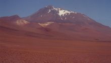
Llullaillaco, Argentina/Chile 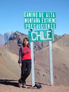
Camino de Alta Montaña, Argentina/Chile


بوليڤيا
- Ancohuma, 6,427 m (21,086 ft)
- Cabaray, 5,860 m (19,226 ft)
- Chacaltaya, 5,421 m (17,785 ft)
- Huayna Potosí, 6,088 m (19,974 ft)
- Illampu, 6,368 m (20,892 ft)
- Illimani, 6,438 m (21,122 ft)
- Macizo de Larancagua, 5,520 m (18,110 ft)
- Macizo de Pacuni, 5,400 m (17,720 ft)
- Nevado Anallajsi, 5,750 m (18,865 ft)
- Nevado Sajama, 6,542 m (21,463 ft)
- Patilla Pata, 5,300 m (17,390 ft)
- Tata Sabaya, 5,430 m (17,815 ft)


الحدود بين بوليڤيا وتشيلي
- Acotango, 6,052 m (19,856 ft)
- Cerro Minchincha, 5,305 m (17,405 ft)
- Irruputuncu, 5,163 m (16,939 ft)
- Licancabur, 5,920 m (19,423 ft)
- Olca, 5,407 m (17,740 ft)
- Parinacota, 6,348 m (20,827 ft)
- Paruma, 5,420 m (17,782 ft)
- Pomerape, 6,282 m (20,610 ft)
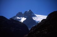
Licancabur, Bolivia/Chile


تشيلي
- Monte San Valentin, 4,058 m (13,314 ft)
- Cerro Paine Grande, c.2,750 m (9,022 ft)
- Cerro Macá, c.2,300 m (7,546 ft)
- Monte Darwin, c.2,500 m (8,202 ft)
- Volcan Hudson, c.1,900 m (6,234 ft)
- Cerro Castillo Dynevor, c.1,100 m (3,609 ft)
- Mount Tarn, c.825 m (2,707 ft)
- Polleras, 5,993 m (19,662 ft)
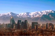
Santiago de Chile on the western slopes of a snowcapped Andes
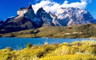
View of Cuernos del Paine in Torres del Paine National Park


كولومبيا
- Nevado del Huila, 5,365 m (17,602 ft)
- Nevado del Ruiz, 5,321 m (17,457 ft)
- Ritacuba Blanco, 5,410 m (17,749 ft)
- Nevado del Quindío, 5,215 m (17,110 ft)
- Galeras, 4,276 m (14,029 ft)
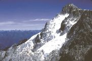
Ritacuba blanco the highest peak of Cordillera Oriental, Colombia.

Nevado del Ruiz, Colombia


الإكوادور
- Antisana, 5,752 m (18,871 ft)
- Cayambe, 5,790 m (18,996 ft)
- Chimborazo, 6,268 m (20,564 ft)
- Corazón, 4,790 m (15,715 ft)
- Cotopaxi, 5,897 m (19,347 ft)
- El Altar, 5,320 m (17,454 ft)
- Illiniza, 5,248 m (17,218 ft)
- Pichincha, 4,784 m (15,696 ft)
- Quilotoa, 3,914 m (12,841 ft)
- Reventador, 3,562 m (11,686 ft)
- Sangay, 5,230 m (17,159 ft)
- Tungurahua, 5,023 m (16,480 ft)
- Titicacha, 5,035 m (16,519 ft)
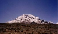
Chimborazo, الإكوادور

پيرو
- Alpamayo, 5,947 m (19,511 ft)
- Artesonraju, 6,025 m (19,767 ft)
- Carnicero, 5,960 m (19,554 ft)
- El Misti, 5,822 m (19,101 ft)
- El Toro, 5,830 m (19,127 ft)
- Huascarán, 6,768 m (22,205 ft)
- Jirishanca, 6,094 m (19,993 ft)
- Nevado de Huaytapallana, 5,557 m (18,232 ft)
- Pumasillo, 5,991 m (19,656 ft)
- Rasac, 6,040 m (19,816 ft)
- Rondoy, 5,870 m (19,259 ft)
- Sarapo, 6,127 m (20,102 ft)
- Seria Norte, 5,860 m (19,226 ft)
- Siula Grande, 6,344 m (20,814 ft)
- Yerupaja, 6,635 m (21,768 ft)
- Yerupaja Chico, 6,089 m (19,977 ft)


ڤنزويلا
- قمة بوليڤار، 4981 م
- قمة هومبولت، 4940 م
- قمة بونپلاند، 4880 م
- قمة لا كونشا، 4870 م
- قمة الحجارة البيضاء، 4740 م
قمة بوليڤار، ڤنزويلا
قمة هومبولت، ڤنزويلا


الهامش
- ^ أ ب Teofilo Laime Ajacopa, Diccionario Bilingüe Iskay simipi yuyayk'ancha, La Paz, 2007 (Quechua–Spanish dictionary)
- ^ "Cordillera". etimologias.dechile.net. Retrieved 27 ديسمبر 2015.
- ^ "Mountains, biodiversity and conservation". www.fao.org. Retrieved 28 يناير 2019.
- ^ Miller, Meghan S.; Levander, Alan; Niu, Fenglin; Li, Aibing (23 يونيو 2008). "Upper mantle structure beneath the Caribbean-South American plate boundary from surface wave tomography" (PDF). Journal of Geophysical Research. 114 (B1): B01312. Bibcode:2009JGRB..114.1312M. doi:10.1029/2007JB005507. Archived from the original (PDF) on 5 يونيو 2010. Retrieved 21 نوفمبر 2010.
- ^ أ ب Isacks, Bryan L. (1988), "Uplift of the Central Andean Plateau and Bending of the Bolivian Orocline", Journal of Geophysical Research 93 (B4): 3211–3231, doi:, Bibcode: 1988JGR....93.3211I, http://geomorphology.sese.asu.edu/Papers/Isacks_Uplift_Andean_Plateau_1988.pdf
- ^ أ ب ت Kley, J. (1999), "Geologic and geometric constraints on a kinematic model of the Bolivian orocline", Journal of South American Earth Sciences 12 (2): 221–235, doi:, Bibcode: 1999JSAES..12..221K
- ^ Beck, Myrl E. (1987), "Tectonic rotations on the leading edge of South America: The Bolivian orocline revisited", Geology 15 (9): 806–808, doi:, Bibcode: 1987Geo....15..806B
- ^ Prezzi, Claudia B.; Vilas, Juan F. (1998). "New evidence of clockwise vertical axis rotations south of the Arica elbow (Argentine Puna)". Tectonophysics. 292 (1): 85–100. Bibcode:1998Tectp.292...85P. doi:10.1016/s0040-1951(98)00058-4.
- ^ Arriagada, César; Ferrando, Rodolfo; Córdova, Loreto; Morata, Diego; Roperch, Pierrick (2013), "The Maipo Orocline: A first scale structural feature in the Miocene to Recent geodynamic evolution in the central Chilean Andes", Andean Geology 40 (3): 419–437, http://www.scielo.cl/pdf/andgeol/v40n3/art02.pdf
- ^ Charrier, Reynaldo; Pinto, Luisa; Rodríguez, María Pía (2006). "3. Tectonostratigraphic evolution of the Andean Orogen in Chile". In Moreno, Teresa; Gibbons, Wes (eds.). Geology of Chile. Geological Society of London. pp. 5–19. ISBN 978-1-86239-219-9.
- ^ Hussey, John (2018). "Bang to Eternity and Betwixt: Cosmos". Cosmos by John Hussey.
- ^ Santos, J.O.S.; Rizzotto, G.J.; Potter, P.E.; McNaughton, N.J.; Matos, R.S.; Hartmann, L.A.; Chemale Jr., F.; Quadros, M.E.S. (2008). "Age and autochthonous evolution of the Sunsás Orogen in West Amazon Craton based on mapping and U–Pb geochronology". Precambrian Research. 165 (3–4): 120–152. Bibcode:2008PreR..165..120S. doi:10.1016/j.precamres.2008.06.009.
- ^ Rapela, C.W.; Pankhurst, R.J; Casquet, C.; Baldo, E.; Saavedra, J.; Galindo, C.; Fanning, C.M. (1998). "The Pampean Orogeny of the southern proto-Andes: Cambrian continental collision in the Sierras de Córdoba" (PDF). In Pankhurst, R.J; Rapela, C.W. (eds.). The Proto-Andean Margin of Gondwana. Vol. 142. pp. 181–217. doi:10.1144/GSL.SP.1998.142.01.10. S2CID 128814617. Retrieved 7 December 2015.
{{cite book}}:|journal=ignored (help) - ^ Wilson, T.J. (1991). "Transition from back-arc to foreland basin development in the southernmost Andes: Stratigraphic record from the Ultima Esperanza District, Chile". Geological Society of America Bulletin. 103 (1): 98–111. Bibcode:1991GSAB..103...98W. doi:10.1130/0016-7606(1991)103<0098:tfbatf>2.3.co;2.
- ^ "Tropical and Subtropical Dry Broadleaf Forest Ecoregions". wwf.panda.org. Archived from the original on 2012-04-25. Retrieved 2015-12-27.
- ^ أ ب ت Tropical Andes Archived 2010-08-21 at the Wayback Machine – biodiversityhotspots.org
- ^ "Pants of the Andies". Archived from the original on 15 December 2007. Retrieved 2007-12-09.
- ^ أ ب ت Eisenberg, J.F.; & Redford, K.H. (2000). Mammals of the Neotropics, Volume 3: The Central Neotropics: Ecuador, Peru, Bolivia, Brazil. ISBN 978-0-226-19542-1
- ^ أ ب Eisenberg, J.F.; & Redford, K.H. (1992). Mammals of the Neotropics, Volume 2: The Southern Cone: Chile, Argentina, Uruguay, Paraguay. ISBN 978-0-226-70682-5
- ^ أ ب ت ث ج ح Fjeldsaa, J.; & Krabbe, N. (1990). Birds of the High Andes: A Manual to the Birds of the Temperate Zone of the Andes and Patagonia, South America. ISBN 978-87-88757-16-3
- ^ Stuart, Hoffmann, Chanson, Cox, Berridge, Ramani and Young, editors (2008). Threatened Amphibians of the World. ISBN 978-84-96553-41-5
- ^ D'Altroy, Terence N. The Incas. Blackwell Publishing, 2003
- ^ W. van Immerzeel, 1989. Irrigation and erosion/flood control at high altitudes in the Andes. Published in Annual Report 1989, pp. 8–24, International Institute for Land Reclamation and Improvement, Wageningen, The Netherlands. On line: [1]
- ^ "Information on Argentina". Argentine Embassy London.
انظر أيضاً
المصادر
- John Biggar, The Andes: A Guide For Climbers, 3rd. edition, 2005, ISBN 0-9536087-2-7
- Tui de Roy, The Andes: As the Condor Flies. 2005, ISBN 1-55407-070-8
- Fjeldså, J., & N. Krabbe (1990). The Birds of the High Andes. Zoological Museum, University of Copenhagen, Copenhagen. ISBN 87-88757-16-1
- Fjeldså, J. & M. Kessler. 1996. Conserving the biological diversity of Polylepis woodlands of the highlands on Peru and Bolivia, a contribution to sustainable natural resource management in the Andes. NORDECO, Copenhagen.
وصلات خارجية
- University of Arizona: Andes geology
- Blueplanetbiomes.org: Climate and animal life of the Andes Archived 14 ديسمبر 2007 at the Wayback Machine
- Discover-peru.org: Regions and Microclimates in the Andes
- Peaklist.org: Complete list of mountains in South America with an elevation at/above 1,500 m (4,920 ft)