قائمة المدن والمقاطعات في فرجينيا
| Independent cities and counties of Virginia | |
|---|---|
 | |
| الموقع | Commonwealth of Virginia |
| العدد | 95 Counties 38 Independent cities 133 Second-level subdivisions |
| عدد السكان | (Counties): 2,318 (Highland) – 1,167,873 (Fairfax) (Independent cities): 3,477 (Norton) – 453,737 (Virginia Beach) |
| المساحة | (Counties): 26 ميل مربع (67 km2) (Arlington) – 978 ميل مربع (2،530 km2) (Pittsylvania) (Independent cities): 2 ميل مربع (5.2 km2) (Falls Church) – 400 ميل مربع (1،000 km2) (Suffolk) |
| الحكومة | County government |
| التقسيمات | (Counties): cities, towns, unincorporated communities, census-designated places (Independent cities): Borough, Neighborhood |
| التجمعات في ڤرجينيا |
|---|

The Commonwealth of Virginia is divided into 95 counties, along with 38 independent cities that are considered county-equivalents for census purposes, totaling 133 second-level subdivisions, the third most of any state. In Virginia, cities are co-equal levels of government to counties, but towns are part of counties. For some counties, for statistical purposes, the Bureau of Economic Analysis combines any independent cities with the county that it was once part of (before the legislation creating independent cities took place in 1871).[1]
Many county seats are politically not a part of the counties they serve; under Virginia law, all municipalities incorporated as cities are independent cities and are not part of any county. Some of the cities in the Hampton Roads area, including Virginia Beach, Chesapeake, Newport News, Hampton, and Suffolk were formed from an entire county. These cities are no longer county seats, since the counties ceased to exist once the cities were completely formed but are functionally equivalent to counties. Also in Virginia, a county seat may be an independent city surrounded by, but not part of, the county of which it is the administrative center; for example, Fairfax City is both the county seat of Fairfax County and is completely surrounded by Fairfax County, but the city is politically independent of the county.

Many towns are as large as cities but are not incorporated as cities and are situated within a parent county or counties. Seven independent cities had 2020 populations of less than 10,000 with the smallest, Norton having a population of only 3,687.[2] In 2020, the largest towns were Leesburg (with 48,250 people) and Blacksburg (44,826). Six other towns also had populations of over 10,000 people.[2] For a complete list of these towns, see List of towns in Virginia. For major unincorporated population centers, see List of unincorporated communities in Virginia.
Virginia's independent cities were classified by the Virginia General Assembly in 1871 as cities of the first class and cities of the second class.[3] The Virginia Constitution of 1902 defined first class cities as those having a population of 10,000 or more based upon the last census enumeration while second class cities were those that had a population of less than 10,000.[3] Cities that previously been granted a city charter, but did not have the requisite population, had their status grandfathered in.[3]
Second class did not have a court of record and were required to share the cost of that court with their adjacent county and also shared the cost for three constitutional officers of that court—generally, the clerk, commonwealth attorney and sheriff—and those shared officers stood for election in both the city and the county.[3] At least two constitutional officers—treasurer and commissioner of the revenue—were required to be elected solely by the residents of the city.[3] The distinction between first and second class cities was ended with the Virginia Constitution of 1971.[3] However, cities that were classified as second class cities at the time of the adoption of the 1971 Virginia Constitution were authorized to continue sharing their court system and three constitutional officers with the adjacent county.[3] اعتبارا من 2003[تحديث], 14 of Virginia's independent cities retain these features.[3]
There are several counties and cities that have the same name but are separate politically. These currently include Fairfax, Franklin, Richmond, and Roanoke. In the past they also included Norfolk and Alexandria, whose counties changed their names, ostensibly to end some of the confusion; as well as Bedford, where a city was surrounded by a county of the same name from 1968 until 2013, when the city reverted to town status. A city and county that share a name may be completely unrelated in geography. For example, Richmond County is nowhere near the City of Richmond, and Franklin County is even farther from the City of Franklin.
More Virginia counties are named for women than in any other state.[4]
Virginia's postal abbreviation is VA and its FIPS state code is 51.
List of the 95 counties in the Commonwealth of Virginia (links shown under FIPS County Code are for the U.S. Census Bureau Statistics Info Page for that county):
قالب:Virginia counties imagemap
List of counties
| المقاطعة |
الكود [5] |
County seat [6][7] |
Est. [6] |
Origin |
Etymology |
السكان [8] |
المساحة [6] |
الخريطة |
|---|---|---|---|---|---|---|---|---|
| مقاطعة Accomack | 001 | Accomac | 1663 | Accomac Shire was established in 1634 as one of the original eight shires of Virginia. In 1642, it was renamed Northampton County. Then in 1663, Northampton County was divided into two counties. The southern half remained Northampton County while the northern half became Accomac County -- later renamed Accomack with a "k." | From the Native American word Accawmack, meaning "on the other side", referencing the county's position across Chesapeake Bay | 33٬859 | 455 ميل² (1٬178 كم²) |

|
| مقاطعة Albemarle | 003 | Charlottesville | 1744 | In 1744, the Virginia General Assembly created Albemarle County by taking the northern portion of Goochland County. | Willem Anne van Keppel, 2nd Earl of Albemarle, colonial proprietary governor | 118٬356 | 723 ميل² (1٬873 كم²) |

|
| مقاطعة Alleghany | 005 | Covington | 1822 | Formed from parts of Bath and Botetourt counties as well as Monroe County (now in WV) | Alleghany Mountains | 14٬546 | 446 ميل² (1٬155 كم²) |

|
| مقاطعة Amelia | 007 | Amelia | 1735 | Formed from Brunswick and Prince George counties | Princess Amelia Sophia, second daughter of George II of Great Britain | 13٬632 | 357 ميل² (925 كم²) |

|
| مقاطعة Amherst | 009 | Amherst | 1761 | From Albemarle county | Jeffery Amherst, British conqueror of Quebec during the Seven Years' War and colonial governor of Virginia | 31٬962 | 475 ميل² (1٬230 كم²) |

|
| مقاطعة Appomattox | 011 | Appomattox | 1845 | From Buckingham, Campbell, Charlotte and Prince Edward counties | Appomattox River | 17٬172 | 334 ميل² (865 كم²) |

|
| مقاطعة Arlington | 013 | Arlington | 1846 | Annexed from the District of Columbia, having previously been part of Fairfax County prior to the district's formation | Arlington House, The Robert E. Lee Memorial, originally called Alexandria County; renamed in 1920 | 243٬931 | 26 ميل² (67 كم²) |

|
| مقاطعة Augusta | 015 | Staunton | 1738 | From Orange County | Augusta of Saxe-Gotha, the Princess of Wales | 78٬940 | 971 ميل² (2٬515 كم²) |

|
| مقاطعة Bath | 017 | Warm Springs | 1791 | From Augusta, Botetourt and Greenbrier counties May 1, 1791 | Bath, England | 4٬076 | 532 ميل² (1٬378 كم²) |

|
| مقاطعة Bedford | 019 | Bedford | 1754 | From Lunenburg county | John Russell, 4th Duke of Bedford, British politician and one of the head negotiators of the Peace of Paris | 83٬059 | 755 ميل² (1٬955 كم²) |

|
| مقاطعة Bland | 021 | Bland | 1861 | From Giles, Tazewell, and Wythe counties | Richard Bland, member of the Continental Congress and publisher of the American Revolutionary War-era tract An Inquiry into the Rights of the British Colonies | 6٬151 | 359 ميل² (930 كم²) |

|
| مقاطعة Botetourt | 023 | Fincastle | 1770 | From Augusta county. | Norborne Berkeley, 4th Baron Botetourt, colonial governor of Virginia | 34٬144 | 543 ميل² (1٬406 كم²) |

|
| مقاطعة Brunswick | 025 | Lawrenceville | 1720 | From Prince George county. Parts of Surry and Isle of Wight counties were added in 1732 (when the county's government was established.) | Duchy of Brunswick-Lüneburg, from which the current line of British monarchs hailed | 15٬727 | 566 ميل² (1٬466 كم²) |

|
| مقاطعة Buchanan | 027 | Grundy | 1858 | From Russell and Tazewell counties | James Buchanan, fifteenth U.S. President | 18٬492 | 504 ميل² (1٬305 كم²) |

|
| مقاطعة Buckingham | 029 | Buckingham | 1761 | From Albemarle county | Duke of Buckingham | 17٬137 | 581 ميل² (1٬505 كم²) |

|
| مقاطعة Campbell | 031 | Rustburg | 1782 | From Bedford county | William Campbell, Revolutionary War general | 55٬629 | 504 ميل² (1٬305 كم²) |

|
| مقاطعة Caroline | 033 | Bowling Green | 1728 | From Essex, King and Queen, and King William counties | Caroline of Ansbach, wife of King George II of Great Britain | 34٬413 | 533 ميل² (1٬380 كم²) |

|
| مقاطعة Carroll | 035 | Hillsville | 1842 | From Grayson county | Charles Carroll of Carrollton | 29٬299 | 476 ميل² (1٬233 كم²) |

|
| مقاطعة Charles City | 036 | Charles City | 1634 | Colonial division before 1635[9] | King Charles I of England | 6٬623 | 182 ميل² (471 كم²) |

|
| مقاطعة Charlotte | 037 | Charlotte Court House | 1765 | From Lunenburg county | Charlotte of Mecklenburg-Strelitz, wife of King George III of Great Britain | 11٬401 | 475 ميل² (1٬230 كم²) |

|
| مقاطعة Chesterfield | 041 | Chesterfield | 1749 | From Henrico County | Philip Stanhope, 4th Earl of Chesterfield, British politician and Lord of the Bedchamber | 397٬148 | 426 ميل² (1٬103 كم²) |

|
| مقاطعة Clarke | 043 | Berryville | 1836 | From Frederick County | George Rogers Clarke, Revolutionary War general | 15٬609 | 177 ميل² (458 كم²) |

|
| مقاطعة Craig | 045 | New Castle | 1851 | Formed from Botetourt, Roanoke, Giles, and Monroe (in present-day West Virginia) Counties | Robert Craig, U.S. Representative from Virginia | 4٬800 | 330 ميل² (855 كم²) |

|
| مقاطعة Culpeper | 047 | Culpeper | 1749 | Culpeper County was established in 1749 from Orange County, Virginia. | Thomas Colepeper, 2nd Baron Colepeper, colonial proprietary governor | 57٬666 | 381 ميل² (987 كم²) |

|
| مقاطعة Cumberland | 049 | Cumberland | 1749 | Goochland County | Prince William, Duke of Cumberland, British general, politician, and son of King George II | 10٬352 | 298 ميل² (772 كم²) |

|
| مقاطعة Dickenson | 051 | Clintwood | 1880 | Formed from parts of Buchanan, Russell, and Wise Counties | William J. Dickinson (1827-1907), member of the Virginia House of Delegates | 13٬236 | 333 ميل² (862 كم²) |

|
| مقاطعة Dinwiddie | 053 | Dinwiddie | 1752 | From Prince George County | Robert Dinwiddie, colonial lieutenant governor of Virginia | 28٬896 | 504 ميل² (1٬305 كم²) |

|
| مقاطعة Essex | 057 | Tappahannock | 1692 | From the original Rappahannock County, Virginia, commonly known as Old Rappahannock County, which was split to form Essex and Richmond counties. | Essex, United Kingdom | 10٬654 | 258 ميل² (668 كم²) |

|
| مقاطعة Fairfax | 059 | Fairfax | 1742 | From Prince William County | Thomas Fairfax, 6th Lord Fairfax of Cameron, the only British noble resident in Virginia | 1٬167٬873 | 396 ميل² (1٬026 كم²) |

|
| مقاطعة Fauquier | 061 | Warrenton | 1759 | From Prince William County | Francis Fauquier, colonial lieutenant governor of Virginia | 76٬503 | 650 ميل² (1٬683 كم²) |

|
| مقاطعة Floyd | 063 | Floyd | 1831 | From Montgomery County | John Floyd, governor of Virginia | 15٬789 | 382 ميل² (989 كم²) |

|
| مقاطعة Fluvanna | 065 | Palmyra | 1777 | From Henrico County | From the Latin name for the James River, which itself translates to "Annie's River" in honor of Queen Anne | 28٬975 | 287 ميل² (743 كم²) |

|
| مقاطعة Franklin | 067 | Rocky Mount | 1786 | Formed from parts of Bedford and Henry Counties | Benjamin Franklin, publisher, orator, scholar, and U.S. Founding Father | 55٬526 | 692 ميل² (1٬792 كم²) |

|
| مقاطعة Frederick | 069 | Winchester | 1738 | From Orange County | Frederick, Prince of Wales, eldest son of George II | 99٬955 | 415 ميل² (1٬075 كم²) |

|
| مقاطعة Giles | 071 | Pearisburg | 1806 | Formed from Montgomery, Monroe, Wythe, and Tazewell Counties | William Branch Giles, U.S. Senator from Virginia | 16٬564 | 358 ميل² (927 كم²) |

|
| مقاطعة Gloucester | 073 | Gloucester | 1651 | From York County | Prince Henry, Duke of Gloucester | 40٬097 | 217 ميل² (562 كم²) |

|
| مقاطعة Goochland | 075 | Goochland | 1728 | From Henrico County | William Gooch, colonial lieutenant governor of Virginia | 29٬187 | 284 ميل² (736 كم²) |

|
| مقاطعة Grayson | 077 | Independence | 1793 | From Wythe County | William Grayson, U.S. Senator from Virginia | 15٬230 | 443 ميل² (1٬147 كم²) |

|
| مقاطعة Greene | 079 | Stanardsville | 1838 | From Orange County | Nathanael Greene, Revolutionary War general | 21٬958 | 157 ميل² (407 كم²) |

|
| مقاطعة Greensville | 081 | Emporia | 1781 | From Brunswick County | Richard Grenville, commander of the English expedition to found Roanoke Colony | 11٬181 | 296 ميل² (767 كم²) |

|
| مقاطعة Halifax | 083 | Halifax | 1752 | From Lunenburg County | George Montagu-Dunk, 2nd Earl of Halifax, President of the Board of Trade | 33٬447 | 814 ميل² (2٬108 كم²) |

|
| مقاطعة Hanover | 085 | Hanover | 1721 | From the area of New Kent County called St. Paul's Parish | Electorate of Hanover, from which the current line of British monarchs hailed | 116٬423 | 473 ميل² (1٬225 كم²) |

|
| مقاطعة Henrico | 087 | Laurel | 1617 | Original county of the Colony under England | Henry Frederick, Prince of Wales, oldest son of James I of England | 342٬775 | 238 ميل² (616 كم²) |

|
| مقاطعة Henry | 089 | Martinsville | 1777 | From Pittsylvania County, it was initially named Patrick Henry County | Patrick Henry, governor of Virginia and U.S. Founding Father | 49٬242 | 382 ميل² (989 كم²) |

|
| مقاطعة Highland | 091 | Monterey | 1847 | From Bath and Pendleton Counties[10] | Mountainous topography | 2٬318 | 416 ميل² (1٬077 كم²) |

|
| مقاطعة Isle of Wight | 093 | Isle of Wight | 1634 | Original county of the Colony under England, initially named Warrosquyoake Shire | Isle of Wight, England | 41٬321 | 316 ميل² (818 كم²) |

|
| مقاطعة James City | 095 | Williamsburg | 1617 | Original county of the Colony under England | King James I of England | 83٬326 | 143 ميل² (370 كم²) |

|
| مقاطعة King and Queen | 097 | King and Queen | 1691 | King and Queen County was established in 1691 from New Kent County, Virginia. | King William III and Queen Mary II | 6٬743 | 316 ميل² (818 كم²) |

|
| مقاطعة King George | 099 | King George | 1721 | From Richmond County | George I of Great Britain | 29٬646 | 180 ميل² (466 كم²) |

|
| مقاطعة King William | 101 | King William | 1702 | English colonists formed King William County in 1702 out of King and Queen County, Virginia. | William III of England | 19٬617 | 275 ميل² (712 كم²) |

|
| مقاطعة Lancaster | 103 | Lancaster | 1651 | Lancaster County was established in 1651 from Northumberland and York counties. | Lancaster, United Kingdom | 10٬995 | 133 ميل² (344 كم²) |

|
| مقاطعة Lee | 105 | Jonesville | 1793 | From Russell County | Light Horse Harry Lee, Revolutionary War general and governor of Virginia | 21٬642 | 437 ميل² (1٬132 كم²) |

|
| مقاطعة Loudoun | 107 | Leesburg | 1757 | From Fairfax County | John Campbell, 4th Earl of Loudoun, British Commander-in-Chief, North America during the Seven Years' War | 449٬749 | 520 ميل² (1٬347 كم²) |

|
| مقاطعة Louisa | 109 | Louisa | 1742 | From Hanover County | Princess Louise, youngest daughter of George II | 42٬924 | 498 ميل² (1٬290 كم²) |

|
| مقاطعة Lunenburg | 111 | Lunenburg | 1746 | From Brunswick County | Duchy of Brunswick-Lüneburg, from which the current line of British monarchs hailed | 12٬058 | 432 ميل² (1٬119 كم²) |

|
| مقاطعة Madison | 113 | Madison | 1793 | From Orange County | James Madison, Congressman from Virginia, principal author of the U.S. Constitution, and future U.S. President | 14٬237 | 322 ميل² (834 كم²) |

|
| مقاطعة Mathews | 115 | Mathews | 1791 | From Gloucester County | Thomas Mathews, Revolutionary War general. | 8٬529 | 86 ميل² (223 كم²) |

|
| مقاطعة Mecklenburg | 117 | Boydton | 1765 | From Lunenburg County | Charlotte of Mecklenburg-Strelitz, wife of King George III | 30٬747 | 624 ميل² (1٬616 كم²) |

|
| مقاطعة Middlesex | 119 | Saluda | 1673 | From Lancaster County | Middlesex, United Kingdom | 10٬841 | 130 ميل² (337 كم²) |

|
| مقاطعة Montgomery | 121 | Christiansburg | 1777 | From Fincastle County | Richard Montgomery, Revolutionary War general | 98٬434 | 388 ميل² (1٬005 كم²) |

|
| مقاطعة Nelson | 125 | Lovingston | 1808 | From Amherst County | Thomas Nelson Jr., governor of Virginia and signer of the Declaration of Independence | 14٬920 | 472 ميل² (1٬222 كم²) |

|
| مقاطعة New Kent | 127 | New Kent | 1654 | New Kent County was established in 1654 from York County, Virginia. | Kent County, England | 28٬022 | 210 ميل² (544 كم²) |

|
| مقاطعة Northampton | 131 | Eastville | 1634 | Original county of the Colony under England, initially named Accomac Shire. In 1642, it was renamed Northampton County. However, in 1663, Northampton County was divided into two counties. The southern half remained Northampton County while the northern half once again became Accomac County -- later spelled Accomack. | Northamptonshire, England | 11٬879 | 207 ميل² (536 كم²) |

|
| مقاطعة Northumberland | 133 | Heathsville | 1648 | The county was created by the Virginia General Assembly in 1648 during a period of rapid population growth and geographic expansion. | Northumberland, United Kingdom | 12٬557 | 192 ميل² (497 كم²) |

|
| مقاطعة Nottoway | 135 | Nottoway | 1789 | From the area of Amelia County called Nottaway Parish | Nodawa tribe | 15٬796 | 315 ميل² (816 كم²) |

|
| مقاطعة Orange | 137 | Orange | 1734 | Settlers established the legal entity of Orange County in 1734 from a portion of Spotsylvania County, Virginia. | William IV, Prince of Orange, to celebrate his marriage to the Royal Princess Anne of the House of Hanover, England on March 25, 1734. The county was formed on August 8, 1734 | 40٬083 | 342 ميل² (886 كم²) |

|
| مقاطعة Page | 139 | Luray | 1831 | From Shenandoah and Rockingham counties | John Page, governor of Virginia | 23٬762 | 311 ميل² (805 كم²) |

|
| مقاطعة Patrick | 141 | Stuart | 1791 | From Patrick Henry County | Patrick Henry, governor of Virginia and U.S. Founding Father | 17٬424 | 483 ميل² (1٬251 كم²) |

|
| مقاطعة Pittsylvania | 143 | Chatham | 1767 | From Halifax County | William Pitt, British Prime Minister | 59٬490 | 978 ميل² (2٬533 كم²) |

|
| مقاطعة Powhatan | 145 | Powhatan | 1777 | From Cumberland County | Powhatan tribe | 32٬591 | 261 ميل² (676 كم²) |

|
| مقاطعة Prince Edward | 147 | Farmville | 1754 | From Amelia County | Prince Edward, Duke of York and Albany, brother of George III | 22٬391 | 353 ميل² (914 كم²) |

|
| مقاطعة Prince George | 149 | Prince George | 1703 | From Charles City County | Prince George of Denmark, the husband of Queen Anne | 43٬936 | 266 ميل² (689 كم²) |

|
| مقاطعة Prince William | 153 | Manassas | 1731 | From Stafford and King George counties | Prince William Augustus, son of George II | 502٬966 | 338 ميل² (875 كم²) |

|
| مقاطعة Pulaski | 155 | Pulaski | 1839 | From Montgomery and Wythe counties | Kazimierz Pulaski, Polish-born Revolutionary War general | 33٬586 | 321 ميل² (831 كم²) |

|
| مقاطعة Rappahannock | 157 | Washington | 1833 | From Culpeper County. The original Rappahannock County, known as Old Rappahannock County, was created in 1656 from part of Lancaster County. Old Rappahannock County became extinct in 1692 when it was split to create Essex and Richmond counties. | Rappahannock River | 7٬439 | 267 ميل² (692 كم²) |

|
| مقاطعة Richmond | 159 | Warsaw | 1692 | From the original Rappahannock County, better known as Old Rappahannock County, which was split to form Richmond and Essex counties. | Charles Lennox, 1st Duke of Richmond, illegitimate son of King Charles II | 9٬294 | 192 ميل² (497 كم²) |

|
| مقاطعة Roanoke | 161 | Salem | 1838 | From the southern part of Botetourt County | Roanoke River | 97٬150 | 251 ميل² (650 كم²) |

|
| مقاطعة Rockbridge | 163 | Lexington | 1778 | From parts of Augusta and Botetourt counties | Natural Bridge | 22٬663 | 600 ميل² (1٬554 كم²) |

|
| مقاطعة Rockingham | 165 | Harrisonburg | 1778 | From Augusta County | Charles Watson-Wentworth, 2nd Marquess of Rockingham, British Prime Minister | 89٬316 | 851 ميل² (2٬204 كم²) |

|
| مقاطعة Russell | 167 | Lebanon | 1786 | From a section of Washington County | William Russell, frontiersman and state representative | 25٬332 | 475 ميل² (1٬230 كم²) |

|
| مقاطعة Scott | 169 | Gate City | 1814 | Formed from parts of Washington, Lee, and Russell Counties | Winfield Scott, War of 1812 and later Mexican-American War general | 21٬200 | 537 ميل² (1٬391 كم²) |

|
| مقاطعة Shenandoah | 171 | Woodstock | 1772 | Formed from non-county territory; originally named for Governor John Murray, 4th Earl of Dunmore, but renamed in 1778. | Shenandoah River | 45٬839 | 512 ميل² (1٬326 كم²) |

|
| مقاطعة Smyth | 173 | Marion | 1832 | From Washington and Wythe counties | Alexander Smyth, Congressman from Virginia | 28٬882 | 452 ميل² (1٬171 كم²) |

|
| مقاطعة Southampton | 175 | Courtland | 1749 | Most of it from part of Warrosquyoake Shire | Disputed; either Southampton, England or Henry Wriothesley, 3rd Earl of Southampton, one of the founders of the Virginia Company | 18٬110 | 600 ميل² (1٬554 كم²) |

|
| مقاطعة Spotsylvania | 177 | Spotsylvania Courthouse | 1721 | Spotsylvania County was established in 1721 from Essex, King and Queen, and King William counties. | Alexander Spotswood, colonial lieutenant governor of Virginia | 155٬388 | 401 ميل² (1٬039 كم²) |

|
| مقاطعة Stafford | 179 | Stafford | 1664 | From part of Westmoreland County | Stafford, England | 170٬803 | 270 ميل² (699 كم²) |

|
| مقاطعة Surry | 181 | Surry | 1652 | From part of James City County | Surrey, United Kingdom | 6٬603 | 279 ميل² (723 كم²) |

|
| مقاطعة Sussex | 183 | Sussex | 1754 | From Surry County | Sussex, United Kingdom | 10٬755 | 491 ميل² (1٬272 كم²) |

|
| مقاطعة Tazewell | 185 | Tazewell | 1800 | From portions of Wythe and Russell counties | Henry Tazewell, U.S. Senator from Virginia | 38٬635 | 520 ميل² (1٬347 كم²) |

|
| مقاطعة Warren | 187 | Front Royal | 1836 | From Frederick and Shenandoah counties | Joseph Warren, Revolutionary War general | 42٬740 | 214 ميل² (554 كم²) |

|
| مقاطعة Washington | 191 | Abingdon | 1777 | From Fincastle County | George Washington, Revolutionary War commander, U.S. Founding Father, and future U.S. President | 53٬898 | 564 ميل² (1٬461 كم²) |

|
| مقاطعة Westmoreland | 193 | Montross | 1653 | From Northumberland County | Westmoreland, United Kingdom | 19٬715 | 229 ميل² (593 كم²) |

|
| مقاطعة Wise | 195 | Wise | 1856 | From Lee, Scott, and Russell Counties | Henry Alexander Wise, governor of Virginia | 34٬824 | 403 ميل² (1٬044 كم²) |

|
| مقاطعة Wythe | 197 | Wytheville | 1790 | From Montgomery County | George Wythe, legal scholar and signer of the Declaration of Independence | 27٬983 | 463 ميل² (1٬199 كم²) |

|
| مقاطعة York | 199 | Yorktown | 1634 | Formed in 1634 as one of the eight shires of Virginia. It was originally called Charles River Shire. | James Stuart, Duke of York, the future King James II | 71٬374 | 106 ميل² (275 كم²) |

|
List of independent cities
| City |
الكود [5] |
Seat [6] |
Est. [6] |
Origin |
Etymology |
السكان [11] |
المساحة [6] |
الخريطة |
|---|---|---|---|---|---|---|---|---|
| Alexandria | 510 | N/A | 1870[12] | From Alexandria County[13] | Phillip & John Alexander, brothers and area plantation owners | 160٬662 | 15 ميل² (39 كم²) |

|
| Bristol | 520 | N/A | 1890[13] | From Washington County[13] | Bristol, England | 16٬418 | 12 ميل² (31 كم²) |

|
| Buena Vista | 530 | N/A | 1892[13] | From Rockbridge County[13] | from the Buena Vista Company, which founded an iron mine in the area and established the town for its laborers | 6٬672 | 7 ميل² (18 كم²) |

|
| Charlottesville | 540 | N/A | 1888[13] | From Albemarle County[13] | Charlotte of Mecklenburg-Strelitz, wife of King George III | 44٬388 | 10 ميل² (26 كم²) |

|
| Chesapeake | 550 | N/A | 1963 | Formed out of consolidation of Norfolk County (extinct) and City of South Norfolk (extinct)[14] | Chesapeake tribe | 255٬332 | 341 ميل² (883 كم²) |

|
| Colonial Heights | 570 | N/A | 1948 | From Chesterfield County | From the actions of Revolutionary War general Gilbert du Motier, marquis de Lafayette; his soldiers, nicknamed the "Colonials", placed an artillery on high ground overlooking Petersburg | 18٬738 | 8 ميل² (21 كم²) |

|
| Covington | 580 | N/A | 1952 | From Alleghany County | Leonard Covington, hero of the Siege of Fort Recovery and Congressman from Maryland | 5٬680 | 4 ميل² (10 كم²) |

|
| Danville | 590 | N/A | 1870[13] | From Pittsylvania County[13] | Dan River | 41٬647 | 43 ميل² (111 كم²) |

|
| Emporia | 595 | N/A | 1967 | From Greensville County | Emporia, Kansas | 5٬447 | 7 ميل² (18 كم²) |

|
| Fairfax | 600 | N/A | 1961 | From Fairfax County | Thomas Fairfax, 6th Lord Fairfax of Cameron, only British noble resident in colonial Virginia | 26٬772 | 6 ميل² (16 كم²) |

|
| Falls Church | 610 | N/A | 1948 | From Fairfax County | The Falls Church | 15٬159 | 2٫1 ميل² (5 كم²) |

|
| Franklin | 620 | N/A | 1961 | From Southampton County | Benjamin Franklin, publisher, scholar, orator, and U.S. Founding Father | 8٬478 | 8 ميل² (21 كم²) |

|
| Fredericksburg | 630 | N/A | 1870[13] | From Spotsylvania County[13] | Frederick, Prince of Wales, eldest son of King George II | 30٬393 | 10 ميل² (26 كم²) |

|
| Galax | 640 | N/A | 1953 | From Grayson County and Carroll County | the galax shrub | 6٬670 | 8 ميل² (21 كم²) |

|
| Hampton | 650 | N/A | 1908 | Founded 1610. Current city formed by consolidation of Elizabeth City County and City of Hampton in 1952[14] | Disputed; either Southampton, England or Henry Wriothesley, 3rd Earl of Southampton, one of the founders of the Virginia Company | 137٬315 | 52 ميل² (135 كم²) |

|
| Harrisonburg | 660 | N/A | 1916 | From Rockingham County[13] | Thomas Harrison, pioneering settler and town founder | 50٬839 | 18 ميل² (47 كم²) |

|
| Hopewell | 670 | N/A | 1916 | From Prince George County[13] | The Hopewell, a ship that carried some of the early English settlers to Virginia | 23٬261 | 10 ميل² (26 كم²) |

|
| Lexington | 678 | N/A | 1966 | From Rockbridge County | Revolutionary War Battle of Lexington | 7٬769 | 2٫5 ميل² (6 كم²) |

|
| Lynchburg | 680 | N/A | 1786 | From Campbell County[13] | John Lynch, ferry operator and constructor of the first bridge across the James River in the area | 81٬347 | 49 ميل² (127 كم²) |

|
| Manassas | 683 | N/A | 1975 | From Prince William County | Manassas Gap Railroad | 44٬332 | 10 ميل² (26 كم²) |

|
| Manassas Park | 685 | N/A | 1975 | From Prince William County | Manassas Gap Railroad and Manassas National Battlefield Park | 16٬560 | 2٫5 ميل² (6 كم²) |

|
| Martinsville | 690 | N/A | 1928 | From Henry County | Joseph Martin, Revolutionary War general | 13٬849 | 11 ميل² (28 كم²) |

|
| Newport News | 700 | N/A | 1896[13] | From Warwick County[13] | Captain Christopher Newport, English privateer[15] | 183٬230 | 68 ميل² (176 كم²) |

|
| Norfolk | 710 | N/A | 1845[16] | Founded 1682.[17] Incorporated as City in 1845 from Norfolk County (extinct)[14] | Norfolk, England | 231٬013 | 54 ميل² (140 كم²) |

|
| Norton | 720 | N/A | 1954 | From Wise County | Eckstein Norton, president of the Louisville and Nashville Railroad | 3٬477 | 7 ميل² (18 كم²) |

|
| Petersburg | 730 | N/A | 1870[13] | From Prince George and Dinwiddie Counties[13] | Peter Jones, early settler and merchant | 33٬734 | 23 ميل² (60 كم²) |

|
| Poquoson | 735 | N/A | 1975 | From York County | An Algonquin term roughly translating to "great marsh" or "flat land" | 13٬292 | 16 ميل² (41 كم²) |

|
| Portsmouth | 740 | N/A | 1858[14] | Founded 1752.[18] Incorporated as City in 1858 from Norfolk County (extinct)[14] | Portsmouth, England | 96٬777 | 33 ميل² (85 كم²) |

|
| Radford | 750 | N/A | 1892[13] | From Montgomery County[13] | John Blair Radford, owner of a plantation that included that town's lands | 17٬243 | 10 ميل² (26 كم²) |

|
| Richmond | 760 | N/A | 1870[13] | From Henrico County[13] | Richmond, Surrey, England | 237٬257 | 60 ميل² (155 كم²) |

|
| Roanoke | 770 | N/A | 1884[13] | From Roanoke County[13] | Roanoke River | 99٬111 | 43 ميل² (111 كم²) |

|
| Salem | 775 | N/A | 1968 | From Roanoke County | After Salem, New Jersey, home of town founder William Bryan | 25٬816 | 15 ميل² (39 كم²) |

|
| Staunton | 790 | N/A | 1870[13] | From Augusta County [13] | Lady Rebecca Staunton, wife of colonial Lieutenant Governor William Gooch | 26٬801 | 20 ميل² (52 كم²) |

|
| Suffolk | 800 | N/A | 1910[19] | Founded 1742.[19] Incorporated as City in 1910 from Nansemond County (extinct)[19] | Suffolk, England | 104٬699 | 400 ميل² (1٬036 كم²) |

|
| Virginia Beach | 810 | N/A | 1963 | Founded 1906 around existing community of Seatack. Incorporated as City in 1963 from Princess Anne County (extinct)[14] | The city's coastal location | 453٬737 | 248 ميل² (642 كم²) |

|
| Waynesboro | 820 | N/A | 1948 | From Augusta County | Anthony Wayne, Revolutionary War general | 23٬951 | 14 ميل² (36 كم²) |

|
| Williamsburg | 830 | N/A | 1902[13] | From James City County | William III of England | 15٬861 | 9 ميل² (23 كم²) |

|
| Winchester | 840 | N/A | 1874[13] | From Frederick County [13] | Winchester, England | 28٬272 | 9 ميل² (23 كم²) |

|
 Top 10 most populated cities in Virginia (2010) |
 Virginia counties and cities by population density (population/ square mile) in 2015 |
 Virginia counties and cities by population in 2010 |
Smithsonian trinomial abbreviations
List of county abbreviations
The counties have the following Smithsonian trinomial abbreviations:[20]
| Code | County name | Code | County name | Code | County name | Code | County name | |||
|---|---|---|---|---|---|---|---|---|---|---|
| AC | Accomack | CU | Cumberland | KQ | King and Queen | PU | Pulaski | |||
| AG | Alleghany | DK | Dickenson | KW | King William | PW | Prince William | |||
| AH | Amherst | DW | Dinwiddie | LA | Lancaster | RA | Rappahannock | |||
| AL | Albemarle | ES | Essex | LE | Lee | RB | Rockbridge | |||
| AM | Amelia | FD | Frederick | LD | Loudoun | RC | Richmond | |||
| AP | Appomattox | FL | Floyd | LO | Louisa | RH | Rockingham | |||
| AR | Arlington County | FQ | Fauquier | LU | Lunenburg | RO | Roanoke | |||
| AU | Augusta | FR | Franklin | MA | Madison | RU | Russell | |||
| BA | Bath | FV | Fluvanna | MI | Middlesex | SC | Scott | |||
| BD | Bedford | FX | Fairfax | MK | Mecklenburg | SH | Shenandoah | |||
| BK | Buckingham | GI | Giles | MO | Montgomery | SM | Smyth | |||
| BL | Bland | GL | Gloucester | MT | Mathews | SO | Southampton | |||
| BO | Botetourt | GO | Goochland | NK | New Kent | SP | Spotsylvania | |||
| BR | Brunswick | GR | Greene | NL | Nelson | ST | Stafford | |||
| BU | Buchanan | GV | Greensville | NO | Northampton | SU | Surry | |||
| CA | Carroll | GY | Grayson | NT | Nottoway | SX | Sussex | |||
| CB | Campbell | HE | Henry | NU | Northumberland | TZ | Tazewell | |||
| CC | Charles City | HI | Highland | OR | Orange | WA | Washington | |||
| CG | Craig | HN | Hanover | PA | Page | WE | Westmoreland | |||
| CH | Chesterfield | HR | Henrico | PE | Prince Edward | WI | Wise | |||
| CK | Clarke | HX | Halifax | PG | Prince George | WR | Warren | |||
| CL | Caroline | IW | Isle of Wight | PK | Patrick | WY | Wythe | |||
| CP | Culpeper | JC | James City | PO | Powhatan | YO | York | |||
| CR | Charlotte | KG | King George | PT | Pittsylvania |
List of independent city abbreviations
The independent cities have the following Smithsonian trinomial abbreviations:[20]
| Code | City name | Code | City name | Code | City name | Code | City name | |||
|---|---|---|---|---|---|---|---|---|---|---|
| ALX | Alexandria | BRI | Bristol | BVA | Buena Vista | CHA | Charlottesville | |||
| CHE | Chesapeake | CHS | Colonial Heights | COV | Covington | DAN | Danville | |||
| EMP | Emporia | FAX | Fairfax | FAL | Falls Church | FRK | Franklin | |||
| FRD | Fredericksburg | GAL | Galax | HAM | Hampton | HAR | Harrisonburg | |||
| HOP | Hopewell | LEX | Lexington | LYN | Lynchburg | MAN | Manassas | |||
| MAP | Manassas Park | MAR | Martinsville | NN | Newport News | NOR | Norfolk | |||
| NRT | Norton | PET | Petersburg | POQ | Poquoson | POR | Portsmouth | |||
| RAD | Radford | RIC | Richmond | ROA | Roanoke | SAL | Salem | |||
| STA | Staunton | SUF | Suffolk | VAB | Virginia Beach | WAY | Waynesboro | |||
| WIL | Williamsburg | WIN | Winchester |
Gallery
-
 Virginia Beach, the largest city in Virginia
 -
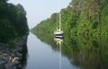 Chesapeake, the second-largest city
 -
 Richmond, the capital and third-largest city
 -
 Norfolk, the fourth-largest city
 -
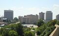 Newport News, the fifth-largest
 -
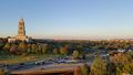 Alexandria, the sixth-largest
 -
 Hampton, the seventh-largest city
 -
 Roanoke, the eighth-largest city
 -
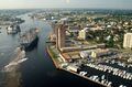 Portsmouth, the ninth-largest city
 -
 Suffolk, the tenth-largest city


.jpg&filetimestamp=20260529122314&)
_from_Mill_Mountain_Star_at_Dusk.jpg&filetimestamp=20231101184532&)
_up_the_Elizabeth_River,_past_Portsmouth_landmarks.jpg&filetimestamp=20231117163749&)

Fictional counties
- The 2016 supernatural horror film The Autopsy of Jane Doe is set in Grantham County, located close to the city of Richmond.
- The Netflix drama miniseries Echoes takes place in Easton County and the county seat of Mt. Echo.
- The historical drama TV series The Waltons is set in Jefferson County, specifically in the fictional community of Walton's Mountain.
See also
- Administrative divisions of Virginia
- List of counties of Kentucky
- List of counties of West Virginia
- List of former counties, cities, and towns of Virginia
- List of towns in Virginia
References
- ^ "Cities of Virginia". The Hornbook of Virginia History. Encyclopedia Virginia. ديسمبر 7, 2020. Retrieved يونيو 5, 2024.
- ^ أ ب "Area and Population of Virginia Localities" (PDF). Virginia Department of Housing and Community Development. أبريل 19, 2012. Archived from the original (PDF) on مايو 25, 2017. Retrieved يناير 25, 2013.
- ^ أ ب ت ث ج ح خ د "Former Second Class Cities in Virginia" (PDF). Virginia Department of Housing and Community Development. نوفمبر 13, 2003. Archived from the original (PDF) on أكتوبر 11, 2014. Retrieved يناير 25, 2013.
- ^ Kane, Joseph Nathan; Aiken, Charles Curry (2005). The American Counties: Origins of County Names, Dates of Creation, and Population Data, 1950-2000. Scarecrow Press. p. 11. ISBN 978-0-8108-5036-1.
- ^ أ ب "EPA County FIPS Code Listing". U.S. Environmental Protection Agency. Archived from the original on ديسمبر 13, 2012. Retrieved فبراير 23, 2008.
- ^ أ ب ت ث ج ح National Association of Counties. "NACo - Find a county". Retrieved أبريل 26, 2007.
- ^ Virginia Commission on Local Government. "County Seats" (PDF). Archived from the original (PDF) on مارس 5, 2010. Retrieved مايو 1, 2017.
- ^ "U.S. Census 2025 population estimates". United States Census Bureau. Retrieved أبريل 3, 2026.
- ^ "Virginia Historical Counties" Archived أغسطس 4, 2004 at the Wayback Machine. Atlas of Historical County Boundaries. Chicago: Newberry Library. Retrieved July 10, 2010. Select the map for December 31, 1634 (the earliest date available).
- ^ "About Us: History". Highland County. Retrieved ديسمبر 26, 2013.
- ^ "2025 U.S. Census Quickfacts website". United States Census Bureau. Retrieved أبريل 3, 2026.
- ^ "Virginia Historical Counties" Archived أغسطس 4, 2004 at the Wayback Machine. Atlas of Historical County Boundaries. Chicago: Newberry Library. Retrieved July 9, 2010. Compare the maps for July 9 and 10, 1902.
- ^ أ ب ت ث ج ح خ د ذ ر ز س ش ص ض ط ظ ع غ ف ق ك ل م ن هـ و ي أأ Census Office (1920), Fourteenth Census of the United States
- ^ أ ب ت ث ج ح Durman, George W. "Current Virginia Counties & Independent Cities". Germanna Colonies. Retrieved يناير 31, 2012.
- ^ King, Lauren. "What's in a name? | Newport News". pilotonline.com.
- ^ City of Norfolk. "19th Century History". City of Norfolk History. Retrieved يناير 31, 2012.
- ^ City of Norfolk. "17th Century History". City of Norfolk History. Retrieved يناير 31, 2012.
- ^ City of Portsmouth. "City of Portsmouth, Virginia - History". City of Portsmouth. Archived from the original on فبراير 14, 2012. Retrieved يناير 31, 2012.
- ^ أ ب ت City of Suffolk. "All About Suffolk: History". Suffolk: Community. Archived from the original on أبريل 19, 2012. Retrieved يناير 31, 2012.
- ^ أ ب "County List". www.vahighways.com. Retrieved أبريل 12, 2023.
Further reading
- "VIRGINIA COUNTY GOVERNMENT OVERVIEW" (PDF). National Association of Counties (NACo). 2022. Retrieved يناير 3, 2025.
- Short description with empty Wikidata description
- Use American English from June 2025
- All Wikipedia articles written in American English
- Use mdy dates from April 2024
- مقالات فيها عبارات متقادمة منذ 2003
- جميع المقالات التي فيها عبارات متقادمة
- Virginia counties
- Lists of cities in the United States by state
- Lists of counties of the United States by state
- Virginia geography-related lists