مقاطعة ميامي-ديد، فلوريدا
Miami-Dade County, Florida | |
|---|---|
| Miami-Dade County | |
|
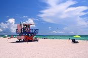
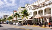
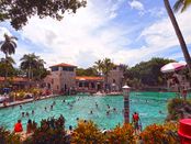
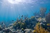
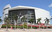
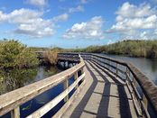
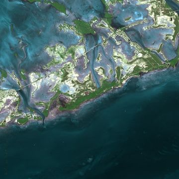
Images, from top down, left to right: Downtown Miami skyline; Lifeguard station on South Beach; Miami Design District's Palm Court; Wynwood Walls in Wynwood Art District; Ocean Drive in Miami Beach; Venetian Pool; Biscayne National Park; American Airlines Arena; Anhinga Trail boardwalk in Everglades National Park | |
| الكنية: "Dade County", "Dade", "Metro-Dade", "Greater Miami" | |
 | |
| الإحداثيات: 25°36′38″N 80°29′50″W / 25.61058°N 80.497099°W[1] | |
| Country | |
| State | |
| Region | South Florida |
| Metro area | Miami |
| Founded | January 18, 1836 |
| السمِيْ | Francis L. Dade |
| County seat | |
| Largest city | Miami |
| Incorporated cities | 19 |
| الحكومة | |
| • النوع | Two-tier federation |
| • الكيان | Miami-Dade Board of County Commissioners |
| • Miami-Dade Board of County Commissioners[2] | Commissioners
|
| • Mayor | Carlos A. Giménez |
| المساحة | |
| • الإجمالي | 2٬431٫178 ميل² (6٬296٫72 كم²) |
| • البر | 1٬898٫753 ميل² (4٬917٫75 كم²) |
| • الماء | 532٫425 ميل² (1٬378٫97 كم²) |
| أعلى منسوب | 34−40 ft (22 m) |
| أوطى منسوب | 0 ft (0 m) |
| التعداد | |
| • الإجمالي | 2٬498٬018 |
| • Estimate (2017)[6] | 2٬751٬796 |
| • الكثافة | 1٬000/sq mi (400/km2) |
| منطقة التوقيت | UTC−5 (Eastern Time Zone) |
| • الصيف (التوقيت الصيفي) | UTC−4 (Eastern Daylight Time) |
| Zip code | 33002, 33010-33018, 33030-33035, 33039, 33054, 33056, 33090, 33092, 33101-33102, 33106, 33109, 33111-33112, 33114, 33116, 33119, 33122, 33124-33147, 33149-33158, 33160-33170, 33172-33199, 33206, 33222, 33231, 33233-33234, 33238-33239, 33242-33243, 33245, 33247, 33255-33257, 33261, 33265-33266, 33269, 33280, 33283, 33296, 33299 |
| Area codes | 305/786, |
| FIPS code | 12086 |
| GNIS feature ID | 295755 |
| Primary Airport | Miami International Airport MIA (Major/International) |
| Secondary Airport | Miami Executive Airport- TMB (Regional)- Miami-Opa Locka Executive Airport- OPF (Regional)- Miami Homestead General Aviation Airport- X51 (Regional) |
| Interstates | |
| U.S. Routes | |
| State Routes | |
| Rapid Transit | Metrorail |
| Commuter Rail | |
| الموقع الإلكتروني | www |
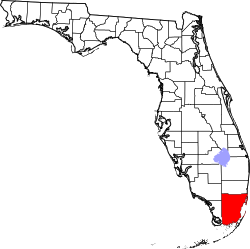
Miami-Dade County (إسپانية: Condado de Miami-Dade)is a county located in the southeastern part of the U.S. state of Florida. It is the southeasternmost county on the U.S. mainland. According to a 2017 census report,[7] the county had a population of 2,751,796,[8] making it the most populous county in Florida and the seventh-most populous county in the United States.[9] It is also Florida's third-largest county in terms of land area, with 1،946 ميل مربع (5،040 km2). The county seat is Miami, the principal city in South Florida.[10]
Miami-Dade County is one of the three counties in South Florida that make up the Miami metropolitan area, which was home to an estimated 6,158,824 people in 2017.[11]
The county is home to 36 incorporated cities and many unincorporated areas. The northern, central and eastern portions of the county are heavily urbanized with many high rises up the coastline, as well as the location of South Florida's central business district, Downtown Miami. Southern Miami-Dade County includes the Redland and Homestead areas, which make up the agricultural economy of Miami. Agricultural Redland makes up roughly one third of Miami-Dade County's inhabited land area, and is sparsely populated, a stark contrast to the densely populated, urban northern Miami-Dade County. The western portion of the county extends into the Everglades National Park and is populated only by a Miccosukee tribal village. East of the mainland in Biscayne Bay is also Biscayne National Park and the Biscayne Bay Aquatic Preserves.[12]
التاريخ
Early history
The Keys were originally inhabited by Calusa and Tequesta Native Americans, and were later charted by Juan Ponce de León in 1513. De León named the islands Los Martires ("The Martyrs"), as they looked like suffering men from a distance.[13] "Key" is derived from the Spanish word cayo, meaning small island. For many years, Key West was the largest town in Florida, and it grew prosperous on wrecking revenues. The isolated outpost was well located for trade with Cuba and the Bahamas, and was on the main trade route from New Orleans. Improved navigation led to fewer shipwrecks, and Key West went into a decline in the late nineteenth century.
Overseas Railway
The Keys were long accessible only by water. This changed with the completion of Henry Flagler's Overseas Railway in the early 1910s. Flagler, a major developer of Florida's Atlantic coast, extended his Florida East Coast Railway down to Key West with an ambitious series of oversea railroad trestles. Three hurricanes disrupted the project in 1906, 1909, and 1910.
Labor Day Hurricane of 1935
The worst hurricane to strike the U.S. made landfall near Islamorada in the Upper Keys on Labor Day, Monday, September 2. Winds were estimated to have gusted to 200 mph (320 km/h), raising a storm surge more than 17.5 أقدام (5.3 m) above sea level that washed over the islands. More than 400 people were killed, though some estimates place the number of deaths at more than 600.
The Labor Day Hurricane was one of only three hurricanes to make landfall at Category 5 strength on the U.S. coast since reliable weather records began (about 1850). The other storms were Hurricane Camille (1969) and Hurricane Andrew (1992).
In 1935, new bridges were under construction to connect a highway through the entire Keys. Hundreds of World War I veterans working on the roadway as part of a government relief program were housed in non-reinforced buildings in three construction camps in the Upper Keys. When the evacuation train failed to reach the camps before the storm, more than 200 veterans perished. Their deaths caused anger and charges of mismanagement that led to a Congressional investigation.
The storm also ended the 23-year run of the Overseas Railway; the damaged tracks were never rebuilt, and the Overseas Highway (U.S. Highway 1) replaced the railroad as the main transportation route from Miami to Key West.[14]
Seven Mile Bridge
One of the longest bridges when it was built, the Seven Mile Bridge connects Knight's Key (part of the city of Marathon in the Middle Keys) to Little Duck Key in the Lower Keys. The piling-supported concrete bridge is 35،862 ft (10،931 m) or 6.79 miles (10.93 km) long. The current bridge bypasses Pigeon Key, a small island that housed workers building Henry Flagler's Florida East Coast Railway in the 1900s, that the original Seven Mile Bridge crossed. A 2.2-ميل (3.5 km) section of the old bridge remains for access to the island, although it was closed to vehicular traffic on March 4, 2008. The aging structure has been deemed unsafe by the Florida Department of Transportation. Costly repairs, estimated to be as much as $34 million, were expected to begin in July 2008. Monroe County was unable to secure a $17 million loan through the state infrastructure bank, delaying work for at least a year. On June 14, 2008, the old bridge section leading to Pigeon Key was closed to fishing as well. While still open to pedestrians—walking, biking and jogging—if the bridge were closed altogether, only a ferry subsidized by FDOT and managed by the county would transport visitors to the island.
Overseas Highway
After the destruction of the Keys railway by the Labor Day Hurricane of 1935, the railroad bridges, including the Seven Mile Bridge, were converted to automobile roadways. This roadway, U.S. Highway 1, became the Overseas Highway that runs from Key Largo south to Key West. Today this unique highway allows travel through the tropical islands of the Florida Keys and view exotic plants and animals found nowhere else on the US mainland and the largest coral reef chain in the United States.
Cuban exiles
Following the Cuban Revolution, many Cubans fled to South Florida. Key West traditionally had strong links with its neighbor ninety miles south by water, and large numbers of Cubans settled there. The Keys still attract Cubans leaving their home country, and stories of "rafters" coming ashore are not uncommon.[citation needed]
Conch Republic
In 1982, the United States Border Patrol established a roadblock and inspection points on US Highway 1, stopping all northbound traffic returning to the mainland at Florida City, to search vehicles for illegal drugs and undocumented peoples. The Key West City Council repeatedly complained about the roadblocks, which were a major inconvenience for travellers, and hurt the Keys' important tourism industry.
After various unsuccessful complaints and attempts to get a legal injunction against the blockade failed in federal court in Miami, on April 23, 1982, Key West mayor Dennis Wardlow and the city council declared the independence of the city of Key West, calling it the "Conch Republic". After one minute of secession, he (as "Prime Minister") surrendered to an officer of the Key West Naval Air Station (NAS), and requested one billion ($1,000,000,000) dollars in "foreign aid".[15]
The stunt succeeded in generating great publicity for the Keys' plight, and the inspection station roadblock was removed. The idea of the Conch Republic has provided a new source of revenue for the Keys by way of tourist keepsake sales, and the Conch Republic has participated in later protests.
Law, government, and politics
Miami-Dade County has operated under a unique metropolitan system of government, a "two-tier federation", since 1957. This was made possible when Florida voters approved a constitutional amendment in 1956 that allowed the people of Dade County (as it was known then) to enact a home rule charter. Prior to this year, home rule did not exist in Florida, and all counties were limited to the same set of powers by the Florida Constitution and state law.
Unlike a consolidated city-county, where the city and county governments merge into a single entity, these two entities remain separate. Instead there are two "tiers", or levels, of government: city and county. There are 34 municipalities in the county, the City of Miami being the largest.
Cities are the "lower tier" of local government, providing police and fire protection, zoning and code enforcement, and other typical city services within their jurisdiction. These services are paid for by city taxes. The County is the "upper tier", and it provides services of a metropolitan nature, such as emergency management, airport and seaport operations, public housing and health care services, transportation, environmental services, solid waste disposal etc. These are funded by county taxes, which are assessed on all incorporated and unincorporated areas.
Of the county's 2.6 million total residents (as of 2013), approximately 52% live in unincorporated areas, the majority of which are heavily suburbanized. These residents are part of the Unincorporated Municipal Services Area (UMSA). For these residents, the County fills the role of both lower- and upper-tier government, the County Commission acting as their lower-tier municipal representative body. Residents within UMSA pay a UMSA tax, equivalent to a city tax, which is used to provide County residents with equivalent city services (police, fire, zoning, water and sewer, etc.). Residents of incorporated areas do not pay UMSA tax.
Structure of county government
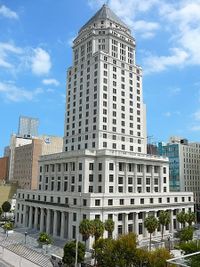
The Mayor of Miami-Dade County is elected countywide to serve a four-year term and is considered a "strong mayor." The mayor is not a member of the County Commission, appoints all 25 directors who oversee the operations of the County Departments and has veto power over the Commission. A mayoral appointment and veto can only be overridden by a two-thirds majority of the County Commission. The post is occupied by Carlos A. Giménez.
The Board of County Commissioners is the legislative body, consisting of 13 members elected from single-member districts. Members are elected to serve four-year terms, and elections of members are staggered. The Board chooses a Chairperson, who presides over the Commission, as well as appoints the members of its legislative committees. The Board has a wide array of powers to enact legislation, create departments, and regulate businesses operating within the County. It also has the power to override the Mayor's veto with a two-thirds vote.
Florida's Constitution provides for six elected officials to oversee executive and administrative functions for each county (called "Constitutional Officers"): Sheriff, Property Appraiser, Supervisor of Elections, Tax Collector, Clerk of the Circuit Court and Comptroller. However, the current Constitution allows voters in home-rule counties (including Miami-Dade) to abolish the offices and reorganize them as subordinate County departments; Miami-Dade voters chose this option for Sheriff, Supervisor of Elections, Controller and Tax Collector. The office of Clerk of the Circuit Court, and the judicial offices of State Attorney, and Public Defender, are still branches of State government and are, therefore, independently elected and not part of County government.[citation needed]
Miami-Dade is the only county in Florida that does not have an elected sheriff or a "Sheriff's Office".[citation needed] Instead, the county's law enforcement agency is known as the Miami-Dade Police Department, and its leader is known as the Metropolitan Sheriff and Director of the Miami-Dade Police Department. (Nonetheless, Miami-Dade Police badges bear the inscription, "Deputy Sheriff, Sheriff's Office, Dade County, Fla.".)
سياسة
استعراض
Miami-Dade County has voted for the Democratic candidate in most of the presidential elections in the past four decades, and has gone Democratic in every election since 1992. However, it did vote twice for Ronald Reagan (1980, 1984) and once for George H. W. Bush (1988). From 1904 to 1972 it voted almost exclusively Democrat except for four elections. In 2008 and 2012 approximately 59.69% of the electorate voted for Democrat Barack Obama. In 2016, Democrat Hillary Clinton won 63.22% of the vote.
| Year | GOP | DEM | Others |
|---|---|---|---|
| 2016 | 33.83% 333,999 | 63.22% 624,146 | 2.94% 29,046 |
| 2012 | 37.87% 332,981 | 61.58% 541,440 | 0.54% 4,758 |
| 2008 | 41.70% 360,551 | 57.81% 499,831 | 0.49% 4,254 |
| 2004 | 46.61% 361,095 | 52.89% 409,732 | 0.50% 3,899 |
| 2000 | 46.29% 289,574 | 52.57% 328,867 | 1.14% 7,111 |
| 1996 | 37.87% 209,740 | 57.34% 317,555 | 4.79% 26,487 |
| 1992 | 43.19% 235,313 | 46.73% 254,609 | 10.08% 54,921 |
| 1988 | 55.26% 270,937 | 44.26% 216,970 | 0.48% 2,358 |
| 1984 | 59.17% 324,414 | 40.83% 223,863 | 0.01% 35 |
| 1980 | 50.65% 265,888 | 40.17% 210,868 | 9.17% 48,149 |
| 1976 | 40.45% 211,148 | 58.06% 303,047 | 1.48% 7,747 |
| 1972 | 58.87% 256,529 | 40.78% 177,693 | 0.35% 1,541 |
| 1968 | 37.02% 135,222 | 48.37% 176,689 | 14.62% 53,391 |
| 1964 | 35.99% 117,480 | 64.01% 208,941 | |
| 1960 | 42.35% 134,506 | 57.65% 183,114 | |
| 1956 | 55.37% 130,938 | 44.63% 105,559 | |
| 1952 | 56.77% 122,174 | 43.23% 93,022 | |
| 1948 | 37.04% 41,301 | 53.52% 59,681 | 9.44% 10,530 |
| 1944 | 33.56% 30,357 | 66.44% 60,100 | |
| 1940 | 32.70% 25,224 | 67.30% 51,921 | |
| 1936 | 26.88% 10,295 | 73.12% 28,007 | |
| 1932 | 34.16% 9,244 | 65.84% 17,820 | |
| 1928 | 60.15% 15,860 | 38.44% 10,136 | 1.41% 372 |
| 1924 | 26.01% 2,753 | 32.83% 3,474 | 41.16% 4,356[17] |
| 1920 | 38.09% 3,077 | 53.08% 4,288 | 8.83% 713 |
| 1916 | 21.94% 629 | 57.69% 1,654 | 20.37% 584 |
| 1912 | 5.56% 99 | 65.71% 1,171 | 28.73% 512 |
| 1908 | 17.34% 275 | 60.59% 961 | 22.07% 350 |
| 1904 | 24.08% 307 | 69.57% 887 | 6.35% 81 |
Voter registration
| Population and registered voters as of 8/1/2018[18] | ||
|---|---|---|
| Total population[19] | 2,751,796 | |
| Registered voters[20] | 1,433,668 | 52.09% |
| Democratic | 601,261 | 41.93% |
| Republican | 377,550 | 26.33% |
| Democratic–Republican spread | +223,711 | +15.60% |
| Independence | 5,320 | 0.37% |
| Libertarian | 1,757 | 0.12% |
| Green | 636 | 0.04% |
| Reform | 141 | 0.00% |
| Constitution | 87 | 0.00% |
| Other | 127 | 0.00% |
| No party preference | 446,789 | 31.16% |
مدن شقيقة
Miami-Dade County has 23 sister cities, as designated by Sister Cities International:
|
|
انظر أيضا
- Gentrification of Miami
- List of tallest buildings in Miami
- List of tallest buildings in Sunny Isles Beach
- List of tallest buildings in Miami Beach
- National Register of Historic Places listings in Miami-Dade County, Florida
- List of counties in Florida
- West End (Florida)
الهامش
- ^ https://www2.census.gov/geo/docs/maps-data/data/gazetteer/2018_Gazetteer/2018_gaz_counties_12.txt
- ^ https://www8.miamidade.gov/global/government.page
- ^ http://www.peakbagger.com/peak.aspx?pid=7934
- ^ Sea level at the Atlantic Ocean.
- ^ https://www.census.gov/quickfacts/fact/table/miamidadecountyflorida/POP060210
- ^ https://www.census.gov/quickfacts/fact/table/miamidadecountyflorida/POP060210
- ^ "U.S. Census Bureau QuickFacts: Miami-Dade County, Florida; UNITED STATES". www.census.gov (in الإنجليزية).
{{cite web}}: Cite has empty unknown parameter:|dead-url=(help) - ^ "State & County QuickFacts". United States Census Bureau. Archived from the original on July 14, 2011. Retrieved November 6, 2015.
{{cite web}}: Unknown parameter|deadurl=ignored (|url-status=suggested) (help) - ^ "MiamiHerald.com".
- ^ "Find a County". National Association of Counties. Retrieved 2011-06-07.
- ^ https://www.census.gov/quickfacts/fact/table/miamidadecountyflorida,browardcountyflorida,palmbeachcountyflorida/POP060210
- ^ "Biscayne Bay Aquatic Preserve". Florida Department of Environmental Protection. Florida Department of Environmental Protection. July 8, 2015. Retrieved December 14, 2015.
- ^ Journal of Antonio de Herrera quoted in Goodwin-Nguyen, S (2008) Key West: A Comprehensive Guide to Florida's Southernmost City, Channel Lake, p. 19.
- ^ "about". overseasrailroad.railfan.net.
- ^ The Conch Republic Archived 2012-11-02 at the Wayback Machine
- ^ Leip, David. "Dave Leip's Atlas of U.S. Presidential Elections". uselectionatlas.org.
- ^ The leading "other" candidate, Prohibition candidate Herman P. Faris, received 3,170 votes while Progressive candidate Robert M. La Follette received 2,753 votes and American Party candidate Gilbert Nations received 172 votes.
- ^ https://www.miamidade.gov/elections/library/reports/voter-registration-statistics-cumulative.pdf
- ^ https://www.census.gov/quickfacts/fact/table/miamidadecountyflorida/POP060210
- ^ https://www.miamidade.gov/elections/library/reports/voter-registration-statistics-cumulative.pdf
- ^ Press, Europa (May 25, 2009). "La ocupación para el primer mes del vuelo Tenerife-Miami de Air Europa alcanza ya el 70 por ciento".
- ^ Prefeitura.Sp – Descentralized Cooperation Archived ديسمبر 24, 2008 at the Wayback Machine
- ^ "International Relations – São Paulo City Hall – Official Sister Cities". Archived from the original on مايو 21, 2010. Retrieved يناير 31, 2010.
{{cite web}}: Unknown parameter|dead-url=ignored (|url-status=suggested) (help) - ^ "Partnerská města HMP" [Prague – Twin Cities HMP]. Portál „Zahraniční vztahy" [Portal "Foreign Affairs"] (in Czech). July 18, 2013. Archived from the original on June 25, 2013. Retrieved August 5, 2013.
{{cite web}}: CS1 maint: unrecognized language (link)
وصلات خارجية

|
Broward County | Collier County | 
| |
| Atlantic Ocean | Monroe County | |||
| Monroe County |
- Pages using gadget WikiMiniAtlas
- CS1 errors: unsupported parameter
- Articles with hatnote templates targeting a nonexistent page
- Short description is different from Wikidata
- Pages using infobox settlement with possible nickname list
- Coordinates on Wikidata
- Articles containing إسپانية-language text
- Pages using Lang-xx templates
- Articles with unsourced statements from December 2018
- المقالات needing additional references from January 2010
- كل المقالات needing additional references
- Articles with unsourced statements from March 2012
- Pages with empty portal template
- Counties in the Miami metropolitan area
- Charter counties in Florida
- Miami-Dade County, Florida
- 1836 establishments in Florida Territory
- Populated places established in 1836

