جزر أوسترال
الاسم الأصلي: Îles Australes (French) / Tuha'a Pae (Tahitian) | |
|---|---|
 | |
 | |
| خطأ: الوظيفة "auto" غير موجودة. خطأ: الوظيفة "autocaption" غير موجودة. | |
| الجغرافيا | |
| الموقع | المحيط الهادي |
| الإحداثيات | 23°53′S 147°40′W / 23.88°S 147.67°W |
| الأرخبيل | پولينيزيا |
| المساحة | 152 km2 (59 sq mi) |
| أعلى منسوب | 650 m (2٬130 ft) |
| أعلى نقطة | Mont Perau |
| الإدارة | |
فرنسا | |
| السكان | |
| التعداد | 6,820[1] |
| الكثافة السكانية | 43 /km2 (111 /sq mi) |
| معلومات إضافية | |
| Time zone | |
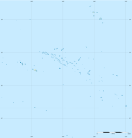
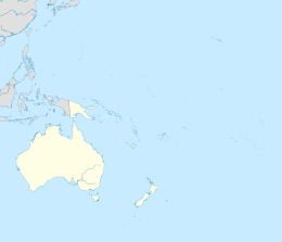
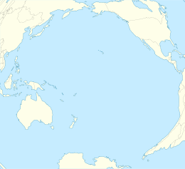
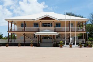
توهاآ پائ Tuha'a Pae، أو جزر أسترال (إنگليزية: Austral Islands؛ [Îles Australes أو Archipel des Australes] Error: {{Lang-xx}}: text has italic markup (help))، هي المجموعة الأقصى جنوباً في پولينيزيا الفرنسية، التي هي تجمع وراء البحار تابع لـفرنسا في جنوب الهادي. وجغرافياً، يتكونون من أرخبيلين منفصلين، هما في الشمال الغربي جزر توپوائي (فرنسية: Îles Tubuaï) وتتكون من Îles Maria, Rimatara, روروتو, وجزيرة توپوائي نفسها و رائيڤاڤائ, and in the southeast the Bass Islands (فرنسية: Îles basses) composed of the main island of راپا إيتي and the small Marotiri (also known as Bass Rocks or Îlots de Bass). سكان الجزر يُعرَفوا بمهاتهم في غزل ألياف pandanus.[2] جزيرتا ماريا و ماروتيري غير صالحتين للسكنى المستدامة. العديد من الجزر فيها جُزيرات أو صخور غير مأهولة أمام سواحلها. تعداد جزر أوسترال يناهز 6,300 نسمة على مساحة 150 كم². عاصمة التقسيم الاداري جزر أوسترال هي توپوائي.
الجغرافيا
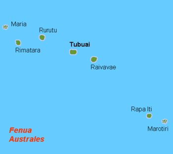
توهاآ پائ أو جزر أوسترال ([Îles Australes أو Archipel des Australes] Error: {{Lang-xx}}: text has italic markup (help)) هي المجموعة الأقصى جنوباً في پولينيزيا الفرنسية، التي هي تجمع وراء البحار تابع لـفرنسا في جنوب الهادي. وجغرافياً، يتكونون من أرخبيلين منفصلين. Geographically, the Austral Islands consist of two separate archipelagos. From northwest to southeast they are:
- جزر توپوائي (فرنسية: Îles Tubuaï), named for one of the main islands. It consists of:
- Îles Maria (21°48′00″S 154°41′00″W / 21.80000°S 154.68333°W) in the northwest, part of Rimatara municipality
- Rimatara (22°38′25″S 152°50′16″W / 22.64028°S 152.83778°W),
- Rūrutu (22°29′04″S 151°20′03″W / 22.48444°S 151.33417°W),
- Tupua'i (23°23′00″S 149°27′00″W / 23.38333°S 149.45000°W),
- Ra'ivāvae (23°52′00″S 147°40′00″W / 23.86667°S 147.66667°W),
- The Bass Islands (فرنسية: Îles Bass) comprise:
- the main island of Rapa Iti (27°35′00″S 144°20′00″W / 27.58333°S 144.33333°W),
- the small Marotiri island (27°55′00″S 143°26′00″W / 27.91667°S 143.43333°W) in the southeast, part of Rapa municipality
The islands of Maria and Marotiri are not suitable for sustained habitation. Several of the islands have uninhabited islets or rocks off their coastlines.
The chain is associated with the Macdonald hotspot. البركان النشط الوحيد هو مكدونالد، الجبل البحري (على عمق 40 متر تحت سطح البحر).[3]
In administrative terms, the Austral Islands (including the Bass Islands) constitute an administrative subdivision, the Tuha'a Pae or Austral Islands (subdivision administrative des (Îles) Australes), one of پولينيزيا الفرنسية's five administrative subdivisions (subdivision administratives). Geographically, the administrative subdivision of the Austral Islands is identical with the constituency of the Austral Islands (circonscription des Îles Australes), one of پولينيزيا الفرنسية's six constituencies (circonscriptions électorales) for the مجلس پولينيزيا الفرنسية.
عاصمة التقسيم الاداري، جزر أوسترال، هو توپوائي.
المناخ
The northern Tupua'i islands have a tropical rainforest climate (Af according to the Köppen climate classification, Arab according to the Trewartha climate classification), but relatively cool compared to the Polynesian islands further north, as the Tupua'i islands are around the Tropic of Capricorn. Summers are hot and muggy, with an abundance of precipitation caused by thunderstorms from easterly winds. In addition, the islands can be affected by cyclones in the austral summer (between November and April). Winters are warm and humid, with easterly winds still creating high precipitation amounts. Far from any landmasses, the Tupua'i islands have a low absolute temperature range – a record high of 32.7 °C (90.9 °F) in March and a record low of 9.2 °C (48.6 °F) in August.
| بيانات المناخ لـ Tubuai (1981−2010 normals, extremes 1948−2014) | |||||||||||||
|---|---|---|---|---|---|---|---|---|---|---|---|---|---|
| الشهر | ينا | فب | مار | أبر | ماي | يون | يول | أغس | سبت | أكت | نوف | ديس | السنة |
| القصوى القياسية °س (°ف) | 32.0 (89.6) |
32.0 (89.6) |
32.7 (90.9) |
32.3 (90.1) |
32.0 (89.6) |
31.0 (87.8) |
30.0 (86.0) |
30.0 (86.0) |
29.0 (84.2) |
30.0 (86.0) |
30.0 (86.0) |
32.0 (89.6) |
32.7 (90.9) |
| متوسط القصوى اليومية °س (°ف) | 28.0 (82.4) |
28.6 (83.5) |
28.6 (83.5) |
27.4 (81.3) |
25.8 (78.4) |
24.4 (75.9) |
23.9 (75.0) |
23.7 (74.7) |
23.9 (75.0) |
24.7 (76.5) |
25.9 (78.6) |
26.9 (80.4) |
26.0 (78.8) |
| المتوسط اليومي °س (°ف) | 25.7 (78.3) |
26.2 (79.2) |
26.0 (78.8) |
24.9 (76.8) |
23.2 (73.8) |
21.7 (71.1) |
21.2 (70.2) |
21.0 (69.8) |
21.1 (70.0) |
22.1 (71.8) |
23.4 (74.1) |
24.5 (76.1) |
23.4 (74.2) |
| متوسط الدنيا اليومية °س (°ف) | 23.3 (73.9) |
23.7 (74.7) |
23.4 (74.1) |
22.3 (72.1) |
20.7 (69.3) |
19.0 (66.2) |
18.6 (65.5) |
18.3 (64.9) |
18.4 (65.1) |
19.5 (67.1) |
20.8 (69.4) |
22.0 (71.6) |
20.8 (69.5) |
| الصغرى القياسية °س (°ف) | 14.5 (58.1) |
15.5 (59.9) |
15.8 (60.4) |
14.6 (58.3) |
10.0 (50.0) |
10.0 (50.0) |
10.0 (50.0) |
9.2 (48.6) |
10.3 (50.5) |
10.7 (51.3) |
12.0 (53.6) |
14.3 (57.7) |
9.2 (48.6) |
| متوسط تساقط الأمطار mm (inches) | 194.4 (7.65) |
192.4 (7.57) |
176.3 (6.94) |
165.3 (6.51) |
153.3 (6.04) |
119.0 (4.69) |
136.0 (5.35) |
133.4 (5.25) |
104.8 (4.13) |
116.5 (4.59) |
133.9 (5.27) |
200.4 (7.89) |
1٬825٫7 (71.88) |
| Average precipitation days (≥ 1.0 mm) | 13.2 | 12.9 | 13.3 | 12.5 | 12.4 | 11.4 | 11.2 | 11.3 | 9.6 | 9.9 | 10.2 | 13.2 | 141.1 |
| Mean monthly ساعات سطوع الشمس | — | — | 204.9 | 175.6 | 158.6 | 141.6 | 165.5 | 165.0 | — | — | 199.9 | 177.0 | — |
| Source: Météo-France[4] | |||||||||||||
The southern Bass Islands have a have a tropical rainforest climate (Af in the Köppen climate classification, Arab in the Trewartha climate classification), bordering on a very-mild winter humid subtropical climate (Cfa in the Köppen climate classification, Cfal in the Trewartha climate classification). Despite being situated south of the Tropic of Capricorn, the remote location in the middle of a tropical ocean enables the climate to be moderated in all seasons. Summers and winters are slightly cooler than in the Tupua'i Islands, and cyclones are rarer, as the islands are located near the Horse Latitudes at thirty degrees south. Precipitation is abundant in all seasons, and sunshine is uncommon every month of the year. The cool winters and strong winds prohibit ultra tropical fruits such as coconuts to thrive,[5] as it has dropped to 8.5 °C (47.3 °F) in September.
| بيانات المناخ لـ Rapa, French Polynesia, 1981–2010 normals, extremes 1951–present | |||||||||||||
|---|---|---|---|---|---|---|---|---|---|---|---|---|---|
| الشهر | ينا | فب | مار | أبر | ماي | يون | يول | أغس | سبت | أكت | نوف | ديس | السنة |
| القصوى القياسية °س (°ف) | 31.0 (87.8) |
30.9 (87.6) |
31.6 (88.9) |
30.3 (86.5) |
28.1 (82.6) |
26.3 (79.3) |
24.7 (76.5) |
25.0 (77.0) |
26.4 (79.5) |
26.4 (79.5) |
28.9 (84.0) |
30.1 (86.2) |
31.6 (88.9) |
| متوسط القصوى اليومية °س (°ف) | 25.7 (78.3) |
26.4 (79.5) |
26.1 (79.0) |
24.5 (76.1) |
22.9 (73.2) |
21.4 (70.5) |
20.7 (69.3) |
20.4 (68.7) |
20.4 (68.7) |
21.4 (70.5) |
22.7 (72.9) |
24.0 (75.2) |
23.0 (73.4) |
| المتوسط اليومي °س (°ف) | 23.7 (74.7) |
24.4 (75.9) |
23.9 (75.0) |
22.4 (72.3) |
20.8 (69.4) |
19.1 (66.4) |
18.4 (65.1) |
18.1 (64.6) |
18.1 (64.6) |
19.2 (66.6) |
20.6 (69.1) |
21.9 (71.4) |
20.9 (69.6) |
| متوسط الدنيا اليومية °س (°ف) | 21.7 (71.1) |
22.3 (72.1) |
21.7 (71.1) |
20.2 (68.4) |
18.6 (65.5) |
16.8 (62.2) |
16.2 (61.2) |
15.8 (60.4) |
15.8 (60.4) |
16.9 (62.4) |
18.5 (65.3) |
19.9 (67.8) |
18.7 (65.7) |
| الصغرى القياسية °س (°ف) | 12.2 (54.0) |
15.6 (60.1) |
15.2 (59.4) |
13.5 (56.3) |
10.1 (50.2) |
10.2 (50.4) |
9.8 (49.6) |
8.9 (48.0) |
8.5 (47.3) |
10.5 (50.9) |
12.0 (53.6) |
13.2 (55.8) |
8.5 (47.3) |
| متوسط تساقط الأمطار mm (inches) | 229.4 (9.03) |
186.9 (7.36) |
275.8 (10.86) |
251.4 (9.90) |
185.0 (7.28) |
208.7 (8.22) |
258.4 (10.17) |
237.8 (9.36) |
165.1 (6.50) |
184.1 (7.25) |
170.6 (6.72) |
221.4 (8.72) |
2٬574٫6 (101.36) |
| Average precipitation days (≥ 1 mm) | 13.2 | 12.5 | 15.3 | 14.9 | 14.5 | 15.7 | 15.4 | 15.5 | 12.7 | 12.2 | 11.8 | 12.7 | 166.4 |
| Mean monthly ساعات سطوع الشمس | 128.9 | 130.3 | 129.1 | 107.7 | 96.6 | 78.9 | 95.0 | — | 104.1 | 119.1 | 129.3 | 119.6 | — |
| Source: Meteo France[6] | |||||||||||||
البيئة
The Austral islands constitute the Tubuai tropical moist forests terrestrial ecoregion. The natural vegetation consisted of lowland and montane rain forests. Much of the original forest has been mostly cleared for pasture and agriculture. The islands are home to several endemic plants and animals, including the Rimatara reed warbler (Acrocephalus rimatarae), Rapa fruit-dove (Ptilonopus huttoni), and Kuhl's lorikeet (Vini kuhli).[7]
Most of the islands are surrounded by coral reefs. The islands constitute a distinct marine ecoregion.
الكساء النباتي
The flora of the Austral Islands has already been modified mainly by the Polynesian aborigines. On the uninhabited Maria Atoll, ancient, largely undestroyed native vegetation can be found. On Rapa, too, there are still small remnants of the original montane rainforest in inaccessible steep areas.[8]
On the four larger islands (Rapa, Raivavae, Tubuai and Rurutu) the vegetation is dominated by secondary growth. Beach vegetation differs little from that of other Pacific island groups, but is less species-rich. In the few areas undisturbed by man, Pisonia grandis palm, heliotropes of the species Heliotropium arboreum (synonyms: Argusia argentea, Tournefortia argentea) and Pandanus tectorius predominate, with shrubby and creeping plants in the understory.[8]
At lower altitudes, outside of cultivated areas, there are thickets of Hibiscus tiliaceus. Guava (Psidium guajava), probably introduced by Europeans, has also spread widely and forms extensive tangled stands up to middle altitudes. However, large areas have been damaged by previous slash-and-burn and goat grazing, and open grasslands have formed with few low-growing trees. Dense stands of ferns have established in the narrow, moist crevices. The higher elevations in the lee of the mountains are arid in places.[8]
الاقتصاد
The inhabitants of the Austral Islands live mainly from subsistence agriculture. The very fertile soils and the warm and humid climate make it possible to grow vegetables, tubers (taro and yams) and tropical and subtropical fruits. The products are mainly consumed by the farmers themselves, and small surpluses are exported to Tahiti. In addition, fishing and livestock (chickens and pigs) are raised for local consumption. Some copra, coffee in small quantities (Raivavae and Rurutu) and vanilla (Rurutu) are grown for export.
Tourism has barely touched the islands so far, and the tourist infrastructure is still underdeveloped. The islands can be reached by regular supply boat from Tahiti and by light aircraft from Tahiti-Faa'a airport. There are airfields at Rurutu, Tubuai, Raivavae and Rimatara.[9] The currency is (still) the CFP franc, which is pegged to the euro. The administrative budget of the Austral Islands is largely financed by France and the EU.
السياسة والحكومة
Politically, the Austral Islands today belong to French Polynesia (Pays d'outre-mer – POM) and are therefore affiliated with the EU. They are administered by a subdivision (Subdivision administrative des Îles Australes) of the High Commissariat of the Republic in French Polynesia (Haut-commissariat de la République en Polynésie française) in Papeete, on the island of Tahiti.
The archipelago is politically divided into 5 municipalities (Communes des Îles Australes), which administer themselves.
The official time zone is UTC −10.
السكان
The 6,820 inhabitants (2012 census)[10] live mainly in small villages; there are no large cities in the Austral Islands. Unlike other regions of Polynesia, the population of the Austral Islands has declined since the mid-1990s.[10] The reason is the high migration of young people from the isolated archipelago to other parts of Polynesia or to France for their better job prospects.
الدين
The majority of the population is Christian[11] mostly belonging to various Protestant groups and the Catholic Church. Catholics follow the Latin rite and administer 4 churches under the Archdiocese of Papeete, 2 on Tubuai Island: the Church of Mary and the Church of Saint Joseph (Église de Maria no te Hau; Église de Saint-Joseph)[12] one on Rurutu Island: the Church of Saint Francis Regis (Église de Saint-François-Régis),[13] and one more on Raivavae Island: the Church of Saint Peter (Église de Saint-Pierre).[14] According to 1991 data, Protestant Christian groups represent the majority on these islands.[15]
اللغات
The official language, as in the rest of France, is French. In everyday life, the Austral language, which belongs to the Polynesian languages, is often spoken, but with a tendency to decline.
الثقافة
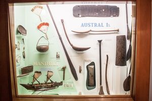
The traces of culture originating from the Austral Islands are quite numerous and the works of art produced there have often been judged as the most remarkable produced in Polynesia However, almost none of these works can be found on these islands but in renowned museums in Western countries.
Indeed, passing ships received numerous offerings but also plundered some of the islands' sites, notably the missionaries of the London Missionary Society, anxious to eradicate all traces of ancient worship. The marae, Polynesian places of worship, were thus excavated and gradually disappeared. In Raivavae, for example, out of sixty-two marae present at the beginning of the 20th century, only twenty-three remain visible today.
The best known work of art stolen from the Austral Islands is certainly the sculpture of the God A'a, discovered in Rurutu and currently exhibited at the British Museum in London.[16] There is a reproduction on the island. It is composed of thirty small figures sculpted on its body; its back had a cavity that could accommodate twenty-four other small sculptures which were however destroyed in 1822.[16]
The Austral Islands are also known for their large vertical drums or "pahu" often decorated with human figures that often welcomed Christian explorers or missionaries.
Numerous other figures carved in wood or even in stone for the marae, carved wooden fly swatters generally with anthropomorphic figures, sometimes even with ivory handles, large decorated spoons as well as highly decorated bowls have been found in the archipelago. Overall, these works are finely decorated with great complexity and often with anthropomorphic figures.
Other objects used to dress the people or personalities of the islands have been discovered, such as elaborate hairstyles as well as large crowns and necklaces of hair or feathers with shell or ivory pendants.
انظر أيضاً
- فرنسا وراء البحار
- التقسيمات الادارية في فرنسا
- الجزر التي تسيطر عليها فرنسا في المحيطين الهندي والهادي
- قائمة جزر فرنسا
- سياسة پولينيزيا الفرنسية
الهامش
- ^ Institut Statistique de Polynésie Française (ISPF). "Recensement de la population 2012" (in الفرنسية). Archived from the original (PDF) on 2014-02-02. Retrieved 2012-08-01.
{{cite web}}: Unknown parameter|deadurl=ignored (|url-status=suggested) (help) - ^ "Australs Resorts". Tahiti Travel Planners. Retrieved 16 December 2014.
- ^ Gillespie, Rosemary G.; David A. Clague (2009). Encyclopedia of Islands. Berkeley, CA: University of California Press. p. 342. ISBN 9780520256491. Retrieved 7 May 2013.
- ^ "climate of Tubuai 1981–2010" (PDF) (in الفرنسية). Météo-France. Archived (PDF) from the original on January 18, 2022. Retrieved April 8, 2022.
- ^ "Rapa Iti Island". Tropical Islands (in الإنجليزية الأمريكية). 2020-08-18. Archived from the original on 2021-08-06. Retrieved 2022-04-23.
- ^ "Fiche Climatologique" (PDF). Météo France. Archived (PDF) from the original on February 10, 2021. Retrieved February 2, 2021.
- ^ قالب:WWF ecoregion
- ^ أ ب ت Mueller-Dombois, Dieter; Fosberg, F. Raymond (1998). Vegetation of the tropical Pacific islands. New York: Springer. p. 400. ISBN 0-387-98285-X. OCLC 37254337.
- ^ Stanley, David (2011-04-05). Moon Tahiti (in الإنجليزية). Avalon Publishing. ISBN 978-1-61238-114-5. Archived from the original on 2022-04-07. Retrieved 2021-11-15.
- ^ أ ب Institut Statistique de Polynésie Française (ISPF): Recensement de la population 2012, Tableaux standards,
- ^ Cone, Steven D.; Rea, Robert F. (2019-09-05). A Global Church History: The Great Tradition through Cultures, Continents and Centuries (in الإنجليزية). Bloomsbury Publishing. ISBN 978-0-567-67307-7. Archived from the original on 2022-09-26. Retrieved 2021-11-15.
- ^ "Église de Saint-Joseph". GCatholic. Archived from the original on 2021-08-14. Retrieved 2021-08-17.
- ^ "Église de Saint-François-Régis". GCatholic. Archived from the original on 2021-08-14. Retrieved 2021-08-17.
- ^ "Église de Saint-Pierre". GCatholic. Archived from the original on 2021-08-14. Retrieved 2021-08-17.
- ^ Saura, Bruno (1991). "The Tahitian Churches and the Problem of the French Presence in 1991". The Journal of Pacific History. 26 (2): 347–357. doi:10.1080/00223349108572673. ISSN 0022-3344. JSTOR 25169083. Archived from the original on 2021-08-15. Retrieved 2021-08-17.
- ^ أ ب "Carved wooden figure known as A'a". Archived from the original on 2007-10-14.
وصلات خارجية
- Official site
- Official site, municipalities with maps
- Oceandots.com satellite images at the Wayback Machine (archived ديسمبر 23, 2010)
- Pages using gadget WikiMiniAtlas
- CS1 errors: unsupported parameter
- CS1 الفرنسية-language sources (fr)
- CS1 الإنجليزية الأمريكية-language sources (en-us)
- Short description matches Wikidata
- Coordinates on Wikidata
- Pages using infobox islands with unknown parameters
- Articles containing إنگليزية-language text
- Pages using Lang-xx templates
- Lang and lang-xx template errors
- Articles containing فرنسية-language text
- جزر أوسترال
