ماوي
Nickname: جزيرة الوادي | |
|---|---|
 | |
 موقع ماوي في هاواي. | |
| الجغرافيا | |
| الموقع | 20°48′N 156°20′W / 20.800°N 156.333°W |
| المساحة | 727.2 sq mi (1،883 km2) |
| ترتيب المساحة | ثاني أكبر جزر هاواي |
| أعلى منسوب | 10٫023 ft (3٫055 m)[1] |
| أعلى نقطة | هالىآكالا |
| الإدارة | |
الولايات المتحدة | |
| الرموز | |
| الزهرة | لوكلاني |
| اللون | ʻĀkala (pink) |
| السكان | |
| التعداد | 144.444 (2010) |
| الكثافة السكانية | 162 /sq mi (62٫5 /km2) |

جزيرة ماوي ( Maui ؛ /ˈmaʊ.iː/؛ بالهاوائية: [ˈmɐwwi])[3]، هي ثاني أكبر جزر هاوائي بمساحة 1.883 كم² والجزيرة ال17 من حيث المساحة في الولايات المتحدة.[4] ماوي هي جزء من ولاية هاواي وهي أكبر أربع جزر في مقاطعة ماوي، حيث تعتبر أكبر من مولوكاي، لاناي، وجزيرة كاهولاوه الغير مأهولة. في 2010، كان عدد سكان الجزرة 144.444 نسمة، ثالث أكبر جزر هاواي من حيث عدد السكان، بعد جزيرتي اواهو وهاواي. كاهولوي هي أكبر الأماكن المعينة إحصائياً على الجزيرة بعدد سكان 26.337 نسمة حسب تعداد 2010 وهي المركز التجاري والمالي على الجزيرة.[5] Other significant places include Kīhei (including Wailea and Makena in the Kihei Town CDP, the island's second-most-populated CDP), Lāhainā (including Kāʻanapali and Kapalua in the Lāhainā Town CDP), Makawao, Pukalani, Pāʻia, Kula, Haʻikū, and Hāna.
أصل الاسم
Native Hawaiian tradition gives the origin of the island's name in the legend of Hawaiʻiloa, the navigator credited with discovering the Hawaiian Islands. According to it, Hawaiʻiloa named the island after his son, who in turn was named for the demigod Māui. Maui's previous name was ʻIhikapalaumaewa.[6] The Island of Maui is also called the "Valley Isle" for the large isthmus separating its northwestern and southeastern volcanic masses.
الجغرافيا والطبولوجيا

نتجت طبيعة جزيرة ماوي الجغرافية المتنوّعة عن عدد من التأثيرات الجيولوجية والطوبوغرافية والمناخية. فكلُّ جبلٍ بركاني في سلسلة جبال هاواي - بما في ذلك بركان جزيرة ماوي - مكوَّنٌ من الصخور السوداء الغنية بالحديد والشحيحة بالمرو، والتي تتدفَّقت من آلاف البراكين التي نفثت حممها على المنطقة على مدى ملايين السنين. كانت العديد من البراكين قريبةً من بعضها إلى حدّ أنَّ دفقات الحمم على جوانبها تداخلت معاً، لتشكِّل جزيرة واحدة، ومن بين هذه كانت الحمم التي انبثقت عنها ماوي، التي تكونت من بركانين درعيَّين اتحدا معاً لتشكيل برزخ بينهما.[7]


The older, western volcano has been eroded considerably and is cut by numerous drainages, forming the peaks of the West Maui Mountains (in Hawaiian, Mauna Kahalawai). Puʻu Kukui is the highest of the peaks at 5،788 ft (1،764 m). The larger, younger volcano to the east, Haleakalā, rises to more than 10،000 ft (3،000 m) above sea level, and measures 5 mi (8.0 km) from seafloor to summit.
The eastern flanks of both volcanoes are cut by deeply incised valleys and steep-sided ravines that run downslope to the rocky, windswept shoreline. The valley-like Isthmus of Maui that separates the two volcanic masses was formed by sandy erosional deposits.
Maui's last eruption (originating in Haleakalā's Southwest Rift Zone) occurred around 1790; two of the resulting lava flows are located (1) at Cape Kīnaʻu between ʻĀhihi Bay and La Perouse Bay on the southwest shore of East Maui, and (2) at Makaluapuna Point[8] on Honokahua Bay on the northwest shore of West Maui. Considered to be dormant by volcanologists, Haleakalā is certainly capable of further eruptions.[9]
Maui is part of a much larger unit, Maui Nui, that includes the islands of Lānaʻi, Kahoʻolawe, Molokaʻi, and the now submerged Penguin Bank. During periods of reduced sea level, including as recently as 200,000 years ago,[10] they are joined as a single island due to the shallowness of the channels between them.
المناخ


The climate of the Hawaiian Islands is characterized by a two-season year, tropical and uniform temperatures everywhere (except at high elevations), marked geographic differences in rainfall, high relative humidity, extensive cloud formations (except on the driest coasts and at high elevations), and dominant trade-wind flow (especially at elevations below a few thousand feet). Maui itself has a wide range of climatic conditions and weather patterns that are influenced by several different factors in the physical environment:
- Half of Maui is situated within 5 mi (8.0 km) of the island's coastline. This, and the extreme insularity of the Hawaiian Islands account for the strong marine influence on Maui's climate.
- Gross weather patterns are typically determined by elevation and orientation towards the Trade winds (prevailing air flow comes from the northeast).
- Maui's rugged, irregular topography produces marked variations in conditions. Air swept inland on the Trade winds is shunted one way or another by the mountains, valleys, and vast open slopes. This complex three-dimensional flow of air results in striking variations in wind speed, cloud formation, and rainfall.
Maui displays a unique and diverse set of climatic conditions, each of which is specific to a loosely defined sub-region of the island. These sub-regions are defined by major physiographic features (such as mountains and valleys) and by location on the windward or leeward side of the island.
التاريخ الطبيعي
Maui is a leading whale-watching center in the Hawaiian Islands due to humpback whales wintering in the sheltered ʻAuʻau Channel between the islands of Maui county. The whales migrate approximately 3،500 mi (5،600 km) from Alaskan waters each autumn and spend the winter months mating and birthing in the warm waters off Maui, with most leaving by the end of April. The whales are typically sighted in pods: small groups of several adults, or groups of a mother, her calf, and a few suitors. Humpbacks are an endangered species protected by U.S. federal and Hawaiʻi state law. There are estimated to be about 22,000 humpbacks in the North Pacific.[11] Although Maui's Humpback face many dangers, due to pollution, high-speed commercial vessels, and military sonar testing, their numbers have increased rapidly in recent years, estimated at 7% growth per year.[12]
Maui is home to a large rainforest on the northeastern flanks of Haleakalā, which serves as the drainage basin for the rest of the island. The extremely difficult terrain has prevented the exploitation of much of the forest.
Agricultural and coastal industrial land use has hurt much of Maui's coastal regions. Many of Maui's extraordinary coral reefs have been damaged by pollution, run-off, and tourism, although finding sea turtles, dolphins, and Hawaii's celebrated tropical fish, is still common. Leeward Maui used to boast a vibrant dry 'cloud forest' as well but this was destroyed by human activities over the last three hundred years.[13]
الحياة البرية

The birdlife of Maui lacks the high concentration of endemic birdlife found in some other Hawaiian islands. As recently as 200,000 years ago it was linked to the neighboring islands of Molokai, Lanai, and Kaho'olawe in a large island called Maui Nui, thus reducing the chance of species endemic to any single one of these. Although Molokai does have several endemic species of birds, some extinct and some not, in modern times Maui, Lanai, and Kaho'olawe have not had much endemic birdlife. In ancient times during and after the period in which Maui was part of Maui Nui, Maui boasted a species of moa-nalo (which was also found on Molokai, Lanai, and Kaho'olawe), a species of harrier (the Wood harrier, shared with Molokai), an undescribed sea eagle (Maui only), and three species of ground-dwelling flightless ibis (Apteribis sp.), plus a host of other species. Today, the most notable non-extinct endemics of Maui are probably the 'Akohekohe (Palmeria dolei) and the Maui parrotbill (Pseudonestor xanthophrys), also known as Kiwikiu, both of which are critically endangered and only found in an alpine forest on the windward slopes of Haleakala. Conservation efforts have looked at how to mitigate female parrotbill mortality since this has been identified as a key driving factor driving the decline in population. The parrotbill has a notable lack of resistance to mosquito-born diseases, so only forests above 1500 meters of elevation provide refuge for most parrotbills. The habitat is in the process of being restored on leeward east Maui as of 2018.[14] As Maui's population continues to grow, the previously undeveloped areas of the island that provided a refuge for the wildlife are decreasing in size as they are becoming more developed. This is proving to be a risk for the endangered species of the island. Both flora and fauna habitats need to be protected for the sake of the numerous endangered species that live there. More than 250 species of native flora are federally listed as endangered or threatened.[15] Birds found on other islands as well as Maui include the I'iwi (Drepanis coccinea], 'Apapane (Himatione sanguinea), as well as the Nene (Branta sandvicensis, the state bird of Hawaii), Hawaiian coot (Fulica alai), and a number of others. The Winter months provide a great opportunity for whale watching, as thousands of humpback whales migrate annually and pass by the island.
التاريخ

Polynesians from Tahiti were the original people to populate Maui. The Tahitians introduced the kapu system, a strict social order that affected all aspects of life and became the core of Hawaiʻian culture. Modern Hawaiʻian history began in the mid-18th century. Kamehameha I, king of the island of Hawaiʻi, invaded Maui in 1790 and fought the inconclusive Battle of Kepaniwai, but returned to Hawaiʻi to battle a rival, finally subduing Maui a few years later.
On November 26, 1778, explorer James Cook became the first European to see Maui. Cook never set foot on the island because he was unable to find a suitable landing. The first European to visit Maui was the French admiral Jean-François de Galaup, comte de Lapérouse, who landed on the shores of what is now known as La Perouse Bay on May 29, 1786. More Europeans followed: traders, whalers, loggers (e.g., of sandalwood) and missionaries. The latter began to arrive from New England in 1823, settling in Lahaina, which at that time was the capital. They clothed the natives, banned them from dancing hula, and greatly altered the culture. The missionaries taught reading and writing, created the 12-letter Hawaiian alphabet, started a printing press in Lahaina, and began writing the islands' history, which until then was transmitted orally.[16] Ironically, the missionaries both altered and preserved the native culture. The religious work altered the culture while the literacy efforts preserved native history and language. Missionaries started the first school in Lahaina, which still exists today: Lahainaluna Mission School, which opened in 1831.

At the height of the whaling era (1843–1860), Lahaina was a major center. In one season over 400 ships visited with up to 100 anchored at one time in Lāhainā Roads. Ships tended to stay for weeks rather than days, fostering extended drinking and the rise of prostitution, against which the missionaries vainly battled. Whaling declined steeply at the end of the 19th century as petroleum replaced whale oil.
Kamehameha's descendants reigned until 1872. They were followed by rulers from another ancient family of chiefs, including Queen Liliʻuokalani, deposed in the 1893 overthrow of the Kingdom of Hawaii by American business interests. One year later, the Republic of Hawaii was founded. The island was annexed by the United States in 1898 and made a territory in 1900. Hawaiʻi became the 50th U.S. state in 1959.
In 1937, Vibora Luviminda trade union conducted the last strike action of an ethnic nature in the Hawaiʻian Islands against four Maui sugarcane plantations, demanding higher wages and the dismissal of five foremen. Manuel Fagel and nine other strike leaders were arrested, and charged with kidnapping a worker. Fagel spent four months in jail while the strike continued. Eventually, Vibora Luviminda made its point and the workers won a 15% increase in wages after 85 days on strike, but there was no written contract signed.
Maui was centrally involved in the Pacific Theater of World War II as a staging center, training base, and rest and relaxation site. At the peak in 1943–1944, more than 100,000 soldiers were there. The main base of the 4th Marine Division was in Haiku. Beaches were used to practice landings and train in marine demolition and sabotage.
التنمية الحديثة

| التعداد | Pop. | ملاحظة | %± |
|---|---|---|---|
| 1950 | 40٬103 | — | |
| 1960 | 35٬717 | −10٫9% | |
| 1970 | 38٬691 | 8٫3% | |
| 1980 | 62٬823 | 62٫4% | |
| 1990 | 91٬361 | 45٫4% | |
| 2000 | 117٬644 | 28٫8% | |
| 2010 | 144٬444 | 22٫8% | |
| State of Hawaii [5] | |||
الاقتصاد

الزراعة
تكنولوجيا المعلومات
الرياضة
.jpg&filetimestamp=20151201231518&)
السياحة

النقل
الرعاية الصحية
العلاقات الخارجية
ماوي على توأمة مع:
انظر أيضاً
الهوامش
- ^ "Table 5.11 - Elevations of Major Summits" (PDF). 2004 State of Hawaii Data Book. State of Hawaii. 2004. Retrieved 2007-07-23.
{{cite web}}: External link in|work= - ^ "Hawaii January 29, 2014". Retrieved 10 October 2014.
- ^ Kinney, Ruby Kawena (1956). "A Non-purist View of Morphomorphemic Variations in Hawaiian Speech". Journal of the Polynesian Society. 65 (3): 282–286.
- ^ "Table 5.08 - Land Area of Islands: 2000" (PDF). 2004 State of Hawaii Data Book. State of Hawaii. 2004. Retrieved 2007-07-23.
{{cite web}}: External link in|work= - ^ أ ب "Table 1.05 - Resident Population of Islands 1950 to 2010" (PDF). 2010 State of Hawaii Data Book. State of Hawaii. 2010. Retrieved 2011-09-25.
{{cite web}}: External link in|work= - ^ خطأ استشهاد: وسم
<ref>غير صحيح؛ لا نص تم توفيره للمراجع المسماةSterling - ^ "How Hawaiian Volcanoes Work".
- ^ "Makaluapuna Point". Archived from the original on 2007-10-14.
- ^ Observatory, HVO, Hawaiian Volcano. "East Maui volcano (Haleakala), Hawai'i". hvo.wr.usgs.gov. Archived from the original on 2007-01-15. Retrieved 2016-11-15.
{{cite web}}: CS1 maint: multiple names: authors list (link) - ^ "Once a big island, Maui County now four small islands". Volcano Watch. Hawaiian Volcano Observatory. 2003-04-10. Retrieved 2009-02-27.
- ^ "Population Estimates". iwc.int. Archived from the original on 17 January 2018. Retrieved 19 November 2017.
- ^ "Record Number of Whales Sighted During Great Whale Count". pacificwhale.org. Archived from the original on 2012-02-25. Retrieved 2009-05-31.
- ^ "History of Sandalwood on Maui". tourmaui.com. 30 June 2016. Archived from the original on 8 March 2016. Retrieved 28 April 2015.
- ^ Mounce, Hanna L.; Warren, Christopher C.; McGowan, Conor P.; Paxton, Eben H.; Groombridge, Jim J. (May 9, 2018). "Extinction Risk and Conservation Options for Maui Parrotbill, an Endangered Hawaiian Honeycreeper". Journal of Fish and Wildlife Management. 9 (2): 367–382. doi:10.3996/072017-JFWM-059 – via Silverchair.
- ^ "Maui Island Plan". Archived from the original on 2022-04-02. Retrieved 2022-03-30.
- ^ Goldman, Rita (May 2008). "Hale Pa'i". Maui Magazine. Archived from the original on 31 May 2010. Retrieved 8 December 2010.
المصادر
- Kyselka, Will; Ray E. Lanterman (1980). Maui: How it Came to Be. Honolulu: University of Hawaii Press. ISBN 0-8248-0530-5.
وصلات خارجية
- Official site of Maui County
- ماوي at the Open Directory Project
- High resolution Moku/Ahupua'a map
- "Basic Maui Map: Can I drive around the entire island?".
بلديات ومجتمعات مقاطعة ماوي، هاواي، الولايات المتحدة | ||
|---|---|---|
| الجزر |  | |
| CDPs | ||
| التجمعات الغير مدمجة | ||
| الهوامش | ‡This populated place also has portions in an adjacent county or counties | |
موضوعات عن النشاط البركاني الهاوائي (قائمة) | ||
|---|---|---|
| جزر ويندوارد | 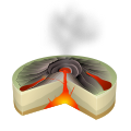 | |
| جزر ليوارد | ||
| جبال الامبراطور البحرية | ||
| موضوعات | ||
- Pages using gadget WikiMiniAtlas
- Short description is different from Wikidata
- Pages using infobox islands with unknown parameters
- Pages with plain IPA
- Articles with hatnote templates targeting a nonexistent page
- Pages with empty portal template
- Coordinates on Wikidata
- جزر هاواي
- ماوي
- مقاطعة ماوي، هاواي
- ماوي نوي