كوكشى تاو
Kokshetau
Kökşetau (قزخ) | |||
|---|---|---|---|
| الترجمة اللفظية بالـ Official Cyrillic | |||
| • Kazakh Cyrillic | Көкшетау | ||
| • Russian Cyrillic | Кокшета́у | ||
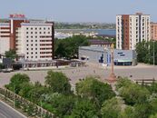
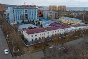
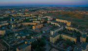
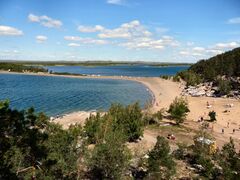
Skyline of Kokshetau with the city's central Ablai Khan Square in the foreground Independence Square Historical center of Kokshetau Akmola Regional Administration Mount Kokshe as seen from the Bukpa Hill Embankment of the Lake Kopa | |||
 Coat of arms | |||
الكنية:
| |||
| النشيد: none | |||
| |||
 Kokshetau Location of Kokshetau in Kazakhstan  Kokshetau Kokshetau (آسيا) | |||
| Coordinates: 53°17′N 69°23′E / 53.283°N 69.383°E | |||
| البلد | |||
| Region | Akmola Region | ||
| تأسست | 19th century (29 April 1824) | ||
| City status since | 1895 | ||
| Government | |||
| • Akim (mayor) | Bauyrzhan Gaisa[1][2] | ||
| Area | |||
| 234 كم² (90 ميل²) | |||
| • Urban | 425 كم² (164 ميل²) | ||
| Elevation | 234 m (768 ft) | ||
| Population | |||
| 150٬649 | |||
| • Rank | 18th in Kazakhstan 1st in Akmola Region | ||
| • Density | 624/km2 (1٬620/sq mi) | ||
| • Urban | 165٬153 | ||
| Demonym(s) | Көкшетаулық (kk) Кокшетауцы (ru) Кокшетауец (ru, male) Кокшетаука (ru, female) | ||
| Demographics (2022 est.)[5] | |||
| • Kazakhs | 59.34% | ||
| • Russians | 28.38% | ||
| • Ukrainians | 2.75% | ||
| • Tatars | 2.22% | ||
| • Germans | 1.98% | ||
| • Poles | 1.35% | ||
| • Ingush | 1.06% | ||
| • Other | 2.92% | ||
| Time zone | UTC+06:00 (ALMT) | ||
| Postal code | 020000–020010 | ||
| Area code | +7-7162 | ||
| Vehicle registration | 03 (region) (before 2012: C – on older plates) | ||
| Sister cities | Waukesha, Wisconsin | ||
| Climate | BSk | ||
| Highways | |||
| International airports | Kokshetau (KOV) | ||
| Major railway stations | |||
| KATO ID | 111010000[6] | ||
| Website | www.kokshetau.kz | ||


كوكشى تاو (بالقزخية: Көкшетау؛ [kɵkʂʲetɑw] (![]() استمع)، حرفياً 'الجبل المائل للزرقة/الجبل الأزرق المدخن'؛ روسية: Кокшета́у; النطق الروسي: [kəkʂɛtaʊ] ؛ إنگليزية: Kokshetau)، وكانت تُعرف سابقاً بإسم كوك تشى تاف (Kokchetav ؛ روسية: Кокчета́в، [kəktɕʲetav]؛ الاسم الرسمي بين 1868–1993) هي مدينة تطل على بحيرة في شمال قزخستان و عاصمة Akmola Region, which stretches along the southern shore of Lake Kopa, lying in the north of Kokshetau Hills, a northern subsystem of the Kokshetau Uplands (Saryarka) and the southern edge of the Ishim Plain. It is named after the Mount Kokshe. Earlier, it was the administrative center of Kokshetau Region, which was abolished in 1997. It is also situated at the junction of the Trans-Kazakhstan and South Siberian railways. Kokshetau lies at an elevation of approximately 234 m (768 ft) above sea level.
استمع)، حرفياً 'الجبل المائل للزرقة/الجبل الأزرق المدخن'؛ روسية: Кокшета́у; النطق الروسي: [kəkʂɛtaʊ] ؛ إنگليزية: Kokshetau)، وكانت تُعرف سابقاً بإسم كوك تشى تاف (Kokchetav ؛ روسية: Кокчета́в، [kəktɕʲetav]؛ الاسم الرسمي بين 1868–1993) هي مدينة تطل على بحيرة في شمال قزخستان و عاصمة Akmola Region, which stretches along the southern shore of Lake Kopa, lying in the north of Kokshetau Hills, a northern subsystem of the Kokshetau Uplands (Saryarka) and the southern edge of the Ishim Plain. It is named after the Mount Kokshe. Earlier, it was the administrative center of Kokshetau Region, which was abolished in 1997. It is also situated at the junction of the Trans-Kazakhstan and South Siberian railways. Kokshetau lies at an elevation of approximately 234 m (768 ft) above sea level.
It has 150,649 inhabitants (2022 est.), up from 123,389 (1999 census), while Akmola Region had a total population of 738,587 (2019 est.), down from 1,061,820 (1989 census), making it the tenth most populous region in Kazakhstan.[7] The city's history has been influenced by people of many nations and religions. Kokshetau retains multiethnic population, with 59% ethnic Kazakhs (up from 36%), the rest being mostly 28% ethnic Russians (down from 42%) and other ethnic groups such as Ukrainians, Tatars and Germans. Kokshetau City Administration (area of 425 km2 [164 sq mi]), with a population of roughly 165,153 residents, includes one settlement administration (which consists of the work settlement of Stantsyonny) and the Krasnoyarsk rural district, which includes two rural settlements (the villages of Krasny Yar and Kyzyl Zhuldyz).
The city is considered to have been founded in 1824 as a military fortress, while it was granted city status in 1895. It was the centre of Kokshetau Region, which was abolished in 1997. It is well known for its nature and tourist sites, such as Burabay and Zerendi, among others. The city's main football team is FC Okzhetpes. Kokshetau is about 185 km (115 mi) from Petropavl, 300 km (190 mi) northwest of the national capital Astana along the A1, 318 km (198 mi) from Omsk along the A13, and 384 km (239 mi) from Kostanay. The city is served by Kokshetau Airport (KOV).
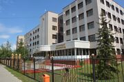
Kokshetau is an important economic, educational, and cultural centre of the Akmola Region. Attractions in and around Kokshetau include Akmola Regional Museum of History and Local Lore, Bukpa Hill, Kokshetau City Park, Kokshetau City History Museum, Museum of Literature and Art. The northwest entrance to Burabay National Park (بالقزخية: Burabai memlekettık ūlttyq tabiği parkı) and Burabay spa town is a little over 43 miles (70 km) from Kokshetau. Kokshetau was awarded the title Kazakhstan City of Culture for the year 2021.[8]
الأسماء وأصولها
- إنگليزية: Kokshetau
- بالقزخية: Көкшетау [kɵkʂʲetɑw] (
 استمع)
 - روسية: Кокшета́у, romanized: Kokshetau النطق الروسي: [kəkʂɛtaʊ]
The name Kokshetau (بالقزخية: Kökşetau; pronounced [køkɕetɑw]) is of Kazakh origin literally meaning a (حرفياً 'smoky-blue mountain'), kokshe / "көкше", meaning (حرفياً 'blueish') and tau / "тау", meaning (حرفياً 'mountain') — the name of always turning blue, as if in a deep haze of mountains, thus "Blueish Mountain/Smoky-Blue Mountain" in English. That is how from ancient times Kazakhs were calling the highest mountain in Akmola Region "Mount Kokshe" (947 m), located 60 miles away from the city.
Following the collapse of the Soviet Union, Kazakhstan declared its independence on 16 December 1991 (Kazakhstan Independence Day), and on 7 October 1993, by the Resolution of the Presidium of the Supreme Council of the Republic of Kazakhstan, the city of Kokchetav (روسية: Кокчета́в; النطق الروسي: [koktɕɪˈtav]) was renamed to the more Kazakh sounding Kokshetau as part of the government's campaign to apply Kazakh names to cities, but the city's airport still retains KOV as its IATA code. In Russian it became known as Kokshetau.
تأريخ تغير الأسماء
Historically, several names in various languages have identified Kokshetau.
- Stanitsa Kokchetavskaya (1827–1868; which is a romanized back-transliteration from Russian name in Cyrillic: стани́ца Кокчетавская; بالقزخية: Көкшетау бекінісі)
- Kokchetav (1868–1993; in publications dating from the Soviet period, the city name was occasionally spelled in English as "Kokchetav", which is a back-transliteration from post-revolution Russian name in Cyrillic: Кокчета́в, Russian name in Cyrillic script (1868-1918): Кокчѣтавъ; Kazakh name in Yañalif script (1929-1940): Kɵkşetau, Kazakh name in Cyrillic script (after 1940): Көкшетау)
- Kokshetau (since 1993; which is a romanized back-transliteration from Russian name in Cyrillic: Кокшета́у; Kazakh name in Cyrillic script: Көкшетау, Kazakh name in Latin script (new version before 2021): Kókshetaý, Kazakh name in Latin script (latest version of the Kazakh Latin alphabet after 2021): Kökşetau)
الجغرافيا الطبيعية والجيولوجيا
الموقع

Kokshetau is located in the country of Kazakhstan and lies in the northern portion of Akmola Region. The city is located on the border of the West Siberian Plain, on the southeastern shore of Lake Kopa, at an altitude of 234 meters above sea level, in the Kokshetau Mountains, north part of the Kokshetau Hills, the foothills of which surround the city from the south and west. It is located at 53°17′0″N 69°23′0″E / 53.28333°N 69.38333°E (52.2833, 69.3833) and covers an area of 234 km2 (90 sq mi). It is located about 300 كيلومتر (190 mi) north-west of the national capital of Astana.
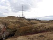
There are numerous hills in the vicinity of the city (Bukpa Hill). The city is located in the flat part of the interfluve of the Kylshakty river, flowing in the eastern part of the city, and the Shagalaly river, flowing from the western side of the city. The city has several parks and gardens. Also, within the city limits can be found small forests, mostly consisting of birches and pine plantations. The Kokshetau area is known for its two national parks, Burabay and Kokshetau.
التوقيت
The time offset from the UTC used by Kokshetau is 6 hours after UTC, or UTC+6:00 (ALMT). This is also used by most of Kazakhstan. This time apply throughout the year as Kazakhstan does not observe Daylight saving time (DST).
الأقسام الإدارية والأحياء


Kokshetau is divided into seven administrative districts.
- Bukpa
- Kokshe
- Bostandyk
- Sary-Arka
- Beybitshilik
- Aul
- Zhaylau
Kokshetau is divided into seventeen administrative microdistricts.
- City Centre
- Barmashino
- Abylai Khan Avenue
- Regional hospital
- Birlik
- Sary-Arka
- Sunkar
- Koktem
- Vasilkov
- Town of builders
- Railway station
- Jubilee
- Khassenov market
- Central
- Zhaylau
- Shanghai
القسم الإداري-الإقليمي

Kokshetau is the capital of the Akmola Region. Kokshetau city administration (بالقزخية: Kökşetau qalasy äkımdıgı, روسية: Городская администрация Кокшетау) (area of 425 km2 [164 sq mi]), with a population of roughly 165 153 residents, includes one settlement administration and the Krasnoyarsk rural district, which includes two rural settlements.
| No. | Populated place | Population | KATO ID |
|---|---|---|---|
| 1 | selo of Krasny Yar | ▲ 9875 | 111033100 |
| 2 | p.g.t of Stantsyonny | ▲ 2623 | 111037100 |
| 3 | selo of Kyzylzhulduz | 111033300 |
المناخ
._Night._2021-22._Winter.jpg&filetimestamp=20230317042105&)

According to the Köppen climate classification, Kokshetau lies in a cold semi-arid climate zone (Köppen climate classification: BSk) with extreme continental influences. The city has an extreme continental climate with long, very cold, frigid, snowy, dry winters and warm, dry, sunny summers (featuring occasional brief rain showers). Winter is frosty and long (more than 5 months). In spring, prevails clear and dry weather, with a large number of sunny days. Autumn begins in August or September, and the weather is observed from clear at the beginning of the season, to cloudy in October–November. The average annual temperature in Kokshetau is 3.6 °C (38.5 °F). Summer temperatures occasionally reach 35 °C (95 °F) while −30 to −35 °C (−22 to −31 °F) is not unusual between mid-December and early March.
The warmest month is July with daily mean temperature near 20.5 °C (68.9 °F), and the coldest month is January, with a daily mean of −14 °C (7 °F). Snow and ice are dominant during the winter season. July is the wettest month (averaging 68.5 mm (2.7 in) of precipitation) while March is the driest (averaging 10.5 mm (0.4 in) of precipitation). Yearly precipitation amounts to 313 mm (12.3 in). Typically, the city's Lake Kopa and rivers of Kylshakty and Shagalaly are frozen over between the second week of November and the beginning of April.
| بيانات المناخ لـ كوكشى تاو (1991–2020، القصوى 1925–الحاضر) | |||||||||||||
|---|---|---|---|---|---|---|---|---|---|---|---|---|---|
| الشهر | ينا | فب | مار | أبر | ماي | يون | يول | أغس | سبت | أكت | نوف | ديس | السنة |
| القصوى القياسية °س (°ف) | 4.0 (39.2) |
6.6 (43.9) |
18.7 (65.7) |
30.3 (86.5) |
35.5 (95.9) |
40.1 (104.2) |
39.2 (102.6) |
37.7 (99.9) |
35.0 (95.0) |
25.0 (77.0) |
16.5 (61.7) |
6.0 (42.8) |
40.1 (104.2) |
| متوسط القصوى اليومية °س (°ف) | −10.3 (13.5) |
−8.8 (16.2) |
−1.2 (29.8) |
10.5 (50.9) |
19.6 (67.3) |
24.3 (75.7) |
25.2 (77.4) |
23.6 (74.5) |
17.3 (63.1) |
9.1 (48.4) |
−2.2 (28.0) |
−8.1 (17.4) |
8.3 (46.9) |
| المتوسط اليومي °س (°ف) | −14.3 (6.3) |
−13.2 (8.2) |
−5.7 (21.7) |
5.1 (41.2) |
13.5 (56.3) |
18.6 (65.5) |
19.6 (67.3) |
17.8 (64.0) |
11.8 (53.2) |
4.7 (40.5) |
−5.6 (21.9) |
−11.7 (10.9) |
3.4 (38.1) |
| متوسط الدنيا اليومية °س (°ف) | −18.8 (−1.8) |
−18.0 (−0.4) |
−10.5 (13.1) |
−0.2 (31.6) |
6.9 (44.4) |
12.1 (53.8) |
13.8 (56.8) |
12.0 (53.6) |
6.4 (43.5) |
0.6 (33.1) |
−9.2 (15.4) |
−15.7 (3.7) |
−1.7 (28.9) |
| الصغرى القياسية °س (°ف) | −42.2 (−44.0) |
−42.0 (−43.6) |
−45.0 (−49.0) |
−26.1 (−15.0) |
−8.9 (16.0) |
−5.7 (21.7) |
2.0 (35.6) |
−2.2 (28.0) |
−10.5 (13.1) |
−26.0 (−14.8) |
−42.6 (−44.7) |
−44.0 (−47.2) |
−45.0 (−49.0) |
| متوسط تساقط الأمطار mm (inches) | 13 (0.5) |
11 (0.4) |
13 (0.5) |
20 (0.8) |
27 (1.1) |
42 (1.7) |
69 (2.7) |
43 (1.7) |
23 (0.9) |
22 (0.9) |
19 (0.7) |
15 (0.6) |
317 (12.5) |
| Average precipitation days (≥ 0.1 mm) | 3.7 | 3.4 | 3.0 | 4.2 | 6.5 | 6.5 | 8.5 | 7.3 | 5.5 | 6.2 | 4.3 | 3.3 | 62.4 |
| Mean monthly ساعات سطوع الشمس | 89 | 127 | 196 | 227 | 277 | 306 | 313 | 250 | 190 | 118 | 88 | 75 | 2٬256 |
| Source 1: Pogoda.ru.net[9] | |||||||||||||
| Source 2: NOAA (sun and precipitation days 1961–1990)[10] | |||||||||||||
- الأماكن القريبة
Destinations from Kokshetau | ||||||||||
|---|---|---|---|---|---|---|---|---|---|---|
| ||||||||||
The village of Krasny Yar lies adjoined directly to the west of Kokshetau, on the bank of the River Shagalaly. Also contiguous with Kokshetau, directly to the east, with no natural border, is the smaller village of Stantsyonny.
المدن القريبة
Nearby towns
- Atbasar
- Arkalyk
- Tara (Russia)
- Taiynsha
- Akkol
- Derzhavinsk
- Ereymentau
- Esil
- Ishim (Russia)
- Makinsk
- Stepnyak
- Stepnogorsk
Nearby villages
- Krasny Yar
- Stantsyonny
- Kyzylzhulduz
- Kyzyltan
- Kaindy
- Akkol (Zerendi District)
- Kishkenekol
- Astrakhanka
- Balkashino
- Shortandy
- Zerendi
- Zhaksy
أفق المدينة
.jpg&filetimestamp=20230317042228&)
التاريخ
∟ جزء من الامبراطورية الروسية
![]() Border control of the Siberian Kirghiz 1838–1854
Border control of the Siberian Kirghiz 1838–1854
∟ جزء من الامبراطورية الروسية
![]() Siberian Kirghiz Oblast 1854–1868
Siberian Kirghiz Oblast 1854–1868
∟ جزء من الامبراطورية الروسية
![]() Akmolinsk Oblast 1868–1917
Akmolinsk Oblast 1868–1917
∟ جزء من الامبراطورية الروسية
![]() Alash Autonomy 1917–1918
Alash Autonomy 1917–1918
![]() The Ufa Directory 1918–1918
The Ufa Directory 1918–1918
![]() الحكومة الروسية 1918–1919
الحكومة الروسية 1918–1919
![]() Kirghiz Territory 1919–1920
Kirghiz Territory 1919–1920
∟ جزء من Russian SFSR
![]() Kirghiz ASSR 1920–1922
Kirghiz ASSR 1920–1922
∟ autonomous part of the Russian SFSR
![]() Kirghiz ASSR 1922–1925
Kirghiz ASSR 1922–1925
∟ جزء من Russian SFSR في الاتحاد السوفيتي
![]() Kazakh ASSR 1925–1936
Kazakh ASSR 1925–1936
∟ جزء من the Russian SFSR in the USSR
![]() Soviet Kazakhstan 1936–1991
Soviet Kazakhstan 1936–1991
∟ constituent republic of the Soviet Union
Kokshetau has a rich centuries-old past, which has incorporated all the main stages and turning points of the history of Kazakhstan. The territory of modern-day Kokshetau has seen the rise and fall of many cultures and empires. For many centuries, nomadic Kazakh tribes lived on the territory of the former Kokshetau Region. The territory of Kokshetau was part of the Middle Horde, the clans of the tribal union of the Argyns that occupied vast regions of Northern and Central Kazakhstan.[11] In the 18th – 19th centuries, the headquarters of famous khans, such as Abylai Khan, Kasym Khan, Kenesary Khan, were located on the land of Kokshetau Region.
As Russia's hand stretched southwards, Kokshetau was initially founded on 29 April 1824 as an administrative outpost at the foot of the southern side of Mount Kokshe on the shores of Lake Ulken Shabakty.[12] The Middle Horde signed treaties of protection with Russia. The local population strongly opposed the fact that the new settlement was placed in the chosen place. In the summer of 1827, the district order was transferred to the new place where the city of Kokshetau is now located. The settlement began to be called Kokchetav. The construction of the settlement began at the foot of Bukpa Hill, on the southern shores of Lake Kopa, and a picket was set up to protect the district order.[13]
By the middle of 19th-century, the population of the settlement was significantly increasing due to the migration of the peasants from Russia (Povolzhye) and Ukraine who were driven to migrate by starvation and poverty to farm the steppe. In 1868, when the Akmolinsk Oblast was formed, Kokshetau became a district city in this region, which further developed as a center of agricultural and animal husbandry and as a resort town. In 1876, the city lost its military significance. The line and fortress were abolished. In 1895, Kokshetau was granted city status.[14] By that time the population in the town was above 5 thousand people.[15]
In 1928, Kokshetau District was divided into several boroughs and until 1944 Kokshetau's territory was part of Karaganda Region and later part of North Kazakhstan Region. On 16 March 1944, according to the Decree of the Presidium of Supreme Soviet of Kazakh SSR, Kokshetau became the administrative center of the newly created Kokchetav Oblast. Relatively rapid growth and development of Kokshetau took place during the years of development of virgin lands, especially in the second half of the 1950s.[16] In the spring of 1997, Kokshetau Oblast was abolished, the city was deprived of the status of a regional center. On 8 April 1999, after Akmola and North Kazakhstan regions were reorganized, Kokshetau became the center of Akmola Region.[17]
-
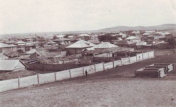
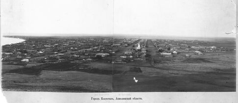 A 19th-century panorama view looking into the city of Kokshetau before rebuilding as seen from the Bukpa Hill Lookout. The Lake Kopa is visible to the left, and the St George's Church to the right.
 -
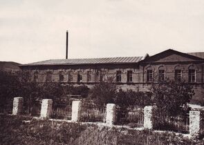
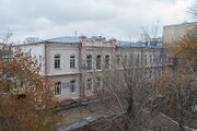
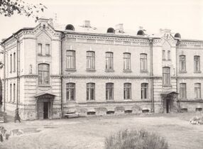 One of the first stone constructions in the city (built in ح. 1904; extended 2019, now regional museum of local lore)
 -
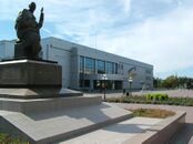
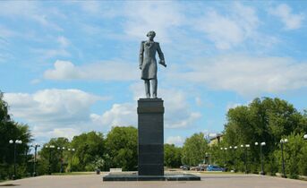 A bronze statue of Shoqan Walikhanov by Tulegen Dosmagambetov in Kokshetau
 -
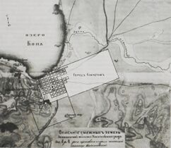
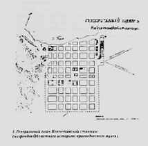 General plan of Kokchetav stanitsa, 19th century
 -
 Map of Kokchetav uezd in the late 19th century
 -
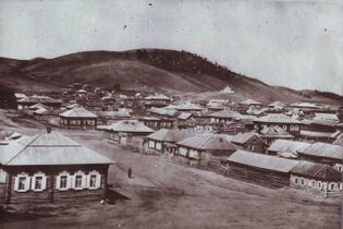
 A 19th-century view of the city
 -
 1880: Bukpa Hill in the background
 -
 Market Square (late 19th early 20th century)
 -
 1916: Military hospital in Kokchetav
 -
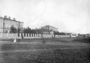
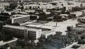 1975: The view of the central square
 -
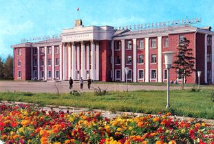 1978: House of the Soviets in the city of Kokchetav
_-_1890_(panoramic_view,_Aqmola_Region,_Kazakhstan).jpg&filetimestamp=20230317042301&)
.jpg&filetimestamp=20230317042255&)


.jpg&filetimestamp=20230317042411&)
,_Kazakhstan.jpg&filetimestamp=20230317042406&)

.jpg&filetimestamp=20230317042355&)
السكان
| السنة | تعداد | ±% |
|---|---|---|
| 2010 | 136٬100 | — |
| 2011 | 137٬217 | +0.8% |
| 2012 | 136٬835 | −0.3% |
| 2013 | 139٬063 | +1.6% |
| 2014 | 140٬847 | +1.3% |
| 2015 | 142٬411 | +1.1% |
| 2016 | 145٬795 | +2.4% |
| 2017 | 145٬531 | −0.2% |
| 2018 | 145٬789 | +0.2% |
| 2019 | 145٬161 | −0.4% |
| 2020 | 146٬104 | +0.6% |
| 2021 | 148٬550 | +1.7% |
| 2022 | 150٬649 | +1.4% |
| Source: Population size may be affected by changes in administrative divisions. Kokshetau, Kazakhstan: Historical statistics – Population[18] | ||
Kokshetau is the eighteenth-largest city in Kazakhstan. Kokshetau is an ethnically and culturally diverse city. Kokshetau ranks fourth in terms of population in Northern Kazakhstan, ranking after Pavlodar, Kostanay and Petropavl. It has changed its demographics, nowadays having more ethnic Kazakhs in a city that formerly had a Slavic majority. It is the only regional center in Northern Kazakhstan where Kazakhs make up the majority. Despite Kokshetau's Kazakh majority, Russian is the dominant language in the city. It is also common to find the Kazakh being spoken in the city, mainly by Kazakhs and other Turkic people. Residents of Kokshetau are referred to as "көкшетаулықтар" (kökşetaulyqtar) in Kazakh and "кокшета́уцы" (kokshetautsy) in Russian.
Histogram of population evolution of Kokshetau from 1959.
| 1897 | 1959 | 1970 | 1979 | 1989 | 1991 | 1999 | 2004 | 2005 | 2006 | 2007 | 2008 | 2009 |
|---|---|---|---|---|---|---|---|---|---|---|---|---|
| 4,962 | 52,909 | 80,564 | 103,162 | 136,757 | 143,300 | 123,389 | 123,640 | 125,455 | 127,317 | 129,244 | 131,215 | 135,106 |
| 2010 | 2011 | 2012 | 2013 | 2014 | 2015 | 2016 | 2017 | 2018 | 2019 | 2020 | 2021 | 2022 |
| 136,100 | 137,217 | 136,835 | 139,063 | 140,847 | 142,411 | 145,795 | 145,531 | 145,789 | 145,161 | 146,104 | 148,550 | 150,649 |
Note: 2020 and 2018 are population estimates; 1897 is the Russian Imperial Census; 1959, 1970, 1979 and 1989 are the Soviet Census.
التركيبة العرقية والقومية
As of January 2022, the population of Kokshetau is 150,649, and the extended urbanized area has 165,153 inhabitants.
Historically, Kokshetau was ethnically diverse. As of the 2020 Census, ethnic Kazakhs made up (~58%) of the city population, representing an increase from 36% in 1999. The ethnic makeup of the city's population as of year 2020 was:[19]
|
|
In 1989, Kokshetau had a population of 136,757. The ethnic mix was about 18.5% Kazakh, 54.5% Russian and 27.0% other ethnic groups.
| Ethnicity | Number | Percentage |
|---|---|---|
| Russians | 74,481 | 54.5% |
| Kazakhs | 25,300 | 18.5% |
| Others | 36,976 | 27.0% |
Kazakh and Russian are both the main spoken languages.
الدين
-
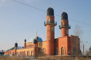
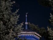 Zhakiya Kazhi Mosque (1893-1894) at night. Islam is the most widely practiced religion in Kokshetau.
 -
 Zhakiya Kazhi Mosque at night.
 -
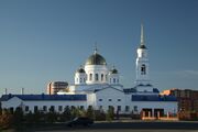
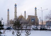 Nauan Hazrat Mosque building in central Kokshetau, completed in 2015
 -
-
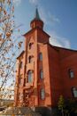 Erected in the 20th century, the Roman Catholic Church of St. Anthony of Padua
 -
 Church of the Resurrection, built between 2015 and 2020.
 -
 Galym Mosque, built in the 1990s
 -
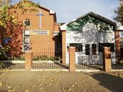 Presbyterian Worship Centre

.jpg&filetimestamp=20230317042344&)


.jpg&filetimestamp=20230317042505&)
The city's religious profile is highly diverse. Islam (primarily Sunni Islam) is the predominant religion within Kokshetau, with 56.65% of residents identifying as Muslims in the 2009 Census. There were 83,436 Muslims reported in the 2009 census. Kokshetau's first Mosque was established by Ablay (Abilkhair) Gabbas in 1846.
Other religions practiced are Christianity (primarily Russian Orthodox, Roman Catholicism, and Protestantism).[21] Christianity is Kokshetau's second largest religion. There were 60,168 Christians reported in the 2009 census. Much of Kokshetau's civic life and civil society is secular in the sense that it has no religious character.
Kokshetau has a mosque constructed in the beginning of the 20th century and a Russian Orthodox Church temple of Archangel Michael. The Kokshetau and Akmola diocese is located in the Church of the Resurrection in the city. In 1997, a Roman Catholic Church was built in neo-Gothic style using red bricks. A new mosque for 1,200 people named after Nauan Hazrat opened in 2015.
المساجد:
- Nauan Hazrat Mosque (capacity 1,200—1,400), located at the corner of Momishuly and Auelbekov streets. It is the largest mosque in Akmola Region.
- Zhakiya Kazhi Mosque
الكنائس الأرثوذكسية الروسية:
- Church of the Resurrection, Kokshetau (capacity 1,500), (ROC)
- Church of the Holy Archangel Michael, Kokshetau, (ROC)
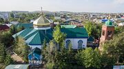
- St George's Church, Kokshetau. Kokshetau's first Christian Church.
Roman Catholic churches:
Culture
-
 Akmola Regional Kazakh Music and Drama Theatre named after Shahhmet Kussainov
 -
 The Akan Sery monument with Palace of Culture and Akmola Regional Russian Drama Theater behind it
 -
 External view of the House of Friendship APK in Kokshetau, 2021
 -
 Akmola Regional Centre of Folk Art and Cultural Leisure in central Kokshetau
 -
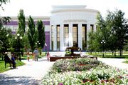
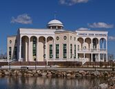
 Akmola Regional Universal Scientific Library building in Kokshetau
 -
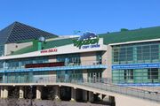
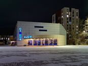 Kokshetau Cinema Alem at night, pictured in December 2022
 -
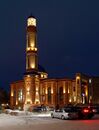
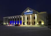 Akmola Regional Philharmonic named after Ükılı Ybyrai at night (formerly known as Culture Palace of Railway Workers)

.jpg&filetimestamp=20230317042454&)

.jpg&filetimestamp=20230317042443&)

.jpg&filetimestamp=20230317042433&)

Theatres
Kokshetau has a strong theater culture.
- Akmola Regional Russian Drama Theater (opened in 1977), which also incorporates Palace of Culture
- Akmola Regional Kazakh Music and Drama Theatre named after Shahhmet Kussainov (opened in 1996)
- Children's puppet theater "Altyn Saka" (opened in 2022)
Philharmonic
- Akmola Regional Philharmonic named after Ükılı Ybyrai was founded in 1956.
Museums
There are about fife museums in Kokshetau.
- Akmola Regional Museum of History and Local Lore (opened in 1920)
- Kokshetau City History Museum (KCHM; opened as Valerian Kuibyshev’s Memorial Museum in 1949)[22]
- Museum of Mercy and Courage (opened in 1982)
- Museum of Literature and Art (opened in 1989)
- Museum of the Hero of the Soviet Union Malik Gabdullin (opened in 1993), located at the corner of Auelbekov and Nazarbayev streets, on the eastern side of the town centre.
| Museum of History and Local Lore | Museum of Literature and Art | Kokshetau City History Museum | Museum of Malik Gabdullin |
|---|---|---|---|
 |
.jpg&filetimestamp=20230317042207&) |
 |
 |
Cinemas
The first film screening in the city of Kokchetav (now Kokshetau) took place in 1910.
- Cinema Alem (formerly known as the Druzhba Cinema; it was built in 1963, and as of 2023 was still being used as a cinema). It is located in Independence Square and is currently the largest cinema in the city.
Libraries
The city has 12 libraries. In addition to the libraries affiliated with the various universities and schools, the Akmola Regional Universal Scientific Library is a major research library. There are several archives in Kokshetau.
- Akmola Regional Universal Scientific Library (ARUSL) named after Magzhan Zhumabayev. ARUSL was inaugurated in 1946.
Economy
Kokshetau has traditionally been an important commercial center in northern Kazakhstan, but after the collapse of the Soviet Union most of the old manufacturing lines either stopped working or had to greatly reduce their operations. Nevertheless, the city continues to be an important regional center for the Akmola Region, acting as a commercial hub for the surrounding areas in the region. In recent years, the city has started attracting more investment from various corporations.
Large industrial enterprises of Kokshetau include: gold mining enterprise JSC "Altyntau Kokshetau"; JSC "Tynys" – the production of medical products, weighing equipment, water meters, aircraft units and assemblies, polyethylene pipes; machine-building plant OJSC "KamAZ-Engineering"; JSC "Kokshetau Mineral Waters".[23] Food factories supply Kokshetau and Akmola Region with sausages, semi-finished meat products, bread, dairy products, and confectionery. The city also has a gold recovery factory and a new ceramic brick factory.
From Ekibastuz to Kokshetau runs an overhead power line designed for a transmission voltage of 1,150 kV, the Ekibastuz-Kokshetau powerline.[24] Kokshetau's retail business is growing with several newly built malls and shopping centres.
Healthcare
Local hospitals include the Avicenna Medical Centre, Viamedis Rehabilitation Centre among many others.
-
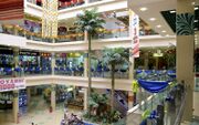 Interior of the “RIO” Shopping Centre, one of the largest modern shopping centres in the city
 -
 Perfume and cosmetics store in Kokshetau. 2021
 -
 The Halyk Bank Branch Office in Kokshetau
 -
 Avicenna Medical Centre
 -
 Viamedis Rehabilitation Centre
.jpg&filetimestamp=20230317042422&)
.jpg&filetimestamp=20230317042604&)


Food
There is a broad array of restaurants in Kokshetau that serve typical and international food. Popular food from Kokshetau includes:
Media

Kokshetau is the center of television and radio broadcasting in Akmola Region. All major Kazakhstani newspapers are active in Kokshetau. There are local TV stations, the Internet, and print media. The city has a developed telecommunications system.
Newspapers
Kokshetau's first newspaper was the weekly Tselinnyy kray, established in 1920, which would change its name to the Akmolinskaya Pravda in 1992. In the city, there are some popular urban newspapers. Akmolinskaya Pravda, Stepnoy mayak and Kokshetau are Russian-language media headquartered in the city. Akmolinskaya Pravda is the oldest newspaper of the city.
- Regional socio-political newspaper "Akmolinskaya Pravda" is a long-running daily local paper, with local and regional coverage.
- Republican newspaper "Bukpa"
- Regional newspaper "Arka Azhary"
- Regional newspaper "Stepnoy mayak"
TV and radio
Kokshetau television networks:
- Local television news is covered by TV channel Kazakhstan–Kokshetau
- Balapan
- Cartoon Network
- Channel One Eurasia
- Channel 31
- Disney Channel
- Euronews
- Gakku TV
- Khabar 24
- MTV
- Nickelodeon
- Qazsport
Kokshetau radio stations:
- "Kazakh Radio": 101.0 FM
- "Russian Radio Asia": 102.0 FM
- "Autoradio Kazakhstan": 102.5 FM
- "Shalkar Radio": 103.7 FM
- "Europe Plus Kazakhstan": 104.2 FM
- "Energy FM": 104.8 FM
- "Radio NS": 105.7 FM
- "Zhuldyz FM": 106.1 FM
- "Radio Dacha": 106.5 FM
- "People's Radio": 107.0 FM
- "Tengri FM": 107.6 FM
Internet media
- Kokshetau City Administration[25] (in إنگليزية) (in قزخ) (in روسية)
- Kokshetau - Kazakhstan[26] (in قزخ) (in روسية)
- Aqmola News[27] (in قزخ) (in روسية)
- Akmolinskaya Pravda[28] (in روسية)
Transport
-
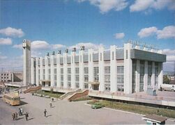 Entrance to Kokshetau Railway Station, designed by V. Utebekov as viewed from vokzal alañy, 1992
 -
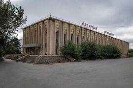 The building of Kokshetau Central Bus Terminal in 2022
 -
 The building of the Akmola branch of the Kazakhstan Railways
 -
-
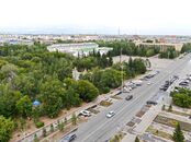
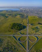 A full cloverleaf interchange near Kokshetau
 -
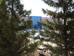
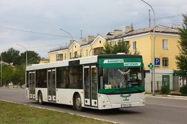 A Kokshetau bus depot operating a service in Kokshetau
 -
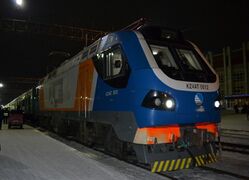 Train No. 057X Astana - Oral, under the electric locomotive KZ4AT-0012 at Kokshetau-1 station, 2019


_in_Kokshetau,_Kazakhstan.jpg&filetimestamp=20230317042516&)

Partly due to its location, Kokshetau is a major transport hub on the highway and rail networks.
City transport
The city transport in Kokshetau consists of a network of buses, minibuses (marshrutka) and taxis that are available 24 hours a day. Public transport in Kokshetau is heavily privatized and mostly handled by private operators.
Railway
The city is an important railroad hub in the northern part of Kazakhstan. Kokshetau Railway station is served by the Kazakhstan Railways, which links Petropavl to Almaty. The first train pulled into the Kokshetau Railway station on 2 June 1922. Railways are Kokshetau's one of the main modes of intracity and suburban transportation. Kazakhstan Railways (who manage the station) provide freight and passenger traffic to and from Kokshetau.
There are two railway stations in the city: Kokshetau-1 and Kokshetau-2. The main railway station Kokshetau-1 station is located 1.3 km (0.81 mi) north-east from the centre of Kokshetau and includes a main building (built in 1981) and some other technical buildings. Kokshetau-1 station is the city's main station and a major stop for numerous passenger trains traveling between Petropavl and the other regions of Kazakhstan each day.[29] The popular Tulpar-Talgo service to Almaty takes sixteen hours.
Intercity buses
Kokshetau Central Bus Terminal (Kökşetau avtobeketı), which opened in 1981, serves the city of Kokshetau. The bus station is on the Vernadsky Street 8 across the road from Kokshetau Railway Station. It links the city with the villages in Akmola Region and other cities in Kazakhstan and the neighboring countries. Frequent schedules of bus routes connect Kokshetau to Astana, Petropavl,[30] Karaganda, Pavlodar, Kostanay, Omsk, Yekaterinburg, Tobolsk, Tyumen and Kurgan. Many of these are cross-country services operating from north to south, for which Kokshetau provides interchange facilities.
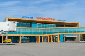
Air travel
Kokshetau and surrounding communities are served by one commercial international airport: Kokshetau International Airport (IATA: KOV, ICAO: UACK), which is the seventeenth-busiest airport (2019) by passenger traffic in Kazakhstan. It is located 12.5 km (7.8 mi) north-east from the centre of city, on the route to Omsk, and used to be the headquarters of now-defunct Air Kokshetau.[31] The airport has a capacity of handling 200 passengers per hour. The Kokshetau International Airport, which opened in 1945, was significantly upgraded in 2013 with a new 2850-metre runway capable of accommodating all aircraft types without any restrictions.[32][33] In 2013, the airport received its first scheduled flight after the renovation to Moscow, Russia. The airport can be reached by car, public transport, or taxi. Seasonal flights to Frankfurt am Main, were available in 2004 but have been cancelled since. It serves mostly domestic flights. SCAT Airlines fly to and from Almaty, Aktau and Turkistan as well as FlyArystan operates three weekly flights to Almaty.[34][35] The former largest carrier of the Kokshetau Airport — Air Kokshetau — is not serving any regular destinations as of 2021.
Highways
The main roads to/from Kokshetau are:
- The city is served by the A1, which begins in Petropavl (189 km [117 mi]) and leads to Astana (292 km [181 mi]) passing Kokshetau, Shchuchinsk and Makinsk.[36] European route
 intersect in Kokshetau;
 - The A13, which connects Kokshetau to Omsk (Russia);
Other major roads passing through Kokshetau include:
- The R11 highway connects Kokshetau to Kostanay (via the M36);[37]
- The R12 highway connects Kokshetau to Atbasar
Architecture
-
 Kokshetau showing the view of Independence Square in 2021, with Independence Monument on the right and Dostyk Hotel on the left background.
 -
 Historical building (1904) in the centre of Kokshetau.
 -
 Panorama to the historical center of Kokshetau.
 -
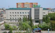
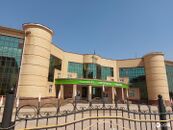
 Akmola Regional Court in Kokshetau.
 -
 Soviet-style residential area buildings in Kokshetau.
 -
 Residential building in Kokshetau.
 -
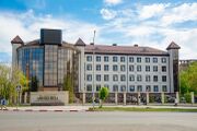
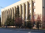 Main facade of the administrative building of Akmola Region, an example of Soviet Kokshetau architecture.


Landmarks
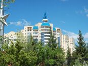
The city is full of numerous buildings and monuments that reflect its rich and diverse history. The architecture of Kokshetau has been shaped through its history by the progression of historical eras. Many buildings of Kokshetau are ranged from a different number of architectural styles. The architecture of the city dates back to 19th century, the city had numerous wooden buildings with elaborate decor. Kokshetau is the home of a unique architectural tradition and community with number of historical buildings in city. Industrialization in Kokshetau started in the late 1920s. There are a number of two-story wooden houses in the city built mostly in the middle of the 20th century as temporary habitations. Among other notable buildings are the mansions of the merchant Andrei Vasilievich Sokolov (late of the 19th century - beginning of the 20th century), the Akmola Regional Museum of History and Local Lore (beginning of the 20th century). The city’s apartment houses are called “Khrushchyovka” and “Stalinka” due to the peculiarities of architectural approaches in their construction.
Education
-
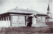 One of the first schools in the city.
 -
 The view of №36 'Akku' kindergarten, 2014.
 -
 Nazarbayev Intellectual School (NIS PhM) in Kokshetau
 -
 The view of the palace of childhood and youth 'Bolashak Sarayi' entrance in 2020.
 -
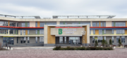
 Founded in 1996, the view of the Main Building of the Kokshetau State University (KSU) named after Shokan Ualikhanov in 2012.


.jpg&filetimestamp=20230317042721&)
Kokshetau is a regional centre of education and has a large number of educational establishments, including universities, professional colleges and gymnasiums (high schools). Primary and secondary schools in Kokshetau include state-run and private institutions.
Pre-university education
Kokshetau has 34 (secondary education) schools, including 6 lyceums and 6 gymnasiums.
- Kokshetau Nazarbayev Intellectual School of Physics and Mathematics (NIS Kokshetau PhM) was established in 2009, as a branch of the Nazarbayev Intellectual Schools (NIS), a network of schools in Kazakhstan.[38][39]
- Kokshetau Bilim-Innovation Public Lyceum (former “Kazakh-Turkish Lyceum”) for gifted children.[40][41]
Institutions of higher education
The city is currently home to the following state higher educational institutions:
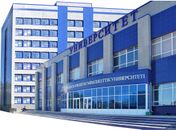
- Kokshetau State University (which is named after Shokan Ualikhanov), established 1962 — offers opportunities to study undergraduate, graduate and PhD programs in most fields. It is the biggest university in Kokshetau with 7,047 students and 499 academic staff.
- Kokshetau University (named after Abay Myrzakhmet), established 2000.
- Kokshetau Technical Institute of the Ministry of Emergency Situations of the Republic of Kazakhstan
- Kokshetau Academy of Economics and Management
A number of other non-state-funded institutions for further education operate in the city.
Sport
-
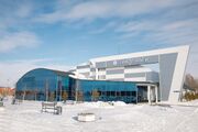
 Main entrance to the Burabay Sports Complex
 -
 Kokshetau Tennis Center
 -
 Okzhetpes Stadium is an outdoor stadium that is home to the FC Okzhetpes, 2005.


.jpg&filetimestamp=20230317042705&)
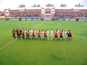
Sport has always been important in Kokshetau. Football and ice hockey are by far the most popular sports in the city. Kokshetau has many parks that provide excellent pitches for impromptu games. The city is home to the FC Okzhetpes football club, based in the Okzhetpes Stadium, and which has a capacity of 4,500, which participates in the Kazakhstan Premier League, the top division of football in Kazakhstan. In 2015 and 2018, they finished first place in the Kazakhstan First Division. A number of well-known athletes, both world and Olympics champions, are associated with the city.
Burabay Sports Complex serves as home arena to the ice hockey club Arlan Kokshetau, which competes in the Kazakhstan Hockey Championship.[42] Arlan Kokshetau hockey players were the champions of Kazakhstan in the season 2017/2018. Arlan Kokshetau players also became the first team from Kazakhstan to win IIHF Continental Cup in the season 2018/2019.[43] The city has an ice rink for winter sports. Several sports clubs are active in the city:
| Club | Sport | Current league | Founded | Stadium | Championships |
|---|---|---|---|---|---|
| Arlan Kokshetau | Ice Hockey | Kazakhstan Hockey Championship | 2009
|
Burabay Sports Complex[44] | 1
|
| FC Okzhetpes Kokshetau | Football | Kazakhstan Premier League | 1957
|
Okzhetpes Stadium | 0
|
Parks and recreation
-
 Bukpa Hill is the highest point in the city, at 363 meters (1,191 ft)
 -
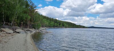
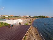 The beach in Kokshetau on a sunny day
 -
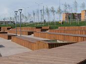
 The view of City Park in 2020. It is one of the main family attractions in central Kokshetau.
 -
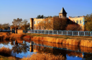
 Embankment of the Lake Kopa in Kokshetau, one of the main tourist destinations
 -
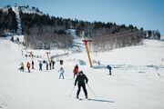 Mount Elikti and Elikti ski resort near Kokshetau
 -
 Sunny day at the Revolution Fighters Park in Kokshetau


Kokshetau is home to a large number of parks and recreation areas.
- City Park, the city's largest and oldest park, established in 1957.
- Revolution Fighters Park
Elikti
Elikti is a ski resort near Kokshetau, located on the slopes of Mount Elikti, at the elevation of 500 metres above sea level. The resort area is about 25 kilometres (16 mi) of Kokshetau city by the P11 road on the way from Kokshetau to Ruzayevka. It is popular for its mild climate, a large quantity of sunny days and a great amount of snow through the winter. Visitors can buy or rent any necessary skiing and snowboarding equipment.[45]
Recreation around Kokshetau
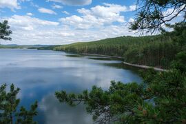
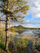
Around Kokshetau, there are numerous nearby freshwater lakes such as Lake Burabay, Lake Ulken Shabakty, Lake Kishi Shabakty, Lake Aiyrtau and the Lake Zerendi, which are popular among Kokshetau residents for recreation, swimming and watersports and can be quickly reached by car.
-
-
-
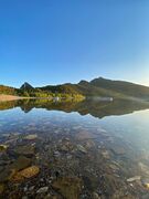 Lake Kishi Shabakty
 -
 Lake Aiyrtau
 -


In literature
- The city was marked by the ethnographer and publicist Grigory Potanin, who visited it in the 1890s.
- Anastasia Tsvetayeva dedicated to the city the story in her famous and one of the best-known work Starost i molodost (Old Age and Youth, 1967).
International relations

Twin towns – Sister cities
Kokshetau is twinned with the following regions, cities, and counties:
| Flag | Country | Year | City/Town | Coat of Arms | County / District / Region / State |
|---|---|---|---|---|---|
| United States | since 1989 | Waukesha[22] | Wisconsin |
Cooperation agreements
Kokshetau has cooperation agreements with:
 Krasnoyarsk, Russia (2022)[46]
See also
References
- ^ Supported unanimously
- ^ "New akim of Kokshetau appointed". 25 March 2021. Retrieved 25 October 2022.
- ^ "Results Of The 2009 National Population Census Of The Republic Of Kazakhstan Analytical Report" (PDF). The Agency On Statistics of the Republic of Kazakhstan.
- ^ "Archived copy". Archived from the original on 26 May 2011. Retrieved 22 October 2009.
{{cite web}}: CS1 maint: archived copy as title (link) - ^ "Population of the Republic of Kazakhstan by individual ethnic groups at the beginning of 2020". Statistics Committee of the Ministry of National Economy of the Republic of Kazakhstan. Retrieved 28 April 2020.
- ^ "KATO base". Statistics Committee of the Ministry of National Economy of the Republic of Kazakhstan. Retrieved 19 June 2017.
- ^ "Cities and towns in Qаzаqstаn". Population Statistics. Retrieved 28 December 2022.
- ^ "Kokshetau Named Cultural Capital of Kazakhstan in 2021". 20 May 2021. Retrieved 21 May 2021.
- ^ "Weather and Climate – Climate of Kokshetau" (in الروسية). Weather and Climate. Retrieved 8 November 2021.
- ^ "Kokshetay (Kokshetau) Climate Normals 1961–1990". National Oceanic and Atmospheric Administration. Retrieved 8 November 2021.
- ^ "The population of Kokshetau. Kazakhstan, the city of Kokshetau: population". Retrieved 21 December 2020.
- ^ "Kokshetau: a beautiful 'Blue Mountain'". 14 May 2018. Retrieved 12 September 2022.
- ^ Map of Kazakhstan Akmolinskaya Oblast 1868 Sibir Kirgizy
- ^ "History of the town". Retrieved 21 December 2020.
- ^ "Kokshetau: the area of blue lakes". 23 February 2017. Retrieved 21 December 2020.
- ^ "Akmola region". Retrieved 21 December 2020.
- ^ "Kokshetau city (Kokchetav) in Akmola Region, Kazakhstan". Retrieved 21 December 2020.
- ^ Cities & towns of Kazakhstan
- ^ "Population of the Republic of Kazakhstan by individual ethnic groups at the beginning of 2020". Stat.kz. Retrieved 6 August 2020.
- ^ "Religious composition of the population of Kazakhstan in 2009". Retrieved 2021-07-22.
- ^ "Evangelical Lutheran Archbishop: Religious harmony in Kazakhstan means respecting our faith, respecting others'". 10 August 2018. Retrieved 12 September 2022.
- ^ أ ب "Cultural Walk: Museum of Kokshetau's History".
- ^ "Economy". Retrieved 16 January 2023.
- ^ "Kazakhstan restores domestic flights with seven cities". Retrieved 25 October 2022.
- ^ "Akimat of the city of Kokshetau". gov.kz.
- ^ "Kokshetau TV".
- ^ "Aqmola News".
- ^ "Akmolinskaya Pravda".
- ^ "North Kazakhstan improves tourism infrastructure". Retrieved 12 September 2022.
- ^ "Electric Passenger Trains Launched from Astana to Karaganda, Kokshetau". Retrieved 12 September 2022.
- ^ "Kazakh Airlines Overview Shows Four Major Airlines Dominating Market". Retrieved 12 September 2022.
- ^ "Reconstruction of Kokshetau Airport".
- ^ "Government Works to Reform Civil Aviation". Retrieved 12 September 2022.
- ^ "Turkish Airlines Launch Flights From Turkistan". Retrieved 12 September 2022.
- ^ "Number of domestic subsidized flights and new air routes to be increased in Kazakhstan". Retrieved 25 October 2022.
- ^ "Central Asia's Largest Bridge Crossing Unveiled in Pavlodar". Retrieved 12 September 2022.
- ^ "Imantau: pearl of Blue Mountains in North Kazakhstan". Retrieved 12 September 2022.
- ^ "Intellectual schools". Nazarbayev Intellectual Schools. Archived from the original on 13 October 2014. Retrieved 7 October 2014.
- ^ "About School - Kokshetau Nazarbayev Intellectual School of Physics and Mathematics". Retrieved 7 January 2023.
- ^ "International Educational Fund "BILIM-INNOVATION"". Retrieved 16 January 2023.
- ^ "Kokshetau Bilim Innovation Public Lyceum". Retrieved 16 January 2023.
- ^ "Arlan Hockey Club Wins Kazakhstan Cup for Second Consecutive Year". Retrieved 12 September 2022.
- ^ "The Arlan Kokshetau players celebrate and staff celebrate the historic Continental Cup win". Retrieved 14 September 2022.
- ^ ""Burabay" sport complex". Retrieved 28 September 2022.
- ^ "Yelikti ski resort is perfect destination for beginner, expert skiers and snowboarders". Retrieved 12 September 2022.
- ^ "Krasnoyarsk signed a memorandum of cooperation with the city of Kokshetau of the Republic of Kazakhstan". Krasnoyarsk - City Administration. 2022-08-25. Retrieved 2022-08-27.
وصلات خارجية
- Official web site (in قزخ, روسية, and إنگليزية)
- 360° QTVR fullscreen panoramas of the Kokshetau
- Visitaqmola.kz – Tourism website for Akmola Region (in قزخ, روسية, and إنگليزية)
| Geography | | |
|---|---|---|
| Transportation | ||
| Religious buildings | ||
| ||
Capital: Kokshetau | ||
| Cities |  | |
| Districts | ||
| Other settlements | ||

.jpg)
- Pages using gadget WikiMiniAtlas
- صفحات ذات رسوم بيانية قديمة فيغا
- صفحات بها مخططات
- CS1 الروسية-language sources (ru)
- Short description is different from Wikidata
- Articles with hatnote templates targeting a nonexistent page
- Missing redirects
- Articles containing قزخ-language text
- Pages using multiple image with auto scaled images
- Pages using multiple image with unknown parameters
- Coordinates on Wikidata
- Pages using infobox settlement with possible demonym list
- Pages with plain IPA
- Articles containing روسية-language text
- Articles containing إنگليزية-language text
- Pages using Lang-xx templates
- Articles with إنگليزية-language sources (en)
- Articles with قزخ-language sources (kk)
- Articles with روسية-language sources (ru)
- كوكشى تاو
- مدن آسيا الوسطى
- مدن وبلدات في قزخستان
- Populated places established in 1824
- Akmolinsk Oblast (Russian Empire)
- أبلاست كوكشى تاو
- Populated places in Akmola Region
- Populated places established in the 19th century
- 19th-century establishments in Kazakhstan
- 1824 establishments in the Russian Empire
- 1824 establishments in Asia
- صفحات مع الخرائط