تشلیابنسك
{{ safesubst:#invoke:Unsubst||date=__DATE__|$B=
تشلیابنسك
Челябинск | |
|---|---|
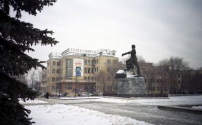
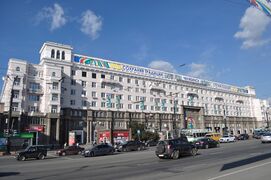
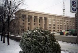
.jpg&filetimestamp=20240409160810&)  .jpg&filetimestamp=20240409160800&)   .jpg&filetimestamp=20240409160743&) من أعلى اليسار: منظر تشلیابنسك، كنيسة التثليث، TDK Building, Ryabanin house, Fortum power plant, Trade center. | |
 Flag .svg&filetimestamp=20190622000814&) Coat of arms | |
Location of تشلیابنسك | |
 تشلیابنسك Location of تشلیابنسك  تشلیابنسك تشلیابنسك (أوبلاست چليابنسك) | |
| Coordinates: 55°09′17″N 61°22′33″E / 55.15472°N 61.37583°E | |
| البلد | روسيا |
| الكيان الاتحادي | Chelyabinsk Oblast |
| Founded | 1736[2] |
| مدينة status since | 1787[2] |
| Government | |
| • Body | مجلس |
| • الرئيس | Stanislav Mosharov |
| Area | |
• Total | 530 كم² (200 ميل²) |
| Population | |
• Total | 1٬130٬132 |
• Estimate (2013)[5] | 1٬156٬201 |
| • Rank | 9th in 2010 |
| • Density | 2٬100/km2 (5٬500/sq mi) |
| • Subordinated to | مدينة چلیابینسك[1] |
| • Capital of | Chelyabinsk Oblast[1], مدينة چلیابینسك[1] |
| • Urban okrug | Chelyabinsky Urban Okrug[1] |
| • Capital of | Chelyabinsky Urban Okrug[1] |
| Postal code(s)[6] | 454xxx |
| Dialing code(s) | +7 351[7] |
| مدينة Day | 13 سبتمبر |
| Website | www |
چلیابنسك (Chelyabinsk[أ]، هي مدينة ومركز اداري في اوبلاست چلیابنسك، روسيا، تقع المدينة شمال غرب الاوبلاست، على بعد 210 كم جنوب يكاترينبورگ، بالقرب من شرق جبال الأورال، على نهر مياس، على حدود أوروپا وآسيا.[8] [9] [10] عدد السكان: 1,130,132 (تعداد 2010);[4] 1,077,174 (تعداد 2002);[11] 1,141,777 (تعداد 1989).[12]
The area of Chelyabinsk contained the ancient settlement of Arkaim, which belonged to the Sintashta culture. In 1736, a fortress by the name of Chelyaba was founded on the site of a Bashkir village. Chelyabinsk was granted town status by 1787. Chelyabinsk began to grow rapidly by the early 20th century as a result of the construction of railway links from the Russian core to Siberia, including the Trans-Siberian Railway. Its population reached 70,000 by 1917. Under the Soviet Union, Chelyabinsk became a major industrial centre during the 1930s. The Chelyabinsk Tractor Plant was built in 1933. During World War II, the city was a major contributor to the manufacture of tanks and ammunition.
In the 1990s and 2000s, a number of industries in Chelyabinsk ceased to exist due to the difficult economic situation,[13] [14] As of the 2020s, it continues to experience difficulties in the areas of ecology, economic and economic spheres, and urban improvement. Nevertheless, it is one of the largest industrial centers of the Urals, where industry accounts for almost 40% of the gross municipal product, especially heavy industries such as metallurgy and military production. It is home to several educational institutions, mainly South Ural State University and Chelyabinsk State University.[15]
التاريخ
حضارة سينتاشتا القديمة
Archaeologists have discovered ruins of the ancient town of Arkaim in the vicinity of the city of Chelyabinsk. Ruins and artifacts in Arkaim and other sites in the region indicate a relatively advanced civilization existing in the area since the 2nd millennium BC, which was of proto-Indo-Iranian origin.[16]
The Arkaim site, located in the Sintashta-Petrovka cultural area, was known by Russian archaeologists for at least 70 years, however, it was mostly ignored by non-Russian anthropological circles. The borders of the Sintashta-Petrovka cultural area run along the eastern Urals of the Eurasian steppe to about 400 km (249 mi) south of Chelyabinsk and to the east for about 200 km (124 mi). 23 archaeological sites are recognized as being part of this area.
The sites resemble towns, laid out in round, square, or oval shapes. Although most of the sites have been discovered by aerial photography, only two, Arkaim and Sintashta, have been thoroughly excavated. These sites are characterized by their fortification, connected houses, and extensive evidence of metallurgy.[17]
The people of the Sintashta culture are thought to have spoken Proto-Indo-Iranian, the ancestor of the Indo-Iranian language family. This identification is based primarily on similarities between their language in comparison to sections of the Rigveda, and based on funerary rituals of the Sintashta culture, as revealed by archaeological studies in the area.[18][17]
التاريخ الروسي الحديث
The fortress of Chelyaba, from which the city takes its name, was founded at the location of the Bashkir village of Chelyaby (بالبشكيرية: Силәбе, Siläbe) by colonel Alexey (Kutlu-Muhammed) Tevkelev in 1736[2] to protect the surrounding trade routes from possible attacks by Bashkir outlaws. During Pugachev's Rebellion, the fortress withstood a siege by the rebel forces in 1774, but was eventually captured for several months in 1775. In 1782, Chelyabinsk became a seat of the uyezd of Ufa Viceroyalty, which was later reformed into Orenburg Governorate. In 1787, Chelyabinsk was granted town status by the government.


Until the late 19th century, Chelyabinsk was a small provincial town. In 1892, the Samara-Zlatoust Railway was completed, which connected it with Moscow and the rest of European Russia. Also in 1892, construction of the Trans-Siberian Railway started from Chelyabinsk, and in 1896, the city was linked to Ekaterinburg. Chelyabinsk then became the main hub for travel to Siberia. For fifteen years, more than fifteen million people - a tenth of Russia's population at the time - passed through Chelyabinsk. Some of them remained in Chelyabinsk, which contributed to its rapid growth. In addition, a so-called "customs fracture" was created in Chelyabinsk, which imposed duties on the shipment of goods between the European and Asian parts of Russia, which led to the emergence of mills and notably, a tea-packing factory. As a result, Chelyabinsk became a major trade center. Its population reached 20,000 inhabitants by 1897, 45,000 by 1913, and 70,000 by 1917. Because of its rapid growth at the turn of the 20th century, similar to that of midwestern American cities, Chelyabinsk was sometimes called "the Chicago of the Urals".[19]
During the first five-year plans of the 1930s, Chelyabinsk experienced rapid industrial growth. Several important factories, including the Chelyabinsk Tractor Plant and the Chelyabinsk Metallurgical Plant, were built at this time. During World War II, Joseph Stalin decided to move a large part of Soviet manufacturing to areas removed from the reach of the advancing German military as part of a general exodus from western occupied areas. This brought new industries and thousands of workers to Chelyabinsk, including facilities for the production of T-34 tanks and Katyusha rocket launchers. During World War II, the city's industries produced 18,000 tanks and 48,500 tank diesel engines as well as over 17 million units of ammunition. During that time Chelyabinsk was informally called "Tankograd" (English: "Tank City"). During World War II, the S.M. Kirov Factory no. 185 or "OKMO" was moved to Chelyabinsk from Leningrad to produce heavy tanks, although it was transferred to Omsk after 1962.
حادث ارتطام النيزك 2013
 مقالة مفصلة: حادث سقوط النيزك الروسي 2013

في 15 فبراير 2013، سقط نيزك مصحوب بشهب عديدة على اوبلاست چلیابینسك، ولا توجد معطيات عن سقوط ضحايا بشرية، ولكن المعلومات تشير إلى أن حوالي ألف شخص قصدوا المستشفيات العامة لتلقي العلاج من اصابات نتجت عن تحطم النوافذ الزجاجية ببعض المباني القريبة من منطقة السقوط.وبلغ عدد المباني المتضررة من سقوط النيزك زهاء 3 آلاف مبنى. وكان النيزك قد سقط وتخلل سقوطه سطوع نور، وهناك معلومات تفيد بأن احتراق الينزك وتفتته وقع على ارتفاع 10 ألاف متر. أدى الحادث إلى تحطم زجاج بعض المنازل في القرى والبلدات القريبة.
ويقول العلماء، أن النيزك الذي سقط في اوبلاست چلیابینسك صغير جدا من حيث حجمه وطاقته، قياسا بنيزك تونگونسك الذي سقط عام 1908 في حوض نهر تونگوسكا في شرق سيبيريا الذي تراوحت قوته بموجب حسابات مختلفة بين 10 و40 ميگاطن من مادة التروتيل الشديدة الانفجار. أما النيزك الذي سقط في 15 فبراير فقوته أقل من ذلك بكثير.[20]
وحسب المؤشرات، فان النيزك الذي سقط في أراضي اوبلاست چلیابینسك هو حجري أو حجري – حديدي. وبعد أن حلق فوق المواقع السكنية، سقط في بحيرة چيباركول على بعد كيلومتر واحد من المدينة التي تحمل الاسم نفسه.
التقسيمات الادارية

Chelyabinsk is divided into seven administrative districts.
| No. | District | Population as of 2018[21] |
|---|---|---|
| 1 | Kalininsky | 224,391 |
| 2 | Kurchatovsky | 223,566 |
| 3 | Leninsky | 191,288 |
| 4 | Metallurgichesky | 138,156 |
| 5 | Sovetsky | 137,533 |
| 6 | Traktorozavodsky | 183,909 |
| 7 | Tsentral'ny | 100,015 |
Geography
Chelyabinsk is located east of the Ural Mountains, 200 كيلومتر (124 mi) south of Yekaterinburg. It is elevated 200–250 متر (656–820 ft) above sea level.
The city is bisected by the Miass River, which is regarded as the border between the Urals and Siberia. This is reflected in the geology of the area, with the granite foothills of the Ural Mountains to the west and the lower sedimentary rock of the West Siberian Plain to the east.
The Leningrad Bridge crosses the river, due to this it is known as "the bridge between the Urals and Siberia". Chelyabinsk itself is also known as "the gateway to Siberia".[22]
Like Rome, Constantinople, San Francisco and Moscow, Chelyabinsk is said to be located on seven hills.[23]
Urban layout
The city of Chelyabinsk developed as a fortress. The first streets began to appear soon after the construction of the fortress on the right (southern) bank of the Miass River - already in September 1736. No residential buildings were built directly in the fortress itself; the houses of the inhabitants were located in the adjoining settlement, which was surrounded by a defensive wall. The very first street was formed between the northern wall of the fortress and the Miass River. A fragment of it is shown already in the foreground of the Chelyabinsk Fortress, attached by Colonel A.I. Tevkelev to his report to V.N. Tatishchev on September 10, 1736. Soon it received the name Sibirskaya (now Truda Street), since outside Chelyabinsk it crossed into the Siberian tract leading to Tobolsk. Apparently, there were also other names: in a number of sources it is called Bolshaya Beregovaya, as mentioned in a document dated March 10, 1753[24] The western end of the street in the last years of the 18th century acquired an independent name - on the pasture near the outskirts of the Ivanovo fair appeared.[25] Apparently, according to it, this part of the street began to be called Sibirskaya-Ivanovskaya (as it is called in the list of 1795). Then, already in the 19th century, it was a little later upstream and downstream of the Miass (that is, west and east of the fortress). Perpendicular to the river, several more streets were planned. At first, there were four of them - two each on the western and eastern sides. The first street to the east got its name from the first Chelyabinsk church, consecrated in 1739 in honor of Nicholas the Wonderworker - Nikolaevskaya street (nowadays Sovetskaya). It was one-sided and went west towards the church and the fortress. After the Chelyabinsk fortress was assigned the status of the center of the Isetskaya province in 1743, the construction of administrative buildings began here, and another street was formed between Nikolaevskaya Street and the square with the church, ending in the south with the Orenburg Gate and continuing further after the then city limit by the road to Orenburg - Orenburgskaya (now Tsvillinga Street). On Orenburgskaya Street, in 1787 only four courtyards were counted, and in the list of 1795 it was already called Khristorozhdestvenskaya, and there were eleven courtyards on it. In the 18th and first half of the 19th century, Khristorozhdestvenskaya Street was the main street in the city, it was the place where its social and business life was concentrated. The urban planning on the territory of the historical center of Chelyabinsk almost without changes coincides with the plan of Chelyabinsk in 1838. The Chelyabinsk fortress was built in the center of this territory in 1736.[26] The plan of 1784 was supposed to streamline not only the layout of the city but the development and maintenance of quarters. Along with the city center, a district center and a second city square are being laid in the riverside part. The plans of 1768 and 1784 were not carried out, though the existing Troitskaya Square, Truda Street and Tsvilinga Street are historical traces remained of them. In 1838, the land surveyor Sidorov drew up a new plan to streamline the city. In many ways, it was the starting point for the further development of the city.
By 1934, during the Soviet period and the mass industrialization, about 250 thousand people lived in the city. Large-scale urban planning tasks necessitated the development of the first master plan of the city, executed under the guidance of the architect N. G. Eismont in 1936 (Leningrad branch of Giprogor, architects N. G. Berlinerblau, S. M. Gotlib, N. V. Gromov, K. M. Zaichenko and A. M. Suborov). The estimated population according to the general plan of 1936 was to reach 550 thousand people. The city developed around the historical core, including by cutting down the island birch forest, in the planning of the central part, a rectangular grid of streets was preserved, but with the enlargement of quarters. The Metallurgichesky, Traktorozavodsky and Leninsky districts were built and developed with heavy industry. Along with the city center, the centers of 5 administrative districts were planned, and interconnected by a system of transport highways. The main street - Spartak Street (now Lenin Avenue) - appears as a link between the Traktorozavodsky district, Revolution Square, and the future ensemble of the pre-park square. Historically developed streets of Kirov and Zwilling connected the main square of the city with the system of squares in Zarechye. The master plan of 1936 provided for the creation of urban recreation areas on the basis of Shershnevsky Bor and Lake Smolino, for the first time the issue of creating a large reservoir on the Miass River (Shershnevskoye Reservoir) was raised.[27]
The war prevented the implementation of the master plan in full. The Chelyabinsk industrial complex has become a deep rear defense base of the country. The relocation of 60 industrial enterprises from the center of the country, and the evacuation of the population were accompanied by mass construction of isolated villages from barracks and dugouts in free territories. At the same time, the urban area has grown significantly. The need to streamline the development of the post-war city is one of the driving reasons for the development of a new master plan, carried out in 1947 under the leadership of D. D. Bagarin (Lengiprogor, architects A. Slonimsky, L. Vertousov, engineers J. Rotenberg, I. Benevich and others). The second general plan is designed for a city with a population of more than 700 thousand people (in 1946, 450 thousand people lived in the city). Chelyabinsk was considered a center of energy-intensive production, so the main attention was paid to the formation of 4 industrial hubs based on the capacities of existing enterprises.[27] The main architectural and planning idea was the unification of disparate parts of the city into a single organism - was transferred from the general plan of the pre-war period. Along with the territory of the districts that had reserves for development (Traktorozavodsky - towards Lake First, Metallurgical - with partial use of the territory of Kashtaksky Bor, Leninsky - to Lake Smolino), new sites for promising construction were envisaged (North-West and Churilovo). The issues of transport construction were actively resolved: the creation of a bypass ring highway connecting the city districts, the routing of the main highways from east to west (Pobedy Avenue, Khudyakov - Dzerzhinsky) and from north to south ("Meridian" and Tchaikovsky Street) with access to the main roads beyond outside the city. In 1951, the master plan was adjusted in terms of the number of floors of the building: the share of multi-storey (up to five floors) buildings increased by reducing the share of 2-storey and estate buildings to 25%.
The third master plan of the city (1967) was developed by a team of authors from the Chelyabinskgrazhdanproekt Institute. The city had a population of 857,000. The main architectural and planning idea was the active inclusion in the composition of the city of Shershnevsky and Kashtak forests, the Shershnevsky reservoir and the Miass River. Building on the free territories of the northwestern residential area, designed for a population of up to 300 thousand people, as a new direction for the development of the city, proposed by the master plan, has been carried out since the late 1960s. The existing historically polycentric system of the center was enriched by the creation of new complexes: at the turn of the river near Garden Island, along Tchaikovsky Street, and the three-beam center of the northwest. The master plan of 1967 provided for the creation of new main streets and a ring road, and the construction of bridges and overpasses, which were planned to free the city center from transit traffic. In 1990 a new city plan was approved and again in 2021.[28]
المناخ
The city has a humid continental climate (Köppen: Dfb) similar to that of the Canadian prairies, despite being located slightly further north. The average temperature in January is well below the freezing point at −14.9 °C أو 5.2 °F. July has a relatively warm average of 19 °C أو 66.2 °F, and the annual average is a few degrees above the freezing point at 3 °C أو 37.4 °F, indicating some moderation. The range of extremes allegedly reaches 70 °C أو 130 °F, claimed to be typical of a mid-latitude climate on a large continent such as Eurasia.[29]
The majority of precipitation occurs in the summer, with less in the winter. The month of July experiences the most, with an average 87 ميليمتر أو 3.43 بوصات of precipitation, while January, the driest month, experiences 15 ميليمتر أو 0.59 بوصات. Total precipitation reaches an average of 429 ميليمتر أو 16.89 بوصات annually, consistent with the city's semi-arid influence. On average, 119 days of the year experience precipitation.[29]
| بيانات المناخ لـ چلیابنسك | |||||||||||||
|---|---|---|---|---|---|---|---|---|---|---|---|---|---|
| الشهر | ينا | فب | مار | أبر | ماي | يون | يول | أغس | سبت | أكت | نوف | ديس | السنة |
| متوسط القصوى اليومية °س (°ف) | −10.5 (13.1) |
−7.9 (17.8) |
1.0 (33.8) |
10.6 (51.1) |
20.3 (68.5) |
23.9 (75.0) |
25.2 (77.4) |
23.6 (74.5) |
17.2 (63.0) |
9.3 (48.7) |
−0.4 (31.3) |
−6.9 (19.6) |
8.8 (47.8) |
| المتوسط اليومي °س (°ف) | −14.1 (6.6) |
−12.5 (9.5) |
−4.8 (23.4) |
4.7 (40.5) |
12.1 (53.8) |
18.3 (64.9) |
19.3 (66.7) |
17.1 (62.8) |
10.9 (51.6) |
4.1 (39.4) |
−5.2 (22.6) |
−11.1 (12.0) |
3.2 (37.8) |
| متوسط الدنيا اليومية °س (°ف) | −19.0 (−2.2) |
−18.9 (−2.0) |
−9.3 (15.3) |
−0.3 (31.5) |
7.9 (46.2) |
12.9 (55.2) |
14.5 (58.1) |
13.5 (56.3) |
7.6 (45.7) |
1.3 (34.3) |
−5.9 (21.4) |
−14.6 (5.7) |
−0.9 (30.4) |
| متوسط تساقط الأمطار mm (inches) | 17 (0.7) |
16 (0.6) |
19 (0.7) |
27 (1.1) |
47 (1.9) |
55 (2.2) |
87 (3.4) |
44 (1.7) |
41 (1.6) |
30 (1.2) |
26 (1.0) |
21 (0.8) |
430 (16.9) |
| Average precipitation days | 6 | 4 | 4 | 5 | 7 | 9 | 10 | 9 | 7 | 8 | 7 | 7 | 83 |
| متوسط الرطوبة النسبية (%) | 85 | 77 | 76 | 66 | 61 | 64 | 69 | 71 | 73 | 73 | 82 | 83 | 73 |
| [citation needed] | |||||||||||||
Population
| السنة | تعداد | ±% |
|---|---|---|
| 1897 | 20٬000 | — |
| 1926 | 57٬655 | +188.3% |
| 1939 | 273٬116 | +373.7% |
| 1959 | 689٬049 | +152.3% |
| 1970 | 875٬210 | +27.0% |
| 1979 | 1٬029٬522 | +17.6% |
| 1989 | 1٬141٬777 | +10.9% |
| 2002 | 1٬077٬174 | −5.7% |
| 2010 | 1٬130٬132 | +4.9% |
| 2021 | 1٬189٬525 | +5.3% |
| Source: Census data | ||
At the time of the official 2010 Census, the ethnic makeup of the city's population whose ethnicity was known (1,082,269) was:[32]
| Ethnicity | Population | Percentage |
|---|---|---|
| Russians | 936,457 | 86.5% |
| Tatars | 54,400 | 5.0% |
| Bashkirs | 33,716 | 3.1% |
| Ukrainians | 15,638 | 1.4% |
| Others | 42,058 | 3.9% |
Cityscape

Architecture
-
 Chelyabinsk main post office (Glavpochtamt) built in constructivist style (1936)
 -
 Historical residential building on Revolution Square built in socialist classicism style (1938)
 -
 ChelyabEnergo HQ building (1955)
 -
 Aloye Pole Park
 -
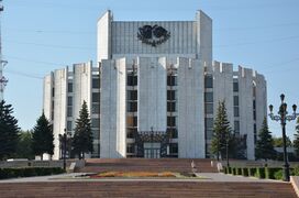 Chelyabinsk Drama Theater


.jpg&filetimestamp=20240409160822&)

The architecture of Chelyabinsk has been shaped through its history by the progression of historical eras in Russia. Before the 1917 Russian Revolution, the city was a trading center, with numerous merchant buildings in the eclectic and modern styles with elements of Russian Revival architecture, some of which are preserved on the pedestrian-only Kirovka Street. Industrialization in Chelyabinsk started in the late 1920s. The construction of large plants was accompanied by the construction of new residential and public buildings (like the city's main post office) in the constructivist style. Entire constructivist neighborhoods can be seen in the area of the Chelyabinsk Tractor Plant.[33]
In the late 1930s, a new era began in the city, with large-scale construction of Stalinist architecture. Many of the buildings in and around the city center and central avenue are constructed in this style.[34]
The next 60 years saw extensive construction of residential high-rise buildings as the city's population rose to about one million, notably within the large residential area called "Severo-Zapad" (English: North-West). With the market reforms of the 1990s, there was an increase in the construction of office buildings and major shopping malls in postmodern and high-tech styles.
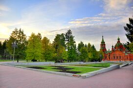
Parks and gardens
Chelyabinsk has seventeen public parks. The largest is Gagarin Central Park.[35] Its territory includes large areas of rocky and forested terrain, located around several now-flooded abandoned quarries.
التعليم
الاقتصاد
النقل


مترو چلیابینسك
المطار
يخدم المدينة مطار چلیابینسك.
التلوث
مشاهير المدينة
- مقالة مفصلة: تصنيف:أشخاص من چلیابنسك
- Lera Auerbach، ملحن وموسيقي
- Sergei Babinov، لاعب هوكي
- Stanislav Chistov، لاعب هوكي
- Evgenii Dadonov، لاعب هوكي
- Evgeny Davydov، لاعب هوكي
- Makhmut Gareev، مؤرخ وعالم عسكري
- Sergei Gonchar، لاعب هوكي
- Dmitri Kalinin، لاعب هوكي
- Viktor Khristenko، سياسي
- Sergei Makarov، لاعب هوكي
- Oleg Mityaev، موسيقي، فنان شعبي روسي
- Andrei Nazarov، لاعب هوكي
- Nelli Rokita، سياسية
- Eugene Roshal، مطور برمجيات
- Mariya Savinova، لاعبة أولمبية
- Galina Starovoytova، سياسي
- Maksim Surayev، رائد فضاء
- Dmitri Tertyshny، لاعب هوكي
- Anna Trebunskaya، باليرينا وراقصة
- Ivan Ukhov، لاعب أولمبي
- Slava Voynov، لاعب هوكي
- Danis Zaripov، لاعب هوكي
الرياضة
Notable people
- Ariel, Soviet pop rock band
- Lera Auerbach (born 1973), composer and musician, born and grew up in Chelyabinsk
- Svyatoslav Belza (1942–2014), musical scholar, critic and essayist, born in Chelyabinsk
- Anatoliy Kroll (born 1943), jazz musician, bandleader, composer, born and started his career in Chelyabinsk
- Zhan Bush (born 1993), figure skater
- Dmitry Shishkin born in 1992 Classical Pianist
- Yekaterina Gamova (born 1980), Olympic volleyball player, born and grew up in Chelyabinsk
- Makhmut Gareev (1923–2019), historian and military scientist, born and grew up in Chelyabinsk
- Sidney Gordin (1918–1996), artist, professor
- Viktor Khristenko (born 1957), politician and statesman born and grew up in Chelyabinsk
- Igor Kurnosov (1985–2013), chess grandmaster, born in Chelyabinsk
- Oleg Mityaev (born 1956), singer-songwriter and actor, born, grew up, and came into prominence in Chelyabinsk
- Vadim Muntagirov (born 1990), ballet dancer, born in Chelyabinsk
- Staņislavs Olijars (born 1979), Latvian 110m hurdler, gold medallist at the 2006 European Athletics Championships, born in Chelyabinsk
- Georgy Ratner (1923–2001), surgeon, born in Chelyabinsk
- Nelli Rokita (born 1957), Polish politician, born in Chelyabinsk
- Eugene Roshal (born 1972), software developer, born in Chelyabinsk
- Mariya Savinova (born 1985), Olympic athlete, born in Chelyabinsk
- Galina Starovoytova (1946–1998), politician and human rights activist, born in Chelyabinsk
- Maksim Surayev (born 1972), cosmonaut, born in Chelyabinsk
- Evgeny Sveshnikov (born 1950), chess grandmaster and writer, born and grew up in Chelyabinsk
- Anna Trebunskaya (born 1980), ballroom and Latin dancer, born in Chelyabinsk
- Ivan Ukhov (born 1986), Olympic high jumper, born in Chelyabinsk
- Mikhail Yurevich (born 1969), businessman, politician, born in Chelyabinsk
- Mikhail Koklyaev (born 1978), Russian strongman competitor
العلاقات الدولية
مدن شقيقة
چلیابنسك على تأومة مع:
 چانگچون، الصين
- اورومچي، الصين
 كلومبيا، كارولينا الجنوبية، الولايات المتحدة
 أنطاليا، تركيا
See also
Notes
- ^ /tʃɛlˈjæbɪnsk/; روسية: Челябинск, النطق Čeljabinsk; النطق الروسي: [tɕɪˈlʲæbʲɪnsk] (
 استمع); بشكير: Силәбе, romanized: Siläbe, [sʲilæˈβɘ]
المراجع
Notes
- ^ أ ب ت ث ج ح خطأ استشهاد: وسم
<ref>غير صحيح؛ لا نص تم توفيره للمراجع المسماةRef30 - ^ أ ب ت "Chelyabinsk - Russia". Retrieved 21 September 2017.
- ^ "Челябинск сегодня – Визитная Карточка". Администрация г. Челябинска. Archived from the original on 26 January 2012.
- ^ أ ب Russian Federal State Statistics Service (2011). "Всероссийская перепись населения 2010 года. Том 1". Всероссийская перепись населения 2010 года (2010 All-Russia Population Census) (in Russian). Federal State Statistics Service. Retrieved June 29, 2012.
{{cite web}}: Invalid|ref=harv(help); Unknown parameter|trans_title=ignored (|trans-title=suggested) (help)CS1 maint: unrecognized language (link) - ^ "Численность населения Российской Федерации по муниципальным образованиям на 1 января 2013 года. — М.: Федеральная служба государственной статистики Росстат, 2013. — 528 с. (Табл. 33. Численность населения городских округов, муниципальных районов, городских и сельских поселений, городских населенных пунктов, сельских населенных пунктов)". Archived from the original on 21 December 2021. Retrieved 8 February 2014.
- ^ "Information about central postal office" (in الروسية). Archived from the original on 3 March 2016.
- ^ "Russian Federation Cities dialing codes" (ZIP 34.4KB) (in الروسية).[dead link]
- ^ "Investing in Chelyabinsk city | Invest in Russia". Investinrussia.biz. Retrieved 2013-02-14.
- ^ http://www.rotobo.or.jp/events/forum/presentation/2-4-05Murzina.pdf
- ^ "Invest in Ural". Invest in Ural. 1933-06-20. Retrieved 2013-02-14.
- ^ Федеральная служба государственной статистики (Federal State Statistics Service) (2004-05-21). "Численность населения России, субъектов Российской Федерации в составе федеральных округов, районов, городских поселений, сельских населённых пунктов – районных центров и сельских населённых пунктов с населением 3 тысячи и более человек[[Category:Articles containing روسية-language text]] (Population of Russia, its federal districts, federal subjects, districts, urban localities, rural localities—administrative centers, and rural localities with population of over 3,000)". Всероссийская перепись населения 2002 года (All-Russia Population Census of 2002) (in Russian). Federal State Statistics Service. Retrieved 2008-07-25.
{{cite web}}: URL–wikilink conflict (help)CS1 maint: unrecognized language (link) - ^ "Всесоюзная перепись населения 1989 г. Численность наличного населения союзных и автономных республик, автономных областей и округов, краёв, областей, районов, городских поселений и сёл-райцентров.[[Category:Articles containing روسية-language text]] (All Union Population Census of 1989. Present population of union and autonomous republics, autonomous oblasts and okrugs, krais, oblasts, districts, urban settlements, and villages serving as district administrative centers.)". Всесоюзная перепись населения 1989 года (All-Union Population Census of 1989) (in Russian). Demoscope Weekly (website of the Institute of Demographics of the State University—Higher School of Economics. 1989. Retrieved 2007-12-13.
{{cite web}}: Italic or bold markup not allowed in:|publisher=(help); URL–wikilink conflict (help)CS1 maint: unrecognized language (link) - ^ "История Челябинска | Администрация г. Челябинска". History of Chelyabinsk. Administration of Chelyabinsk. Archived from the original on December 22, 2017. Retrieved 4 September 2023.
- ^ ""Good News of Chelyabinsk Region"". Top 10 Chelyabinsk enterprises that have turned into a shopping mall. Hornews. Retrieved 4 September 2023.
- ^ (PDF). Administration of Chelyabinsk (2020) https://translate.google.com/website?sl=auto&tl=en&hl=en&u=https://cheladmin.ru/sites/default/files/imceFiles/user704/pasport_na_sayt_0.pdf. Retrieved 4 September 2023.
{{cite web}}: Missing or empty|title=(help) - ^ "Ancient Aryan civilization achieved incredible technological progress 40 centuries ago". Pravda. July 16, 2005.
- ^ أ ب Basu, Dipak (2017). India as an Organization: Volume One. Palgrave Macmillan. p. 23. ISBN 978-3-319-53372-8.
- ^ Anthony 2007, pp. 408–411.
- ^ "Челябинск: Ворота в Сибирь и Зауральский Чикаго". Портал Челябинская область. Archived from the original on April 18, 2011. Retrieved July 6, 2014.
- ^ "إصابة حوالي ألف شخص نتيجة سقوط نيزك بمنطقة الأورال الروسية". روسيا اليوم. 2013-02-15. Retrieved 2013-02-16.
- ^ "Численность населения Российской Федерации по муниципальным образованиям на 1 января 2020 года" (in الروسية). Rosstat. Retrieved 17 October 2020.
- ^ История Челябинска - от крепости до железнодорожной станции (in الروسية). Портал Челябинская область. Archived from the original on March 31, 2008. Retrieved July 6, 2014.
- ^ "Холмы Челябинска". Электронное периодическое издание Mediazavod.ru. Archived from the original on July 14, 2014. Retrieved July 9, 2014.
- ^ Улицы Челябинска XVIII века: прогулка по городу
- ^ то мы знаем об историческом облике столицы Южного Урала?, Missayski Rabochi
- ^ yuvlatyshev (2016-08-21). "Памятники истории и культуры / Исторический центр Челябинска. Часть 1. Улица Васенко" [Monuments of history and culture / Historic centre of Chelyabinsk. Part 1. Vasyenko street] (in الروسية).
- ^ أ ب O. Shelnikova (2020-10-07). "ГЕНЕРАЛЬНЫЙ ПЛАН ЧЕЛЯБИНСКА" [Chelyabinsk General Plan] (in الروسية).
- ^ Карина Кальярова (2021-12-21). "В Челябинске утверждают новый генплан на 20 лет" [A new general plan for 20 years is approved in Chelyabinsk] (in الروسية).
- ^ أ ب "Chelyabinsk, Russia Köppen Climate Classification (Weatherbase)". Weatherbase. Retrieved 2018-11-13.
- ^ "Pogoda.ru.net" (in Russian). Weather and Climate (Погода и климат). Retrieved December 13, 2012.
{{cite web}}: CS1 maint: unrecognized language (link) - ^ "World Weather Information Service – Cheljabinsk". منظمة الأرصاد الجوية العالمية. Retrieved December 13, 2012.
- ^ "Наиболее многочисленные национальности" (PDF). Rosstat. Archived from the original (PDF) on 2016-08-22. Retrieved 2016-09-11.
- ^ Конструктивизм в архитектуре Челябинска (in الروسية). April 27, 2009.
- ^ "Сталинский ампир". January 16, 2016.
- ^ "Парк Гагарина в Челябинске попал в топ-5 лучших в России".
المراجع
- Законодательное Собрание Челябинской области. Постановление №161 от 25 мая 2006 г. «Об утверждении перечня муниципальных образований (административно-территориальных единиц) Челябинской области и населённых пунктов, входящих в их состав», в ред. Постановления №2255 от 23 октября 2014 г. «О внесении изменений в перечень муниципальных образований (административно-территориальных единиц) Челябинской области и населённых пунктов, входящих в их состав». (Legislative Assembly of Chelyabinsk Oblast. Resolution #161 of November 25, 2006 On Adoption of the Registry of the Municipal Formations (Administrative-Territorial Units) of Chelyabinsk Oblast and of the Inhabited Localities They Comprise, as amended by the Resolution #2255 of October 23, 2014 On Amending the Registry of the Municipal Formations (Administrative-Territorial Units) of Chelyabinsk Oblast and of the Inhabited Localities They Comprise).
- Lennart Samuelson, Tankograd. The Formation of a Soviet Company Town: Cheliabinsk, 1900s–1950s (Basingstoke, Palgrave Macmillan, 2011).
وصلات خارجية
- موقع إلكتروني عن چلیابینسك
- بوابة مدينة چلیابنسك (بالروسية)
- وكالة أخبار چلیابنسك (بالروسية)
- 360 degree panoramas of Chelyabinsk at 360cities.net
 Chisholm, Hugh, ed. (1911). . دائرة المعارف البريطانية (eleventh ed.). Cambridge University Press.
 {{cite encyclopedia}}: Cite has empty unknown parameter:|coauthors=(help)
- Pages using gadget WikiMiniAtlas
- Articles containing روسية-language text
- Articles containing بشكير-language text
- Pages with بشكير IPA
- CS1 errors: unsupported parameter
- CS1 الروسية-language sources (ru)
- Articles with dead external links from August 2017
- CS1 errors: URL–wikilink conflict
- CS1 errors: markup
- CS1 errors: missing title
- CS1 errors: bare URL
- CS1 uses الروسية-language script (ru)
- Short description with empty Wikidata description
- Pages using infobox mapframe with missing coordinates
- Coordinates not on Wikidata
- Pages using infobox settlement with image map1 but not image map
- Articles with unsourced statements from أغسطس 2011
- Articles with hatnote templates targeting a nonexistent page
- مقالات المعرفة المحتوية على معلومات من دائرة المعارف البريطانية طبعة 1911
- چلیابینسك
- تاريخ الأورال
- Chelyabinsky Uyezd
- أماكن مأهولة تأسست في 1736