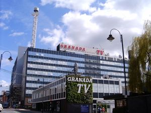
شمال غرب إنگلترة
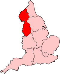 شمال غرب في إنگلترة | |
| الجغرافيا | |
|---|---|
| الحالة | اقيم |
| المساحة الاجمالية | Ranked 6 14,165 كم² 5,469 ميل² |
| NUTS 1 | UKD |
| الديموغرافيا | |
| اجمالي الكثافة السكانية | الترتيب3 7,052,000 (تعداد 2011) 498 كم² |
| القيمة المضافة للفرد | £17,433 (6) |
| الحكومة | |
| المقر الاداري | سانت هلينز |
| القيادة | North West Regional Leaders Board |
| التنمية المحلية | شمال غرب |
| البرلمان الأوروپي | شمال غرب إنگلترة |
| الموقع الإلكتروني | |
 |
|---|
شمال غرب إنگلترة North West England، هو أحد الأقاليم الإنگليزية التسعة الرسمية من المستوى الأول لأغراض إحصائية. ويتكون الاقليم من خمس مقاطعات احتفالية - كمبريا، لانكشاير، مانشستر الكبرى، مرسايسايد وتششاير. وصل عدد سكان الاقليم في تعداد 2011 إلى 7.052.000 نسمة.[1] وهو ثالث أكثر الأقاليم اكتظاظاً بالسكان بعد لندن الكبرى وشمال شرق إنگلترة.
الجغرافيا
الحكومة المحلية
يضم الاقليم رسمياً التقسيمات التالية:
| خريطة | Ceremonial county | County/Unitary | Metropolitan/non-metropolitan districts |
|---|---|---|---|
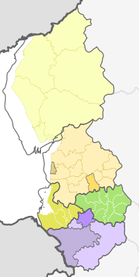 |
Cheshire | 1. Cheshire East U.A. | |
| 2. Cheshire West and Chester U.A. | |||
| 3. Halton U.A. | |||
| 4. Warrington U.A. | |||
| 5. Cumbria † | a) Barrow-in-Furness, b) South Lakeland, c) Copeland, d) Allerdale, e) Eden, f) Carlisle | ||
| 6. Greater Manchester * | a) Bolton, b) Bury, c) Manchester, d) Oldham, e) Rochdale, f) Salford, g) Stockport, h) Tameside, i) Trafford, j) Wigan | ||
| Lancashire | 7. Lancashire † | a) West Lancashire, b) Chorley, c) South Ribble, d) Fylde, e) Preston, f) Wyre, g) Lancaster, h) Ribble Valley, i) Pendle, j) Burnley, k) Rossendale, l) Hyndburn | |
| 8. Blackpool U.A. | |||
| 9. Blackburn with Darwen U.A. | |||
| 10. Merseyside * | a) Knowsley, b) Liverpool, c) St. Helens, d) Sefton, e) Wirral | ||
المفتاح: †shire county | *مقاطعة كبرى
الديموغرافيا
السكان، الكثافة، والمستوطنات
المصدر: مكتب الاحصائات الوطنية للتعداد النصف سنوي للسكان:[2]
| الاقليم/المقاطعة | السكان | الكثافة | أكبر بلدة/مدينة | أكبر منطقة حضرية |
|---|---|---|---|---|
| Greater Manchester | 2,629,400 | 2,016/كم² | مانشستر (394,269) | منطقة مانشستر الحضرية الكبرى (2,240,230) |
| لاانكشاير | 1,449,600 | 468/كم² | پرستون (184,836) | Preston/Chorley/Leyland Urban Area (335,000) |
| Merseyside | 1,353,600 | 2,118/كم² | ليڤرپول (436,100) | منطقة ليڤرپول الكبرى (816,000) |
| Cheshire | 1,003,600 | 424/كم² | Chester (77,040) | Warrington (194,700) |
| كمبريا | 496,200 | 73/كم² | Carlisle (71,773) | Carlisle (71,773) |
العرقيات
مكان الميلاد
- إنگلترة – 6,169,753
- اسكتلندا – 109,163
- ويلز – 73,850
- إيرلندا – 56,887 (51,000 في 2008)
- پاكستان – 46,529 (58,000 في 2008)
- إيرلندا الشمالية – 34,879
- الهند – 34,600 (48,000 في 2008)
- ألمانيا – 19,931 (25,000 في 2008)
- الصين وهونگ كونگ – 15,491
- بنگلادش – 13,746
- جنوب أفريقيا – 7,740
- الولايات المتحدة – 7,037
- جاميكا – 6,661
- إيطاليا – 6,325
- أستراليا – 5,880
- پولندا – (37,000 في 2008)
الديانات
الجدول التال يحسب تعداد المملكة المتحدة 2011.
| الدين | المسيحية | الاسلام | الهندوسية | السيخية | اليهودية | البوذية | أخرى | بلاد دين/ لم يعلن |
|---|---|---|---|---|---|---|---|---|
| شمال شرق إنگلترة | 78.0% | 3.0% | 0.4% | 0.1% | 0.4% | 0.2% | 0.2% | 17.7% |
| المملكة المتحدة | 71.6% | 2.7% | 1.0% | 0.6% | 0.5% | 0.3% | 0.3% | 23.2% |
حمل المراهقين
الحرمان الاجتماعي
الانتخابات
اللغات واللهجات
الأقاليم الاحصائية في الاتحاد الأوروپي
| من المستوى 1 | الرمز | من المستوى 2 | الرمز | من المستوى 3 | الرمز |
|---|---|---|---|---|---|
| شمال شرق إنگلترة | UKD | كمبريا | UKD1 | West Cumbria (Allerdale, Barrow-in-Furness, Copeland) | UKD11 |
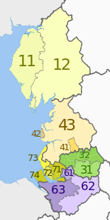
|
East Cumbria (Carlisle, Eden, South Lakeland) | UKD12 | |||
| Cheshire | UKD6 | Warrington | UKD61 | ||
| Cheshire East | UKD62 | ||||
| Cheshire West and Chester | UKD63 | ||||
| Greater Manchester | UKD3 | Greater Manchester South (Manchester, Salford, Stockport, Tameside, Trafford) | UKD31 | ||
| Greater Manchester North (Bolton, Bury, Oldham, Rochdale, Wigan) | UKD32 | ||||
| لانكشاير | UKD4 | Blackburn with Darwen | UKD41 | ||
| Blackpool | UKD42 | ||||
| لانكشاير CC | UKD43 | ||||
| Merseyside | UKD7 | East Merseyside (Knowsley, St Helens and Halton) | UKD71 | ||
| ليڤرپول | UKD72 | ||||
| سفتون | UKD73 | ||||
| ويرال | UKD74 | ||||
المدن والبلدات
- GM = مانشستر الكبرى، ME = Merseyside، CU = كمبريا، LA = لانكشايرـ CH = Cheshire
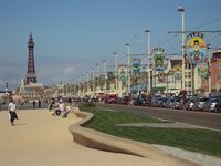
Blackpool promenade
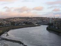
وسطن مدينة لانكستر.
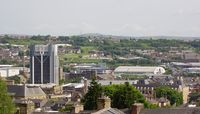
Blackburn townscape
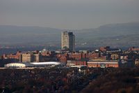
Oldham town centre
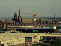
Barrow-in-Furness central skyline
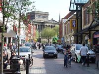
وسط مدينة پرستون.
المناطق الحضرية
المجلس المحلي المنتخب

Proposed flag for the region designed by Peter Saville.
البرلمان الأوروپي
التاريخ
الارث العلمي والصناعي
النقل
الطرق
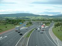
The M6 motorway is one of the North West's principal roads
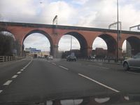
Old meets new at the Stockport Viaduct.
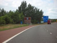
A sign marking entry to Scotland located on the M6 motorway crossing the border.
النق الجوي
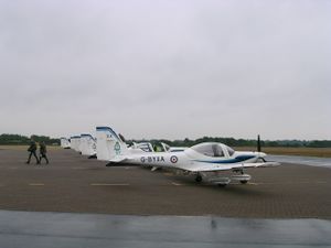
Tutor aircraft at RAF Woodvale
السكك الحديدية
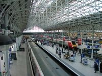
Manchester's Piccadilly station is the largest railway station in the region.
النقل البحري
الاقتصاد
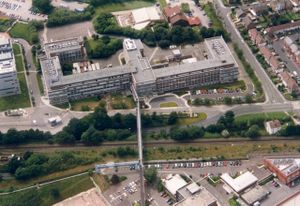
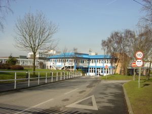
Unilever Research Laboratory at Port Sunlight (Bebington)
التعليم
الكليات

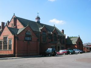
Manchester College, Northenden
الجامعات
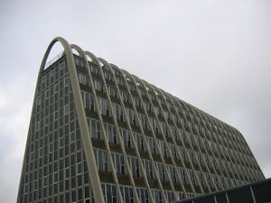
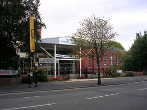
Manchester Metropolitan University's Hollings Campus – the Toast Rack
الاعلام المحلي
Local media include:
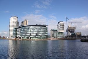
MediaCityUK being built at Salford Quays
توأمة المدن
انظر أيضاً
- موضوعات عن إنگلترة
- Cumbric language
- Envirolink Northwest
- قائمة مدارس شمال غرب إنگلترة
- وكالة تنمية شمال غرب إنگلترة
المصادر
- ^ "2011 Census - Population and Household Estimates for England and Wales, March 2011" (PDF). Office of National Statistics. 2012. Retrieved 16 يوليو 2012.
- ^ "Office for National Statistics". Statistics.gov.uk. Retrieved 17 مايو 2012.
وصلات خارجية
الكلمات الدالة:
This article contains content from Wikimedia licensed under CC BY-SA 4.0. Please comply with the license terms.
