سلاڠور دار الإحسان
ولايات ومناطق ماليزيا | |||||
| سلاڠور دار الإحسان Selangor Darul Ehsan | |||||
| |||||
| شعار الولاية: Dipelihara Allah | |||||
| النشيد: Duli Yang Maha Mulia | |||||
 | |||||
| العاصمة | شاه علم | ||||
|---|---|---|---|---|---|
| العاصمة الملكية | كلاڠ | ||||
| الحزب الحاكم | Pakatan Rakyat (People's Pact) | ||||
| - السلطان | السلطان شرف الدين إدريس | ||||
| - منتري بسار | أبو خالد ابراهيم | ||||
| التاريخ | |||||
| - انضمت إلى و.م.م. | 1895 | ||||
| - الاحتلال الياباني | 1942 | ||||
| - الإنضمام إلى اتحاد الملايا | 1948 | ||||
| المساحة | |||||
| - الإجمالي | 7,956 كم² | ||||
| التعداد | |||||
| - تقدير 2007 | 7,200,000 | ||||
| - الكثافة | 905/كم² | ||||
| HDI لعام (2000) | 0.817 (high) | ||||
| المفتاح الهاتفي للولاية | 03 | ||||
| الرمز البريد للولاية | 40xxx to 48xxx 62xxx to 64xxx | ||||
| سابقة لوحة السيارة | B | ||||
| الموقع الإلكتروني: | http://www.selangor.gov.my | ||||


سلاڠور دار الإحسان (/səˈlæŋər/؛ ملايو: [s(ə)laŋo(r)]),[1] وتـُنطـَق: "سـِلانگور" ؛ بالجاوي: "سلڠور")، هي أحد الأقاليم الثلاثة عشر في ماليزيا. كما أنها أحد السلطنات.
عاصمتها الحديثة هي مدينة (شاه علم) بعد أن كانت كوالا لامبور سابقا,
غير إنها تضم مدينتي فيدرالتين مستقلتين عنها داخلها,
هما مدينة كوالا لامبور عاصمة ماليزيا التاريخية والسياسية,
ومدينة بوترا جايا العاصمة الحكومية,
غير أستانا نيجارا وهو القصر الوطني المخصص للملك الذي يتم إختياره لحكم ماليزيا بكوالا لامبور,
بينما بيت رئيس الوزراء BM في بوترا جايا,
It is on the west coast of Peninsular Malaysia and is bordered by Perak to the north, Pahang to the east, Negeri Sembilan to the south and the Strait of Malacca to the west. Selangor surrounds the federal territories of Kuala Lumpur and Putrajaya, both of which were previously part of it.
The state capital of Selangor is Shah Alam and its royal capital is Klang. Petaling Jaya, was awarded city status in 2006. Selangor is one of three Malaysian states that contain more than one city; the others are Sarawak and Johor.[2][3]
The state of Selangor has the largest economy in Malaysia in terms of gross domestic product (GDP), with RM 239.968 billion (roughly USD 55.5 billion) in 2015, comprising 22.6% of the country's GDP.[4] It is the most developed state in Malaysia; it has good infrastructure such as highways and transport, and has the largest population in Malaysia, a high standard of living and the lowest poverty rate in the country.[5]
أصل الاسم
The origin of the name Selangor is unknown. A common suggestion is that the name refers to the Malay word langau, a large fly or blowfly that is found in the marshes along the Selangor River in the state's north-west. According to local lore, a warrior who escaped from Malacca after the Portuguese conquest, took a break from his journey north and rested under a tree here. However, he was disturbed by a persistent fly, whereupon he decided to explore the area. When he found the place to be his liking and chose to settle there, he named the place "satu (se) langau" meaning "a large blowfly".[6][7] Another suggestion is that the name may have originate from a kind of tree found in Kuala Selangor and along Selangor River named mentangau.[8]
In the absence of a firm etymological explanation, alternative theories abound. One theory claims the state's name is derived from the term Salang Ur where ur means "town" or "village" in Tamil, meaning village of the salang people.[6] Another proposed that it means "land of the straits" where selang means "straits"[citation needed], however, "strait" in Malay is selat and not "selang" according to Kamus Dewan, not even in obsolete usage.[9] It has also been proposed that the name is derived from a combination of salang (stabbing) and jemur (dry in the sun), indicating that it was once a place where traitors were stabbed (salang) then left to roast in the sun (jemur).[6]
التاريخ
| الانتماءات التاريخية | Period |
|---|---|
| 15th century-1510 | |
| 1511-1765 | |
| 1766-1894 | |
| 1895-1941 | |
| 1941–1945 | |
| 1946–1948 | |
| 1948–1963 | |
| 1963–الحاضر |
يعود تاريخ المستوطنات البشرية في وادي نهر كيلانج إلى العصور النيوليتية (العصور الحجرية الحديثة). انظر: العصر الحجري. خلال القرن الرابع عشر الميلادي كانت كلاڠ والمنطقة الساحلية المحيطة تشكّل جزءًا من الإمبراطورية الجاوية في ماجاپاهيت. وفي القرن الخامس عشر الميلادي صارت تحت سيطرة ملقا في الجنوب.
في عام 1511 سقطت ملقا في أيدي البرتغاليين وحصل حُكام كلاڠ على استقلال أكبر. لكن خامات القصدير الضخمة في أراضيهم جذبت الكثيرين من التّجار الأجانب. فبعد أن أخذ الهولنديون ملقا من البرتغاليين في عام 1641م حاولوا السيطرة على تجارة القصدير المحلية عن طريق بناء حصون في كوالا لنجي وكوالا سيلانجور. وفي الوقت ذاته طرد التجار البوجينيون المستوطنين الأصليين من شعب المنانكباو. وفي منتصف القرن الثامن عشر الميلادي كانت جماعة البوجينيون قد أرست دعائم السلطنة الحالية في العاصمة كوالا سيلانجور وبدأت تقاوم السلطة الهولندية بنجاح.
أدى التوسع السريع في الطلب العالمي على القصدير منذ منتصف القرن التاسع عشر إلى تغير الوضع الاقتصادي في سلاڠور. فقد وفد الآلاف من الصينيين العاملين في التعدين لاستخراج القصدير. واشتبك الصينيون الأثرياء المشتغلون باستخراج القصدير مع الحكام الماليزيين في صراعات عنيفة من أجل السيطرة على المناطق الرئيسية الغنية بالخامات. في الستينيات من القرن التاسع عشر كانت الولاية تنحدر نحو الفوضى والحرب الأهلية. وفي منتصف السبعينيات من القرن التاسع عشر تدخّلت الإدارة البريطانية في مستوطنات المضائق من أجل إعادة النظام. في أغسطس 1874 عيّنت بريطانيا مقيمًا رسميًا مُمثلاً لها في سلاڠور. بقي السلطان رئيسًا للولاية وبقي السكان المحليون رعايا له، ولكن الحكم كان للبريطانيين. في 1896 أكمل البريطانيون خطة تضم سلاڠور مع پراق ونگري سمبلان وپهڠ لتُشكّل معًا الولايات الماليزية الاتحادية وعاصمتها الاتحادية كوالا لمپور، وقد أضعف هذا الإجراء المكانة السياسية للحكام الماليزيين.
في الوقت ذاته نما اقتصاد سلاڠور نموًا كبيرًا، وازداد إنتاج القصدير بسرعة فائقة في أواخر القرن التاسع عشر. في بداية القرن العشرين بدأت صادرات السلعة الجديدة، المطاط، تنافس صادرات القصدير في الأهمية. نشأت مزارع ضخمة للمطاط يملكها أوروبيون جلبوا أعدادًا كبيرة من العمال الهنود من جنوبيّ الهند. كانت المزارع تقع بشكل رئيسي بين الهضاب والساحل. كذلك جاء مهاجرون كثيرون من جزر الهند الشرقية الهولندية (إندونيسيا) لزراعة جوز الهند، والفواكه، والأرز، والبهارات.
في بداية القرن العشرين كانت سلانجور الولاية الأكثر تقدمًا بين الولايات الماليزية الخاضعة للإدارة البريطانية. كانت تملك شبكة طرق برية وحديدية وموانئ بحرية ممتازة وعددًا من السكان يتنامى بسرعة.
في عام 1948م أصبحت سلاڠور جزءاً من الاتحاد الماليزي الفيدرالي. في 31 أغسطس من عام 1957 أصبح الاتحاد الفدرالي الماليزي مستقلاً عن الحكم البريطاني. ومنذ ستينيات القرن العشرين استمر اقتصاد سيلانجور في التقدم على اقتصاد الولايات الأخرى في ماليزيا. توجد في سلاڠور الآن قاعدة أساسية للصناعات التحويلية وقطاع خدمات حديث متطور بشكل رفيع.
لكن الولاية تعرضت أيضًا لاضطرابات عرقية أكثر حدة مما حدث في أي مكان آخر في شبه الجزيرة. وخلال المصادمات وأحداث الشغب التي وقعت بين الصينيين والماليزيين في مايو عام 1969 كان العنف أسوأ ما يكون في سلانجور.
ولازالت الإضطرابات العرقية والعنصريين من الصينين والهندوس يحاولون إفتعال المشاكل كل فترة,
إما بإقامة تجمعات أو مظاهرات أشهرها برسيه bersih,
وأشهر جريمة مؤخرا الإعتداء علي ممتلكات المالايو ثم محاولة قتل 3 مالايو من الإطفاء, وبعد نقلهم للمستشفي مات (محمد أديب) Muhammad Adib التي مازالت قضيته مفتوحه وتتداول في الإعلام والسياسة,
يحاول البوذيين والهندوس الإعتداء علي كل ما هو مالايو او إسلامي طالما أتتهم الفرصة,
وحتي الإعتداء علي مسلمين من خارج ماليزيا مقيمين أو طلاب وقتلهم إن تمكنو خصوصا في تجمعاتهم,
كما ان الجامعات الخاصة التي غالبا ما يفتحها الصينين لتدوير الأموال تتحيز للصينين وتؤجج الطائفية ضد الطلاب المسلمين من بلاد أخري,
أما في مجالات الأعمال فطائفية ولا يسمح الصينين والهنود بأي من خارجهم إلا في حالات للإستفادة منهم أو خداع,
هذا الخداع منتشر بمحاولات الصينين والهنود بإقامة شركات ذات إسم مالايو أو إسلامي أو وضع شعارات حلال للبيع للمسلمين داخل ماليزيا وخارجها,
وتعد مطالبتهم لتسليم الداعية ذاكر نايك للهند من أشهر الحالات ...
غير مطالبتهم بإلغاء تعميم لغة المالايو والإصرار علي نشر الصينية والهندية ...
Tho most important settlement of the area in the ancient period may have been Klang. Ancient artefacts including Bronze Age axes and bronze bell dating from the 2nd century BC,[10][11][12] and iron tools called "tulang mawas" ("ape bones") have been found in or near Klang.[13] The Mao Kun map dating to the Ming dynasty and used by the Admiral Zheng He during his voyages of expedition between 1405 and 1433 refers to places in Selangor such as the Klang River estuary (吉令港) and perhaps a hilly area.[14] The Malay Annals indicates that the Selangor area was under the control of the Sultanate of Malacca in the 15th century; however, Selangor at that time was not a unified domain—separate river states such as Klang and Jeram existed in the region.[13] According to the Malay Annals, Tun Perak was appointed the chief of Klang during the reign of Muzaffar Shah. Later, the son of Mansur Shah and Hang Li Po named Paduka Sri Cina was made raja of Jeram near Langat, which may be due to presence of Chinese miners there.[13]

After the fall of Malacca to the Portuguese in 1511, the area came under the control of Johor Sultanate and was later governed by Sri Agar Diraja, son of the Bendahara family of Johor.[15] In the 17th century, Johor was involved in a war against Jambi, and the Sultan of Johor engaged the help of Bugis mercenaries from Sulawesi to fight against Jambi.[16] After Johor won in 1679, the Bugis decided to stay and started to gain power in the region.[17] Many Bugis began to migrate and settled along the coast of Selangor and some inland regions. In some places, the Bugis displaced the Minangkabaus who had settled earlier.[18] The Bugis and the Minangkabaus from Sumatra struggled for control of Johor; Raja Kecil, backed by the Minangkabaus, invaded Selangor but were driven off by the Bugis in 1742. In order to establish a power base, the Bugis led by Raja Salehuddin founded the present hereditary Selangor Sultanate with its capital at Kuala Selangor in 1766.[19] Selangor is unique as the only state on the Malay Peninsula that was founded by the Bugis.[20]
In the 19th century, the economy boomed due to the exploitation of huge tin reserves; mining occurred in various parts of Selangor, for example in Ampang, that led to the growth of Kuala Lumpur. In 1854, the Sultan of Selangor granted Raja Abdullah control of Klang, passing over Raja Mahdi, the son of the chief who previously ruled Klang, leading to the Selangor Civil War of 1867 to 1874, which was partly a struggle for control of the revenues from tin.[21] Tin mining also attracted a large influx of Chinese migrant labourers. Chinese clans allied with Selangor chiefs joined the civil war. The conflicts between Malay and Chinese factions in Perak and Selangor, as well as concerns over piracy that affected coastal trade, led to increasing British involvement in the affairs of the Malay states.[22]

In 1874, Sultan Abdul Samad of Selangor accepted a British Resident in a system that allowed the British to govern while the Sultan remained the apparent ruler. Klang was the capital of the British colonial administration for Selangor from 1875 until 1880 when it was moved to Kuala Lumpur. Under the stability imposed by the British, Selangor again prospered. In 1896, largely through the coordination of the Resident Frank Swettenham, Selangor united with Negeri Sembilan, Perak and Pahang to form the Federated Malay States, with Kuala Lumpur its capital.[23]
The Federated Malay States evolved into the Federation of Malaya in 1948, which became independent in 1957 and was renamed Malaysia in 1963. The city of Kuala Lumpur functioned as the national capital of Malaysia and as the state capital of Selangor. In 1974, Selangor relinquished Kuala Lumpur to the federal government.[24] The Sultan of Selangor commemorated the city's transfer by building an archway on the borders of the new Federal Territory and Selangor; this archway is the Kota Darul Ehsan that straddles a section of the Federal Highway between Bangsar and Petaling Jaya. The state capital was moved to Shah Alam after the cession.
Putrajaya, a new city designed to be the new administrative capital of Malaysia, was built by the federal government in Selangor; Sultan Salahuddin was asked again to cede land to the federal government.[25] Putrajaya became a federal territory in 2001.[26]
الجغرافيا
تشكل سلسلة الجبال الرئيسية حدود الولاية مع پهڠ شرقًا. وهذه الجبال مغطاة بالغابات بشكل كثيف. وتنبع أنهار سيلانجور، ولانجات، وكيلانج، وبرنام من هذه المنطقة، ثم تتجه غربًا عبر الولاية إلى مضيق ملقا. وتمتد سلانجور من سلسلة الجبال هذه نحو الغرب فوق هضاب من الصخور الجيرية والرملية، حيث تُوجد خامات القصدير بكميات كبيرة. وإلى الغرب من هذه الهضاب يقع سهل منخفض يمتد دون انقطاع على طول الساحل. ويتكون هذا السهل من الطّمي ورسوبات صخرية تأتي بها الأنهار من سلسلة الجبال الرئيسية. وثمة حزام من غابات المانجروف يُغطّي التخوم الساحلية من السهل. وتوجد خلف هذا الحزام من الغابات أراضٍ زراعية كثيرة، لكن تبقى في السهل مساحات شاسعة من المستنقعات وغابات الأمطار في الأراضي المنخفضة.
النبيت والوحيش


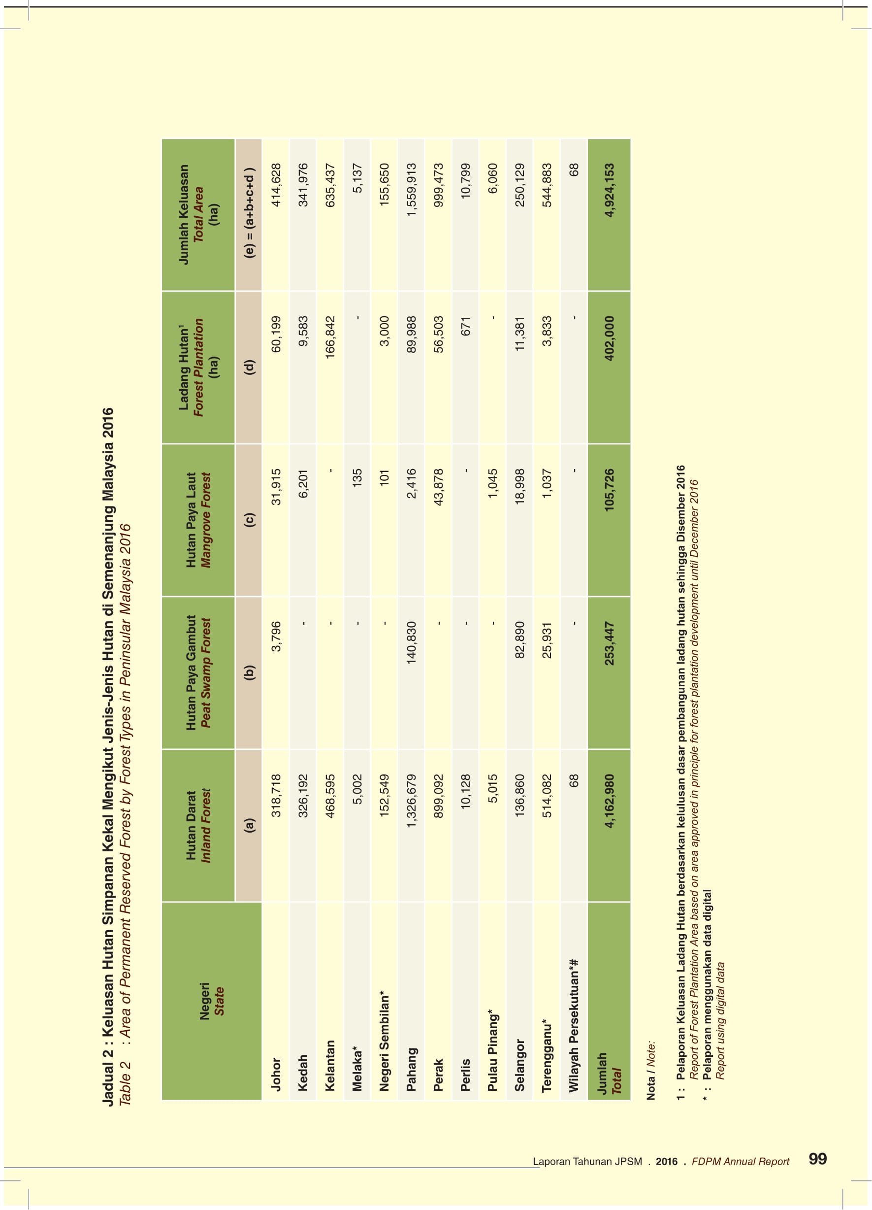
Malaysian forest can be classified as tropical rainforest. Selangor has 250,129 ha of permanent reserve forest, of which 82,890 ha are peat swamp forest and 18,998 ha formed mangrove forest along the coast. The permanent reserve forest makes up about 32 percent of the state land.[27][28] Ecoforests that are situated in Selangor are Gabai Waterfall, Taman Rimba Templer, Taman Rimba Ampang, Taman Rimba Komanwel, Sungai Chongkak, Sungai Tua, Sungai Sendat, Sungai Tekala, Kanching, Gunung Nuang and Bukit Tabur.[29][30] Reserve forest in Selangor is managed and conserved by the state's forestry department, as the National Forestry Act 1984 of the federal constitution provides that forestry comes under the jurisdiction of the respective state.[31] The Selangor's forestry department office is located at Sultan Salahuddin Abdul Aziz Shah Building in Shah Alam.[32]
Selangor is also home to a statutory agency of the Government of Malaysia, the Forest Research Institute Malaysia (FRIM). Located in Kepong, FRIM promotes sustainable management and optimal use of forest resources in Malaysia by generating knowledge and technology through research, development and application in tropical forestry.[33][34]
Selangor has a few declared protected areas (PAs) in order to safeguard biodiversity and wildlife. They are Sungai Dusun Wildlife Reserve which is first to be reserved to protect the Sumatran Rhinos,[35] Kutu Hill Wildlife Reserve,[36] and Bukit Sungai Puteh Hill Wildlife Reserve which is located at Kuala Lumpur and Selangor's border.[37] The state also has an ecotourism centre, Paya Indah Wetlands, which is located in the district Kuala Langat near Dengkil. It is a sanctuary to migratory and residential birds, Nile hippos and crocodiles.[38][39]
المناخ
| بيانات المناخ لـ Selangor (LTSAAS) in 2017 | |||||||||||||
|---|---|---|---|---|---|---|---|---|---|---|---|---|---|
| الشهر | ينا | فب | مار | أبر | ماي | يون | يول | أغس | سبت | أكت | نوف | ديس | السنة |
| متوسط القصوى اليومية °س (°ف) | 34 (93) |
35 (95) |
36 (97) |
36 (97) |
36 (97) |
37 (99) |
36 (97) |
36 (97) |
32 (90) |
32 (90) |
30 (86) |
31 (88) |
34 (94) |
| المتوسط اليومي °س (°ف) | 31 (88) |
32 (90) |
32 (90) |
33 (91) |
33 (91) |
34 (93) |
33 (91) |
33 (91) |
30 (86) |
30 (86) |
28 (82) |
29 (84) |
32 (89) |
| متوسط الدنيا اليومية °س (°ف) | 26 (79) |
26 (79) |
27 (81) |
27 (81) |
28 (82) |
27 (81) |
27 (81) |
27 (81) |
26 (79) |
26 (79) |
26 (79) |
25 (77) |
27 (80) |
| متوسط تساقط الأمطار mm (inches) | 482.5 (19.00) |
296.2 (11.66) |
307.7 (12.11) |
289.0 (11.38) |
232.2 (9.14) |
127.1 (5.00) |
127.4 (5.02) |
213.8 (8.42) |
232.7 (9.16) |
102.2 (4.02) |
366.7 (14.44) |
319.9 (12.59) |
3٬097٫4 (121.94) |
| Average rainy days (≥ 1.0mm) | 28 | 28 | 31 | 27 | 31 | 24 | 29 | 31 | 24 | 21 | 30 | 31 | 335 |
| متوسط الرطوبة النسبية (%) (daily average) | 78 | 78 | 77 | 76 | 75 | 72 | 71 | 74 | 75 | 72 | 82 | 79 | 76 |
| Mean monthly ساعات سطوع الشمس | 236.5 | 255.0 | 290.0 | 271.0 | 280.5 | 266.5 | 283.5 | 277.0 | 268.5 | 266.0 | 163.0 | 225.0 | 3٬082٫5 |
| Source: [40] | |||||||||||||
As in the rest of Malaysia, Selangor has a tropical rainforest climate bordering on a tropical monsoon climate. The climate is very much dictated by the surrounding sea and the prevailing wind system. It has high average temperature and high average rainfall.
الديموغرافيا والسكان

سيلانجور ولاية على الساحل الغربي في شبه جزيرة ماليزيا، وتقع العاصمة الفيدرالية كوالا لامبور, والعاصمة الحكومية بوترا جايا داخل سلطنة سيلانجور.
أكثر من 44% من سكان سيلانجور ماليزيُّون، ونحو 37% صينيون، و17% هنود. يعيش معظم السكان حول كوالا لامبور. وأدّى توسع الصناعة إلى بناء عدة بلدات تابعة لها، مثل بلدة بتالنج جايا التي يغادرها الكثيرون يوميًا للعمل في العاصمة الفيدرالية. ورئيس ولاية سيلانجور سلطان، تلزم مساجد الولاية بالدعاء له في كل جمعة, وفي مجلسها التشريعي 42 مقعدًا. انظر أيضًا: ماليزيا، حكومة.
الجماعات العرقية
| الجماعة العرقية | السكان | |||
|---|---|---|---|---|
| 2010[41] | 2015[42] | |||
| الملايو | 2,814,597 | 51.34% | 3,069,100 | 52.24% |
| بوميپوترا آخرون | 62,657 | 1.14% | 77,500 | 1.32% |
| إجمالي البوميپوترا | 2,877,254 | 52.48% | 3,146,600 | 53.57% |
| صينيون | 1,441,774 | 28.6% | 1,499,400 | 25.52% |
| هنود | 679,130 | 13.5% | 712,000 | 12.12% |
| آخرون | 42,163 | 0.8% | 41,400 | 0.70% |
| إجمالي الماليزيون | 5,040,321 | 92.20% | 5,399,400 | 91.92% |
| غير ماليزيين | 421,820 | 7.80% | 474,700 | 8.08% |
| الإجمالي | 5,482,141 | 100.00% | 5,874,100 | 100.00% |

الديانات

الإسلام 50-65% تبعا للمنطقة,
السياسة
الدستور
سلطنة سلانغور

المجلس التنفيذي للولاية
مجلس الولاية
الادارة
قائمة المناطق
| الترقيم | الاسم | السكان[44] | المساحة (كم²) | المناطق الفرعية | ملاحظات |
|---|---|---|---|---|---|
 | |||||
| 1 | Gombak | 682,226 | 650.08[45] | Ulu Klang, Ampang, Setapak, Batu Caves, Selayang, Rawang, Taman Templer, Sungai Buloh, Kundang, Batu 20, Kampung Sungai Pusu | The meaning of Gombak is unknown but it is believed that the name comes from a village in Setapak called gombak (Gombak Setia). The district was created on February 1, 1974, the same day when Kuala Lumpur was declared a Federal Territory. Gombak is one of the few districts that has many cities and all of its sub-districts are cities except Batu 20, Kampung Sungai Pusu, and Setapak. Popular tourism places include Zoo Negara, Batu Caves, and Forest Research Institute Malaysia. |
| 2 | Hulu Langat | 1,156,585 | 829.44[46] | Kajang, Beranang, Cheras, Hulu Langat, Hulu Semenyih, Kelanang, Tanjong 12, Tarun, Sungai Makau, Sungai Lui, Sungai Kembong Beranang, Sri nanding, Simpang Balak, Rumah Murah Sungai Lui, Kampung Sungai Tangkas, Kacau, Kampung pasir batu 14 Semenyih, Desa Raya, Sungai Raya, Batu 26, Batu 23, Batu 26. | The name Hulu Langat means the beginning of Langat River. Hulu Langat has many major cities which are mostly located in the north of the district such as Cheras and Kajang. Popular tourism places includes Sungai Congkak Recreational Forest[47] and Gabai River.[48] |
| 3 | Hulu Selangor | 198,132 | 1,740.46[49] | Kuala Kubu Bharu, Sungai Chick, Ulu Yam, Ulu Yam Baru, Kerling, Kuala Kalumpang, Sungai Gumut, Serendah, Peretak, Sungai Choh | The name Hulu Selangor means the beginning of river of selangor. Hulu Selangor have a city but majority of the districts are village live by malays. You can see many forest in this district if you see it in the map. Popular tourism places include Bukit Kutu,[50] and Kerling Hot Spring.[51] |
| 4 | Klang | 861,189 | 626.78[52] | Klang, Kapar, Bukit Raja, Port Klang, Pandamaran, Telok Menegun, Bukit Kemuning, Batu 4. | The origin of the Klang name is unknown. The Royal Town of Klang, which is also the former capital of the state. Port Klang played major rolled in Malaysia economy. There are many popular tourism places in the district such as Istana Alam Shah, Klang Royal Town Mosque, Sultan Abdul Aziz Royal Gallery, Tanjung Harapan, Pulau Ketam and Little India.[53] |
| 5 | Kuala Langat | 224,648 | 858[54] | Jenjarom, Kanchong Darat, Sijangkang, Tongkah, Teluk Datok, Telok, Sungai Raba, Morib, Permatang Pasir, Kelanang Batu 6, Kanchong, Chodoi, Bukit Changgang, Batu, Jugra | Kuala Langat name derives from the combination of the word "Kuala" which means the meeting between two or more river and Langat from Langat River. Popular tourism places includes Jugra and Morib. |
| 6 | Kuala Selangor | 209,590 | 1,194.52[55] | Api-api, Kuala Selangor, Bukit Melawati, Ijok, Kampung Kuantan, Kuala Sungai Buloh, Pasangan, Ulu Tinggi, Ujong Permatang, Tambak Jawa, Taman PKNS, Sungai Sembilang, Simpang 3 Ijok, Pasir Penambang, Simpang 3, Parit Mahang, Kg. Baru Hulu Tiram Buruk, Bukit Talang, Bukit Belimbing. | The word "Kuala" means the meeting between two or more river while the word Selangor comes from the name of the river located in the district, Selangor River.[56] The combination of two words generates the name Kuala Selangor.[57] Popular place to visit includes Bukit Melawati,[58] Kuala Selangor Nature Park and Kampung Kuantan Fireflies. [59] |
| 7 | Petaling | 1,812,633 | 484.32[60] | بيتالنغ جايا, Subang Jaya, شاه علم, دامان سارا, Bandar Sri Damansara, Country Heights, Puchong Jaya, Puchong Perdana, Batu Tiga, Sungai Besi, Serdang, Bandar Saujana Putra, Glenmaire, Penaga, Merbau Sempak, Kayu ara, Desa Puchong. | The name Petaling comes from an extincted species of tree called Petaling.[61] Petaling has many major cities such as بيتالنغ جايا, شاه علم, and سوبانغ جايا. Popular tourism places include مسجد السلطان صلاح الدين عبد العزيز, بندر صن واي, and ون أوتاما |
| 8 | Sabak Bernam | 105,777 | 997.1[62] | Sabak, Sungai Besar, Sekinchan. | The name Sabak Bernam comes from the story that this place is opened by six friend (Malay : Sahabat berenam).[63] Sabak Bernam main economic activity is agriculture and it is popular for its paddy fields especially in Sekinchan.[64] |
| 9 | Sepang | 211,361 | 599.66[65] | Dengkil, Beranang, Salak Tinggi. | The name Sepang is taken from a tree called Sepang.[66] Popular tourism places include Sepang International Circuit, Kuala Lumpur International Airport and Cyberjaya. |
...
البقعة الكبيرة داخل سلانجور هي كوالا لامبور,
والبقعة الصغيرة الجنوبية هي بوترا جايا ...
...
الاقتصاد

لا تزال سيلانجور منذ عهد طويل واحدة من أكثر الولايات تقدماً في ماليزيا من الناحية الاقتصادية. وخلال الفترة التي حكم فيها البريطانيون ماليزيا بوصفها مستعمرة، كانت صادرات القصدير والمطاط هي أساس ثروتها. ومنذ الستينيات من القرن العشرين انخفضت أهمية هذه الصناعات وكان الكثير من عروق خامات القصدير قد استُنفد، وفي الفترة ذاتها حدث توسع سريع في الصناعة التحويلية التي قام الكثير منها في وادي كيلانج، بين ميناء كيلانج ومدينة كوالا لامبور. تشمل الصناعة الثقيلة مصنعًا ضخمًا لإنتاج الفولاذ، وهناك تركيز قوي على إنتاج يتسم بتقنية عالية. وتُصنع السيارة الماليزية، التي تحمل اسم بروتون ساجا، بالقرب من مدينة شاه عَلَم عاصمة الولاية. كما يوجد عدد كبير من مصانع الأغذية.
تتمتع هذه الولاية بوسائل مواصلات ممتازة، ويعود ذلك بشكل رئيسي إلى وجود العاصمة الفيدرالية كوالا لامبور ضمن حدودها. يسير الخط الحديدي الرئيسي على الساحل الغربي من الشمال إلى الجنوب ويمر عبر سيلانجور. كذلك فإن الولاية مركز لشبكة الطرق البرية في شبه الجزيرة، ومنها الطرق الرئيسية التي تنطلق من كوالا لامبور إلى الشمال والجنوب والساحل الشرقي. ويوجد الميناء الدولي الرئيسي في شبه الجزيرة في بورت كيلانج، يوجد مطار ماليزيا الدولي الرئيسي في سوبانج.
التجارة والصناعة
توجد شركات ومصانع i.t عالمية للهاردوير وتركيب السوفت وير, وشركات إتصالات,
وشركات سيارات أشهرها بيردوا وبرتون, وشركات سكوتر,
وشركات أجهزة تبريد وشركات معادن وإعادة تصنيع ,
وشركات مطاط حيث المطاط الماليزي من الأجود عالميا,
وشركات بترول أشهرهم (ڤيترونس) بتروناس,
وشركات زيوت طعام ومشتقاته,
...
الزراعة
السياحة


النقل


التعليم


مراكز التسوق
تتميز سلانجور بمولاتها الضخمة ويعتبر 1utama الأضخم في ماليزيا,
1utama, the curve , giant ,sunway ..................
المشافي
الأشهر هي جامعة مالايا
المطبخ
ناسي ليماك وروتي شاناي هم أكثر الأطباق شعبية,
لكن يوجد الكثير من أطباق المالايو والمماك (مسلمي الهند) وشاينيز مسلم(مسلمي الصين) بالإضافة للعربية والتركي والإيراني والأفغاني والغربي والعالمي وخليط,
وأماكن خاصة وبارات لغير المسلمين ...
الإعلام
التلفزيون
, TV9 ,TV3 , TV1 ,
الهجرة TV Alhijrah,
TVSelangor,

الإذاعة
الصحف
معرض الصور
-
 Silver Leaf Monkey in Bukit Melawati
 -
-
 Commonwealth Forest Park
 -
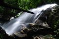
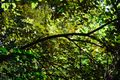
 Kanching Rainforest Waterfall
 -
 Pasar Borong Selayang
 -
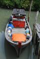 Pulau Ketam
 -
 Forest Research Institute of Malaysia (FRIM)
 -
 Gold Coast Morib


.jpg&filetimestamp=20180129222527&)

انظر أيضاً
المصادر
- ^ "Selangor". collinsdictionary.com. HarperCollins. Retrieved 23 January 2018.
- ^ "Senarai Nama dan Alamat PBT". jkt.kpkt.gov.my. Retrieved 24 January 2018.
- ^ "Iskandar Puteri Jadi Bandar Raya ke-13 di Malaysia". mynewshub.cc. 21 November 2017. Retrieved 24 January 2018.
- ^ "GDP By State - National Accounts - 2010-2015". Department of Statistics, Malaysia. Department of Statistics, Malaysia. 30 September 2016. p. 10. Retrieved 3 May 2017. -- Select "Publication GDP by State 2010-2015.pdf" to download and view data
- ^ Leete, Richard. "Selangor's Human Development Progress and Challenges" (PDF). UN Development Program. Archived from the original (PDF) on 25 أبريل 2012. Retrieved 9 يوليو 2011.
{{cite web}}: Unknown parameter|dead-url=ignored (|url-status=suggested) (help) - ^ أ ب ت "Kuala Selangor Info: Page 3 of 4: Oral History". Kuala Selangor District Council. Archived from the original on 3 August 2018.
- ^ Tang Ruxyn (26 April 2017). "The Stories And Facts Behind How The 13 States Of Malaysia Got Their Names". Says.
- ^ "Info Kuala Selangor: Halaman 3 dari 4 - Cerita-Cerita Lisan". Majlis Daerah Kuala Selangor. Archived from the original on 8 December 2016.
- ^ "selang": entry at Kamus Dewan
- ^ British Museum Collection
- ^ The Kettledrums of Southeast Asia: A Bronze Age World and Its Aftermath – August Johan Bernet Kempers – Google Books. Books.google.com.au. Retrieved 17 September 2013.
- ^ W. Linehan (October 1951). "Traces of a Bronze Age Culture Associated With Iron Age Implements in the Regions of Klang and the Tembeling, Malaya". Journal of the Malayan Branch of the Royal Asiatic Society. Malaysian Branch of the Royal Asiatic Society. 24 (3 (156)): 1–59.
- ^ أ ب ت R. O. Winstedt (October 1934). "A History of Selangor". Journal of the Malayan Branch of the Royal Asiatic Society. Malaysian Branch of the Royal Asiatic Society. 12 (3 (120)): 1–34.
- ^ "Latar Belakang Kuala Selangor (Malay)". Kuala Selangor District Council. Archived from the original on 17 May 2009. Retrieved 7 June 2010.
- ^ Tan Ding Eing (1975). A Portrait of Malaysia and Singapore. Oxford University Press. p. 81. ISBN 978-0195807226.
- ^ Tan Ding Eing (1978). A Portrait of Malaysia and Singapore. Oxford University Press. p. 22. ISBN 978-0195807226.
- ^ Jim Baker. Crossroads (2nd Edn): A Popular History of Malaysia and Singapore. Marshall Cavendish International (Asia) Pte Ltd. pp. 64–65. ISBN 978-9814516020.
- ^ Bungo, N.; Hussin, Nordin; Omar, Rahilah; Bidin, Aishah (September 2012). "Early settlements of the minangkabaus community in Selangor". Pertanika Journal of Social Science and Humanities. 20 (3): 931–947.
- ^ Jim Baker. Crossroads (2nd Edn): A Popular History of Malaysia and Singapore. Marshall Cavendish International (Asia) Pte Ltd. p. 71. ISBN 978-9814516020.
- ^ Tan Ding Eing (1975). A Portrait of Malaysia and Singapore. Oxford University Press. p. 74. ISBN 978-0195807226.
- ^ J.M. Gullick (1983). The Story of Kuala Lumpur, 1857-1939. Eastern Universities Press (M). pp. 17–18. ISBN 978-9679080285.
- ^ Paul H. Kratoska (2000). South East Asia, Colonial History: Peaceful transitions to independence (1945-1963). Routledge. p. 139. ISBN 978-0415247849.
- ^ Benfield, H. Conway. "Handbook of The Federated Malay States" (PDF). sabrizain.org. Retrieved 23 January 2018.
- ^ "The Birth Of A Metropolis ..A Moment Of History For All ". New Straits Times. 29 January 1974. Retrieved 25 October 2010.
- ^ "Putrajaya milik Persekutuan, Selangor dibayar RM200 juta". Utusan Malaysia. 8 November 2000. Retrieved 23 May 2018.
- ^ "PM isytihar Putrajaya sebagai Wilayah Persekutuan". Utusan Malaysia. 2 February 2001. Retrieved 23 May 2018.
- ^ "Kawasan Hutan Simpanan kekal di Semenanjung Malaysia". data.gov.my. Forestry Department Peninsular Malaysia. Retrieved 16 July 2018.
- ^ "JPSM Annual Report 2016 - page 99". www.forestry.gov.my. Jabatan Perhutanan Semenanjung Malaysia. Retrieved 17 July 2018.
- ^ "Hutan Lipur & Hutan Taman Negeri". www.forestry.gov.my. Jabatan Perhutanan Semenanjung Malaysia. Retrieved 17 July 2018.
- ^ "Senarai Hutan Lipur". forestry.selangor.gov.my. Jabatan Perhutanan Negeri Selangor. Retrieved 17 July 2018.[dead link]
- ^ "Akta Perhutanan Negara 1984". www.forestry.gov.my. Jabatan Perhutanan Semenanjung Malaysia. Retrieved 17 July 2018.
- ^ "Jabatan Perhutanan Negeri". www.forestry.gov.my. Jabatan Perhutanan Semenanjung Malaysia. Retrieved 17 July 2018.
- ^ "Forest Research Institute Malaysia | Official Portal". frim.gov.my. Retrieved 14 March 2014.
- ^ "Forest Research Institute of Malaysia (FRIM), Kepong". tourismselangor.my. Retrieved 14 March 2014.
- ^ "Sungai Dusun Wildlife Reserve, Selangor". www.wildlife.gov.my. Department of Wildlife and Natural Parks (PERHILITAN) Peninsular Malaysia. Retrieved 17 July 2018.
- ^ "Kutu Hill Wildlife Reserve". www.wildlife.gov.my. Department of Wildlife and Natural Parks (PERHILITAN) Peninsular Malaysia. Retrieved 17 July 2018.
- ^ "Sungai Puteh Hill Wildlife Reserve, Kuala Lumpur/Selangor". www.wildlife.gov.my. Department of Wildlife and Natural Parks (PERHILITAN) Peninsular Malaysia. Retrieved 17 July 2018.
- ^ "Paya Indah Wetlands". www.tourismselangor.my. Tourism Selangor. Retrieved 17 July 2018.
- ^ "Paya Indah Wetlands". www.nre.gov.my. Ministry of Land, Water and Natural Resources. Retrieved 17 July 2018.
- ^ "Selangor Monthly Climate Averages". World Weather Online. Retrieved July 5, 2018.
- ^ "2010 Population and Housing Census of Malaysia" (PDF). Department of Statistics, Malaysia. p. 94. Archived from the original (PDF) on 5 February 2013.
- ^ خطأ استشهاد: وسم
<ref>غير صحيح؛ لا نص تم توفيره للمراجع المسماة2015 population - ^ "2010 Population and Housing Census of Malaysia" (PDF). Department of Statistics, Malaysia. Archived from the original (PDF) on 22 May 2014. Retrieved 17 June 2012.
{{cite web}}: Unknown parameter|deadurl=ignored (|url-status=suggested) (help) p. 13 - ^ "Laporan Tinjauan Kajian Rancangan Struktur Negeri Selangor 2035 - A2 : Penduduk dan Perancangan Sumber Manusia" (PDF) (in Bahasa Melayu). p. A2-3. Archived from the original (PDF) on 24 January 2018. Retrieved 24 January 2018.
{{cite web}}: CS1 maint: unrecognized language (link) - ^ "Portal Rasmi PDT Gombak Profil Gombak". ww2.selangor.gov.my. Retrieved 24 January 2018.
- ^ "Portal Rasmi PDT Hulu Langat Latar Belakang". ww2.selangor.gov.my. Retrieved 24 January 2018.
- ^ "Sungai Congkak Recreational Forest". malaysia-traveller.com. Retrieved 24 January 2018.
- ^ "Gabai Waterfall, Hulu Langat". tourismselangor.my. Retrieved 24 January 2018.
- ^ "Portal Rasmi PDT Hulu Selangor Guna Tanah". ww2.selangor.gov.my. Retrieved 24 January 2018.
- ^ "Bukit Kutu (Gunung Kutu)". tourismselangor.my. Retrieved 24 January 2018.
- ^ "Kerling Hot Spring". tourismselangor.my. Retrieved 24 January 2018.
- ^ "Klang District Background". luas.gov.my. Retrieved 24 January 2018.
- ^ "Little India, Jalan tengku Kelana". tourismselangor.my. Retrieved 24 January 2018.
- ^ "Portal Rasmi PDT Kuala Langat Profil Kuala Langat". ww2.selangor.gov.my. Retrieved 24 January 2018.
- ^ "Laporan Profil Daerah - Jabatan Pengairan dan Saliran Daerah Kuala Selangor" (PDF). apps.water.gov.my. p. 7. Retrieved 24 January 2018.
- ^ "Kuala". glosbe.com. Retrieved 24 January 2018.
- ^ "Kuala Selangor - The Land Of History, Firefly, Seafood And Eagle". Retrieved 24 January 2018.
- ^ "Malawati Hill". tourismselangor.my. Retrieved 24 January 2018.
- ^ "Kampung Kuantan Fireflies". tourismselangor.my. Retrieved 24 January 2018.
- ^ "Portal Rasmi PDT Petaling Sejarah Daerah بيتالنغ Petaling". ww2.selangor.gov.my. Retrieved 24 January 2018.
- ^ "Sejarah Ringkas Daerah Petaling". ww2.selangor.gov.my (in Bahasa Melayu). Retrieved 24 January 2018.
{{cite web}}: CS1 maint: unrecognized language (link) - ^ "Portal Rasmi PDT Sabak Bernam Profil Daerah". ww2.selangor.gov.my. Retrieved 24 January 2018.
- ^ "Sejarah Ringkas Daerah Sabak Bernam". ww2.selangor.gov.my (in Bahasa Melayu). Retrieved 24 January 2018.
{{cite web}}: CS1 maint: unrecognized language (link) - ^ "Sekinchan Paddy Field". tourismselangor.my. Retrieved 24 January 2018.
- ^ "Portal Rasmi PDT Sepang Data Keluasan". ww2.selangor.gov.my. Retrieved 24 January 2018.
- ^ "Sejarah Daerah Sepang". ww2.selangor.gov.my. Retrieved 24 January 2018.
وصلات خارجية
- Official website
- Rail map of Selangor
- Geographical maps of Selangor
- History of Selangor
- Official Website of Online Shopping & Great Deals in Selangor, Malaysia - Everydayonsales
- Tourism Selangor Official Website
- Invest Selangor Berhad Official Website
أماكن قريبة من سلاڠور دار الإحسان | |
|---|---|
| الولايات | ||
|---|---|---|
| الأراضي الفدرالية | ||