مقاطعة مدلسكس، مساتشوستس
مقاطعة مدلسكس | |
|---|---|
 Middlesex South Registry of Deeds in Cambridge | |
 الشعار | |
 الموقع ضمن ولاية مساتشوستس | |
 موقع مساتشوستس ضمن الولايات المتحدة | |
| Coordinates: 42°29′N 71°23′W / 42.49°N 71.39°W | |
| البلد | |
| State | |
| تأسست | May 10, 1643 |
| Named after | Middlesex, England |
| Seat | لـُوِل و كمبردج |
| أكبر مدينة | كمبردج |
| Area | |
• Total | 847 ميل² (2٬190 كم²) |
| • Land | 818 ميل² (2٬120 كم²) |
| • Water | 29 ميل² (80 كم²) 3.5% |
| Population (2020) | |
• Total | 1٬632٬002 |
| • Density | 1٬996/sq mi (771/km2) |
| Time zone | UTC−5 (Eastern) |
| • Summer (DST) | UTC−4 (EDT) |
| Congressional districts | 3rd، 4th، 5th، 6th، 7th |
مقاطعة مدلسكس Middlesex County تقع في كومنولث مساتشوستس، في الولايات المتحدة. As of the 2020 census, the population was 1,632,002,[1] making it the 22nd most populous county in the United States, and the most populous county in both Massachusetts and New England. Middlesex County is one of two U.S. counties (along with Santa Clara County, California) to be amongst the top 25 counties with the highest household income and the 25 most populated counties. As part of the 2010 national census, the Commonwealth's mean center of population[2] for that year was geo-centered in Middlesex County, in the town of Natick at (42°16′20″N 71°21′48″W / 42.272291°N 71.363370°W).[3] (This is not to be confused with the geographic center of Massachusetts, which is in Rutland, in neighboring Worcester County.) Middlesex County is included in the Census Bureau's Boston–كمبردج–Newton, MA–NH Metropolitan Statistical Area.
On July 11, 1997, the Massachusetts legislature voted to abolish the executive government of Middlesex County due primarily to the county's insolvency. Though Middlesex County continues to exist as a geographic boundary[4] it is used primarily as district jurisdictions within the court system and for other administrative purposes, such as an indicator for elections. The National Weather Service weather alerts (such as severe thunderstorm warning) continue issuances based upon Massachusetts's counties.
الديمغرافيا
التقسيم الديمغرافي حسب البلدة
الدخل
| الترتيب | البلدة | Per capita income |
Median household income |
Median family income |
Population | Number of households | |
|---|---|---|---|---|---|---|---|
| 1 | Weston | Town | $96,475 | $180,815 | $220,441 | 11,229 | 3,557 |
| 2 | Sherborn | Town | $70,983 | $152,083 | $183,456 | 4,102 | 1,463 |
| 3 | Wayland | Town | $70,185 | $125,076 | $151,812 | 12,939 | 4,902 |
| 4 | Carlisle | Town | $68,060 | $159,063 | $171,167 | 4,814 | 1,612 |
| 5 | Lexington | Town | $67,584 | $136,610 | $158,888 | 31,129 | 11,411 |
| 6 | Concord | Town | $67,374 | $127,951 | $156,352 | 17,523 | 6,197 |
| 7 | Winchester | Town | $65,172 | $127,665 | $160,706 | 21,205 | 7,611 |
| 8 | Sudbury | Town | $63,862 | $159,713 | $173,587 | 17,482 | 5,613 |
| 9 | Newton | City | $60,323 | $109,724 | $141,944 | 84,583 | 30,735 |
| 10 | Lincoln | Town | $57,471 | $130,523 | $141,667 | 6,480 | 2,150 |
| 11 | Hopkinton | Town | $56,939 | $126,350 | $149,213 | 14,691 | 4,893 |
| Chestnut Hill (02467) | ZCTA | $55,947 | $114,140 | $151,375 | 21,952 | 6,237 | |
| 12 | Belmont | Town | $54,361 | $99,529 | $121,250 | 24,548 | 9,465 |
| Cochituate | CDP | $52,936 | $107,589 | $133,082 | 6,384 | 2,496 | |
| 13 | Boxborough | Town | $51,159 | $103,918 | $134,583 | 4,957 | 1,984 |
| 14 | Acton | Town | $49,603 | $109,491 | $135,000 | 21,656 | 7,924 |
| 15 | Natick | Town | $49,012 | $90,046 | $117,259 | 32,729 | 13,440 |
| 16 | Bedford | Town | $48,899 | $101,886 | $128,448 | 13,192 | 4,951 |
| 17 | Stow | Town | $48,448 | $112,130 | $132,061 | 6,488 | 2,328 |
| West Concord | CDP | $47,633 | $103,693 | $145,242 | 6,134 | 2,069 | |
| 18 | Holliston | Town | $47,624 | $107,374 | $125,236 | 13,512 | 4,918 |
| 19 | Westford | Town | $47,587 | $119,511 | $135,000 | 21,716 | 7,308 |
| 20 | Arlington | Town | $47,571 | $85,059 | $107,862 | 42,570 | 19,007 |
| 21 | Groton | Town | $47,003 | $117,903 | $135,143 | 10,478 | 3,650 |
| 22 | Ashland | Town | $46,626 | $93,770 | $116,799 | 16,305 | 6,484 |
| 23 | Cambridge | City | $46,242 | $69,017 | $94,536 | 104,322 | 45,386 |
| 24 | Reading | Town | $44,949 | $99,131 | $117,477 | 24,504 | 9,055 |
| 25 | Chelmsford | Town | $42,535 | $90,895 | $110,967 | 33,610 | 13,304 |
| 26 | North Reading | Town | $42,256 | $104,069 | $116,729 | 14,703 | 5,077 |
| 27 | Dunstable | Town | $41,937 | $109,205 | $121,406 | 3,128 | 1,087 |
| 28 | Littleton | Town | $41,815 | $103,438 | $114,094 | 8,810 | 3,198 |
| Middlesex County | County | $41,453 | $79,691 | $100,267 | 1,491,762 | 577,349 | |
| 29 | Watertown | City | $41,090 | $76,718 | $90,521 | 31,792 | 14,042 |
| 30 | Wakefield | Town | $40,227 | $85,379 | $112,293 | 24,794 | 10,058 |
| 31 | Burlington | Town | $40,083 | $92,236 | $107,339 | 24,207 | 9,177 |
| 32 | Melrose | City | $39,873 | $84,599 | $105,893 | 26,864 | 10,963 |
| Groton | CDP | $39,208 | $55,446 | $127,708 | 1,077 | 507 | |
| Hopkinton | CDP | $38,507 | $71,536 | $105,882 | 2,110 | 877 | |
| 33 | Tyngsborough | Town | $38,067 | $101,103 | $111,780 | 11,198 | 3,797 |
| 34 | Stoneham | Town | $37,573 | $77,476 | $95,490 | 21,413 | 8,909 |
| 35 | Marlborough | City | $37,314 | $72,853 | $94,770 | 38,087 | 15,856 |
| 36 | Wilmington | Town | $37,084 | $100,861 | $107,436 | 22,116 | 7,200 |
| 37 | Pepperell | Town | $37,081 | $84,618 | $102,946 | 11,407 | 4,125 |
| 38 | Maynard | Town | $36,818 | $77,255 | $93,116 | 10,083 | 4,222 |
| 39 | Tewksbury | Town | $36,509 | $86,378 | $103,008 | 28,778 | 10,670 |
| 40 | Hudson | Town | $36,141 | $76,714 | $95,746 | 18,845 | 7,679 |
| Pepperell | CDP | $35,227 | $68,500 | $65,417 | 2,239 | 852 | |
| Massachusetts | State | $35,051 | $65,981 | $83,371 | 6,512,227 | 2,522,409 | |
| 41 | Medford | City | $34,615 | $72,033 | $83,078 | 55,843 | 22,461 |
| Hudson | CDP | $33,734 | $68,812 | $86,216 | 14,797 | 6,129 | |
| 42 | Woburn | City | $33,725 | $72,540 | $87,924 | 37,831 | 15,357 |
| 43 | Waltham | City | $33,717 | $68,326 | $82,233 | 60,209 | 23,520 |
| 44 | Framingham | City | $33,665 | $66,047 | $86,977 | 67,844 | 26,167 |
| Pinehurst | CDP | $33,572 | $95,038 | $100,650 | 7,289 | 2,414 | |
| 45 | Billerica | Town | $33,347 | $88,531 | $98,371 | 39,930 | 13,859 |
| 46 | Somerville | City | $32,785 | $64,480 | $71,518 | 75,566 | 31,476 |
| 47 | Ashby | Town | $32,434 | $82,614 | $84,655 | 3,030 | 1,060 |
| 48 | Ayer | Town | $32,179 | $54,899 | $78,947 | 7,370 | 3,063 |
| Littleton Common | CDP | $32,058 | $80,352 | $105,217 | 2,907 | 1,131 | |
| 49 | Dracut | Town | $31,533 | $71,824 | $88,281 | 29,249 | 11,173 |
| 50 | Townsend | Town | $31,201 | $76,250 | $91,023 | 8,906 | 3,114 |
| East Pepperell | CDP | $30,475 | $74,077 | $79,104 | 2,195 | 811 | |
| Ayer | CDP | $30,456 | $42,055 | $79,708 | 2,573 | 1,205 | |
| United States | Country | $27,915 | $52,762 | $64,293 | 306,603,772 | 114,761,359 | |
| Townsend | CDP | $27,166 | $51,512 | $71,023 | 968 | 453 | |
| 51 | Malden | City | $26,893 | $52,842 | $65,763 | 58,821 | 23,422 |
| Shirley | CDP | $24,943 | $41,250 | $41,838 | 1,330 | 593 | |
| 52 | Everett | City | $24,575 | $48,319 | $58,045 | 41,079 | 15,681 |
| 53 | Shirley | Town | $24,427 | $71,146 | $78,493 | 7,235 | 2,189 |
| 54 | Lowell | City | $23,600 | $51,471 | $57,934 | 105,860 | 39,399 |
| Devens | CDP | $13,933 | $72,986 | $73,194 | 1,704 | 113 |
السياسة
| تسجيل الناخبين والقيد الحزبي في 17 أكتوبر 2018[5] | |||||
|---|---|---|---|---|---|
| الحزب | عدد المصوتين | النسبة | |||
| Democratic | 360,454 | 34.71% | |||
| Republican | 93,276 | 8.98% | |||
| Unenrolled | 572,900 | 55.17% | |||
| Minor Parties | 11,730 | 1.13% | |||
| Total | 1,038,360 | 100% | |||
Prior to 1960, Middlesex County was a Republican Party stronghold, backing only two Democratic Party presidential candidates from 1876 to 1956. The 1960 election started a reverse trend, with the county becoming a Democratic stronghold. This has been even more apparent in recent years, with George H.W. Bush in 1988 being the last Republican presidential candidate to manage forty percent of the county's votes and Mitt Romney in 2012 being the last Republican presidential candidate to manage even thirty percent of the vote. In 2020, Joe Biden won 71% of the vote, the highest percent for any presidential candidate since 1964.
| السنة | الجمهوري | الديمقراطي | حزب ثالث | |||
|---|---|---|---|---|---|---|
| رقم. | % | رقم. | % | رقم. | % | |
| 2020 | 226,956 | 26٫28% | 617,196 | 71٫47% | 19,425 | 2٫25% |
| 2016 | 219,793 | 27٫59% | 520,360 | 65٫31% | 56,582 | 7٫10% |
| 2012 | 267,321 | 35٫45% | 471,804 | 62٫56% | 15,045 | 1٫99% |
| 2008 | 245,766 | 33٫85% | 464,484 | 63٫98% | 15,781 | 2٫17% |
| 2004 | 237,815 | 34٫52% | 440,862 | 63٫99% | 10,283 | 1٫49% |
| 2000 | 198,914 | 30٫27% | 404,043 | 61٫49% | 54,091 | 8٫23% |
| 1996 | 169,926 | 27٫06% | 398,190 | 63٫41% | 59,861 | 9٫53% |
| 1992 | 193,703 | 28٫10% | 343,994 | 49٫89% | 151,756 | 22٫01% |
| 1988 | 290,352 | 43٫82% | 361,563 | 54٫57% | 10,713 | 1٫62% |
| 1984 | 319,604 | 49٫42% | 325,065 | 50٫26% | 2,085 | 0٫32% |
| 1980 | 256,999 | 40٫30% | 270,751 | 42٫46% | 109,929 | 17٫24% |
| 1976 | 260,044 | 40٫42% | 359,919 | 55٫94% | 23,419 | 3٫64% |
| 1972 | 269,064 | 43٫56% | 345,343 | 55٫91% | 3,244 | 0٫53% |
| 1968 | 188,304 | 32٫60% | 370,310 | 64٫11% | 18,982 | 3٫29% |
| 1964 | 134,729 | 23٫36% | 439,790 | 76٫25% | 2,291 | 0٫40% |
| 1960 | 246,126 | 40٫78% | 356,130 | 59٫01% | 1,260 | 0٫21% |
| 1956 | 343,125 | 61٫12% | 216,668 | 38٫60% | 1,580 | 0٫28% |
| 1952 | 316,069 | 56٫99% | 236,910 | 42٫72% | 1,626 | 0٫29% |
| 1948 | 228,262 | 46٫98% | 248,240 | 51٫09% | 9,406 | 1٫94% |
| 1944 | 236,102 | 52٫81% | 210,253 | 47٫03% | 725 | 0٫16% |
| 1940 | 242,658 | 52٫36% | 218,663 | 47٫18% | 2,116 | 0٫46% |
| 1936 | 199,704 | 47٫60% | 189,512 | 45٫17% | 30,304 | 7٫22% |
| 1932 | 184,486 | 50٫44% | 174,257 | 47٫64% | 7,008 | 1٫92% |
| 1928 | 189,189 | 52�00% | 173,339 | 47٫64% | 1,313 | 0٫36% |
| 1924 | 162,530 | 63٫68% | 64,544 | 25٫29% | 28,161 | 11٫03% |
| 1920 | 156,636 | 69٫90% | 61,661 | 27٫52% | 5,781 | 2٫58% |
| 1916 | 60,802 | 53٫77% | 49,844 | 44٫08% | 2,426 | 2٫15% |
| 1912 | 30,511 | 29٫66% | 36,689 | 35٫67% | 35,667 | 34٫67% |
| 1908 | 58,672 | 61٫19% | 31,362 | 32٫71% | 5,853 | 6٫10% |
| 1904 | 55,704 | 60٫63% | 32,889 | 35٫80% | 3,275 | 3٫56% |
| 1900 | 49,638 | 60٫57% | 29,476 | 35٫97% | 2,841 | 3٫47% |
| 1896 | 57,281 | 71٫36% | 19,591 | 24٫41% | 3,394 | 4٫23% |
| 1892 | 40,375 | 52٫37% | 34,769 | 45٫10% | 1,946 | 2٫52% |
| 1888 | 35,768 | 54٫31% | 28,570 | 43٫38% | 1,519 | 2٫31% |
| 1884 | 27,654 | 48٫50% | 22,206 | 38٫95% | 7,157 | 12٫55% |
| 1880 | 30,339 | 59٫31% | 19,801 | 38٫71% | 1,013 | 1٫98% |
| 1876 | 27,304 | 58٫02% | 19,561 | 41٫57% | 193 | 0٫41% |
انظر أيضاً
- Middlesex, historic county of England
- Registry of Deeds (Massachusetts)
- National Register of Historic Places listings in Middlesex County, Massachusetts
- Middlesex Fells
- Middlesex Community College (Massachusetts)
- Middlesex Turnpike (Massachusetts)
- Middlesex County Sheriff's Office
المراجع
- ^ "Census - Geography Profile: Middlesex County, Massachusetts". United States Census Bureau. Retrieved November 14, 2021.
- ^ "Center of Population". United States Census Bureau. 2010. Retrieved January 28, 2018.
Definition: The center is determined as the place where an imaginary, flat, weightless and rigid map of the United States would balance perfectly if all residents were of identical weight. In 2000, Edgar Springs, Mo., was announced as the new U.S. population center.
- ^ "Centers of Population by State: 2010". United States Census Bureau. 2010. Archived from the original on April 2, 2013. Retrieved September 16, 2014.
- ^ قالب:MassGenLaws
- ^ "Registration and Party Enrollment Statistics as of October 17, 2018" (PDF). Massachusetts Elections Division. Retrieved 2019-01-23.
- ^ Leip, David. "Dave Leip's Atlas of U.S. Presidential Elections". uselectionatlas.org.
ببليوگرافيا
- History of Middlesex County, Massachusetts, Volume 1 (A-H), Volume 2 (L-W) by Samuel Adams Drake, published 1879 and 1880. 572 and 505 pages.
- Ancient Middlesex with Brief Biographical Sketches. By Levi Swanton Gould, published 1905, 366 pages.
للاستزادة
- Jedidiah Morse (1797). "Middlesex". The American Gazetteer. Boston, Massachusetts: At the presses of S. Hall, and Thomas & Andrews. OL 23272543M.
- Edwin P. Conklin, Middlesex County and Its People: A History. In Four Volumes. New York: Lewis Historical Pub. Co., 1927.
- Samuel Adams Drake, History of Middlesex County, Massachusetts: Containing Carefully Prepared Histories of Every City and Town in the County. Boston: Estes and Lauriat, 1880. Volume 1 | Volume 2
- D. Hamilton Hurd, History of Middlesex County, Massachusetts: With Biographical Sketches of Many of its Pioneers and Prominent Men. In Three Volumes. Philadelphia, PA: J.W. Lewis & Co., 1890. Volume 1 | Volume 2 | Volume 3
- Robert H. Rodgers, Middlesex County in the Colony of the Massachusetts Bay in New England: Records of Probate and Administration, February 1670/71-June 1676. Rockport, ME: Picton Press, 2005.
وصلات خارجية
- Middlesex County Sheriff's Department
- 1856 Map of Middlesex County by Henry F. Walling
- Walling & Gray. 1871 Map of Middlesex County Plate 44-45 from the 1871 Atlas of Massachusetts.
- National Register of Historic Places listing for Middlesex Co., Massachusetts
- Middlesex County entry from Hayward's New England Gazetteer of 1839
- Map of cities and towns of Massachusetts
- Massachusetts County Map
- History of Middlesex County by Samual Adams Drake, 1880. Contains histories of each town in the county.
- History of Middlesex County, Massachusetts With Biographical Sketches of Many of Its Pioneers and Prominent Men, edited by Duane Hamilton Hurd. J. W. Lewis & Co., Philadelphia. 1890.
- Middlesex North District Registry of Deeds
- Middlesex South District Registry of Deeds
- League of Women Voters, Massachusetts: County Government

|
Essex County | Hillsborough County, New Hampshire |
| |
| Worcester County | ||||
| Suffolk County | Norfolk County |
بلديات ومجتمعات Middlesex County، Massachusetts، الولايات المتحدة | ||
|---|---|---|
| Cities | 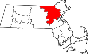 | |
| Towns |
| |
| CDPs | ||
| Other villages |
| |
| Footnotes | ‡This populated place also has portions in an adjacent county or counties | |

- Pages using gadget WikiMiniAtlas
- Short description is different from Wikidata
- Coordinates on Wikidata
- مقاطعات مساتشوستس
- Articles with hatnote templates targeting a nonexistent page
- مقاطعة مدلسكس، مساتشوستس
- Counties in Greater Boston
- تأسيسات 1643 في مساتشوستس
- أماكن مأهولة تأسست في 1643
- انحلالات 1997 في مساتشوستس
- أماكن مأهولة انحلت في 1997