كيپ تاون
(تم التحويل من مدينة الكاب)
كيپ تاون
Cape Town Kaapstad (Afrikaans) iKapa (Xhosa) | |
|---|---|
City | |
Iconic view of Table Mountain seen from Bloubergstrand | |
| الكنية: The Mother City, The Tavern of the Seas | |
| الشعار: Spes Bona (Latin for "Good Hope") | |
 منطقة كيب تاون العمرانية | |
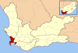 Location in the Western Cape | |
| الإحداثيات: 33°55′31″S 18°25′26″E / 33.92528°S 18.42389°E | |
| البلد | |
| المحافظة | الكاپ الغربي |
| Municipality | City of Cape Town |
| Founded | 1652 |
| Municipal government | 1839 |
| الحكومة | |
| • النوع | City council |
| • Mayor | Dan Plato (DA) |
| • Council | Cape Town City Council |
| • City manager | Achmat Ebrahim |
| المساحة | |
| • City | 2٬454٫72 كم² (947٫77 ميل²) |
| أعلى منسوب | 1٬590٫4 m (5٬217٫8 ft) |
| أوطى منسوب | 0 m (0 ft) |
| التعداد (2007)[3] | |
| • City | 3٬497٬097 |
| • الكثافة | 1٬400/km2 (3٬700/sq mi) |
| • العمرانية | 7٬280٬000 |
| صفة المواطن | Capetonian |
| منطقة التوقيت | UTC+2 (SAST) |
| Postal code range | 7700 to 8099 |
| مفتاح الهاتف | +27 (0)21 |
| الموقع الإلكتروني | www.capetown.gov.za |
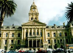
كيب تاون (بالأفريكانية: Kaapstad) هي ثالث أكبر مدن جنوب أفريقيا من حيث عدد السكان. كيب تاون هي عاصمة مقاطعة كيب الغربية، والعاصمة التشريعية لجنوب أفريقيا. حسب إحصاء عام 2001 يسكن كيب تاون 2.9 مليون نسمة. مساحتها 2499 كم2. تشتهر كيب تاون بالمرفئ الموجود بها، وبالطبيعة الخلابة، وببعض المناطق المشهورة مثل تيبل ماونتن وكيب بوينت.
التاريخ
كانت كيب تاون في الأصل مرفأ للسفن الهولندية المبحرة إلى شرق أفريقيا والهند، وقارة آسيا. تأسست في عام 1652 وكانت أول استيطان أوروبي دائم في المنطقة الواقعة جنوب الصحراء الكبرى. تشتهر المدينة حالياً بمطار كيب تاون الدولي، ثاني أنشط مطارات جنوب أفريقيا.
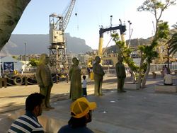
Nobel Square at the Victoria & Alfred Waterfront.
الحكومة
التوزيع السكانى
الاقتصاد
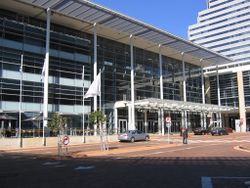
The main entrance to the Cape Town International Convention Centre
السياحة

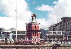
The Victoria & Alfred Waterfront with Table Mountain and its characteristic tablecloth in the background
ملف:Cape Town Bo-Kaap city street.jpg
وسائل الاعلام والاتصالات
النقل

The interior of Cape Town Railway Station

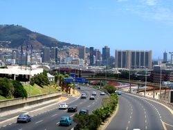
The M3 as it passes the University of Cape Town. The M3 is the major link between the City Bowl and the southern suburbs.
انظر ايضا
وصلات خارجية
مشاع المعرفة فيه ميديا متعلقة بموضوع كيپ تاون.
- حكومة
33°55′S 18°25′E / 33.917°S 18.417°E{{#coordinates:}}: لا يمكن أن يكون هناك أكثر من وسم أساسي واحد لكل صفحة
نص عريض
- ^ Pollack, Martin (2006-05-31). "Achmat Ebrahim is the new city manager of Cape Town". City of Cape Town Metropolitan Municipality. Retrieved 2007-03-25.
- ^ خطأ استشهاد: وسم
<ref>غير صحيح؛ لا نص تم توفيره للمراجع المسماةS.Afr. MunDemBoard - ^ خطأ استشهاد: وسم
<ref>غير صحيح؛ لا نص تم توفيره للمراجع المسماةS.Afr. CS 2007 - ^ Saint Petersburg in figures - International and Interregional Ties. Saint Petersburg City Government. Retrieved on 2008-03-23.
الكلمات الدالة:
This article contains content from Wikimedia licensed under CC BY-SA 4.0. Please comply with the license terms.
تصنيفات:
- Pages using gadget WikiMiniAtlas
- صفحات ذات وسوم إحداثيات غير صحيحة
- Short description is different from Wikidata
- Pages using infobox settlement with possible nickname list
- Coordinates on Wikidata
- Pages using infobox settlement with unknown parameters
- مدن تأسست في 1652
- كيپ تاون
- عواصم أفريقيا
- مدن موانئ في جنوب أفريقيا
- مدن الكاپ الغربي
- مدن جنوب أفريقيا


