سلاو
سلاو
Slough Borough of Slough | |
|---|---|
|
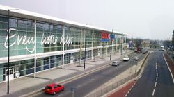
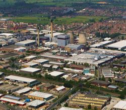
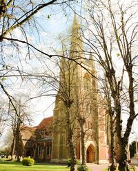
From top clockwise: Tesco Extra, Upton Court Park, Observatory House, Slough Trading Estate, Horlicks Factory and the Ditton Park Manor | |
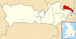 Shown within Berkshire | |
| الإحداثيات: 51°31′N 0°35′W / 51.51°N 0.59°W | |
| Sovereign state | United Kingdom |
| Constituent country | England |
| Region | South East England |
| Ceremonial county | Berkshire |
| Historic county | Buckinghamshire (including town centre) Middlesex (part of east of town) |
| Status | Unitary authority |
| Incorporated | 1 April 1974 |
| Admin HQ | Bath Road, Slough |
| الحكومة | |
| • النوع | Unitary authority |
| • الكيان | Slough Borough Council |
| • Leadership | Leader & Cabinet ( ) |
| • MPs | Tanmanjeet Singh Dhesi Adam Afriyie |
| المساحة | |
| • الإجمالي | 12٫56 ميل² (32٫54 كم²) |
| ترتيب المساحة | (of 326) |
| التعداد (تقدير منتصف 2019) | |
| • الإجمالي | 164٬046 |
| • الترتيب | 137th (of 326) |
| • الكثافة | 13٬000/sq mi (5٬000/km2) |
| • Ethnicity | 45٫7% White 39٫7% Asian or British Asian 8٫6% Black or Black British 3٫4% Mixed Race 2٫6% Other[1] |
| منطقة التوقيت | UTC0 (GMT) |
| • الصيف (التوقيت الصيفي) | UTC+1 (BST) |
| ONS code | 00MD (ONS) E06000039 (GSS) |
| OS grid reference | SU978797 |
| الموقع الإلكتروني | www |
Slough (/slaʊ/) is a large town in Berkshire, England, 20 ميل (32 km) west of central London and 17 ميل (27 km) north-east of Reading, in the Thames Valley at the intersection of the M4, M40 and M25 motorways. Slough had a population of 164,000 in 2017.
The A4 and the Great Western Main Line pass through the town, which was historically part of neighbouring Buckinghamshire. The Elizabeth line is expected to allow faster journeys to central London.
Slough's population is one of the most ethnically diverse in the United Kingdom,[2][3] attracting people from across the country and the world for labour since the 1920s, which has helped shape it into a major trading centre. In 2017, unemployment stood at 1.4%,[4] one-third the UK average of 4.5%.[5]
Slough has the highest concentration of global corporate HQs outside London. Slough Trading Estate is the largest industrial estate in single private ownership in Europe with over 17,000 jobs in 400 businesses.[6] Blackberry, McAfee, Burger King and Lego have head offices in the town.[7]
التاريخ
الجغرافيا
المناخ
| بيانات المناخ لـ Heathrow Airport, elevation 25 m, 1981–2010 | |||||||||||||
|---|---|---|---|---|---|---|---|---|---|---|---|---|---|
| الشهر | ينا | فب | مار | أبر | ماي | يون | يول | أغس | سبت | أكت | نوف | ديس | السنة |
| متوسط القصوى اليومية °س (°ف) | 8.1 (46.6) |
8.4 (47.1) |
11.3 (52.3) |
14.2 (57.6) |
17.9 (64.2) |
21.0 (69.8) |
23.5 (74.3) |
23.2 (73.8) |
19.9 (67.8) |
15.5 (59.9) |
11.1 (52.0) |
8.3 (46.9) |
15.2 (59.4) |
| متوسط الدنيا اليومية °س (°ف) | 2.3 (36.1) |
2.1 (35.8) |
3.9 (39.0) |
5.5 (41.9) |
8.7 (47.7) |
11.7 (53.1) |
13.9 (57.0) |
13.7 (56.7) |
11.4 (52.5) |
8.4 (47.1) |
4.9 (40.8) |
2.7 (36.9) |
7.4 (45.4) |
| متوسط تساقط الأمطار mm (inches) | 55.2 (2.17) |
40.9 (1.61) |
41.6 (1.64) |
43.7 (1.72) |
49.4 (1.94) |
45.1 (1.78) |
44.5 (1.75) |
49.5 (1.95) |
49.1 (1.93) |
68.5 (2.70) |
59.0 (2.32) |
55.2 (2.17) |
601.7 (23.68) |
| Average rainy days | 11.1 | 8.5 | 9.3 | 9.1 | 8.8 | 8.2 | 7.7 | 7.5 | 8.1 | 10.8 | 10.3 | 10.2 | 109.6 |
| Mean monthly ساعات سطوع الشمس | 61.5 | 77.9 | 114.6 | 168.7 | 198.5 | 204.3 | 212.0 | 204.7 | 149.3 | 116.5 | 72.6 | 52.0 | 1٬632٫6 |
| Source: Met Office[11] | |||||||||||||
الديمغرافيا
See also
Notes
- ^ خطأ استشهاد: وسم
<ref>غير صحيح؛ لا نص تم توفيره للمراجع المسماة2011census - ^ Focus on Ethnicity and Diversity. UK National Statistics. Retrieved 16 February 2008.
- ^ Travis, Alan (23 September 2010). "Office for National Statistics survey". The Guardian. London.
- ^ Bilton, Richard (27 February 2017). "Slough: What is it like to live in 'immigration town'?" – via www.bbc.co.uk.
- ^ "Unemployment - Office for National Statistics". www.ons.gov.uk.
- ^ Slough Estates petition to Parliament, Crossrail bill 2005–06 (PDF)
- ^ Centre for Cities
- ^ p11, The Changing Face of Slough, Slough Museum, Breedon Books, Derby, 2003
- ^ خطأ استشهاد: وسم
<ref>غير صحيح؛ لا نص تم توفيره للمراجع المسماةsloughobserver.co.uk - ^ "Search Results - No Matches".
- ^ "Climate Normals 1981–2010". MetOffice. August 2011. Retrieved 23 February 2011.
References
- Fraser, Maxwell (1973). The History of Slough. Slough Corporation. ISBN 978-0-904164-00-8.
External links
 Slough travel guide from Wikivoyage
- Slough Borough Council
- Pages using gadget WikiMiniAtlas
- Short description is different from Wikidata
- Coordinates on Wikidata
- Articles with OS grid coordinates
- Articles with hatnote templates targeting a nonexistent page
- سلاو
- Pages including recorded pronunciations (UK English)
- Local government districts of South East England
- Local government in Berkshire
- Unitary authority districts of England
- Towns in Berkshire
