جبل أرارات
| جبل أرارات | |
|---|---|
 جبل أرارات Location in Turkey  جبل أرارات جبل أرارات (أرمينيا)  جبل أرارات جبل أرارات (الشرق الأدنى)  جبل أرارات جبل أرارات (الأرض) | |
| أعلى نقطة | |
| الارتفاع | 5،137 m (16،854 ft) انظر قسم الارتفاع |
| البروز | 3،611 m (11،847 ft) الترتيب 48 |
| الإدراج | أعلى نقطة في البلاد Ultra |
| الإحداثيات | 39°42.113′N 44°17.899′E / 39.701883°N 44.298317°E[2] |
| الجغرافيا | |
| Location | أقرب مدينة، وجهة المتسقلين:[note 1] دغوبازيد، محافظة أغري، تركيا[1] |
| السلسلة الأم | المرتفعات الأرمينية |
| الجيولوجيا | |
| نوع الجبل | بركان طبقي |
| آخر ثوران | 1840[3] |
| التسلق | |
| أول صعود | 1829 دr. فريدريش پارو and Khachatur Abovian[4] |
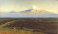
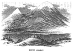
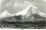
جبل أرارات (بالأرمينية: Արարատ أو مسيس Մասիս; تركية: Ağrı Dağı)، هو هو أعلى قمة جبلية (5165 م) بتركيا. جبل أرارات بركان نائم تغطيه الثلوج، يقع في شمال منطقة شرق الأناضول بمحافظة أغري، على بعد 16 كم من الحدود مع إيران و 32 كلم من الحدود مع أرمينيا.
يبلغ قطر جبل أرارات حوالي 40 كيلومتر يحاذي حدود إيران وتركيا وأرمينيا وأذربيجان. وله قمتان: ماسيس الكبير (أعلى قمة في هضبة أرمينيا بارتفاعِ 5.137)، وماسيس الصغير أقل ارتفاعاً (بارتفاعِ 3.896). وتشكل الجبل نتيجة لثورات البركانية وكميات الحمم. سجل آخر نشاط زلزالي في شهر يوليو من سنة 1840.


يرتبط جبال أرارات بعدة ديانات حيث طبقاً لكتابِ التكوينِ، فقد استقرت سفينة نوح على قمته، كما يحظى بمكانة رفيعة لدى الأرمن، حيث يرتبط بالقومية الأرمنية منذ عصور ما قبل الميلاد.
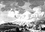
تمكن فريدرش پاروت (ابن أول رئيس لجامعة تارتو بإستونيا) لأول مرة من تسلق الجبل والوصول لقمته برفقة أربعة من الطلبة. كان ذلك سنة 1829.
الحدود السياسية
Mount Ararat forms a near-quadripoint between Turkey, Armenia, Iran, and the Nakhchivan exclave of Azerbaijan. Its summit is located some 16 km (10 mi) west of both the Iranian border and the border of the Nakhchivan exclave of Azerbaijan, and 32 km (20 mi) south of the Armenian border. The Turkish–Armenian–Azerbaijani and Turkish–Iranian–Azerbaijani tripoints are some 8 km apart, separated by a narrow strip of Turkish territory containing the E99 road which enters Nakhchivan at 39°39′19″N 44°48′12″E / 39.6553°N 44.8034°E.
From the 16th century until 1828 the range was part of the Ottoman-Persian border; Great Ararat's summit and the northern slopes, along with the eastern slopes of Little Ararat were controlled by Persia. Following the 1826–28 Russo-Persian War and the Treaty of Turkmenchay, the Persian controlled territory was ceded to the Russian Empire. Little Ararat became the point where the Turkish, Persian, and Russian imperial frontiers converged.[5] The current international boundaries were formed throughout the 20th century. The mountain came under Turkish control during the 1920 Turkish–Armenian War.[6] It formally became part of Turkey according to the 1921 Treaty of Moscow and Treaty of Kars.[7] In the late 1920s, Turkey crossed the Iranian border and occupied the eastern flank of Lesser Ararat as part of its effort to quash the Kurdish Ararat rebellion,[8] during which the Kurdish rebels used the area as a safe haven against the Turkish state.[9] Iran eventually agreed to cede the area to Turkey in a territorial exchange.[8][10] The Iran-Turkey boundary skirts east of Lesser Ararat, the lower peak of the Ararat massif.
اعتبارا من 2004[تحديث] the mountain is open to climbers only with "military permission". The procedure to obtain the permission involves submitting a formal request to a Turkish embassy for a special "Ararat visa", and it is mandatory to hire an official guide from the Turkish Federation for Alpinism. Access is still limited, even for climbers who obtain the necessary permission, and those who venture off the approved path may be fired upon without warning.[11]
الأسماء
.jpg&filetimestamp=20220706194633&)


Ararat (Western Armenian pronunciation: Ararad) is the Biblical Hebrew name (אררט ʾrrṭ; Tiberian vocalization אֲרָרָט ʾărārāṭ; DSS הוררט hōrārāṭ),[12] cognate with Assyrian Urartu,[13] of a kingdom that existed in the Armenian Highlands in the 9th–6th centuries BC. German orientalist and Bible critic Wilhelm Gesenius speculated that the word "Ararat" came from Arjanwartah, an unattested Sanskrit word without any clear cognates, supposedly meaning "holy ground."[14][15] Some Armenian historians, such as Ashot Melkonyan, link the origin of the word "Ararat" to the root of the endonym of the indigenous peoples of the Armenian Highland ("ar–"), including the Armenians.[16][17] The mountain is known as Ararat in European languages,[18][19] however, none of the native peoples have traditionally referred to the mountain by that name.[20] In classical antiquity, particularly in Strabo's Geographica, the peaks of Ararat were known in ancient Greek as Ἄβος (Abos) and Νίβαρος (Nibaros).[أ] This mountain was not called by the name Ararat until the Middle Ages; early Armenian historians considered the biblical Ararat to be in Corduene.[25][26]
The traditional Armenian name is Masis (Մասիս [maˈsis]; sometimes Massis).[27][20] However, nowadays, the terms Masis and Ararat are both widely, often interchangeably, used in Armenian.[28][ب] The folk etymology expressed in Movses Khorenatsi's History of Armenia derives the name from king Amasya, the great-grandson of the legendary Armenian patriarch Hayk, who is said to have called the mountain Masis after himself.[33][34] According to Russian orientalist Anatoly Novoseltsev the word Masis derives from Middle Persian masist, "the largest."[35] According to Armenian historian Sargis Petrosyan the mas root in Masis means "mountain", cf. Proto-Indo-European *mņs-.[34] According to archaeologist Armen Petrosyan, the name originates from the Māšu (Mashu) mountain mentioned in the Epic of Gilgamesh, which sounded like Māsu in Assyrian.[36] According to this theory, the name meant "twin," referring to the twin peaks of the mountain. Erkuahi, a land mentioned in Urartian texts and identified with Mt. Ararat, could reflect the native Armenian-language form of this same name (compare to Armenian erku (երկու, meaning "two")).[37]
The Turkish name is Ağrı Dağı [aːɾɯ da.ɯ], تركية عثمانية: اغـر طاغ Ağır Dağ), i.e. "Mountain of Ağrı". Ağrı literally translates to "pain" or "sorrow".[18][35][38][39] This name has been known since the late Middle Ages.[35] Greater and Lesser Ararat are known as Büyük Ağrı and Küçük Ağrı, respectively. The Persian name is کوه نوح, [ˈkuːhe ˈnuːh], Kūh-e Nūḥ,[5] literally the "mountain of Noah".[18][27] The Kurdish name of the mountain is Çiyayê Agirî[40][41] [t͡ʃɪjaːˈje aːgɪˈriː], which translates to "fiery mountain".[42]
الجغرافيا
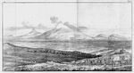
Mount Ararat is located in the Eastern Anatolia Region of Turkey between the provinces of Ağrı and Iğdır, near the border with Iran, Armenia and Nakhchivan exclave of Azerbaijan, between the Aras and Murat rivers.[1] The Serdarbulak lava plateau, at 2600 meters of elevation, separates the peaks of Greater and Little Ararat.[43] Mount Ararat's summit is located some 16 km (10 mi) west of the Turkey-Iran border and 32 km (20 mi) south of the Turco-Armenian border. The Ararat plain runs along its northwest to western side.
الارتفاع
Ararat is the third most prominent mountain in West Asia.
An elevation of 5،165 m (16،946 ft) for Mount Ararat is given by some encyclopedias and reference works such as Merriam-Webster's Geographical Dictionary and Encyclopedia of World Geography.[44][45][46][47] However, a number of sources, such as the United States Geological Survey and numerous topographic maps indicate that the alternatively widespread figure of 5،137 m (16،854 ft) is probably more accurate.[48][49] The current elevation may be as low as 5،125 m (16،814 ft) due to the melting of its snow-covered ice cap.[50]

القمة الجليدية

The ice cap on the summit of Mount Ararat has been shrinking since at least 1957. In the late 1950s, Blumenthal observed that there existed 11 outlet glaciers emerging from a summit snow mass that covered about 10 km2 (3.9 sq mi).[51] At that time, it was found that the present glaciers on the summit of Ararat extend as low as an elevation of 3،900 متر (12،800 ft) on the north-facing slope, and an elevation of 4،200 متر (13،800 ft) on its south-facing slope.[51] Using pre-existing aerial imagery and remote sensing data, Sarıkaya and others studied the extent of the ice cap on Mount Ararat between 1976 and 2011.[40][52] They discovered that this ice cap had shrunk to 8.0 km2 (3.1 sq mi) by 1976 and to 5.7 km2 (2.2 sq mi) by 2011. They calculated that between 1976 and 2011, the ice cap on top of Mount Ararat had lost 29% of its total area at an average rate of ice loss of 0.07 km2 (0.027 sq mi) per year over 35 years. This rate is consistent with the general rates of retreat of other Turkish summit glaciers and ice caps that have been documented by other studies.[52] According to a 2020 study by Yalcin, "if the glacial withdrawals continue with the same acceleration, the permanent glacier will likely turn into a temporary glacier by 2065."[53]
Blumenthal estimated that the snow line had been as low as 3،000 متر (9،800 ft) in elevation during the Late Pleistocene.[51] Such a snow line would have created an ice cap of 100 km2 (39 sq mi) in extent. However, he observed a lack of any clear evidence of prehistoric moraines other than those which were close to the 1958 glacier tongues. Blumenthal explained the absence of such moraines by the lack of confining ridges to control glaciers, insufficient debris load in the ice to form moraines, and their burial by later eruptions. Years later, Birman observed on the south-facing slopes a possible moraine that extends at least 300 متر (980 ft) in altitude below the base of the 1958 ice cap at an elevation of 4،200 متر (13،800 ft).[54] He also found two morainal deposits that were created by a Mount Ararat valley glacier of Pleistocene, possibly Wisconsinan (Last Glacial Maximum) age, downvalley from Lake Balık. The higher moraine lies at an altitude of about 2،200 متر (7،200 ft) and the lower moraine lies at an altitude of about 1،800 متر (5،900 ft). The lower moraine occurs about 15 كيلومتر (9.3 mi) downstream from Lake Balık. Both moraines are about 30 متر (98 ft) high. It is suspected that Lake Balık occupies a glacial basin.[54]
الجيولوجيا
Mount Ararat is a polygenic, compound stratovolcano. Covering an area of 1،100 km2 (420 sq mi), it is the largest volcanic edifice within the region. Along its northwest–southeast trending long axis, Mount Ararat is about 45 كيلومتر (28 mi) long and is about 30 كيلومتر (19 mi) long along its short axis. It consists of about 1،150 km3 (280 cu mi) of dacitic and rhyolitic pyroclastic debris and dacitic, rhyolitic, and basaltic lavas.[55]
Mount Ararat consists of two distinct volcanic cones, Greater Ararat and Lesser Ararat (Little Ararat). The western volcanic cone, Greater Ararat, is a steep-sided volcanic cone that is larger and higher than the eastern volcanic cone. Greater Ararat is about 25 كيلومتر (16 mi) wide at the base and rises about 3 كيلومتر (1.9 mi) above the adjacent floors of the Iğdir and Doğubeyazıt basins. The eastern volcanic cone, Lesser Ararat, is 3،896 متر (12،782 ft) high and 15 كيلومتر (9.3 mi) across. These volcanic cones, which lie 13 كيلومتر (8.1 mi) apart, are separated by a wide north–south-trending crack. This crack is the surface expression of an extensional fault. Numerous parasitic cones and lava domes have been built by flank eruptions along this fault and on the flanks of both of the main volcanic cones.[55]
Mount Ararat lies within a complex, sinistral pull-apart basin that originally was a single, continuous depression. The growth of Mount Ararat partitioned this depression into two smaller basins, the Iğdir and Doğubeyazıt basins. This pull-apart basin is the result of strike-slip movement along two en-echelon fault segments, the Doğubeyazıt–Gürbulak and Iğdir Faults, of a sinistral strike–slip fault system. Tension between these faults not only formed the original pull-apart basin, but created a system of faults, exhibiting a horsetail splay pattern, that control the position of the principal volcanic eruption centers of Mount Ararat and associated linear belt of parasitic volcanic cones. The strike-slip fault system within which Mount Ararat is located is the result of north–south convergence and tectonic compression between the Arabian Platform and Laurasia that continued after the Tethys Ocean closed during the Eocene epoch along the Bitlis–Zagros suture.[55][56][57]
التاريخ الجيولوجي


During the early Eocene and early Miocene, the collision of the Arabian platform with Laurasia closed and eliminated the Tethys Ocean from the area of what is now Anatolia. The closure of these masses of continental crust collapsed this ocean basin by middle Eocene and resulted in a progressive shallowing of the remnant seas, until the end of the early Miocene. Post-collisional tectonic convergence within the collision zone resulted in the total elimination of the remaining seas from East Anatolia at the end of early Miocene, crustal shortening and thickening across the collision zone, and uplift of the East Anatolian–Iranian plateau. Accompanying this uplift was extensive deformation by faulting and folding, which resulted in the creation of numerous local basins. The north–south compressional deformation continues today as evidenced by ongoing faulting, volcanism, and seismicity.[55][56][58]
Within Anatolia, regional volcanism started in the middle-late Miocene. During the late Miocene–Pliocene period, widespread volcanism blanketed the entire East Anatolian–Iranian plateau under thick volcanic rocks. This volcanic activity has continued uninterrupted until historical times. Apparently, it reached a climax during the latest Miocene–Pliocene, 6 to 3 Ma. During the Quaternary, the volcanism became restricted to a few local volcanoes such as Mount Ararat. These volcanoes are typically associated with north–south tensional fractures formed by the continuing north–south shortening deformation of Anatolia.[55]
In their detailed study and summary of the Quaternary volcanism of Anatolia, Yilmaz et al. recognized four phases to the construction of Mount Ararat from volcanic rocks exposed in glacial valleys deeply carved into its flanks.[55] First, they recognized a fissure eruption phase of Plinian-subPlinian fissure eruptions that deposited more than 700 متر (2،300 ft) of pyroclastic rocks and a few basaltic lava flows. These volcanic rocks were erupted from approximately north northwest–south southeast-trending extensional faults and fissures prior to the development of Mount Ararat. Second, a cone-building phase began when the volcanic activity became localized at a point along a fissure. During this phase, the eruption of successive flows of lava up to 150 متر (490 ft) thick and pyroclastic flows of andesite and dacite composition and later eruption of basaltic lava flows, formed the Greater Ararat cone with a low conical profile. Third, during a climatic phase, copious flows of andesitic and basaltic lavas were erupted. During this phase, the current cones of Greater and Lesser Ararat were formed as eruptions along subsidiary fissures and cracks and flank occurred. Finally, the volcanic eruptions at Mount Ararat transitioned into a flank eruption phase, during which a major north–south-trending fault offset the two cones that developed along with a number of subsidiary fissures and cracks on the volcano's flanks. Along this fault and the subsidiary fissures and cracks, a number of parasitic cones and domes were built by minor eruptions. One subsidiary cone erupted voluminous basalt and andesite lava flows. They flowed across the Doğubeyazıt plain and along the southerly flowing Sarısu River. These lava flows formed black ʻaʻā and pāhoehoe lava flows that contain well preserved lava tubes.[55] The radiometric dating of these lava flows yielded radiometric ages of 0.4, 0.48 and 0.81 Ma.[59] Overall, radiometric ages obtained from the volcanic rocks erupted by Mount Ararat range from 1.5 to 0.02 Ma.[55]
Recent volcanic and seismic activity
The chronology of Holocene volcanic activity associated with Mount Ararat is documented by either archaeological excavations, oral history, historical records, or a combination of these data, which provide evidence that volcanic eruptions of Mount Ararat occurred in 2500–2400 BC, 550 BC, possibly in 1450 AD and 1783 AD, and definitely in 1840 AD. Archaeological evidence demonstrates that explosive eruptions and pyroclastic flows from the northwest flank of Mount Ararat destroyed and buried at least one Kura–Araxes culture settlement and caused numerous fatalities in 2500–2400 BC. Oral histories indicated that a significant eruption of uncertain magnitude occurred in 550 BC and minor eruptions of uncertain nature might have occurred in 1450 AD and 1783 AD.[3][57][58][60] According to the interpretation of historical and archaeological data, strong earthquakes not associated with volcanic eruptions also occurred in the area of Mount Ararat in 139, 368, 851–893, and 1319 AD. During the 139 AD earthquake, a large landslide that caused many casualties and was similar to the 1840 AD landslide originated from the summit of Mount Ararat.[57][58][61]
1840 eruption
A phreatic eruption occurred on Mount Ararat on July 2, 1840 and pyroclastic flow from radial fissures on the upper north flank of the mountain and a possibly associated earthquake of magnitude 7.4 that caused severe damage and numerous casualties. Up to 10,000 people died in the earthquake, including 1,900 villagers in the village of Akhuri (Armenian: Akori, modern Yenidoğan) who were killed by a gigantic landslide and subsequent debris flow. In addition, this combination of landslide and debris flow destroyed the Armenian monastery of St. Jacob near Akori, the town of Aralik, several villages, and Russian military barracks. It also temporarily dammed the Sevjur (Metsamor) River.[3][57][58][60]
تسلق جبل أرارات
The 13th century missionary William of Rubruck wrote that "Many have tried to climb it, but none has been able."[62]
Religious objections
The Armenian Apostolic Church was historically opposed to ascents of Ararat on religious grounds. Thomas Stackhouse, an 18th-century English theologian, noted that "All the Armenians are firmly persuaded that Noah's ark exists to the present day on the summit of Mount Ararat, and that in order to preserve it, no person is permitted to approach it."[63] In response to its first ascent by Parrot and Abovian, one high-ranking Armenian Apostolic Church clergyman commented that to climb the sacred mountain was "to tie the womb of the mother of all mankind in a dragonish mode." By contrast, in the 21st century to climb Ararat is "the most highly valued goal of some of the patriotic pilgrimages that are organized in growing number from Armenia and the Armenian diaspora."[64]
أول صعود مسجل في العصور الحديثة
أحدث التسلقات
| التاريخ | المتسلق/ون | ملاحظات |
|---|---|---|
| 9 أكتوبر 1829 | Friedrich Parrot and Khachatur Abovian | First ascent of the summit of Mount Ararat Started from the monastery of St. Jacob (Surb Hakob) and made the ascent by the north-western slope.[4] |
| 5 أغسطس 1834 | Kozma Spassky-Avtonomov | Climbed Ararat from Akori, to prove that the stars could be seen at noon and used ice from the summit to baptize his son.[65] |
| 8–9 أغسطس 1835 | Karl Behrens[65] | Imperial Russian Geographical Society attested to the expedition. |
| 29 يوليو 1845 | Otto Wilhelm Hermann von Abich | Armenian guide led him up the southeastern face from Sardar Bulak, a Cossack station with a well, located in the middle of the wide semicircular valley or sloping plain between Greater and Lesser Ararat. Abich I & II Glaciers named after him.[65] Climbed western and eastern summit.[4] They climbed from Sardar Bulak. |
| 1846 | Henry Danby Seymour | With 2 Armenians and a Cossack officer Climbed from New Akori.[65] |
| 1–9 أغسطس 1850 | Iosif Khodko (Иосиф Ходько), P.H. Moritz, N. V. Khanikov and many others | Ascended from Sardar Bulak. Six days were spent on top of Mt. Ararat[65] |
| 29 يونيو 1856 | English Major Robert Stuart | With major Alick J. Fraser, Reverend Walter Thursby, James Theobald, John Evans of Darley Abbey. They climbed from Bayazid. |
| 31 أغسطس 1876 | James Bryce | He was alone. And he founded a timber at 3965 m (13,500 ft)[65] He climbed from Sardar Bulak. |
| 1878 | G. P. Baker | He climbed from Sardar Bulak. |
| 1882 | Sivoloboff | |
| 13 أغسطس 1888 | Yevgeniy Markov | With Ivan Kovalewski and Mosokevich (young lady).[65] They climbed from Saradar Bulak. |
| 1888 | Semenoff | |
| 1889 | Raphalovich and others | He climbed from Sardar Bulak. |
| 4 يوليو 1891 | Thomas Gaskell Allen, Jr. and William Lewis Sachtleben [4] | First American ascent of the summit of Mount Ararat [4] He climbed from Bayazid. |
| 1893 | Postukhoff | He climbed from Sardar Bulak. |
| أكتوبر 1893 | H. F. B. Lynch | With Rudolph Taugwalder[65] and H. B. Lynch |
| 1897 | Herr A. Oswald[65] Eine Besteigung des Ararat, Alpenclub, Berne, 1899–1900, vol. XXXV. pp. 157–183 | |
| 5 سبتمبر 2009 | Erik Weihenmayer, Edwin Albert Weihenmayer, Gökmen Önay, Bahar Ganjavi, Behrouz Khabbaz Beheshti, Seyed Hassan Moghimi[66] | Erik Weihenmayer is first known blind person to reach the summit of Mount Ararat. Group guided by Gökmen Önay from إيطاليا. Hassan Moghimi Iran, born without one hand and is a professional cyclist.[66] |
مسارات، تصريحات وأدلة التسلق

أهميته في الثقافة الأرمنية

أما اسم ماسيس الذي يشير إلى كلتا القمتين فهو مشتق من اسم الملك أماسيا الأرمني، ابن حفيد أبو القومية الأرمنية هايك. وتتوسط صورة الجبل حالياً شعار جمهورية أرمينيا بعد نيل استقلالها عام 1991، لما لآرارات من مكانة خاصة لدى الأرمن في الوطن الأم، أو الناجين من المذبحة الأرمنية والمنتشرين في دول الاغتراب.
تصويره في الرموز
| Image | وصف البلد، المقاطعة، المنطقة |
|---|---|

|
City of Tiflis (1843) coat of arms on the left upper corner |

|
Democratic Republic of Armenia (1918-1920) coat of arms in the center |

|
Transcaucasian Socialist Federative Soviet Republic (1922-1936) coat of arms |

|
Armenian Soviet Socialist Republic (1937-1991) emblem |

|
Republic of Armenia (established 1991) coat of arms in the center |
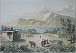
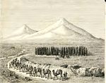
معرض الصور


_view_from_plane_under_naxcivan_sharur.jpg&filetimestamp=20150804224612&)

الفن
-
 Gevorg Bashinjaghyan, 1912

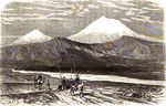
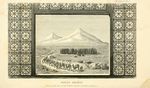
التاريخ
-
 1812
1812 -
 1822
1822 -
 1823
1823 -
 1838
1838 -
 1859
1859 -
 1861
1861 -
 1869
1869 -
 1876
1876 -
 1876
1876
.jpg&filetimestamp=20150807000039&)
.jpg&filetimestamp=20150807000216&)


._Floriant_Gille._Lettres_sur_le_Caucase_et_la_Crim%C3%A9e._1859.jpg&filetimestamp=20150812213237&)


.jpg&filetimestamp=20150812183953&)

انظر أيضاً
- 96205 أرارات، هو كويكب على اسم جبل أرارات.
- القمم البركانية السبعة
الهوامش
- ^ The only permitted route to climb Mount Ararat begins in Doğubeyazıt, optionally by automobile. Ministry of Culture and Tourism (2005).
المصادر
- ^ أ ب "Ağrı – Mount Ararat". Republic of Turkey Ministry of culture and tourism (kultur.gov.tr). 2005.
- ^ Bjørstad, Petter E. (August 2007). "Ararat Trip Report". ii.uib.no. University of Bergen. Archived from the original on 21 October 2017.
- ^ أ ب ت خطأ استشهاد: وسم
<ref>غير صحيح؛ لا نص تم توفيره للمراجع المسماةSiebertOther2010a - ^ أ ب ت ث ج Early American Expedition Of Mount Ararat
- ^ أ ب خطأ استشهاد: وسم
<ref>غير صحيح؛ لا نص تم توفيره للمراجع المسماةiranicaonline - ^ Hovannisian, Richard G. (1973). "Armenia and the Caucasus in the Genesis of the Soviet-Turkish Entente". International Journal of Middle East Studies. 4 (2): 129–147. doi:10.1017/s0020743800027409. JSTOR 162238.
...Nationalist Turkey annexed the Surmalu district, embracing Mount Ararat, the historic symbol of the Armenian people.
- ^ de Waal, Thomas (2015). Great Catastrophe: Armenians and Turks in the Shadow of Genocide. Oxford University Press. p. 86. ISBN 978-0199350698.
- ^ أ ب Parrot 2016, p. xxiii.
- ^ Yildiz, Kerim; Taysi, Tanyel B. (2007). The Kurds in Iran: The Past, Present and Future. London: Pluto Press. p. 71. ISBN 978-0745326696.
- ^ Tsutsiev, Arthur (2014). Atlas of the Ethno-Political History of the Caucasus. Translated by Nora Seligman Favorov. New Haven: Yale University Press. p. 92. ISBN 978-0300153088.
- ^ Westerman, Frank (2008-12-02). Ararat: In Search of the Mythical Mountain. Random House. ISBN 978-1-4070-1951-2.
- ^ Frymer, Tikva S.; Sperling, S. David (2008). "Ararat, Armenia". Encyclopaedia Judaica (2nd ed.). view online Archived 2015-12-22 at the Wayback Machine
- ^ Arnold 2008, p. 104.
- ^ Rogers, Thorold (1884). Bible Folk-Lore: A Study in Comparative Methodology. London: Kegan Paul, Trench, Trübner & Co. p. 21.
Ararat was thought by Gesenius to be a Sanskrit word (Arjawartah), signifying "holy ground,"...
- ^ Bonomi, Joseph (1866). "Ararat". In Fairbairn, Patrick (ed.). The Imperial Bible-Dictionary: Historical, Biographical, Geographical and Doctrinal - Volume I. Glasgow: Blackie and Son. p. 118.
- ^ خطأ استشهاد: وسم
<ref>غير صحيح؛ لا نص تم توفيره للمراجع المسماةAvakyan - ^ Teryan, Anzhela (31 August 2011). "Երևան անվան ծագման մասին [On the origin of the name Yerevan]" (in الأرمنية). Yerevan History Museum. Archived from the original on 7 June 2018.
Հայտնի է, որ Հայկական լեռնաշխարհում Ար-ով /նաև էր, Ուր, Իր/ սկսվող բազմաթիվ աշխարհագրական (նաև անձնական) անուններ կան. Արարատ, Արագած, Արա, Արաքս, Արածանի, Արմավիր, Արճեշ…: Այս երևույթը կապված է Արարչի /Ար Աստված/ և նրա պաշտանմունքն ունեցող Հայկական լեռնաշխարհի բնիկների՝ հայ-արմենների՝ արմեն, նաև արի /Էրի/ անվան հետ:
- ^ أ ب ت ث خطأ استشهاد: وسم
<ref>غير صحيح؛ لا نص تم توفيره للمراجع المسماةHewsen - ^ Smith, Eli (1832). "Foreign Correspondence". The Biblical Repository and Classical Review: 203.
...called by the Armenians, Masis, and by Europeans generally Ararat...
- ^ أ ب Bryce 1877, p. 198.
- ^ أ ب Petrossyan 2010, p. 220.
- ^ Jones, Horace Leonard, ed. (1928). "XI.14". The Geography of Strabo. Harvard University Press. view Book XI, Chapter 14 online
- ^ Minorsky, V. (1944). "Roman and Byzantine Campaigns in Atropatene". Bulletin of the School of Oriental and African Studies, University of London. 11 (2): 243–265. doi:10.1017/S0041977X0007244X. JSTOR 609312.
Although what Strabo means by Abos seems to be the southern spurs of Mt. Ararat...
- ^ خطأ استشهاد: وسم
<ref>غير صحيح؛ لا نص تم توفيره للمراجع المسماةFürst - ^ Alexander Agadjanian (15 April 2016). Armenian Christianity Today: Identity Politics and Popular Practice. Routledge. p. 14. ISBN 978-1-317-17857-6.
It is worth noting that, contrary to Armenian Apostolic Church discourse and popular knowledge, it was probably as late as the beginning of the second millennium AD when the localization of the biblical Mount Ararat was permanently moved from the highlands hemming upper Mesopotamia to Mount Masis in the heart of historical Armenian territory.
- ^ Petrosyan, Hamlet (2001). "The Sacred Mountain". In Levon Abrahamian and Nancy Sweezy (ed.). Armenian Folk Arts, Culture, and Identity. Indiana University Press. p. 36. ISBN 978-0-253-33704-7.
When Armenians were first introduced to the biblical story of the flood, there was no special interest in the location of Mount Ararat. Most Armenian historians in the Early Middle Ages accepted the generally held Christian opinion of the time that Ararat was located near Mesopotamia in Korduk (Corduene), the southernmost province of Armenia. However, when European Crusaders on their way to free the Holy Land from Moslem rule appeared in the region in the 11th century, Armenian hopes for similar "salvation" helped to catalyze the final identification of Masis with Ararat. From the 12th century on, Catholic missionaries and other travelers to the region returned to Europe with the same story: that the mountain where the Ark landed was towering in the heart of Armenia.
- ^ أ ب خطأ استشهاد: وسم
<ref>غير صحيح؛ لا نص تم توفيره للمراجع المسماةJewEnc - ^ Avetisyan, Kamsar (1979). Հայրենագիտական էտյուդներ [Armenian studies sketches] (in الأرمنية). Yerevan: Sovetakan grogh. p. 14. Archived from the original on 2015-11-27. Retrieved 2015-11-24.
Հայերը Արարատը անվանում են Մասիս...
- ^ أ ب خطأ استشهاد: وسم
<ref>غير صحيح؛ لا نص تم توفيره للمراجع المسماةencyclopedia.am - ^ خطأ استشهاد: وسم
<ref>غير صحيح؛ لا نص تم توفيره للمراجع المسماةPeroomian - ^ خطأ استشهاد: وسم
<ref>غير صحيح؛ لا نص تم توفيره للمراجع المسماةDelitzsch - ^ Hovhannisyan, L. Sh. (2016). Բառերի մեկնությունը հինգերորդ դարի հայ մատենագրուտյան մեջ [Interpretation of words in 5th century Armenian manuscripts] (in الأرمنية). Yerevan: Gitutyun. p. 61.
- ^ Khorenatsi 1978, p. 91.
- ^ أ ب Petrossyan 2010, p. 221.
- ^ أ ب ت Novoseltsev 1978.
- ^ Petrosyan 2016, p. 72.
- ^ Armen Petrosyan. "Biblical Mt. Ararat: Two Identifications." Comparative Mythology. December 2016. Vol. 2. Issue 1. pp. 68-80.
- ^ Dalton, Robert H. (2004). Sacred Places of the World: A Religious Journey Across the Globe. Abhishek. p. 133. ISBN 9788182470514.
The Turkish name for Mt Ararat is Agri Dagi (which means mountain of pain).
- ^ McCarta, Robertson (1992). Turkey (2nd ed.). Nelles. p. 210. ISBN 9783886184019.
(Turkish: Agri Dagi, "Mount of Sorrows")
- ^ أ ب Sarıkaya, Mehmet Akif (2012). "Recession of the ice cap on Mount Ağrı (Ararat), Turkey, from 1976 to 2011 and its climatic significance". Journal of Asian Earth Sciences. 46: 190–194. Bibcode:2012JAESc..46..190S. doi:10.1016/j.jseaes.2011.12.009.
- ^ "Xortekî tirk dixwaze bi bîsîklêtê xwe ji çiyayê Agirî berde xwarê" (in الكردية). Rudaw Media Network. 19 June 2014. Archived from the original on 17 November 2015. Retrieved 16 November 2015.
- ^ Waugh, Alexander (27 August 2008). "Will he, won't He? Ararat by Frank Westerman, translated by Sam Garrett". The Spectator. Archived from the original on 11 August 2016. Retrieved 22 June 2016.
- ^ "Mount Agri (Ararat)". anatolia.com. 2003. Retrieved 26 December 2020.
the Serdarbulak lava plateau (2600 m) stretches out between the two pinnacles.
- ^ Merriam-Webster's Geographical Dictionary (3rd ed.). Springfield, Massachusetts: Merriam-Webster. 2001. p. 63. ISBN 9780877795469.
- ^ Haggett, Peter, ed. (2002). "Turkey". Encyclopedia of World Geography: The Middle East (2nd ed.). Marshall Cavendish. p. 2026. ISBN 978-0-7614-7289-6.
- ^ Hartemann, Frederic; Hauptman, Robert (2005). The Mountain Encyclopedia. Lanham, Maryland: Taylor Trade. p. 17. ISBN 978-0-8108-5056-9.
- ^ Galichian, Rouben (2004). Historic Maps of Armenia: The Cartographic Heritage. I.B. Tauris. p. 26. ISBN 978-1-86064-979-0.
- ^ Kurter, Ajun (20 May 1988). "Glaciers of the Middle East and Africa: Turkey" (PDF). United States Geological Survey Professional Paper 1386-G. Archived (PDF) from the original on 11 October 2017.
{{cite web}}: Check|author-link1=value (help) - ^ "Maps of Ararat - Ararat Map, Turkey (Agri Dagi)". turkeyodyssey.com. Terra Anatolia. Archived from the original on 2007-02-25.
- ^ According to Petter E. Bjørstad, Head of Informatics Department at the University of Bergen (Norway). "Ararat Trip Report". ii.uib.no. August 2007. Archived from the original on 11 October 2017.
I measured the summit elevation, averaging more than 300 samples in my GPS, it settled on 5132 meter, 5 meter lower than the often quoted 5137 figure. This clearly shows that the 5165 meter elevation that many sources use is wrong. The summit is a snow ridge with no visible rock anywhere. Thus, the precise elevation will change with the seasons and could definitely be influenced by climate change (global warming). Later GPS measurements in Iran suggested that the GPS data may be about 10 meter too high also in this part of the world. This would in fact point in the direction of a true Ararat elevation around 5125 meter.
- ^ أ ب ت Blumenthal, M. M. (1958). "Vom Agrl Dag (Ararat) zum Kagkar Dag. Bergfahrten in nordostanatolischen Grenzlande". Die Alpen (in الألمانية). 34: 125–137.
- ^ أ ب Sarıkaya, Mehmet Akif; Tekeli, A. E. (2014). "Satellite inventory of glaciers in Turkey". In J. S. Kargel; et al. (eds.). Global Land Ice Measurements from Space. New York: Springer-Verlag. pp. 465–480. ISBN 978-3540798170.
- ^ Yalcin, Mustafa (2020). "A GIS-Based Multi-Criteria Decision Analysis Model for Determining Glacier Vulnerability". ISPRS International Journal of Geo-Information. 9 (3): 180. Bibcode:2020IJGI....9..180Y. doi:10.3390/ijgi9030180.
- ^ أ ب Birman, J. H. (1968). "Glacial Reconnaissance in Turkey". Geological Society of America Bulletin. 79 (8): 1009–1026. Bibcode:1968GSAB...79.1009B. doi:10.1130/0016-7606(1968)79[1009:GRIT]2.0.CO;2.
- ^ أ ب ت ث ج ح خ د خطأ استشهاد: وسم
<ref>غير صحيح؛ لا نص تم توفيره للمراجع المسماةYilmazOther1998a - ^ أ ب Dewey, J. F.; Hempton, M. R.; Kidd, W. S. F.; Saroglum, F.; Sengὃr, A. M. C. (1986). "Shortening of continental lithosphere: the neotectonics of Eastern Anatolia – a young collision zone". In Coward, M. P.; Ries, A. C. (eds.). Collision Tectonics. Geological Society of London. pp. 3–36.
- ^ أ ب ت ث Karakhanian, A.; Djrbashian, R.; Trifonov, V.; Philip, H.; Arakelian, S.; Avagian, A. (2002). "Holocene–Historical Volcanism and Active Faults as Natural Risk Factor for Armenia and Adjacent Countries". Journal of Volcanology and Geothermal Research. 113 (1): 319–344. Bibcode:2002JVGR..113..319K. doi:10.1016/s0377-0273(01)00264-5.
- ^ أ ب ت ث خطأ استشهاد: وسم
<ref>غير صحيح؛ لا نص تم توفيره للمراجع المسماةKarakhanianOther2004a - ^ Allen, Mark B.; Mark, Darren F.; Kheirkhah, Monireh; Barfod, Dan; Emami, Mohammad H.; Saville, Christopher (2011). "40Ar/39Ar dating of Quaternary lavas in northwest Iran: constraints on the landscape evolution and incision rates of the Turkish–Iranian plateau" (PDF). Geophysical Journal International. 185 (3): 1175–1188. Bibcode:2011GeoJI.185.1175A. doi:10.1111/j.1365-246x.2011.05022.x.
- ^ أ ب خطأ استشهاد: وسم
<ref>غير صحيح؛ لا نص تم توفيره للمراجع المسماةАрутюнянOthers2005a - ^ خطأ استشهاد: وسم
<ref>غير صحيح؛ لا نص تم توفيره للمراجع المسماةTaymazOther1991a - ^ خطأ استشهاد: وسم
<ref>غير صحيح؛ لا نص تم توفيره للمراجع المسماةWilliam of Rubruck - ^ Stackhouse, Thomas (1836). A History of the Holy Bible. Glasgow: Blackie and Son. p. 93.
- ^ Siekierski, Konrad (2014). ""One Nation, One Faith, One Church": The Armenian Apostolic Church and the Ethno-Religion in Post-Soviet Armenia". In Agadjanian, Alexander (ed.). Armenian Christianity Today: Identity Politics and Popular Practice. Ashgate Publishing. p. 14. ISBN 978-1-4724-1273-7.
- ^ أ ب ت ث ج ح خ د ذ Mount Ararat Search Expeditions & Early Ascents
- ^ أ ب Erik Weihenmayer's Blog
المراجع
- ^ Hewsen, Robert H. (2001), Armenia: A Historical Atlas (1st ed.), Chicago, IL: University of Chicago Press, ISBN 0-226-33228-4, http://www.press.uchicago.edu/Misc/Chicago/332284.html
- ^ Moses of Khoren; Thomson, Robert W. (1978). History of the Armenians. Cambridge, Massachusetts: Harvard University Press. ISBN 0-674-39571-9.
{{cite book}}: Cite has empty unknown parameter:|coauthors=(help)
وصلات خارجية
خطأ استشهاد: وسوم <ref> موجودة لمجموعة اسمها "lower-alpha"، ولكن لم يتم العثور على وسم <references group="lower-alpha"/>
- Pages using gadget WikiMiniAtlas
- CS1 الأرمنية-language sources (hy)
- CS1 الكردية-language sources (ku)
- CS1 الألمانية-language sources (de)
- Short description is different from Wikidata
- Articles with hatnote templates targeting a nonexistent page
- Coordinates on Wikidata
- Pages using infobox mountain with unknown parameters
- Articles containing أرمنية-language text
- Pages using Lang-xx templates
- مقالات فيها عبارات متقادمة منذ 2004
- جميع المقالات التي فيها عبارات متقادمة
- Pages with plain IPA
- Articles containing التركية العثماثية (1500-1928)-language text
- Articles containing فارسية-language text
- Pages using gallery with unknown parameters
- براكين طبقية في تركيا
- تضاريس محافظة إغدير
- تضاريس محافظة أغري
- رموز وطنية في أرمنيا
- أماكن مرسومة عل أوراق العملة التركية
- جبال أسطورية
- جبال تركيا
- قمم جبلية