منطقة شرق قزخستان
East Kazakhstan Region
| |
|---|---|
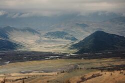 Bukhtarma river in East Kazakhstan | |
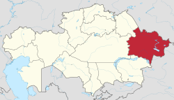 Map of Kazakhstan, location of East Kazakhstan Region highlighted | |
| الإحداثيات: 49°57′N 82°37′E / 49.950°N 82.617°E | |
| Country | |
| Established | 1932 |
| Capital | Oskemen |
| الحكومة | |
| • Akim | Daniyal Akhmetov |
| المساحة | |
| • الإجمالي | 283٬226 كم² (109٬354 ميل²) |
| التعداد (2020)[1] | |
| • الإجمالي | 1٬369٬597 |
| • الكثافة | 4٫8/km2 (13/sq mi) |
| منطقة التوقيت | UTC+6 (East) |
| • الصيف (التوقيت الصيفي) | UTC+6 (not observed) |
| Postal codes | 070000 |
| Area codes | +7 (722), +7 (723) |
| ISO 3166 code | KZ-VOS |
| لوحة السيارة | 16, F, U |
| Districts | 15 |
| Cities | 10 |
| Townships | 30 |
| Villages | 870 |
| الموقع الإلكتروني | akimvko |
منطقة شرق قزخستان (بالقزخية: Шығыс Қазақстан облысы؛ روسية: Восточно-Казахстанская область, romanized: Vostochno-Kazakhstanskaya oblast؛ إنگليزية: East Kazakhstan Region) هي منطقة في قزخستان. It occupies the easternmost part of Kazakhstan, and includes parts of the Irtysh River, Lake Markakol, and Lake Zaysan.[2] Its administrative center is Oskemen (also known as Ust'-Kamenogorsk).[2] The region borders Russia in the north and northeast and the People's Republic of China, via Xinjiang, in the south and southeast. The easternmost point of the Oblast is within about 50 kilometres of the westernmost tip of Mongolia;[citation needed] however, Kazakhstan and Mongolia do not share a common border, the two countries being separated by a small part of Russia and China.
On 17 March 2022, announced that region will be divided, creating the Abai Region.
The region was created by the merger of two Soviet-era Kazakhstan oblasts: the old Vostochno-Kazakhstanskaya (East Kazakhstan) Oblast and Semipalatinsk Oblast.
الجغرافيا
East Kazakhstan Region borders the Kazakh regions of Pavlodar Region to the northwest, منطقة قرغندة to the west, Almaty Region to the south, Russia's Altai Krai and Altai Republic to the north and China's Xinjiang Uyghur Autonomous Region to the east.[2]
The region occupies a very diverse range of geographic and climatic regions with the Altai Mountains in the east and the eastern margins of the Kazakh Steppe in the west of the region.[citation needed]
التاريخ
The territory of the East Kazakhstan region has been inhabited since ancient times. According to him , there are traces of ancient mines, irrigation systems, fortifications and settlements in the Altai , Zaisan basin , Tarbagatai and Sauyr ridges . At the beginning of the 15th century, after the Oirats conquered the upper part of the Irtysh River basin, it became part of the Dzungarian Khanate.
1758 After the destruction of the Dzungarian Khanate by Chinese troops, the Kalmyks moved to the other side of the Volga River. The Kazakh tribes, which had moved away from the Kalmyks and settled mainly in Saryarka, returned to their ancient settlements.
The tribes of the Middle Zhuz lived on the territory of the East Kazakhstan region in the 19th century : Naimans (clan Bura , Karatay , Kokzharly , Karakerey , Sadyr , Tortuyl ), Argyns ( Karakesek , Tarakty , Tobykty ), Kerei , Uaki.
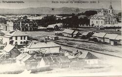
At the beginning of the 18th century, tsarist RussiaIn order to deepen the colonization of the Kazakh lands, the Kazakhs built a network of Irtysh fortifications on the territory of the present-day region, expelling the Kazakhs from their homeland. A system of fortifications and outposts was gradually established along this line, and later Cossack-Russian stanitsa ( Semipalatinsk in 1718, Ust-Kamenogorsk in 1720)., 1763 Bukhtarma fortifications) were built. Cossack-Russian settlements appeared on the right bank of the Irtysh and its tributaries. Ten kilometers of fertile land on both sides of the Irtysh River ("Irtysh Desiativstnaya strip") was taken from the Kazakhs and given to the use of the Cossack-Russians. That is, the Kazakhs were forbidden to settle closer than 10 km to the Irtysh River. The Kazakhs lost their most fertile lands and lost the names of their ancestral settlements, and were replaced by Russian names preserved on the pages of the map. All the tributaries, ravines and rivers that flow into the Irtysh River are named in Russian. The stations gradually moved south and southwest. 1826 Kokpekty fortress at the foot of Kalba ridge, 1831 Sergiopol Fortress, Shaueshek , near the right bank of the Ayagoz River, near the modern city of Ayagozstanitsa appeared along the way.
Along with Cossack-Russian colonization, Russians began to flee from the tsarist regime in the remote taiga valleys of the Altai Mountains. They were Kerzhaks (old-fashioned people) and workers and artisans who had fled the factories and mines of the Urals and Altai. They settled in the upper reaches of the Bukhtarma and its tributaries, and along the rivers Naryn and Kalzhyr . At that time Katon-Karagai, Belaya, Chernovaya, etc. villages appeared. In the 1860's, peasants from the inner provinces of Russia, known as the Poles, settled in the valleys of the Oba and Ulba rivers in northwestern Altai. At the end of the 18th century, the mining industry appeared within the Ore Altai. Here one after another Ridder (1784),Zyryanov (1794), Belousov (1797), Sokolny (1822), etc. non-ferrous metal mines were launched. In 1844, the Zyryanovsk mine became a raw material base for the Altai mines. In Russia, due to the abolition of the right of occupation, cheap labor was lost, and tech. The Altai mining industry, which needed to be restructured, began to decline sharply. It was exacerbated by the fall in the price of silver, which at that time was the main product of the Altai mining industry. With the closure of almost all Altai plants, the Altai mining area, some polymetallic mines are located in Australia, England, France, etc. concession to foreign capital.
From the end of the 19th century, the processing industry in Semipalatinsk began to develop. Its main industries were flour milling and wool washing. The harvested grain and wheat flour were shipped across the Irtysh to the Siberian Railway, about 600 km away. The wool, which was collected from the whole eastern part of Kazakhstan and partly from the Xinjiang region (China), was washed in Semipalatinsk and after the first processing was delivered to European Russian textile factories. In addition to these two industries, large settlements located in different parts of the region also had vodka and beer brewing, as well as tanning, sewing, oil and soap production. Fishing in the Zaisan , Markakol , Alakol lakes and the Irtysh River, Ridder andAltai carpentry and blacksmithing took place. In the second half of the 19th century, the importance of shipping on the Irtysh River increased. Ships ascended from Semipalatinsk to Omsk, along Lake Zaisan and the Black Irtysh.
On August 26, 1920, the Decree of the All- Russian Central Executive Committee and the Council of People's Commissars of the RSFSR "On the formation of the Kirghiz (Kazakh) Autonomous Socialist Soviet Republic " was adopted, which included the Semipalatinsk region with the counties: Pavlodar , Semipalatinsk , Ust-Kamenogorsk , Zaysan and Karkaralinsky . The Semipalatinsk region (since December 11, 1920 - the province) until April 1921 was subordinate to Sibrevkom . On the basis of the decision of the All-Russian Central Executive Committee of June 13, 1921, from the Altai province to the Semipalatinsk province were transferredBukhtarma and part of Zmeinogorsk districts [5] .
On January 17, 1928, from the Semipalatinsk, Ust-Kamenogorsk, Bukhtarma, Zaisan districts of the Semipalatinsk province and part of the Lepsinsky district of the Jetysuy province , the Semipalatinsk district was formed , consisting of 23 districts. On December 17, 1930, the district, like all other districts of the Kazak ASSR , was abolished, its districts were enlarged and transferred to direct subordination to the republican authorities [6] .
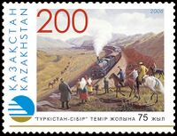
East Kazakhstan region did not develop significantly in the first years of Soviet rule. Only in the 30s of the 20th century, due to the organization of agriculture and the implementation of the campaign to industrialize the country, Ore Altai became the largest center of non-ferrous metallurgy and mining in Kazakhstan. A variety of settlements appeared in the Kazakh parts of Altai. The further development of the region's economy was significantly influenced by the construction of the Turkestan-Siberian railway and the Lokot-Ridder and Ust-Kamenogorsk-Zyryanovsk railways, increasing the transport value of the Irtysh River, the construction of an improved bypass called the Eastern Ring Road.
In the years after the Second World War , the regional economy developed rapidly. Bukhtarma , Ust-Kamenogorsk and Shulbinsk power stations were built on the Irtysh River . New non-ferrous metal mines and metallurgical enterprises along the Altai Mountains, the second largest meat processing plant in the USSR in the former Soviet Union, and many industrial enterprises such as the Titanium and Magnesium Plant and the Artificial Silk Plant have appeared in Ust-Kamenogorsk. Numerous highways of regional significance have been built in Almaty-Semipalatinsk of republican significance and within the region, connecting industrial enterprises with railway stations and rural settlements with large cities and district centers.
The East Kazakhstan region was formed on February 20, 1932 with the administrative center of the region in the city of Semipalatinsk , consisting of 21 districts. On October 14, 1939, by decree of the Presidium of the Supreme Soviet of the USSR , a separate Semipalatinsk region was allocated from part of the East Kazakhstan region . The administrative center of the reduced East Kazakhstan region was moved to the city of Ust-Kamenogorsk . In 1997, the territory of the abolished Semipalatinsk region was again included in the East Kazakhstan region . The administrative center of the enlarged region remained in Ust-Kamenogorsk.
الآثار
- Early Paleolithic finds on the banks of the Kolgutta River near the village of Karatogai are known from the Kozybay locality [18] and the locality of stone artifacts Kozybay II [19] .
- In the western foothills of the Narym Range, on the eastern coast of the Bukhtarma Reservoir , two Paleolithic sites were discovered - Kurchum-1 and Kurchum-2. The ocher clay deposits where artifacts were found correspond to the Ust-Uba Formation, the upper limit of which is dated to ca. 1.8 million liters n. The underlying red-colored clays may belong to the Pavlodar or Vtorushkinskaya suite of the Pliocene [20] .
- In the Zaisan region in the Shilikta valley along the mountain ranges, stone tools were found that date back to the beginning of the Upper Paleolithic (40 thousand years ago) [21] . The Ushbulak site has eight geological layers: the initial stages of the Upper Paleolithic (layers 5-8), the final Upper Paleolithic layers (layers 2-4), the Mesolithic/Neolithic (layer 1). The lower member of layer 6 (6.5-6.8) has a calibrated date of 45,249–44,012 years ago. In layers 6-7, the share of blades and microblades is 50%, flakes - 39%. The industries of the lower layers of the Ushbulak site are closest to the Early Upper Paleolithic complexes of Altai ( Kara-Bom site ) and Mongolia (monuments of the valley of the right tributary of the Selenga River Ikh Tulberiyn-Gol). The types of impact platforms of plates of the Ushbulak industry are closest to the complexes of layers 4-6 of the Tolbor-4 site and horizon VP 1 of the Kara-Bom site [22] .
- The skull of a man from the burial ground Chernovaya II in the Katon-Karagai region belongs to the Eneolithic era (3rd millennium BC) [23] .
- According to the skull of a man from the burial ground of Chilikty (Saki, VI-V centuries BC), a sculptural reconstruction was made
الديمغرافيا
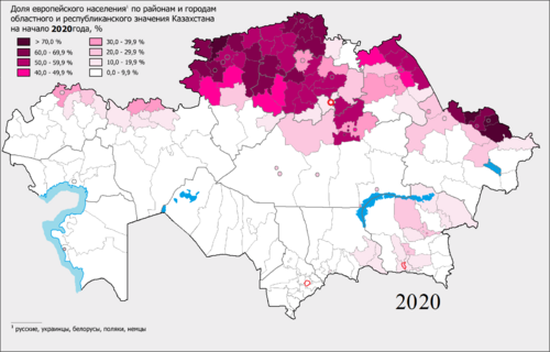
As of 2020, the East Kazakhstan Region has a population of 1,369,597.[1]
Ethnic groups (2020):[3]
| Year | تعداد | ±% p.a. |
|---|---|---|
| 1979 | 1٬657٬403 | — |
| 1989 | 1٬767٬225 | +0.64% |
| 1999 | 1٬531٬024 | −1.42% |
| 2009 | 1٬396٬593 | −0.91% |
| 2021 | 1٬363٬656 | −0.20% |
| Source: Citypopulation[4] | ||
التقسيمات الادارية
تنقسم المنطقة إدارياً إلى خمسة عشر مقاطعة ومدن Oskemen (Ust-Kamenogorsk), Ayagoz, Kurchatov, Ridder, سمي (سميپلاتينسك)، و Zyryanovsk.[5]
- Abay District, with the administrative center in the selo of Karauyl;
- Ayagoz District, the town of Ayagoz;
- Beskaragay District, the selo of Beskaragay;
- Borodulikha District, the selo of Borodulikha;
- Glubokoye District, the settlement of Glubokoye;
- Katonkaragay District, the selo of Ulken Narym;
- Kokpekti District, the selo of Kokpekti;
- Kurshim District, the selo of Kurshim;
- Shemonaikha District, the town of Shemonaikha;
- Tarbagatay District, the selo of Aksuat;
- مقاطعة أولان، مستوطنة Molodyozhny;
- Urzhar District, the selo of Urzhar;
- Zaysan District, the town of Zaysan;
- Zharma District, the selo of Kalbatau (Georgiyevka);
- Zyryan District, the town of Zyryanovsk.
* The following ten localities in East Kazakhstan Region have town status: Oskemen (Ust-Kamenogorsk), Ayagoz, Charsk (Shar), Kurchatov, Ridder, Semey (Semipalatinsk), Serebryansk, Shemonaikha, Zaysan, and Zyryanovsk.
الاقتصاد
East Kazakhstan Region's economy is dominated by industry, particularly the metallurgy industry, although the region also has a significant energy industry, forestry industry, food industry, and various light industries.[2]
₸619.4 billion was invested in the regional economy, an increase of 23.0%.[citation needed][when?] A significant increase in investment was observed in industry (30.6%), transport and warehousing (36.2%), agriculture (13.8%), and construction (7.2%).[citation needed][when?] Investments in fixed assets increased by 5.4% to ₸59.7 billion.[citation needed][when?]
Since 2010, 74 investment projects have been implemented, at a value of ₸1.3 trillion, creating 17,600 jobs, including 3 projects of national significance.[citation needed]
For the period from 2010 to 2019, 50 projects were commissioned for a total of ₸731.4 billion, creating 8,600 jobs, including 4 projects in 2019 for a total of ₸24.1 billion, creating 164 jobs.[citation needed]
In 2020, the region plans to implement 5 projects totaling ₸16.0 billion, creating 610 jobs.[citation needed]
From 2021 to 2025, the region plans to implement 19 projects with a total investment of ₸555.0 billion and the creation of 8.4 thousand new jobs.[citation needed]
Significant industrial projects planned by the region include the construction of an automobile plant and industrial park for the production of automotive components in Oskemen under the joint-stock company "Asia Auto Kazakhstan" in 2021,[citation needed] and the expansion of processing capacities of Aktogay GOK by duplicating the existing sulfide factory run by KAZ Minerals Aktogay LLP in 2021.[citation needed]
In January–February 2020, ₸59.7 billion was invested in the regional economy, with an increase of 105.4%.[citation needed]
التعدين

The basis of the industry of the region is the mining industry. There are 197 facilities in this area (2006). The main products are non- ferrous metals ( copper , zinc , silver ), gold , titanium , coal . 2005 10.8 million tons of non-ferrous metal ore were produced in the region. The deposits are mainly owned by Kazakhzinc JSC in the Ridder and Zyryanovsk polymetallic ore districts, and Kazakhmys Corporation in the Irtysh polymetallic ore district .affiliated enterprises. There are 27 enterprises in the field of precious metals in the East Kazakhstan region. They employ more than 3.5 thousand people and produce 17.3 tons of gold. The main gold producers are the Bakyrchik mine, FIK, Alel, Altyntobe JSC, Andas Altyn, Dank, Zherek and Inter Gold Capital LLP. 2006 The Satpayev ilmenite sand deposit, which supplies the Ust-Kamenogorsk titanium-magnesium plant with local raw materials (in Kokpekty district), has been launched. It produces 15.0 thousand tons of ilmenite concentrate per year. Coal production in the region is carried out at 6 facilities. It is mainly Karazhyra, Kenderlik and Alakol fields owned by Karazhyra LTD .
The main non-ferrous metallurgy of the region is "Kazzinc" , " Ust-Kamenogorsk Titanium and Magnesium Plant ", " Ulba Metallurgical Plant " JSC, "East Kazmys" branch of " Kazakhmys Corporation" JSC, RSE "Kazakhstan Mint" of the National Bank of the Republic of Kazakhstan. Kazniobium Irtysh Chemical and Metallurgical Plant, Irtysh Rare Element Company, Kazzinctech LLP. These enterprises are known around the world for their diverse and valuable products.
الزراعة
During the first half of 2020, the region's agricultural output totaled ₸157.1 billion, of which, ₸155.9 billion came from cattle breeding, and ₸1.1 billion came from crop growing.[6] Investments in agricultural fixed assets in the first half of 2020 totaled to ₸14.7 billion.[6]
In the first half of 2020, 1.371. million hectares of crops were sown.[6] During that time, the region recorded 1.2777 million heads of cattle, 477.4 thousand heads of horses, and 2.1759 million heads of sheep and goats.[6]
التحريج والأخشاب
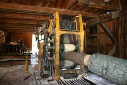
The woodworking industry of the East Kazakhstan region consists mainly of LLPs, including 4 large and medium-sized enterprises, including "Irtystransoil", "Zhanasemeyshpalzauyty", "Ust-Kamenogorsk Innotex", " Ust-Kamenogorsk Furniture Plant ". They specialize in the production of sawn timber, blanks, logs for building houses, window and door frames. The furniture industry consists of 119 enterprises, six of which are large and medium-sized. Production of 30 thousand m 3 of plywood, furniture boards, particleboard per year was launched in Borodulikha district.
الصناعة

In the first half of 2020, the region's industrial output totaled ₸1.0973 trillion.[7] During this period, the region's mining industry accounted for ₸286.7 billion in output, the metallurgy industry accounted for ₸489.5 billion, the machine-building industry accounted for ₸120.4 billion, the chemicals industry accounted for ₸10.9 billion, woodworking accounted for ₸2.5 billion, light industry accounted for ₸2.3 billion, and another ₸185 billion came from other industries.[7]
The bulk of the region's metallurgical products are exported.[7]
The region's machine-building industry mostly produces mining equipment, equipment for mineral processing, oil and gas production, industrial capacitors, cables and wires, and vehicles.[7]
التعليم
As of 2019, the region has 312 libraries, 10 museums, and 1 "institution for the protection of historical and cultural heritage".[8]
الثقافة
As of 2019, the region has 301 culture clubs, 2 theaters, a zoo, 9 "houses of friendship", 6 cinemas, and 3 parks.[8]
In 2018, the Kazakhstan Ministry of Culture has funded archaeological excavations into the Shilikty Mounds and other nearby sites in the region to uncover cultural artifacts.[8]
السياحة
The East Kazakhstan Region and neighboring Almaty Region share Lake Alakol, a major domestic tourist site. In 2013, UNESCO established the Alakol Biosphere Reserve, stating that the lake and its surroundings are an important part of the Central Asian Flyway.[9] Birds native to the lake include the Dalmatian Pelican, the Eurasian Spoonbill, the Greater Flamingo, and the Ferruginous Duck.[9] The lake's color changes during the day, from azure-blue in the morning to purple at sunset.[citation needed] On sunny days the lake has a notably bright color, and on cloudy days the water is dark grey.[citation needed] The improvement of infrastructure near the lake, as well as its alleged medicinal properties, have led to increased tourism in recent years.[citation needed]
The Altai Alps ski resort, in the town of Tawlı Ülbi approximately 24 kilometres east of Oskemen, serves as a popular skiing destination.[10]
The Raxman Spring Sanatorium and the Katon-Karagay National Park are both located in the Katonkaragay District in the northeastern part of the region.
الرياضة
The region sent a bandy team to the Spartakiade 2009 and finished third.[11]
انظر أيضاً
المراجع
- ^ أ ب "Численность населения Республики Казахстан по отдельным этносам на начало 2020 года". Stat.kz. Retrieved 2020-08-06.
- ^ أ ب ت ث "East Kazakhstan Region" (in الإنجليزية). The Office of the Prime Minister of Kazakhstan. 2017. Archived from the original on 2017-03-17. Retrieved 2020-08-14.
{{cite web}}:|archive-date=/|archive-url=timestamp mismatch; 2017-03-07 suggested (help) - ^ "Численность населения Республики Казахстан по отдельным этносам на начало 2020 года". Stat.kz. Retrieved 2020-08-06.
- ^ "Kazakhstan: Regions" (in الإنجليزية).
- ^ "Akimats of cities and districts". East Kazakhstan Region's Akimat. Retrieved 12 December 2012.
- ^ أ ب ت ث Сельское хозяйство [Agriculture] (in الروسية). Akimat of the East Kazakhstan Region. Archived from the original on 2020-08-14. Retrieved 2020-08-14.
- ^ أ ب ت ث Промышленность и бизнес [Industry and Business]. Akimat of the East Kazakhstan Region. Archived from the original on 2020-08-14. Retrieved 2020-08-14.
- ^ أ ب ت Культура [Culture] (in الروسية). Akimat of the East Kazakhstan Region. Archived from the original on 2020-08-14. Retrieved 2020-08-14.
- ^ أ ب "Alakol". UNESCO. July 2013. Archived from the original on 2020-08-14. Retrieved 2020-08-14.
- ^ Shayakhmetova, Zhanna (2017-12-14). "Altai Alps ski resort welcomes visitors to enjoy winter activities, improve skills". The Astana Times (in الإنجليزية). Archived from the original on 2020-08-14. Retrieved 2020-08-14.
- ^ "Команда Восточно-Казахстанской области". Archived from the original on 2014-06-10. Retrieved 2014-06-10.
وصلات خارجية
- Pages using gadget WikiMiniAtlas
- صفحات بها مخططات
- CS1 errors: archive-url
- CS1 uses الروسية-language script (ru)
- CS1 الروسية-language sources (ru)
- Short description is different from Wikidata
- Articles containing قزخ-language text
- Articles containing روسية-language text
- Coordinates on Wikidata
- Pages using Lang-xx templates
- Articles containing إنگليزية-language text
- Articles with unsourced statements from August 2020
- Vague or ambiguous time from August 2020
- East Kazakhstan Region
- Regions of Kazakhstan
