گيورگييڤسك
{{ safesubst:#invoke:Unsubst||date=__DATE__|$B=
گيورگييڤسك
Георгиевск | |
|---|---|
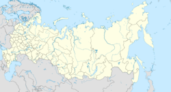
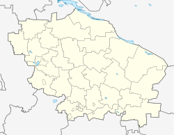
Location of گيورگييڤسك خطأ: الوظيفة "main" غير موجودة. | |
| الإحداثيات: 44°9′0″N 43°28′0″E / 44.15000°N 43.46667°E | |
| البلد | روسيا |
| الكيان الاتحادي | Stavropol Krai[1] |
| [2] | 1777 |
| Town status since | 1786[2] |
| المنسوب | 300 m (1٬000 ft) |
| التعداد | |
| • الإجمالي | 72٬153 |
| • Estimate (2018) | 67٬714 (−6٫2%) |
| • الترتيب | 218th in 2010 |
| • Subordinated to | town of krai significance of Georgiyevsk[1] |
| • Capital of | town of krai significance of Georgiyevsk[1], Georgiyevsky District[1] |
| • Urban okrug | Georgiyevsk Urban Okrug[4] |
| • Capital of | Georgiyevsk Urban Okrug[4], Georgiyevsky Municipal District[4] |
| منطقة التوقيت | UTC+ ([5]) |
| Postal code(s)[6] | |
| OKTMO ID | 07707000001 |
| الموقع الإلكتروني | www |
گيورگييڤسك (روسية: Гео́ргиевск؛ إنگليزية: Georgiyevsk) هي بلدة تاريخية في كراي ستاڤروپول، روسيا، تقع في شمال القوقاز على السفح بالضفة اليمنى لـنهر پودكوموك (رافد نهر كوما)، على بعد 210 كم جنوب شرق ستاڤروپول. وتعدادها: 72,153 (تعداد 2010).[3]
التاريخ
It was founded in September[citation needed] 1777 as St. George fortress[2] on the Azov-Mozdok defense line. In 1783, Georgievsk saw the signing of the Treaty of Georgievsk between the Russian Empire and Georgia, which made Georgia a Russian protectorate. After 1785, Georgiyevsk grew considerably. In 1786, it was granted town status.[2] After 1802, it was the seat of Caucasian Governorate. The early 19th century marked a peak in Georgiyevsk's influence as a trading center. After 1822, the town's influence began to wane.
In 1875, a railway station was built 6 كيلومتر (3.7 mi) away in Nezlobnaya. This became a new beginning in town's development. In 1894, the first blacksmith works was founded. This was the beginning of "ArZiL", the biggest enterprise in the town. In 1900, a slaughter house and oil mill were founded. In the 1920s, Georgiyevsk became a big industrial and trade center of the Ciscaucasia.
During World War II, Georgiyevsk was under German occupation from 15 August 1942 to 10 January 1943. After the war, Georgiyevsk became the largest center of machine construction in Stavropol Krai.
تاريخ التعداد
- 1897 Census: 11,000;
- 1914 Census: 21,200;
- 1939 Census: 31,600;
- 1959 Census: 35,100;
- 1970 est.: 44,000;
- 1979 Census: 53,600;
- 62,926 (تعداد 1989);[7]
- 70,575 (تعداد 2002);[8]
- 72,153 (تعداد 2010).[3]
مشاهير
Well-known Russians who visited Georgiyevsk include: ألكسندر پوشكين, Mikhail Lermontov, ليو تولستوي، ماكسيم گوركي, and Emperor Alexander II. الجنرالان Nikolay Raevsky and Alexey Yermolov lived in the town.
الهامش
هامش
- ^ أ ب ت ث ج خطأ استشهاد: وسم
<ref>غير صحيح؛ لا نص تم توفيره للمراجع المسماةRef372 - ^ أ ب ت ث Энциклопедия Города России. Moscow: Большая Российская Энциклопедия. 2003. p. 107. ISBN 5-7107-7399-9.
- ^ أ ب ت Russian Federal State Statistics Service (2011). "Всероссийская перепись населения 2010 года. Том 1". Всероссийская перепись населения 2010 года (2010 All-Russia Population Census) (in Russian). Federal State Statistics Service. Retrieved June 29, 2012.
{{cite web}}: Invalid|ref=harv(help); Unknown parameter|trans_title=ignored (|trans-title=suggested) (help)CS1 maint: unrecognized language (link) - ^ أ ب ت خطأ استشهاد: وسم
<ref>غير صحيح؛ لا نص تم توفيره للمراجع المسماةRef893 - ^ "Об исчислении времени". Официальный интернет-портал правовой информации (in Russian). 3 June 2011. Retrieved 19 January 2019.
{{cite web}}: CS1 maint: unrecognized language (link) - ^ Почта России. Информационно-вычислительный центр ОАСУ РПО. (Russian Post). Поиск объектов почтовой связи (Postal Objects Search) (in روسية)
- ^ "Всесоюзная перепись населения 1989 г. Численность наличного населения союзных и автономных республик, автономных областей и округов, краёв, областей, районов, городских поселений и сёл-райцентров.[[Category:Articles containing روسية-language text]] (All Union Population Census of 1989. Present population of union and autonomous republics, autonomous oblasts and okrugs, krais, oblasts, districts, urban settlements, and villages serving as district administrative centers.)". Всесоюзная перепись населения 1989 года (All-Union Population Census of 1989) (in Russian). Demoscope Weekly (website of the Institute of Demographics of the State University—Higher School of Economics. 1989. Retrieved 2007-12-13.
{{cite web}}: Italic or bold markup not allowed in:|publisher=(help); URL–wikilink conflict (help)CS1 maint: unrecognized language (link) - ^ Федеральная служба государственной статистики (Federal State Statistics Service) (2004-05-21). "Численность населения России, субъектов Российской Федерации в составе федеральных округов, районов, городских поселений, сельских населённых пунктов – районных центров и сельских населённых пунктов с населением 3 тысячи и более человек[[Category:Articles containing روسية-language text]] (Population of Russia, its federal districts, federal subjects, districts, urban localities, rural localities—administrative centers, and rural localities with population of over 3,000)". Всероссийская перепись населения 2002 года (All-Russia Population Census of 2002) (in Russian). Federal State Statistics Service. Retrieved 2008-07-25.
{{cite web}}: URL–wikilink conflict (help)CS1 maint: unrecognized language (link)
المصادر
وصلات خارجية
- Pages using gadget WikiMiniAtlas
- CS1 errors: unsupported parameter
- Articles with روسية-language sources (ru)
- Articles containing روسية-language text
- CS1 errors: markup
- CS1 errors: URL–wikilink conflict
- Short description is different from Wikidata
- Coordinates on Wikidata
- Pages using infobox settlement with image map1 but not image map
- Pages using Lang-xx templates
- Articles containing إنگليزية-language text
- Articles with unsourced statements from March 2012
- مدن وبلدات في كراي ستاڤروپول
- اوبلاست تيرك
- أماكن مأهولة تأسست في 1777


