جزر الأمراء
جزر الأمراء
Prens Adaları (Adalar) | |
|---|---|
district | |
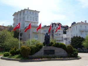 | |
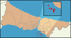 موقع جزر الأمراء (Adalar district) في اسطنبول | |
| الإحداثيات: 40°52′N 29°06′E / 40.867°N 29.100°E | |
| البلد | تركيا |
| المدينة | اسطنبول |
| الحكومة | |
| • العمدة | Atilla Aytaç (CHP) |
| • الحاكم | مولود قربان |
| المساحة | |
| • District | 15٫85 كم² (6٫12 ميل²) |
| التعداد (2012)[2] | |
| • District | 14٬552 |
| • كثافة District | 920/km2 (2٬400/sq mi) |
| منطقة التوقيت | UTC+2 (EET) |
| • الصيف (التوقيت الصيفي) | UTC+3 (EEST) |
| مفتاح الهاتف | 0-216 |
| الموقع الإلكتروني | www |
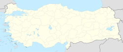
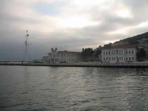
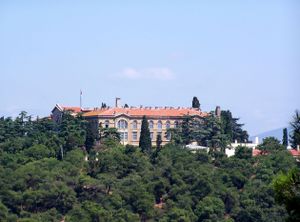
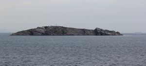
The Prince Islands (تركية: Prens Adaları, from the historic Greek name Prinkēpōn nēsoi (Πριγκήπων νήσοι), alternatively written as Princes' Islands in which the "princes" are plural (meaning "Islands of the Princes"); or Kızıl Adalar ("Red Islands") in Turkish); officially just Adalar ("Islands"), are an archipelago off the coast of Istanbul, تركيا, in the Sea of Marmara. The islands constitute the Adalar district of محافظة اسطنبول. The mayor of the Adalar district is Atilla Aytaç (CHP).
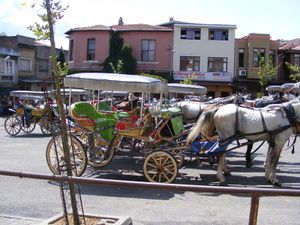
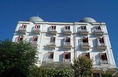
- رغم أن الجزر تتمتع بمناظر طبيعية جميلة، وهو ما يجعلها مقصداً للسواح، إلاّ أن هناك سبباً إضافياً يجعلها مقصداً لهم وهو أن التنقل فيها يكون بالعربات التي تجرها الخيول، أو بالدرجات الهوائية، أو بالدرجات النارية الصغيرة، ويمنع استعمال السيارت العادية باستثناء بعض السيارات مثل السيارات الحكومية.
- يمكن الانتقال إالى الجزر من بعض الموانئ الصغيرة لإسطنبول مثل ميناء قاباطاش (en)، وتتنقل بشكل أساسي عبر الجزر الكبيرة باستخدام خدمة الحافلات البحرية (بالتركية: deniz otobüsleri hatları). في فصل الشتاء، يصبح الانتقال إلى تلك الجزر صعباً، ناهيك عن تعرضها للبرد القارس، مما يخفض عدد سواحها بشكل بارز.
- أكبر هذه الجزر هي بيوك أطه التي يمثل الوسط التجاري جزءاً بسيطاً منها، في حين ينقسم معظمها ما بين الغابات الطبيعية، ومساكن الأثرياء.
قائمة الجزر
| الاسم (أحرف عربية) | الاسم (أحرف تركية) | معنى الاسم | المساحة (كم مربع) |
|---|---|---|---|
| بيوك أطه (en) | Büyükada | الجزيرة الكبرى | 5.46 |
| هيبيلي أطه (en) | Heybeliada | جزيرة حقيبة السرج | 2.4 |
| بورغاز أطه (en) | Burgazada | جزيرة القلعة | 1.5 |
| كينالي أطه (en) | Kınalıada | جزيرة الحناء | 1.3 |
| صيديف أطاسي (en) | Sedef Adası | جزيرة أم اللؤلؤ | 0.157 |
| ياسي أطه (en) | Yassıada | الجزيرة المسطحة | 0.05 |
| سفري أطه (en) | Sivriada | الجزيرة الحادة | 0.05 |
| كاشيك أطاسي (en) | Kaşık Adası | جزيرة الملعقة | 0.006 |
| طڤشان أطاسي (en) | Tavşan Adası | جزيرة الأرنب | 0.0004 |
| المجموع | 15.85 |
They consist of four larger islands, Büyükada ("Big Island") بمساحة 5.46 km2 (2.11 sq mi), Heybeliada ("Saddlebag Island") بمساحة 2.4 km2 (0.93 sq mi), Burgazada ("جزيرة الحصن") بمساحة 1.5 km2 (0.58 sq mi), Kınalıada ("Henna Island") بمساحة 1.3 km2 (0.50 sq mi), and five much smaller ones, Sedef Adası ("Mother-of-Pearl Island") بمساحة 0.157 km2 (0.061 sq mi), Yassıada ("Flat Island") بمساحة 0.05 km2 (0.019 sq mi), Sivriada ("Sharp Island") بمساحة 0.05 km2 (0.019 sq mi), Kaşık Adası ("Spoon Island") بمساحة 0.006 km2 (0.0023 sq mi), and Tavşan Adası ("Rabbit Island") بمساحة 0.004 km2 (0.0015 sq mi).
السياحة والمواصلات
التاريخ
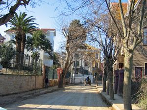

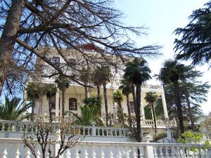
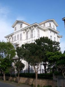
During the Byzantine period, princes and other royalty were exiled on the islands, and later members of the Ottoman sultans family were exiled there too, giving the islands their present name. They were taken by the Ottoman fleet during the siege of Constantinople in 1453. During the nineteenth century, the islands became a popular resort for Istanbul's wealthy, and Victorian-era cottages and houses are still preserved on the largest of the Princes' Islands.
Büyükada
Büyükada (meaning "Big Island"; باليونانية: Πρίγκηπος, Prínkēpos) is the largest of the nine islands comprising the Princes' Islands in the Marmara Sea, close to Istanbul.
Heybeliada
Burgazada
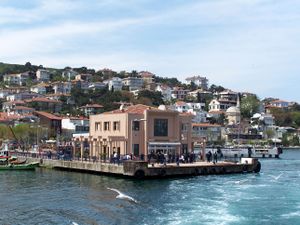
Kınalıada
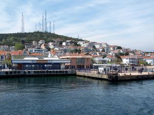
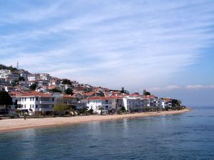
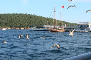
Kınalıada (meaning "Henna Island" in Turkish, named after the colour of its earth) is the nearest island to the European and Asian side of Istanbul, about 12 كيلومتر (7 mi) to the south. This is one of the least forested islands, and the land has a reddish colour from the iron and copper that has been mined here. This was the island most used as a place of exile in Byzantine times (the most notable exile being the former emperor Romanos IV Diogenes, after the Battle of Manzikert, 1071).Also, this island has a historical abbey top of it. In modern times, Kinaliada residents have been predominantly Armenian, giving it the highest density of Armenians living anywhere in Istanbul, albeit mainly in summer homes. During the summer, approximately 90% of the population on the island is Armenian.
The islands are reachable by ferry services that depart from Kabataş on the European side. The voyage takes about 25 minutes by fast ferry and 40 minutes by regular ferry (vapur).
جريرة طڤشان
Tavşan Adası (وتعني "جزيرة الأرنب"؛ Greek: Νέανδρος Neandros, the name of a mythological figure) is the smallest of the Princes' Islands, بمساحة 0.004 km2 (0.0015 sq mi).
الهامش
- ^ "Area of regions (including lakes), km²". Regional Statistics Database. Turkish Statistical Institute. 2002. Retrieved 2013-03-05.
- ^ "Population of province/district centers and towns/villages by districts - 2012". Address Based Population Registration System (ABPRS) Database. Turkish Statistical Institute. Retrieved 2013-02-27.
وصلات خارجية
- Princes' Islands virtual web site 360 degree official website (لغة تركية)
- District governor's official website (لغة تركية)
- District municipality's official website (لغة تركية)
 جزر الأمراء travel guide from Wikivoyage
- Istanbul's isle of diversity from the Christian Science Monitor, By Yigal Schleifer, 28 July 2005
- The islands that refused to motorize Sustainable Transport, an ITDP publication, By Yaakov Garb, Fall 2002
- Interactive Maps: MultiMap.com, FallingRain.com
- Istanbul islands Turkish Daily News
- Cornucopia special edition on the Princes' Islands, Princes' Islands: Paradise Lost?
- Princes' Islands Princes' Islands information, know more about Princes' Islands
- Short description is different from Wikidata
- Pages using gadget WikiMiniAtlas
- Pages using Lang-xx templates
- صفحات بها وصلات إنترويكي
- Articles containing Greek-language text
- مقاطعات محافظة اسطنبول
- منطقة مرمرة
- جزر بحر مرمرة
- أرخبيلات تركيا
- جزر الأمراء
- تضاريس محافظة اسطنبول
- أقضية محافظة اسطنبول
- مناطق خالية من السيارات
- مقالات تحتوي مقاطع ڤيديو
