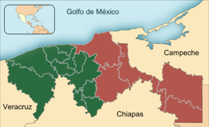
تاباسكو
Tabasco | |
|---|---|
| Estado Libre y Soberano de Tabasco | |
|
| |
| الكنية: El Edén de México (The Eden of Mexico) | |
| النشيد: Marcha Tabasco | |
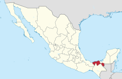 State of Tabasco within Mexico | |
| الإحداثيات: 17°58′N 92°35′W / 17.967°N 92.583°W | |
| Country | Mexico |
| Capital | Villahermosa |
| Largest City | Villahermosa |
| Municipalities | 17 |
| Admission | February 7, 1824[1] |
| Order | 13th |
| الحكومة | |
| • Governor | Adán Augusto López Hernández |
| • Senators[2] | Mónica Fernández Balboa Ovidio Salvador Peralta Suárez Juan Manuel Fócil Pérez |
| • Deputies[3] | |
| المساحة | |
| • الإجمالي | 24٬731 كم² (9٬549 ميل²) |
| Ranked 24th | |
| أعلى منسوب | 1٬100 m (3٬600 ft) |
| التعداد (2015)[6] | |
| • الإجمالي | 2٬395٬272 |
| • الترتيب | 20th |
| • الكثافة | 97/km2 (250/sq mi) |
| • ترتيب الكثافة | 12th |
| صفة المواطن | Tabasqueño (a) |
| منطقة التوقيت | UTC−6 (CST) |
| • الصيف (التوقيت الصيفي) | UTC−5 (CDT) |
| Postal code | 86 |
| Area code | |
| ISO 3166 code | MX-TAB |
| HDI | ▲ 0.773 High Ranked 19th |
| GDP | US$ 17,492,682,260 [a] US$ 7,575, per capita (nominal) |
| الموقع الإلكتروني | Official Web Site |
| ^ a. The state's GDP was $223,906,333,000 pesos in 2008,[7] amount corresponding to $17,492,682,260 dollars, at a conversion rate of 1 dollar = 12.80 pesos (value of June 3, 2010).[8] | |
تاباسكو (Tabasco) هي إحدى ولايات المكسيك. عاصمتها فيلاهيرموسا. It is divided into 17 municipalities and its capital city is Villahermosa. It is located in the southeast of the country, bordering the states of Campeche to the northeast, Veracruz to the west, and Chiapas to the south and the Petén department of Guatemala to the southeast. It has a coastline to the north with the Gulf of Mexico. Most of the state is covered in rainforest as, unlike most other areas of Mexico, it has plentiful rainfall year-round. For this reason, it is also covered in small lakes, wetlands and rivers. The state is subject to major flooding events, with the last occurring in 2007, which affected eighty percent of the state. The state is also home to La Venta, the major site of the Olmec civilization, considered to be the origin of later Mesoamerican cultures. Even though it produces significant quantities of petroleum and natural gas, poverty is still a concern.
الجغرافيا
السياحة
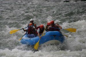
| Ecological and adventure tourism in Tabasco | ||||

|

|

|

| |
| Pantanos de Centla | Desarrollo Ecoturístico "Kolem-Jaa" | Cascadas de Aguas Blancas | Puerto Ceiba | Cañón del Usumacinta |

|

|

|

|

|
| Grutas del Coconá | Sierra de Tabasco | Rápidos de San José-Desempeño | El Bellote | Tapijulapa |
الآثار
| Archaeological and colonial tourism in Tabasco | |||||||

|

|

|

|
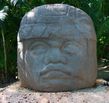
| |||
| La Venta | Comalcalco | Pomoná | Moral-Reforma | Olmec Head, La Venta Park | |||

|
|

|

| ||||
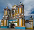
| Oxolotán | Cunduacán | Cupilco | Villahermosa | Tapijulapa | |||
الحكومة والسياسة
البلديات
تنقسم الولاية إلى 17 بلدية في أربعة مناطق هي: تشونتالبا، والمنطقة الوسطى، وسيرا، ومنطقة النهر. بلديات هي:
|
|
الطوائف الرئيسية
|
|
الاسبانية
المناطق
مناطق الجذب السياحى
الفيضانات
البنية التحتية المخطط الطاقة الكهرماءية
اللغة
بخلاف بقية ولايات المكسيك، تستخدم في تاباسكو (مع فيراكروز) اللهجة الكاريبية من اللغة الإسبانية بسبب التأثير الكوبي الكبير على المنطقة.
جغرافيا
تجاور تاباسكو ولاية فيراكروز غرباً، وتشياباس جنوباً، وكامبيتشيه في شمال الشرق، وقسم بيتين (في غواتيمالا) شرقاً، وخليج المكسيك شمالاً. من بين مدن تاباسكو: سيوداد بيميكس، وكارديناس، إمليانو زاباتا، وماكوسبانا، وسان ميغيل، وتينوسيكوي، وتورتوغويرو.
أكبر الأنهار التي تجري في الولاية هما غريجالفا وأوسوماسينتا، اللذان يجريان في سهل تاباسكو. سهل تاباسكو ساحلي، تهطل عليه أمطاراً غزيرة، وهو مغطّى بغابات الأمطار الإستوائية.
وصلات خارجية
- (بالإسپانية) Tabasco State Government
- (بالإسپانية) Towns, cities, and postal codes in Tabasco
- (بالإسپانية) Paraíso Tabasco
- (بالإسپانية) TourTabasco (Regional Magazine)
- (بالإسپانية) Diario Tabasco Hoy (State and regional News)
- ^ "Las Diputaciones Provinciales" (PDF) (in Spanish). p. 15.
{{cite news}}: CS1 maint: unrecognized language (link) - ^ "Senadores por Tabasco LXI Legislatura". Senado de la Republica. Retrieved April 7, 2011.
- ^ "Listado de Diputados por Grupo Parlamentario del Estado de Tabasco". Camara de Diputados. Retrieved April 7, 2011.
- ^ "Resumen". Cuentame INEGI. Archived from the original on May 12, 2013. Retrieved February 12, 2013.
- ^ "Relieve". Simulador de Flujos de Agua de Cuencas Hidrográficas (INEGI). Retrieved November 11, 2011.
- ^ "Encuesta Intercensal 2015" (PDF). Retrieved December 9, 2015.
- ^ "Mexico en Cifras". INEGI. Archived from the original on أبريل 20, 2011. Retrieved أبريل 7, 2011.
- ^ "Reporte: Jueves 3 de Junio del 2010. Cierre del peso mexicano". www.pesomexicano.com.mx. Retrieved August 10, 2010.


