نيوىخاين
نيوىخاين
Nieuwegein | |
|---|---|
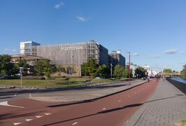
.jpg&filetimestamp=20230829213230&) قناة في نيوىخاين | |
 Flag  Coat of arms | |
.svg&filetimestamp=20230829213213&) الموقع في أوترخت | |
| الإحداثيات: 52°2′N 5°5′E / 52.033°N 5.083°E | |
| Country | Netherlands |
| Province | Utrecht |
| Established | 1 July 1971 |
| الحكومة | |
| • الكيان | Municipal council |
| • Mayor | Marijke van Beukering (D66) |
| المساحة | |
| • الإجمالي | 25٫65 كم² (9٫90 ميل²) |
| • البر | 23٫66 كم² (9٫14 ميل²) |
| • الماء | 1٫99 كم² (0٫77 ميل²) |
| المنسوب | 1 m (3 ft) |
| التعداد (أغسطس 2017)[4] | |
| • الإجمالي | 62٬235 |
| • الكثافة | 2٬630/km2 (6٬800/sq mi) |
| صفة المواطن | Nieuwegeiner |
| منطقة التوقيت | UTC+1 (CET) |
| • الصيف (التوقيت الصيفي) | UTC+2 (CEST) |
| Postcode | 3430–3439 |
| Area code | 030 |
| الموقع الإلكتروني | www |
 | |
نيوىخاين ( Nieuwegein ؛ النطق الهولندي: [ˌniʋəˈɣɛin] (![]() استمع)) هي بلدية ومدينة في مقاطعة أوترخت الهولندية. It is bordered on the north by the city of Utrecht, the provincial capital. It is separated from Vianen to the south by the river Lek and borders on IJsselstein in the southwest and Houten in the east. Nieuwegein has 64,606 inhabitants as of 1 December 2021.
استمع)) هي بلدية ومدينة في مقاطعة أوترخت الهولندية. It is bordered on the north by the city of Utrecht, the provincial capital. It is separated from Vianen to the south by the river Lek and borders on IJsselstein in the southwest and Houten in the east. Nieuwegein has 64,606 inhabitants as of 1 December 2021.
Several national sports federations are housed in Nieuwegein, including the NeVoBo (volleyball), KNZB (swimming), NBb (basketball) and KNCB (cricket).
There are three main secondary schools in the city, including the Anna van Rijn College, Oosterlicht College and the Cals College.
التاريخ
Nieuwegein was founded on 1 July 1971 as a planned city, following the merger of the former municipalities of Jutphaas and Vreeswijk. The new town was built for the expanding population of the city of Utrecht, and grew rapidly during the decades following its foundation.
In the area between Jutphaas and Vreeswijk there used to be a settlement called Geyne (Gein). This settlement received city rights in 1295 but was destroyed in 1333, in a war between the Bishop of Utrecht and the Count of Holland. Today only Oudegein House remains from that time. After the boards of Vreeswijk and Jutphaas had debated for some time about the name of the new municipality, they decided to name it after this old settlement - Nieuwegein meaning 'New Gein'.[5]
التعداد
السكان
As of 2016, 50.7% of the population consider themselves religious. The largest denomination are Catholics, which are 27.5% of the population, followed by various protestant denominations (23.8%), and Islam (5.3%). 14.3% of the Nieuwegein population attends religious service regularly.[6]
السمات والقضايا الاجتماعية
As of 2017, Nieuwegein has a poverty rate of 4.7% compared to the 5.7% national average.[7]
المواصلات
Nieuwegein is surrounded by three motorways (Dutch: autosnelweg), the A2 to the west, the A12 to the north and the A27 to the east.
Nieuwegein is connected to Utrecht and IJsselstein by the Sneltram (light rail) line. There is a pedestrian ferry across the river Lek to Vianen. Three canals flow through Nieuwegein: the Amsterdam-Rhine Canal, the Lek River and the Merwede Canal. There are also a few sports clubs in Nieuwegein, such as: KV Koveni, SV Geinoord, VSV Vreeswijk and JSV Nieuwegein.
مباني
In Nieuwegein, there is a mandi (Mandaean temple) called Vereniging Mandi van de Mandeeërs Gemeenschap in Nederland.[8]
بلدات توأم
 Puławy, Lublin Voivodeship, Poland, was a twin town of Nieuwegein from 1994 to 2020. In July 2020, after Puławy installed a gay-free zone, Nieuwegein ended the partnership.[9]
 Rundu, Kavango East Region, Namibia, is a twin town of Nieuwegein since 1994. Because of the current state of gay rights in Namibia, the city council is debating on continuing the partnership.[10]
أشخاص بارزون
- Piet Schrijvers (born 1946 in Jutphaas) a Dutch football manager and former goalkeeper with 563 club caps
- Veronique Renard (born 1965) a Dutch author and visual artist
- Jasper van Dijk (born 1971 in Jutphaas) a Dutch politician
- Mark Snoeren (born 1974) a Dutch politician
- Nine Kooiman (born 1980) a Dutch politician and former social worker
- Finne Jager (born 1984) stage name Phynn, a Dutch trance and techno DJ and producer
- Manuel "Grubby" Schenkhuizen (born 1986) a Dutch professional eSports player
- Sari van Veenendaal (born 1990) a Dutch football goalkeeper with Atlético Madrid Femenino, captains the Dutch national team
- Robin de Kruijf (born 1991) a Dutch volleyball player, competed at the 2016 Summer Olympics
معرض صور
Nieuwegein, hospital
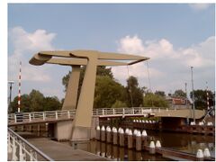
Nieuwegein, drawbridge
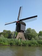
Nieuwegein, windmill
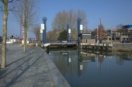
De Liesbosbrug in Nieuwegein


المراجع
- ^ "Burgemeester Frans Backhuijs" [Mayor Frans Backhuijs] (in الهولندية). Gemeente Nieuwegein. Archived from the original on 8 April 2014. Retrieved 8 April 2014.
- ^ "Kerncijfers wijken en buurten" [Key figures for neighbourhoods]. CBS Statline (in Dutch). CBS. 2 July 2013. Retrieved 12 March 2014.
{{cite web}}: CS1 maint: unrecognized language (link) - ^ "Postcodetool for 3431LZ". Actueel Hoogtebestand Nederland (in الهولندية). Het Waterschapshuis. Retrieved 8 April 2014.
- ^ "Bevolkingsontwikkeling; regio per maand" [Population growth; regions per month]. CBS Statline (in Dutch). CBS. 27 October 2017. Retrieved 27 October 2017.
{{cite web}}: CS1 maint: unrecognized language (link) - ^ (in nl)Nieuwegein, 2019-05-26, https://nl.wikipedia.org/w/index.php?title=Nieuwegein&oldid=53895131, retrieved on 2019-06-14
- ^ "Helft van de Nieuwegeiners (50,7%) is kerkelijk of religieus". 2022-12-28.
- ^ "Waar wonen de armen in Nederland?". 2022-12-28.
- ^ "Vereniging Mandi van de Mandeeërs Gemeenschap in Nederland" (in الهولندية). 2016-11-12. Retrieved 2022-06-07.
- ^ Boffey, Daniel (16 July 2020). "Dutch town ends ties with Polish twin declared 'gay-free zone'". The Guardian. Retrieved 17 July 2020.
- ^ "Nieuwegein 'ontvriendt' Poolse partnerstad: 'Homovrije zones zijn not done'". NOS.nl. 14 July 2020.
وصلات خارجية
 Media related to نيوىخاين at Wikimedia Commons
- Official website
أماكن قريبة من نيوىخاين | ||||||||||
|---|---|---|---|---|---|---|---|---|---|---|
| ||||||||||