نوسا تنگارا الشرقية
East Nusa Tenggara
Nusa Tenggara Timur | |
|---|---|
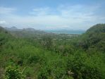
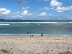
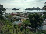
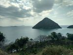
From top, left to right : Kelimutu, Nature in Flores, Boa Beach in Rote Ndao Regency, Labuan Bajo, view of Komodo Island, Dancers in Watublapi in traditional costume, Kukusan Island in Flores | |
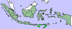 Location of East Nusa Tenggara in Indonesia | |
| الإحداثيات: 10°11′S 123°35′E / 10.183°S 123.583°E | |
| Country | |
| Established | December 17, 1958 |
| Capital | |
| الحكومة | |
| • الكيان | East Nusa Tenggara Regional Government |
| • Governor | Frans Lebu Raya (PDI-P) |
| • Vice Governor | Benny Alexander Litelnoni |
| المساحة | |
| • الإجمالي | 47٬245٫82 كم² (18٬241٫71 ميل²) |
| ترتيب المساحة | 13th |
| أعلى منسوب | 2٬458 m (8٬064 ft) |
| التعداد (2014 Estimate)[1] | |
| • الإجمالي | 5٬070٬746 |
| • الترتيب | 12th |
| • الكثافة | 110/km2 (280/sq mi) |
| Demographics | |
| • Ethnic groups | Atoni or Dawan (22%) Manggarai (15%) Sumba (12%) Belu (9%) Lamaholot (8%) Rote (5%) Lio (4%)[2] |
| • Religion | Roman Catholicism (57.14%) Protestantism (35.74%) Islam (5.05%) Other (3%)[3] |
| • Languages | Indonesian, Kupang Malay, Lamaholot, Uab Meto, Bunak, Tetum |
| منطقة التوقيت | UTC+8 (Indonesia Central Time) |
| Postcodes | 80xxx, 81xxx, 82xxx |
| Area codes | (62)3xx |
| ISO 3166 code | ID-NT |
| Vehicle sign | DH (Timor), EB (Flores, Alor, Lembata), ED (Sumba) |
| HDI | ▲ 0.631 (Medium) |
| HDI rank | 32nd (2016) |
| Largest city by area | Kupang - 26.18 متر كيلومربع (10.11 sq mi) |
| Largest city by population | Kupang - (336,239 - 2010) |
| Largest regency by area | East Sumba Regency - 7،000.50 متر كيلومربع (2،702.91 sq mi) |
| Largest regency by population | South Central Timor Regency - (441,155 - 2010) |
| الموقع الإلكتروني | Government official site |
مقاطعة نوسا تنگارا الشرقية هي إحدى مقاطعات إندونسيا. It has a total area of 47,245.82 km2, and the population at the 2010 Census was 4,683,827; the latest official estimate in January 2014 was 5,070,746. The provincial capital is Kupang on West Timor.
The province consists of more than 500 islands, the three largest being Flores, Sumba, and the western half of Timor (West Timor). The eastern part of Timor is the independent country of East Timor.
East Nusa Tenggara is the only province in Indonesia where Roman Catholicism is the predominant religion. Nusa Tenggara Timur, in Indonesian, means "eastern southeastern islands"; compare to Nusa Tenggara Barat, which means "western southeastern islands" where Lombok and Sumbawa are located.
التاريخ
After the declaration of Indonesian independence in 1945, the eastern part of Indonesia declared the State of East Indonesia.[4] The state was further included in the United States of Indonesia as part of the agreement with the Dutch contained in the transfer of its sovereignty to Indonesia in 1949.
In 1950, United States of Indonesia dissolved itself into a unitary state and began to divide its component area into provinces. In 1958, by Indonesian law (Undang-Undang) No. 64/1958, three provinces were established in the Lesser Sunda Islands, namely Bali, West Nusa Tenggara and East Nusa Tenggara.[5] The area of East Nusa Tenggara province included the western part of Timor island, Flores, Sumba and other several small islands in the region. The province was sub-divided into twelve regencies and the City of Kupang, which had regency-level status.[6]
Following the fall of the Suharto regime in 1998 and the passage of a new regional autonomy law, there was a dramatic proliferation (known as pemekaran) of regional governments across Indonesia (at both provincial and regency level). Several new regencies were created in East Nusa Tenggara by the division of existing regencies:
- In 1999, the new Lembata Regency was formed after the division of the East Flores Regency.[7]
- In 2002, Rote and Ndao Islands were split off from Kupang Regency, to form a new Rote Ndao Regency.[8]
- In 2003, Manggarai Regency was split into two and a new West Manggarai Regency was established.[9]
- In 2007, the administration of East Nusa Tenggara province was expanded by the establishment of four new regencies - Central Sumba and Southwest Sumba (both cut out of West Sumba Regency), Nagekeo (cut out of Ngada Regency) and East Manggarai (cut out of Manggarai Regency).
- In October 2008 a further regency - Sabu Raijua (comprising the Savu Islands group) - was formed from part of the remaining Kupang Regency.
- In December 2012 yet another regency - Malaka - was created out of the southern half of Belu Regency.
Therefore, as of early 2013, there were twenty-one regencies plus the one autonomous city (Kupang) in the province.
الجغرافيا
Located in the east of Lesser Sunda Islands, East Nusa Tenggara faces the Indian Ocean in the south and Flores Sea in the north. The province is bordered by other provinces, West Nusa Tenggara in the west. In the east, the province is bordered by East Timor and southern part of Maluku.

The province consists of about 566 islands, the largest and most dominant are Flores, Sumba, and the western part of Timor. The other is smaller islands include Adonara, Alor, Komodo, Lembata (formerly called Lomblen), Menipo, Raijua, Rincah, Rote Island (the southernmost island in Indonesia), Savu, Semau, and Solor. The highest point in the province is Mount Mutis in the South Central Timor Regency, 2,427 meters above sea level.[10]
Administrative divisions
The province is divided into twenty-one regencies and one city. These are listed below with their areas and their populations at the 2010 Census and at the latest (2014) estimates:[11]
| Name | Statute (including year when established) |
Area (km2) |
Population 2010 Census |
Population 2014 estimate[11] |
Capital | HDI[12] 2014 estimate |
|---|---|---|---|---|---|---|
| Alor Regency (Alor Archipelago) |
UU 69/1958 | 2٬864٫60 | 190٬026 | 205٬724 | Kalabahi | 0.580 (Low) |
| East Flores Regency (Flores Timur) (includes Adonara and Solor) |
UU 69/1958 | 1٬813٫20 | 232٬605 | 251٬820 | Larantuka | 0.604 (Medium) |
| East Manggarai Regency (Manggarai Timur) |
UU 36/2007 | 2٬642٫93 | 252٬744 | 273٬623 | Borong | 0.565 (Low) |
| Ende Regency | UU 69/1958 | 2٬046٫50 | 260٬605 | 282٬133 | Ende | 0.652 (Medium) |
| Lembata Regency (Lomblen) |
UU 52/1999 | 1٬266٫00 | 117٬829 | 127٬563 | Lewoleba | 0.614 (Medium) |
| Manggarai Regency | UU 69/1958 | 2٬096٫44 | 292٬451 | 316٬610 | Ruteng | 0.600 (Medium) |
| Nagekeo Regency | UU 2/2007 | 1٬416٫96 | 130٬120 | 140٬869 | Mbay | 0.627 (Medium) |
| Ngada Regency | UU 69/1958 | 1٬645٫88 | 142٬393 | 154٬156 | Bajawa | 0.646 (Medium) |
| Sikka Regency | UU 69/1958 | 1٬731٫90 | 300٬328 | 325٬137 | Maumere | 0.613 (Medium) |
| West Manggarai Regency (Manggarai Barat) (includes Komodo and Rinca) |
UU 8/2003 | 2٬397٫03 | 221٬703 | 240٬017 | Labuan Bajo | 0.596 (Low) |
| Northern (Flores) group | 19٬921٫44 | 2٬140٬804 | 2٬317٬652 | |||
| Central Sumba Regency (Sumba Tengah) |
UU 3/2007 | 1٬868٫74 | 62٬485 | 67٬647 | Waibakul | 0.576 (Low) |
| East Sumba Regency (Sumba Timur) |
UU 69/1958 | 7٬000٫50 | 227٬732 | 246٬544 | Waingapu | 0.620 (Medium) |
| Southwest Sumba Regency (Sumba Barat Daya) |
UU 16/2007 | 1٬480٫46 | 284٬903 | 308٬438 | Tambolaka | 0.599 (Low) |
| West Sumba Regency (Sumba Barat) |
UU 69/1958 | 709٫90 | 111٬993 | 120٬162 | Waikabubak | 0.609 (Medium) |
| Southwestern (Sumba) group | 11٬059٫60 | 687٬113 | 742٬791 | |||
| Kupang City | 26٫18 | 336٬239 | 364٬014 | Kupang | 0.775 (High) | |
| Belu Regency | UU 69/1958 | 2٬445٫60 | 352٬297 | 381٬399 | Atambua | 0.597 (Low) |
| Kupang Regency | UU 69/1958 | 5٬434٫76 | 304٬548 | 329٬706 | Oelmasi | 0.616 (Medium) |
| Malaka Regency | 2012 | included in Belu Regency |
included in Belu Regency |
included in Belu Regency |
Betun | 0.569 (Low) |
| North Central Timor Regency (Timor Tengah Utara) |
UU 69/1958 | 2٬669٫70 | 229٬803 | 248٬786 | Kefamenanu | 0.604 (Medium) |
| Rote Ndao Regency | UU 9/2002 | 1٬280٫00 | 119٬908 | 129٬813 | Baa | 0.578 (Low) |
| Sabu Raijua Regency | Oct. 2008 |
460٫54 | 72٬960 | 78٬987 | West Savu | 0.525 (Low) |
| South Central Timor Regency (Timor Tengah Selatan) |
UU 69/1958 | 3٬947٫00 | 441٬155 | 477٬598 | Soe | 0.594 (Low) |
| Southeastern (Timor) group | 16٬264٫78 | 1٬856٬910 | 2٬010٬303 |
Provincial Government
Below is a list of Governors who have held office in the East Nusa Tenggara.
- J. Lala Mentik (1960–1965)
- El Tari (1966–1978)
- Ben Mboi (1978–1988)
- Hendrik Fernandez (1988–1993)
- Herman Musakabe (1993–1998)
- Piet Alexander Tallo (1998–2008)
- Frans Lebu Raya (2008–present)
الديمغرافيا
| السنة | تعداد | ±% |
|---|---|---|
| 1971 | 2٬295٬287 | — |
| 1980 | 2٬737٬166 | +19.3% |
| 1990 | 3٬268٬644 | +19.4% |
| 1995 | 3٬577٬472 | +9.4% |
| 2000 | 3٬952٬279 | +10.5% |
| 2010 | 4٬683٬827 | +18.5% |
| المصدر: Badan Pusat Statistik 2010 | ||
السياحة
الهامش
- ^ Central Bureau of Statistics: Census 2010 Archived نوفمبر 13, 2010 at the Wayback Machine, retrieved 17 January 2011 (إندونيسية)
- ^ Indonesia's Population: Ethnicity and Religion in a Changing Political Landscape, Institute of Southeast Asian Studies, 2003
- ^ 2008 estimate Archived 2016-03-03 at the Wayback Machine
- ^ Statute of Staatsblad No. 143, 1946.
- ^ Government of Indonesia (11 August 1958), Establishment of the First-level Administrative Regions of Bali, West Nusa Tenggara and East Nusa Tenggara (in Indonesian ed.), Indonesia Ministry of Law and Justice, UU No. 64/1958, http://www.djpp.depkumham.go.id/incl-php/buka.php?d=1900+58&f=uu64-1958.htm, retrieved on 2007-08-24[dead link]
- ^ Government of Indonesia (9 August 1958), Establishment of the Second-level Administrative Regions under the First-level Administrative Region of Bali, West Nusa Tenggara and East Nusa Tenggara (in Indonesian ed.), Indonesia Ministry of Law and Justice, UU No. 69/1958, http://www.djpp.depkumham.go.id/incl-php/buka.php?d=1900+58&f=uu69-1958.htm, retrieved on 2007-08-24[dead link]
- ^ Government of Indonesia (4 October 1999), Establishment of Lembata Regency in the East Nusa Tenggara province (in Indonesian ed.), Indonesia Ministry of Law and Justice, UU No. 52/1999, http://www.djpp.depkumham.go.id/incl-php/buka.php?d=1900+99&f=uu52-1999.htm, retrieved on 2007-08-24[dead link]
- ^ Government of Indonesia (10 April 2002), Establishment of Rote-Ndao Regency in the East Nusa Tenggara province (in Indonesian ed.), Indonesia Ministry of Law and Justice, UU No. 9/2002, http://www.djpp.depkumham.go.id/incl-php/buka.php?d=2000+2&f=uu9-2002.pdf, retrieved on 2007-08-24[dead link]
- ^ Government of Indonesia (25 February 2003), Establishment of West Manggarai Regency in the East Nusa Tenggara province (in Indonesian ed.), Indonesia Ministry of Law and Justice, UU No. 8/2003, http://www.djpp.depkumham.go.id/incl-php/buka.php?d=2000+3&f=uu8-2003.pdf, retrieved on 2007-08-24[dead link]
- ^ "The Meto People on Mutis Mountain". Travel Destination Indonesia. Archived from the original on 7 July 2011. Retrieved 3 July 2010.
{{cite web}}: Unknown parameter|deadurl=ignored (|url-status=suggested) (help) - ^ أ ب Estimasi Penduduk Mennurat Jenis Kelamin dan Provinsi di Indonesia Tahun 2014.
- ^ Indeks-Pembangunan-Manusia-2014
وصلات خارجية
 Media related to East Nusa Tenggara at Wikimedia Commons
- Official website
- Official website of the NTT Tourist Office
- The NTT website of the Indonesian Central Statistics Bureau (Badan Pusat Statistik or BPS) which provides data on a range of matters in the province. Especially helpful is the annual publication NTT dalam Angka [NTT in Figures] which provides very extensive statistics about a wide range of issues.
- The quarterly reports of economic conditions in NTT issued by the provincial branch of Bank Indonesia.
- The local Kupang newspaper Pos Kupang provides local news coverage of many provincial events.
- Website on music from the islands of Roti and Lombok.
