متنزه الغابة المتحجرة الوطني
| متنزه الغابة المتحجرة الوطني Petrified Forest National Park | |
| متنزه وطني أمريكي | |
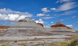
التپي
| |
| Named for: خشب متحجر عُثر عليه في المتنزه | |
| البلد | |
|---|---|
| State | أريزونا |
| Counties | أپاتشي, نڤاهو |
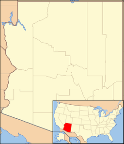
| الموقع | بالقرب من هولبروك [1]
|
| - elevation | 5،436 ft (1،657 m) [1] |
| - الاحداثيات | 35°05′17″N 109°48′23″W / 35.08806°N 109.80639°W |
| أعلى نقطة | |
| - المنسوب | 6،235 ft (1،900 m) [2] |
| أوطى نقطة | |
| - المنسوب | 5،300 ft (1،615 m) [2] |
| المساحة | 221،552 acre (89،659 ha) [3] |
| - Designated wilderness | 50،260 acre (20،340 ha) [4] |
| متنزه وطني | 1962 [5] |
| - National Monument | 1906 |
| Management | National Park Service |
| Visitation | 614,054 (2011) [6] |
| IUCN category | II - National Park [7] |
| الموقع: Petrified Forest National Park | |
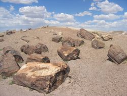
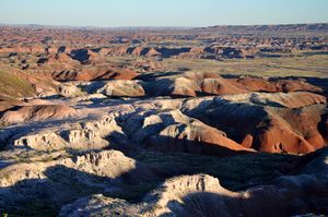
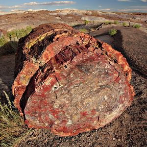
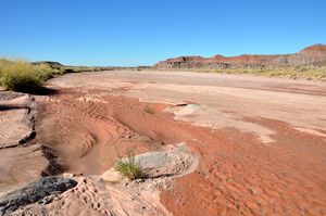
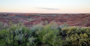
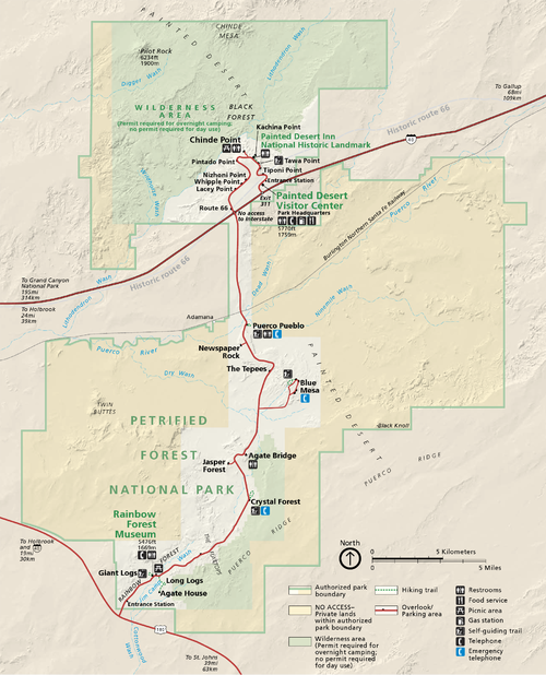
متنزه الغابة المتحجرة الوطني Petrified Forest National Park هو متنزه وطني أمريكي في مقاطعتي نڤاهو وأپاتشي في شمال شرق ولاية أريزونا. وتقع ادارة المتنزه على بعد 26 ميل (42 km) شرق هولبروك على Interstate 40 (I-40)، الذي يوازي خط سكة حديدية. نهر پويركو، وطريق الولايات المتحدة 66 التاريخي، كلهم يعبرون المتنزه تقريباً من الشرق إلى الغرب. اسم المتنزه يأتي من رواسب كبيرة من خشب متحجر، ويغطي نحو 146 ميل مربع (380 km2)، تضم سهوب أكمات شبه صحراوية وكذلك بادلاندز عالية التآكل وملونة. وقد أُعلِن الموقع، الذي يمتد جزؤه الشمالي إلى الصحراء الملونة، National Monument في 1906 ومتنزه وطني في 1962. ويزوره نحو 600,000 شخص سنوياً حيث يشاركون في أنشطة منها الفرجة والتصوير الفوتوغرافي والمشي، وbackpacking.
الجيولوجيا
الأحفورات
المناخ
| بيانات المناخ لـ متنزه الغابة المتحجرة الوطني | |||||||||||||
|---|---|---|---|---|---|---|---|---|---|---|---|---|---|
| الشهر | ينا | فب | مار | أبر | ماي | يون | يول | أغس | سبت | أكت | نوف | ديس | السنة |
| متوسط القصوى اليومية °ف (°س) | 48 (9) |
55 (13) |
62 (17) |
70 (21) |
79 (26) |
90 (32) |
92 (33) |
90 (32) |
84 (29) |
72 (22) |
59 (15) |
49 (9) |
71 (22) |
| متوسط الدنيا اليومية °ف (°س) | 21 (−6) |
25 (−4) |
29 (−2) |
35 (2) |
43 (6) |
52 (11) |
60 (16) |
59 (15) |
52 (11) |
40 (4) |
28 (−2) |
21 (−6) |
39 (4) |
| متوسط تساقط الأمطار inches (mm) | 0.65 (17) |
0.69 (18) |
0.80 (20) |
0.40 (10) |
0.53 (13) |
0.30 (7.6) |
1.45 (37) |
1.62 (41) |
1.33 (34) |
1.20 (30) |
0.79 (20) |
0.78 (20) |
10.54 (267.6) |
| Source: The Weather Channel[8] | |||||||||||||
التاريخ
قبل الولايات المتحدة
الولايات المتحدة
الأحياء
النبيت
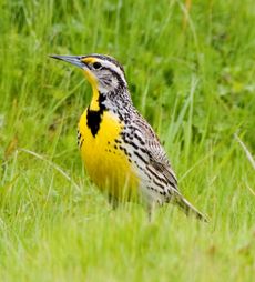
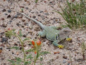
الحيوان
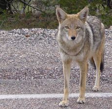
Coyotes are omnivores with a widely varied diet including many rodents.
الأنشطة
طالع أيضاً
الهامش
- ^ أ ب خطأ استشهاد: وسم
<ref>غير صحيح؛ لا نص تم توفيره للمراجع المسماةgnis - ^ أ ب "Natural Features and Ecosystems". National Park Service. Retrieved October 5, 2010.
- ^ "Listing of acreage as of December 31, 2011". Land Resource Division, National Park Service. Retrieved March 7, 2011.
- ^ "Petrified Forest National Wilderness Area". Wilderness.net. Retrieved March 7, 2011.
- ^ The National Parks Index 2009-2011 (PDF). National Park Service. 2009. ISBN 978-0-912627-81-6. Retrieved October 7, 2010.
- ^ قالب:NPS visitation
- ^ "Protected Areas Database of the United States (PAD-US), Version 1.1". US Geological Survey, National Biological Information Infrastructure, Gap Analysis Program (GAP). May 2010. Retrieved November 6, 2010.
- ^ "Monthly Averages for Petrified Forest National Park". The Weather Channel Interactive, Inc. Retrieved October 1, 2010.
أعمال مذكورة
- Ash, Sidney (2005). Petrified Forest: A Story in Stone (2nd rev. ed.). Petrified Forest National Park, Arizona: Petrified Forest Museum Association. ISBN 0-945695-11-X.
- Jones, Anne Trinkle (1993). Stalking the Past: Prehistory at the Petrified Forest. Petrified Forest National Park, Arizona: Petrified Forest Museum Association. ISBN 0-945695-04-7.
- Parker, William G., and Thompson, Patricia A., eds.; Van Riper III, Charles, and Lamow, Marg (2006). "A 2006 Bird Checklist for Petrified Forest National Park" in A Century of Research at Petrified Forest National Park: Bulletin No. 63. Flagstaff, Arizona: Museum of Northern Arizona. ISBN 0-89734-133-3.
- Parker, William G., and Thompson, Patricia A., eds.; Hansen, Monica L., and Thomas, Kathryn A. (2006). "The Flora of a Unique Badland and Arid Grassland Environment: Petrified Forest National Park, Arizona" in A Century of Research at Petrified Forest National Park: Bulletin No. 63. Flagstaff, Arizona: Museum of Northern Arizona. ISBN 0-89734-133-3.
وصلات خارجية
- Official website
- Petrified Forest National Park Wilderness, photo tour at National Park Service
- American Southwest, a National Park Service Discover Our Shared Heritage Travel Itinerary
الكلمات الدالة:
This article contains content from Wikimedia licensed under CC BY-SA 4.0. Please comply with the license terms.
تصنيفات:
- صفحات المعرفة التي فيها البلد أو التقسيم غير معروف
- Pages using gadget WikiMiniAtlas
- Pages using deprecated coordinates format
- Pages using geobox2 unit with unknown unit type
- Pages using geobox with a locator map
- Geobox usage tracking for protected area type
- Official website different in Wikidata and Wikipedia
- مواقع أثرية في أريزونا
- مناطق محمية تأسست في 1962
- Visitor attractions along U.S. Route 66
- متاحف في أريزونا
- متاحف تاريخ طبيعي في أريزونا
- متنزه الغابة المتحجرة الوطني
