كورگان، أوبلاست كورگان
{{ safesubst:#invoke:Unsubst||date=__DATE__|$B=
Kurgan
Курган | |
|---|---|
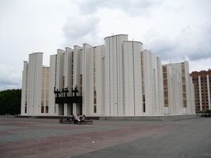
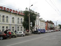 Kuybysheva Street in Kurgan | |
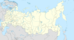
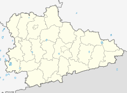
| الإحداثيات: 55°28′N 65°21′E / 55.467°N 65.350°E | |
| البلد | روسيا |
| الكيان الاتحادي | Kurgan Oblast[1] |
| Founded | 1679 |
| City status since | 1782 |
| الحكومة | |
| • الكيان | City Duma[2] |
| • Head | Andrey Yurievish Potapov |
| المساحة | |
| • الإجمالي | 393 كم² (152 ميل²) |
| المنسوب | 75 m (246 ft) |
| التعداد | |
| • الإجمالي | 333٬606 |
| • Estimate (2018) | 318٬045 (−4٫7%) |
| • الترتيب | 53rd in 2010 |
| • الكثافة | 850/km2 (2٬200/sq mi) |
| • Subordinated to | Kurgan City Under Oblast Jurisdiction[1] |
| • Capital of | Kurgan Oblast[1], Kurgan City Under Oblast Jurisdiction[1] |
| • Urban okrug | Kurgan Urban Okrug[5] |
| • Capital of | Kurgan Urban Okrug[5] |
| منطقة التوقيت | UTC+ ([6]) |
| Postal code(s)[7] | 640ххх |
| Dialing code(s) | +7 3522 |
| OKTMO ID | 37701000001 |
| الموقع الإلكتروني | www |
مدينة كورگان (روسية: Курган; النطق الروسي: [kʊrˈgan]؛ Kurgan) تعمل كمركز اداري لأوبلاست كورگان في جنوب منطقة الأورال الاتحادية في روسيا. التعداد: 333,606 (تعداد 2010);[4] 345,515 (تعداد 2002);[8] 355,517 (تعداد 1989).[9] نسمة.
حتى 1782 حملت كورگان اسم Tsaryovo Gorodishche.
التاريخ
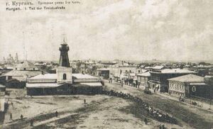
An urban settlement was established here between 1659 and 1662 as Tsaryovo Gorodishche (Царёво Городи́ще) by Timofey Nevezhin, a farmer from Tyumen.[بحاجة لمصدر] In the ensuing years it was developed as a fortress town. It served as a frontier post and its fortified position enabled it to defend other Russian settlements from nomad attacks. Nevertheless, it was itself not always able to withstand such attacks, and was sometimes plundered and burnt down.[بحاجة لمصدر]
The city was granted city privileges by the Empress Catherine the Great in 1782, which is when it acquired its present name and became the seat of an uyezd.[بحاجة لمصدر] الاسم الحالي مأخوذ من كورگان (كوم دفن) كبير بالقرب من المستوطنة الأصلية.
وقد حصلت على درعها في 17 مارس 1785, وأصبحت المركز الادارية لأوبلاست كورگان في 1943.[بحاجة لمصدر] حصلت كورگان على مرتبة الراية الحمراء للعمل في 1982.[بحاجة لمصدر]
الوضع الاداري والبلدي
كورگان هي المركز الاداري للأوبلاست.[1] ضمن إطار التقسيمات الادارية، فقد أُشهـِرت كـ Kurgan City Under Oblast Jurisdiction—an administrative unit with the status equal to that of the districts.[1] As a municipal division, Kurgan City Under Oblast Jurisdiction is incorporated as Kurgan Urban Okrug.[5]
الاقتصاد والعسكرية
تقع كورگان على خط سكة الحديد عبر سيبريا، بين يكاترينبورگ وأومسك. It is served by two railway stations and the Kurgan Airport, and it was home to the Kurgan West air base during the Cold War. It is also home to Russian Ilizarov Scientific Center for Restorative Traumatology and Orthopaedics, KAvZ autobus plant, and the machine building company Kurganmashzavod which produces the widely known BMP-1, BMP-2 and BMP-3 infantry fighting vehicles.
المناخ
Kurgan has a humid continental climate (Köppen climate classification Dfb). Influenced by the Siberian High, it is a relatively dry climate. Winters are cold, although not severe by Siberian standards. Summers are variable but relatively moderate, even though heat waves can bring temperatures well above the 26 °C (79 °F) average July highs.
| بيانات المناخ لـ كورگان | |||||||||||||
|---|---|---|---|---|---|---|---|---|---|---|---|---|---|
| الشهر | ينا | فب | مار | أبر | ماي | يون | يول | أغس | سبت | أكت | نوف | ديس | السنة |
| القصوى القياسية °س (°ف) | 4.3 (39.7) |
8.0 (46.4) |
17.3 (63.1) |
31.3 (88.3) |
36.6 (97.9) |
38.5 (101.3) |
40.5 (104.9) |
38.5 (101.3) |
34.5 (94.1) |
23.8 (74.8) |
14.2 (57.6) |
5.8 (42.4) |
40.5 (104.9) |
| متوسط القصوى اليومية °س (°ف) | −11 (12) |
−9.3 (15.3) |
−1.3 (29.7) |
10.5 (50.9) |
19.2 (66.6) |
24.8 (76.6) |
25.9 (78.6) |
23.2 (73.8) |
16.6 (61.9) |
8.5 (47.3) |
−2.8 (27.0) |
−9.1 (15.6) |
7.9 (46.2) |
| المتوسط اليومي °س (°ف) | −15.2 (4.6) |
−14.2 (6.4) |
−6.5 (20.3) |
4.6 (40.3) |
12.6 (54.7) |
18.4 (65.1) |
19.8 (67.6) |
17.2 (63.0) |
10.9 (51.6) |
3.9 (39.0) |
−6.4 (20.5) |
−12.9 (8.8) |
2.7 (36.9) |
| متوسط الدنيا اليومية °س (°ف) | −19.2 (−2.6) |
−18.6 (−1.5) |
−11.1 (12.0) |
−0.5 (31.1) |
6.5 (43.7) |
12.1 (53.8) |
14.0 (57.2) |
11.8 (53.2) |
6.1 (43.0) |
0.2 (32.4) |
−9.8 (14.4) |
−16.8 (1.8) |
−2.1 (28.2) |
| الصغرى القياسية °س (°ف) | −47.9 (−54.2) |
−47.9 (−54.2) |
−44.3 (−47.7) |
−27.2 (−17.0) |
−17.1 (1.2) |
−3.5 (25.7) |
3.0 (37.4) |
−1.6 (29.1) |
−7.7 (18.1) |
−24.8 (−12.6) |
−38.8 (−37.8) |
−46.4 (−51.5) |
−47.9 (−54.2) |
| متوسط تساقط الأمطار mm (inches) | 19 (0.7) |
12 (0.5) |
14 (0.6) |
18 (0.7) |
39 (1.5) |
52 (2.0) |
54 (2.1) |
54 (2.1) |
42 (1.7) |
31 (1.2) |
26 (1.0) |
22 (0.9) |
383 (15.1) |
| Average rainy days | 1 | 1 | 4 | 10 | 16 | 16 | 15 | 17 | 18 | 14 | 6 | 2 | 120 |
| متوسط الرطوبة النسبية (%) | 82 | 80 | 78 | 66 | 59 | 63 | 69 | 72 | 74 | 77 | 81 | 81 | 74 |
| Mean monthly ساعات سطوع الشمس | 72 | 118 | 185 | 237 | 279 | 306 | 300 | 251 | 180 | 109 | 69 | 56 | 2٬162 |
| Source 1: Pogoda.ru.net[10] | |||||||||||||
| Source 2: NOAA (sun, 1961–1990)[11] | |||||||||||||
المنشآت التعليمية
- الأكاديمية الزراعية
- جامعة كورگان الحكومية
- جامعة كورگان الدولية
- الأكاديمية العسكرية
- Railroad Academy
- Various theaters
- Academy of Labor and Social Relations
أشخاص بارزون
- Oleg Bogomolov (born 1950), governor of Kurgan Oblast
- Dmitri Bushmanov (born 1978), association football player
- Maxim Fadeev (born 1968), singer-songwriter, composer and producer
- Sergej Marulin (born 1971), composer and guitar player
- Gavriil Ilizarov (1921–1992), physician
- Vyacheslav Kamoltsev (born 1971), association football player
- Larisa Korobeynikova (born 1987), fencer
- Evgeni Krasilnikov (1965–2014), volleyball player
- Leonid Krasin (1870–1926), politician and diplomat
- Ivan Kurpishev (born 1969), powerlifter
- Dmitri Loskov (born 1974), association football player
- Aleksey Markovsky (born 1957), swimmer
- Yana Romanova (born 1983), biathlete
- Sergei Rublevsky (born 1974), chess grandmaster
- Yulia Savicheva (born 1987), singer
- Alexander Solonik (1960–1997), hitman
- Elena Temnikova (born 1985), singer
- Sergei Teryayev (born 1994), professional ice hockey defenceman
- Alexander Vinogradov (1930–2011), journalist and writer
- Sergey Vinogradov (1958–2010), journalist, translator, and writer
- Gavriil Abramovich Ilizarov (Russian: Гавриил Абрамович Илизаров; 15 June 1921 – 24 July 1992) was a Soviet physician, known for inventing the Ilizarov apparatus for lengthening limb bones and for the method of surgery named after him, the Ilizarov surgery.
العلاقات الدولية
البلدات التوأم والمدن الشقيقة
كورگان متوأمة مع:
المراجع
الهامش
- ^ أ ب ت ث ج ح خ Law #316
- ^ КУРГАНСКАЯ ГОРОДСКАЯ ДУМА (из Устава города Кургана)
- ^ "Паспорт муниципального образования Курганской области город Курган". City of Kurgan. Archived from the original on مايو 10, 2012. Retrieved أكتوبر 28, 2012.
- ^ أ ب Russian Federal State Statistics Service (2011). "Всероссийская перепись населения 2010 года. Том 1". Всероссийская перепись населения 2010 года (2010 All-Russia Population Census) (in Russian). Federal State Statistics Service. Retrieved يونيو 29, 2012.
{{cite web}}: Invalid|ref=harv(help); Unknown parameter|trans_title=ignored (|trans-title=suggested) (help)CS1 maint: unrecognized language (link) - ^ أ ب ت Law #419
- ^ "Об исчислении времени". Официальный интернет-портал правовой информации (in Russian). يونيو 3, 2011. Retrieved يناير 19, 2019.
{{cite web}}: CS1 maint: unrecognized language (link) - ^ Почта России. Информационно-вычислительный центр ОАСУ РПО. (Russian Post). Поиск объектов почтовой связи (Postal Objects Search) (in روسية)
- ^ Федеральная служба государственной статистики (Federal State Statistics Service) (مايو 21, 2004). "Численность населения России, субъектов Российской Федерации в составе федеральных округов, районов, городских поселений, сельских населённых пунктов – районных центров и сельских населённых пунктов с населением 3 тысячи и более человек[[Category:Articles containing روسية-language text]] (Population of Russia, its federal districts, federal subjects, districts, urban localities, rural localities—administrative centers, and rural localities with population of over 3,000)". Всероссийская перепись населения 2002 года (All-Russia Population Census of 2002) (in Russian). Federal State Statistics Service. Retrieved يوليو 25, 2008.
{{cite web}}: URL–wikilink conflict (help)CS1 maint: unrecognized language (link) - ^ "Всесоюзная перепись населения 1989 г. Численность наличного населения союзных и автономных республик, автономных областей и округов, краёв, областей, районов, городских поселений и сёл-райцентров.[[Category:Articles containing روسية-language text]] (All Union Population Census of 1989. Present population of union and autonomous republics, autonomous oblasts and okrugs, krais, oblasts, districts, urban settlements, and villages serving as district administrative centers.)". Всесоюзная перепись населения 1989 года (All-Union Population Census of 1989) (in Russian). Demoscope Weekly (website of the Institute of Demographics of the State University—Higher School of Economics. 1989. Retrieved ديسمبر 13, 2007.
{{cite web}}: Italic or bold markup not allowed in:|publisher=(help); URL–wikilink conflict (help)CS1 maint: unrecognized language (link) - ^ "Weather and Climate-The Climate of Kurgan" (in الروسية). Weather and Climate. Retrieved نوفمبر 30, 2015.
- ^ "Kurgan Climate Normals 1961–1990". National Oceanic and Atmospheric Administration. Retrieved نوفمبر 30, 2015.
- ^ "Sister Cities". appleton.org. Retrieved أغسطس 30, 2020.
المصادر
وصلات خارجية
- Official website of Kurgan (in روسية)
- Kurgan news portal (in روسية)
- Cultural heritage of Kurgan (in روسية)
- Pages using gadget WikiMiniAtlas
- CS1 errors: unsupported parameter
- Articles with روسية-language sources (ru)
- Articles containing روسية-language text
- CS1 errors: URL–wikilink conflict
- CS1 errors: markup
- CS1 الروسية-language sources (ru)
- Short description is different from Wikidata
- Use mdy dates from October 2012
- Coordinates on Wikidata
- Pages using infobox settlement with image map1 but not image map
- Articles with unsourced statements from August 2020
- Articles with unsourced statements from May 2010
- كورگان، أوبلاست كورگان
- تأسيسات 1662 في روسيا
- أماكن مأهولة تأسست في 1662
- Kurgansky Uyezd
- صفحات مع الخرائط


