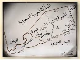
جغرافيا اليمن
 | |
| القارة | آسيا |
|---|---|
| المنطقة | الشرق الأوسط |
| الإحداثيات | 15°N 48°E / 15°N 48°E |
| المساحة | Ranked رقم 49 |
| • الإجمالية | 555.000 km2 (214.287 sq mi) |
| الخط الساحلي | 1.906 km (1.184 mi) |
| الحدود | 1.746 كم عُمان: 288 كم السعودية: 1.458 كم |
| أعلى نقطة | جبل النبي شعيب 3.667 م |
| أوطى نقطة | بحر العرب 0 م |
| المصادر الطبيعية | النفط، الغاز، الملح الصغري، الرخام |
تقع اليمن في جنوب غرب آسيا، على الطرف الجنوبي من شبه الجزيرة العربية، بين سلطنة عمان والسعودية. تقع اليمن عند مدخل مضيق باب المندب، الذي يربط البحر الأحمر بالمحيط الهندي (عبر خليج عدن) وهو واحد من أكثر ممرات الشحن نشاطًا واستراتيجية في العالم. تبلغ مساحة اليمن 555.000 كيلومتر مربع، بما في ذلك جزر بريم في الطرف الجنوبي للبحر الأحمر وسقطرى عند مدخل خليج عدن.[1] يبلغ إجمالي الحدود البرية لليمن 1.746 كم. تحدها شمالاً السعودية (1458 كم) وسلطنة عمان من الشمال الشرقي (288 كم).[2]
من خلال جزيرة سقطرى، تشترك اليمن أيضًا في الحدود مع قناة غواردافوي والبحر الصومالي.[3]
الطبوغرافيا
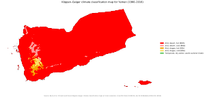
تحتل اليمن الطرف الجنوبي من الصفيحة العربية.[5]
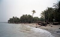
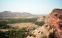
المناطق الداخلية الجبلية في البلاد محاطة بسهول ساحلية ضيقة من الغرب والجنوب والشرق وصحراء المرتفعات من الشمال على امتاد الحدود مع السعودية. تهامة هي سهل ساحلي شبه صحراوي يبلغ طوله 419 كيلومترًا ويمتد على ساحل البحر الأحمر وهو جزء من منطقة بيئية تسمى صحراء الضباب الساحلية لشبه الجزيرة العربية. تتخلل مناطق المرتفعات الوديان، أو وديان الأنهار، التي تجف في أشهر الشتاء (اليمن ليس بها أنهار دائمة) وأبرزها وادي حضرموت في شرق اليمن، الأجزاء العليا من التي تحتوي على تربة غرينية ومياه فيضانات والجزء السفلي منها قاحل وغير مأهول إلى حد كبير. كل من منطقة الهضبة الشرقية والصحراء في الشمال حارة وجافة مع القليل من الغطاء النباتي.[2]
في الربع الخالي الشمالي الشرقي، تغلب الرمال على تضاريس المنطقة، كونها أكبر مساحة رملية في العالم. قد تتسقاط عليها القليل الأمطار أو لا يحدث هطول للأمطار لفترات طويلة. تنمو القليل من النباتات هناك أيضًا. تعتبر المرتفعات الوسطى أكثر جفافاً من المرتفعات الغربية بسبب تأثيرات الأمطار الشحيحة، لكنها لا تزال تتلقى أمطارًا كافية في السنوات الرطبة لزراعة المحاصيل بشكل موسع. تعد تغيرات درجات الحرارة اليومية من بين أعلى المعدلات في العالم: تتراوح درجات الحرارة من 30 درجة مئوية نهاراً إلى 0 درجة مئوية ليلاً. يسمح تخزين المياه بالري وزراعة القمح والشعير بينما تشتهر المرتفعات الغربية بالذرة الرفيعة والبن وبعض الفواكه الاستوائية مثل الموز والمانجو.
الارتفاع
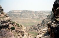
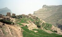
Yemen is a continuously elevated country, with only the coastal plains being the lowest-lying areas. Jagged peaks and plateaus cover most of Yemen, and the average elevation in the country is about 2،000 متر (6،600 ft). The interior mountains have elevations ranging from a few hundred meters to the highest point in the country and the Arabian Peninsula, Jabal An-Nabi Shu'ayb, which is 3،666 m (12،028 ft) above sea level, within the Harazi subrange of the Sarawat.[6][7] The range of elevation is thus from sea level to 3،666 متر (12،028 ft), and among the countries in the Arab world, it is the one with the second highest high point, after Morocco's 4،167 متر (13،671 ft) high Jbel Toubkal. The Yemenis used the elevation of their homeland to stay isolated for thousands of years with foreign trade conducted only when the Yemenis wished to go to the coastal areas. The mountains are young, jagged peaks that are known to rise from an elevation of a few hundred meters to well over 3،000 m (9،800 ft). The mountains can be separated into a western and central highland. The western highlands have peaks reaching around 3،000 متر (1.9 ميل), with relatively fertile soil and sufficient and plentiful rainfall. The central highlands is more like a plateau of about 2،000–3،200 متر (1.2–2.0 ميل), with rolling hills, small knolls, and some very prominent peaks, but is still relatively more elevated. Less rainfall can be seen in this region, but the summer months give enough to sustain crops.
المناخ
Temperatures are lower in most of Yemen than in most of the Arab world due to most of the country being at high elevation. Rainfall is higher at higher elevations. The highlands enjoy a temperate, rainy summer with an average high temperature of 21 °C (69.8 °F) and a cool, moderately dry winter with temperatures occasionally dipping below 0 °C (32.0 °F). The climate of the Tihamah (western coastal plain) is tropical; temperatures occasionally exceed 54 °C (129.2 °F), and the humidity ranges from 50 to 70 percent. Rainfall, which comes in irregular heavy torrents, averages 130 ميليمتر (5.12 in) annually. In Aden the average temperature is 25 °C (77.0 °F) in January and 32 °C (89.6 °F) in June, but with highs often exceeding 37 °C (98.6 °F). Average annual rainfall is 127 ميليمتر (5 in). The highest mountainous areas of southern Yemen receive from 520 إلى 760 mm (20.5 إلى 29.9 in) of rain a year. Some areas of the western highlands, most notably Ibb and Ta'izz, receive from about 1،000–1،500 ميليمتر (39.4–59.1 in) of rain each year. The capital, Sana'a, receives around 300 mm (11.8 in) a year, it is not uncommon for the northern and eastern sections of the country to receive no rain for five years or more. The Wadi Hadhramaut in the eastern part of Yemen is arid and hot, and the humidity ranges from 35 percent in June to 64 percent in January. Yemen has the most fertile land in the Arabian peninsula.
| بيانات المناخ لـ صنعاء، اليمن | |||||||||||||
|---|---|---|---|---|---|---|---|---|---|---|---|---|---|
| الشهر | ينا | فب | مار | أبر | ماي | يون | يول | أغس | سبت | أكت | نوف | ديس | السنة |
| القصوى القياسية °س (°ف) | 30 (86) |
31 (88) |
32 (90) |
32 (90) |
37 (99) |
39 (102) |
41 (106) |
38 (100) |
40 (104) |
34 (93) |
33 (91) |
31 (88) |
41 (106) |
| متوسط القصوى اليومية °س (°ف) | 22.3 (72.1) |
24.7 (76.5) |
25.6 (78.1) |
24.8 (76.6) |
25.7 (78.3) |
28.2 (82.8) |
26.6 (79.9) |
25.9 (78.6) |
25.1 (77.2) |
22.2 (72.0) |
20.3 (68.5) |
20.5 (68.9) |
24.3 (75.8) |
| المتوسط اليومي °س (°ف) | 12.6 (54.7) |
14.1 (57.4) |
16.3 (61.3) |
16.6 (61.9) |
18.0 (64.4) |
19.3 (66.7) |
20.0 (68.0) |
19.6 (67.3) |
17.8 (64.0) |
15.0 (59.0) |
12.9 (55.2) |
12.4 (54.3) |
16.2 (61.2) |
| متوسط الدنيا اليومية °س (°ف) | 3.0 (37.4) |
3.6 (38.5) |
7.0 (44.6) |
8.5 (47.3) |
10.4 (50.7) |
10.5 (50.9) |
13.4 (56.1) |
13.3 (55.9) |
10.6 (51.1) |
7.9 (46.2) |
5.5 (41.9) |
4.4 (39.9) |
8.2 (46.7) |
| الصغرى القياسية °س (°ف) | −4 (25) |
−1 (30) |
1 (34) |
4 (39) |
1 (34) |
9 (48) |
5 (41) |
0 (32) |
3 (37) |
1 (34) |
−1 (30) |
−2 (28) |
−4 (25) |
| متوسط تساقط الأمطار mm (inches) | 5 (0.2) |
5 (0.2) |
17 (0.7) |
48 (1.9) |
29 (1.1) |
6 (0.2) |
50 (2.0) |
77 (3.0) |
13 (0.5) |
2 (0.1) |
8 (0.3) |
5 (0.2) |
265 (10.4) |
| Average rainy days | 2 | 3 | 4 | 5 | 5 | 4 | 4 | 5 | 3 | 3 | 2 | 1 | 41 |
| متوسط الرطوبة النسبية (%) | 39.3 | 35.8 | 38.5 | 41.1 | 36.0 | 27.2 | 40.1 | 45.5 | 29.9 | 29.0 | 38.1 | 37.7 | 36.5 |
| المتوسط اليومي ساعات سطوع الشمس | 8 | 8 | 8 | 9 | 9 | 8 | 6 | 7 | 8 | 9 | 9 | 8 | 8 |
| Source 1: Climate-Data.org (على ارتفاع: 2259م)،[8] Weather2Travel (الأيام المطيرة، الأيام المشرقة)[9] | |||||||||||||
| Source 2: Climatebase.ru (الرطوبة)،[10] Voodoo Skies (السجلات)[11] | |||||||||||||
| بيانات المناخ لـ عدن | |||||||||||||
|---|---|---|---|---|---|---|---|---|---|---|---|---|---|
| الشهر | ينا | فب | مار | أبر | ماي | يون | يول | أغس | سبت | أكت | نوف | ديس | السنة |
| القصوى القياسية °س (°ف) | 31.1 (88.0) |
31.7 (89.1) |
35.0 (95.0) |
37.8 (100.0) |
41.1 (106.0) |
41.1 (106.0) |
41.1 (106.0) |
42.8 (109.0) |
38.3 (100.9) |
38.9 (102.0) |
35.0 (95.0) |
32.8 (91.0) |
42.8 (109.0) |
| متوسط القصوى اليومية °س (°ف) | 28.5 (83.3) |
28.6 (83.5) |
30.2 (86.4) |
32.2 (90.0) |
34.1 (93.4) |
36.6 (97.9) |
35.9 (96.6) |
35.3 (95.5) |
35.4 (95.7) |
33.0 (91.4) |
30.7 (87.3) |
28.9 (84.0) |
32.4 (90.3) |
| المتوسط اليومي °س (°ف) | 25.7 (78.3) |
26.0 (78.8) |
27.2 (81.0) |
28.9 (84.0) |
31.0 (87.8) |
32.7 (90.9) |
32.1 (89.8) |
31.5 (88.7) |
31.6 (88.9) |
28.9 (84.0) |
27.1 (80.8) |
26.0 (78.8) |
29.1 (84.4) |
| متوسط الدنيا اليومية °س (°ف) | 22.6 (72.7) |
23.2 (73.8) |
24.0 (75.2) |
25.6 (78.1) |
27.7 (81.9) |
28.8 (83.8) |
28.0 (82.4) |
27.5 (81.5) |
27.8 (82.0) |
24.6 (76.3) |
23.2 (73.8) |
22.9 (73.2) |
25.5 (77.9) |
| الصغرى القياسية °س (°ف) | 15.6 (60.1) |
17.2 (63.0) |
18.9 (66.0) |
18.9 (66.0) |
21.1 (70.0) |
23.9 (75.0) |
22.8 (73.0) |
23.3 (73.9) |
25.0 (77.0) |
18.9 (66.0) |
18.3 (64.9) |
16.7 (62.1) |
15.6 (60.1) |
| متوسط تساقط الأمطار mm (inches) | 6 (0.2) |
3 (0.1) |
5 (0.2) |
2 (0.1) |
1 (0.0) |
0 (0) |
3 (0.1) |
3 (0.1) |
5 (0.2) |
1 (0.0) |
3 (0.1) |
5 (0.2) |
36 (1.4) |
| Average precipitation days (≥ 0.1 mm) | 3 | 2 | 2 | 2 | 1 | 1 | 2 | 2 | 1 | 1 | 1 | 3 | 20 |
| متوسط الرطوبة النسبية (%) | 72 | 72 | 74 | 74 | 72 | 66 | 65 | 65 | 69 | 68 | 70 | 70 | 70 |
| Mean monthly ساعات سطوع الشمس | 241.8 | 203.4 | 217.0 | 240.0 | 303.8 | 282.0 | 241.8 | 269.7 | 270.0 | 294.5 | 285.0 | 257.3 | 3٬106٫3 |
| المتوسط اليومي ساعات سطوع الشمس | 7.8 | 7.2 | 7.0 | 8.0 | 9.8 | 9.4 | 7.8 | 8.7 | 9.0 | 9.5 | 9.5 | 8.3 | 8.5 |
| Source: Deutscher Wetterdienst[12] | |||||||||||||
الموارد الطبيعية
Yemen's principal natural resources are oil and natural gas as well as agriculturally productive land in the west. Other natural resources include fish and seafood, rock salt, marble, and major unexplored deposits of coal, gold, lead, nickel, and copper.[2]
استخدام الأراضي
Only 2.91 percent of Yemen is considered to be arable land, and less than 0.6 percent of the land is planted with permanent crops. About 6،801 متر كيلومربع (2،626 sq mi) of the land is irrigated. According to the United Nations, Yemen has 19،550 متر كيلومربع (7،550 sq mi) of forest and other wooded land, which constitutes almost 4 percent of total land area.[2]
العوامل البيئية
Yemen is subject to sandstorms and dust storms, resulting in soil erosion and crop damage. The country has very limited natural freshwater and consequently inadequate supplies of potable water. Desertification (land degradation caused by aridity) and overgrazing are also problems.[2] It is a party to international Biodiversity, Climate Change, Desertification, Endangered Species, Environmental Modification, Hazardous Wastes, Law of the Sea, and Ozone Layer Protection agreements.[13]
الأراضي المتنازع عليها
Yemen has 1،906 كيلومتر (1،184 mi) of coastline along the Arabian Sea, the Gulf of Aden, and the Red Sea. Yemen claims a territorial sea of 12 ميل بحري (13.8 mi; 22.2 km), a contiguous zone of 24 ميل بحري (27.6 mi; 44.4 km), an Exclusive Economic Zone of 552،669 km2 (213،387 sq mi) based on 200 ميل بحري (230.2 mi; 370.4 km). It has a continental shelf of 200 ميل بحري (230.2 mi; 370.4 km) or to the edge of the continental margin.[2]
A long-standing dispute between Saudi Arabia and Yemen was resolved in June 2000 with the signing of the Treaty of Jeddah. This agreement provides coordinates for use in delineating the land and maritime border, including the section in the eastern desert region of Yemen that potentially contains significant amounts of oil. Friction between the two countries in recent years over security of the borders appears to have been alleviated by the establishment of joint border patrols. Following years of dispute between Yemen and Eritrea over ownership of the Hanish Islands and fishing rights in the Red Sea, in 1999 an international arbitration panel awarded sovereignty of the islands to Yemen. Relations between the two countries remain strained, however, and Yemen continues to protest Eritrean fishing in the disputed territory.[2]
انظر أيضاً
المصادر
- ^ "About Yemen". Ministry of Oil and Minerals.
- ^ أ ب ت ث ج ح خ "Country Profile: Yemen" (PDF). Federal Research Division. United States Library of Congress. August 2008. Archived from the original (PDF) on 16 March 2015. Retrieved 23 May 2019. This article incorporates text from this source, which is in the public domain.
- ^ McLaughlin, Rob. "The Continuing Conundrum of the Somali Territorial Sea and Exclusive Economic Zone." The International Journal of Marine and Coastal Law 30.2 (2015): 305-334.
- ^ Peel, M. C. and Finlayson, B. L. and McMahon, T. A. (2007). "Updated world map of the Köppen–Geiger climate classification". Hydrol. Earth Syst. Sci. 11 (5): 1633–1644. Bibcode:2007HESS...11.1633P. doi:10.5194/hess-11-1633-2007. ISSN 1027-5606.
{{cite journal}}: CS1 maint: multiple names: authors list (link) (direct: Final Revised Paper) - ^ Hadden, R. L. (2012), The Geology of Yemen: An Annotated Bibliography of Yemen's Geology, Geography, and Earth Science, Alexandria, VA: Army Geospatial Center, U.S. Army Corps of Engineers, https://purl.fdlp.gov/GPO/gpo31923
- ^ Robert D. Burrowes (2010). Historical Dictionary of Yemen. Rowman & Littlefield. pp. 5–340. ISBN 978-0-8108-5528-1.
- ^ McLaughlin, Daniel (2008). "1: Background". Yemen. Bradt Travel Guides. p. 3. ISBN 978-1-8416-2212-5.
- ^ "Climate: Sanaa - Climate graph, Temperature graph, Climate table". Climate-Data.org. Retrieved 2014-02-23.
- ^ "Sana Climate and Weather Averages, Yemen". Weather2Travel. Retrieved 2014-02-23.
- ^ "Sanaa, Yemen". Climatebase.ru. Retrieved 2014-02-23.
- ^ "Sanaa, Yemen". Voodoo Skies. Retrieved 2014-02-23.
- ^ "Klimatafel von Aden-Chormaksar / Jemen" (PDF). Baseline climate means (1961–1990) from stations all over the world (in الألمانية). Deutscher Wetterdienst. Retrieved 25 February 2016.
- ^ "Yemen". The World Factbook. United States Central Intelligence Agency. Retrieved 23 May 2019.

