كريبي
كريبي
Kribi | |
|---|---|
 شاطئ كريبي، 2006 | |
  كريبي الموقع في الكاميرون الوضع على الخريطة تقريبي | |
| الإحداثيات: 02°56′06″N 09°54′36″E / 2.93500°N 9.91000°E | |
| البلد |  الكاميرون الكاميرون |
| المنطقة | الجنوبية |
| القسم | Océan |
| المنسوب | 13 m (43 ft) |
| التعداد (2012)[1] | |
• الإجمالي | 80٬957 |


كريبي هي منتجع شاطئي و ميناء بحري في الكاميرون.
الموقع
The coastal town of Kribi lies on the خليج غينيا, in Océan Department, المنطقة الجنوبية، على مصب Kienké River. هذا الموقع، على بعد نحو ١٥٠ كم، على الطريق، جنوب دوالا، أكبر مدن الكاميرون وأزحم ميناء بحري في البلاد.[2] The coordinates of Kribi are: 2° 56' 6.00"N, 9° 54' 36.00"E (Latitude: 2.9350; Longitude: 9.9100)
استعراض

It has an estimated population of 55,401.[3] It services sea traffic in the Gulf of Guinea and also lies near the terminus of the Chad-Cameroon pipeline. The Lobé Waterfalls are nearby and there is a road inland, through the Littoral Evergreen Forest, as far as Bipindi and Lolodorf where native communities of Pygmies are found.
البنية البلدية
Kribi is more of a municipality than a developed town. The town is divided into Kribi Première, with its main town, Massaka, and Kribi Deuxième, with its main town, Dombé.
الصحة العامة
A January 2024 study[4] found high levels of parasitic worm eggs and larvae in waters along Kribi's famed beach. The species included tapeworms and nematode worms that cause significant morbidity in humans, likely passed from human fecal material in waste water.
محطة كهرباء كريبي
Kribi Power Development Company (KPDC) has built a natural gas-powered electricity generating plant, Kribi Power Station, in the community of Mpolongwe, approximately 10 كيلومتر (6.2 mi), north of the Kribi central business district. The 216 MW plant that cost US$390 million (CFA:176.3 billion) to build,[5] came on line in 2013. It is now owned by Globeleq[6] A second phase expansion is planned.
الميناء
Near Kribi is the location of a proposed port for the export of iron ore from about 500 كيلومتر (310 mi) away and also bauxite. Since there is no natural harbour at Kribi, the port itself would be several kilometres offshore where deepwater of at least 20 متر (66 ft) is suitable for large Capesize ships.[7] It is also the location for the Kribi Lighthouse.
By 2017, the port development had started,[8] and by 2020 the port was being developed by Louis Berger.[9]
The port will be served by railways of two different gauges, 1435mm and 1000mm. There will be a new 130 km rail link between the port and the existing metre gauge network at Edéa. Dual gauge sleepers could be installed so that the new lines are compatible with the proposed African Integrated High Speed Rail Network (AIHSRN).
The port of Kribi is supported by Autonome de Kribi[10] It is also cooperates with the Cameroon National Ports Authority (APN)[11] The port of Kribi is a member of the International Association of Ports and Harbors (IAPH).[12][13]
على ساحل وسط أفريقيا، في موقع تجاهلته طرق الشحن العالمية لعقود، يمتد الآن ميناء ضخم للمياه العميقة في المحيط الأطلسي، وهو ميناء كريبي للمياه العميقة. يقع الميناء على الساحل الجنوبي للكاميرون، على امتداد خليج غينيا، على بعد حوالي 150 كم جنوب دوالا، المركز التجاري الرئيسي للبلاد. على المستوى الأساسي، هو ميناء مياه عميقة حديث، بُني للتعامل مع أحجام البضائع والسفن التي تعجز عنها الموانئ القديمة في المنطقة. لكن لفهم أهمية ميناء كريبي، لا بد من النظر إلى ما كان موجوداً قبل إنشائه. فعلى مدى عقود، اعتمدت الكاميرون اعتماداً كبيراً على ميناء دوالا. كان هذا الميناء يُعالج غالبية واردات وصادرات البلاد، كما كان بمثابة بوابة للبلدان المجاورة غير الساحلية مثل تشاد وجمهورية أفريقيا الوسطى. لكن المشكلة تكمن في أن ميناء دوالا لم يُصمم أصلاً لتلبية متطلبات صناعة الشحن الحالية. فهو يقع على ضفاف نهر ووري، مما يعني أن السفن مُضطرة للإبحار عبر قناة ضيقة باتجاه الداخل.[14]
العمق محدود، ويتراوح عادةً بين سبعة وثمانية أمتار، مما يقيد حجم السفن التي يمكنها الرسو. أما السفن الأكبر حجماً، فلا يمكنها الدخول أو يتعين عليها تخفيض حمولتها قبل الوصول. يُؤدي هذا إلى سلسلة من التفاعلات. فالسفن الأصغر حجماً تحمل حمولة أقل، مما يزيد من تكلفة الوحدة. ويتفاقم الازدحام مع ازدياد مدة انتظار السفن للرسو. تؤدي التأخيرات في الميناء إلى إبطاء جميع العمليات في المناطق الداخلية، بدءًا من النقل بالشاحنات وصولًا إلى التوزيع. ومع تحول التجارة العالمية نحو سفن الحاويات الأكبر حجماً والأحجام الأعلى، ازدادت هذه الفجوة وضوحاً. لذا، واجهت الكاميرون خياراً واضحاً. إما الاستمرار في الاعتماد على نظام قديم يحد من النمو، أو بناء نظام جديد كلياً يضاهي حجم التجارة العالمية الحديثة. تمثل كريبي الخيار الثاني. وقد خُطط لها كحل طويل الأمد، ليس فقط لتجاوز قيود دوالا، بل لتوسيع دور الكاميرون في التجارة الإقليمية.
كانت الفكرة بسيطة، بناء ميناء على الساحل المفتوح، وتصميمه لاستقبال السفن الكبيرة منذ البداية، وتوفير طاقة استيعابية كافية لخدمة ليس بلد واحد فحسب، بل منطقة بأكملها. ومع ذلك، لم يقع الاختيار على كريبي صدفة. عندما بدأ المخططون البحث عن موقع لميناء جديد، لم يكونوا يبحثون عن أرض خالية فحسب، بل كانوا بحاجة إلى موقع قادر على استيعاب السفن الكبيرة دون الحاجة إلى تحديثات مستمرة، موقع يمكن تشغيله بكفاءة منذ البداية مع إمكانية التوسع على مدى عقود. وقد وفرت كريبي ميزة نادرة على طول ساحل وسط أفريقيا، ألا وهي العمق الطبيعي. يصل عمق الخط الساحلي قرب كريبي إلى حوالي 16 متراً بالقرب من الشاطئ، وهو عمق كافي لاستقبال سفن الحاويات الكبيرة دون الحاجة إلى عمليات تجريف واسعة النطاق. أما في موانئ مثل دوالا، فتضطر السلطات إلى تجريف مجرى النهر باستمرار للحفاظ على العمليات الأساسية. يُضيف ذلك تكاليف وتأخيرات ومشاكل صيانة طويلة الأمد. أما في كريبي، فقد تم تقليل هذه المشكلة إلى حد كبير. إذ يُمكن للسفن الاقتراب مباشرة من المحيط الأطلسي، والرسو بشكل أسرع، والمغادرة دون الحاجة إلى الإبحار في الممرات المائية الداخلية الضيقة. هذا وحده يُغيّر من كفاءة الميناء. لكن العمق لم يكن سوى جزء من القرار. فالموقع يُتيح أيضاً الوصول المباشر إلى طرق الشحن الرئيسية في خليج غينيا.
يمكن للبضائع المتجهة بين أوروپا وآسيا وغرب أفريقيا الوصول إلى ميناء كريبي دون الحاجة إلى تحويلات كبيرة. وهذا يُسهّل دمج الميناء في شبكات التجارة العالمية. ثم هناك المساحة المتاحة. تقع كريبي على امتداد ساحلي مفتوح نسبياً، مع مساحات شاسعة من الأراضي المتاحة للتوسع. وهذا أمر هام لأن الموانئ الحديثة لم تعد مجرد نقاط رسو، بل أصبحت مراكز لوجستية ومناطق صناعية ومراكز معالجة. في كريبي، لم يقتصر تخصيص الأراضي على محطات الموانئ فحسب، بل شمل أيضاً الصناعات المستقبلية، ومصانع الصلب، ومرافق المعالجة، ومناطق التخزين، وشبكات النقل. ويرتبط هذا ارتباطاً وثيقاً بفكرة أوسع نطاقاً، فبدلاً من مجرد تصدير المواد الخام عبر نظام قائم، يتمثل الهدف في بناء منظومة متكاملة تُمكّن من تداول البضائع وتخزينها وشحنها من الموقع نفسه. يُقلل ذلك من تكاليف النقل، ويُقصر سلاسل التوريد، ويُبقي المزيد من النشاط الاقتصادي داخل البلاد. لذا، يُلبي مشروع كريبي ثلاثة متطلبات أساسية في آنٍ واحد: المياه العميقة، والوصول المباشر إلى المحيط، ومساحة للتوسع. لكن اختيار الموقع لم يكن سوى الخطوة الأولى.
كان التحدي التالي هو بناء ميناء بهذا الحجم، وتمويله، وربطه بشبكات التجارة العالمية. إن بناء ميناء بحري عميق من الصفر يتطلب أكثر من مجرد موقع جيد، فهو يتطلب تمويلاً طويل الأجل، وخبرة فنية، والقدرة على إنجاز مشاريع البنية التحتية الضخمة في المواعيد المحددة. وهنا برز دور الصين المحوري في تطوير ميناء كريبي العميق. وقد تقدم المشروع على مراحل، حيث بدأت المرحلة الأولى من بناء كريبي عام 2012، وبدأ تشغيله رسمياً عام 2018 تقريباً. شملت هذه المرحلة محطة الحاويات الرئيسية وأرصفة متعددة الأغراض، صُممت لتخفيف الضغط فوراً عن الموانئ القديمة مثل دوالا. وجاء التمويل في معظمه من بنك التصدير والاستيراد الصيني، الذي قدم غالبية القروض اللازمة لبناء الميناء. وتختلف التقديرات باختلاف طريقة حساب المراحل، لكن قيمة المرحلة الأولى وحدها بلغت حوالي 1.2 بليون دولار.
أما فيما يتعلق بالجانب الإنشائي، فقد كانت شركة هندسة الموانئ الصينية، إحدى أكبر شركات الهندسة المملوكة للدولة في الصين والمعروفة ببناء الموانئ والجسور والبنية التحتية الساحلية في قارات متعددة، هي المقاول الرئيسي. وكان حجم العمل ضخماً، حيث كان على المهندسين إنشاء أرصفة مياه عميقة، وحواجز أمواج لحماية الميناء من تقلبات المحيط، ومناطق واسعة لمناولة الحاويات. لم يكن هذا تحديثاً لمنشأة قائمة، بل كان ميناءً جديداً تماماً بُني على ساحل مفتوح. ثم جاء التوسع عام 2025. دفعت المرحلة الثانية المشروع للمضي قدماً، بإضافة محطات إضافية، وزيادة الطاقة الاستيعابية، وتجهيز الميناء لتصدير البضائع السائبة مثل خام الحديد. وقد أضافت هذه المرحلة مئات الملايين إلى التكلفة الإجمالية، ليصل إجمالي الاستثمار إلى ما يقارب 2 بليون دولار.
أما بالنسبة للكاميرون، فالفوائد واضحة. تحصل الدولة على بنية تحتية حديثة ربما لم تكن لتستطيع تمويلها بمفردها بهذا الحجم، إلى جانب الوصول إلى خبرات عالمية في مجال الإنشاءات وتسريع وتيرة إنجاز المشاريع. أما بالنسبة للصين، فالفوائد ذات طابع استراتيجي، إذ تضمن المؤسسات والشركات الصينية مشاركة طويلة الأمد في النظام التجاري الإقليمي. يشمل ذلك النفوذ على شبكات الخدمات اللوجستية، والوصول إلى المواد الخام، وتعزيز الروابط الاقتصادية في جميع أنحاء وسط أفريقيا. ولكن هناك أيضاً منافسة، حيث تشهد الموانئ في بلدان مثل نيجيريا والگابون توسعاً وتحديثاً. يسعى كل منها إلى ترسيخ مكانته كبوابة رئيسية للتجارة الإقليمية. يدخل ميناء كريبي هذه المنافسة بميزة تقنية من حيث العمق والتصميم، لكن ذلك وحده لا يضمن لها الهيمنة. ما يمنح ميناء كريبي الأفضلية هو هيكله طويل الأمد.
يجمع هذا المشروع بين ميناء بحري عميق ومنطقة صناعية وشبكة مواصلات مستقبلية في موقع واحد. وإذا ما رُبطت هذه العناصر بشكل صحيح، فإنه قادر على جذب تدفقات تجارية تمر حالياً عبر عدة بلدان. ولكن ثمة شرط، لكي تعتمد تشاد أو جمهورية أفريقيا الوسطى على ميناء كريبي، يجب أن تنتقل البضائع بكفاءة من الميناء إلى وجهاتها الداخلية. وهذا يتطلب شبكة طرق وسكك حديدية قوية، وتنسيقاً حدودياً، وخدمات لوجستية متواصلة. وبدون ذلك، ستقتصر فائدة الميناء على الساحل فقط. لذا، فبينما يمتلك مشروع كريبي القدرة على إعادة تشكيل طرق التجارة عبر وسط أفريقيا، فإن هذه النتيجة تعتمد على عوامل تتجاوز الميناء نفسه. فهي تعتمد على ما إذا كانت الوصلات الداخلية قادرة على منافسة حجم وكفاءة ما تم بناؤه بالفعل على الساحل. وهذا يقودنا إلى أحد أهم جوانب هذا المشروع برمته. يستطيع الميناء استيعاب ملايين الأطنان من البضائع، لكن بدون روابط قوية مع المناطق الداخلية، تبقى هذه القدرة غير مستغلة بالكامل. هذا هو التحدي الرئيسي الذي يواجه ميناء كريبي البحري العميق. حالياً، تُنقل معظم البضائع المغادرة من كريبي براً.
استثمرت الكاميرون في شبكات الطرق السريعة التي تربط كريبي بالمدن الرئيسية مثل دوالا وياوندي. تسمح هذه الطرق بنقل الحاويات والبضائع السائبة إلى المناطق الداخلية، إلا أن النقل البري له حدوده. فهو أبطأ، وأكثر تكلفة للطن الواحد على مسافات طويلة، وعرضة للازدحام والتلف مع مرور الوقت. بالنسبة للمسافات القصيرة، يمكن للطرق استيعاب حجم الشحن، لكن بالنسبة لميناء مصمم لخدمة منطقة بأكملها، لا تكفي الطرق وحدها، ويصبح النقل بالسكك الحديدية أمراً بالغ الأهمية. تمتلك الكاميرون بالفعل شبكة سكك حديدية تديرها شركة كامريل، تربط المدن الرئيسية وتمتد شمالاً. مع ذلك، لم تُصمم هذه الشبكة في الأصل لاستيعاب حجم الشحن الثقيل والكبير المتوقع أن يولده ميناء كريبي.
لذا، ثمة حاجة إلى روابط جديدة. وقد نوقشت خطط لإنشاء خطوط سكك حديدية تربط كريبي مباشرةً بالمناطق الصناعية الداخلية ومناطق التعدين. وستتيح هذه الخطوط نقل البضائع السائبة، مثل خام الحديد، بكفاءة من مواقع الاستخراج إلى الميناء. يعتبر هذا الأمر هاماً لأن الصادرات بالجملة تعتمد على حجمها. نقل خام الحديد أو البوكسيت بالشاحنات لمسافات طويلة ليس مجدياً اقتصادياً. يقلل النقل بالسكك الحديدية من التكاليف لكل طن ويسمح بنقل كميات كبيرة بشكل مستمر. إذن، يبدو الوضع كالتالي: على الساحل، تمتلك الكاميرون الآن أحد أكثر الموانئ تطوراً في المنطقة، لكن في الداخل، لا يزال النظام قيد التطوير. إذا ما تقدمت مشاريع السكك الحديدية واستمر تحسن شبكات الطرق، فسيتمكن ميناء كريبي من العمل بكامل طاقته تقريباً. إذا تأخرت هذه الروابط، فإن الميناء يُخاطر بأن يصبح منشأة ذات سعة عالية دون قدرة كافية على المناولة. وهذا يُحدث فجوة بين الإمكانات والواقع، وتزداد هذه الفجوة أهميةً عند النظر إلى ما بُني هذا الميناء من أجله في الأصل. فإلى جانب الحاويات والبضائع العامة، يعتمد جزء كبير من استراتيجية كريبي طويلة الأجل على أمر واحد.
الموارد الطبيعية والقدرة على تصديرها على نطاق واسع. لذا، عندما تنظر إلى هذا الميناء البحري العميق، يتضح حجمه جلياً. تمتلك الكاميرون الآن ميناءً بحرياً عميقاً قادراً على استقبال بعض أكبر السفن العاملة اليوم، وهو أمر عانت منه المنطقة لعقود. تتمتع المدينة بمساحة للتوسع، وخطط للنمو الصناعي، ودعم من إحدى أكثر شركات بناء البنية التحتية نشاطًا في العالم.
منجم الحديد
The iron ore will come from mines near Mbalam in Cameroon and near Nabeba in Republic of Congo. The mines would have an output of approximately 35 million tonnes per year, with a 30-year or so lifespan.[15] This line is to be standard gauge lines (1435mm) with a 37.5t axle load. In 2021, a contract was let to build the rail line to Mbalam.[16]
منجم البوكسيت
It is proposed to connect the port of Kribi to a new bauxite mine in the north of Cameroon at Minim, Martap with a metre gauge (1000mm) 20t axle load railway.[17][18][19] A link line junctions from the Camrail line at Edéa and proceeds 110 km to Kribi.
العلاقات الدولية
البلدات التوأم - المدن الشقيقة
كريبي متوأمة مع:
 Ouistreham, France[20]
- St-Nazaire, France[21]
المناخ
Kribi has a tropical monsoon climate (Köppen climate classification Am), very close to being classed as a tropical rainforest climate (Af). Due to its equatorial position, Kribi sees a short, fairly dry season and a long, very wet season. The hottest month, February, has an average high temperature of 32 °C أو 89.6 °F, and an average low of 25 °C أو 77 °F. The wettest month, September, sees 483 mm (19 in) of rain, with 27 of the 30 days typically seeing some rainfall. The driest month, December, sees 59 mm (2 in) of rain. The coolest month is August, with an average high of 28 °C أو 82.4 °F, and a low of 23 °C أو 73.4 °F. Humidity remains high year-round.
| بيانات المناخ لـ كريبي، الكاميرون | |||||||||||||
|---|---|---|---|---|---|---|---|---|---|---|---|---|---|
| الشهر | ينا | فب | مار | أبر | ماي | يون | يول | أغس | سبت | أكت | نوف | ديس | السنة |
| متوسط القصوى اليومية °س (°ف) | 32 (90) |
32 (90) |
32 (90) |
32 (90) |
31 (88) |
30 (86) |
29 (84) |
28 (82) |
29 (84) |
30 (86) |
31 (88) |
31 (88) |
31 (87) |
| متوسط الدنيا اليومية °س (°ف) | 24 (75) |
25 (77) |
24 (75) |
24 (75) |
24 (75) |
23 (73) |
23 (73) |
23 (73) |
23 (73) |
24 (75) |
23 (73) |
24 (75) |
24 (74) |
| متوسط تساقط الأمطار mm (inches) | 68 (2.7) |
84 (3.3) |
194 (7.6) |
236 (9.3) |
296 (11.7) |
281 (11.1) |
240 (9.4) |
313 (12.3) |
483 (19.0) |
456 (18.0) |
160 (6.3) |
59 (2.3) |
2٬870 (113) |
| Average rainy days | 9 | 10 | 14 | 17 | 20 | 18 | 16 | 22 | 27 | 26 | 16 | 9 | 204 |
| Source: World Meteorological Organisation (UN)[22] | |||||||||||||
معرض
-
 Storage of wood in the port, Kribi 1997
 -
 Shop on main street, Kribi 1997
 -
 The garden of Hotel De l'Océan, Kribi 1997
 -
 Lighthouse in Kribi, 2007
 -
 Fishermen at work, 2010
 -
 Fishermen selling fish, 2010
 -
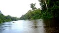 Lobé River, 2016
 -
 Kribi water waves, 2017
 -
 Kribi Beach, 2017


انظر أيضاً
المراجع
- ^ "World Gazetteer". Archived from the original on January 11, 2013.
- ^ "Distance between Douala Obs. () Airport) and Kribi () (Airport) (Cameroon)". distancecalculator.globefeed.com. Retrieved October 27, 2019.
- ^ "City (town) Kribi: map, population, location". www.tiptopglobe.com. Archived from the original on August 3, 2020. Retrieved October 27, 2019.
- ^ Nana, Paul Alain (January 2024). "Influence of tides on the dissemination and related health risks of intestinal helminths along the Kribi beaches (Atlantic Coast, Southern Cameroon)". Journal of Helminthology. 98 e10. doi:10.1017/S0022149X24000026. PMID 38263759.
- ^ "Cameroon Business - FCFA 60 Billion For Kribi Gas Fired Power Plant - Cameroon Today - Breaking News | Daily News Updates". news.cameroon-today.com. Archived from the original on July 11, 2012. Retrieved October 27, 2019.
{{cite web}}: CS1 maint: unfit URL (link) - ^ "Cameroon: Kribi, Dibamba Power Plants Get New Owners". Retrieved October 27, 2019.
- ^ Ship size.
- ^ "Cameroon: Port Expansion Steers Cameroon's Vision 2035". Retrieved October 27, 2019.
- ^ "Louis Berger". Retrieved September 6, 2020.
- ^ Port Autonome de Kribi (P.A.K.).
- ^ Cameroon National Ports Authority (APN)
- ^ IAPH Member Ports - PAK
- ^ IAPH Member Ports CNPA
- ^ "China Just Built $2B Mega Port in Cameroon That Could Reshape Central Africa". Civil Mentors. 2026-05-2. Retrieved 2026-05-26.
{{cite web}}: Check date values in:|date=(help) - ^ "Overview of Mbalam Iron Ore Project in the Republic of Cameroon" (PDF). Archived from the original (PDF) on 2016-03-03. Retrieved 2007-08-29.
- ^ Mbalam-Kribi railway
- ^ Minim-Martap mine
- ^ "Canyon Resources Map". Archived from the original on 2022-06-15. Retrieved 2021-02-25.
- ^ "Canyon Resources & Map". Archived from the original on 2022-06-15. Retrieved 2021-02-25.
- ^ "National Commission for Decentralised cooperation". Délégation pour l’Action Extérieure des Collectivités Territoriales (Ministère des Affaires étrangères) (in الفرنسية). Archived from the original on 2013-11-27. Retrieved 2013-12-26.
- ^ Kribi, twinned with Saint Nazaire in France[dead link].
- ^ "World Weather Information Service - Kribi". July 2011. Retrieved July 25, 2011.
وصلات خارجية
 كريبي travel guide from Wikivoyage
 Media related to كريبي at Wikimedia Commons
02°56′06″N 09°54′36″E / 2.93500°N 9.91000°E
| Océan |  | |
|---|---|---|
| Vallée-du-Ntem | ||
| مڤيلا |
| |
| Dja-et-Lobo |
| |
- CS1 maint: unfit URL
- CS1 الفرنسية-language sources (fr)
- Articles with dead external links from February 2020
- Pages using gadget WikiMiniAtlas
- Short description with empty Wikidata description
- Pages using infobox settlement with deprecated parameters
- Articles with hatnote templates targeting a nonexistent page
- Coordinates not on Wikidata
- أماكن مأهولة في المنطقة الجنوبية (الكاميرون)
- موانئ بحرية على خليج غينيا