38°57′06″N 92°19′43″W / 38.951561°N 92.328638°W / 38.951561; -92.328638 (Boone County, Missouri )
Place
مقاطعة بون إنگليزية: Boone County هي إحدى المقاطعات في ولاية ميزوري في الولايات المتحدة الأمريكية .
National protected area المقاطعات المجاورة Major highways الديمغرافيا السياسة المحلية Like nearly all counties nationwide with a major university, the Democratic Party predominantly controls politics at the local level in Boone County. Democrats currently hold all but one of the elected county-wide positions, which is an associate commissioner.
قالب:Missouri county elected officials
الولاية
Past Gubernatorial Elections Results
Year
Republican
Democratic
Third Parties
2016
41.28% 34,106
54.95% 45,396
3.77% 3,117
2012
37.59% 29,171
58.38% 45,302
4.03% 3,125
2008
42.71% 35,785
55.28% 46,315
2.01% 1,688
2004
47.33% 35,666
51.08% 38,489
1.59% 1,201
2000
43.13% 25,609
52.22% 31,007
4.65% 2,767
1996
30.51% 15,929
65.62% 34,266
3.87% 2,021
Missouri House of Representatives , three are held by Republicans, with two held by Democrats.
Missouri House of Representatives — District 44 — Boone County (2016)[7]
الحزب
المرشح
الأصوات
%
±%
Republican
Cheri Toalson-Reisch
8,965
55.41%
-7.49
Democratic
Tom Pauley
7,215
44.59%
+7.49
Missouri House of Representatives — District 44 — Boone County (2014)[8]
الحزب
المرشح
الأصوات
%
±%
Republican
Caleb Rowden
5,107
62.90%
+12.12
Democratic
Thomas Pauley
3,012
38.10%
-12.12
Missouri House of Representatives – District 44 – Boone County (2012)[9]
الحزب
المرشح
الأصوات
%
±%
Republican
Caleb Rowden
7,801
50.78%
Democratic
Ken Jacob
7,560
49.22%
District 45 — Kip Kendrick (D-Columbia ). Consists of the north-central part of the city of Columbia.
Missouri House of Representatives — District 45 — Boone County (2016)[7]
الحزب
المرشح
الأصوات
%
±%
Democratic
Kip Kendrick
8,688
71.19%
-28.81
Independent
William Lee
3,516
28.81%
+28.81
Missouri House of Representatives — District 45 — Boone County (2014)[8]
الحزب
المرشح
الأصوات
%
±%
Democratic
Kip Kendrick
3,889
100.00%
Missouri House of Representatives — District 45 — Boone County (2012)[9]
الحزب
المرشح
الأصوات
%
±%
Democratic
Chris Kelly
10,274
100.00%
Missouri House of Representatives — District 46 — Boone County (2016)[7]
الحزب
المرشح
الأصوات
%
±%
Democratic
Martha Stevens
12,140
62.65%
-37.35
Republican
Don Waterman
7,238
37.35%
+37.35
Missouri House of Representatives — District 46 — Boone County (2014)[8]
الحزب
المرشح
الأصوات
%
±%
Democratic
Stephen Webber
7,948
100.00%
-34.98
Missouri House of Representatives — District 46 — Boone County (2012)[9]
الحزب
المرشح
الأصوات
%
±%
Democratic
Stephen Webber
12,202
65.02%
Republican
Fred Berry
6,564
34.98%
District 47 — Charles Basye (R-Rocheport ). Consists of the western part of the city of Columbia and the communities of Harrisburg and Rocheport.
Missouri House of Representatives — District 47 — Boone County (2016)[7]
الحزب
المرشح
الأصوات
%
±%
Republican
Charles (Chuck) Basye
7,490
52.75%
+3.49
Democratic
Susan McClintic
6,709
47.25%
-3.49
Missouri House of Representatives — District 47 — Boone County (2014)[8]
الحزب
المرشح
الأصوات
%
±%
Republican
Charles (Chuck) Basye
3,902
49.26%
-4.53
Democratic
John Wright
4,020
50.74%
+4.53
Missouri House of Representatives - District 47 - Boone County (2012)[9]
الحزب
المرشح
الأصوات
%
±%
Republican
Mitch Richards
6,003
46.21%
Democratic
John Wright
6.988
53.79%
District 50 – Sara Walsh Consists of parts of the city of Columbia and the communities of Ashland, Hartsburg, and McBaine.
Missouri House of Representatives - District 50 - Boone County (2017 Special Election)
الحزب
المرشح
الأصوات
%
±%
Republican
Sara Walsh
2,540
46.91%
Democratic
Michela Skelton Birk
2,875
53.09%
Missouri House of Representatives — District 50 — Boone County (2016)[7]
الحزب
المرشح
الأصوات
%
±%
Republican
Caleb Jones
11,522
100.00%
Missouri House of Representatives — District 50 — Boone County (2014)[8]
الحزب
المرشح
الأصوات
%
±%
Republican
Caleb Jones
5,600
100.00%
Missouri House of Representatives — District 50 — Boone County (2012)[9]
الحزب
المرشح
الأصوات
%
±%
Republican
Caleb Jones
9,667
100.00%
All of Boone County is a part of Missouri's 19th District in the Missouri Senate and is currently represented by Caleb Rowden (R-Columbia ).
Missouri Senate — District 19 — Boone County (2016)[7]
الحزب
المرشح
الأصوات
%
±%
Republican
Caleb Rowden
39,795
49.34%
-7.14
Democratic
Stephen Webber
40,858
50.66%
+7.14
Missouri Senate — District 19 — Boone County (2012)[9]
الحزب
المرشح
الأصوات
%
±%
Republican
Kurt Schaefer
41,780
56.48%
Democratic
Mary Wynne Still
32,197
43.52%
Federal
U.S. Senate — Missouri — Boone County (2016)[7]
الحزب
المرشح
الأصوات
%
±%
Democratic
Jason Kander
45,100
54.29%
-5.13
Republican
Roy Blunt
34,171
41.13%
+8.52
Libertarian
Jonathan Dine
2,167
2.61%
-5.36
Green
Johnathan McFarland
919
1.11%
+1.11
Constitution
Fred Ryman
695
0.84%
+0.84
Write-In
Write-ins
19
0.02%
U.S. Senate — Missouri — Boone County (2012)[9]
الحزب
المرشح
الأصوات
%
±%
Democratic
Claire McCaskill
46,332
59.42%
Republican
Todd Akin
25,431
32.61%
Libertarian
Jonathan Dine
6,217
7.97%
All of Boone County is included in Missouri's 4th Congressional District and is currently represented by Vicky Hartzler (R-Harrisonville ) in the U.S. House of Representatives .
U.S. House of Representatives — Missouri's 4th Congressional District — Boone County (2016)[7]
الحزب
المرشح
الأصوات
%
±%
Republican
Vicky Hartzler
39,442
49.66%
-2.72
Democratic
Gordon Christensen
36,517
45.98%
+4.35
Libertarian
Mark Bliss
3,462
4.36%
-1.63
U.S. House of Representatives — Missouri’s 4th Congressional District — Boone County (2014)[8]
الحزب
المرشح
الأصوات
%
±%
Republican
Vicky Hartzler
21,089
52.38%
+6.04
Democratic
Nate Irvin
16,762
41.63%
-6.69
Libertarian
Hershel L. Young
2,411
5.99%
+1.60
U.S. House of Representatives — Missouri's 4th Congressional District — Boone County (2012)[9]
الحزب
المرشح
الأصوات
%
±%
Republican
Vicky Hartzler
34,167
46.34%
Democratic
Teresa Hensley
35,625
48.32%
Libertarian
Thomas Holbrook
3,240
4.39%
Constitution
Greg Cowan
696
0.94%
Political culture Presidential elections results
Presidential elections results [10]
Year
Republican
Democratic
Third parties
2016 43.2% 36,200
49.0% 41,125
7.8% 6,543
2012 47.1% 37,404
50.2% 39,847
2.7% 2,171
2008 43.2% 36,849
55.2% 47,062
1.6% 1,340
2004 49.7% 37,801
49.5% 37,643
0.8% 602
2000 47.7% 28,426
48.3% 28,811
4.0% 2,372
1996 42.5% 22,047
48.1% 24,984
9.4% 4,889
1992 33.5% 19,405
45.2% 26,176
21.3% 12,309
1988 48.4% 22,948
51.4% 24,370
0.3% 140
1984 57.9% 26,600
42.1% 19,364
1980 42.0% 16,313
47.7% 18,527
10.3% 3,997
1976 46.9% 16,373
50.7% 17,674
2.4% 846
1972 56.1% 17,488
43.9% 13,666
1968 46.4% 11,917
45.8% 11,771
7.8% 2,015
1964 34.3% 7,695
65.7% 14,758
1960 47.6% 10,453
52.4% 11,514
1956 44.1% 8,197
55.9% 10,404
1952 42.4% 7,545
57.4% 10,206
0.2% 34
1948 29.3% 4,289
69.6% 10,200
1.1% 164
1944 30.1% 4,195
69.7% 9,704
0.2% 30
1940 29.4% 4,869
70.2% 11,615
0.4% 59
1936 24.3% 3,624
75.3% 11,241
0.4% 61
1932 21.6% 3,241
77.1% 11,554
1.2% 184
1928 36.6% 4,876
63.2% 8,422
0.2% 21
1924 28.7% 3,547
70.0% 8,657
1.4% 169
1920 31.6% 4,077
67.9% 8,748
0.5% 65
1916 27.8% 2,180
71.5% 5,601
0.7% 57
1912 18.9% 1,350
70.2% 5,027
10.9% 781
1908 29.6% 2,149
69.5% 5,041
0.9% 64
1904 29.4% 1,857
69.2% 4,375
1.5% 95
1900 25.4% 1,672
72.7% 4,793
1.9% 124
1896 25.0% 1,705
74.4% 5,075
0.6% 42
1892 25.8% 1,495
69.8% 4,054
4.4% 257
1888 26.8% 1,512
72.1% 4,068
1.1% 64
Missouri Presidential Preference Primary (2008) قالب:Missouri Republican primary, 2008
قالب:Missouri Democratic primary, 2008
Communities Cities Villages Unincorporated communities Townships Township boundaries have changed over time. See links at end of article for maps of Boone County showing boundaries of different dates. As a rule, older townships were split, with newer townships created from their subdivisions. This is significant for historical and genealogical research. Note that maps show changes in township boundaries between 1898 and 1930 were minimal.
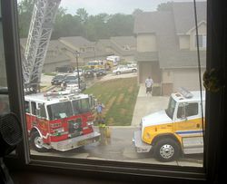
Public safety The BCFPD at a working structure fire.
See also References
^ "Population and Housing Unit Estimates" . Retrieved June 9, 2017 .^ "U.S. Decennial Census" . United States Census Bureau. Archived from the original on April 26, 2015. Retrieved November 13, 2014 .^ "Historical Census Browser" . University of Virginia Library. Retrieved November 13, 2014 .^ "Population of Counties by Decennial Census: 1900 to 1990" . United States Census Bureau. Retrieved November 13, 2014 .^ "Census 2000 PHC-T-4. Ranking Tables for Counties: 1990 and 2000" (PDF) . United States Census Bureau. Retrieved November 13, 2014 .^ خطأ استشهاد: وسم <ref> غير صحيح؛ لا نص تم توفيره للمراجع المسماة QF ^ أ ب ت ث ج ح خ د "Boone County, Missouri - November 8, 2016 - General Election" . County Clerk. November 21, 2016. Retrieved April 14, 2017 .
^ أ ب ت ث ج ح "County Results, State of Missouri - General Election - November 4, 2014" . Retrieved March 23, 2016 .
^ أ ب ت ث ج ح خ د "County Results, State of Missouri - General Election - November 6, 2012" . Retrieved March 23, 2016 .
^ Leip, David. "Dave Leip's Atlas of U.S. Presidential Elections" . uselectionatlas.org . Retrieved 2018-03-24 .
Further reading History of Boone County, Missouri: Written and comp. from the most authentic official and private sources; including a history of its townships, towns, and villages. Together with ... biographical sketches and portraits of prominent citizens (1882) online وصلات خارجية Digitized 1930 Plat Book of Boone County from University of Missouri Division of Special Collections, Archives, and Rare BooksMap of Boone County in 1898, showing township boundaries of that date: [1]
Map of Boone County in 1917, showing township boundaries of that date: [2]
Map of Boone County in 1930, showing township boundaries of that date: [3]
Map Boone County today, showing current township boundaries: [4] قالب:Boone County, Missouri


 Interstate 70
 U.S. Route 40 (Concurrent with I-70 until exit 121 towards Boonville)
 U.S. Route 63
 Route 22
 Route 124
 Route 163
 Route 740


