كانزس سيتي، المنطقة العمرانية
كانزس سيتي، المنطقة العمرانية Kansas City metropolitan area | |
|---|---|
| Kansas City, MO–KS | |
 | |
 | |
| الإحداثيات: 39°06′N 94°35′W / 39.1°N 94.58°W | |
| البلد | الولايات المتحدة |
| أكبر مدينة | كانزس سيتي، مزوري |
| المدن الأخرى | - أوڤرلاند پارك، كانزس - كانزس سيتي، كانزس - إندپندنس، مزوري - أوليثه، كانزس - ليز سمت، مزوري - شوني، كانزس - بلو سپرنگز، مزوري - ليبرتي، مزوري - لنكسا، كانزس - ليڤنورث، كانزس - ليوود، كانزس |
| المساحة | |
| • الإجمالي | 8٬472 ميل² (21٬940 كم²) |
| أعلى منسوب | 1٬1601 ft (353٫51 m) |
| أوطى منسوب | 6901 ft (210٫31 m) |
| التعداد | |
| • الإجمالي | (2٬015) 2٬159٬159 |
| • الترتيب | 30th MSA (2,087,471), 24th CSA (2,428,362) in the U.S. |
| • الكثافة | 260٫0/sq mi (100٫4/km2) |
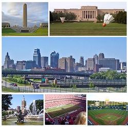
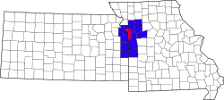
كانزس سيتي، المنطقة العمرانية is a bi-state منطقة عمرانية تمتد في ولايتين وتتمركز حول كانزس سيتي، مزوري. تمتطي مقاطعاتها الأربعة عشر الحدود بين الولايتين الأمريكيتين مزوري (9 مقاطعات) و كانزس (5 مقاطعات). وهي ثاني أكبر منطقة عمرانية متمركزة في مزوري (بعد سانت لويس الكبرى) وهي أكبر منطقة عمرانية في كانزس، بالرغم من أن ويتشيتا هي أكبر منطقة عمرانية متمركزة في كانزس.[1] Alongside Kansas City, these are other cities and suburbs with populations above 100,000: Overland Park, Kansas (the largest); Kansas City, Kansas; Olathe, Kansas; and Independence, Missouri. The Mid-America Regional Council (MARC) serves as the Council of Governments and the Metropolitan Planning Organization for the area.
استعراض الجغرافيا
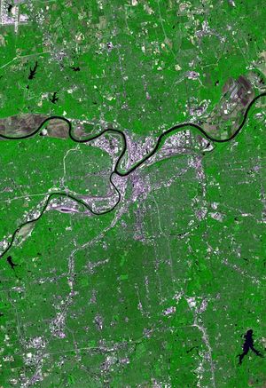
The larger Kansas City Metropolitan Area as seen on a map can be visualized roughly as four quadrants:
The southeast quadrant includes Kansas City, Missouri, and surrounding areas in Missouri. It includes the notorious Grandview Triangle.
The southwest quadrant includes all of Johnson County, Kansas, which includes the towns in the area known as Shawnee Mission, Kansas. Interstate 35 runs diagonally through Johnson County, Kansas, from the southwest to downtown Kansas City, Missouri.
المعالم الثقافية
| الصورة | الاسم | المدينة | الملاحظات | ||||||||
|---|---|---|---|---|---|---|---|---|---|---|---|
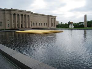
| Nelson-Atkins Museum of Art | Kansas City, Missouri | Founded in 1933, the Nelson-Atkins maintains wide-ranging collections of more than 35,000 works of art and welcomes 500,000 visitors a year. | |||||||||
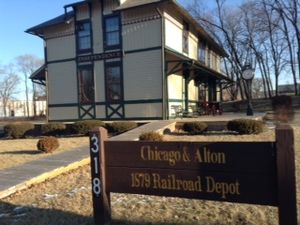
| Chicago & Alton Railroad Depot | Independence, Missouri | The oldest business building in Independence, Missouri. In 1978, the hotel, which originally served the railroad, moved from the original site just south of Main Street to its present location. | |||||||||
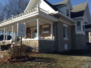
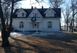
| Dillingham-Lewis House Museum | Blue Springs, Missouri | Built in 1906, the only native limestone structure in Blue Springs. The house is named after two families. | |||||||||
 |
Fort Osage National Historic Site | Sibley, Missouri | Part of the early 19th century U.S. factory trading post system for the Osage Nation. | ||||||||
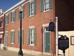 |
Jackson County Jail and Marshal's House | Independence, Missouri | Former jail site, operated by the county historical society, which housed thousands of prisoners including Frank James and William Clark Quantrill. | ||||||||
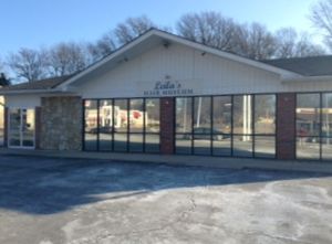
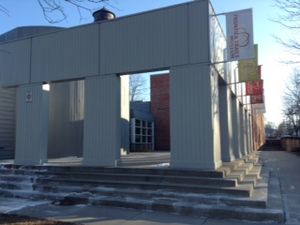
| Leila's Hair Museum | Independence, Missouri | A museum of hair art dating back to the 19th century. | |||||||||
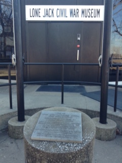
| Lone Jack Battlefield Museum | Lone Jack | The only Civil War Museum in Jackson County, Missouri, and one of the few battlefields where the soldiers – who perished during the battle – are still buried on the battlefield. | |||||||||
 |
Midwest Genealogy Center | Independence, Missouri | The largest freestanding public genealogy research library in the USA. | ||||||||
| National Frontier Trails Museum | Independence, Missouri | A museum, interpretive center, and research library about the history of principle western U.S. trails. | |||||||||
| Rice-Tremonti Home | Raytown, Missouri | Home built on the Santa Fe Trail in 1844 by Archibald Rice and his family. | |||||||||
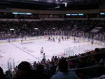 |
Silverstein Eye Centers Arena | Independence, Missouri | A 5,800-seat multi-purpose arena that hosts the Kansas City Mavericks ice hockey team. | ||||||||
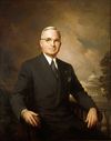 |
Harry S. Truman Historic District | Independence and Grandview, Missouri |
| ||||||||
 |
Truman Sports Complex | Kansas City, Missouri | Two major sports venues: * Arrowhead Stadium, Kansas City Chiefs (football) * Kauffman Stadium, Kansas City Royals (baseball) | ||||||||
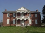 |
Grinter Place | Kansas City, Kansas | A home built in 1857 by one of the earliest settlers. | ||||||||
التعداد
| التعداد | Pop. | ملاحظة | %± |
|---|---|---|---|
| 1900 | 305٬427 | — | |
| 1910 | 422٬180 | 38٫2% | |
| 1920 | 528٬833 | 25٫3% | |
| 1930 | 665٬655 | 25٫9% | |
| 1940 | 686٬643 | 3٫2% | |
| 1950 | 814٬357 | 18٫6% | |
| 1960 | 1٬266٬447 | 55٫5% | |
| 1970 | 1٬434٬793 | 13٫3% | |
| 1980 | 1٬504٬203 | 4٫8% | |
| 1990 | 1٬636٬528 | 8٫8% | |
| 2000 | 1٬836٬038 | 12٫2% | |
| 2010 | 2٬009٬342 | 9٫4% | |
| 2019 (تق.) | 2٬157٬990 | [2] | 7٫4% |
| U.S. Decennial Census[3] 1790–1960[4] 1900–1990[5] 1990–2000[6] | |||
المقاطعات
The MSA covers a total area of 7،952 sq mi (20،600 km2) including 97 sq mi (250 km2) of water.
| المقاطعة | الولاية | 2019 Estimate | 2010 Census | التغيير |
|---|---|---|---|---|
| Jackson | MO | 706٬164 | 674٬158 | +4٫75% |
| Johnson | KS | 605٬721 | 544٬179 | +11٫31% |
| Clay | MO | 249٬432 | 221٬939 | +12٫39% |
| Wyandotte | KS | 167٬635 | 157٬505 | +6٫43% |
| Cass | MO | 103٬832 | 99٬478 | +4٫38% |
| Platte | MO | 105٬032 | 89٬322 | +17٫59% |
| Leavenworth | KS | 82٬554 | 76٬277 | +8٫23% |
| Miami | KS | 33٬655 | 32٬787 | +2٫65% |
| Lafayette | MO | 32٬432 | 33٬381 | −2٫84% |
| Ray | MO | 22٬676 | 23٬494 | −3٫48% |
| Clinton | MO | 20٬501 | 20٬743 | −1٫17% |
| Bates | MO | 16٬138 | 17٬049 | −5٫34% |
| Linn | KS | 9٬746 | 9٬656 | +0٫93% |
| Caldwell | MO | 9٬011 | 9٬424 | −4٫38% |
| الإجمالي | 2٬164٬529 | 2٬009٬342 | +7٫72% |
انظر أيضاً
المراجع
- ^ "Annual Estimates of the Resident Population: April 1, 2010 to July 1, 2018". United States Census Bureau, Population Division. April 2019. Archived from the original on February 13, 2020. Retrieved May 30, 2019.
- ^ "Population and Housing Unit Estimates". Retrieved May 10, 2019.
- ^ "U.S. Decennial Census". United States Census Bureau. Retrieved May 18, 2014.
- ^ "Historical Census Browser". University of Virginia Library. Retrieved May 18, 2014.
- ^ "Population of Counties by Decennial Census: 1900 to 1990". United States Census Bureau. Retrieved May 18, 2014.
- ^ "Census 2000 PHC-T-4. Ranking Tables for Counties: 1990 and 2000" (PDF). United States Census Bureau. Retrieved May 18, 2014.
للاستزادة
- Shortridge, James R. Kansas City and How It Grew, 1822–2011 (University Press of Kansas; 2012) 248 pages; historical geography
وصلات خارجية
| Find more about كانزس سيتي، المنطقة العمرانية at Wikipedia's sister projects | |
| Travel guide from Wikivoyage | |
| Database entry Q2307187 on Wikidata | |
- Articles with hatnote templates targeting a nonexistent page
- Missing redirects
- Short description is different from Wikidata
- Pages using gadget WikiMiniAtlas
- Pages using US Census population needing update
- Portal-inline template with redlinked portals
- Pages with empty portal template
- Kansas City metropolitan area
- Metropolitan areas of Missouri
- Metropolitan areas of Kansas
- مناطق مزوري
- مناطق كانزس
