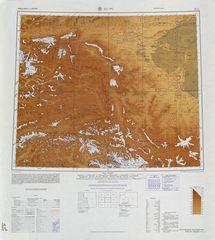
حدود طاجيكستان-قيرغيزستان
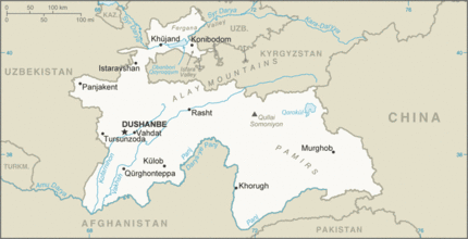
حدود طاجيكستان-قيرغيزستان يبلغ طولها 984 كم وتجري من النقطة الثلاثية مع أوزبكستان إلى النقطة الثلاثية مع الصين.[1]
الوصف
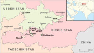
The border starts in the north at the tripoint with أوزبكستان in the وادي فرغانة. The border proceeds roughly westwards, with a sharp Tajik protrusion at the town of Chorku; it almost reaches the Kayrakkum Reservoir, however a thin strip of Tajik territory lies between the reservoir and the border. It then turn southwards near the Tajik enclave of Kayragach before turning sharply eastwards upon reaching the Turkestan Range. The border then follows this range, and the Alay and Trans-Alay ranges, eastwards to the Chinese tripoint.
الجيوب
ويوجد جيبان قريبان من الحدود (ڤاروخ و لالهزار (كايراگاچ))، كلاهما طاجيكي داخل قيرغيزستان.
التاريخ
المعابر الحدودية
- بادكند (KGZ) – إسفرة (TJK) (road)[2]
- Kulundu (KGZ) – Ovchi Kalacha (TJK) (road)[2]
- Madaniyat (KGYZ) – Madaniyay (TJK) (road)[2]
- Karamyk (KGZ) – Daroot Korgan (TJK) (road)[2]
- Bor-Doba (KGZ) – Kyzylart (TJK) (road)[2]
التجمعات القريبة من الحدود
قيرغيزستان
طاجيكستان
- Lakkon
- Kulkent
- Navgilem
- إسفرة
- Surkh
- Chorku, Tajikistan
- Shurab, Tajikistan
- Qistaquz
- Ghafurov
- Proletarsk
- Mujum
- Dakhkat
- Rosrovut
خرائط تاريخية
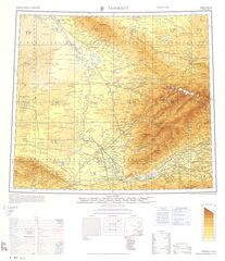
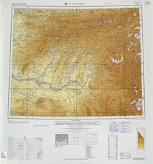
Historical English-language maps of the Kyrgyz SSR-Tajik SSR border, mid to late 20th century:
الهامش
- ^ CIA World Factbook - Kyrgyzstan, 23 September 2018, https://www.cia.gov/the-world-factbook/countries/kyrgyzstan/
- ^ أ ب ت ث ج Caravanistan - Kyrgyzstan border crossings, http://caravanistan.com:80/border-crossings/kyrgyzstan, retrieved on 23 September 2018
