أبلاست خملنيتسكي
Khmelnytskyi Oblast
Хмельницька область | |
|---|---|
| Khmelnytska oblast[1] | |
 Khmelnytskyi Oblast administration building | |
 Flag  Coat of arms | |
| الكنية: Хмельниччина (Khmelnychchyna) | |
 | |
| الإحداثيات: 49°32′N 26°52′E / 49.53°N 26.87°E | |
| البلد | |
| تأسست | 22 September 1937 |
| المركز الإداري | خملنيتسكي |
| أكبر المدن | Khmelnytskyi, Kamianets-Podilskyi |
| الحكومة | |
| • الحاكم | Serhiy Tyurin (acting) |
| • Oblast council | 84 seats |
| • Chairperson | Mykhailo Zagorodniy (Petro Poroshenko Bloc)[2] |
| المساحة | |
| • الإجمالي | 20٬645 كم² (7٬971 ميل²) |
| ترتيب المساحة | Ranked 19th |
| التعداد (2022)[3] | |
| • الإجمالي | |
| • الترتيب | Ranked 14th |
| GDP | |
| • Total | ₴ 120 billion (€3.104 billion) |
| • Per capita | ₴ 96,964 (€2,511) |
| منطقة التوقيت | UTC+2 (EET) |
| • الصيف (التوقيت الصيفي) | UTC+3 (EEST) |
| Postal code | |
| Area code | +380-38 |
| ISO 3166 code | UA-68 |
| Vehicle registration | вх, нх |
| الرايونات | 3 |
| Cities (total) | 13 |
| • المدن المحلية | 4 |
| Urban-type settlements | 24 |
| القرى | 1416 |
| FIPS 10-4 | UP09 |
| الموقع الإلكتروني | adm-km.gov.ua |
أبلاست خملنيتسكي (أوكرانية: Хмельни́цька о́бласть, romanized: Khmelnytska oblast), ويُعرف أيضاً بإسم Khmelnychchyna (أوكرانية: Хмельни́ччина), is an oblast (province) in western Ukraine covering portions of the historical regions of western Podolia and southern Volhynia. The administrative center of the oblast is the city of Khmelnytskyi.
The current estimated population is around 1,228,829 (2022 estimate).[3]
Created in 1937 out of border okrugs of Vinnytsia Oblast, in 1941–44 it was under Nazi Germany occupation and part of the Reichskommissariat Ukraine (Wolhynien und Podolien general district). Following the Kamenets-Podolsky pocket in spring of 1944 as part of the Proskurov-Chernovtsy operation, Soviet troops removed the German occupation in the region. Until 4 February 1954 it was called Kamianets-Podilskyi Oblast (أوكرانية: Кам'янець-Подільська область, romanized: Kamianets-Podilska oblast) and was centered in Kamianets-Podilsky until 1941. The region rebranding took place after the official renaming of the region's administrative center to Khmelnytskyi.
الجغرافيا
Khmelnytskyi Oblast has a total area of 20،600 km2 (7،953.70 sq mi) (3.4% of the total area of Ukraine) and is located between 48°27' and 50°37' north latitude and between 26°09' and 27°56' east longitude. It is 220 km (136.70 mi) long when measured from north to south, and is 120 km (74.56 mi) in length when measured from east to west. It is associated with a historical region of Podolia, yet in reality its territory is split almost in half, the northern in Volhynia, and the southern in Podolia. Its Volhynian region contains smaller cities like Iziaslav, Starokostiantyniv, Shepetivka, while its Podolian portion more developed cities of Khmelnytskyi and Kamianets-Podilskyi.
The oblast borders the Rivne Oblast to the northwest, the Zhytomyr Oblast to the northeast, the Vinnytsia Oblast to the east, the Chernivtsi Oblast to the south, and the Ternopil Oblast to the west.
الارتفاعات
The Podolian Upland (270–370 meters above sea-level) occupies the central area of the Khmelnytskyi Oblast. The northwestern areas of the oblast are part of the Volyn highland (highest point — 329 m above sea-level), while to the north, the oblast claims a part of the historic region of Polissia (highest point — 200–250 m above sea-level). The southwestern territory of the Khmelnytskyi Oblast is crossed by the Tovtry range (أوكرانية: Товтровий кряж, translit. Tovtryi kryazh), which includes Mount Velyka Buhaikha (أوكرانية: Велика Бугаїха), the highest point of the oblast at 409 m above sea-level. The extreme south of the oblast has a surface with canyon-like river valleys. The Dneister Reservoir located there is the lowest point of the oblast (121 m above sea-level) .
الأنهار والبحيرات
There are 120 rivers with a length of 10 km (6.21 mi) or more in the Khmelnytskyi Oblast. The largest of these are the Dniester River (which flows for 160 km (99.42 mi) within the oblast), as well as its tributaries: Smotrych, Ushytsia, and the Zbruch — and the Southern Buh River (which flows for 120 km (74.56 mi) within the oblast), as well as its tributaries: Buzhok, Ikva, and Vovk. The rivers of the Dnieper River's basin — Horyn, Khmora, and Sluch Rivers also run through the oblast. The oblast's lakes are located mostly in basin of the Horyn River. The largest reservoir in the oblast is the Dniester Reservoir.
There are 1858 ponds and/or reservoirs in the oblast. The largest of these include Shchedrivske (with a surface area of 12.58 km2 (4.86 sq mi)), Novostavske (with a surface area of 11.68 km2 (4.51 sq mi)), and Kuzmynske (with a surface area of 7.65 km2 (2.95 sq mi)).
التاريخ
Historic administrative affiliation of the area:
- 1937-1941: USSR, Ukrainian SSR
- 1944-1991: USSR, Ukrainian SSR
- since 1991: Ukraine: Khmelnytskyi Oblast
Khmelnytskyi Oblast was created on September 22, 1937, as the Kamianets-Podilskyi Oblast (أوكرانية: Кам’янець-Подільськa область, translit., Kamyanets-Podil'ska oblast’) out of border okrugs (Proskuriv and Kamianets-Podilskyi) of the Vinnytsia Oblast.
In March 1941 the administrative center of the oblast was moved from Kamianets-Podilskyi to the city of Proskuriv. During the World War II the territory was part of another administrative division (General District Wolhynien und Podolien, see Reichskommissariat Ukraine), but after liberation from the Nazi Germany, Khmelnytskyi Oblast was reinstated in its original borders. In 1954, Proskuriv was renamed Khmelnytskyi, and soon afterward, the oblast was renamed to Khmelnytskyi Oblast (أوكرانية: Хмельницька область, translit., Khmel'nytska oblast’).
Administrative divisions
The oblast is subdivided into 3 raions (administrative districts). It consists of 6 municipalities, 13 cities, 24 towns, and more than 1,417 villages.
The following data incorporates the number of each type of administrative divisions of Kyiv Oblast:
- Administrative Center – 1 (Khmelnytskyi)
- Raions — 3;
- City raions — 0;
- Settlements — 1452, including:
- Villages — 1415;
- Cities/Towns — 37, including:
- Urban-type settlement — 24;
- Cities — 13, including:
- Cities of oblast' subordinance — 6;
- Cities of raion subordinance — 7;
- Selsovets — 568.
The local administration of the oblast' is controlled by the Khmelnytskyi Oblast Rada. The governor of the oblast' is the Khmelnytskyi Oblast Rada speaker, appointed by the President of Ukraine.

السكان
Khmelnytskyi Oblast's population is 1,401,140 as of January 1, 2004. As of 2002, the oblast ranks 13th by population in Ukraine. The population density is 69.5/km2.
Pensioners make up 453,800 thousand people or 31,7% of population. The birth rate per 1,000 residents is 8.3, and the death rate — per 1000 residents – 16.1.[5] The urban population, according to the 2001 Ukrainian Census data, accounted for 729,600 people, or 51%, and the rural population — for 701,200 people, or 49%.[6]
According to the data, the number of men accounted for 659,900 people, or 46.1%, that of women — 770,900 people, or 53.9%.
Age structure
- 0-14 years: 15.1% ▲ (male 101,597/female 95,783)
- 15-64 years: 68.5%
 (male 435,464/female 463,058)
 - 65 years and over: 16.4% (male 69,479/female 145,420) (2013 official)
Median age
- total: 40.4 years ▲
- male: 37.1 years ▲
- female: 43.6 years
 (2013 official)
Economy
The economy of the oblast mostly deals with the energy industry, transport and agriculture. The oblast is situated at a historical crossroad of the railway and highway routes connecting Central Europe to Black Sea coast and Russia (with the city of Shepetivka being the most important railway junction). The Khmelnyts’ka nuclear power plant in the city of Netishyn is the most important industrial company of the oblast. Notable machinery, armament and chemical industries are also present.
Attractions
- Kamianets National historical-architectural preserve
- Medzhybizh National historical-cultural preserve
- Samchyky State historical-cultural preserve
Nomenclature
Most of Ukraine's oblasts are named after their administrative center cities, officially referred to as "oblast centers" (أوكرانية: обласний центр, translit. oblasnyi tsentr). The name of each oblast is a relative adjective, formed by adding a feminine suffix to the name of respective center city: Khmelnytskyi is the center of the Khmelnyts’ka oblast’.
Gallery
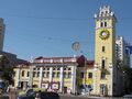
Proskuriv kalancha
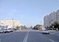
Independence Avenue in Netishyn
Church of Saint Dorothy in Slavuta
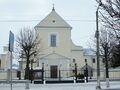
John the Baptist Church in Starokostiantyniv

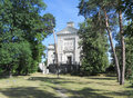
Defense tower in Starokostiantyniv

National University named after I. Ohienko
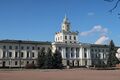
Khmelnytskyi Oblast administration building
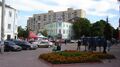
Proskurivska street in Khmelnytskyi
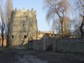
Medieval fortress in Letychiv

Highway H03
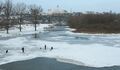
Horyn River in Iziaslav
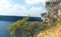
Dniester panorama


.jpg&filetimestamp=20240609193350&)


انظر أيضاً
- Romanization of Ukrainian
- List of villages in Khmelnytskyi Oblast
- Subdivisions of Ukraine
- Volhynia
- Podolia
References
- Inline
- ^ Syvak, Nina; Ponomarenko, Valerii; Khodzinska, Olha; Lakeichuk, Iryna (2011). Veklych, Lesia (ed.). Toponymic Guidelines for Map and Other Editors for International Use (PDF). scientific consultant Iryna Rudenko; reviewed by Nataliia Kizilowa; translated by Olha Khodzinska. Kyiv: DerzhHeoKadastr and Kartographia. p. 20. ISBN 978-966-475-839-7. Retrieved 2020-10-06.
{{cite book}}:|website=ignored (help) - ^ "Голова Хмельницької обласної ради". km-oblrada.gov.ua (in الأوكرانية).
- ^ أ ب Чисельність наявного населення України на 1 січня 2022 [Number of Present Population of Ukraine, as of January 1, 2022] (PDF) (in الأوكرانية and الإنجليزية). Kyiv: State Statistics Service of Ukraine. Archived (PDF) from the original on 4 July 2022.
- ^ "Валовии регіональнии продукт".
- ^ Cabinet of Ministers of Ukraine – Khmelnytsky Region URL accessed on November 26, 2006
- ^ Ukrcensus.gov.ua – Khmel'nyts'kyi region region Archived 2007-09-30 at the Wayback Machine URL accessed on January 11, 2007
- Information Card of the Region – Official site of the Cabinet of Ministers of Ukraine
وصلات خارجية
- adm-km.gov.ua – Official website of Khmelnytska oblast Administration (in أوكرانية)
- Khmelnytsky – Site of Khmelnytskyi (in أوكرانية and روسية)

| International | |
|---|---|
| National | |
- Pages using gadget WikiMiniAtlas
- CS1 errors: periodical ignored
- CS1 الأوكرانية-language sources (uk)
- CS1 uses الأوكرانية-language script (uk)
- Short description is different from Wikidata
- Articles containing أوكرانية-language text
- Coordinates on Wikidata
- Pages using Lang-xx templates
- Articles with hatnote templates targeting a nonexistent page
- Articles with أوكرانية-language sources (uk)
- Articles with روسية-language sources (ru)
- أبلاست خملنيتسكي
- أبلاستات أوكرانيا
- States and territories established in 1937
- 1937 establishments in Ukraine