الجبلين
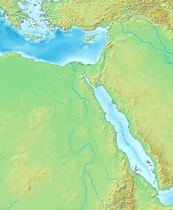
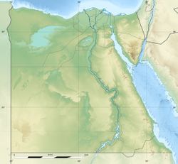
الجبلين Gebelein[1] (Egyptian Arabic: الجبلين, Two Mountains; Egyptian: Inerty or Per-Hathor; Ancient Greek: Παθυρις Pathuris or Ἀφροδιτόπολις Aphroditópolis;[2] Latin: Pathyris or Aphroditopolis) was a town in Egypt. It is located on the Nile, about 40 km south of Thebes، في محافظة الوادي الجديد.
الجبلين | |
| المكان | Egypt |
|---|---|
| المنطقة | Esna-Luxor Governorate |
| الإحداثيات | 25°29′00″N 32°29′00″E / 25.483333°N 32.483333°E |
المنطقة الجغرافية الحديثة تُعرف بإسم نجع الغريرة.[2]
. . . . . . . . . . . . . . . . . . . . . . . . . . . . . . . . . . . . . . . . . . . . . . . . . . . . . . . . . . . . . . . . . . . . . . . . . . . . . . . . . . . . . . . . . . . . . . . . . . . . . . . . . . . . . . . . . . . . . . . . . . . . . . . . . . . . . . . . . . . . . . . . . . . . . . . . . . . . . . . . . . . . . . . .
الآثار
|
|
|
Gebelein is known for its cemetery, where archeological finds stretching from the Predynastic Period to the Middle Kingdom have been made.[5][6] Archaeological interest in the town started in the early 18th century AD and was included in Benoît de Maillet's Description de l'Egypte.[7] As well as official excavations, many artifacts from the site were traded on the antiquities market ويمكن العثور عليها في متاحف تورينو والقاهرة وبرلين وليون، والمتحف البريطاني.[2]
مومياوات قبل الأسرات
مومياوات الجبلين من عصر ما قبل الأسرات هم ستة أجساد محنطة طبيعياً، في نحو 3400 ق.م. من أواخر فترة ما قبل الأسرات في مصر، وكانت أول أجساد كاملة تُكتشَف من عصر ما قبل الأسرات. The well-preserved bodies were excavated at the end of the nineteenth century by Wallis Budge, the British Museum Keeper for Egyptology, from shallow sand graves near Gebelein (modern name Naga el-Gherira) in the Egyptian desert.[1]
A Pre-dynastic mummified body dated to 3400 BC, excavated from this site، معروضة في المتحف البريطاني منذ 1901.[8]
معبد حتحور
يضم الموقع بقايا معبد لحتحور عليها عدد من الخراطيش على قوالب طوب طينية ونصب ملكية من الأسَر الثانية إلى الثالثة.[9] The temple is located on the east hill of the site. Items of several Second Intermediate Period rulers include a stele of Dedumose II, a block of Djedankhre Montemsaf, and a stela of a ruler named Sekhemtawy. Hyksos rulers mentioned are Apophis (on a lintel) and Khyan (on a black granite block).[9]
Later period finds include a brick naming the High Priest of Amun Menkheperre and his wife Isetemkheb. The brick likely came from the Fort that enclosed the temple.[9] From the Ptolemaic period came fragments of a statue of Ptolemy VIII Euergetes II Limestone fragments from the shrine that would have held the statue were also found.[9]
المعسكر العسكري من العصر البطلمي
During the reign of Ptolemy VI Philometor, a military camp was established at Gebelein after the Theban rebellion of 186 B.C.[10] The camp was destroyed by rebel forces 88 BC and the site was never again inhabited on a larger scale. Several hundred Demotic and Greek papyri and ostraca pertaining to the soldiers and the local temple were found at the ruins between 1890 and 1930. These including the archive of the mercenary Horos son of Nechoutes and the Dryton and Apollonia Archive.[10]
وصلات خارجية
- Egyptian artefacts at the Musée de Confluences, Lyon
- Egyptian artefacts from Gebelein at the British Museum, London
|
المراجع
- ^ أ ب Budge, Ernest Alfred Thompson Wallis (1920), By Nile and Tigris: a narrative of journeys in Egypt and Mesopotamia on behalf of the British Museum between the years 1886 and 1913, John Murray: London, OCLC 558957855, https://archive.org/stream/cu31924088412592#page/n435
- ^ أ ب ت Bard, Kathryn A.; Shubert, Steven Blake (1999), Encyclopedia of the archaeology of ancient Egypt, Routledge, p. 338, ISBN 978-0-415-18589-9
- ^ Gauthier, Henri (1925). Dictionnaire des Noms Géographiques Contenus dans les Textes Hiéroglyphiques. Vol. 1. Societe Royale de Geographie d'Egypte. p. 86.
- ^ أ ب Gauthier, Henri (1925). Dictionnaire des Noms Géographiques Contenus dans les Textes Hiéroglyphiques. Vol. 2. Societe Royale de Geographie d'Egypte. p. 117.
- ^ "Gebelein human mummy, 3400 BC". British Museum. Retrieved 2010-06-05.
- ^ "Cosmetic-box, Graeco-Roman". British Museum. 2010-05-14. Retrieved 2010-06-05.
- ^ Mascrier, Jean Baptiste Le; de Maillet, Benoit (1735), Description de l'Egypte, chez Louis Genneay
- ^ Maev Kennedy (October 14, 1987). "Ancient Egyptian given new lease of life: Maev Kennedy goes down among the dead men at the British Museum to see a mummy made up". The Guardian (London).
- ^ أ ب ت ث Porter, Bertha and Moss, Rosalind. Topographical Bibliography of Ancient Egyptian Hieroglyphic Texts, Reliefs and Paintings, V Upper Egypt: Sites (Volume 5). Griffith Institute. 2004.
- ^ أ ب J. G. Manning, Land and Power in Ptolemaic Egypt: The Structure of Land Tenure, Cambridge University Press, May 29, 2003 (Via Google books)


