محافظة ناگاساكي
محافظة ناگاساكي
長崎県 | |
|---|---|
| الترجمة اللفظية بالـ اليابانية | |
| • اليابانية | 長崎県 |
| • روماجي | Nagasaki-ken |
 | |
| البلد | اليابان |
| المنطقة | كيوشو |
| الجزيرة | كيوشو |
| العاصمة | ناگاساكي |
| التقسيمات | Districts: 4، البلديات: 21 |
| الحكومة | |
| • المحافظ | Hōdō Nakamura |
| المساحة | |
| • الإجمالي | 4٬130٫88 كم² (1٬594٫94 ميل²) |
| ترتيب المساحة | 37th |
| التعداد (June 1, 2019) | |
| • الإجمالي | 1٬328٬478 |
| • الترتيب | 26th |
| • الكثافة | 320/km2 (830/sq mi) |
| ISO 3166 code | JP-42 |
| الموقع الإلكتروني | www |
| الرموز Japan | |
| الطائر | Mandarin duck (Aix galericulata) |
| الزهرة | Unzentsutsuji (Rhododendron serpyllifolium) |
| الشجرة | Sawara (Chamaecyparis pisifera) |
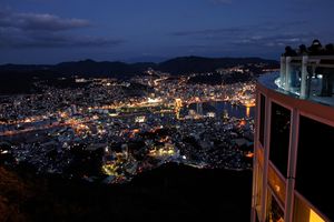
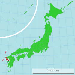
محافظة ناگاساكي (長崎県, Nagasaki-ken) هي محافظة في اليابان تقع في جزيرة كيوشو.[1] عاصمتها هي مدينة ناگاساكي.[2]
المدن
Thirteen cities are located in Nagasaki Prefecture:
المقاطعات
These are the towns and villages of each district:
الاندماجات
The following municipalities have been dissolved since the year 2000.
- Kitamatsuura District:
- Minamimatsuura District:
- Nishisonogi District:
- Kitatakaki District:
- Minamitakaki District:
- Kamiagata District:
- Shimoagata District:
- Iki District:
الثقافة
الدين
Nagasaki is the most Christianized area in Japan with Roman Catholic missions having been established there as early as the 16th century. Shusaku Endo's novel Silence draws from the oral history of the local Christian (Kirishitan) communities, both Kakure Kirishitan and Hanare Kirishitan.
As of 2002, there are 68,617 Catholics in Nagasaki Prefecture, accounting for 4.52 percent of the population of the prefecture.
الرياضة
The Nagasaki Saints of the Shikoku-Kyūshū Island League make Nagasaki Prefecture their home.
Tourism

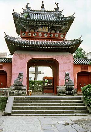
- ناگاساكي (العاصمة)
- Hirado
- Sasebo
- Saikai
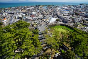
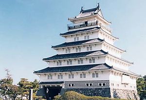
- Shimabara Peninsula
النقل
السكك الحديدية
الترام
الموانئ
- ميناء ناگاساكي
- Sasebo Port
- Matsuura Port
- Hirado Port
- Shimabara Port
- Fukue Port
- Izuhara Port of Tsushima
- Gonoura Port of Iki Island
المطارات
الهامش
المراجع
- Nussbaum, Louis-Frédéric and Käthe Roth. (2005). Japan encyclopedia. Cambridge: Harvard University Press. ISBN 978-0-674-01753-5; OCLC 58053128
وصلات خارجية
- Official website
 Nagasaki (prefecture) travel guide from Wikivoyage
 Geographic data related to محافظة ناگاساكي at OpenStreetMap
- Pages using gadget WikiMiniAtlas
- Short description is different from Wikidata
- Pages using infobox settlement with no coordinates
- Articles with hatnote templates targeting a nonexistent page
- Official website different in Wikidata and Wikipedia
- Coordinates on Wikidata
- محافظة ناگاساكي
- منطقة كيوشو
- محافظات اليابان


