جورا (إقليم فرنسي)
(تم التحويل من Jura (department))
Jura | |
|---|---|
|
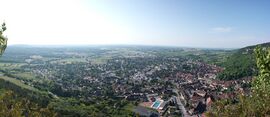
From top down, left to right: Lac de Vouglans, Baume-les-Messieurs, Poligny, Lac de Bonlieu, Lac de l'Abbaye, Les Planches-près-Arbois, Chancia | |
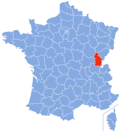
 Location of Jura in France | |
| الإحداثيات: 46°40′31″N 5°33′16″E / 46.67528°N 5.55444°E | |
| Country | France |
| Region | Bourgogne-Franche-Comté |
| Prefecture | Lons-le-Saunier |
| Subprefectures | Dole Saint-Claude |
| الحكومة | |
| • President of the Departmental Council | Clément Pernot[1] (DVD) |
| المساحة | |
| • الإجمالي | 4٬999 كم² (1٬930 ميل²) |
| أعلى منسوب | 1٬200 m (3٬900 ft) |
| أوطى منسوب | 200 m (700 ft) |
| التعداد (يناير 2019) | |
| • الإجمالي | 259٬199 |
| • الترتيب | 83rd |
| • الكثافة | 52/km2 (130/sq mi) |
| منطقة التوقيت | UTC+1 (CET) |
| • الصيف (التوقيت الصيفي) | UTC+2 (CEST) |
| Department number | 39 |
| Arrondissements | 3 |
| Cantons | 17 |
| Communes | 494 |
| ^1 French Land Register data, which exclude estuaries, and lakes, ponds, and glaciers larger than 1 km2 | |
جورا ( Jura ؛ /ˈ(d)ʒʊərə/ JOOR-ə, ZHOOR-ə، بالفرنسية: [ʒyʁa] (![]() استمع))[يحتاج أصد Arpitan] هو إقليم فرنسي تابع لمنطقة فرانش كومته.
استمع))[يحتاج أصد Arpitan] هو إقليم فرنسي تابع لمنطقة فرانش كومته.
التاريخ
الجغرافيا
- البحيرات:
المناخ
السياسة
| Party | seats | |
|---|---|---|
| • | Union for a Popular Movement | 15 |
| Socialist Party | 8 | |
| Miscellaneous Left | 6 | |
| French Communist Party | 3 | |
| • | Miscellaneous Right | 2 |
الإقتصاد
السياحة
انظر أيضاً
- Cantons of the Jura department
- Communes of the Jura department
- Arrondissements of the Jura department
- French language
- Franco-Provençal language
المصادر
وصلات خارجية
مشاع المعرفة فيه ميديا متعلقة بموضوع Jura (département).
- (بالفرنسية) Prefecture website
- (بالفرنسية) General council website
- (بالفرنسية) Tourism website
- (إنگليزية) Jura Tourism Guide
- (إنگليزية) Tourism Information
- ^ "Répertoire national des élus: les conseillers départementaux". data.gouv.fr, Plateforme ouverte des données publiques françaises (in الفرنسية). 4 May 2022.
This article may include material from Wikimedia licensed under CC BY-SA 4.0. Please comply with the license terms.


