ملف:MedicineLakeBathymetricMeters20080926.png
حجم هذه المعاينة: 800 × 535 بكسل. البعد الآخر: 992 × 663 بكسل.
الملف الأصلي (992 × 663 بكسل حجم الملف: 123 كيلوبايت، نوع MIME: image/png)
| Description | |
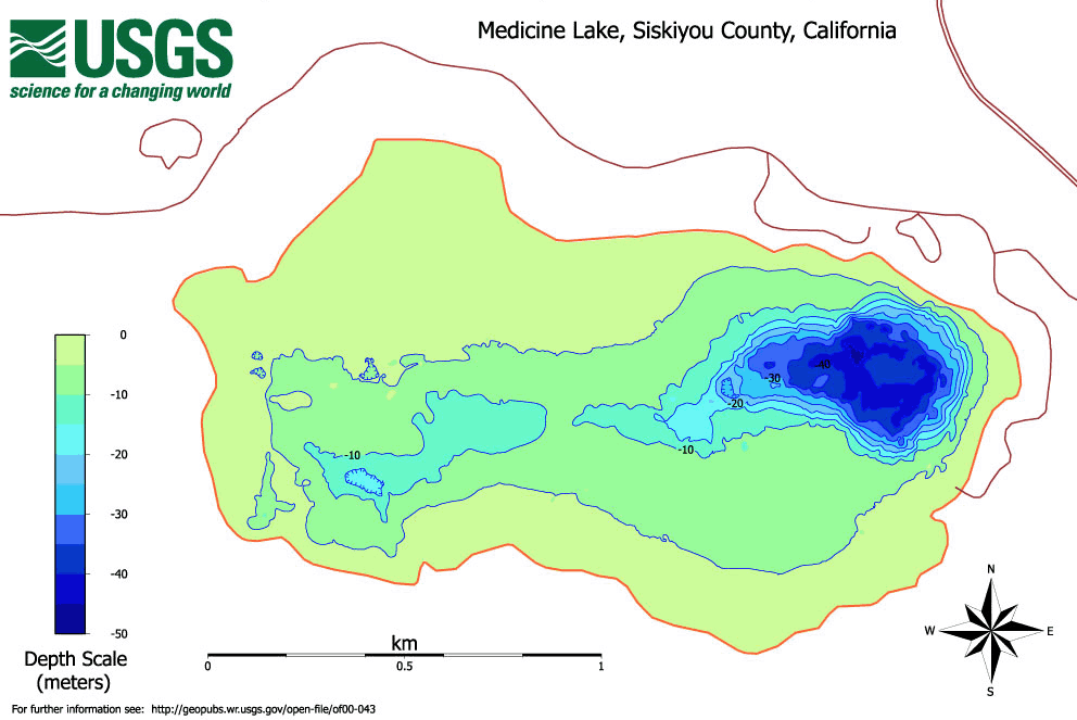
| Date | 2000 |
| Source | United States Geological Survey, Bathymetric, geophysical and geologic sample data from Medicine Lake, Siskiyou County, northern California |
| Author | Jonathan R. Childs |
| ⧼wm-license-information-permission⧽ (⧼wm-license-information-permission-reusing-text⧽) |
from a U.S. federal government source |
ترخيص
This image is a work of a United States Geological Survey employee, taken or made during the course of the person's official duties. As a work of the United States Government, the image is in the public domain. For more information, see the USGS copyright policy.
قالب:Original upload log
قالب:Original description page
- 2008-09-27 01:10 Burntnickel 992×663× (125839 bytes) {{Information |Description=A bathymetric map of the lake (in meters) of [[Medicine Lake Volcano|Medicine Lake]], [[California|CA]] |Source=[[United States Geological Survey]], [http://geopubs.wr.usgs.gov/open-file/of00-043/ Bathymetric, geophysical and ge
تاريخ الملف
اضغط على زمن/تاريخ لرؤية الملف كما بدا في هذا الزمن.
| زمن/تاريخ | صورة مصغرة | الأبعاد | مستخدم | تعليق | |
|---|---|---|---|---|---|
| حالي | ★ مراجعة معتمدة 15:29، 8 نوفمبر 2023 | | 992 × 663 (123 كيلوبايت) | Pastakhov (نقاش | مساهمات) | Upload https://upload.wikimedia.org/wikipedia/commons/b/bb/MedicineLakeBathymetricMeters20080926.png |
لا يمكنك استبدال هذا الملف.
وصلات
لا يوجد صفحات تصل لهذه الصورة.