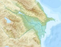
سد آراس
سد آراس (آذربيجاني: Araz su anbarı؛ فارسية: سد ارس)، هو سد ركامي على نهر آراس، على الحدود الإيرانية الأذربيجانية. يقع السد أسفل مجرى پلدشت في محافظة أذربيجان الغربية، إيران ومدينة نخجوان في جمهورية نخجوان الذاتية، أذربيجان. الغرض الأساسي من السد هو توليد الطاقة الكهرومائية وإمدادات المياه.
| سد آراس | |
|---|---|
| ملف:Araz su anbarı-1.jpg سد آراس. | |
| الموقع | پلدشت، نخجوان |
| الإحداثيات | 39°05′28″N 45°24′08″E / 39.09111°N 45.40222°ECoordinates: 39°05′28″N 45°24′08″E / 39.09111°N 45.40222°E |
| الوضع | شغال |
| بدء الإنشاءات | 1964 |
| تاريخ الافتتاح | 1971 |
| السد والمفايض | |
| الارتفاع | 40 م |
| الطول | 1026 م |
| عرض القمة | 8 م |
| سعة المفيض | 66.5 م³ |
| الخزان | |
| يخلق | Aras Reservoir |
| السعة الإجمالية | 1.35 كم³ |
| المساحة السطحية | 145 كم² |
| محطة الطاقة | |
| المشغـِّل | أذرإنرجي شركة إيران لإدارة الموارد المائية |
| تاريخ الترخيص | 1971 |
| التوربينات | 4 × 11 م.و. |
| القدرة المركـّبة | 44 م.و. |
. . . . . . . . . . . . . . . . . . . . . . . . . . . . . . . . . . . . . . . . . . . . . . . . . . . . . . . . . . . . . . . . . . . . . . . . . . . . . . . . . . . . . . . . . . . . . . . . . . . . . . . . . . . . . . . . . . . . . . . . . . . . . . . . . . . . . . . . . . . . . . . . . . . . . . . . . . . . . . . . . . . . . . . .
التاريخ
في 11 أغسطس 1957، وقع الاتحاد السوڤيتي وإيران پروتوكولاً في طهران لبناء سد آراس على نهر آراس.[1] جرى ذلك في وقت كانت فيه أذربيجان تحت السيطرة السوڤيتية. بدأ بناء السد عام 1963 واكتمل عام 1970.[2] أُفتتح السد رسميًا في 28 يونيو 1971 من قبل نائب رئيس الوزراء الإيراني صافي آصفيا ونائب رئيس مجلس الوزراء السوڤيتي ميخائيل يفرموڤ.[3]
تم التوقيع على پروتوكول تكميلي لاتفاقية الحدود لعام 1954 بين إيران والاتحاد السوڤيتي في 7 مايو 1970 في موسكو لإعادة ترسيم الحدود على امتداد خزان آراس.[4]
المواصفات
Dam
The Aras Dam is 40 metres (130 ft) tall from its foundation and 34 metres (112 ft) tall from the riverbed.[2] It is an embankment type dam with sand fill and a clay core. It is 1,026 metres (3,366 ft) long and 8 metres (26 ft) wide on its crest.[2]
Reservoir
The Aras Reservoir (آذربيجاني: Araz su anbarı), also known as Aras Water Junction (آذربيجاني: Araz Su Qovsağı), is a large reservoir created by the Aras Dam and shared by Nakhchivan exclave of Azerbaijan Republic and Iran.
At a normal water elevation of 777.5 metres (2,551 ft) above sea level, the dam withholds a reservoir of 1.35 cubic kilometres (1,090,000 acre⋅ft) with a surface area of 145 square kilometres (56 sq mi).[2][5] Of the reservoir's normal capacity, 1.15 cubic kilometres (930,000 acre⋅ft) of it is active or "useful" while 0.2 cubic kilometres (160,000 acre⋅ft) is inactive or dead storage. The maximum storage of the reservoir is 1.75 cubic kilometres (1,420,000 acre⋅ft).[2] The reservoir is 52 kilometres (32 mi) long and 6.1 kilometres (3.8 mi) wide. The average depth at normal water levels is 18.2 metres (60 ft).[6]
There are a total of four hydro-electric stations in Azerbaijan and Iran (two on each side) with four turbines. The discharge capacity of one spillway of a station is 66.5 m3/s (2,350 cu ft/s).[6]
Since its opening, the reservoir has provided irrigation water for 400,000 hectares (990,000 acres) of arable land in Azerbaijan and Iran, including about 60,000 hectares (150,000 acres) in Dasht-e Moghan area.[6][7]
محطة الطاقة
The dam's power station contains four turbine-generators for a capacity of 11 megawatts (15,000 hp) each. Two of the generators are on the Iranian side and the other two on the Azerbaijani side along with the dam's spillway.[2] The discharge capacity of one spillway of a station is 66.5 cubic metres per second (2,350 cu ft/s).[6] The total installed capacity is 44 MW.[8]
انظر أيضاً
المصادر
- ^ "Agreement between Iran and the Soviet Union for the joint utilisation of the frontier parts of the rivers Aras and Atrak for irrigation and power generation" (PDF). Iran, USSR. Archived from the original (PDF) on 23 July 2011. Retrieved 29 January 2011.
- ^ أ ب ت ث ج ح Filipuzzi, Serena; Faramarzi, Monireh (March 2007). The Science and Politics of Large Dam Project Aras river basin: dam facility and water management policy. An analysis on performance (PDF). Eawag. Retrieved 29 January 2011.[dead link]
- ^ Collard, Elizabeth (1971). Middle East economic digest. Vol. 15. I.B.Tauris. p. 772.
- ^ "Iran – U.S.S.R. Boundary" (PDF). International Boundary Study. The Geographer (25): 6. 1978-02-28. Archived from the original (PDF) on 2012-05-09. Retrieved 2011-01-29.
- ^ "Information on Water Reservoirs". Water resources database. Archived from the original on 2011-07-10. Retrieved 2011-02-15.
- ^ أ ب ت ث "Su anbarlari" [Water reservoirs] (in الأذربيجانية). Melioration. Archived from the original on 2011-01-19. Retrieved 2011-02-15.
- ^ McLachlan, Keith Stanley (1988). The neglected garden: the politics and ecology of agriculture in Iran. I.B.Tauris. p. 135. ISBN 978-1-85043-045-2.
- ^ World water. Vol. 12. T. Telford Ltd. 1989. p. cxxxv.
