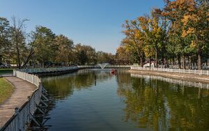
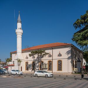
أدابازاري
أداپازاري
Adapazarı | |
|---|---|
 | |
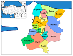 قضاء أداپازاري في محافظة صقاريا | |
| الإحداثيات: 40°47′N 30°24′E / 40.783°N 30.400°E | |
| البلد | |
| المحافظة | محافظة صقاريا |
| القضاء | قضاء أداپازاري |
| الحكومة | |
| • العمدة | Mutlu Işıksu |
| المنسوب | 31 m (102 ft) |
| التعداد (2012)[1] | |
| • Urban | 244٬748 |
| • District | 257٬826 |
| منطقة التوقيت | UTC+2 (EET) |
| • الصيف (التوقيت الصيفي) | UTC+3 (EEST) |
| الرمز البريدي | 54*** |
| مفتاح الهاتف | (+90) 264 |
| لوحة السيارة | 54 |
| Climate | Cfa |
| الموقع الإلكتروني | Municipality site |
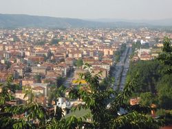
أداپازاري (Adapazarı ؛ تُنطق [adapaˈzaɾɯ]) هي مدينة في شمال غرب تركيا وعاصمة محافظة صقاريا. The province itself was originally named Adapazarı as well. Adapazarı is a part of the densely populated region of the country known as the Marmara Region. In 2014, the city had a population of 462,087.[3]
التاريخ
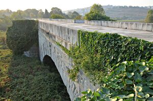
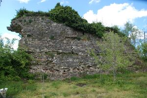
يعود تاريخ أداپازاري إلى سنة 378 ق.م.، حين كانت تُدعى أگريليون Agrilion (Αγρίλιον). المستوطنون القدماء ضموا الفريگيين، البيثينيين، Cimmerians, Lydians, اليونانيين، والفرس، ولكن أداپازاري أخذت هويتها من الهلينيين القدماء، والرومان والحكام البيزنطيين اليونانيين. One of the most important remains of historical significance is the Justinianus Bridge (تركية: Beş Köprü) built by الامبراطور البيزنطي جستنيان في 533م. وتاريخياً، فقد كانت تقع على الطريق العسكري القديم من القسطنطينية (الآن اسطنبول) إلى الشرق، وارتبطت في القدم المتأخر بـ جسر سنگاريوس القديم، ومنذ نهاية القرن 19، بخط فرعي مع سكك الحديد الأناضولية.[4]
في 1868، تأسست رسمياً بلدية أداپازاري مكان بلدة اسمها "در سعادت". A sugar factory and agricultural sugar factory attracted many migrants and accelerated the industrialization of the city. A law passed on 17 June 1954 in the Grand National Assembly saw the city separated from Kocaeli Province and made the center of its own province. زلزال مرمرة 1999 أصاب أداپازاري وألحق أضراراً بالأرواح والممتلكات. وفي تعداد 2000 الرسمي، كان عدد سكان المدينة هو 158,474 نسمة. بمرسوم رسمي، المحافظة تغير اسمها إلى صقاريا، على اسم نهر صقاريا الذي يجري خلالها.
المناخ
Adapazarı has a humid subtropical climate (Köppen climate classification Cfa), with considerable maritime and continental influences. Summers are hot and very humid, and the average maximum temperature is around 29 °C in July and August, although temperatures do usually exceed 30 °C in June, July, August and even September. Winters are cool and damp, and the lowest average minimum temperature is around 3 °C in January. Precipitation is high and fairly evenly distributed the year round, and is heaviest in autumn, winter, spring.
Snowfall is quite common between the months of December and March, snowing for a week or two, and it can be heavy.
| بيانات المناخ لـ أداپازاري | |||||||||||||
|---|---|---|---|---|---|---|---|---|---|---|---|---|---|
| الشهر | ينا | فب | مار | أبر | ماي | يون | يول | أغس | سبت | أكت | نوف | ديس | السنة |
| متوسط القصوى اليومية °س (°ف) | 9.6 (49.3) |
10.6 (51.1) |
13.6 (56.5) |
18.7 (65.7) |
23.4 (74.1) |
27.6 (81.7) |
29.3 (84.7) |
29.3 (84.7) |
26.1 (79.0) |
21.2 (70.2) |
16.2 (61.2) |
11.5 (52.7) |
19.8 (67.6) |
| المتوسط اليومي °س (°ف) | 6.1 (43.0) |
6.4 (43.5) |
8.6 (47.5) |
12.8 (55.0) |
17.3 (63.1) |
21.5 (70.7) |
23.4 (74.1) |
23.2 (73.8) |
19.5 (67.1) |
15.5 (59.9) |
11.3 (52.3) |
8.0 (46.4) |
14.5 (58.0) |
| متوسط الدنيا اليومية °س (°ف) | 3.1 (37.6) |
3.1 (37.6) |
4.7 (40.5) |
8.2 (46.8) |
12.1 (53.8) |
15.9 (60.6) |
18.1 (64.6) |
18.2 (64.8) |
14.5 (58.1) |
11.3 (52.3) |
7.4 (45.3) |
5.0 (41.0) |
10.1 (50.3) |
| متوسط تساقط الأمطار mm (inches) | 94.1 (3.70) |
77.0 (3.03) |
70.0 (2.76) |
61.2 (2.41) |
49.5 (1.95) |
67.1 (2.64) |
53.1 (2.09) |
47.6 (1.87) |
47.8 (1.88) |
89.4 (3.52) |
85.8 (3.38) |
104.2 (4.10) |
846.8 (33.33) |
| Average rainy days | 15.5 | 14.1 | 13.0 | 11.6 | 9.8 | 8.6 | 6.3 | 6.7 | 7.7 | 11.9 | 12.7 | 15.6 | 133.5 |
| Mean monthly ساعات سطوع الشمس | 71.3 | 81.2 | 117.8 | 150 | 210.8 | 249 | 272.8 | 260.4 | 204 | 139.5 | 96 | 71.3 | 1٬924٫1 |
| Source: Devlet Meteoroloji İşleri Genel Müdürlüğü [5] | |||||||||||||
الاقتصاد
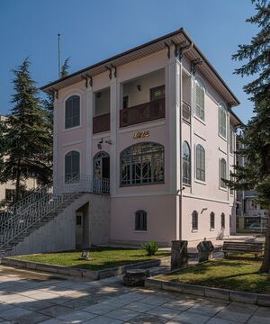
Adapazarı is the location of a large automobile factory owned by the Toyota Motor Corporation, as well as the Hyundai EURotem train factory. One of the biggest Turkish defense industry Tank Pallet 1st Main Maintenance of Turkish Defense and Otokar a major manufacturer of buses and military vehicles are located in Sakarya. Other major industries in the city and its surrounding province include textile factories for silk and linen products. Agriculture and forestry also form an important part of the city's economy, with the production of tobacco, hazelnuts (fındık variety), walnut-wood, cocoons and vegetables. Adapazari is one of the most important industrial capitals of Turkey. While Turkey is a developing country, the city of Adapazari renovated its infrastructure and industry after the 17 August 1999 catastrophic earthquake which left more than 18,000 casualties behind. In memory of the earthquake municipality had built a museum of earthquake in city center.
التعليم والثقافة
The only university in the city is Sakarya University, one of the largest universities in Turkey in terms of student enrollment. Since its establishment in 1992, Sakarya University has influenced the culture of the city and transformed public life.
In addition to the university, many different institutions shape and influence the culture of the city. Adapazarı Kültür Merkezi (Adapazarı Culture Center), Ofis Sanat Merkezi (Ofis Art Center), and Sakarya Sanat Galerisi (Sakarya Art Gallery) are the main cultural institutions led by the municipality. Adapazari also hosts non-governmental cultural and educational organizations. Of them, Sakarya Bilgi Kültür Merkezi provides educational and cultural activities.
الرياضة
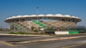
Adapazarı is home to Sakaryaspor. Sakaryaspor has won the Turkish Cup once and has played in the Süper Lig for 11 seasons. They were promoted again to the TFF First League in 2011, the second level in the Turkish football pyramid, as they beat Konya Şeker S.K., Bugsaşspor and Bandırmaspor consecutively in the play-off games of the TFF Second League. However they were relegated in the following season, and since 2013 they have played in the TFF Third League. Even though Sakaryaspor is not always a permanent team in the Süper Lig, they have raised many of Turkey's best players, such as Hakan Şükür, Tuncay, Oğuz Çetin, Aykut Kocaman and many more.
أبرز السكان
- Udi Hrant (1901–1978) – oud player, singer and composer of Turkish and Armenian songs
- Kriton Ilyadis (1916–1980) – cinematographer
- Sait Faik Abasıyanık – writer, poet
المدن الشقيقة
| المدينة | البلد | السنة |
|---|---|---|
| دلفت | ||
| شومن | ||
| لويڤل، كنتكي | 2012 | |
| سوخومي | 1992 |
المراجع
- ^ "Population of province/district centers and towns/villages by districts - 2012". Address Based Population Registration System (ABPRS) Database. Turkish Statistical Institute. Retrieved 2013-02-27.
- ^ "Area of regions (including lakes), km²". Regional Statistics Database. Turkish Statistical Institute. 2002. Retrieved 2013-03-05.
- ^ "Turkey: Major cities and provinces". citypopulation.de. Retrieved 2015-02-08.
- ^
 Chisholm, Hugh, ed. (1911). . دائرة المعارف البريطانية. Vol. 1 (eleventh ed.). Cambridge University Press. p. 166.
 {{cite encyclopedia}}: Cite has empty unknown parameter:|coauthors=(help) - ^ "Sakarya Merkez (Adapazarı)". Devlet Meteoroloji İşleri Genel Müdürlüğü. Archived from the original on 13 March 2011. Retrieved 14 March 2011.
وصلات خارجية
| الترتيب | المحافظة | التعداد | الترتيب | المحافظة | التعداد | ||||
|---|---|---|---|---|---|---|---|---|---|
 إسطنبول  أنقرة |
1 | إسطنبول | إسطنبول | 13,820,334 | 11 | قيصرية | قيصرية | 880,255 |  إزمير  بورصة |
| 2 | أنقرة | أنقرة | 4,474,305 | 12 | إسكيشهر | إسكيشهر | 670,544 | ||
| 3 | إزمير | إزمير | 2,828,927 | 13 | گبزه | خوجةإلي | 582,352 | ||
| 4 | بورصة | بورصة | 1,769,752 | 14 | شانلياورفا | شانلياورفا | 551,511 | ||
| 5 | أضنة | أضنة | 1,645,965 | 15 | دنيزلي | دنيزلي | 540,000 | ||
| 6 | غازيعنتپ | غازيعنتپ | 1,465,019 | 16 | سمسون | سمسون | 523,192 | ||
| 7 | قونية | قونية | 1,138,609 | 17 | كهرمانمراش | كهرمانمراش | 458,628 | ||
| 8 | أنطاليا | أنطاليا | 1,027,551 | 18 | آداپازاری | ساكاريا | 449,290 | ||
| 9 | ديار بكر | ديار بكر | 906,013 | 19 | ملاطية | ملاطية | 425,000 | ||
| 10 | مرسين | مرسين | 898,813 | 20 | أرضروم | أرضروم | 381,104 | ||
40°47′N 30°24′E / 40.783°N 30.400°E
- ^ http://www.citypopulation.de/Turkey-RBC20.html December 2013 address-based حساب المعهد الإحصائي التركي مقدم من citypopulation.de
