معمورة العزيز
Elazığ (النطق التركي: [eˈlazɯː], كردي: Elezîz/Xarpêt[3]), formerly Mamuretülaziz, is a city in Eastern Anatolia, Turkey, and the administrative centre of Elazığ Province. It is located in the uppermost Euphrates valley. The plain on which the city extends has an altitude of 1,067 metres (3,501 ft). Elazığ resembles an inland peninsula surrounded by the natural Lake Hazar and reservoirs of Keban Dam, Karakaya Dam, Kıralkızı and Özlüce.[4]
معمورة العزيز
Elazığ Charpert ، خرپوط | |
|---|---|
 A view of İzzet Pasha Mosque in the city centre. | |
 Seal | |
 معمورة العزيز Location of Elazığ | |
| الإحداثيات: 38°40′N 39°13′E / 38.667°N 39.217°E | |
| Country | |
| Region | Eastern Anatolia |
| Province | Elazığ |
| الحكومة | |
| • Mayor | Şahin Şerifoğulları (AKP) |
| • Governor | Ömer Faruk Koçak |
| المساحة | |
| • District | 2٬211٫07 كم² (853٫70 ميل²) |
| المنسوب | 1٬067 m (3٬501 ft) |
| التعداد (2012)[2] | |
| • Urban | 347٬857 |
| • District | 406٬300 |
| • كثافة District | 180/km2 (480/sq mi) |
| منطقة التوقيت | UTC+2 (EET) |
| • الصيف (التوقيت الصيفي) | UTC+3 (EEST) |
| Postal code | 23 xxx |
| مفتاح الهاتف | (+90) 424 |
| Licence plate | 23 |
| الموقع الإلكتروني | http://www.elazig.bel.tr/ |
Elazığ was initially developed in 1834 as an extension of the historic city of Harput, which was situated on a hill and difficult to access in winter. ينتسب إليها العديد من الأسر التي تقطن حالياً الشام ومصر ومنهم الفنان الكوميدي الشهير نهاد قلعي أو حسني بورزان صديق غوار الطوشة.
. . . . . . . . . . . . . . . . . . . . . . . . . . . . . . . . . . . . . . . . . . . . . . . . . . . . . . . . . . . . . . . . . . . . . . . . . . . . . . . . . . . . . . . . . . . . . . . . . . . . . . . . . . . . . . . . . . . . . . . . . . . . . . . . . . . . . . . . . . . . . . . . . . . . . . . . . . . . . . . . . . . . . . . .
أصل الاسم
The ancient town and citadel of Harput was located about five kilometres (3.1 miles) from modern Elazığ; its name meant "rock fortress" in Armenian, and was pronounced Kharberd, in Eastern Armenian, and Kharpert Խարբերդ in Western Armenian) (Byzantine version, Charpete (Χάρπετε)).[بحاجة لمصدر]
In the 19th century, under the reign of Mahmud II, the governor Reşid Mehmed Pasha started an expansion of Mezre, a suburb located on the plain below Kharput. During the reign of Sultan Abdülazîz, military barracks, a hospital and a governor's mansion were built to accommodate the seat of a new vilâyet (province). The town was renamed "Mamuretülaziz" (تركية عثمانية: معمورة العزيز made prosperous by Aziz in Ottoman Turkish) in 1866 on the occasion of the fifth anniversary of the enthronement of Sultan Abdülaziz, although he was not the initial founder. In time the city became known as "Elâzîz" due to its ease of pronunciation. On November 17, 1937, President Mustafa Kemal Atatürk changed the name of the city to "El'azık". However, since this was hard to pronounce in Turkish, on December 10, 1937, the government changed the city's name to its final form, "Elazığ".[5]
التاريخ
The city of Elazığ was founded among the skirts of the hill on which the historical Harput Castle was constructed. According to the present historical sources, the most ancient inhabitants of Harput was the Hurrian nation who settled in these parts in ح. 2000 B.C.
Harput and its surrounding region was part of the kingdom of Urartu at the period of its maximum extension.[6]

The ancient town and citadel called Kharput (Kharpert), which means "rocky fortress" in Armenian, was built by the first Armenian kings about five km (3.1 miles) from modern Elazığ. However, very little written material about this city reached our day. It is possible that Harput stands on or is near the site of Carcathio-certa in Sophene, reached by Corbulo in A.D. 65. The early Muslim geographers knew it as Ḥiṣn Ziyād, but the Armenian name, Khartabirt or Kharbirt, whence Kharput and Harput, was generally adopted in time.
William of Tyre wrote that Joscelin I, Count of Edessa (Jocelyn) of Courtenay, and King Baldwin II of Jerusalem were prisoners of the Amir Balak in Kharput's castle and that they were rescued by their Armenian allies. William of Tyre calls the place Quart Piert or Pierre.
خرپوط العثمانية ومعمورة العزيز
Harput and its vicinity fell under Turkish control in the year 1085 as the outcome of the معركة ملاذ كرد on August 26, 1071. The Çubukoğulları, Artuqids, Sultanate of Rum, Ilkhanate, Beylik of Dulkadir, Aq Qoyunlu, Safavids and Ottomans had reigned in the region.[7]
Harput was an important station of the American missionaries for many years. The missionaries built Euphrates College, a theological seminary, and boys' and girls' schools. It operated until 1915 when its buildings were confiscated and used by the Ottoman army as barracks. In November 1895, government-backed Turks and Kurds massacred, looted and burned the Armenian villages on the plain. In the same month, Harput was attacked and the American schools were burned down.[8][9] During the Armenian Genocide, many residents were killed.[10]
Harput is still partly settled today, but due to its high elevation and lack of water, it is slowly in the process of being abandoned, with most of its residents moving to Elazığ. Harput still has a few thousand inhabitants.
عصر الجمهورية التركية
الاقتصاد

In the late 19th and early 20th century, Elazığ exported raisins, apricots and almonds to Europe. Opium was also grown in the area.[11] Honey was also produced, but not so much exported, but used by locals.[12] Gold was also found in the area in the early 20th century.[13]
الجغرافيا
Elazığ is situated at the northwestern corner of a 30-mile-long valley, known locally as Uluova (literally the Great Valley). The area's Armenians called this valley "Vosgetashd" (the Golden Plain). Its altitude is 3,300 feet (1,000 m), latitude and longitude of 38 degrees and 41 minutes North, and 39 degrees and 14 minutes East. Elazığ Province is surrounded by the Euphrates in the north, and since the completion of Keban Dam the rivers came to cover almost ten percent of the surface area (826 square kilometres (319 sq mi)) of the province (8,455 square kilometres (3,264 sq mi)). Elazığ's adjacent province borders are with: Tunceli (North), Erzincan (North-West), Bingöl (East), Diyarbakır (South), and Malatya (West).
المناخ
Elazığ has a continental climate (Köppen climate classification: Dsa) with cold and snowy winters and hot and dry summers. However, due to the natural and artificial lakes around the city, some partial variations from this climate is experienced.[14]
| بيانات مناخ معمورة العزيز (1960-2012) | |||||||||||||
|---|---|---|---|---|---|---|---|---|---|---|---|---|---|
| الشهر | يناير | فبراير | مارس | أبريل | مايو | يونيو | يوليو | أغسطس | سبتمبر | اكتوبر | نوفمبر | ديسمبر | العام |
| العظمى القياسية °س (°ف) | 12.4 (54.3) |
17.3 (63.1) |
26.4 (79.5) |
32.2 (90) |
34.4 (93.9) |
38.6 (101.5) |
42.2 (108) |
41.4 (106.5) |
37.8 (100) |
32.1 (89.8) |
24.3 (75.7) |
19.6 (67.3) |
42٫2 (108) |
| العظمى المتوسطة °س (°ف) | 2.9 (37.2) |
4.9 (40.8) |
11.1 (52) |
17.7 (63.9) |
23.6 (74.5) |
29.6 (85.3) |
34.3 (93.7) |
34.1 (93.4) |
29.4 (84.9) |
21.7 (71.1) |
12.6 (54.7) |
5.6 (42.1) |
18٫96 (66٫13) |
| المتوسط اليومي °س (°ف) | -0.8 (30.6) |
0.5 (32.9) |
5.8 (42.4) |
11.9 (53.4) |
17.2 (63) |
22.9 (73.2) |
27.3 (81.1) |
26.8 (80.2) |
21.6 (70.9) |
14.6 (58.3) |
7.1 (44.8) |
1.9 (35.4) |
13٫07 (55٫52) |
| الصغرى المتوسطة °س (°ف) | -3.9 (25) |
-3.1 (26.4) |
1.0 (33.8) |
6.4 (43.5) |
10.7 (51.3) |
15.2 (59.4) |
19.3 (66.7) |
19.0 (66.2) |
14.3 (57.7) |
9.0 (48.2) |
3.0 (37.4) |
-1.1 (30) |
7٫48 (45٫47) |
| الصغرى القياسية °س (°ف) | -22.6 (-8.7) |
-21.4 (-6.5) |
-17.0 (1.4) |
-7.0 (19.4) |
0.0 (32) |
4.0 (39.2) |
6.7 (44.1) |
10.2 (50.4) |
1.0 (33.8) |
-2.2 (28) |
-15.2 (4.6) |
-17.7 (0.1) |
−22٫6 (−8٫7) |
| هطول mm (inches) | 40.9 (1.61) |
40.9 (1.61) |
53.2 (2.094) |
65.1 (2.563) |
51.5 (2.028) |
12.8 (0.504) |
2.0 (0.079) |
0.7 (0.028) |
7.8 (0.307) |
43.5 (1.713) |
46.9 (1.846) |
43.6 (1.717) |
408٫9 (16٫098) |
| Avg. precipitation days | 11.9 | 11.9 | 12.2 | 12.7 | 10.6 | 4.3 | 1.1 | 0.8 | 2.2 | 7.2 | 9.1 | 11.7 | 95٫7 |
| Sunshine hours | 89.9 | 112 | 173.6 | 207 | 288.3 | 354 | 387.5 | 365.8 | 300 | 223.2 | 144 | 77.5 | 2٬722٫8 |
| Source: Devlet Meteoroloji İşleri Genel Müdürlüğü [1] | |||||||||||||
. . . . . . . . . . . . . . . . . . . . . . . . . . . . . . . . . . . . . . . . . . . . . . . . . . . . . . . . . . . . . . . . . . . . . . . . . . . . . . . . . . . . . . . . . . . . . . . . . . . . . . . . . . . . . . . . . . . . . . . . . . . . . . . . . . . . . . . . . . . . . . . . . . . . . . . . . . . . . . . . . . . . . . . .
المطبخ
Elazığ cuisine is the second richest among all cities in Turkey with 154 different types of food and drinks according to a study conducted by Ankara Chamber of Commerce.[15] Particularly those originated in the historic city of Harput have an important fame in the region and the country. Apart from famous meat platters most of which include meatballs, naturally dried fruits and vegetables and using them in main dishes are unique to Elazığ cuisine. Several examples could include:[4]
- Kofik dolma - stuffed dried peppers or aubergines
- Kelecoş - fried meat and onion served over a bed of flatbread pieces softened in yogurt
- İşkene - a breakfast soup containing broth and vegetables
- Harput köfte - meatballs made with a mixture of minced meat, cracked wheat, herbs and spices boiled in tomato sauce
- Taş Ekmeği - unleavened flatbread baked over hot stone or hotplate served with butter and jam
- Işkın yemeği - a wild rhubarb dish
- Sırın - pan-broiled handmade filo pastry roundels with a layer of yogurt and tomato sauce on top
- Kömme - baked handmade filo pastry roundels built with a layer of meat filling and a layer of walnut paste
- Gaygana - a mixture of eggs, yogurt, bicarbonate, and flour drops fried in oil
- Orcik - walnut halves sewn in a thread, dipped into deep grape syrup
- Orcik şekeri - caramelised sugar coated walnut pieces
Elazığ is also very famous with its vineyards, and two types of grape varieties Öküzgözü and Boğazkere.
أبرز الأشخاص من معمورة العزيز
- Feyzi İşbaşaran - (died 1956) Turkish politician and businessman
- Mehmet Ağar — Former leader of the DYP
- Kenan Çoban — Turkish actor, known as abdulhey in Valley of the Wolves
- Vedat Dalokay — Turkish architect and a former mayor of Ankara
- Cahit Kıraç — Former Symrina Governor (now Diyarbakır Governor)"
- Reha Denemeç — Co-founder of the Justice and Development Party (AKP)
- Balak Gazi — Turkish commander
- J. Michael Hagopian - (died 2010) Armenian-American documentary filmmaker
- Hamastegh - (died 1966) Armenian writer, student of Tlgadintzi
- Bekir İrtegün — Turkish professional footballer playing for Fenerbahçe
- Ahmet Kabaklı — (died 2001) Turkish writer
- Esat Kabaklı — Turkish musician
- Dursun Karataş— Founder and leader of the Revolutionary People's Liberation Party–Front (DHKP-C)
- George A. Kiraz—Syriac specialist (grandparents from Ivos, Kharput)
- Fatih Kısaparmak — Turkish musician
- Stephen P. Mugar — (died 1982) Armenian-American businessman and entrepreneur
- Shahan Natalie — (died 1983), Armenian writer and principal organizer of Operation Nemesis
- Catholicos Nerses IV — (died 1173), Armenian church leader, theologian and writer
- Erkan Oğur — Turkish Musician
- Ahmet Tevfik Ozan — Turkish poet/writer
- Necati Şaşmaz — Star of the Valley of the Wolves TV series and the 2006 movie Valley of the Wolves: Iraq
- Raci Şaşmaz — Scriptwriter and producer of the "Valley of the Wolves" and other movies and TV series
- Mümtaz Sevinç — Turkish actor
- Yakup Şevki Subaşı - Military officer in the Ottoman and Turkish armies
- Tlgadintsi (Hovhannes Haroutiunian) — (died 1915) Armenian writer
- Muhammed Hadi Güngören — student of the year
- Vahan Totovents — (died 1938) Armenian writer, student of Tlgadintzi
- Mahir Ünlü — Turkish Literature writer, from Harput
- Namık Kemal Yolga — Turkish Diplomat and statesman
- Aşur Yusuf — (died 1915) Assyrian journalist and teacher at the Euphrates College
- İhsan Yüce — (died 1991) Turkish actor
- Rupen Zartarian — (died 1915) Armenian writer, student of Tlgad
- Ensar Albayrak - German rapper, stage name Eno
معالم

- جامعة الفرات
- Harput Kalesi (Harput Castle)
- Elazığ Culture Park
- Elazığ Botanical Park
- Elazığ Gazi Caddesi
- Buzluk Mağarası (Ice Cave)
- متحف الآثار والأعراق
- Hazar Gölü (Lake Hazar)


- Hazarbaba Ski Centre
- Historic mosques (Cami in Turkish), churches and shrines (Türbe in Turkish)
- Ulu Camii: Built by Artuqid Sultan Fahrettin Karaaslan in 1156. It is one of the oldest and important structures in Anatolia
- Sarahatun Camii (also known as Sarayhatun Cami): Built by Sara Hatun, mother of Aq Qoyunlu (White Sheep Turkomans) Sultan Bahadır Han (also known as Uzun Hassan), in 1465 as a small mosque. It was renovated in 1585 and 1843.
- Kurşunlu Camii: Built between 1738 and 1739 in Harput during the Ottoman era.
- Alacalı Camii
- Ağall Camii: built in 1559.
- مسجد وتربة عرپ بابا: بُنيت في عهد السلطان السلجوقي غياث الدين كيخسرو الثالث (ابن قلچأرسلان الرابع) في 1279. يضم الضريح جسداً محنطاً يُعرف بين العامة بإسم عرپ بابا.
- تربة فتيح أحمد بابا
- تربة منصور بابا
- Mary Church
- Sefik Gul Community Center of Culture
العلاقات الدولية
البلدات التوأم – المدن الشقيقة
معمورة العزيز متوأمة مع:
معرض صور
Hazarbaba
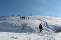
Elazığ on a snowy day
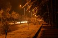
Elazığ train station
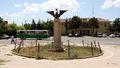
Elazığ
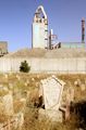
Old cemetery of Elazığ (with a cement plant behind it)


المراجع
- ^ "Area of regions (including lakes), km²". Regional Statistics Database. Turkish Statistical Institute. 2002. Retrieved 2013-03-05.
- ^ "Population of province/district centers and towns/villages by districts - 2012". Address Based Population Registration System (ABPRS) Database. Turkish Statistical Institute. Retrieved 2013-02-27.
- ^ Adem Avcıkıran (2009). Kürtçe Anamnez Anamneza bi Kurmancî (PDF) (in التركية and الكردية). p. 56. Retrieved 17 December 2019.
- ^ أ ب http://www.kultur.gov.tr/genel/medya/iltanitimbrosuru-eng/elazig_eng.pdf
- ^ "ELAZIĞ ismi nerden gelmiştir, adını nasıl almıştır, efsanesi hikayesi nedir - BilgilerSitesi.Com". www.bilgilersitesi.com.
- ^ Anatolian Iron Ages: the proceedings of the second Anatolian Iron Ages Colloquium held at İzmir, 4–8 May 1987.
- ^ "Republic Of Turkey Ministry Of Culture And Tourism". Kultur.gov.tr. Retrieved 2014-08-09.
- ^ "History of Elazig". www.turkeyforyou.com.
- ^ Dadrian, Vahakn N. (2003). The History of the Armenian Genocide. Berghahn Books. p. 160. ISBN 1571816666.
- ^ Henry H. Riggs, "Days of Tragedy in Armenia: Personal Experiences in Harpoot, 1915-1917", 1997, Michigan.
- ^ Prothero, W. G. (1920). Armenia and Kurdistan. London: H.M. Stationery Office. p. 62.
- ^ Prothero, W. G. (1920). Armenia and Kurdistan. London: H.M. Stationery Office. p. 64.
- ^ Prothero, W. G. (1920). Armenia and Kurdistan. London: H.M. Stationery Office. p. 74.
- ^ "Republic Of Turkey Ministry Of Culture And Tourism". Kultur.gov.tr. Retrieved 2014-08-09.
- ^ "Lezzetli Ülkenin Lezzet Haritası (2008-01-05) - ANKARA TICARET ODASI ". Atonet.org.tr. 2008-01-05. Archived from the original on 2014-09-24. Retrieved 2014-08-09.
- ^ "Twin-cities of Azerbaijan". Azerbaijans.com. Retrieved 2013-08-09.
المصادر
- David Ayalon, Moshe Sharon (1986). Studies in Islamic History and Civilization; Article: Ma'mûrat al-Aziz. Brill Publishers. p. 342. ISBN 978-0-510-03200-5.
- Alpaslan Koyunlu (1982). Keban Project 1974-1975 Excavations; Article: The Village Settlement of Mumzuroğlu – Observations on Housing. M.E.T.U.
- Fiey, Jean Maurice (1993). Pour un Oriens Christianus Novus: Répertoire des diocèses syriaques orientaux et occidentaux. Beirut: Orient-Institut.
{{cite book}}: Invalid|ref=harv(help)
. . . . . . . . . . . . . . . . . . . . . . . . . . . . . . . . . . . . . . . . . . . . . . . . . . . . . . . . . . . . . . . . . . . . . . . . . . . . . . . . . . . . . . . . . . . . . . . . . . . . . . . . . . . . . . . . . . . . . . . . . . . . . . . . . . . . . . . . . . . . . . . . . . . . . . . . . . . . . . . . . . . . . . . .